SNOWREPORT
/
METEOCAM
世界のスキー場の天気予報
GFS・ECMWF・ICON 気象モデル ·
最大16日先までの予報
2,272 スキー場 最新の追加スキー場: Moose Mountain Ski Resort ↗
125 スノーカメラ 最新の追加カメラ: Skeetawk ↗
1996年からの山岳気象の専門知識

- ホーム
-
国
- Albania
- Andorra
- Argentina
- Armenia
- Australia
- Austria
- Azerbaijan
- Belarus
- Belgium
- Bosnia and Herzegovina
- Bulgaria
- Canada
- Chile
- China
- Croatia
- Cyprus
- Czech Republic
- Denmark
- Estonia
- Finland
- France
- Georgia
- Germany
- Greece
- Hong Kong
- Hungary
- Iceland
- Iran
- Israel
- Italy
- Japan
- Kazakhstan
- Kosovo
- Kyrgyzstan
- Latvia
- Lebanon
- Liechtenstein
- Lithuania
- Mauritius
- Montenegro
- Morocco
- Netherlands
- New Zealand
- North Korea
- North Macedonia
- Norway
- Poland
- Portugal
- Romania
- Russia
- Serbia
- Slovakia
- Slovenia
- South Africa
- South Korea
- Spain
- Sweden
- Switzerland
- Turkey
- Ukraine
- United Kingdom
- United States
- Uzbekistan
-
スキー場
- Park City Mountain Resort
- Big Sky Resort
- Vail
- Deer Valley Resort
- Beaver Creek
- Powder Mountain Ski Resort
- Steamboat Ski Resort
- Aspen Snowmass
- Keystone
- Copper Mountain
- Winter Park Resort
- Breckenridge
- Killington Resort
- Yellowstone Club
- Snowbird
- Telluride Ski Area
- Mt. Bachelor
- Snowbasin Resort
- Mammoth Mountain
- Sunday River
- Heavenly Mountain Resort
- Whitefish Mountain Resort
- Northstar at Tahoe Resort
- Sugarbush Resort
- Sun Valley - Bald Mountain
- Jackson Hole Mountain Resort
- Sugarloaf
- Schweitzer Mountain Resort
- Alta Ski Area
- Okemo Mountain
- Purgatory Resort
- Stowe Mountain Resort
- Palisades Tahoe Olympic Valley
- Stratton Mountain Resort
- Gore Mountain
- Mount Snow
- Bogus Basin Mountain Recreation Area
- Aspen Mountain
- Tamarack Resort
- Mt. Hood Meadows Ski Resort
- Grand Targhee Resort
- Crested Butte Mountain Resort
- Timberline Lodge Ski Area
- Angel Fire Resort
- 49° North Mountain Resort
- Wolf Creek Ski Area
- Brundage Mountain
- Arapahoe Basin
- Smugglers' Notch Resort
- Loveland Basin Ski Area
- Brighton Resort
- Loon Mountain Resort
- Great Divide Ski Area
- Three Summits
- Taos Ski Valley
- Aspen Highlands
- Montana Snowbowl
- Bridger Bowl
- Sunrise Park Resort
- Bretton Woods Ski Area
- Discovery Ski Area
- Kirkwood Mountain Resort
- Jay Peak Resort
- Buttermilk
- Crystal Mountain
- Cannon Mountain
- Attitash Mountain Resort
- Sugar Bowl Resort
- Silver Mountain Resort
- Palisades Tahoe Alpine Meadows
- Brian Head Resort
- Whiteface Mountain Ski Center
- Lookout Pass
- Monarch Mountain
- Powderhorn
- Solitude Mountain Resort
- Mt. Spokane
- Bear Valley
- Saddleback Mountain
- White Pass Ski Area
- Lost Trail
- China Peak Mountain Resort
- Homewood Ski Area
- Dodge Ridge Ski Area
- Pajarito Mountain
- Red Lodge Mountain
- Mission Ridge
- Belleayre Mountain Ski Center
- Ski Cooper
- Sundance Resort
- Ski Apache
- Snowshoe Mountain
- Waterville Valley Resort
- Holiday Valley
- Pico Mountain Resort
- Mount Sunapee
- Beaver Mountain
- Bolton Valley Resort
- Stevens Pass
- Alyeska Resort
- Burke Mountain Resort
- Eldora
- Ski Santa Fe
- Windham Mountain Club
- Mt. Shasta Ski Park
- Red River Ski Area
- Lutsen Mountains
- Sierra-at-Tahoe Ski Resort
- June Mountain
- Mad River Glen
- Hunter Mountain
- Mt. Hood Skibowl
- Seven Springs Mountain Resort
- Gunstock Recreation Area
- Sandia Peak Ski Area
- Boyne Mountain
- Cranmore Mountain Resort
- Mount Rose Ski Tahoe
- Granby Ranch
- Eagle Point
- The Hermitage Club at Haystack Mountain
- Nordic Valley Resort (Wolf Mountain)
- Mt Baker
- Bromley Mountain Ski Resort;Bromley Mountain
- Arizona Snowbowl
- Willamette Pass
- Titus Mountain
- Boyne Highlands Resort
- Greek Peak Mountain Resort
- Hoodoo Ski Area
- Snow Summit
- Granite Peak Ski Area
- Berkshire East Ski Resort
- Snowy Range
- Mountain Creek
- Whitecap Mountain
- Bristol Mountain Ski Resort
- Mountain High
- Blue Mountain Resort
- Ragged Mountain Resort
- Donner Ski Ranch
- Mount Abram
- Snow King Mountain
- Catamount Mountain Resort
- Jiminy Peak Resort
- Holimont
- Wisp Resort
- Black Mountain
- Cascade Mountain
- Elk Mountain Ski Resort
- Crystal Mountain
- Kissing Bridge
- Terry Peak Ski Area
- Nub's Nob
- Camelback Mountain Resort
- Jackson Creek Summit
- Pleasant Mountain
- Wachusett Mountain Ski Area
- Diamond Peak
- Pats Peak
- Welch Village
- Boreal Mountain Resort
- Mount Ashland
- Afton Alps
- Big Powderhorn Mountain Resort
- Sun Valley - Dollar Mountain
- Bear Mountain
- Snow Valley Mountain Resort
- Labrador Mountain
- Sipapu Ski and Summer Resort
- Alpental
- Buffalo Ski Club
- Giants Ridge Resort
- Ski Butternut
- Canaan Valley Ski Resort
- Swain Ski & Snowboard Resort
- Magic Mountain Ski Area
- Hidden Valley Resort
- Whitetail Resort
- Black River Basin
- Devil's Head Ski Area
- Blue Knob
- Lee Canyon
- Montage Mountain Ski Area
- Shawnee Mountain
- Snow Ridge
- Massanutten Resort
- Peek'n Peak Ski Area
- Spirit Mountain
- Liberty Mountain Resort
- Jack Frost Mountain Resort
- Schuss Mountain
- Winterplace Ski Resort
- West Mountain Ski Resort
- Tahoe Donner Downhill Ski Area
- Wintergreen Ski Resort
- Ski Brule
- Crotched Mountain Ski & Ride
- Norway Mountain Ski Resort
- Whaleback Mountain
- Sugar Mountain Resort
- Mohawk Mountain Ski Area
- Roundtop Mountain Resort
- McCauley Mountain Ski Area
- Trollhaugen Ski Area
- Summit West
- Bear Creek Mountain Resort Ski Slopes
- Soda Springs
- Otsego Club
- Caberfae Peaks
- Big Boulder Ski Resort Area
- Perfect North Slopes
- Wild Mountain
- Beech Mountain Resort
- Ski Sundown
- Badger Pass Ski Area
- Alpine Valley Resort
- King Pine
- Ski Sawmill Family Resort
- Christie Mountain Ski Area
- Big Bear Ski Resort
- Chestnut Mountain Resort
- Mount Kato Ski Area
- Wilmot Mountain
- Mt. Holly Ski & Snowboard Resort
- Nordic Mountain
- Mt Brighton
- Utah Olympic Park
- Powder Ridge Ski Area
- Timber Ridge Ski Area
- Thunder Ridge
- Andes Tower Hills
- Bittersweet
- Little Switzerland
- Alpine Valley Ski Area
- Bryce Resort
- Nashoba Valley Ski Area
- Mad River Mountain
- Cannonsburg Ski Area
- Paoli Peaks
- Tyrol Basin Ski And Snowboard Area
- Powder Ridge
- Willard Mountain
- Snow Trails
- Pine Knob Ski & Snowboard Resort
- Cataloochee Ski Area
- Mount Peter
- Hidden Valley
- Buena Vista Ski Area
- Mount Ski Gull
- Ski Bradford
- Spring Mountain Ski Area
- Buck Hill
- Mount Southington Ski Area
- The Mountain Top at Grand Geneva Resort & Spa
- Paul Bunyan
- Campgaw Mountain Ski Area
- Alpine Valley
- Sundown Mountain Resort
- Ober Mountain
- Bruce Mound Winter Sports Area
- Kettlebowl
- Hickory Hills
- Snow Creek
- Hyland Hills Ski Area
- Swiss Valley Ski Lodge
- Sunburst Ski Area
- Brandywine Ski Resort
- McIntyre Ski Area
- Appalachian Mountain Ski Area
- Snow Snake Ski Resort
- Ski Ward
- Boston Mills Ski Resort
- Brantling Ski Slopes
- Bottineau Winter Park
- Crystal Ridge (Rock Snowpark)
- Mulligan's Hollow
- Villa Olivia
- Blacktail Mountain Ski Area
- Eaglecrest Ski Area
- Gladstone Ski Hill
- Liberty Mountain Snowflex Centre — outdoor dry ski slope
- Moose Mountain Ski Resort
- Mount Bohemia
- Silverton Mountain
- Skeetawk
- Ski Land - Fairbanks
- Ski Snowstar
- ルートの天気
- LIVE on the go PILOT
- 気象マップ
- 現在の天気
-
その他
-
人工ゲレンデ
- Kagura Area — Japan (summer)
- Kopaonik — Serbia (summer)
- Nozawa Onsen — Japan (summer)
- CopenHill — Denmark
- Gala Yuzawa Snow Resort — Japan (summer)
- Loisinord - Noeux-les-Mines — France
- Gloucester Ski and Snowboard Centre — United Kingdom
- Pontypool Ski Centre — United Kingdom
- Chatham Snowsports Centre — United Kingdom
- Norfolk Snowsports Club — United Kingdom
- Gosling Ski Centre — United Kingdom
- Liberty Mountain Snowflex Centre — United States
- Llandudno Ski and Snowboard Centre — United Kingdom
- Midlothian Snowsports Centre (Hillend Dry Slope) — United Kingdom
- Plymouth Snowsports Centre — United Kingdom
- Skistar Hammarbybacken — Sweden (summer)
- The Hill - Ski Rossendale — United Kingdom
- Wolfskamer Wintersport — Netherlands
-
風のスポット
-
地点
- Abbeville
- Abbeville
- Aberdeen
- Aberdeen
- Aberdeen Proving Ground
- Aberdeen/amory
- Abilene
- Abilene
- Abilene
- Abilene
- Abington
- Acacia Falls Mobile Home Court
- Acacia Falls Mobile Home Court
- Ada
- Adak
- Adrian
- Ahoskie
- Aiken
- Ainsworth
- Airlake
- Aitkin
- Akhiok
- Akron
- Akron
- Akron
- Akron
- Akron-Canton
- Alabaster
- Alamogordo
- Alamogordo
- Alamogordo
- Alamosa
- Albany
- Albany County
- Albemarle
- Albert Lea
- Albertville
- Albion
- Albuquerque
- Albuquerque
- Albuquerque
- Albuquerque
- Albuquerque
- Alexander City
- Alexandria
- Alexandria
- Alexandria
- Alexandria
- Algona
- Alice
- Allen Parish
- Allentown
- Allentown
- Alliance
- Alma
- Alma
- Alma
- Alpena
- Alpine
- Alton
- Altoona
- Altoona
- Alturas
- Alturas
- Alturas
- Altus
- Altus
- Altus
- Alva
- Amarillo
- Ambler
- Ambler
- Ambler
- Ambrose
- Amelia
- Americus
- Ames
- Anacostia
- Anaktuvuk Pass
- Anchorage
- Anchorage
- Anchorage
- Anchorage
- Anchorage Ak,
- Andalusia
- Anderson
- Anderson
- Anderson
- Andover
- Andrews
- Andrews
- Angel Fire
- Angleton
- Angoon
- Aniak
- Ankeny
- Ann Arbor
- Annapolis
- Annette Island
- Anniston
- Antigo
- Anvik
- Apalachicola
- Apalachicola
- Apalachicola
- Apple Valley
- Appleton
- Appleton
- Arcata
- Archbold
- Arctic Village
- Ardmore
- Ardmore
- Ardmore
- Argyle
- Argyle
- Argyle
- Argyle
- Argyle
- Arkadelphia
- Arlington
- Arlington
- Arlington
- Arlington
- Artesia
- Asheboro
- Asheboro
- Asheville
- Ashland
- Ashtabula
- Ashtabula
- Ashtabula
- Aspen
- Astor
- Astoria
- Athens
- Atka
- Atlanta
- Atlanta
- Atlanta
- Atlanta
- Atlanta
- Atlantic
- Atlantic
- Atlantic City
- Atoka
- Atqasuk
- Auburn
- Auburn
- Auburn
- Auburn
- Auburn
- Auburn
- Auburn
- Audubon
- Audubon Park
- Augusta
- Augusta
- Augusta
- Aurora
- Aurora
- Aurora
- Aurora State
- Austin
- Austin
- Austin
- Austin
- Austin
- Austin
- Austin
- Austin
- Austin
- Avalon
- Avon Park
- Ayer
- Bad Axe
- Baker
- Baker
- Baker
- Bakersfield
- Baltimore
- Baltimore
- Baltimore
- Bangor
- Bar Harbor
- Baraboo
- Baraboo
- Barbers Point
- Barbers Point
- Barkerville
- Barkerville
- Barkerville
- Barnwell
- Barre/barre Plains
- Barrow
- Barrow
- Barter Island
- Bartlesville
- Bartlesville
- Bartow
- Bastrop
- Batesville
- Batesville
- Baton Rouge
- Battle Creek
- Battle Mountain
- Battle Mountain
- Baudette
- Bay City
- Bay City
- Bay St Louis
- Bay St Louis
- Beach
- Beatrice
- Beatty
- Beaufort
- Beaufort
- Beaufort
- Beaumont
- Beaumont
- Beaumont
- Beaumont/Port Arthur
- Beaver Falls
- Beaver Island
- Beaver Rim
- Beckley
- Bedford
- Beeville
- Beeville
- Belen
- Bellaire
- Belle Fourche
- Belle Fourche
- Bellefontaine
- Bellefonte
- Belleville
- Bellingham
- Belmar
- Bemidji
- Bend
- Benkelman
- Bennettville
- Bennington
- Bennington
- Benson
- Benton Harbor Airport
- Bentonville
- Bentonville
- Berlin
- Berthoud Pass
- Bethel
- Bettles
- Bettles
- Beverly
- Big Bear City
- Big Bear City
- Big Piney
- Big Rapids
- Big River Lake
- Big Spring
- Big Spring
- Big Spring
- Bigfork
- Billings
- Billings
- Biloxi
- Binghamton
- Birchwood
- Birchwood
- Birmingham
- Birmingham
- Bishop
- Bismarck
- Bison
- Bitter Creek
- Black River Falls
- Blacksburg
- Blackwell
- Blair
- Blairstown
- Blairsville
- Blakely
- Blakely
- Blanding
- Block Island
- Bloomington
- Bloomington/Normal Airport
- Blue Canyon
- Bluefield
- Blythe
- Blytheville
- Blytheville
- Boca Raton
- Bodega Bay
- Bogalusa
- Bogue Field
- Boise
- Bolivar
- Bonifay Tri Co Airport
- Bonners Ferry
- Boone
- Boone
- Boonville
- Boothville
- Boothville
- Boothville
- Boothville
- Bordeaux
- Borger
- Boscobel
- Boston
- Boston
- Boston
- Boston
- Boulder
- Boulder City
- Boulder Municipal
- Bowie
- Bowling Green
- Bowman
- Boysen
- Bozeman
- Bradford
- Bradford
- Brady
- Brainerd
- Branson
- Breckenridge
- Bremerton
- Brenham
- Bridgeport
- Bridgeport
- Bridgeport
- Bridgeport
- Bristol
- Britton
- Broad Acres
- Broad Acres
- Broad Acres
- Broadus
- Broken Bow
- Brookhaven
- Brookings
- Brookings
- Brookings
- Brooksville
- Brookville
- Browning
- Brownsville
- Brownwood
- Brownwood
- Brunswick
- Brunswick
- Brunswick
- Bryce Canyon
- Buckeye
- Buckhannon
- Buckland
- Buena Vista
- Buffalo
- Buffalo
- Buffalo
- Buffalo
- Buffalo
- Bullfrog Marina
- Bullhead City
- Buoy
- Burbank
- Burley
- Burlington
- Burlington
- Burlington
- Burlington
- Burlington
- Burlington
- Burlington
- Burlington
- Burlington
- Burnet
- Burney
- Burns
- Burwell
- Butler
- Butler
- Butler
- Butte
- Cadillac
- Cahokia
- Cairo
- Caldwell
- Caldwell
- Caldwell
- Caldwell
- Calera
- Calera
- Calexico
- Caliente
- Camarillo
- Cambridge
- Cambridge
- Cambridge
- Camden
- Camden
- Camdenton
- Cameron
- Camp David
- Camp David
- Camp Springs
- Campo
- Canadian
- Canandaigua
- Canby
- Cando
- Canon City
- Canton
- Canton
- Cantwell
- Cape Blanco
- Cape Decision
- Cape Girardeau
- Cape Hatteras
- Cape Kennedy
- Cape Lisburne
- Cape Newenham
- Cape Romanzoff
- Carbondale
- Caribou
- Carlisle
- Carlsbad
- Carlsbad
- Carmi
- Caro
- Caro
- Carrabassett
- Carrington
- Carrizo Springs
- Carroll
- Carrollton
- Carson
- Cartersville
- Casa Grande
- Cascade Locks
- Casper
- Casper
- Castroville
- Cavalier
- Cedar City
- Cedar Grove
- Cedar Grove
- Cedar Rapids
- Cemetery Separation
- Centerville
- Central
- Central
- Centralia
- Centreville
- Centreville
- Chadron
- Challis
- Challis
- Chama
- Chama
- Chama
- Chama
- Chama
- Chama
- Chamberlain
- Champaign
- Champion
- Chandalar Lake
- Chandler
- Chandler
- Chandler
- Chandler
- Chanute
- Chapel Hill
- Chapel Hill
- Chapel Hill
- Chariton
- Charles City
- Charleston
- Charleston
- Charleston
- Charleston
- Charleston
- Charleston
- Charlevoix
- Charlotte
- Charlotte
- Charlotte Amalie
- Charlottesville
- Chatham
- Chatham
- Chatham
- Chattanooga
- Cheboygan
- Cheboygan
- Chehalis-Centralia
- Cheraw
- Cherokee
- Cherry Point
- Chester
- Chester
- Chester County
- Chestervale
- Chestervale
- Chevak
- Cheyenne
- Cheyenne F E Warren
- Chicago
- Chicago
- Chicago
- Chicago
- Chicago
- Chicago
- Chicago
- Chicago
- Chicago
- Chicago
- Chicago
- Chicago
- Chickasha
- Chico
- Chief Joseph
- Chignik
- Childress
- Chillicothe
- Chincoteague
- Chino
- Chinook
- Chulitna
- Cincinnati
- Cincinnati
- Circle City
- Claiborne Range
- Claremore
- Clarinda
- Clarion
- Clark
- Clarksburg
- Clarksdale
- Clarksville
- Clarksville
- Clarksville Outlaw Fld
- Claxton
- Clayton
- Clayton Lake
- Clayton Lake
- Clayton Lake
- Clayton Lake
- Clayton Lake
- Clearfield
- Clearfield
- Cleburne
- Cleburne
- Clemson
- Cleveland
- Cleveland
- Cleveland
- Cleveland
- Cleveland
- Clewiston
- Clines Corner
- Clines Corner
- Clines Corner
- Clinton
- Clinton
- Clinton
- Clinton
- Clinton
- Clinton
- Clinton
- Clinton
- Clintonville
- Cloquet
- Clovis
- Clovis
- Coatesville
- Coatesville
- Cocoa Beach
- Cocoa Beach
- Cody
- Coeur D'Alene
- Coffeyville
- Colby
- Cold Bay
- Coldwater
- Coleman
- College Park
- College Station
- Colorado Springs
- Colorado Springs
- Colorado Springs
- Colorado Springs
- Colstrip
- Columbia
- Columbia
- Columbia
- Columbia
- Columbia
- Columbus
- Columbus
- Columbus
- Columbus
- Columbus
- Columbus
- Columbus
- Columbus
- Columbus
- Columbus
- Columbus
- Columbus
- Colville
- Colville
- Comanche
- Comanche
- Concord
- Concord
- Concord
- Concordia
- Conroe
- Continental Divide
- Conway
- Cook
- Cook Corners
- Cook Corners
- Cook Corners
- Cooperstown
- Copper Harbor
- Copper Mountain
- Cordova
- Cordova
- Corinth
- Corning
- Corona
- Corona
- Corona Pass
- Corpus Christi
- Corpus Christi
- Corpus Christi
- Corpus Christi
- Corsicana
- Cortez
- Corvallis
- Cottonwood Pass
- Cotulla
- Council Bluffs
- Courtland
- Covington
- Covington
- Covington
- Cozad
- Craig
- Crane Lake
- Crane Lake
- Crazy Woman
- Creole
- Crescent City
- Creston
- Crestview
- Crockett
- Crockett
- Crookston
- Crosby
- Cross City
- Cross Keys
- Crossville
- Crows Landing
- Crystal River
- Cullman
- Culpeper
- Cumberland
- Cumberland
- Cumminsville
- Currituck
- Currituck
- Cushing
- Custer
- Custer
- Custer
- Cut Bank
- Daggett
- Dalhart
- Dalhart
- Dallas
- Dallas
- Dallas
- Dallas
- Dallas
- Dallas
- Dallas
- Dallas
- Dalton
- Danbury
- Dansville
- Danville
- Danville
- Danville
- Darlington
- Dauphin Island
- Davenport
- Davenport
- Davis
- Dayton
- Dayton
- Dayton
- Daytona Beach
- De Kalb
- De Queen
- De Ridder
- Dead Horse
- Deadhorse
- Deadhorse
- Decatur
- Decatur
- Decatur
- Decatur
- Decatur
- Decorah
- Deer Creek
- Deer Park
- Deer Park
- Deering
- Defiance
- Del Rio
- Del Rio
- Deland
- Delaware
- Dell
- Delta
- Delta
- Delta
- Delta Junction
- Deming
- Denison
- Denton
- Denver
- Denver
- Denver
- Denver
- Denver
- Denver
- Denver
- Denver
- Denver
- Denver
- Derby Downs
- Des Moines
- Desmet
- Destin
- Detroit
- Detroit
- Detroit
- Detroit
- Detroit Lakes
- Devils Lake
- Devils Lake
- Diamond Shoals
- Dickinson
- Dickson
- Dillingham
- Dillon
- Dixon
- Dodge Center
- Dodge Center
- Dodge City
- Dothan
- Douglas
- Douglas
- Douglas
- Douglas Converse Co Airport
- Dover
- Doylestown
- Driggs
- Drummond
- Drummond Island
- Dryden
- Dryden
- Du Bois
- Dublin
- Dublin
- Dubois
- Dubuque
- Dugway
- Duke Fld
- Duluth
- Duluth
- Duluth
- Dumas
- Duncan
- Dunkirk
- Dunnellon
- Durango
- Durango
- Durant
- Dyersburg
- Eagle
- Eagle Butte
- Eagle County
- Eagle Range
- Eagle Range
- Eagle River
- East Addition B323
- East Hodgdon
- East Hodgdon
- Easthampton
- Eastman
- Easton
- Eastover
- Eastport
- Eastsound
- Eau Claire County
- Edenbower
- Edenton
- Edinburg
- Edinburg
- Edwards AFB
- Edwards AFB
- Effingham
- Egegik
- Ekalaka
- El Centro
- El Dorado
- El Monte
- El Paso
- El Paso
- El Paso
- El Reno
- El Reno
- Elbert Co Airport
- Elbow Lake
- Elfin Cove
- Elizabeth City
- Elizabethton
- Elizabethtown
- Elizabethtown
- Elk City
- Elk Mountain
- Elkhart
- Elkhart
- Elkhart
- Elkins
- Elko
- Elko
- Ellensburg
- Ellicott
- Ellsworth
- Elmira
- Ely
- Ely Municipal Airport
- Emanuel County
- Emmonak
- Emporia
- Emporia
- Endicott
- Engelhard
- Enid
- Enid
- Ennis
- Ephrata
- Erie
- Erie
- Erwin
- Erwin
- Escanaba Delta Co Airport
- Estherville
- Eufaula
- Eugene
- Eureka
- Eureka
- Eureka
- Eureka
- Eureka
- Eureka
- Evanston
- Evansville
- Eveleth
- Everett
- Everglades City
- Evergreen
- Fairbanks
- Fairbanks
- Fairbanks
- Fairfield
- Fairfield
- Fairfield
- Fairhope
- Fairhope
- Fairmont
- Faith
- Falfurrias
- Fallon
- Falls City
- Falmouth
- Falmouth
- False Pass
- Farewell Lake
- Fargo
- Faribault
- Farmingdale
- Farmington
- Farmington
- Farmville
- Faulkton
- Fayetteville
- Fayetteville
- Fayetteville
- Fayetteville
- Fayetteville Municipal
- Fentress
- Fergus Falls
- Fernandina Beach
- Findlay
- First Divide
- Fitchburg
- Flag Island
- Flagler County
- Flagstaff
- Flagstaff
- Flint
- Flippin
- Flora
- Florala
- Florence
- Florence
- Folkston
- Fond Du Lac
- Forest City
- Forsyth
- Fort Belvoir
- Fort Bragg
- Fort Campbell
- Fort Carson
- Fort Collins
- Fort Collins
- Fort Dodge
- Fort Drum
- Fort Eustis
- Fort Huachuca
- Fort Huachuca
- Fort Irwin
- Fort Knox
- Fort Lauderdale
- Fort Lauderdale
- Fort Leavenworth
- Fort Madison
- Fort Meade
- Fort Morgan
- Fort Morgan Municipal
- Fort Myers
- Fort Myers
- Fort Ord
- Fort Payne
- Fort Pierce
- Fort Polk
- Fort Polk
- Fort Polk
- Fort Polk
- Fort Riley
- Fort Ritchie
- Fort Ritchie
- Fort Rucker
- Fort Rucker
- Fort Scott
- Fort Smith
- Fort Stockton
- Fort Walton Beach
- Fort Wayne
- Fort Wayne
- Fort Worth
- Fort Worth
- Fort Worth
- Fort Worth
- Fort Worth
- Fort Worth
- Fort Worth
- Fort Worth
- Fort Yukon
- Fort Yukon
- Fortuna
- Fosston
- Fountain Dale
- Fourchon
- Frankfort
- Frankfort
- Franklin
- Franklin
- Franklin
- Frederick
- Frederick
- Fredericksburg
- Fredonia
- Fredonia
- Freeport
- Freeport
- Fremont
- Fremont Muni
- Frenchville
- Fresno
- Fresno
- Friday Harbor
- Fryeburg
- Fryeburg
- Fullerton
- Fulton
- Fulton
- Fulton County
- Gadsden
- Gage
- Gainesville
- Gainesville
- Gainesville
- Gainesville
- Gaithersburg
- Galbraith Lake
- Galena
- Galesburg
- Gallatin
- Galliano
- Galliano Heliport
- Gallup
- Galveston
- Gambell
- Garden City
- Gardner
- Garnett
- Garnett
- Garrison
- Gary
- Gastonia
- Gatesville
- Gatesville
- Gaylord
- Georgetown
- Georgetown
- Georgetown
- Georgetown
- Gettysburg
- Giddings
- Giddings
- Gifford
- Gifford
- Gila Bend
- Gillette
- Gilmer
- Gilmer
- Gilroy
- Glasgow
- Glasgow
- Glencoe
- Glencoe
- Glendale
- Glendive
- Glens Falls
- Glenwood
- Goffs Falls
- Goffs Falls
- Goffs Falls
- Gold Beach
- Goldsboro
- Goldsboro
- Golovin
- Gooding
- Goodland
- Gordons Mobile Plaza
- Gordons Mobile Plaza
- Gordons Mobile Plaza
- Gordons Mobile Plaza
- Goshen
- Grafton
- Graham
- Granbury
- Granbury
- Granby
- Grand Canyon
- Grand Canyon Park
- Grand Cheiner
- Grand Forks
- Grand Forks
- Grand Island
- Grand Isle
- Grand Junction
- Grand Marais
- Grand Marais
- Grand Marais
- Grand Prairie
- Grand Rapids
- Grand Rapids
- Grand Rapids
- Grandview
- Grangeville
- Grangeville
- Granite Falls
- Granite Falls
- Grants-Milan
- Grass Valley
- Grayfield Mobile Home Park
- Grayfield Mobile Home Park
- Grayling
- Grayling
- Grayling
- Great Barrington
- Great Bend
- Great Falls
- Great Falls
- Great Falls
- Greeley
- Green Bay
- Green River Range
- Greensboro
- Greensboro Greene Co Rgnl Airport
- Greenville
- Greenville
- Greenville
- Greenville
- Greenville
- Greenville
- Greenville
- Greenville
- Greenville
- Greenville
- Greenville
- Greenville-Spartanburg
- Greenwood
- Greenwood
- Greenwood
- Gregory
- Greybull
- Griffin
- Grinnel
- Grinnell
- Grosse Ile
- Grosse Ile [Grosse Ile NAS]
- Groton
- Grove
- Grove City
- Guadalupe Pass
- Gulf Shores
- Gulfport
- Gulkana
- Gunbarrel
- Gunnison
- Gunnison
- Gustavus
- Guthrie
- Guymon
- Gwinner
- Hagerstown
- Hailey
- Haines
- Haleyville
- Half Moon Bay
- Hallock
- Hamilton
- Hamilton
- Hamilton
- Hamilton
- Hamilton
- Hammond
- Hammonton
- Hampton
- Hampton
- Hana
- Hanford
- Hanford
- Hanford
- Hanksville
- Hanksville
- Hannibal
- Hannibal
- Harbor Springs
- Harbor Springs
- Harlan
- Harlan
- Harlingen
- Harlowton
- Harper
- Harpersville
- Harrietstown
- Harrisburg
- Harrisburg
- Harrisburg
- Harrisburg
- Harrisburg
- Harrison
- Harrisonville
- Hart/shelby
- Hartford
- Hartsville
- Harvey
- Hastings
- Hathaway Mead
- Hathaway Mead
- Hathaway Mead
- Hatteras
- Hatteras
- Hattiesburg
- Hattiesburg
- Havre
- Hawthorne
- Hawthorne
- Hayden
- Hayes River
- Hays
- Hayward
- Hayward
- Hazen
- Healy River
- Hearne
- Hearne
- Hebbronville
- Heber City
- Hebron
- Helena
- Henderson
- Henderson City
- Henderson City
- Henry Tift Myers
- Hereford
- Hereford
- Herington
- Hermiston
- Hermiston Municipal Airport
- Hettinger
- Hibbing-Chisholm
- Hickam Usaf Automatic Weather Switch,oahu,hi.
- Hickory
- Hickory Village - Mobile Home Park
- Highgate
- Hiland
- Hill City
- Hill Range
- Hill Range
- Hillenbrand Industries
- Hilliard
- Hillsboro
- Hillsboro
- Hillsdale
- Hillsville
- Hilo
- Hilton Head
- Hinckley
- Hinesville
- Hobart
- Hobbs
- Hoffman
- Holdrege
- Holland
- Hollister
- Hollywood
- Holy Cross
- Holyoke
- Holyoke
- Homer
- Homerville
- Homestead
- Hondo
- Hondo
- Honolulu
- Honolulu
- Hoonah
- Hooper Bay
- Hopedale
- Hoquiam
- Hornell
- Hot Springs
- Hot Springs
- Hot Springs
- Hot Springs
- Houghton
- Houghton Lake
- Houlton
- Houlton
- Houma
- Houston
- Houston
- Houston
- Houston
- Houston
- Houston
- Houston
- Houston
- Houston
- Houston
- Houston
- Houston
- Howell
- Howell
- Hoxie
- Hudson
- Hugo
- Hugoton
- Hulett Muni
- Hunter Ligget
- Huntingburg
- Huntingdon
- Huntington
- Huntsville
- Huntsville
- Huntsville
- Huntsville
- Huntsville
- Huron
- Huslia
- Hutchinson
- Hutchinson
- Hyannis
- Hydaburg
- I-25 Divide
- Idabel
- Idaho Falls
- Idalia
- Igiugig
- Iliamna
- Imperial
- Imperial
- Imperial Beach
- Independence
- Independence
- Indian Springs
- Indian Springs
- Indian Springs
- Indiana
- Indianapolis
- Indianapolis
- Indianapolis
- Indianapolis
- Indianapolis
- Indianapolis
- Indiantown
- Ingleside
- International Falls
- Intracoastal City
- Inverness
- Inverness
- Inyan Kara
- Inyokern
- Inyokern
- Ionia
- Iowa City
- Iowa Falls
- Iron Mountain
- Ironwood
- Irvine
- Islip
- Islip
- Ithaca
- Jackpot
- Jackson
- Jackson
- Jackson
- Jackson
- Jackson
- Jackson
- Jackson
- Jackson Hole
- Jacksonville
- Jacksonville
- Jacksonville
- Jacksonville
- Jacksonville
- Jacksonville
- Jacksonville
- Jacksonville
- Jacksonville
- Jacksonville
- Jaffrey
- Jamestown
- Jamestown
- Janesville
- Janesville
- Jasper
- Jasper
- Jasper County
- Jefferson
- Jefferson
- Jefferson City
- Jerome
- Jerome
- Jesup
- John C Tune
- John Day
- John Day
- Johnson
- Johnsonville
- Johnstown
- Joliet
- Joliet
- Jonesboro
- Jonesville
- Joplin
- Jordan
- Joseph
- Junction
- Juneau
- Juneau
- K. I. Sawyer Air Force Base
- K. I. Sawyer Air Force Base
- K. I. Sawyer Air Force Base
- Kahului
- Kailua Kona
- Kaiser
- Kake
- Kalamazoo
- Kalispell
- Kalispell
- Kalskag
- Kaltag
- Kamuela
- Kamuela
- Kaneohe
- Kankakee
- Kansas City
- Kansas City
- Kansas City
- Kansas City
- Kansas City
- Kearney
- Keene
- Kekaha
- Kelso
- Kenai
- Kenansville
- Kenosha
- Keokuk
- Kerrville
- Ketchikan
- Key West
- Key West
- Keystone Heights
- Kiana
- Kickapoo
- Kill Devil Hills
- Killeen
- Killeen
- Killeen
- Kimball
- Kimberly
- King Cove
- King Salmon
- Kingman
- Kingman
- Kings Point
- Kingstree
- Kingsville
- Kinston
- Kiowa
- Kipnuk
- Kirk
- Kirksville
- Kivalina
- Klamath Falls
- Klawock
- Knob Noster
- Knox
- Knoxville
- Knoxville
- Kodiak
- Kokomo
- Koliganek
- Kotzebue
- Koyuk
- Kremmling
- Kuparuk
- Kwiguk
- La Belle Muni
- La Crosse
- La Crosse
- La Grande
- La Grange
- La Grange
- La Junta
- La Verne
- La Veta Pass
- Lacon
- Laconia
- Lady Lake
- Ladysmith
- Lafayette
- Lafayette
- Lago Vista
- Lahaina
- Lake Charles
- Lake Charles
- Lake Clear
- Lake Clear
- Lake Clear
- Lake Clear
- Lake Elmo
- Lake Havasu
- Lakehurst
- Lakeland
- Lakeview
- Lakeview Lake Co Airport
- Lakewood
- Lamar
- Lamar
- Lambertville
- Lambertville
- Lamoni
- Lamoni
- Lamoni
- Lamoni
- Lampasas
- Lanai Airport 656
- Lancaster
- Lancaster
- Lancaster
- Lancaster
- Lancaster
- Lancaster
- Lancaster
- Land O Lakes
- Lander
- Lane
- Langdon
- Lansing
- Lansing
- Lapeer
- Laramie
- Laredo
- Las Cruces
- Las Vegas
- Las Vegas
- Las Vegas
- Las Vegas
- Las Vegas
- Las Vegas
- Latrobe
- Laurel
- Laurel
- Laurens
- Laurinburg
- Lawrence
- Lawrence
- Lawrenceburg
- Lawrenceville
- Lawrenceville
- Lawton
- Lawton
- Lazy Mountain
- Lazy Mtn
- Le Mars
- Leadville
- Lebanon
- Lebanon
- Lebanon
- Lebanon
- Lebo
- Lees Summit
- Leesburg
- Leesburg
- Leesburg
- Leeville
- Leisure Town
- Leisure Town
- Leisure Town
- Lemmon
- Lemmon
- Lemoore
- Lemoore
- Leonardtown
- Leoti
- Lesbia
- Lesbia
- Lesbia
- Lewisburg
- Lewisburg
- Lewisburg
- Lewisburg-Ellington
- Lewiston
- Lewistown
- Lexington
- Lexington
- Lexington
- Lexington
- Lexington
- Lexington
- Libby
- Liberal
- Lidgerwood
- Lihue
- Lihue
- Lima
- Limestone
- Limon
- Limon
- Lincoln
- Lincoln
- Lincoln Airport
- Lincoln Logan Co Airport
- Lincoln Park
- Lincolnton
- Linden
- Linton
- Litchfield
- Litchfield
- Litchfield
- Little Falls
- Little Rock
- Little Rock
- Livermore
- Livingston
- Livingston Municipal
- Llano
- Llano
- Lock Haven
- Logan
- Logan
- Logansport
- Lomita
- Lompoc
- London-Corbin
- Lone Pine
- Lone Rock
- Long Beach
- Long Prairie
- Longmont
- Longview
- Longville
- Longville
- Lorain
- Lorain
- Lordsburg
- Los Alamitos
- Los Alamos
- Los Angeles
- Los Angeles
- Los Angeles
- Los Angeles
- Los Angeles
- Los Angeles
- Louisa
- Louisburg
- Louisville
- Louisville
- Louisville
- Louisville
- Lovelock
- Lovelock
- Lowell
- LTS Mobile Home Park
- Lubbock
- Lubbock
- Lubbock
- Ludington
- Lufkin
- Lumberton
- Lumberton
- Luray
- Luray
- Luverne
- Lynchburg
- Lyndonville
- Mackinac Island
- Mackinac Island
- Macomb
- Macon
- Madera
- Madison
- Madison
- Madison
- Madisonville
- Maine
- Malad City
- Malaga
- Malden
- Malone
- Malta
- Malta
- Mammoth
- Manassas
- Manchester
- Mandan
- Manhattan
- Manistee
- Manistique
- Manistique
- Manitowac
- Manitowish Waters
- Mankato
- Manley Hot Springs
- Manning
- Manokotak
- Mansfield
- Mansfield
- Manteo
- Manville
- Maple Lake
- Maple Lake
- Marathon
- Marble Falls
- Marfa
- Marianna
- Marietta
- Marietta
- Marietta
- Marion
- Marion
- Marion
- Marion
- Marion
- Marquette
- Marquette
- Marseilles
- Marshall
- Marshall
- Marshall
- Marshall
- Marshall
- Marshalltown
- Marshfield
- Marshfield
- Marshfield Municipal Airport
- Marthas Vineyard
- Martin
- Martinsburg
- Martinsville B Ridge Airport
- Mary Esther
- Maryanna Mobile Estates
- Maryanna Mobile Estates
- Marysville
- Marysville
- Marysville
- Maryville
- Mason
- Mason
- Mason City
- Massena
- Mattoon
- Maxton
- Mayport
- Mc Call
- Mc Pherson
- McAlester
- McAllen
- McCarthy
- McComb
- McCook
- McCook
- McGrath
- McGregor
- McGregor
- McGregor
- McKinley
- McKinney
- McMinnville
- McMinnville
- Meacham
- Meadville
- Meadville
- Medford
- Medford
- Medford
- Medicine Lodge
- Meeker
- Mekoryuk
- Melbourne
- Melfa
- Mellan
- Melrose
- Memphis
- Memphis
- Memphis
- Memphis
- Mena
- Mena
- Mendocino
- Mendocino
- Menominee
- Menomonie
- Merced
- Merced
- Mercury
- Meriden
- Meridian
- Meridian
- Merrill
- Merrill Pass West
- Merritt Island
- Mesa
- Mesa
- Mesquite
- Metlakatla
- Metropolis
- Mexico
- Miami
- Miami
- Miami
- Miami
- Miami
- Miami
- Miami
- Michigan City
- Middlebury
- Middlesboro
- Middleton
- Middleton Island
- Middletown
- Midland
- Midland
- Midland-Odessa
- Midway Island
- Milbank
- Miles City
- Milford
- Milledgeville
- Miller
- Millington
- Millinocket
- Millville
- Milton
- Milton
- Milton
- Milwaukee
- Milwaukee
- Milwaukee
- Minchumina
- Minden
- Minden
- Mineola-Quitman
- Mineola-Quitman
- Mineral Point
- Mineral Wells
- Minneapolis
- Minneapolis
- Minneapolis
- Minneapolis
- Minneapolis
- Minneapolis
- Minocqua
- Minot
- Minot
- Mission
- Missoula
- Mitchell
- Moab
- Moberly
- Mobile
- Mobile
- Mobridge
- Mobridge
- Modesto City
- Mojave
- Moline
- Molokai
- Molokai
- Monarch Pass
- Moncks Corner
- Monee
- Monett
- Monett
- Monida
- Monroe
- Monroe
- Monroe
- Monroe
- Montague
- Montague
- Montauk Airport
- Monteagle
- Monterey
- Montevideo
- Montgomery
- Montgomery
- Montgomery
- Montgomery
- Montgomery
- Monticello
- Monticello
- Monticello
- Monticello
- Montpelier
- Montrose
- Monument
- Moorestown
- Moorhead
- Moorhead
- Moose Lake
- Mora
- Mora
- Morehead City
- Morganton
- Morgantown
- Moriarty
- Moriarty
- Mormon Mesa
- Morris
- Morris
- Morristown
- Morrisville
- Moses Lake
- Moses Lake North
- Moses Lake North
- Moses Lake North
- Mosinee
- Moultrie
- Moultrie
- Moultrie
- Mount Airy
- Mount Carmel
- Mount Clemens
- Mount Comfort
- Mount Holly
- Mount Ida
- Mount Pleasant
- Mount Pleasant
- Mount Pleasant Reg-Faison
- Mount Shasta
- Mount Vernon
- Mount Vernon-Knox Co
- Mount Wilson
- Mountain Home
- Mountain Home
- Mountain View
- Mountain Village
- Mt Horeb
- Mt Pleasant
- Mt Pocono
- Mt Washington
- Mt Werner
- Mullan
- Mullan Pass
- Mullen
- Muncie
- Munsing Lakeshore
- Murfreesboro
- Murray
- Muscatine
- Muscle Shoals
- Muskegon
- Muskogee
- Myrtle Beach
- Nabesna
- Nacogdoches
- Naknek
- Nampa
- Nantucket
- Napa
- Naples
- Naples
- Nashua
- Nashua
- Nashville
- Natchez
- Natchitoches
- Nebraska City
- Needles
- Neenah
- Nelson Lagoon
- Nenana
- Neosho
- Nevada
- Nevada Test Site
- New Bedford
- New Bern
- New Braunfels
- New Braunfels
- New Castle
- New Haven
- New Iberia
- New Orleans
- New Orleans
- New Orleans
- New Orleans
- New Orleans
- New Philadelphia
- New Port Richie
- New Port Richie
- New Richmond
- New Roads
- New Smyrna Beach
- New Stuyahok
- New Stuyahok
- New Ulm
- New York
- New York City
- New York City
- New York City
- New York City
- New York City
- Newark
- Newark
- Newark
- Newberry
- Newberry
- Newburgh
- Newburyport
- Newcastle
- Newhall
- Newhall
- Newnan
- Newport
- Newport
- Newport
- Newport
- Newport
- Newport
- Newport News
- Newton
- Newton
- Niagara Falls
- Nikolai
- Noatak
- Nogales
- Nogales
- Nome
- Noorvik
- Norfolk
- Norfolk
- Norfolk
- Norfolk
- Norfolk
- Norman
- Norristown
- North Adams
- North Adams
- North Bend
- North Kingston
- North Las Vegas
- North Las Vegas
- North Las Vegas
- North Las Vegas
- North Little Rock
- North Myrtle Beach
- North Omaha
- North Platte
- North Pole
- North Wilkesboro
- Northampton
- Northway
- Norton
- Norwich
- Norwood
- Novato
- Nucla
- Nuiqsut
- O'Neill
- Oak Harbor
- Oak Harbor Air Pk
- Oak Ridge
- Oakdale
- Oakes
- Oakland
- Oakland
- Oakland
- Oakland
- Oakley
- Oberlin
- Oberlin
- Ocala
- Ocean City
- Ocean City
- Ocean City
- Ocean Shores
- Oceanside
- Oceanside
- Oceanside
- Oceanside
- Oceanside
- Odessa
- Odessa
- Oelwein
- Offshore
- Ogallala
- Ogden
- Ogden
- Ogdensburg
- Ohio University
- Okeechobee
- Oklahoma City
- Oklahoma City
- Oklahoma City
- Oklahoma City
- Okmulgee
- Olathe
- Olathe
- Old Bridge
- Old Town
- Olean
- Oliktok Point/lrrs Aiportak
- Olive Branch
- Olivia
- Olney
- Olympia
- Omaha
- Omaha
- Omaha
- Omak
- Onida
- Onondaga
- Ontario
- Ontario
- Orange
- Orange
- Orange
- Orange City
- Orange Grove
- Orangeburg
- Ord
- Orlando
- Orlando
- Orlando
- Orlando
- Orlando
- Ormond Beach
- Oroville
- Orr
- Ortonville
- Osceola
- Osceola
- Oscoda
- Oshkosh
- Oskaloosa
- Ottumwa
- Owatonna
- Owensboro
- Owosso
- Owyhee
- Oxford
- Oxford
- Oxford
- Oxnard
- Ozark
- Ozona
- Pacific City State
- Paducah
- Page
- Page Mountain
- Pagosa Springs
- Palacios
- Palestine
- Palm Coast
- Palm Springs
- Palmdale
- Palmdale
- Palmdale
- Palmdale
- Palmer
- Palmetto Hall Plantation
- Palo Alto
- Pampa
- Pampa
- Panama City
- Panama City
- Panama City
- Paris
- Paris
- Paris
- Park Falls
- Park Rapids
- Parkersburg
- Parkston
- Parsons
- Pascagoula
- Pascagoula
- Pascagoula
- Pasco
- Paso Robles
- Paso Robles
- Paterson
- Pathfinder Hill
- Patterson
- Patuxent River
- Pauls Valley
- Pawtucket
- Paxson
- Paynesville
- Paynesville Muni
- Payson
- Payson
- Pearl Harbor
- Peck
- Pecos
- Pella
- Pellston
- Pendleton
- Penn Cove Park
- Penn Cove Park
- Penn Cove Park
- Penn Yan
- Pensacola
- Pensacola
- Pensacola
- Pensacola
- Peoria
- Pequot Lake
- Perkasie
- Perry
- Perry
- Perry
- Perry
- Perryton
- Peru
- Peru
- Petaluma
- Petersburg
- Petersburg
- Petersburg
- Philadelphia
- Philadelphia
- Philadelphia
- Philadelphia
- Philadelphia
- Philip
- Philip
- Philipsburg
- Phillips
- Phillips Oil Platform
- Phillips Platform
- Phillipsburg
- Phoenix
- Phoenix
- Phoenix
- Phoenix
- Phoenix
- Pickens
- Piedmont
- Pierre
- Pikeville
- Pillar Point
- Pilot Point
- Pilot Point
- Pilot Point
- Pine Bluff
- Pine Bluff
- Pine Ridge
- Pine River
- Pinedale
- Pineville
- Piney Creek
- Piney Island
- Pipestone
- Pittsburg
- Pittsburgh
- Pittsburgh
- Pittsburgh
- Pittsfield
- Pittsfield
- Pittsfield
- Pittstown
- Pittstown
- Placerville
- Plains
- Plainview
- Plant City
- Platinum
- Platte
- Platteville
- Plattsburgh
- Plattsburgh
- Plattsmouth
- Pleasant Hill
- Pleasonton
- Plentywood
- Plymouth
- Plymouth Municipal Airport
- Pocatello
- Pohakuloa
- Poinsett Range
- Point Arguello
- Point Hope
- Point Lay
- Point Mugu
- Point Piedras Blancas
- Point Pleasant
- Polk AAF
- Pompano Beach
- Ponca City
- Pontiac
- Pontiac
- Poplar
- Poplar Bluff
- Poplar Bluff
- Port Alexander
- Port Alsworth
- Port Angeles
- Port Angeles
- Port Angeles
- Port Aransas
- Port Aransas
- Port Clarence
- Port Fourchon
- Port Heiden
- Port Hope
- Port Huron
- Port Isabel
- Port Isabel
- Port Lavaca
- Port Lavaca
- Port Mansfield
- Portage Glacier
- Porterville
- Portland
- Portland
- Portland
- Portland
- Portland
- Portland
- Portland
- Portland
- Portland
- Portsmouth
- Poteau
- Potsdam
- Pottstown
- Poughkeepsie
- Prairie Du Chien
- Pratt
- Prescott
- Presque Isle
- Presque Isle
- Preston
- Price
- Princeton
- Princeton/rocky Hill
- Prospect Creek
- Providence
- Provincetown
- Provo
- Prudhoe Bay
- Pueblo
- Pueblo
- Pulliam
- Pullman
- Pumpkin Vine
- Punta Gorda
- Puntilla
- Puyallup
- Quakertown
- Quantico
- Quillayute
- Quincy
- Quincy
- Racine
- Raleigh
- Raleigh
- Ramona
- Ramona
- Ramona
- Rancho Murieta
- Rangeley
- Rangely
- Rantoul
- Rantoul
- Rapid City
- Rapid City
- Raton
- Ravenna
- Ravenna
- Rawlins
- Raymond
- Raymond
- Reading
- Reading WBO City
- Red Bluff
- Red Dog Mine
- Red Dog Mine
- Red Oak
- Red Wing
- Redding
- Redig
- Redlands
- Redmond
- Redwood Falls
- Reidsville
- Reno
- Reno
- Reno
- Rensselaer
- Renton
- Rexburg
- Rexburg
- Rhinelander
- Rice
- Rice Lake
- Rice Lake
- Richlands
- Richlands
- Richmond
- Richmond
- Richmond
- Richmond
- Ridgely
- Rifle
- Rim
- Rio Vista
- Riverside
- Riverside
- Riverton
- Roanoke
- Roanoke
- Roanoke Rapids
- Roanoke Rapids
- Robbinsville
- Robinson
- Robstown
- Robstown
- Rochelle
- Rochelle
- Rochester
- Rochester
- Rochester
- Rochester
- Rochester
- Rock Hill
- Rock Hill
- Rock Springs
- Rockford
- Rockford
- Rockingham
- Rockingham
- Rockland
- Rockport
- Rocksprings
- Rockwood
- Rocky Mount
- Rodeo
- Rogers
- Rolla
- Rolla
- Rome
- Rome
- Rome
- Rome
- Roosevelt
- Roseau
- Roseburg
- Roseglen
- Rosemont
- Roswell
- Roswell
- Roswell
- Roswell
- Roundup
- Roxboro
- Ruby
- Rugby
- Ruidoso
- Rumford
- Rush City
- Rush City
- Russell
- Russell
- Russellville
- Russian Mission
- Ruston
- Rutherfordton
- Rutland
- Sabine Pass
- Sabine Pass
- Sacramento
- Sacramento
- Sacramento
- Sacramento
- Sacramento
- Safford
- Safford
- Sagauche
- Sage
- Saginaw
- Saginaw
- Saint Cloud
- Saint Marys
- Saint Michaels
- Saint Michaels
- Saint Paul
- Saint Paul
- Saint Paul
- Saint Petersburg
- Saint Petersburg
- Salem
- Salem
- Salida
- Salida
- Salina
- Salina
- Salinas
- Salisbury
- Salisbury
- Sallisaw
- Salmon
- Salmon
- Salt Lake City
- Salt Lake City
- Salt Lake City
- Salt Lake City
- Salt Point
- San Angelo
- San Angelo
- San Angelo
- San Antonio
- San Antonio
- San Antonio
- San Antonio
- San Antonio
- San Antonio
- San Antonio
- San Bernardino
- San Carlos
- San Clemente
- San Diego
- San Diego
- San Diego
- San Diego
- San Diego
- San Diego
- San Diego
- San Francisco
- San Francisco
- San Joaquin
- San Jose
- San Jose
- San Luis Obispo
- San Marcos
- San Marcos
- San Martin
- San Mateo
- San Nicolas Island
- Sand Point
- Sandberg
- Sanderson
- Sandpoint
- Sandy
- Sandy Hook
- Sanford
- Sanford
- Sanford
- Sanford
- Santa Ana
- Santa Anna Mountains
- Santa Barbara
- Santa Fe
- Santa Maria
- Santa Monica
- Santa Rosa
- Santa Rosa
- Santa Teresa
- Santa Ynez
- Saranac Lake
- Sarasota
- Sarasota
- Sarasota
- Saratoga
- Saratoga
- Saratoga Springs
- Sauk Centre
- Sault Ste Marie
- Sault Ste Marie
- Sault Ste Marie
- Sault Ste Marie
- Savanna
- Savannah
- Savannah
- Savannah
- Savannah
- Savoonga
- Savoonga
- Scammon Bay
- Scappoose
- Schell
- Schenectady
- Scobey
- Scott City
- Scottsbluff
- Scottsboro
- Scottsdale
- Searcy
- Seattle
- Seattle
- Seattle
- Seattle
- Sedalia
- Sedona
- Selawik
- Seldovia
- Selinsgrove
- Selmer
- Seminole
- Seminole
- Seminole
- Seminole
- Seul Choix Pt
- Seward
- Seward
- Sexton Summit
- Shaktoolik
- Shamrock
- Shannon
- Shawano
- Shawnee
- Sheboygan
- Sheep Mountain
- Sheep Mountain
- Shelby
- Shelbyville
- Shelbyville
- Shelbyville
- Sheldon
- Shelter Cove
- Shelton
- Shemya
- Shenandoah
- Sheridan
- Sherman
- Sherman
- Shirley
- Shishmaref
- Show Low
- Show Low
- Shreveport
- Shreveport
- Shreveport
- Shungnak
- Shute Creek
- Sibley Peak
- Sidney
- Sidney
- Sidney
- Sikeston
- Siler City
- Siloam Springs
- Silver Bay
- Silver City
- Sioux City
- Sioux Falls
- Siren
- Sisseton
- Sisters
- Sitka
- Skagway
- Skwentna
- Skwentna
- Skyline
- Slana
- Slayton
- Slayton Muni
- Sleetmute
- Slidell
- Slidell
- Slidell
- Slidell
- Smith Center
- Smithfield
- Smyrna
- Snowshoe Lake
- Snyder
- Socorro
- Soda Springs
- Soldotna
- Soldotna
- Somerset
- Somerville
- Somerville
- Somerville
- Sonora
- Sonora
- South Bend
- South Brazos A70
- South Haven
- South Hill
- South Kauai
- South Lake Tahoe
- South Padre Island
- South Pass
- South Shore
- South Weymouth
- Southern Pines
- Southland Field-Sulphur
- Southport
- Sparland
- Sparland
- Sparrevohn
- Sparta
- Sparta
- Sparta
- Spartanburg
- Spearfish
- Spencer
- Spencer
- Spencer
- Spickard
- Spokane
- Spokane
- Spokane
- Spokane
- Springdale
- Springfield
- Springfield
- Springfield
- Springfield
- Springfield
- Springfield
- Squantum
- St Augustine
- St Charles
- St Charles
- St Francis
- St George
- St George
- St George
- St George
- St George Island
- St Inigoes
- St James
- St James
- St Johns
- St Johnsbury
- St Joseph
- St Louis
- St Louis
- St Michael
- St. Paul Island
- Stafford
- Stampede Pass
- Stanley
- Stanley
- Stanley
- Stanton
- Staples
- Star Lake Johnson Ranch
- Starkville
- State College
- Statesboro
- Statesville
- Staunton
- Steamboat Springs
- Stephenville
- Sterling
- Sterling
- Sterling Rock Falls Airport
- Stevens Field
- Stevens Point
- Stevenson Ranch
- Stevenson Ranch
- Stevensville
- Stigler
- Stillwater
- Stockton
- Stoney Creek
- Stoney Creek
- Stony River Land
- Storm Lake
- Stratton
- Stuart
- Sturgeon Bay
- Sturgis
- Sturgis
- Stuttgart
- Suffolk
- Suitland
- Sullivan
- Sulphur
- Sulphur Springs
- Summerville
- Sumter
- Sumter
- Sunbury
- Sunlight
- Superior
- Superior Valley
- Susanville
- Sussex
- Sussex
- Sutton
- Sutton
- Swainsboro
- Swansboro
- Sweetwater
- Sylvania
- Syracuse
- Syracuse
- Syracuse
- Tacoma
- Tacoma
- Tacoma Narrows
- Tahlequah
- Talkeetna
- Talladega
- Talladega
- Tallahassee
- Tallahassee
- Tallahassee
- Tallulah
- Tampa
- Tampa
- Tampa
- Tampa
- Tampa
- Tanana
- Taos
- Taos
- Tappahannock
- Tarboro
- Tatalina
- Taylorville
- Tea
- Tehachapi
- Tekamah
- Teller
- Telluride
- Temple
- Ten Sleep
- Terre Haute
- Terrell
- Teterboro
- Texarkana
- The Dalles
- Thedford
- Thermal
- Thief River Falls
- Thomaston
- Thomasville
- Thompson Falls
- Thompson Falls Ph
- Thomson
- Three Rivers
- Tifton
- Tillamook
- Tillamook
- Tin City
- Tioga
- Titusville
- Tobyhanna
- Tofte
- Togiak Village
- Toledo
- Toledo
- Toledo
- Toledo/Winlock
- Tomahawk
- Tompkinsville
- Toms River
- Tonopah
- Tonopah Test Range
- Tonopah Test Range
- Tooele
- Tooksok Bay
- Topeka
- Topeka
- Torrance
- Torreon
- Torrington
- Towanda
- Town Hill
- Town Hill
- Tracy
- Traverse City
- Trenton
- Tribune
- Tribune
- Trinidad
- Trinity Center
- Troy
- Troy
- Troy
- Truckee
- Truth Or Consequences
- Tse Bonito
- Tse Bonito
- Tuba City
- Tucson
- Tucson
- Tucson
- Tucson
- Tucson
- Tucumcari
- Tullahoma
- Tulsa
- Tulsa
- Tulsa
- Tulsa
- Tunica
- Tunica
- Tupelo
- Tuscaloosa
- Tustin
- Twenty Mile Hill
- Twentynine Palms
- Twin Bridges
- Twin Falls
- Twin Mountain
- Two Harbors
- Tyler
- Ukiah
- Ulysses
- Umiat
- Unalakleet
- Unalaska
- Union City
- University
- Upolu Point
- Utica
- Utica
- Utopia Creek
- Uvalde
- Vacaville
- Vacaville
- Valdez
- Valdez
- Valdosta
- Valdosta
- Valentine
- Valkaria
- Valle
- Valley City
- Valparaiso
- Valparaiso
- Van Nuys
- Vance Brand
- Vancouver
- Vandalia
- Vandenberg
- Vandenberg
- Vedauwoo
- Venice
- Venice
- Venice Heliport
- Vermillion
- Vernal
- Vernal
- Vernon
- Vero Beach
- Versailles
- Vicksburg
- Vicksburg
- Victoria
- Victorville
- Vidalia
- Vinton
- Virginia Beach
- Viroqua
- Visalia
- Volens
- Volk
- Waco
- Waco
- Wadena
- Wadena
- Wadesboro
- Wagner
- Wahiawa
- Wahiawa
- Wahoo
- Wahpeton
- Wainwright
- Wakefield
- Walden
- Wales
- Walhalla
- Wall
- Walla Walla
- Wallace
- Walnut Ridge
- Walterboro
- Wapakoneta
- Warner Robins
- Warner Robins
- Warrensburg
- Warrenton
- Warroad
- Warroad
- Warroad
- Warsaw
- Warsaw
- Waseca
- Washington
- Washington
- Washington
- Washington
- Washington
- Washington
- Washington
- Wasilla
- Waskish
- Waterloo
- Watertown
- Watertown
- Watertown
- Waterville
- Watford City
- Watonga
- Watsonville
- Waukesha
- Waupaca
- Wausau
- Wausau
- Wautoma
- Waxahachie
- Waycross
- Wayne
- Weatherford
- Weaverville
- Webster
- Webster City
- Weeksville
- Wellington
- Wells
- Wells
- Wells
- Wells
- Wells
- Wellsville
- Wenatchee
- Wendover
- Weslaco
- Wessington Springs
- West Bend
- West Chester
- West Memphis
- West Milford
- West Palm Beach
- West Plains
- West Point
- West Yellowstone
- West Yellowstone
- Westerly
- Westfield
- Westhampton Beach
- Westminster
- Westminster
- Wharton
- Wharton
- Wheatland
- Wheaton
- Wheeling
- Whidbey Island
- Whitaker
- White Mountain
- White Mountain
- White Plains
- White Sands Missile Range
- White Sands Missile Range
- White Sulphur Springs
- Whitefield
- Whiteville
- Whittier
- Whittier
- Wichita
- Wichita
- Wichita
- Wichita
- Wichita
- Wichita Falls
- Wichita Falls
- Wildhorse
- Wildwood
- Wilkerson Pass
- Wilkes-Barre
- Williams
- Williamsburg
- Williamsburg
- Williamson
- Williamsport
- Willimantic
- Willimantic
- Williston
- Willmar
- Willmar
- Willmar
- Willoughby
- Willow
- Willow Grove
- Wilmington
- Wilmington
- Wilmington
- Winchester
- Winchester
- Winder
- Windom
- Windom
- Window Rock
- Window Rock
- Windsor Locks
- Winfield
- Wink
- Winnemucca
- Winner
- Winner
- Winnsboro
- Winona
- Winslow
- Winston-Salem
- Winter Haven
- Winter Park Basic
- Wiscasset
- Wiscasset Airport
- Wisconsin Rapids
- Wise
- Wolf Creek Pass
- Wolf Point
- Woodbine
- Woodward
- Wooster
- Worcester
- Worland
- Worthington
- Wrangell
- Wray
- Wrightstown
- Yakima
- Yakutat
- Yankton
- Yellowstone
- York
- York
- Youngstown
- Yukon
- Yuma
- Yuma
- Yuma
- Yuma
- Yuma
- Zanesville
- Zapata
- Zuni
- 予報の精度
-
人工ゲレンデ
- ♫ 音声アラート
色の凡例 気温 · 風 · 雨 · 雪
気温 °C
< −10 / −10 / 0 / 10 / 20 / 30+
風速 km/h
< 10 / 10 / 29 / 50 / 75+
雨量 mm
< 1 / 1 / 3 / 10 / 20+
降雪量 cm
< 1 / 1 / 5 / 10 / 20+
各色は表示された値から始まります。風の色は3種類の単位で対応しています。降水のないセルは中立色です。色は表示値を示すもので、公的な気象警報ではありません。
Nashoba Valley Ski Area - Low lift station · 60 m
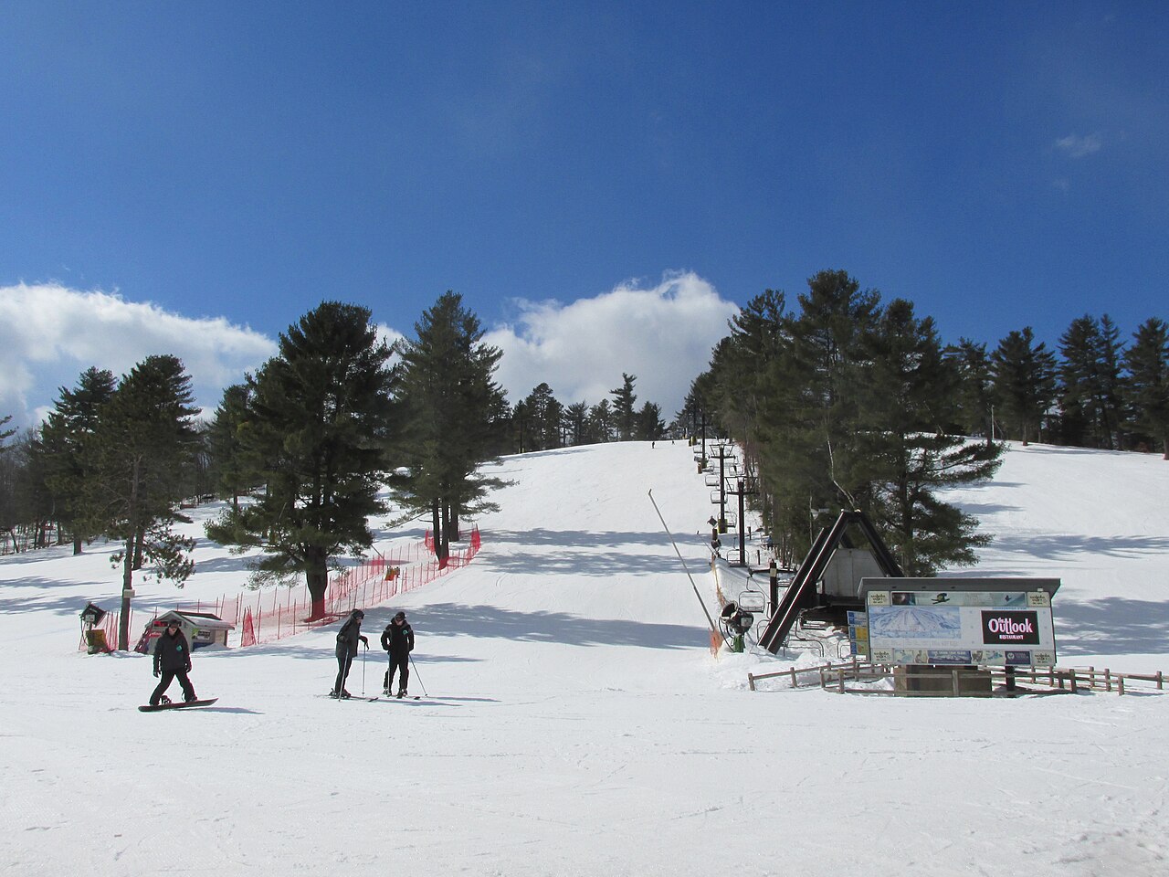
Nashoba Valley Ski Area is a downhill ski area in Massachusetts, United States. Mapped terrain includes beginner, intermediate, advanced routes. Its mapped lift network extends from approximately 60 to 131 metres above sea level.
Data: OpenSkiData / OpenSkiMap, OpenStreetMap contributors (ODbL), Skimap.org, Who's On First, Mapterhorn.
Nearby (straight-line):Ski Ward33 km SWWachusett Mountain Ski Area36 km WSki Bradford39 km NEMcIntyre Ski Area51 km NCrotched Mountain Ski & Ride63 km NW