Borovets ski centre
Camera image unavailable
Camera image · refreshes every 60 seconds while visible.
Open camera page ↗
Chaque couleur commence à la valeur indiquée. Les couleurs du vent correspondent dans les trois unités. Les cases sans précipitations restent neutres. Les couleurs décrivent les valeurs affichées et ne sont pas des alertes officielles.
ECMWF · Cycle du modèle : Prochaine mise à jour attendue :
Jour Heure (UTC) Temp. (°C) Humidité (%) Vent (km/h) Vent (nœuds) Vent (Bft) Direction Précip. (mm) Neige fraîche (cm) Pression (hPa) Isotherme 0 °C (m) Conditions | Mercredi, 04/11 06:00 3 94 2 1 1B N — — 1021 2139 Overcast 97% cloud  09:00 4.7 85 5 3 1B N 0.05 0 1022 2304 Overcast 85% cloud 12:00 4.7 88 5 3 1B N 0.08 0 1023 2287 Overcast 100% cloud 15:00 3.4 95 3 2 1B NE 0.19 0 1024 2108 Overcast 100% cloud 18:00 3.1 96 2 1 1B NE 0.24 0 1026 2041 Overcast 99% cloud 21:00 3 96 2 1 1B NE 0.58 0 1027 2012 Overcast 100% cloud Jeudi, 05/11 00:00 2.6 96 2 1 1B N 0.34 0 1027 1937 Overcast 100% cloud 03:00 2.5 95 3 2 1B NE 0.31 0 1028 1899 Overcast 100% cloud 06:00 2.3 96 4 2 1B NE 0.61 0 1028 1824 Overcast 100% cloud 09:00 2.7 96 6 3 1B NE 0.13 0 1029 1867 Overcast 100% cloud 12:00 3.1 91 5 3 1B NE 0.05 0 1028 1932 Overcast 99% cloud 15:00 2.7 90 3 2 1B N 0.05 0 1028 1891 Overcast 95% cloud 18:00 1.1 91 1 0 0B SW 0.01 0 1029 1578 Overcast 88% cloud 21:00 -0.2 88 2 1 1B SW 0 0 1028 < 1479 Overcast 82% cloud Vendredi, 06/11 00:00 -1.8 87 3 2 1B SW 0 0 1027 < 1479 Partly cloudy 45% cloud  03:00 -2 73 3 2 1B SW 0 0 1026 < 1479 Partly cloudy 25% cloud 06:00 0.5 60 1 1 1B SW 0 0 1025 < 1479 Clear 10% cloud  09:00 5 45 4 2 1B N 0 0 1024 2384 Clear 5% cloud 12:00 6.6 43 6 3 1B N 0 0 1021 2507 Clear 3% cloud 15:00 2.3 67 3 1 1B W 0 0 1021 2013 Clear 12% cloud 18:00 1.1 53 4 2 1B SW 0 0 1021 1620 Partly cloudy 47% cloud 21:00 0.9 47 1 1 1B SW 0 0 1022 1549 Partly cloudy 35% cloud Samedi, 07/11 00:00 -0.3 61 1 1 0B S 0 0 1023 < 1479 Clear 11% cloud 03:00 -1.4 60 1 1 1B SW 0 0 1024 < 1479 Clear 0% cloud 06:00 -0.2 51 1 1 1B S 0 0 1025 < 1479 Clear 0% cloud 09:00 4.5 46 5 3 1B NE 0 0 1025 2167 Clear 0% cloud 12:00 5.2 54 6 3 2B NE 0 0 1024 2193 Clear 2% cloud 15:00 0.6 81 1 0 0B S 0 0 1025 < 1479 Clear 0% cloud 18:00 -1.2 64 2 1 1B S 0 0 1027 < 1479 Clear 9% cloud 21:00 -1.7 63 2 1 1B SE 0 0 1028 < 1479 Partly cloudy 21% cloud Dimanche, 08/11 00:00 -2.2 62 1 1 1B SE 0 0 1030 < 1479 Clear 9% cloud 03:00 -2.2 66 1 1 1B S 0 0 1030 < 1479 Clear 8% cloud 06:00 -0.5 63 1 1 0B S 0 0 1030 < 1479 Clear 5% cloud 09:00 4.5 54 4 2 1B N 0 0 1030 2183 Clear 2% cloud 12:00 5.6 58 5 3 1B N 0 0 1028 2298 Clear 5% cloud 15:00 1.4 79 1 0 0B SE 0 0 1029 1688 Clear 1% cloud 18:00 -0.5 74 2 1 1B S 0 0 1029 < 1479 Clear 0% cloud 21:00 -0.3 64 1 1 1B S 0 0 1028 < 1479 Clear 2% cloud Lundi, 09/11 00:00 0.4 57 1 1 1B S 0 0 1028 < 1479 Clear 16% cloud 03:00 1 53 1 1 1B S 0 0 1027 1570 Overcast 99% cloud 06:00 3.2 52 1 0 0B S 0.07 0 1027 2061 Overcast 94% cloud 09:00 7.2 45 3 2 1B N 0 0 1027 2464 Cloudy 58% cloud  12:00 6.5 61 2 1 1B N 0.01 0 1026 2436 Overcast 93% cloud 15:00 4 76 1 1 0B S 0 0 1026 2197 Overcast 94% cloud 18:00 2.2 76 2 1 1B S 0 0 1025 1907 Cloudy 74% cloud 21:00 1.9 77 2 1 1B S 0 0 1025 1866 Cloudy 67% cloud Mardi, 10/11 00:00 1.3 80 3 2 1B S 0 0 1024 1683 Cloudy 54% cloud 03:00 2 76 3 2 1B S 0 0 1023 1918 Partly cloudy 50% cloud 06:00 3.7 70 3 2 1B S 0 0 1023 2351 Overcast 96% cloud |
|---|
Forecast table times: UTC.
Coordinates: 42.26587667°N, 23.60292435°E · Requested elevation: 1341 m. Model terrain: 1477 m. Terrain and 1000/925/850/700 hPa profiles are used for height estimates.
Outside the available profile, temperature uses an estimated 5.5°C/km height correction; wind retains the nearest available model-level value. Humidity is estimated with adjusted pressure and temperature.
These are altitude estimates, not a simulation of local mountain terrain. Precipitation, cloud and sea-level pressure use horizontal interpolation only.
Precipitation includes rain and snow water equivalent: preceding 3 hours through day 6, then 6 hours (see cell tooltip). Snow (cm) estimates fresh snowfall from precipitation and temperature using the GFS conversion; it is not snow depth on the ground. Freezing (m) uses additional 600/500 hPa temperatures when available and estimates the lowest resolved 0°C crossing above sea level. When all sampled levels are warm, the upper profile limit is shown (see tooltip). < marks an entirely cold sampled profile and its lower height limit. No extrapolation is used.
Source: ECMWF · CC BY 4.0 · Processed by Snow Report.
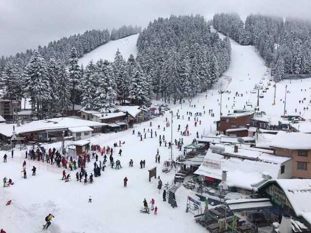
Camera image · refreshes every 60 seconds while visible.
Open camera page ↗
Camera image · refreshes every 60 seconds while visible.
Open camera page ↗
Camera image · refreshes every 60 seconds while visible.
Open camera page ↗ECMWF · Cycle du modèle : Prochaine mise à jour attendue :
Jour Heure (UTC) Temp. (°C) Humidité (%) Vent (km/h) Vent (nœuds) Vent (Bft) Direction Précip. (mm) Neige fraîche (cm) Pression (hPa) Isotherme 0 °C (m) Conditions | Mercredi, 04/11 06:00 0.8 93 3 1 1B E — — 1021 2143 Overcast 97% cloud 09:00 1.9 89 3 2 1B NE 0.04 0 1022 2318 Overcast 82% cloud 12:00 1.8 93 2 1 1B NE 0.08 0 1023 2298 Overcast 99% cloud 15:00 0.8 99 1 0 0B N 0.21 0 1024 2116 Overcast 100% cloud 18:00 0.5 100 1 1 0B N 0.26 0.1 1025 2050 Overcast 99% cloud 21:00 0.4 98 2 1 1B N 0.62 0.2 1027 2019 Overcast 100% cloud Jeudi, 05/11 00:00 0.1 99 2 1 1B NW 0.32 0.1 1027 1938 Overcast 100% cloud 03:00 -0.1 99 3 2 1B N 0.31 0.1 1028 1901 Overcast 100% cloud 06:00 -0.4 99 4 2 1B NE 0.61 0.2 1028 1829 Overcast 100% cloud 09:00 -0.2 99 5 3 1B NE 0.13 0 1029 1876 Overcast 100% cloud 12:00 0 94 6 3 2B N 0.07 0 1028 1931 Overcast 100% cloud 15:00 -0.2 89 7 4 2B N 0.08 0 1028 1877 Overcast 96% cloud 18:00 -1.2 79 4 2 1B N 0.03 0 1029 1544 Overcast 89% cloud 21:00 -2.1 72 4 2 1B N 0.03 0 1028 < 1524 Overcast 84% cloud Vendredi, 06/11 00:00 -3.2 68 4 2 1B N 0.01 0 1027 < 1524 Partly cloudy 44% cloud 03:00 -3.2 59 3 2 1B N 0.00 0 1026 < 1524 Partly cloudy 23% cloud 06:00 -1.2 52 4 2 1B N 0.00 0 1025 < 1524 Clear 6% cloud 09:00 2.2 43 9 5 2B N 0 0 1024 2396 Clear 5% cloud 12:00 3.4 41 10 6 2B N 0 0 1021 2513 Clear 3% cloud 15:00 0.2 58 8 4 2B NW 0 0 1021 1984 Clear 12% cloud 18:00 -0.9 46 9 5 2B NW 0 0 1021 1565 Partly cloudy 48% cloud 21:00 -1.1 43 8 5 2B N 0 0 1022 1530 Partly cloudy 38% cloud Samedi, 07/11 00:00 -2 50 8 4 2B N 0 0 1023 < 1524 Clear 13% cloud 03:00 -2.7 45 8 4 2B N 0 0 1023 < 1524 Clear 0% cloud 06:00 -1.9 39 7 4 2B N 0 0 1025 < 1524 Clear 0% cloud 09:00 1.4 40 11 6 2B N 0 0 1025 2179 Clear 0% cloud 12:00 1.8 49 11 6 2B N 0 0 1024 2200 Clear 2% cloud 15:00 -1.8 70 6 3 2B N 0 0 1025 < 1524 Clear 0% cloud 18:00 -3.2 54 5 3 1B N 0 0 1027 < 1524 Clear 9% cloud 21:00 -3.5 53 5 3 1B N 0 0 1028 < 1524 Partly cloudy 22% cloud Dimanche, 08/11 00:00 -3.9 51 5 3 1B N 0 0 1029 < 1524 Clear 5% cloud 03:00 -3.8 55 5 3 1B N 0 0 1029 < 1524 Clear 4% cloud 06:00 -2.3 54 4 2 1B N 0 0 1030 < 1524 Clear 2% cloud 09:00 1.5 50 6 3 1B N 0 0 1030 2201 Clear 2% cloud 12:00 2.3 56 5 3 1B N 0 0 1028 2306 Clear 6% cloud 15:00 -0.8 70 3 1 1B NW 0 0 1029 1669 Clear 1% cloud 18:00 -2.1 62 3 2 1B W 0 0 1029 < 1524 Clear 0% cloud 21:00 -1.8 53 4 2 1B W 0 0 1028 < 1524 Clear 0% cloud Lundi, 09/11 00:00 -1.3 49 4 2 1B W 0 0 1028 < 1524 Clear 15% cloud 03:00 -0.9 50 4 2 1B W 0 0 1027 1586 Overcast 99% cloud 06:00 0.7 54 4 2 1B W 0.08 0 1027 2088 Overcast 94% cloud 09:00 3.7 52 6 3 2B NW 0 0 1027 2475 Cloudy 61% cloud 12:00 3.1 67 7 4 2B NW 0 0 1026 2442 Overcast 92% cloud 15:00 1.3 80 8 4 2B W 0 0 1025 2209 Overcast 94% cloud 18:00 -0 75 9 5 2B W 0 0 1025 1920 Cloudy 74% cloud 21:00 -0.2 74 8 4 2B W 0 0 1025 1861 Cloudy 66% cloud Mardi, 10/11 00:00 -0.7 77 8 4 2B W 0 0 1024 1639 Cloudy 54% cloud 03:00 -0.1 74 8 4 2B W 0 0 1023 1897 Partly cloudy 49% cloud 06:00 1.5 67 7 4 2B W 0 0 1023 2350 Overcast 96% cloud |
|---|
Forecast table times: UTC.
Coordinates: 42.24389581°N, 23.59039307°E · Requested elevation: 1921 m. Model terrain: 1522 m. Terrain and 1000/925/850/700 hPa profiles are used for height estimates.
These are altitude estimates, not a simulation of local mountain terrain. Precipitation, cloud and sea-level pressure use horizontal interpolation only.
Precipitation includes rain and snow water equivalent: preceding 3 hours through day 6, then 6 hours (see cell tooltip). Snow (cm) estimates fresh snowfall from precipitation and temperature using the GFS conversion; it is not snow depth on the ground. Freezing (m) uses additional 600/500 hPa temperatures when available and estimates the lowest resolved 0°C crossing above sea level. When all sampled levels are warm, the upper profile limit is shown (see tooltip). < marks an entirely cold sampled profile and its lower height limit. No extrapolation is used.
Source: ECMWF · CC BY 4.0 · Processed by Snow Report.
ECMWF · Cycle du modèle : Prochaine mise à jour attendue :
Jour Heure (UTC) Temp. (°C) Humidité (%) Vent (km/h) Vent (nœuds) Vent (Bft) Direction Précip. (mm) Neige fraîche (cm) Pression (hPa) Isotherme 0 °C (m) Conditions | Mercredi, 04/11 06:00 -1.3 86 6 3 1B E — — 1021 2188 Overcast 95% cloud 09:00 -0.9 88 5 3 1B SE 0.03 0 1022 2363 Cloudy 78% cloud 12:00 -0.9 92 3 2 1B S 0.07 0 1022 2356 Overcast 93% cloud 15:00 -1.6 97 2 1 1B SW 0.19 0 1024 2171 Overcast 97% cloud 18:00 -1.9 98 2 1 1B NW 0.23 0 1025 2093 Overcast 98% cloud 21:00 -2.1 96 3 2 1B NW 0.60 0.2 1027 2056 Overcast 100% cloud Jeudi, 05/11 00:00 -2.3 97 4 2 1B NW 0.32 0.1 1027 1979 Overcast 100% cloud 03:00 -2.6 98 7 4 2B NW 0.41 0.1 1027 1942 Overcast 100% cloud 06:00 -3.1 98 7 4 2B N 0.63 0.6 1028 1875 Overcast 100% cloud 09:00 -3.1 98 6 3 1B N 0.16 0.2 1029 1921 Overcast 100% cloud 12:00 -3.1 91 10 6 2B NW 0.21 0.2 1028 1962 Overcast 100% cloud 15:00 -3 79 14 8 3B N 0.29 0.3 1028 1909 Overcast 97% cloud 18:00 -3 57 12 6 2B N 0.24 0.2 1029 1639 Overcast 90% cloud 21:00 -3.1 44 13 7 3B N 0.19 0.2 1028 < 1515 Overcast 87% cloud Vendredi, 06/11 00:00 -3.3 38 14 7 3B N 0.09 0.1 1027 < 1515 Cloudy 53% cloud 03:00 -3.3 38 13 7 3B N 0.02 0 1026 < 1515 Partly cloudy 30% cloud 06:00 -2.3 40 13 7 3B N 0.01 0 1025 < 1515 Clear 11% cloud 09:00 -0.6 38 15 8 3B N 0 0 1024 2415 Clear 14% cloud 12:00 0 37 18 10 3B N 0 0 1021 2531 Clear 5% cloud 15:00 -1.4 41 20 11 4B N 0 0 1021 2069 Clear 15% cloud 18:00 -2.3 34 25 13 4B N 0 0 1021 1532 Partly cloudy 50% cloud 21:00 -2.7 36 23 12 4B N 0 0 1022 < 1515 Partly cloudy 40% cloud Samedi, 07/11 00:00 -3 32 22 12 4B N 0 0 1023 < 1515 Clear 19% cloud 03:00 -3.2 23 21 11 4B N 0 0 1023 < 1515 Clear 0% cloud 06:00 -2.9 21 20 11 4B N 0 0 1025 < 1515 Clear 0% cloud 09:00 -1.8 26 20 11 4B N 0 0 1025 2208 Clear 0% cloud 12:00 -1.9 35 19 10 3B N 0 0 1024 2232 Clear 6% cloud 15:00 -3.6 46 17 9 3B N 0 0 1025 < 1515 Clear 2% cloud 18:00 -4.6 39 16 9 3B N 0 0 1027 < 1515 Clear 11% cloud 21:00 -4.7 37 15 8 3B N 0 0 1028 < 1515 Partly cloudy 26% cloud Dimanche, 08/11 00:00 -4.9 36 15 8 3B N 0 0 1029 < 1515 Clear 6% cloud 03:00 -4.6 37 14 7 3B N 0 0 1029 < 1515 Clear 6% cloud 06:00 -3.8 39 10 5 2B N 0 0 1030 < 1515 Clear 4% cloud 09:00 -1.7 41 7 4 2B N 0 0 1030 2212 Clear 3% cloud 12:00 -1.2 45 6 3 2B N 0 0 1028 2327 Clear 9% cloud 15:00 -2.5 49 7 4 2B NW 0 0 1029 1742 Clear 3% cloud 18:00 -3.1 41 9 5 2B NW 0 0 1029 < 1515 Clear 1% cloud 21:00 -2.9 35 10 5 2B NW 0 0 1029 < 1515 Clear 0% cloud Lundi, 09/11 00:00 -2.7 36 11 6 2B W 0 0 1028 < 1515 Clear 17% cloud 03:00 -2.6 44 12 6 2B NW 0 0 1027 1524 Overcast 99% cloud 06:00 -2 56 11 6 2B W 0.07 0 1027 2063 Overcast 95% cloud 09:00 -0.5 63 14 7 3B W 0 0 1027 2460 Cloudy 66% cloud 12:00 -0.5 72 16 9 3B W 0 0 1026 2456 Overcast 90% cloud 15:00 -1.4 83 19 10 3B W 0 0 1025 2225 Overcast 94% cloud 18:00 -2.1 69 21 12 4B W 0 0 1025 1927 Cloudy 72% cloud 21:00 -2 67 20 11 4B W 0 0 1025 1836 Cloudy 64% cloud Mardi, 10/11 00:00 -2.3 68 20 11 4B W 0 0 1024 1594 Cloudy 56% cloud 03:00 -1.9 67 20 11 4B W 0 0 1023 1837 Cloudy 50% cloud 06:00 -0.7 59 16 9 3B W 0 0 1023 2318 Overcast 96% cloud |
|---|
Forecast table times: UTC.
Coordinates: 42.20741355°N, 23.57648849°E · Requested elevation: 2529 m. Model terrain: 1513 m. Terrain and 1000/925/850/700 hPa profiles are used for height estimates.
These are altitude estimates, not a simulation of local mountain terrain. Precipitation, cloud and sea-level pressure use horizontal interpolation only.
Precipitation includes rain and snow water equivalent: preceding 3 hours through day 6, then 6 hours (see cell tooltip). Snow (cm) estimates fresh snowfall from precipitation and temperature using the GFS conversion; it is not snow depth on the ground. Freezing (m) uses additional 600/500 hPa temperatures when available and estimates the lowest resolved 0°C crossing above sea level. When all sampled levels are warm, the upper profile limit is shown (see tooltip). < marks an entirely cold sampled profile and its lower height limit. No extrapolation is used.