Banderishka Polyana · 1,620 m
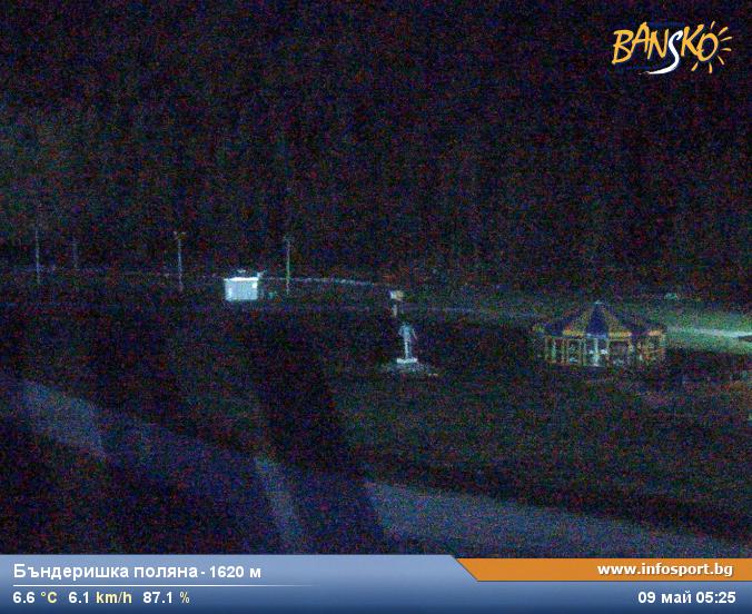
Camera image unavailable
Camera image · refreshes every 60 seconds while visible.
Open camera page ↗
Each colour starts at the value shown. Wind colours match across all three units. Dry cells stay neutral. Colours describe the displayed values, not official weather warnings.
ECMWF · Model run: Next update expected:
Day Time (UTC) Temp. (°C) Humidity (%) Wind (km/h) Wind (knots) Wind (Bft) Direction Precip. (mm) Snow (cm) Pressure (hPa) Freezing (m) Conditions | Friday, 30/10 06:00 8.5 76 1 0 0B N — — 1020 2528 Overcast 87% cloud  09:00 10.3 74 3 1 1B E 0.55 0 1020 2599 Overcast 94% cloud 12:00 10.1 75 1 1 1B SE 1.8 0 1020 2601 Overcast 99% cloud 15:00 8.9 83 0 0 0B E 2.0 0 1020 2535 Overcast 98% cloud 18:00 8.2 83 1 0 0B SW 0.76 0 1021 2455 Overcast 99% cloud 21:00 7.9 84 0 0 0B — 0.96 0 1021 2412 Overcast 97% cloud Saturday, 31/10 00:00 7.7 84 1 1 1B SW 0.97 0 1021 2375 Overcast 96% cloud 03:00 7.7 84 1 0 0B W 0.42 0 1021 2352 Overcast 95% cloud 06:00 7.8 83 1 0 0B SW 0.15 0 1021 2355 Overcast 98% cloud 09:00 8 82 2 1 1B SW 2.7 0 1021 2364 Overcast 100% cloud 12:00 8 83 1 1 1B SW 2.7 0 1020 2370 Overcast 97% cloud 15:00 7.6 83 0 0 0B — 1.2 0 1020 2330 Overcast 99% cloud 18:00 6.7 83 0 0 0B — 0.09 0 1020 2224 Overcast 100% cloud 21:00 6.5 82 1 1 0B E 0.45 0 1020 2206 Overcast 100% cloud Sunday, 01/11 00:00 6.5 83 2 1 1B E 1.4 0 1020 2208 Overcast 100% cloud 03:00 6.4 84 4 2 1B E 1.5 0 1019 2196 Overcast 100% cloud 06:00 6.3 84 4 2 1B E 2.5 0 1019 2173 Overcast 100% cloud 09:00 6.6 83 5 3 1B E 3.2 0 1019 2285 Overcast 100% cloud 12:00 6.7 84 3 2 1B E 5.7 0 1019 2312 Overcast 100% cloud 15:00 6.3 84 2 1 1B NE 6.6 0 1018 2296 Overcast 100% cloud 18:00 6.1 83 1 1 1B NE 5.5 0 1018 2279 Overcast 100% cloud 21:00 6.4 83 1 1 1B N 4.9 0 1018 2319 Overcast 100% cloud Monday, 02/11 00:00 6.4 82 1 1 1B N 5.5 0 1017 2313 Overcast 100% cloud 03:00 6.7 81 1 1 1B N 1.9 0 1016 2320 Overcast 96% cloud 06:00 7.3 82 2 1 1B NE 0.15 0 1016 2401 Overcast 85% cloud 09:00 9.3 75 3 2 1B E 0.31 0 1017 2562 Cloudy 67% cloud  12:00 11.2 62 4 2 1B SE 0.36 0 1014 2638 Cloudy 73% cloud 15:00 8.5 76 4 2 1B E 0.39 0 1014 2540 Overcast 85% cloud 18:00 7.4 81 2 1 1B E 0.11 0 1016 2450 Cloudy 75% cloud 21:00 6.9 80 2 1 1B NE 0 0 1016 2421 Overcast 97% cloud Tuesday, 03/11 00:00 6.9 81 4 2 1B NE 0 0 1014 2443 Overcast 100% cloud 03:00 7.4 83 4 2 1B NE 0.52 0 1013 2516 Overcast 100% cloud 06:00 7.8 83 4 2 1B E 3.5 0 1012 2521 Overcast 100% cloud 09:00 7.7 85 3 2 1B E 9.0 0 1013 2502 Overcast 100% cloud 12:00 7 83 2 1 1B N 11.1 0 1012 2447 Overcast 100% cloud 15:00 7.4 84 2 1 1B NE 2.9 0 1011 2452 Overcast 98% cloud 18:00 7.3 83 1 1 0B N 0.69 0 1012 2445 Overcast 97% cloud 21:00 7 81 1 1 1B NW 0.56 0 1013 2371 Overcast 98% cloud Wednesday, 04/11 00:00 6.7 81 2 1 1B NW 0.68 0 1014 2342 Overcast 83% cloud 03:00 5.9 83 3 1 1B NW 0.24 0 1015 2225 Overcast 100% cloud 06:00 6.3 83 2 1 1B N 0.07 0 1016 2299 Overcast 89% cloud 09:00 8.6 76 2 1 1B NE 0.08 0 1018 2493 Overcast 99% cloud 12:00 9.2 72 0 0 0B W 0.15 0 1018 2526 Overcast 91% cloud 15:00 7.8 78 0 0 0B E 0.31 0 1020 2417 Overcast 89% cloud 18:00 6.8 81 1 0 0B NE 0 0 1022 2266 Overcast 89% cloud 21:00 6.5 81 0 0 0B SW 0.15 0 1024 2190 Overcast 93% cloud Thursday, 05/11 00:00 6.1 81 1 1 1B SW 0 0 1024 2113 Overcast 89% cloud 03:00 5.5 80 1 1 1B W 0.07 0 1025 1999 Overcast 96% cloud 06:00 5 81 0 0 0B SW 0.15 0 1026 1910 Overcast 98% cloud |
|---|
Forecast table times: UTC.
Coordinates: 41.82685121°N, 23.47709656°E · Requested elevation: 993 m. Model terrain: 1617 m. Terrain and 1000/925/850/700 hPa profiles are used for height estimates.
Outside the available profile, temperature uses an estimated 5.5°C/km height correction; wind retains the nearest available model-level value. Humidity is estimated with adjusted pressure and temperature.
These are altitude estimates, not a simulation of local mountain terrain. Precipitation, cloud and sea-level pressure use horizontal interpolation only.
Precipitation includes rain and snow water equivalent: preceding 3 hours through day 6, then 6 hours (see cell tooltip). Snow (cm) estimates fresh snowfall from precipitation and temperature using the GFS conversion; it is not snow depth on the ground. Freezing (m) uses additional 600/500 hPa temperatures when available and estimates the lowest resolved 0°C crossing above sea level. When all sampled levels are warm, the upper profile limit is shown (see tooltip). < marks an entirely cold sampled profile and its lower height limit. No extrapolation is used.
Source: ECMWF · CC BY 4.0 · Processed by Snow Report.
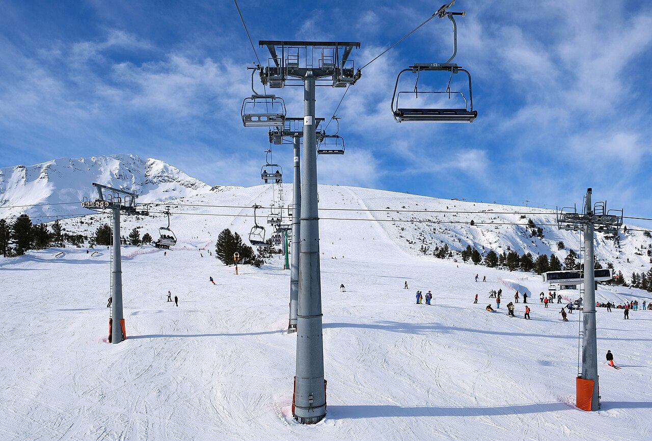
Camera image · refreshes every 60 seconds while visible.
Open camera page ↗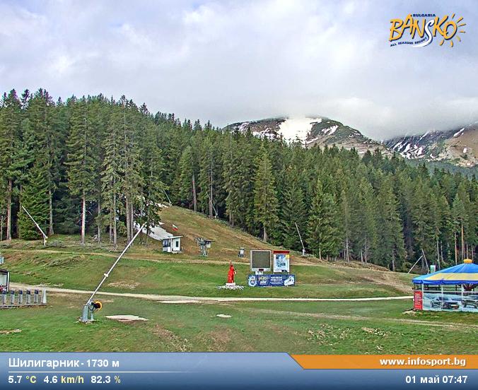
Camera image · refreshes every 60 seconds while visible.
Open camera page ↗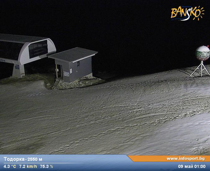
Camera image · refreshes every 60 seconds while visible.
Open camera page ↗ECMWF · Model run: Next update expected:
Day Time (UTC) Temp. (°C) Humidity (%) Wind (km/h) Wind (knots) Wind (Bft) Direction Precip. (mm) Snow (cm) Pressure (hPa) Freezing (m) Conditions | Friday, 30/10 06:00 4.9 91 1 1 1B N — — 1020 2510 Overcast 93% cloud 09:00 6.5 89 1 1 1B E 0.61 0 1020 2581 Overcast 97% cloud 12:00 6.6 91 1 0 0B E 2.0 0 1020 2589 Overcast 98% cloud 15:00 5.5 98 1 0 0B NE 2.2 0 1020 2537 Overcast 96% cloud 18:00 4.8 98 0 0 0B SW 0.99 0 1021 2454 Overcast 100% cloud 21:00 4.5 99 0 0 0B SW 0.95 0 1021 2407 Overcast 98% cloud Saturday, 31/10 00:00 4.3 99 1 1 1B SW 1.1 0 1021 2369 Overcast 98% cloud 03:00 4.3 98 1 0 0B SW 0.47 0 1021 2349 Overcast 97% cloud 06:00 4.4 98 1 0 0B SW 0.18 0 1021 2348 Overcast 99% cloud 09:00 4.7 97 1 1 1B SW 3.1 0 1021 2367 Overcast 100% cloud 12:00 4.8 96 1 1 1B SW 2.5 0 1020 2386 Overcast 95% cloud 15:00 4.4 97 0 0 0B W 1.0 0 1020 2339 Overcast 98% cloud 18:00 3.4 97 0 0 0B SW 0.04 0 1020 2232 Overcast 100% cloud 21:00 3.2 96 1 1 0B SE 0.47 0 1020 2213 Overcast 100% cloud Sunday, 01/11 00:00 3.2 97 2 1 1B E 1.5 0 1020 2215 Overcast 100% cloud 03:00 3.1 99 3 2 1B E 1.7 0 1019 2202 Overcast 100% cloud 06:00 2.9 98 3 2 1B E 2.8 0 1019 2169 Overcast 100% cloud 09:00 3.3 98 3 2 1B E 3.5 0 1019 2297 Overcast 100% cloud 12:00 3.5 98 2 1 1B E 6.1 0 1018 2333 Overcast 100% cloud 15:00 3 99 1 1 1B NE 7.1 0 1018 2305 Overcast 99% cloud 18:00 2.6 98 1 1 1B NE 6.2 0 1018 2267 Overcast 100% cloud 21:00 2.9 97 1 1 1B N 5.7 0 1018 2300 Overcast 100% cloud Monday, 02/11 00:00 2.8 98 2 1 1B N 6.3 0 1017 2284 Overcast 100% cloud 03:00 3.2 95 1 0 0B N 2.0 0 1016 2310 Overcast 94% cloud 06:00 3.8 97 1 1 1B NE 0.16 0 1016 2391 Overcast 86% cloud 09:00 5.9 89 2 1 1B E 0.32 0 1017 2564 Cloudy 70% cloud 12:00 7.6 75 3 2 1B SE 0.48 0 1014 2630 Cloudy 77% cloud 15:00 5.2 92 3 2 1B E 0.59 0 1015 2546 Cloudy 80% cloud 18:00 4.2 96 2 1 1B E 0.13 0 1016 2467 Overcast 86% cloud 21:00 3.5 94 1 1 1B NE 0 0 1016 2423 Overcast 98% cloud Tuesday, 03/11 00:00 3.6 95 2 1 1B NE 0 0 1014 2450 Overcast 100% cloud 03:00 3.9 98 3 2 1B NE 1.0 0 1013 2507 Overcast 100% cloud 06:00 4.3 98 3 1 1B E 4.3 0 1012 2507 Overcast 100% cloud 09:00 4.2 100 2 1 1B NE 10.4 0 1013 2496 Overcast 100% cloud 12:00 3.5 99 3 1 1B N 11.7 0 1012 2445 Overcast 100% cloud 15:00 4 99 2 1 1B N 3.4 0 1011 2451 Overcast 95% cloud 18:00 3.8 99 1 1 1B N 1.0 0 1012 2425 Overcast 98% cloud 21:00 3.5 96 2 1 1B NW 0.76 0 1013 2350 Overcast 99% cloud Wednesday, 04/11 00:00 3.3 97 3 2 1B N 1.2 0 1014 2321 Overcast 84% cloud 03:00 2.4 98 4 2 1B N 0.24 0 1015 2192 Overcast 100% cloud 06:00 2.7 97 3 2 1B N 0.02 0 1017 2272 Overcast 90% cloud 09:00 5.1 89 3 2 1B N 0.03 0 1018 2482 Overcast 100% cloud 12:00 5.6 85 2 1 1B N 0.16 0 1018 2510 Overcast 89% cloud 15:00 4.4 92 2 1 1B N 0.32 0 1020 2406 Overcast 89% cloud 18:00 3.4 95 2 1 1B N 0 0 1022 2259 Overcast 87% cloud 21:00 3 96 1 0 0B N 0.16 0 1024 2170 Overcast 90% cloud Thursday, 05/11 00:00 2.5 95 1 0 0B W 0 0 1024 2090 Overcast 90% cloud 03:00 2 94 1 1 1B NW 0.02 0 1025 1970 Overcast 97% cloud 06:00 1.5 95 1 1 1B N 0.16 0 1026 1887 Overcast 98% cloud |
|---|
Forecast table times: UTC.
Coordinates: 41.7819115°N, 23.44018936°E · Requested elevation: 1600 m. Model terrain: 1593 m. Terrain and 1000/925/850/700 hPa profiles are used for height estimates.
These are altitude estimates, not a simulation of local mountain terrain. Precipitation, cloud and sea-level pressure use horizontal interpolation only.
Precipitation includes rain and snow water equivalent: preceding 3 hours through day 6, then 6 hours (see cell tooltip). Snow (cm) estimates fresh snowfall from precipitation and temperature using the GFS conversion; it is not snow depth on the ground. Freezing (m) uses additional 600/500 hPa temperatures when available and estimates the lowest resolved 0°C crossing above sea level. When all sampled levels are warm, the upper profile limit is shown (see tooltip). < marks an entirely cold sampled profile and its lower height limit. No extrapolation is used.
Source: ECMWF · CC BY 4.0 · Processed by Snow Report.
ECMWF · Model run: Next update expected:
Day Time (UTC) Temp. (°C) Humidity (%) Wind (km/h) Wind (knots) Wind (Bft) Direction Precip. (mm) Snow (cm) Pressure (hPa) Freezing (m) Conditions | Friday, 30/10 06:00 -0.1 90 1 1 1B NW — — 1020 2505 Overcast 95% cloud 09:00 0.3 95 2 1 1B S 0.66 0.2 1020 2576 Overcast 98% cloud 12:00 0.4 96 3 1 1B S 2.2 0.7 1020 2586 Overcast 98% cloud 15:00 0.1 98 3 2 1B SE 2.3 0.7 1020 2539 Overcast 95% cloud 18:00 -0.4 99 6 3 2B S 1.1 0.3 1021 2458 Overcast 100% cloud 21:00 -0.7 99 8 4 2B S 0.93 0.3 1021 2407 Overcast 99% cloud Saturday, 31/10 00:00 -0.9 100 6 3 2B SW 1.2 0.3 1021 2370 Overcast 99% cloud 03:00 -1 98 6 3 2B SW 0.50 0.2 1021 2351 Overcast 98% cloud 06:00 -1 98 5 3 1B SW 0.19 0 1021 2350 Overcast 99% cloud 09:00 -0.9 99 6 4 2B SW 3.3 1.3 1021 2372 Overcast 100% cloud 12:00 -0.8 97 12 6 2B SW 2.5 0.7 1020 2393 Overcast 94% cloud 15:00 -1.1 95 10 6 2B SW 0.98 0.3 1020 2344 Overcast 98% cloud 18:00 -1.5 95 9 5 2B SW 0.01 0 1020 2235 Overcast 100% cloud 21:00 -1.6 96 10 5 2B S 0.48 0.1 1020 2213 Overcast 100% cloud Sunday, 01/11 00:00 -1.6 98 15 8 3B S 1.6 0.5 1020 2216 Overcast 100% cloud 03:00 -1.6 99 19 10 3B SE 1.8 0.5 1019 2203 Overcast 100% cloud 06:00 -1.8 98 20 11 4B SE 2.9 0.9 1019 2166 Overcast 100% cloud 09:00 -1.1 98 31 16 5B SE 3.6 1.5 1019 2298 Overcast 100% cloud 12:00 -0.9 98 29 16 5B S 6.4 2.6 1018 2334 Overcast 100% cloud 15:00 -0.9 99 26 14 4B S 7.5 3 1018 2297 Overcast 99% cloud 18:00 -1 98 21 12 4B SE 6.6 2.6 1018 2250 Overcast 100% cloud 21:00 -1 98 23 12 4B SE 6.1 2.4 1018 2283 Overcast 100% cloud Monday, 02/11 00:00 -1.1 99 22 12 4B S 6.7 2.7 1017 2264 Overcast 100% cloud 03:00 -1 93 12 7 3B S 2.1 0.6 1016 2304 Overcast 94% cloud 06:00 -0.7 86 13 7 3B S 0.18 0 1016 2386 Overcast 87% cloud 09:00 0.2 84 16 9 3B S 0.35 0.1 1017 2564 Cloudy 72% cloud 12:00 0.8 83 14 7 3B S 0.54 0.2 1014 2627 Cloudy 79% cloud 15:00 0.1 87 15 8 3B SE 0.66 0.2 1015 2546 Cloudy 79% cloud 18:00 -0.3 90 18 10 3B SE 0.13 0 1016 2471 Overcast 91% cloud 21:00 -0.4 89 22 12 4B SE 0 0 1015 2423 Overcast 98% cloud Tuesday, 03/11 00:00 -0.3 96 29 16 5B SE 0 0 1014 2450 Overcast 100% cloud 03:00 -0.1 97 33 18 5B SE 1.2 0.4 1013 2500 Overcast 100% cloud 06:00 -0.1 99 34 19 5B SE 4.6 1.9 1012 2500 Overcast 100% cloud 09:00 -0.2 99 31 17 5B SE 11.1 5.5 1013 2489 Overcast 100% cloud 12:00 -0.4 98 21 11 4B SE 12.1 6.1 1012 2432 Overcast 100% cloud 15:00 -0.4 94 14 8 3B S 3.6 1.4 1011 2446 Overcast 95% cloud 18:00 -0.5 96 10 5 2B SE 1.1 0.3 1012 2416 Overcast 99% cloud 21:00 -0.8 97 6 3 2B SE 0.84 0.3 1013 2344 Overcast 100% cloud Wednesday, 04/11 00:00 -0.9 95 3 2 1B NE 1.3 0.4 1014 2316 Overcast 84% cloud 03:00 -1.3 93 7 4 2B N 0.24 0 1015 2179 Overcast 100% cloud 06:00 -1 90 6 3 1B N 0.01 0 1017 2263 Overcast 90% cloud 09:00 -0.2 89 4 2 1B N 0.01 0 1018 2480 Overcast 100% cloud 12:00 -0.1 88 4 2 1B W 0.18 0 1018 2506 Overcast 88% cloud 15:00 -0.6 91 3 2 1B W 0.35 0.1 1020 2406 Overcast 90% cloud 18:00 -1.3 94 4 2 1B SW 0 0 1022 2263 Overcast 86% cloud 21:00 -1.9 93 5 3 1B SW 0.18 0 1024 2171 Overcast 89% cloud Thursday, 05/11 00:00 -2.2 92 5 3 1B SW 0 0 1024 2092 Overcast 91% cloud 03:00 -2.9 94 4 2 1B W 0.01 0 1025 1971 Overcast 97% cloud 06:00 -3.5 96 2 1 1B W 0.18 0.2 1026 1884 Overcast 98% cloud |
|---|
Forecast table times: UTC.
Coordinates: 41.75773941°N, 23.43495369°E · Requested elevation: 2521 m. Model terrain: 1609 m. Terrain and 1000/925/850/700 hPa profiles are used for height estimates.
These are altitude estimates, not a simulation of local mountain terrain. Precipitation, cloud and sea-level pressure use horizontal interpolation only.
Precipitation includes rain and snow water equivalent: preceding 3 hours through day 6, then 6 hours (see cell tooltip). Snow (cm) estimates fresh snowfall from precipitation and temperature using the GFS conversion; it is not snow depth on the ground. Freezing (m) uses additional 600/500 hPa temperatures when available and estimates the lowest resolved 0°C crossing above sea level. When all sampled levels are warm, the upper profile limit is shown (see tooltip). < marks an entirely cold sampled profile and its lower height limit. No extrapolation is used.