Banderishka Polyana · 1,620 m
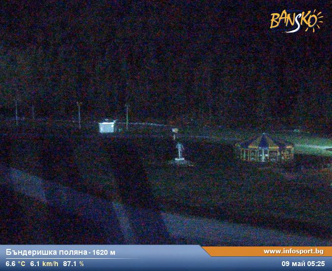
Camera image unavailable
Camera image · refreshes every 60 seconds while visible.
Open camera page ↗
Κάθε χρώμα ξεκινά από την τιμή που αναγράφεται. Τα χρώματα ανέμου αντιστοιχούν και στις τρεις μονάδες. Οι τιμές χωρίς υετό παραμένουν ουδέτερες. Τα χρώματα περιγράφουν τις τιμές και δεν αποτελούν επίσημες προειδοποιήσεις.
ECMWF · Εκτέλεση μοντέλου: Αναμενόμενη επόμενη ενημέρωση:
Ημέρα Ώρα (UTC) Θερμ. (°C) Υγρασία (%) Άνεμος (km/h) Άνεμος (κόμβοι) Άνεμος (Bft) Διεύθυνση Υετός (mm) Νέο χιόνι (cm) Πίεση (hPa) Σημείο παγοποίησης (m) Συνθήκες | Τετάρτη, 04/11 06:00 6.6 80 2 1 1B N — — 1018 2318 Overcast 90% cloud  09:00 9.2 72 3 2 1B E 0.01 0 1020 2513 Cloudy 79% cloud  12:00 10.2 64 2 1 1B SE 0.09 0 1020 2549 Overcast 83% cloud 15:00 8 78 1 1 1B E 0.55 0 1021 2392 Overcast 93% cloud 18:00 7.3 81 1 1 1B E 0.39 0 1024 2306 Overcast 98% cloud 21:00 6.5 84 1 0 0B NE 0.90 0 1025 2219 Overcast 100% cloud Πέμπτη, 05/11 00:00 6.3 85 1 0 0B NE 1.4 0 1026 2162 Overcast 100% cloud 03:00 6 85 1 0 0B E 1.4 0 1026 2109 Overcast 100% cloud 06:00 5.9 84 1 1 1B E 1.0 0 1027 2069 Overcast 100% cloud 09:00 6.3 81 2 1 1B E 0.73 0 1028 2107 Overcast 100% cloud 12:00 6.6 81 0 0 0B NE 0.87 0 1027 2125 Overcast 100% cloud 15:00 6 82 0 0 0B NW 0.92 0 1027 2070 Overcast 96% cloud 18:00 5.2 83 1 1 1B N 0.59 0 1027 1993 Overcast 99% cloud 21:00 4.5 82 1 1 1B N 0.52 0 1027 1909 Overcast 99% cloud Παρασκευή, 06/11 00:00 3.9 83 1 1 1B NW 0.21 0 1026 1782 Overcast 87% cloud 03:00 3.2 82 2 1 1B NW 0.04 0 1025 < 1620 Cloudy 62% cloud 06:00 3 80 1 0 0B W 0.04 0 1025 < 1620 Cloudy 77% cloud 09:00 7.5 60 1 1 0B SE 0 0 1023 2465 Partly cloudy 46% cloud  12:00 9.2 53 1 1 0B W 0 0 1020 2599 Partly cloudy 26% cloud 15:00 6.1 67 1 1 1B W 0 0 1020 2380 Partly cloudy 25% cloud 18:00 2.5 65 1 1 1B W 0 0 1020 < 1620 Partly cloudy 44% cloud 21:00 2.8 55 1 1 1B NW 0 0 1021 < 1620 Partly cloudy 50% cloud Σάββατο, 07/11 00:00 2.5 55 1 0 0B NW 0 0 1021 < 1620 Cloudy 61% cloud 03:00 1.8 62 1 0 0B W 0 0 1022 < 1620 Clear 9% cloud  06:00 2.8 65 1 0 0B SW 0 0 1024 < 1620 Clear 0% cloud 09:00 7.6 51 2 1 1B SE 0 0 1024 2337 Clear 1% cloud 12:00 8.9 46 1 1 0B SE 0 0 1022 2379 Clear 11% cloud 15:00 4.7 63 1 0 0B W 0 0 1024 1912 Clear 4% cloud 18:00 1.9 68 0 0 0B W 0 0 1027 < 1620 Clear 3% cloud 21:00 0.9 67 1 0 0B W 0 0 1029 < 1620 Partly cloudy 20% cloud Κυριακή, 08/11 00:00 1.5 67 1 1 1B W 0 0 1030 < 1620 Partly cloudy 37% cloud 03:00 1.2 68 1 1 1B W 0 0 1030 < 1620 Partly cloudy 46% cloud 06:00 1.6 67 2 1 1B W 0 0 1031 < 1620 Cloudy 50% cloud 09:00 6.6 55 1 1 1B S 0 0 1030 2210 Clear 19% cloud 12:00 8 54 1 0 0B SE 0 0 1028 2377 Partly cloudy 35% cloud 15:00 4.6 72 1 0 0B E 0 0 1029 1949 Clear 17% cloud 18:00 1.7 75 2 1 1B W 0 0 1030 < 1620 Cloudy 51% cloud 21:00 -0.4 72 2 1 1B W 0 0 1030 < 1620 Partly cloudy 44% cloud Δευτέρα, 09/11 00:00 1 57 2 1 1B W 0 0 1029 < 1620 Partly cloudy 35% cloud 03:00 2.4 51 1 1 1B W 0 0 1028 < 1620 Overcast 95% cloud 06:00 4.5 54 1 1 1B W 0 0 1028 1939 Overcast 83% cloud 09:00 8.4 47 1 1 0B SW 0 0 1028 2467 Partly cloudy 48% cloud 12:00 8.8 56 1 1 0B SW 0.08 0 1027 2491 Overcast 93% cloud 15:00 6.2 69 0 0 0B NW 0.61 0 1026 2253 Overcast 94% cloud 18:00 4.3 70 1 1 0B W 0 0 1026 1896 Cloudy 68% cloud 21:00 3.9 73 2 1 1B W 0 0 1026 1785 Partly cloudy 47% cloud Τρίτη, 10/11 00:00 4 74 2 1 1B W 0 0 1025 1854 Partly cloudy 45% cloud 03:00 4.5 72 3 2 1B W 0 0 1024 1993 Partly cloudy 41% cloud 06:00 5.7 71 3 1 1B W 0 0 1024 2353 Overcast 92% cloud |
|---|
Forecast table times: UTC.
Coordinates: 41.82685121°N, 23.47709656°E · Requested elevation: 993 m. Model terrain: 1617 m. Terrain and 1000/925/850/700 hPa profiles are used for height estimates.
Outside the available profile, temperature uses an estimated 5.5°C/km height correction; wind retains the nearest available model-level value. Humidity is estimated with adjusted pressure and temperature.
These are altitude estimates, not a simulation of local mountain terrain. Precipitation, cloud and sea-level pressure use horizontal interpolation only.
Precipitation includes rain and snow water equivalent: preceding 3 hours through day 6, then 6 hours (see cell tooltip). Snow (cm) estimates fresh snowfall from precipitation and temperature using the GFS conversion; it is not snow depth on the ground. Freezing (m) uses additional 600/500 hPa temperatures when available and estimates the lowest resolved 0°C crossing above sea level. When all sampled levels are warm, the upper profile limit is shown (see tooltip). < marks an entirely cold sampled profile and its lower height limit. No extrapolation is used.
Source: ECMWF · CC BY 4.0 · Processed by Snow Report.
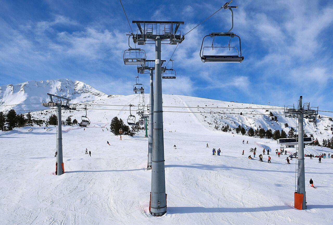
Το Μπάνσκο (βουλγαρικά: Банско) είναι πόλη της νοτιοδυτικής Βουλγαρίας, στους πρόποδες της οροσειράς Πιρίν, σε υψόμετρο περίπου 1.200 μέτρων. Αποτελεί δημοφιλή χιονοδρομικό προορισμό.
Από κοινότητα που βασιζόταν κυρίως στην κτηνοτροφία και στο εμπόριο, εξελίχθηκε σε διεθνές κέντρο χειμερινού και θερινού τουρισμού. Οι γύρω κορυφές, οι πολυάριθμες λίμνες και τα παλιά πευκοδάση προσφέρουν ένα ιδιαίτερο φυσικό περιβάλλον για αναψυχή. Η αρχική περιγραφή συνδέει την τουριστική ανάπτυξη με το συγκριτικά χαμηλότερο κόστος διακοπών και την προσπάθεια ανταγωνισμού των χιονοδρομικών προορισμών της Γαλλίας και της Ελβετίας.
Η υποδομή και η οργάνωση του χιονοδρομικού πεδίου στην Τοντόρκα βελτιώθηκαν σταδιακά για να εξυπηρετήσουν τον αυξανόμενο αριθμό επισκεπτών. Το 2003 κατασκευάστηκε η τηλεκαμπίνα από την πόλη, αντικαθιστώντας τη μεταφορά με μικρά λεωφορεία προς την κύρια βάση του χιονοδρομικού κέντρου, στην Μπαντερίσκα Πολιάνα.
Τα ιστορικά στοιχεία του 2010 που παραθέτει η αρχική περιγραφή αναφέρουν 75 χλμ. πιστών, 14 αναβατήρες και συρόμενα μέσα, με συνολική μεταφορική ικανότητα έως 24.500 ατόμων την ώρα. Πρόκειται για στοιχεία εκείνης της περιόδου και όχι για σημερινή καταγραφή των ανοιχτών εγκαταστάσεων.
Το ανώτερο σημείο που εξυπηρετείται από αναβατήρες βρίσκεται, σύμφωνα με την ίδια περιγραφή, σε υψόμετρο περίπου 2.600 μέτρων. Η υψομετρική διαφορά έως τη βάση της Μπαντερίσκα Πολιάνα πλησιάζει τα 1.000 μέτρα, ενώ ξεπερνά τα 1.600 μέτρα εάν συνυπολογιστούν οι διαδρομές που καταλήγουν στην πόλη.
Camera image · refreshes every 60 seconds while visible.
Open camera page ↗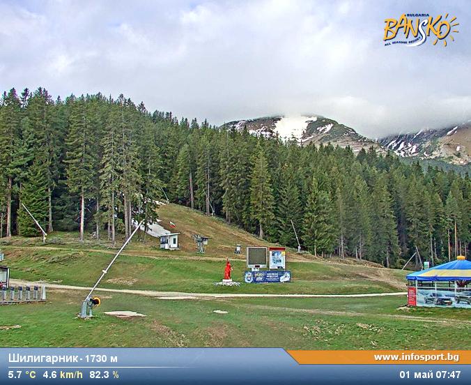
Camera image · refreshes every 60 seconds while visible.
Open camera page ↗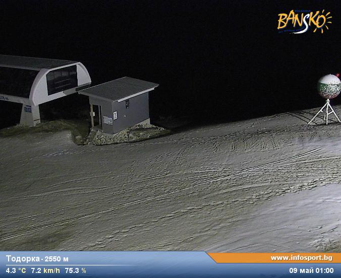
Camera image · refreshes every 60 seconds while visible.
Open camera page ↗ECMWF · Εκτέλεση μοντέλου: Αναμενόμενη επόμενη ενημέρωση:
Ημέρα Ώρα (UTC) Θερμ. (°C) Υγρασία (%) Άνεμος (km/h) Άνεμος (κόμβοι) Άνεμος (Bft) Διεύθυνση Υετός (mm) Νέο χιόνι (cm) Πίεση (hPa) Σημείο παγοποίησης (m) Συνθήκες | Τετάρτη, 04/11 06:00 2.9 96 3 2 1B N — — 1018 2265 Overcast 95% cloud 09:00 5.5 86 3 2 1B NE 0.01 0 1020 2489 Overcast 88% cloud 12:00 6.4 77 1 1 1B NE 0.10 0 1020 2527 Overcast 93% cloud 15:00 4.5 92 1 1 1B NE 0.59 0 1022 2380 Overcast 97% cloud 18:00 3.9 95 1 1 1B NE 0.41 0 1024 2294 Overcast 99% cloud 21:00 3.1 98 1 1 1B N 0.95 0 1025 2202 Overcast 100% cloud Πέμπτη, 05/11 00:00 2.8 100 1 1 1B N 1.5 0 1026 2137 Overcast 100% cloud 03:00 2.5 99 1 1 1B N 1.3 0 1026 2082 Overcast 100% cloud 06:00 2.4 99 1 1 1B NE 0.88 0 1027 2044 Overcast 100% cloud 09:00 2.9 96 1 0 0B NE 0.71 0 1028 2097 Overcast 100% cloud 12:00 3.3 94 2 1 1B NW 0.71 0 1027 2127 Overcast 100% cloud 15:00 2.6 95 1 1 1B NW 0.65 0 1027 2066 Overcast 89% cloud 18:00 1.7 97 2 1 1B N 0.26 0 1027 1979 Overcast 96% cloud 21:00 1.1 97 1 1 1B N 0.24 0 1027 1896 Overcast 98% cloud Παρασκευή, 06/11 00:00 0.6 98 2 1 1B NW 0.08 0 1026 1826 Overcast 81% cloud 03:00 0 97 2 1 1B NW 0.02 0 1025 1621 Cloudy 62% cloud 06:00 -0.3 96 2 1 1B NW 0.02 0 1025 < 1595 Overcast 88% cloud 09:00 3.8 71 1 0 0B NE 0 0 1023 2436 Partly cloudy 40% cloud 12:00 5.5 63 2 1 1B NW 0 0 1021 2581 Partly cloudy 26% cloud 15:00 2.6 76 2 1 1B NW 0 0 1020 2377 Partly cloudy 23% cloud 18:00 -0.9 79 1 0 0B NW 0 0 1020 < 1595 Partly cloudy 42% cloud 21:00 -0.4 67 1 1 1B NW 0 0 1021 < 1595 Cloudy 51% cloud Σάββατο, 07/11 00:00 -0.7 66 1 0 0B NW 0 0 1022 < 1595 Cloudy 64% cloud 03:00 -1.4 76 1 0 0B W 0 0 1022 < 1595 Clear 14% cloud 06:00 -0.6 81 1 0 0B SW 0 0 1024 < 1595 Clear 0% cloud 09:00 4 63 0 0 0B S 0 0 1024 2318 Clear 1% cloud 12:00 5.3 55 1 1 1B NE 0 0 1023 2367 Clear 6% cloud 15:00 1.2 75 1 0 0B NW 0 0 1024 1890 Clear 1% cloud 18:00 -1.5 82 0 0 0B W 0 0 1027 < 1595 Clear 2% cloud 21:00 -2.4 82 1 0 0B SW 0 0 1029 < 1595 Clear 17% cloud Κυριακή, 08/11 00:00 -1.6 85 1 1 1B SW 0 0 1030 < 1595 Partly cloudy 49% cloud 03:00 -1.8 86 1 1 1B W 0 0 1030 < 1595 Cloudy 58% cloud 06:00 -1.7 83 2 1 1B SW 0 0 1031 < 1595 Cloudy 63% cloud 09:00 3.1 67 1 1 1B S 0 0 1030 2190 Partly cloudy 28% cloud 12:00 4.4 65 1 1 1B SE 0 0 1028 2357 Partly cloudy 36% cloud 15:00 1.1 87 1 1 1B SE 0 0 1029 1921 Partly cloudy 21% cloud 18:00 -1.7 91 2 1 1B SW 0 0 1030 < 1595 Cloudy 60% cloud 21:00 -4.2 90 1 1 0B SW 0 0 1030 < 1595 Cloudy 54% cloud Δευτέρα, 09/11 00:00 -2.5 71 1 1 1B SW 0 0 1029 < 1595 Partly cloudy 41% cloud 03:00 -0.9 61 1 1 1B SW 0 0 1028 < 1595 Overcast 94% cloud 06:00 1.1 64 1 1 1B SW 0 0 1028 1934 Cloudy 72% cloud 09:00 5.2 55 1 1 1B SW 0 0 1028 2475 Partly cloudy 44% cloud 12:00 5.1 69 1 0 0B S 0.11 0 1027 2463 Overcast 96% cloud 15:00 2.6 83 1 0 0B SE 0.65 0 1026 2226 Overcast 95% cloud 18:00 0.8 83 1 1 0B SW 0 0 1026 1890 Cloudy 72% cloud 21:00 0.6 86 1 1 1B W 0 0 1026 1824 Partly cloudy 48% cloud Τρίτη, 10/11 00:00 0.9 87 2 1 1B W 0 0 1025 1934 Partly cloudy 44% cloud 03:00 1.3 86 2 1 1B W 0 0 1024 2059 Partly cloudy 39% cloud 06:00 2.5 84 2 1 1B W 0 0 1024 2379 Overcast 91% cloud |
|---|
Forecast table times: UTC.
Coordinates: 41.7819115°N, 23.44018936°E · Requested elevation: 1600 m. Model terrain: 1593 m. Terrain and 1000/925/850/700 hPa profiles are used for height estimates.
These are altitude estimates, not a simulation of local mountain terrain. Precipitation, cloud and sea-level pressure use horizontal interpolation only.
Precipitation includes rain and snow water equivalent: preceding 3 hours through day 6, then 6 hours (see cell tooltip). Snow (cm) estimates fresh snowfall from precipitation and temperature using the GFS conversion; it is not snow depth on the ground. Freezing (m) uses additional 600/500 hPa temperatures when available and estimates the lowest resolved 0°C crossing above sea level. When all sampled levels are warm, the upper profile limit is shown (see tooltip). < marks an entirely cold sampled profile and its lower height limit. No extrapolation is used.
Source: ECMWF · CC BY 4.0 · Processed by Snow Report.
ECMWF · Εκτέλεση μοντέλου: Αναμενόμενη επόμενη ενημέρωση:
Ημέρα Ώρα (UTC) Θερμ. (°C) Υγρασία (%) Άνεμος (km/h) Άνεμος (κόμβοι) Άνεμος (Bft) Διεύθυνση Υετός (mm) Νέο χιόνι (cm) Πίεση (hPa) Σημείο παγοποίησης (m) Συνθήκες | Τετάρτη, 04/11 06:00 -1.2 89 3 2 1B NE — — 1018 2248 Overcast 97% cloud 09:00 -0.2 89 2 1 1B E 0.01 0 1020 2485 Overcast 91% cloud 12:00 0 87 2 1 1B S 0.11 0 1020 2524 Overcast 97% cloud 15:00 -0.8 96 3 1 1B S 0.64 0.2 1022 2381 Overcast 99% cloud 18:00 -1.3 97 2 1 1B S 0.44 0.1 1024 2297 Overcast 100% cloud 21:00 -1.6 99 2 1 1B SW 1.0 0.3 1025 2201 Overcast 100% cloud Πέμπτη, 05/11 00:00 -2 100 2 1 1B SW 1.6 0.5 1026 2134 Overcast 100% cloud 03:00 -2.3 98 3 2 1B W 1.4 0.4 1026 2077 Overcast 100% cloud 06:00 -2.6 98 3 2 1B N 0.85 0.3 1027 2038 Overcast 100% cloud 09:00 -2.5 97 5 3 1B NW 0.74 0.2 1028 2094 Overcast 100% cloud 12:00 -2.5 97 8 4 2B NW 0.65 0.2 1027 2128 Overcast 100% cloud 15:00 -2.5 89 12 7 3B N 0.54 0.2 1027 2065 Overcast 88% cloud 18:00 -2.5 74 13 7 3B N 0.13 0 1027 1974 Overcast 95% cloud 21:00 -2.3 64 11 6 2B N 0.12 0 1027 1891 Overcast 98% cloud Παρασκευή, 06/11 00:00 -2 54 15 8 3B N 0.02 0 1026 1842 Cloudy 79% cloud 03:00 -2.1 52 14 8 3B N 0.00 0 1025 1663 Cloudy 61% cloud 06:00 -2 52 11 6 2B N 0.00 0 1025 < 1612 Overcast 93% cloud 09:00 -0.4 47 12 6 2B N 0 0 1023 2432 Partly cloudy 35% cloud 12:00 0.3 48 15 8 3B N 0 0 1021 2577 Partly cloudy 26% cloud 15:00 -0.5 48 18 10 3B N 0 0 1020 2376 Partly cloudy 22% cloud 18:00 -2 45 21 11 4B N 0 0 1020 < 1612 Partly cloudy 41% cloud 21:00 -2.1 42 19 10 3B N 0 0 1021 < 1612 Cloudy 51% cloud Σάββατο, 07/11 00:00 -2.3 40 15 8 3B N 0 0 1022 < 1612 Cloudy 65% cloud 03:00 -2.5 38 17 9 3B N 0 0 1022 < 1612 Clear 16% cloud 06:00 -2.3 40 16 9 3B N 0 0 1024 < 1612 Clear 0% cloud 09:00 -1.1 40 16 9 3B N 0 0 1024 2315 Clear 1% cloud 12:00 -1.1 41 16 9 3B N 0 0 1023 2368 Clear 3% cloud 15:00 -2.7 52 17 9 3B N 0 0 1024 1876 Clear 0% cloud 18:00 -3.8 53 16 9 3B N 0 0 1027 < 1612 Clear 1% cloud 21:00 -4.3 50 15 8 3B N 0 0 1029 < 1612 Clear 16% cloud Κυριακή, 08/11 00:00 -3.9 52 15 8 3B N 0 0 1030 < 1612 Cloudy 54% cloud 03:00 -3.9 50 15 8 3B N 0 0 1031 < 1612 Cloudy 64% cloud 06:00 -3.6 48 9 5 2B N 0 0 1031 < 1612 Cloudy 69% cloud 09:00 -1.8 47 6 3 2B N 0 0 1030 2185 Partly cloudy 31% cloud 12:00 -1 46 6 3 1B N 0 0 1028 2350 Partly cloudy 37% cloud 15:00 -2.1 51 8 4 2B NW 0 0 1029 1902 Partly cloudy 23% cloud 18:00 -3 46 11 6 2B NW 0 0 1030 < 1612 Cloudy 65% cloud 21:00 -4 46 12 6 2B NW 0 0 1030 < 1612 Cloudy 60% cloud Δευτέρα, 09/11 00:00 -3.4 52 13 7 3B NW 0 0 1029 < 1612 Partly cloudy 43% cloud 03:00 -2.7 51 13 7 3B NW 0 0 1028 < 1612 Overcast 93% cloud 06:00 -2 63 11 6 2B NW 0 0 1028 1925 Cloudy 67% cloud 09:00 -0.2 68 14 7 3B W 0 0 1028 2484 Partly cloudy 40% cloud 12:00 -0.4 84 16 9 3B W 0.12 0 1027 2454 Overcast 98% cloud 15:00 -1.3 88 18 10 3B NW 0.70 0.2 1026 2214 Overcast 96% cloud 18:00 -1.9 75 19 10 3B W 0 0 1026 1866 Cloudy 73% cloud 21:00 -1.8 73 19 10 3B W 0 0 1026 1814 Partly cloudy 49% cloud Τρίτη, 10/11 00:00 -1.6 71 20 11 3B W 0 0 1025 1949 Partly cloudy 43% cloud 03:00 -1.3 70 19 10 3B NW 0 0 1024 2077 Partly cloudy 38% cloud 06:00 -0.4 65 17 9 3B NW 0 0 1024 2386 Overcast 91% cloud |
|---|
Forecast table times: UTC.
Coordinates: 41.75773941°N, 23.43495369°E · Requested elevation: 2521 m. Model terrain: 1609 m. Terrain and 1000/925/850/700 hPa profiles are used for height estimates.
These are altitude estimates, not a simulation of local mountain terrain. Precipitation, cloud and sea-level pressure use horizontal interpolation only.
Precipitation includes rain and snow water equivalent: preceding 3 hours through day 6, then 6 hours (see cell tooltip). Snow (cm) estimates fresh snowfall from precipitation and temperature using the GFS conversion; it is not snow depth on the ground. Freezing (m) uses additional 600/500 hPa temperatures when available and estimates the lowest resolved 0°C crossing above sea level. When all sampled levels are warm, the upper profile limit is shown (see tooltip). < marks an entirely cold sampled profile and its lower height limit. No extrapolation is used.