North ski area
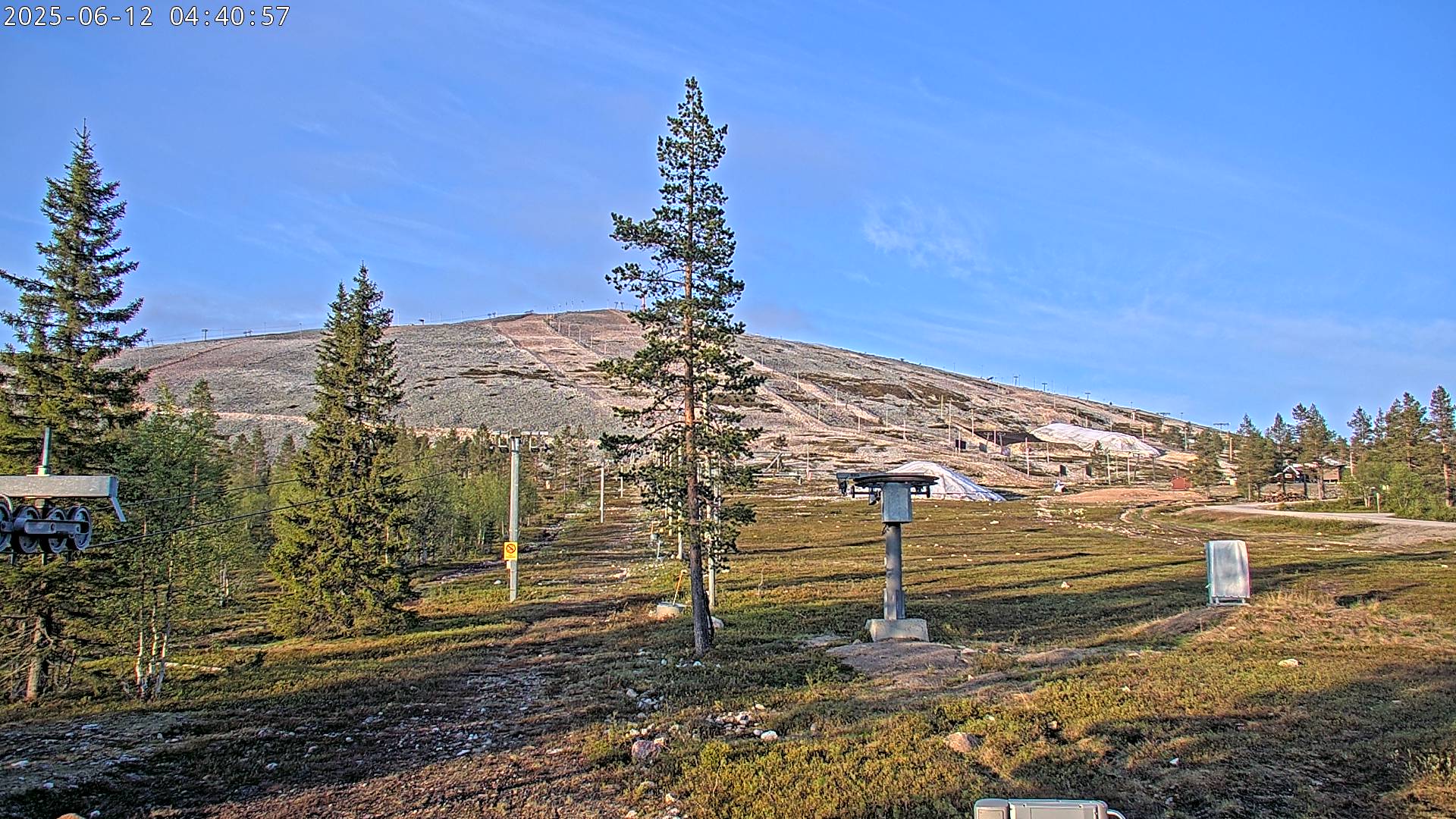
Camera image unavailable
Camera image · refreshes every 60 seconds while visible.
Open camera page ↗
Chaque couleur commence à la valeur indiquée. Les couleurs du vent correspondent dans les trois unités. Les cases sans précipitations restent neutres. Les couleurs décrivent les valeurs affichées et ne sont pas des alertes officielles.
ECMWF · Cycle du modèle : Prochaine mise à jour attendue :
Jour Heure (UTC) Temp. (°C) Humidité (%) Vent (km/h) Vent (nœuds) Vent (Bft) Direction Précip. (mm) Neige fraîche (cm) Pression (hPa) Isotherme 0 °C (m) Conditions | Mercredi, 04/11 06:00 1.4 96 19 10 3B SW — — 1011 1348 Overcast 94% cloud  09:00 3.6 90 21 11 4B W 0 0 1009 1764 Clear 11% cloud  12:00 5 79 20 11 4B W 0 0 1008 1249 Clear 6% cloud 15:00 1.4 73 17 9 3B W 0 0 1008 994 Clear 3% cloud 18:00 2 64 23 12 4B W 0 0 1005 997 Partly cloudy 34% cloud  21:00 3.2 69 29 16 5B NW 0 0 1005 949 Partly cloudy 25% cloud Jeudi, 05/11 00:00 2.4 74 22 12 4B NW 0 0 1007 788 Partly cloudy 22% cloud 03:00 1.1 71 20 11 3B NW 0 0 1009 523 Clear 18% cloud 06:00 0.6 68 21 11 4B NW 0 0 1011 425 Partly cloudy 35% cloud 09:00 1 67 19 10 3B NW 0 0 1013 455 Partly cloudy 28% cloud 12:00 0.8 64 18 10 3B NW 0 0 1015 418 Partly cloudy 39% cloud 15:00 -0.9 74 17 9 3B NW 0 0 1018 < 252 Clear 7% cloud 18:00 -0.9 76 16 9 3B NW 0 0 1020 < 252 Clear 15% cloud 21:00 -0.8 72 17 9 3B NW 0 0 1021 < 252 Cloudy 64% cloud  Vendredi, 06/11 00:00 -1.2 69 15 8 3B NW 0 0 1022 < 252 Partly cloudy 42% cloud 03:00 -2.1 80 12 7 3B W 0 0 1023 < 252 Overcast 90% cloud 06:00 -1.5 80 15 8 3B W 0 0 1023 < 252 Overcast 88% cloud 09:00 -0.9 76 11 6 2B W 0 0 1022 < 252 Overcast 96% cloud 12:00 -0.5 76 13 7 3B W 0 0 1021 < 252 Overcast 97% cloud 15:00 -0.5 90 11 6 2B SW 0.51 0.2 1019 462 Overcast 96% cloud 18:00 0.6 89 16 9 3B W 0.12 0 1016 1128 Overcast 99% cloud 21:00 0.7 90 16 9 3B W 0 0 1014 1197 Overcast 93% cloud Samedi, 07/11 00:00 2.1 84 16 9 3B W 0 0 1012 1171 Overcast 94% cloud 03:00 1 90 16 9 3B W 0 0 1010 1203 Cloudy 62% cloud 06:00 0.9 92 16 8 3B W 0.00 0 1007 1380 Overcast 82% cloud 09:00 1.5 88 14 8 3B W 0 0 1007 1206 Overcast 86% cloud 12:00 2.2 82 16 9 3B W 0 0 1007 934 Overcast 97% cloud 15:00 0.4 89 16 9 3B W 0 0 1007 829 Overcast 89% cloud 18:00 -0.1 89 12 6 2B W 0.12 0 1008 347 Overcast 97% cloud 21:00 -0.2 90 12 7 3B W 0.25 0.1 1008 342 Overcast 99% cloud Dimanche, 08/11 00:00 0.2 87 16 9 3B W 0.10 0 1008 801 Overcast 88% cloud 03:00 0.8 88 13 7 3B W 0.22 0 1007 852 Overcast 98% cloud 06:00 0.6 83 17 9 3B W 0.12 0 1007 964 Cloudy 78% cloud 09:00 2.3 85 18 10 3B SW 0.02 0 1006 1148 Overcast 100% cloud 12:00 4.9 73 21 11 4B W 0.02 0 1005 1265 Overcast 90% cloud 15:00 2.7 84 17 9 3B SW 0 0 1004 1454 Overcast 85% cloud 18:00 3.2 77 20 11 4B SW 0 0 1003 1517 Overcast 95% cloud 21:00 3.8 74 23 13 4B SW 0 0 1001 1509 Overcast 85% cloud Lundi, 09/11 00:00 3.5 76 25 14 4B SW 0 0 1000 1421 Overcast 91% cloud 03:00 3.6 76 25 14 4B W 0 0 999 1293 Overcast 88% cloud 06:00 4 75 20 11 4B W 0 0 1000 1149 Overcast 95% cloud 09:00 3.2 80 14 7 3B W 0 0 1000 1123 Cloudy 72% cloud 12:00 2.5 84 11 6 2B W 0.02 0 1000 1036 Overcast 94% cloud 15:00 0.7 92 9 5 2B W 0.16 0 1001 995 Overcast 87% cloud 18:00 -0.4 96 12 6 2B W 0 0 1001 336 Partly cloudy 47% cloud 21:00 -0.4 96 14 7 3B W 0 0 1002 371 Overcast 81% cloud Mardi, 10/11 00:00 -1.7 93 10 5 2B NW 0 0 1003 < 252 Overcast 86% cloud 03:00 -1.7 92 7 4 2B W 0 0 1003 < 252 Overcast 82% cloud 06:00 -2.1 89 5 3 1B W 0 0 1003 < 252 Cloudy 76% cloud |
|---|
Forecast table times: UTC.
Coordinates: 67.546461°N, 24.2535825°E · Requested elevation: 273 m. Model terrain: 250 m. Terrain and 1000/925/850/700 hPa profiles are used for height estimates.
These are altitude estimates, not a simulation of local mountain terrain. Precipitation, cloud and sea-level pressure use horizontal interpolation only.
Precipitation includes rain and snow water equivalent: preceding 3 hours through day 6, then 6 hours (see cell tooltip). Snow (cm) estimates fresh snowfall from precipitation and temperature using the GFS conversion; it is not snow depth on the ground. Freezing (m) uses additional 600/500 hPa temperatures when available and estimates the lowest resolved 0°C crossing above sea level. When all sampled levels are warm, the upper profile limit is shown (see tooltip). < marks an entirely cold sampled profile and its lower height limit. No extrapolation is used.
Source: ECMWF · CC BY 4.0 · Processed by Snow Report.
Ylläs is a downhill ski area in Lapland, Finland. Mapped terrain includes beginner, easy, intermediate routes. Its mapped lift network extends from approximately 273 to 717 metres above sea level. Cross-country skiing is also mapped within the area.
Data: OpenSkiData / OpenSkiMap, OpenStreetMap contributors (ODbL), Skimap.org, Who's On First, Mapterhorn.
Camera image · refreshes every 60 seconds while visible.
Open camera page ↗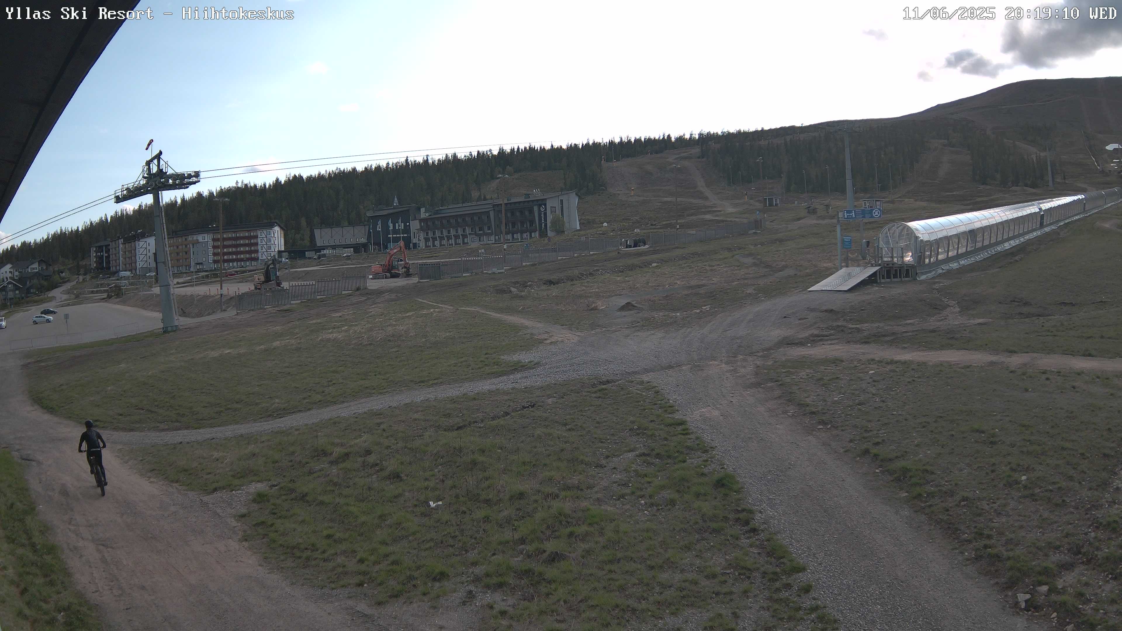
Camera image · refreshes every 60 seconds while visible.
Open camera page ↗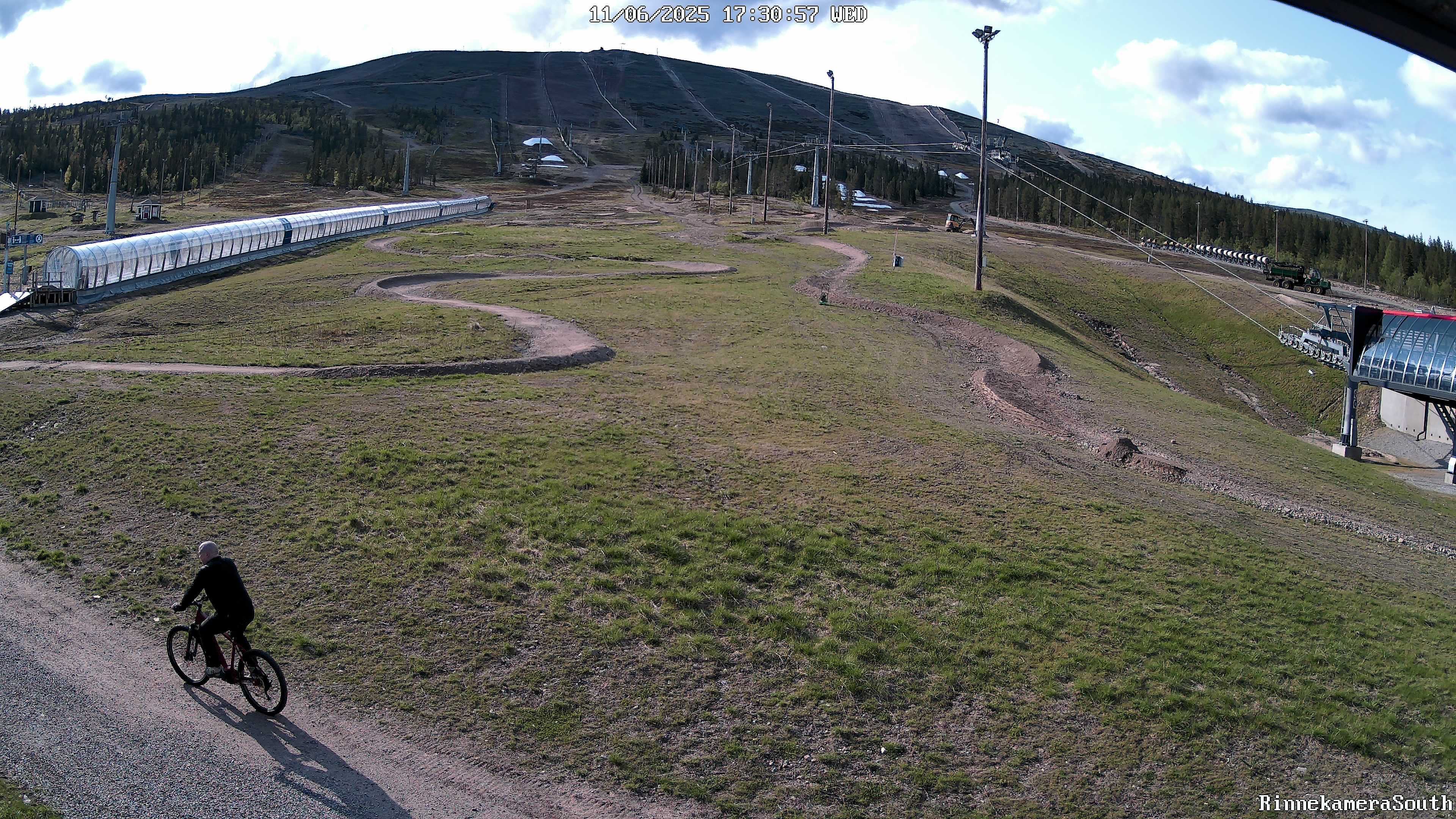
Camera image · refreshes every 60 seconds while visible.
Open camera page ↗ECMWF · Cycle du modèle : Prochaine mise à jour attendue :
Jour Heure (UTC) Temp. (°C) Humidité (%) Vent (km/h) Vent (nœuds) Vent (Bft) Direction Précip. (mm) Neige fraîche (cm) Pression (hPa) Isotherme 0 °C (m) Conditions | Mercredi, 04/11 06:00 2.1 90 28 15 4B W — — 1011 1345 Overcast 94% cloud 09:00 3.9 86 31 16 5B W 0 0 1009 1764 Clear 11% cloud 12:00 4.9 77 30 16 5B W 0 0 1008 1250 Clear 6% cloud 15:00 1.6 67 26 14 4B W 0 0 1008 992 Clear 4% cloud 18:00 1.9 64 37 20 5B W 0 0 1005 996 Partly cloudy 34% cloud 21:00 2.9 69 45 24 6B NW 0 0 1005 947 Partly cloudy 25% cloud Jeudi, 05/11 00:00 2 74 35 19 5B NW 0 0 1007 786 Partly cloudy 22% cloud 03:00 0.6 71 31 17 5B NW 0 0 1009 520 Clear 18% cloud 06:00 0.2 68 32 17 5B NW 0 0 1011 421 Partly cloudy 35% cloud 09:00 0.5 68 29 16 5B NW 0 0 1013 454 Partly cloudy 29% cloud 12:00 0.3 65 27 15 4B NW 0 0 1015 416 Partly cloudy 40% cloud 15:00 -1.2 74 25 13 4B NW 0 0 1018 < 255 Clear 7% cloud 18:00 -1.3 76 23 13 4B NW 0 0 1019 < 255 Clear 15% cloud 21:00 -1.3 73 25 13 4B NW 0 0 1021 < 255 Cloudy 66% cloud Vendredi, 06/11 00:00 -1.7 70 22 12 4B NW 0 0 1022 < 255 Partly cloudy 42% cloud 03:00 -2.3 80 17 9 3B NW 0 0 1023 < 255 Overcast 90% cloud 06:00 -1.8 81 20 11 3B W 0 0 1023 < 255 Overcast 88% cloud 09:00 -1.1 76 16 8 3B NW 0 0 1022 < 255 Overcast 96% cloud 12:00 -0.4 77 17 9 3B W 0 0 1021 < 255 Overcast 97% cloud 15:00 -0.2 89 14 8 3B W 0.52 0.2 1019 454 Overcast 96% cloud 18:00 0.8 87 21 11 4B W 0.12 0 1016 1130 Overcast 99% cloud 21:00 1.2 86 22 12 4B W 0 0 1014 1197 Overcast 93% cloud Samedi, 07/11 00:00 2.4 80 23 12 4B W 0 0 1012 1170 Overcast 93% cloud 03:00 1.6 85 23 13 4B W 0 0 1010 1206 Cloudy 63% cloud 06:00 1.3 87 24 13 4B W 0.00 0 1007 1379 Overcast 81% cloud 09:00 2 83 23 12 4B W 0 0 1007 1202 Overcast 85% cloud 12:00 2.2 80 24 13 4B W 0 0 1007 930 Overcast 97% cloud 15:00 0.6 84 24 13 4B W 0 0 1007 825 Overcast 89% cloud 18:00 0 86 18 10 3B W 0.12 0 1008 359 Overcast 97% cloud 21:00 0.1 87 20 11 3B W 0.24 0 1008 340 Overcast 99% cloud Dimanche, 08/11 00:00 0.4 83 24 13 4B W 0.09 0 1008 798 Overcast 89% cloud 03:00 0.9 86 23 12 4B W 0.22 0 1007 848 Overcast 98% cloud 06:00 1 78 27 14 4B W 0.12 0 1007 962 Cloudy 79% cloud 09:00 2.5 82 29 15 4B W 0.03 0 1006 1146 Overcast 100% cloud 12:00 4.7 72 31 17 5B W 0.03 0 1005 1262 Overcast 90% cloud 15:00 3.1 79 27 14 4B W 0 0 1004 1451 Overcast 85% cloud 18:00 3.4 75 29 16 5B W 0 0 1003 1517 Overcast 95% cloud 21:00 3.7 73 35 19 5B W 0 0 1001 1507 Overcast 85% cloud Lundi, 09/11 00:00 3.5 75 37 20 5B W 0 0 1000 1418 Overcast 91% cloud 03:00 3.6 75 38 20 5B W 0 0 999 1287 Overcast 88% cloud 06:00 3.8 74 30 16 5B W 0 0 1000 1144 Overcast 95% cloud 09:00 3.3 79 21 12 4B W 0 0 1000 1119 Cloudy 73% cloud 12:00 2.5 83 17 9 3B W 0.03 0 1000 1034 Overcast 94% cloud 15:00 1.2 89 16 8 3B W 0.20 0 1001 992 Overcast 87% cloud 18:00 0.2 93 19 10 3B W 0 0 1001 335 Partly cloudy 46% cloud 21:00 -0 89 22 12 4B NW 0 0 1002 375 Overcast 80% cloud Mardi, 10/11 00:00 -1.4 83 16 9 3B NW 0 0 1003 < 255 Overcast 86% cloud 03:00 -1.7 82 13 7 3B NW 0 0 1003 < 255 Overcast 82% cloud 06:00 -2.2 81 9 5 2B NW 0 0 1003 < 255 Cloudy 76% cloud |
|---|
Forecast table times: UTC.
Coordinates: 67.5571635°N, 24.2499888°E · Requested elevation: 369 m. Model terrain: 252 m. Terrain and 1000/925/850/700 hPa profiles are used for height estimates.
These are altitude estimates, not a simulation of local mountain terrain. Precipitation, cloud and sea-level pressure use horizontal interpolation only.
Precipitation includes rain and snow water equivalent: preceding 3 hours through day 6, then 6 hours (see cell tooltip). Snow (cm) estimates fresh snowfall from precipitation and temperature using the GFS conversion; it is not snow depth on the ground. Freezing (m) uses additional 600/500 hPa temperatures when available and estimates the lowest resolved 0°C crossing above sea level. When all sampled levels are warm, the upper profile limit is shown (see tooltip). < marks an entirely cold sampled profile and its lower height limit. No extrapolation is used.
Source: ECMWF · CC BY 4.0 · Processed by Snow Report.
ECMWF · Cycle du modèle : Prochaine mise à jour attendue :
Jour Heure (UTC) Temp. (°C) Humidité (%) Vent (km/h) Vent (nœuds) Vent (Bft) Direction Précip. (mm) Neige fraîche (cm) Pression (hPa) Isotherme 0 °C (m) Conditions | Mercredi, 04/11 06:00 4.5 72 66 36 8B W — — 1011 1340 Overcast 93% cloud 09:00 4.7 74 66 35 8B W 0 0 1009 1762 Clear 11% cloud 12:00 4.1 72 62 34 8B W 0 0 1008 1250 Clear 6% cloud 15:00 2 52 61 33 7B W 0 0 1008 992 Clear 4% cloud 18:00 1.6 64 85 46 9B NW 0 0 1005 996 Partly cloudy 34% cloud 21:00 1.7 69 97 52 10B NW 0 0 1005 945 Partly cloudy 25% cloud Jeudi, 05/11 00:00 0.6 74 78 42 9B NW 0 0 1007 784 Partly cloudy 24% cloud 03:00 -0.9 69 72 39 8B NW 0 0 1009 520 Clear 18% cloud 06:00 -1.2 68 73 39 8B NW 0 0 1011 418 Partly cloudy 35% cloud 09:00 -1.5 71 66 36 8B NW 0 0 1013 452 Partly cloudy 29% cloud 12:00 -1.8 68 61 33 7B NW 0 0 1015 415 Partly cloudy 41% cloud 15:00 -2.3 74 57 31 7B NW 0 0 1018 < 256 Clear 8% cloud 18:00 -2.9 77 53 29 7B NW 0 0 1020 < 256 Clear 15% cloud 21:00 -3.1 77 54 29 7B NW 0 0 1021 < 256 Cloudy 66% cloud Vendredi, 06/11 00:00 -3.3 72 51 28 7B NW 0 0 1022 < 256 Partly cloudy 42% cloud 03:00 -3.2 81 41 22 6B NW 0 0 1023 < 256 Overcast 90% cloud 06:00 -2.8 84 40 22 6B NW 0 0 1023 < 256 Overcast 88% cloud 09:00 -1.8 75 39 21 5B NW 0 0 1022 < 256 Overcast 95% cloud 12:00 -0.4 82 40 21 6B NW 0 0 1021 < 256 Overcast 97% cloud 15:00 0.8 83 34 18 5B NW 0.54 0.2 1019 442 Overcast 96% cloud 18:00 1.9 78 43 23 6B W 0.11 0 1016 1131 Overcast 99% cloud 21:00 3 72 46 25 6B W 0 0 1014 1194 Overcast 93% cloud Samedi, 07/11 00:00 3.4 67 51 27 7B W 0 0 1012 1169 Overcast 91% cloud 03:00 3.2 71 50 27 6B W 0 0 1010 1209 Cloudy 63% cloud 06:00 2.6 73 54 29 7B W 0.00 0 1007 1378 Cloudy 79% cloud 09:00 3.3 70 52 28 7B W 0 0 1007 1199 Overcast 84% cloud 12:00 1.7 73 51 27 7B W 0 0 1007 927 Overcast 97% cloud 15:00 0.9 71 50 27 7B W 0 0 1007 822 Overcast 89% cloud 18:00 0.3 77 39 21 5B W 0.12 0 1008 367 Overcast 96% cloud 21:00 0.5 76 45 24 6B W 0.24 0 1008 309 Overcast 99% cloud Dimanche, 08/11 00:00 0.7 68 49 26 6B W 0.09 0 1008 799 Overcast 89% cloud 03:00 0.9 78 54 29 7B W 0.20 0 1007 845 Overcast 98% cloud 06:00 1.9 65 57 31 7B W 0.11 0 1007 960 Cloudy 80% cloud 09:00 2.7 74 62 33 7B W 0.04 0 1006 1145 Overcast 100% cloud 12:00 3.7 72 62 34 8B W 0.03 0 1005 1262 Overcast 90% cloud 15:00 4.2 67 56 30 7B W 0 0 1004 1450 Overcast 86% cloud 18:00 3.8 65 60 33 7B W 0 0 1003 1516 Overcast 95% cloud 21:00 3.2 70 67 36 8B W 0 0 1001 1505 Overcast 85% cloud Lundi, 09/11 00:00 3.3 70 70 38 8B W 0 0 1000 1413 Overcast 91% cloud 03:00 3.1 72 71 38 8B W 0 0 999 1280 Overcast 87% cloud 06:00 2.9 75 57 31 7B W 0 0 1000 1141 Overcast 96% cloud 09:00 2.8 77 43 23 6B W 0 0 1000 1116 Cloudy 74% cloud 12:00 2.1 82 35 19 5B W 0.04 0 1000 1034 Overcast 94% cloud 15:00 1.9 82 36 19 5B W 0.22 0 1001 992 Overcast 87% cloud 18:00 1.3 83 41 22 6B W 0 0 1001 336 Partly cloudy 46% cloud 21:00 0.5 73 46 25 6B NW 0 0 1002 376 Cloudy 79% cloud Mardi, 10/11 00:00 -0.9 59 35 19 5B NW 0 0 1003 < 256 Overcast 86% cloud 03:00 -2 52 34 18 5B NW 0 0 1003 < 256 Overcast 82% cloud 06:00 -2.8 57 23 13 4B NW 0 0 1003 < 256 Cloudy 77% cloud |
|---|
Forecast table times: UTC.
Coordinates: 67.5654091°N, 24.2215831°E · Requested elevation: 717 m. Model terrain: 253 m. Terrain and 1000/925/850/700 hPa profiles are used for height estimates.
These are altitude estimates, not a simulation of local mountain terrain. Precipitation, cloud and sea-level pressure use horizontal interpolation only.
Precipitation includes rain and snow water equivalent: preceding 3 hours through day 6, then 6 hours (see cell tooltip). Snow (cm) estimates fresh snowfall from precipitation and temperature using the GFS conversion; it is not snow depth on the ground. Freezing (m) uses additional 600/500 hPa temperatures when available and estimates the lowest resolved 0°C crossing above sea level. When all sampled levels are warm, the upper profile limit is shown (see tooltip). < marks an entirely cold sampled profile and its lower height limit. No extrapolation is used.