全球滑雪场天气预报

颜色说明 温度 · 风 · 降雨 · 降雪
每种颜色从所示数值开始。三种风速单位的颜色相互对应。无降水单元格保持中性色。颜色仅描述显示值,并非官方天气预警。
正在准备预报图表…
时间和数值与详细预报一致。点击数值查看详情,横向滚动查看后续日期。降水量为每时段总水当量,包含降雪;新雪量指每时段新增降雪,并非地面积雪深度。
GFS与ECMWF模式对比。各模式保留各自的预报时间和时长。降水量和降雪量对应各模式自身的时段,模式之间的时段可能不同。
预报数值与模式说明
Wildhaus - Low lift station
ECMWF · 模式起报时间: 预计下次更新:
日期 时间(UTC) 气温(°C) 湿度(%) 风速(km/h) 风速(节) 风力(Bft) 风向 降水(mm) 新雪(cm) 气压(hPa) 零度层(m) 天气状况 | 星期三, 04/11 06:00 1.1 89 1 1 1B SE — — 1024 1233 Overcast 93% cloud  09:00 4.1 80 2 1 1B E 0 0 1024 1832 Cloudy 66% cloud  12:00 8 66 4 2 1B NE 0 0 1022 2288 Clear 13% cloud  15:00 5.8 76 4 2 1B NE 0 0 1022 2192 Partly cloudy 22% cloud  18:00 2.2 87 3 2 1B SE 0 0 1023 1606 Cloudy 65% cloud 21:00 3.1 80 5 3 1B SE 0 0 1022 1938 Partly cloudy 20% cloud 星期四, 05/11 00:00 3.1 75 6 3 2B S 0 0 1023 2059 Clear 8% cloud 03:00 2.4 77 6 3 2B S 0 0 1022 2041 Clear 10% cloud 06:00 1.8 79 6 3 2B S 0 0 1022 2232 Clear 9% cloud 09:00 8.5 65 6 3 2B S 0 0 1023 2976 Clear 10% cloud 12:00 12.2 52 2 1 1B SE 0 0 1022 3006 Clear 2% cloud 15:00 9.6 72 1 1 0B NE 0 0 1022 2930 Clear 4% cloud 18:00 4.4 86 2 1 1B SE 0 0 1022 2816 Partly cloudy 32% cloud 21:00 3.9 84 2 1 1B SE 0 0 1022 2962 Cloudy 59% cloud 星期五, 06/11 00:00 3.2 84 4 2 1B S 0 0 1021 3110 Cloudy 57% cloud 03:00 2.6 78 3 1 1B S 0 0 1019 3099 Cloudy 57% cloud 06:00 2.3 80 2 1 1B S 0 0 1019 2809 Partly cloudy 44% cloud 09:00 7.1 74 2 1 1B W 0 0 1021 2943 Overcast 94% cloud 12:00 6.6 77 3 2 1B W 0.03 0 1022 2648 Overcast 99% cloud 15:00 5.3 85 1 1 1B NW 0.14 0 1022 2405 Overcast 98% cloud 18:00 3.7 91 2 1 1B SW 0.39 0 1023 2115 Overcast 98% cloud 21:00 4 92 2 1 1B W 1.2 0 1023 2041 Overcast 100% cloud 星期六, 07/11 00:00 3.9 92 2 1 1B SW 2.3 0 1023 1926 Overcast 100% cloud 03:00 3.7 93 3 2 1B SW 1.5 0 1023 1843 Overcast 100% cloud 06:00 3.9 92 2 1 1B W 0.31 0 1023 1835 Overcast 100% cloud 09:00 4.4 90 2 1 1B S 1.5 0 1024 1865 Overcast 100% cloud 12:00 5.3 89 3 1 1B SW 0.67 0 1023 1930 Overcast 99% cloud 15:00 5.4 88 1 1 1B E 0.21 0 1023 1932 Overcast 87% cloud 18:00 3.4 92 1 1 0B SE 0 0 1023 1701 Partly cloudy 33% cloud 21:00 2.2 92 2 1 1B S 0 0 1024 1484 Cloudy 50% cloud 星期日, 08/11 00:00 1.1 89 3 1 1B S 0 0 1024 1240 Cloudy 73% cloud 03:00 1.1 87 2 1 1B S 0.13 0 1023 1229 Overcast 89% cloud 06:00 1.2 88 4 2 1B S 0.68 0 1023 1256 Cloudy 56% cloud 09:00 5.7 84 2 1 1B SW 0.04 0 1024 1904 Clear 9% cloud 12:00 8.8 56 0 0 0B NE 0 0 1022 2173 Clear 3% cloud 15:00 6.8 73 1 1 1B E 0 0 1022 2066 Clear 7% cloud 18:00 2.8 80 4 2 1B S 0 0 1021 1675 Clear 13% cloud 21:00 2.5 67 5 3 1B S 0 0 1021 1652 Partly cloudy 27% cloud 星期一, 09/11 00:00 3.8 68 5 3 1B S 0.38 0 1020 1939 Overcast 100% cloud 03:00 3.7 68 5 3 1B S 2.3 0 1019 1991 Overcast 96% cloud 06:00 3.8 68 7 4 2B S 2.5 0 1019 2009 Overcast 93% cloud 09:00 7.8 62 6 3 2B S 0 0 1018 2542 Overcast 83% cloud 12:00 10.4 52 7 4 2B S 0 0 1016 2679 Overcast 94% cloud 15:00 8.2 61 8 4 2B S 0 0 1016 2659 Overcast 100% cloud 18:00 7.4 62 9 5 2B S 0.06 0 1015 2707 Overcast 100% cloud 21:00 6.2 77 9 5 2B S 0.41 0 1015 2812 Overcast 100% cloud 星期二, 10/11 00:00 6.6 75 10 5 2B S 0.12 0 1014 2930 Overcast 89% cloud 03:00 6.9 71 9 5 2B S 0 0 1012 2962 Overcast 100% cloud 06:00 7.1 70 9 5 2B S 0 0 1011 3039 Overcast 100% cloud |
|---|
Forecast notes
Forecast table times: UTC.
Coordinates: 47.1989358°N, 9.3421841°E · Requested elevation: 1016 m. Model terrain: 1192 m. Terrain and 1000/925/850/700 hPa profiles are used for height estimates.
Outside the available profile, temperature uses an estimated 5.5°C/km height correction; wind retains the nearest available model-level value. Humidity is estimated with adjusted pressure and temperature.
These are altitude estimates, not a simulation of local mountain terrain. Precipitation, cloud and sea-level pressure use horizontal interpolation only.
Precipitation includes rain and snow water equivalent: preceding 3 hours through day 6, then 6 hours (see cell tooltip). Snow (cm) estimates fresh snowfall from precipitation and temperature using the GFS conversion; it is not snow depth on the ground. Freezing (m) uses additional 600/500 hPa temperatures when available and estimates the lowest resolved 0°C crossing above sea level. When all sampled levels are warm, the upper profile limit is shown (see tooltip). < marks an entirely cold sampled profile and its lower height limit. No extrapolation is used.
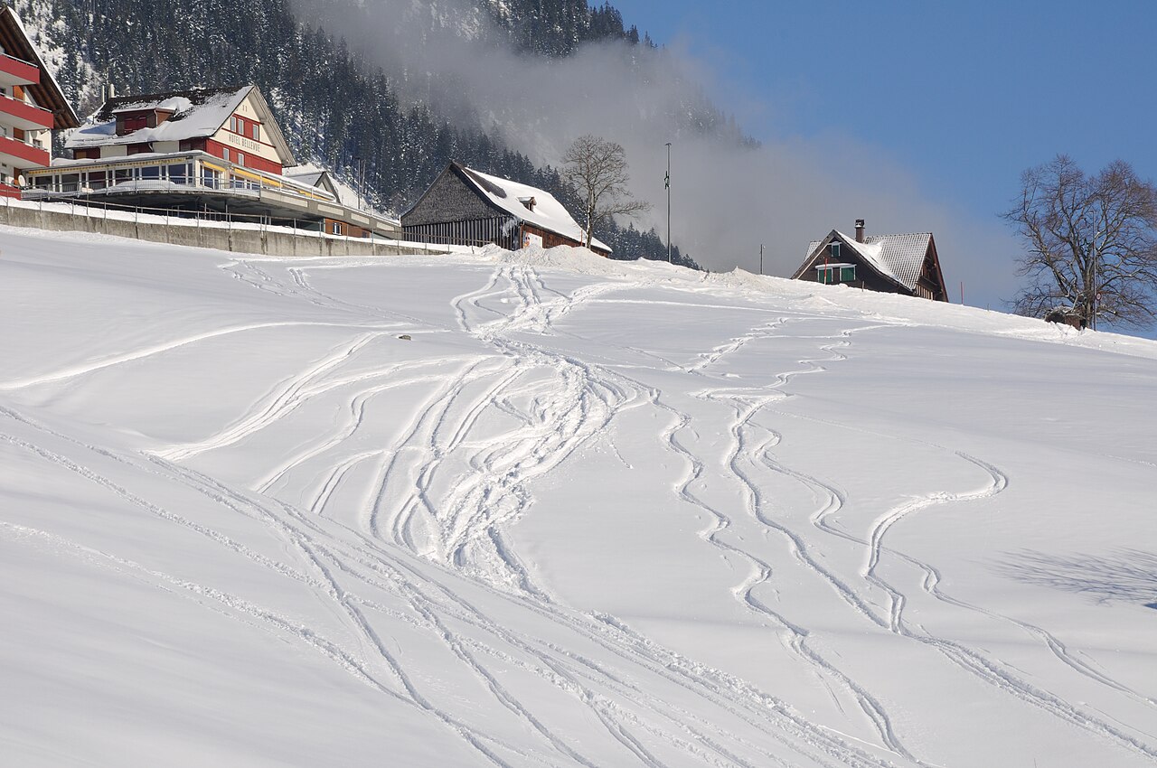
Wildhaus is a downhill ski area in Saint Gallen, Switzerland. Mapped terrain includes beginner, easy, intermediate, advanced, freeride routes. Its mapped lift network extends from approximately 1016 to 2070 metres above sea level. Cross-country skiing is also mapped within the area.
Data: OpenSkiData / OpenSkiMap, OpenStreetMap contributors (ODbL), Skimap.org, Who's On First, Mapterhorn.
正在准备预报图表…
时间和数值与详细预报一致。点击数值查看详情,横向滚动查看后续日期。降水量为每时段总水当量,包含降雪;新雪量指每时段新增降雪,并非地面积雪深度。
GFS与ECMWF模式对比。各模式保留各自的预报时间和时长。降水量和降雪量对应各模式自身的时段,模式之间的时段可能不同。
预报数值与模式说明
Wildhaus - Base lift station
ECMWF · 模式起报时间: 预计下次更新:
日期 时间(UTC) 气温(°C) 湿度(%) 风速(km/h) 风速(节) 风力(Bft) 风向 降水(mm) 新雪(cm) 气压(hPa) 零度层(m) 天气状况 | 星期三, 04/11 06:00 0 93 1 1 1B SE — — 1023 1235 Overcast 92% cloud 09:00 3.1 83 2 1 1B E 0 0 1024 1850 Cloudy 63% cloud 12:00 7 68 4 2 1B NE 0 0 1022 2294 Clear 14% cloud 15:00 4.9 79 4 2 1B NE 0 0 1022 2201 Partly cloudy 24% cloud 18:00 1.3 90 4 2 1B SE 0 0 1023 1631 Cloudy 66% cloud 21:00 2 83 5 3 1B SE 0 0 1022 1941 Partly cloudy 21% cloud 星期四, 05/11 00:00 2 79 6 3 2B S 0 0 1023 2046 Clear 8% cloud 03:00 1.4 81 6 3 2B S 0 0 1022 2027 Clear 11% cloud 06:00 0.8 82 6 3 2B S 0 0 1022 2202 Clear 9% cloud 09:00 7.4 68 6 3 2B S 0 0 1023 2972 Clear 10% cloud 12:00 11.1 54 3 1 1B SE 0 0 1022 3005 Clear 2% cloud 15:00 8.5 75 1 0 0B NE 0 0 1022 2931 Clear 4% cloud 18:00 3.4 89 2 1 1B S 0 0 1022 2819 Partly cloudy 31% cloud 21:00 2.9 87 3 1 1B SE 0 0 1022 2955 Cloudy 60% cloud 星期五, 06/11 00:00 2.1 88 4 2 1B S 0 0 1021 3110 Cloudy 56% cloud 03:00 1.5 82 3 2 1B S 0 0 1019 3099 Cloudy 57% cloud 06:00 1.3 83 2 1 1B S 0 0 1019 2792 Partly cloudy 44% cloud 09:00 6.1 77 1 1 1B SW 0 0 1021 2942 Overcast 94% cloud 12:00 5.7 80 3 2 1B W 0.04 0 1021 2654 Overcast 98% cloud 15:00 4.2 89 1 1 0B NW 0.14 0 1022 2407 Overcast 98% cloud 18:00 2.7 96 1 1 1B SW 0.39 0 1022 2116 Overcast 98% cloud 21:00 2.9 96 2 1 1B W 1.2 0 1023 2038 Overcast 100% cloud 星期六, 07/11 00:00 2.8 97 2 1 1B SW 2.3 0 1023 1922 Overcast 100% cloud 03:00 2.5 97 3 2 1B SW 1.5 0 1023 1840 Overcast 100% cloud 06:00 2.8 97 2 1 1B W 0.32 0 1023 1830 Overcast 100% cloud 09:00 3.3 95 2 1 1B S 1.6 0 1024 1860 Overcast 100% cloud 12:00 4.1 93 3 1 1B SW 0.67 0 1023 1929 Overcast 99% cloud 15:00 4.2 93 1 1 1B E 0.21 0 1023 1930 Overcast 87% cloud 18:00 2.2 96 1 1 1B S 0 0 1023 1685 Partly cloudy 35% cloud 21:00 1 96 2 1 1B S 0 0 1024 1469 Cloudy 51% cloud 星期日, 08/11 00:00 -0 94 3 2 1B S 0 0 1024 1224 Cloudy 73% cloud 03:00 -0.1 91 2 1 1B S 0.13 0 1023 < 1209 Overcast 89% cloud 06:00 0 93 4 2 1B S 0.65 0.2 1023 1236 Cloudy 57% cloud 09:00 4.5 88 2 1 1B SW 0.03 0 1024 1904 Clear 9% cloud 12:00 7.5 59 0 0 0B — 0 0 1022 2174 Clear 3% cloud 15:00 5.6 76 1 1 0B E 0 0 1022 2066 Clear 7% cloud 18:00 1.6 83 4 2 1B S 0 0 1021 1656 Clear 13% cloud 21:00 1.3 70 5 3 1B S 0 0 1021 1625 Partly cloudy 27% cloud 星期一, 09/11 00:00 2.7 72 5 3 1B S 0.37 0 1020 1932 Overcast 100% cloud 03:00 2.6 71 5 3 1B S 2.2 0 1020 1984 Overcast 97% cloud 06:00 2.7 71 6 3 2B S 2.4 0 1019 2002 Overcast 92% cloud 09:00 6.7 65 6 3 2B S 0 0 1018 2544 Overcast 83% cloud 12:00 9.2 55 7 4 2B S 0 0 1016 2681 Overcast 94% cloud 15:00 7.1 64 8 4 2B S 0 0 1016 2660 Overcast 100% cloud 18:00 6.2 66 8 5 2B S 0.06 0 1015 2708 Overcast 100% cloud 21:00 5.1 81 9 5 2B S 0.40 0 1015 2813 Overcast 100% cloud 星期二, 10/11 00:00 5.5 79 10 5 2B S 0.12 0 1014 2932 Overcast 89% cloud 03:00 5.7 75 9 5 2B S 0 0 1012 2963 Overcast 100% cloud 06:00 6 74 9 5 2B S 0 0 1011 3039 Overcast 100% cloud |
|---|
Forecast notes
Forecast table times: UTC.
Coordinates: 47.189917°N, 9.3433875°E · Requested elevation: 1224 m. Model terrain: 1207 m. Terrain and 1000/925/850/700 hPa profiles are used for height estimates.
These are altitude estimates, not a simulation of local mountain terrain. Precipitation, cloud and sea-level pressure use horizontal interpolation only.
Precipitation includes rain and snow water equivalent: preceding 3 hours through day 6, then 6 hours (see cell tooltip). Snow (cm) estimates fresh snowfall from precipitation and temperature using the GFS conversion; it is not snow depth on the ground. Freezing (m) uses additional 600/500 hPa temperatures when available and estimates the lowest resolved 0°C crossing above sea level. When all sampled levels are warm, the upper profile limit is shown (see tooltip). < marks an entirely cold sampled profile and its lower height limit. No extrapolation is used.
正在准备预报图表…
时间和数值与详细预报一致。点击数值查看详情,横向滚动查看后续日期。降水量为每时段总水当量,包含降雪;新雪量指每时段新增降雪,并非地面积雪深度。
GFS与ECMWF模式对比。各模式保留各自的预报时间和时长。降水量和降雪量对应各模式自身的时段,模式之间的时段可能不同。
预报数值与模式说明
Wildhaus - Top lift station
ECMWF · 模式起报时间: 预计下次更新:
日期 时间(UTC) 气温(°C) 湿度(%) 风速(km/h) 风速(节) 风力(Bft) 风向 降水(mm) 新雪(cm) 气压(hPa) 零度层(m) 天气状况 | 星期三, 04/11 06:00 -2.8 84 8 4 2B S — — 1023 < 1275 Overcast 88% cloud 09:00 -0.8 77 10 5 2B SE 0 0 1023 1918 Cloudy 53% cloud 12:00 1.7 63 13 7 3B S 0 0 1021 2320 Clear 15% cloud 15:00 0.9 68 15 8 3B S 0 0 1022 2234 Partly cloudy 32% cloud 18:00 -1.2 76 18 10 3B S 0 0 1022 1717 Cloudy 67% cloud 21:00 -0.3 68 13 7 3B S 0 0 1023 1966 Partly cloudy 25% cloud 星期四, 05/11 00:00 -0.1 65 11 6 2B S 0 0 1023 2010 Clear 10% cloud 03:00 -0.2 62 12 6 2B S 0 0 1023 1980 Clear 13% cloud 06:00 0 58 14 7 3B S 0 0 1022 2094 Clear 11% cloud 09:00 3.8 59 13 7 3B S 0 0 1023 2958 Clear 11% cloud 12:00 5.9 53 11 6 2B S 0 0 1022 3004 Clear 2% cloud 15:00 4.5 66 6 3 2B S 0 0 1022 2935 Clear 4% cloud 18:00 1.7 70 8 5 2B S 0 0 1022 2829 Partly cloudy 25% cloud 21:00 1.3 68 10 5 2B S 0 0 1022 2934 Cloudy 66% cloud 星期五, 06/11 00:00 1.1 68 10 5 2B S 0 0 1021 3110 Cloudy 55% cloud 03:00 0.8 69 10 5 2B S 0 0 1019 3099 Cloudy 55% cloud 06:00 0.5 72 10 5 2B S 0 0 1019 2738 Partly cloudy 44% cloud 09:00 3.3 67 8 5 2B SE 0 0 1020 2941 Overcast 94% cloud 12:00 2.6 76 7 4 2B SE 0.06 0 1021 2673 Overcast 97% cloud 15:00 1.2 88 9 5 2B SE 0.15 0 1022 2410 Overcast 98% cloud 18:00 0.1 95 9 5 2B SE 0.36 0.1 1022 2117 Overcast 99% cloud 21:00 -0.2 98 8 4 2B SE 1.2 0.4 1023 2025 Overcast 100% cloud 星期六, 07/11 00:00 -0.7 98 7 4 2B S 2.3 0.7 1023 1906 Overcast 100% cloud 03:00 -1 98 5 3 1B SW 1.4 0.4 1023 1825 Overcast 100% cloud 06:00 -1.2 98 2 1 1B SW 0.36 0.1 1023 1812 Overcast 100% cloud 09:00 -1.2 97 3 1 1B SE 1.7 0.5 1024 1842 Overcast 100% cloud 12:00 -0.9 97 6 3 1B S 0.68 0.2 1023 1926 Overcast 99% cloud 15:00 -0.9 95 7 4 2B SW 0.22 0 1023 1922 Overcast 87% cloud 18:00 -2.1 90 7 4 2B S 0 0 1023 1622 Partly cloudy 44% cloud 21:00 -2.7 87 10 5 2B S 0 0 1024 1419 Cloudy 55% cloud 星期日, 08/11 00:00 -3.4 86 11 6 2B SW 0 0 1023 < 1275 Cloudy 72% cloud 03:00 -3.7 89 8 5 2B SW 0.12 0.1 1023 < 1275 Overcast 91% cloud 06:00 -3.8 90 8 4 2B SW 0.56 0.6 1023 < 1275 Cloudy 60% cloud 09:00 -1.1 81 9 5 2B SW 0.03 0 1024 1909 Clear 10% cloud 12:00 0.8 57 13 7 3B W 0 0 1022 2178 Clear 4% cloud 15:00 -0 65 16 9 3B W 0 0 1022 2068 Clear 6% cloud 18:00 -1.8 63 20 11 3B W 0 0 1022 1581 Clear 11% cloud 21:00 -1.7 71 20 11 3B W 0 0 1021 1524 Partly cloudy 27% cloud 星期一, 09/11 00:00 -0.6 80 18 10 3B SW 0.33 0.1 1021 1908 Overcast 100% cloud 03:00 -0.4 79 22 12 4B W 1.9 0.6 1020 1958 Overcast 97% cloud 06:00 -0.3 79 23 12 4B SW 2.1 0.6 1019 1972 Overcast 90% cloud 09:00 2.4 68 21 11 4B SW 0 0 1018 2551 Overcast 84% cloud 12:00 3.8 67 24 13 4B SW 0 0 1017 2685 Overcast 93% cloud 15:00 2.8 73 22 12 4B SW 0 0 1016 2660 Overcast 100% cloud 18:00 2.6 78 23 12 4B SW 0.05 0 1016 2708 Overcast 100% cloud 21:00 2.3 86 24 13 4B SW 0.36 0 1015 2817 Overcast 100% cloud 星期二, 10/11 00:00 2.6 85 26 14 4B SW 0.12 0 1014 2935 Overcast 91% cloud 03:00 2.8 84 20 11 4B SW 0 0 1012 2966 Overcast 100% cloud 06:00 3.2 81 17 9 3B SW 0 0 1011 3039 Overcast 100% cloud |
|---|
Forecast notes
Forecast table times: UTC.
Coordinates: 47.1589556°N, 9.3378605°E · Requested elevation: 2070 m. Model terrain: 1272 m. Terrain and 1000/925/850/700 hPa profiles are used for height estimates.
These are altitude estimates, not a simulation of local mountain terrain. Precipitation, cloud and sea-level pressure use horizontal interpolation only.
Precipitation includes rain and snow water equivalent: preceding 3 hours through day 6, then 6 hours (see cell tooltip). Snow (cm) estimates fresh snowfall from precipitation and temperature using the GFS conversion; it is not snow depth on the ground. Freezing (m) uses additional 600/500 hPa temperatures when available and estimates the lowest resolved 0°C crossing above sea level. When all sampled levels are warm, the upper profile limit is shown (see tooltip). < marks an entirely cold sampled profile and its lower height limit. No extrapolation is used.