Worldwide Ski Resort Forecasts

Colour guide Temperature · Wind · Rain · Snow
Each colour starts at the value shown. Wind colours match across all three units. Dry cells stay neutral. Colours describe the displayed values, not official weather warnings.
Preparing forecast graphs…
Times and values match the detailed forecast. Tap or point at a value for details. Scroll each chart sideways for later days. Rain / precipitation is the total water equivalent per forecast interval, including snow; snowfall is fresh snow per interval, not snow depth.
GFS and ECMWF model comparison. Each model retains its own forecast times and horizon. Precipitation and snowfall amounts cover their own forecast intervals; these can differ between models.
Forecast values and model notes
St Moritz - base
ECMWF IFS · Run 2026-10-17 00:00:00 UTC · 10 days · Times: Europe/Zurich.
Coordinates: 46.48347158°N, 9.83263493°E · Requested elevation: 1774 m. Model terrain: 2333 m. Terrain and 1000/925/850/700 hPa profiles are used for height estimates.
Outside the available profile, temperature uses an estimated 5.5°C/km height correction; wind retains the nearest available model-level value. Humidity is estimated with adjusted pressure and temperature.
These are altitude estimates, not a simulation of local mountain terrain. Precipitation, cloud and sea-level pressure use horizontal interpolation only.
Precipitation includes rain and snow water equivalent: preceding 3 hours through day 6, then 6 hours (see cell tooltip). Snow (cm) estimates fresh snowfall from precipitation and temperature using the GFS conversion; it is not snow depth on the ground. Freezing (m) uses additional 600/500 hPa temperatures when available and estimates the lowest resolved 0°C crossing above sea level. When all sampled levels are warm, the upper profile limit is shown (see tooltip). < marks an entirely cold sampled profile and its lower height limit. No extrapolation is used.
Day Local time Temp. (°C) Humidity (%) Wind (km/h) Wind (knots) Wind (Bft) Direction Precip. (mm) Snow (cm) Pressure (hPa) Freezing (m) Conditions | Saturday, 17/10 02:00 5.9 54 1 0 0B S — — 1023 3711 Overcast 97% cloud  05:00 4.4 57 1 0 0B S 0 0 1021 3644 Partly cloudy 38% cloud  08:00 3.3 54 1 1 0B SE 0.00 0 1020 3543 Clear 2% cloud  11:00 10 37 2 1 1B N 0 0 1019 3462 Clear 0% cloud 14:00 12.6 36 3 2 1B NW 0 0 1016 3419 Clear 3% cloud 17:00 11 48 3 2 1B NW 0 0 1016 3330 Clear 18% cloud 20:00 6 77 1 0 0B NW 0.02 0 1018 3126 Cloudy 55% cloud  23:00 6.3 81 0 0 0B S 0.05 0 1018 2944 Overcast 99% cloud Sunday, 18/10 02:00 5.4 85 1 1 1B SE 0.03 0 1018 2790 Overcast 94% cloud 05:00 5.2 84 3 2 1B SE 0.03 0 1018 2717 Overcast 94% cloud 08:00 5.1 81 3 2 1B SE 0.05 0 1019 2698 Overcast 93% cloud 11:00 8 62 8 4 2B S 0.04 0 1020 2852 Cloudy 74% cloud 14:00 9.6 55 9 5 2B S 0.06 0 1020 2955 Overcast 90% cloud 17:00 8.7 62 8 4 2B S 0.11 0 1020 2983 Overcast 95% cloud 20:00 7.3 73 3 2 1B SE 0.07 0 1022 3014 Overcast 93% cloud 23:00 6.8 77 3 2 1B SE 0.03 0 1024 3026 Overcast 97% cloud Monday, 19/10 02:00 6.8 79 3 2 1B E 0.04 0 1025 3007 Overcast 98% cloud 05:00 6.5 81 2 1 1B E 0.02 0 1025 3049 Overcast 96% cloud 08:00 5.9 84 2 1 1B SE 0.00 0 1026 3278 Overcast 83% cloud 11:00 10 63 3 2 1B S 0 0 1025 3442 Partly cloudy 39% cloud 14:00 13.2 47 5 3 1B SW 0.00 0 1023 3389 Cloudy 61% cloud 17:00 11.7 55 6 3 2B SW 0.00 0 1022 3496 Partly cloudy 33% cloud 20:00 7 74 2 1 1B S 0 0 1022 3515 Clear 10% cloud 23:00 4.1 83 4 2 1B S 0 0 1021 3493 Cloudy 66% cloud Tuesday, 20/10 02:00 2.2 83 5 3 1B S 0.00 0 1020 2709 Cloudy 65% cloud 05:00 3.1 81 4 2 1B S 0.00 0 1019 3121 Cloudy 63% cloud 08:00 4.9 83 2 1 1B SE 0 0 1018 2926 Overcast 82% cloud 11:00 7.9 76 5 3 1B S 0.05 0 1017 3014 Overcast 99% cloud 14:00 9.1 70 6 3 2B S 0.05 0 1015 3060 Overcast 97% cloud 17:00 8.7 73 5 3 1B S 0.18 0 1014 3056 Overcast 100% cloud 20:00 7.6 80 4 2 1B SE 0.45 0 1013 3154 Overcast 100% cloud 23:00 7.2 81 4 2 1B SE 0.99 0 1011 3075 Overcast 100% cloud Wednesday, 21/10 02:00 5.5 86 5 3 1B E 5.4 0 1011 2917 Overcast 100% cloud 05:00 4.4 86 4 2 1B E 7.7 0 1008 2972 Overcast 100% cloud 08:00 4.2 85 2 1 1B E 5.7 0 1007 2915 Overcast 100% cloud 11:00 4.6 84 1 0 0B SE 6.2 0 1008 2803 Overcast 100% cloud 14:00 4.9 83 0 0 0B N 2.3 0 1008 2690 Overcast 100% cloud 17:00 3.9 85 1 0 0B W 3.8 0 1009 2488 Overcast 100% cloud 20:00 3.1 84 5 3 1B NW 3.5 0 1011 < 2336 Overcast 100% cloud 23:00 1.7 85 5 3 1B N 1.8 0 1015 < 2336 Overcast 100% cloud Thursday, 22/10 02:00 0.8 81 3 2 1B NW 0.33 0.1 1017 < 2336 Overcast 100% cloud 05:00 -0.2 78 2 1 1B NW 0.83 0.2 1018 < 2336 Overcast 99% cloud 08:00 -0.9 79 0 0 0B N 0.48 0.1 1020 < 2336 Overcast 92% cloud 11:00 0.8 72 9 5 2B N 0.25 0.1 1022 < 2336 Overcast 94% cloud 14:00 0.2 67 9 5 2B N 0.10 0 1024 < 2336 Overcast 89% cloud 17:00 -1.2 63 4 2 1B N 0.02 0 1026 < 2336 Partly cloudy 44% cloud 20:00 -5.8 74 0 0 0B N 0 0 1027 < 2336 Clear 18% cloud 23:00 -11.5 72 2 1 1B SE 0 0 1026 < 2336 Cloudy 62% cloud Friday, 23/10 02:00 -9.1 55 4 2 1B S 0 0 1022 < 2336 Partly cloudy 27% cloud 08:00 -7.1 65 4 2 1B S 0 0 1020 < 2336 Overcast 95% cloud 14:00 2.2 67 8 4 2B S 0.02 0 1018 < 2336 Cloudy 79% cloud 20:00 -0.6 81 1 0 0B W 1.1 0.3 1020 < 2336 Partly cloudy 46% cloud Saturday, 24/10 02:00 -7.9 77 3 2 1B S 0.06 0.1 1025 < 2336 Overcast 90% cloud 08:00 -9.9 72 4 2 1B S 0.02 0 1026 < 2336 Overcast 89% cloud 14:00 0.5 48 3 1 1B W 0.02 0 1023 < 2336 Partly cloudy 39% cloud 20:00 -5 60 2 1 1B S 0 0 1021 < 2336 Overcast 91% cloud Sunday, 25/10 02:00 -2.7 64 4 2 1B S 0 0 1021 < 2336 Overcast 99% cloud 07:00 -0.4 66 6 3 2B S 0.09 0 1018 < 2336 Overcast 100% cloud 13:00 4.8 64 7 4 2B S 0.01 0 1014 2949 Overcast 94% cloud 19:00 2.3 75 1 1 1B S 0.08 0 1016 < 2336 Overcast 93% cloud Monday, 26/10 01:00 -3.2 80 3 1 1B S 0.00 0 1017 < 2336 Overcast 96% cloud 07:00 -7.2 76 2 1 1B SE 0.00 0 1019 < 2336 Cloudy 74% cloud 13:00 5.2 57 3 2 1B S 0 0 1017 2633 Partly cloudy 34% cloud 19:00 0 76 3 2 1B S 0 0 1018 < 2336 Overcast 97% cloud Tuesday, 27/10 01:00 -0.8 80 5 3 1B S 0 0 1019 < 2336 Overcast 89% cloud |
|---|
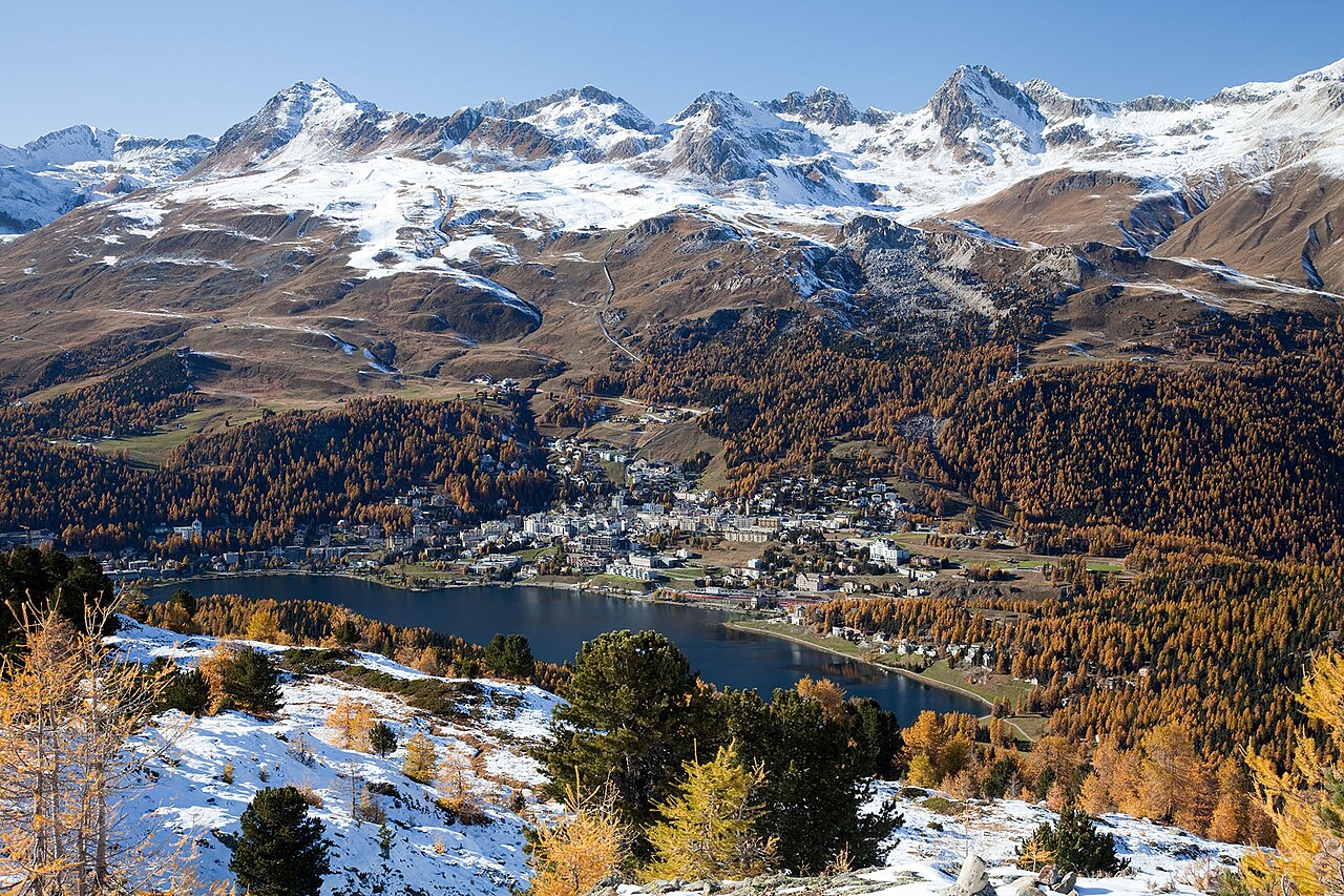
The region’s slopes are linked by a system of 56 lifts with the ability to transport 65,000 skiers per hour. In addition to the downhill runs, there are 180kms of cross-country trails, and some superb off-piste options for skiers and snowboarders.