Worldwide Ski Resort Forecasts

Colour guide Temperature · Wind · Rain · Snow
Each colour starts at the value shown. Wind colours match across all three units. Dry cells stay neutral. Colours describe the displayed values, not official weather warnings.
Stratton Mountain Resort - Low lift station
ECMWF · Model run: Next update expected:
Day Time (UTC) Temp. (°C) Humidity (%) Wind (km/h) Wind (knots) Wind (Bft) Direction Precip. (mm) Snow (cm) Pressure (hPa) Freezing (m) Conditions | Wednesday, 04/11 06:00 10.8 85 8 4 2B SW — — 1021 3151 Partly cloudy 23% cloud  09:00 11.5 77 9 5 2B SW 0 0 1020 3146 Cloudy 78% cloud  12:00 10.6 81 9 5 2B W 0 0 1020 3149 Overcast 92% cloud  15:00 17.9 55 8 4 2B SW 0 0 1019 3146 Clear 0% cloud  18:00 20.6 45 11 6 2B SW 0 0 1016 3134 Clear 0% cloud 21:00 17.9 57 9 5 2B SW 0 0 1016 3129 Clear 0% cloud Thursday, 05/11 00:00 13.1 79 13 7 3B SW 0 0 1016 3129 Clear 14% cloud 03:00 12.3 79 13 7 3B SW 0 0 1015 3121 Clear 12% cloud 06:00 11.3 75 15 8 3B SW 0 0 1014 3110 Partly cloudy 22% cloud 09:00 10.9 84 16 9 3B SW 0 0 1014 3096 Partly cloudy 39% cloud 12:00 11 97 17 9 3B SW 0 0 1013 3088 Overcast 91% cloud 15:00 14.6 98 20 11 4B S 1.1 0 1012 3079 Overcast 100% cloud 18:00 14.7 98 22 12 4B SW 6.4 0 1010 3063 Overcast 100% cloud 21:00 15.2 98 17 9 3B SW 2.9 0 1009 3058 Overcast 96% cloud Friday, 06/11 00:00 15.1 98 17 9 3B SW 0.24 0 1010 3062 Overcast 100% cloud 03:00 14.6 99 15 8 3B SW 1.7 0 1010 3060 Overcast 99% cloud 06:00 14 99 14 8 3B W 1.3 0 1011 3052 Overcast 99% cloud 09:00 12.5 96 7 4 2B W 0.13 0 1012 3052 Overcast 91% cloud 12:00 10.4 97 3 1 1B SW 0 0 1013 3055 Overcast 98% cloud 15:00 14.4 78 2 1 1B SW 0 0 1013 3057 Overcast 97% cloud 18:00 17.1 53 7 4 2B SW 0.02 0 1011 3047 Cloudy 76% cloud 21:00 15.1 65 5 3 1B NW 0 0 1011 3047 Overcast 91% cloud Saturday, 07/11 00:00 11.4 82 7 4 2B N 0 0 1012 3048 Overcast 100% cloud 03:00 10.6 83 9 5 2B NE 0 0 1013 3043 Overcast 100% cloud 06:00 10 83 10 6 2B NE 0 0 1011 2921 Overcast 100% cloud 09:00 9.7 86 9 5 2B NE 0 0 1011 2832 Overcast 100% cloud 12:00 8.9 88 8 4 2B NE 0 0 1011 2802 Cloudy 66% cloud 15:00 12.2 74 15 8 3B E 0 0 1010 2791 Cloudy 74% cloud 18:00 11.8 78 13 7 3B E 0.04 0 1009 2660 Overcast 100% cloud 21:00 9.4 95 9 5 2B E 1.1 0 1008 2576 Overcast 100% cloud Sunday, 08/11 00:00 7.9 99 3 2 1B NE 8.4 0 1008 2378 Overcast 99% cloud 03:00 7.2 100 5 3 1B NE 8.4 0 1007 2145 Overcast 100% cloud 06:00 6.3 100 5 3 1B NW 3.7 0 1006 1981 Overcast 100% cloud 09:00 3.5 99 14 8 3B NW 2.8 0 1007 1766 Overcast 100% cloud 12:00 1.9 95 16 9 3B NW 2.0 0 1009 1664 Cloudy 79% cloud 15:00 4.5 79 19 10 3B NW 0.07 0 1008 1379 Overcast 90% cloud 18:00 7.1 70 23 13 4B W 0.17 0 1006 1325 Overcast 91% cloud 21:00 6.4 75 18 10 3B W 0.15 0 1006 1316 Partly cloudy 39% cloud Monday, 09/11 00:00 4.1 70 22 12 4B W 0 0 1006 1260 Partly cloudy 35% cloud 03:00 4 75 15 8 3B W 0 0 1005 1305 Overcast 87% cloud 06:00 4 91 16 9 3B W 0.23 0 1004 1317 Overcast 98% cloud 09:00 4 97 18 10 3B W 1.0 0 1002 1259 Overcast 98% cloud 12:00 3.6 98 16 9 3B W 1.9 0 1004 1213 Overcast 97% cloud 15:00 4.1 90 17 9 3B NW 1.2 0 1006 1167 Overcast 94% cloud 18:00 5.5 69 24 13 4B NW 0.44 0 1007 1166 Overcast 98% cloud 21:00 3.9 68 25 14 4B NW 0 0 1009 1031 Cloudy 76% cloud Tuesday, 10/11 00:00 2.3 73 24 13 4B NW 0 0 1012 923 Partly cloudy 37% cloud 03:00 1.3 74 21 12 4B NW 0 0 1013 827 Cloudy 52% cloud 06:00 0.8 76 19 10 3B NW 0 0 1014 748 Overcast 82% cloud |
|---|
Forecast notes
Forecast table times: UTC.
Coordinates: 43.0971281°N, -72.8911865°E · Requested elevation: 608 m. Model terrain: 580 m. Terrain and 1000/925/850/700 hPa profiles are used for height estimates.
These are altitude estimates, not a simulation of local mountain terrain. Precipitation, cloud and sea-level pressure use horizontal interpolation only.
Precipitation includes rain and snow water equivalent: preceding 3 hours through day 6, then 6 hours (see cell tooltip). Snow (cm) estimates fresh snowfall from precipitation and temperature using the GFS conversion; it is not snow depth on the ground. Freezing (m) uses additional 600/500 hPa temperatures when available and estimates the lowest resolved 0°C crossing above sea level. When all sampled levels are warm, the upper profile limit is shown (see tooltip). < marks an entirely cold sampled profile and its lower height limit. No extrapolation is used.
Source: ECMWF · CC BY 4.0 · Processed by Snow Report.
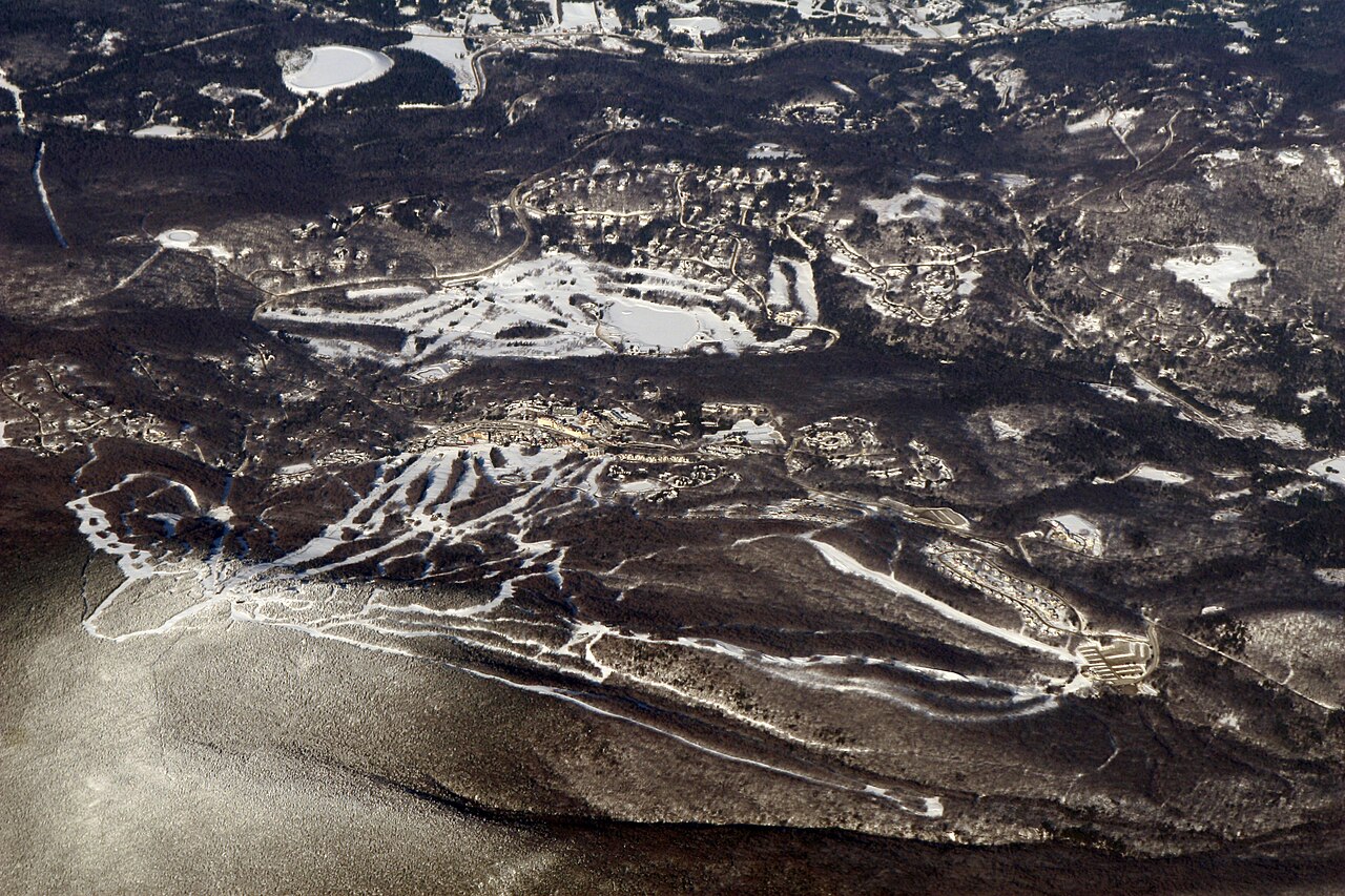
Stratton Mountain Resort is a downhill ski area in Vermont, United States. Mapped terrain includes beginner, easy, intermediate, advanced, expert routes. Its mapped lift network extends from approximately 608 to 1183 metres above sea level. Cross-country skiing is also mapped within the area.
Data: OpenSkiData / OpenSkiMap, OpenStreetMap contributors (ODbL), Skimap.org, Who's On First, Mapterhorn.
Stratton Mountain Resort - Base lift station
ECMWF · Model run: Next update expected:
Day Time (UTC) Temp. (°C) Humidity (%) Wind (km/h) Wind (knots) Wind (Bft) Direction Precip. (mm) Snow (cm) Pressure (hPa) Freezing (m) Conditions | Wednesday, 04/11 06:00 11.7 82 11 6 2B SW — — 1021 3151 Partly cloudy 23% cloud 09:00 12.1 74 14 7 3B SW 0 0 1020 3146 Cloudy 78% cloud 12:00 11.3 77 12 7 3B W 0 0 1020 3149 Overcast 91% cloud 15:00 17.3 55 11 6 2B SW 0 0 1019 3146 Clear 0% cloud 18:00 19.9 47 13 7 3B SW 0 0 1016 3134 Clear 0% cloud 21:00 17.7 57 12 6 2B SW 0 0 1016 3129 Clear 0% cloud Thursday, 05/11 00:00 13.6 76 17 9 3B SW 0 0 1016 3129 Clear 13% cloud 03:00 13 74 17 9 3B SW 0 0 1015 3121 Clear 13% cloud 06:00 12 70 21 11 4B SW 0 0 1014 3109 Partly cloudy 22% cloud 09:00 11.6 80 22 12 4B SW 0 0 1014 3096 Partly cloudy 39% cloud 12:00 11.4 96 23 12 4B SW 0 0 1013 3088 Overcast 90% cloud 15:00 14.4 98 26 14 4B S 1.0 0 1012 3079 Overcast 100% cloud 18:00 14.6 98 27 15 4B SW 6.4 0 1010 3062 Overcast 100% cloud 21:00 15 98 19 10 3B SW 3.0 0 1009 3057 Overcast 96% cloud Friday, 06/11 00:00 14.9 98 22 12 4B SW 0.26 0 1010 3061 Overcast 100% cloud 03:00 14.4 99 20 11 4B SW 1.8 0 1010 3059 Overcast 99% cloud 06:00 13.8 99 19 10 3B W 1.4 0 1011 3051 Overcast 99% cloud 09:00 12.2 96 10 5 2B W 0.14 0 1012 3052 Overcast 91% cloud 12:00 10.7 94 4 2 1B SW 0 0 1013 3054 Overcast 98% cloud 15:00 13.8 79 3 2 1B SW 0 0 1013 3056 Overcast 97% cloud 18:00 16.4 55 8 4 2B SW 0.02 0 1012 3047 Cloudy 78% cloud 21:00 14.7 65 6 3 2B NW 0 0 1012 3047 Overcast 90% cloud Saturday, 07/11 00:00 11.7 80 9 5 2B N 0 0 1012 3048 Overcast 100% cloud 03:00 10.8 80 13 7 3B NE 0 0 1013 3043 Overcast 100% cloud 06:00 10.3 80 15 8 3B NE 0 0 1011 2919 Overcast 100% cloud 09:00 9.4 87 10 5 2B E 0 0 1011 2831 Overcast 100% cloud 12:00 8.8 88 9 5 2B E 0 0 1011 2798 Cloudy 62% cloud 15:00 12 74 16 9 3B E 0 0 1010 2788 Cloudy 70% cloud 18:00 11.6 78 15 8 3B E 0.04 0 1009 2659 Overcast 100% cloud 21:00 9.2 95 10 5 2B E 1.2 0 1008 2571 Overcast 100% cloud Sunday, 08/11 00:00 7.7 99 4 2 1B NE 8.5 0 1008 2379 Overcast 99% cloud 03:00 7 100 5 3 1B NE 8.3 0 1007 2144 Overcast 100% cloud 06:00 6 100 6 3 2B NW 3.9 0 1006 1982 Overcast 100% cloud 09:00 3.3 99 15 8 3B NW 2.9 0 1007 1756 Overcast 100% cloud 12:00 1.7 95 18 10 3B NW 1.9 0 1009 1635 Overcast 81% cloud 15:00 4.2 80 22 12 4B NW 0.08 0 1009 1358 Overcast 91% cloud 18:00 6.6 72 25 13 4B W 0.18 0 1006 1321 Overcast 92% cloud 21:00 6 76 20 11 3B W 0.16 0 1006 1315 Partly cloudy 41% cloud Monday, 09/11 00:00 3.8 70 25 13 4B W 0 0 1006 1246 Partly cloudy 35% cloud 03:00 3.7 76 19 10 3B W 0 0 1005 1303 Overcast 88% cloud 06:00 3.6 92 18 10 3B W 0.23 0 1004 1314 Overcast 99% cloud 09:00 3.7 97 20 11 4B W 1.0 0 1002 1258 Overcast 98% cloud 12:00 3.3 98 17 9 3B W 1.8 0 1004 1206 Overcast 98% cloud 15:00 3.7 92 19 10 3B NW 1.3 0 1007 1158 Overcast 95% cloud 18:00 5.1 71 26 14 4B NW 0.46 0 1007 1162 Overcast 98% cloud 21:00 3.5 69 27 15 4B NW 0 0 1009 1027 Cloudy 77% cloud Tuesday, 10/11 00:00 1.9 74 26 14 4B NW 0 0 1012 913 Partly cloudy 37% cloud 03:00 0.9 74 23 13 4B NW 0 0 1013 809 Cloudy 53% cloud 06:00 0.6 76 21 11 4B NW 0 0 1014 742 Overcast 84% cloud |
|---|
Forecast notes
Forecast table times: UTC.
Coordinates: 43.1125563°N, -72.9075396°E · Requested elevation: 653 m. Model terrain: 587 m. Terrain and 1000/925/850/700 hPa profiles are used for height estimates.
These are altitude estimates, not a simulation of local mountain terrain. Precipitation, cloud and sea-level pressure use horizontal interpolation only.
Precipitation includes rain and snow water equivalent: preceding 3 hours through day 6, then 6 hours (see cell tooltip). Snow (cm) estimates fresh snowfall from precipitation and temperature using the GFS conversion; it is not snow depth on the ground. Freezing (m) uses additional 600/500 hPa temperatures when available and estimates the lowest resolved 0°C crossing above sea level. When all sampled levels are warm, the upper profile limit is shown (see tooltip). < marks an entirely cold sampled profile and its lower height limit. No extrapolation is used.
Source: ECMWF · CC BY 4.0 · Processed by Snow Report.
Stratton Mountain Resort - Top lift station
ECMWF · Model run: Next update expected:
Day Time (UTC) Temp. (°C) Humidity (%) Wind (km/h) Wind (knots) Wind (Bft) Direction Precip. (mm) Snow (cm) Pressure (hPa) Freezing (m) Conditions | Wednesday, 04/11 06:00 13.9 74 29 15 4B W — — 1021 3151 Partly cloudy 23% cloud 09:00 13.5 70 36 19 5B W 0 0 1020 3146 Cloudy 78% cloud 12:00 13.4 65 35 19 5B W 0 0 1020 3149 Overcast 91% cloud 15:00 14.1 58 26 14 4B W 0 0 1019 3146 Clear 0% cloud 18:00 15.2 52 26 14 4B SW 0 0 1016 3134 Clear 0% cloud 21:00 14.9 54 27 14 4B SW 0 0 1016 3129 Clear 0% cloud Thursday, 05/11 00:00 14.7 57 29 16 5B SW 0 0 1016 3129 Clear 13% cloud 03:00 15.3 53 31 17 5B SW 0 0 1015 3121 Clear 13% cloud 06:00 14.6 43 39 21 6B SW 0 0 1014 3109 Partly cloudy 24% cloud 09:00 13.9 51 45 24 6B SW 0 0 1014 3096 Partly cloudy 42% cloud 12:00 12.5 76 50 27 6B SW 0 0 1013 3088 Overcast 91% cloud 15:00 12.9 93 59 32 7B SW 1.1 0 1012 3079 Overcast 100% cloud 18:00 12.5 96 60 32 7B SW 6.6 0 1010 3062 Overcast 100% cloud 21:00 12.5 98 45 25 6B SW 3.1 0 1009 3057 Overcast 97% cloud Friday, 06/11 00:00 12.9 94 50 27 6B SW 0.28 0 1010 3061 Overcast 100% cloud 03:00 12.7 96 49 27 6B SW 1.9 0 1010 3060 Overcast 99% cloud 06:00 10.8 94 43 23 6B W 1.4 0 1011 3051 Overcast 99% cloud 09:00 9.6 85 35 19 5B W 0.14 0 1012 3052 Overcast 93% cloud 12:00 9.2 78 20 11 4B W 0 0 1013 3054 Overcast 98% cloud 15:00 9.6 72 17 9 3B SW 0 0 1013 3057 Overcast 97% cloud 18:00 10.6 71 13 7 3B SW 0.01 0 1012 3047 Cloudy 79% cloud 21:00 10.9 71 9 5 2B SW 0 0 1012 3047 Overcast 90% cloud Saturday, 07/11 00:00 10.1 80 2 1 1B NE 0 0 1012 3048 Overcast 100% cloud 03:00 9.3 84 11 6 2B NE 0 0 1013 3043 Overcast 100% cloud 06:00 8.9 84 21 11 4B E 0 0 1011 2918 Overcast 100% cloud 09:00 8 93 22 12 4B E 0 0 1011 2833 Overcast 100% cloud 12:00 7.8 88 23 12 4B E 0 0 1011 2799 Cloudy 67% cloud 15:00 8.8 81 29 16 5B E 0 0 1010 2789 Cloudy 69% cloud 18:00 7.5 93 28 15 4B E 0.05 0 1009 2660 Overcast 100% cloud 21:00 6.4 98 27 15 4B E 1.2 0 1008 2569 Overcast 100% cloud Sunday, 08/11 00:00 5.2 97 16 9 3B E 9.0 0 1008 2380 Overcast 99% cloud 03:00 4.4 100 13 7 3B NE 9.1 0 1007 2144 Overcast 100% cloud 06:00 3.5 100 17 9 3B NW 4.0 0 1006 1976 Overcast 100% cloud 09:00 2.1 99 34 18 5B N 2.9 0 1007 1756 Overcast 100% cloud 12:00 1.1 84 50 27 7B NW 1.9 0.6 1009 1637 Overcast 83% cloud 15:00 1 90 58 31 7B NW 0.08 0 1009 1352 Overcast 92% cloud 18:00 1.4 89 48 26 6B W 0.20 0 1006 1325 Overcast 93% cloud 21:00 1.1 89 45 24 6B W 0.19 0 1006 1312 Partly cloudy 42% cloud Monday, 09/11 00:00 0.4 66 57 31 7B W 0 0 1006 1242 Partly cloudy 36% cloud 03:00 0.7 90 58 31 7B W 0 0 1005 1307 Overcast 88% cloud 06:00 0.7 97 49 26 6B W 0.26 0.1 1004 1313 Overcast 99% cloud 09:00 0.4 98 50 27 6B W 1.2 0.3 1003 1254 Overcast 98% cloud 12:00 0.1 98 43 23 6B NW 2.0 0.6 1004 1202 Overcast 98% cloud 15:00 -0.2 96 39 21 6B NW 1.3 0.4 1007 1156 Overcast 96% cloud 18:00 -0.2 90 46 25 6B NW 0.48 0.1 1007 1165 Overcast 98% cloud 21:00 -1.5 86 51 28 7B NW 0 0 1009 1030 Cloudy 79% cloud Tuesday, 10/11 00:00 -2 79 61 33 7B NW 0 0 1012 913 Partly cloudy 41% cloud 03:00 -2.4 75 54 29 7B NW 0 0 1013 805 Cloudy 55% cloud 06:00 -2.8 81 49 26 6B NW 0 0 1014 740 Overcast 84% cloud |
|---|
Forecast notes
Forecast table times: UTC.
Coordinates: 43.0957486°N, -72.9210288°E · Requested elevation: 1183 m. Model terrain: 604 m. Terrain and 1000/925/850/700 hPa profiles are used for height estimates.
These are altitude estimates, not a simulation of local mountain terrain. Precipitation, cloud and sea-level pressure use horizontal interpolation only.
Precipitation includes rain and snow water equivalent: preceding 3 hours through day 6, then 6 hours (see cell tooltip). Snow (cm) estimates fresh snowfall from precipitation and temperature using the GFS conversion; it is not snow depth on the ground. Freezing (m) uses additional 600/500 hPa temperatures when available and estimates the lowest resolved 0°C crossing above sea level. When all sampled levels are warm, the upper profile limit is shown (see tooltip). < marks an entirely cold sampled profile and its lower height limit. No extrapolation is used.