Προγνώσεις για χιονοδρομικά σε όλο τον κόσμο

Περισσότερα
Χρωματική κλίμακα Θερμοκρασία · Άνεμος · Βροχή · Χιόνι
Κάθε χρώμα ξεκινά από την τιμή που αναγράφεται. Τα χρώματα ανέμου αντιστοιχούν και στις τρεις μονάδες. Οι τιμές χωρίς υετό παραμένουν ουδέτερες. Τα χρώματα περιγράφουν τις τιμές και δεν αποτελούν επίσημες προειδοποιήσεις.
Strallegg - Base lift station
ECMWF · Εκτέλεση μοντέλου: Αναμενόμενη επόμενη ενημέρωση:
Ημέρα Ώρα (UTC) Θερμ. (°C) Υγρασία (%) Άνεμος (km/h) Άνεμος (κόμβοι) Άνεμος (Bft) Διεύθυνση Υετός (mm) Νέο χιόνι (cm) Πίεση (hPa) Σημείο παγοποίησης (m) Συνθήκες | Τετάρτη, 04/11 06:00 2.5 89 5 3 1B N — — 1029 1342 Overcast 100% cloud  09:00 4.7 77 1 1 1B E 0 0 1030 1440 Overcast 100% cloud 12:00 6.3 72 4 2 1B S 0.00 0 1029 1451 Overcast 100% cloud 15:00 5.5 76 4 2 1B SE 0.04 0 1029 1420 Overcast 100% cloud 18:00 4 81 3 2 1B SE 0.04 0 1031 1334 Overcast 99% cloud 21:00 1.9 87 1 0 0B SW 0 0 1032 1142 Clear 17% cloud  Πέμπτη, 05/11 00:00 0.6 89 1 1 1B SE 0 0 1032 < 945 Cloudy 57% cloud  03:00 0.8 90 2 1 1B S 0 0 1032 < 945 Overcast 91% cloud 06:00 2.2 89 4 2 1B S 0 0 1032 1177 Overcast 100% cloud 09:00 4.2 80 7 4 2B S 0.01 0 1033 1550 Overcast 99% cloud 12:00 6.2 68 8 4 2B S 0 0 1031 2024 Cloudy 79% cloud 15:00 5 76 5 3 1B S 0 0 1030 2746 Partly cloudy 40% cloud  18:00 1.6 89 2 1 1B S 0 0 1030 2908 Partly cloudy 31% cloud 21:00 1 89 2 1 1B SW 0 0 1030 1008 Overcast 83% cloud Παρασκευή, 06/11 00:00 0.9 92 3 2 1B W 0 0 1029 998 Overcast 81% cloud 03:00 0.2 91 2 1 1B NW 0 0 1027 1052 Overcast 88% cloud 06:00 -0.2 92 1 0 0B W 0 0 1027 1090 Overcast 83% cloud 09:00 5.9 73 4 2 1B S 0 0 1027 2904 Clear 15% cloud 12:00 9.1 54 6 3 1B S 0 0 1025 2830 Clear 0% cloud 15:00 6.2 67 3 2 1B SE 0 0 1025 2826 Clear 0% cloud 18:00 1.4 82 1 1 1B SE 0 0 1026 2770 Clear 0% cloud 21:00 0.5 83 2 1 1B SE 0 0 1027 1075 Clear 0% cloud Σάββατο, 07/11 00:00 -0 85 2 1 1B SE 0 0 1027 1216 Clear 2% cloud 03:00 -0.2 88 2 1 1B SE 0 0 1028 1329 Partly cloudy 42% cloud 06:00 -0.5 89 2 1 1B S 0 0 1029 1303 Partly cloudy 37% cloud 09:00 4.5 63 6 3 1B S 0 0 1029 1731 Clear 5% cloud 12:00 7.1 52 8 4 2B S 0 0 1027 1693 Clear 1% cloud 15:00 3.7 68 3 2 1B S 0 0 1027 2085 Clear 0% cloud 18:00 -0 79 2 1 1B S 0 0 1028 1166 Clear 0% cloud 21:00 -1 86 2 1 1B S 0 0 1029 1239 Clear 1% cloud Κυριακή, 08/11 00:00 -1.5 87 1 1 1B W 0 0 1028 1245 Clear 9% cloud 03:00 -2 84 2 1 1B NW 0 0 1028 1285 Cloudy 52% cloud 06:00 -1.9 81 1 1 1B W 0 0 1027 1323 Cloudy 60% cloud 09:00 4.5 51 5 3 1B S 0 0 1027 1905 Clear 3% cloud 12:00 7.1 49 7 4 2B S 0 0 1025 1933 Clear 2% cloud 15:00 3.1 74 3 2 1B S 0 0 1026 1916 Partly cloudy 22% cloud 18:00 0.2 84 1 1 1B W 0 0 1026 1124 Clear 0% cloud 21:00 -0.1 84 2 1 1B NW 0 0 1026 1139 Clear 0% cloud Δευτέρα, 09/11 00:00 -0.3 84 2 1 1B NW 0 0 1025 1140 Clear 0% cloud 03:00 -0.3 82 2 1 1B NW 0 0 1024 1118 Clear 0% cloud 06:00 -0.2 81 2 1 1B NW 0 0 1023 1102 Partly cloudy 22% cloud 09:00 7 57 3 1 1B SW 0 0 1023 2412 Partly cloudy 42% cloud 12:00 9.7 49 4 2 1B S 0 0 1021 2487 Overcast 93% cloud 15:00 5 74 3 2 1B S 0.08 0 1020 2536 Cloudy 67% cloud 18:00 2.5 83 2 1 1B W 0 0 1019 2740 Partly cloudy 23% cloud 21:00 1.9 82 4 2 1B NW 0 0 1018 2768 Cloudy 54% cloud Τρίτη, 10/11 00:00 1.9 84 5 3 1B NW 0 0 1017 2866 Cloudy 62% cloud 03:00 2.5 86 6 3 2B NW 0.02 0 1014 2972 Overcast 100% cloud 06:00 3.4 83 5 3 1B NW 0.08 0 1014 2948 Overcast 99% cloud |
|---|
Forecast notes
Forecast table times: UTC.
Coordinates: 47.4408945°N, 15.7040781°E · Requested elevation: 688 m. Model terrain: 943 m. Terrain and 1000/925/850/700 hPa profiles are used for height estimates.
Outside the available profile, temperature uses an estimated 5.5°C/km height correction; wind retains the nearest available model-level value. Humidity is estimated with adjusted pressure and temperature.
These are altitude estimates, not a simulation of local mountain terrain. Precipitation, cloud and sea-level pressure use horizontal interpolation only.
Precipitation includes rain and snow water equivalent: preceding 3 hours through day 6, then 6 hours (see cell tooltip). Snow (cm) estimates fresh snowfall from precipitation and temperature using the GFS conversion; it is not snow depth on the ground. Freezing (m) uses additional 600/500 hPa temperatures when available and estimates the lowest resolved 0°C crossing above sea level. When all sampled levels are warm, the upper profile limit is shown (see tooltip). < marks an entirely cold sampled profile and its lower height limit. No extrapolation is used.
Source: ECMWF · CC BY 4.0 · Processed by Snow Report.
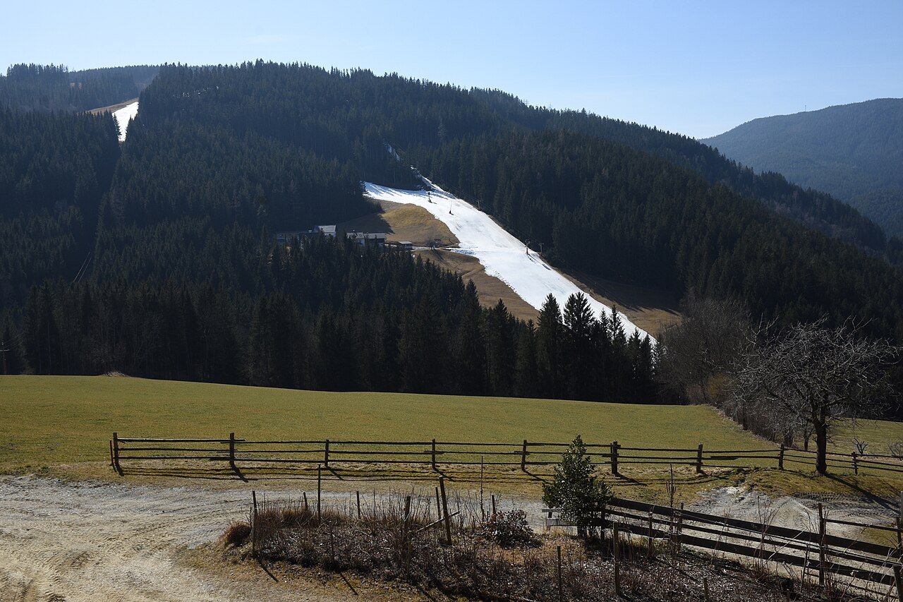
Strallegg is a mapped downhill ski area in AT. Forecasts cover three real lift-station locations from approximately 688 to 990 metres. Elevations are terrain-model estimates.
Data: OpenSkiData / OpenSkiMap, OpenStreetMap contributors (ODbL), Skimap.org, Who's On First, Mapterhorn.
Strallegg - Middle lift station
ECMWF · Εκτέλεση μοντέλου: Αναμενόμενη επόμενη ενημέρωση:
Ημέρα Ώρα (UTC) Θερμ. (°C) Υγρασία (%) Άνεμος (km/h) Άνεμος (κόμβοι) Άνεμος (Bft) Διεύθυνση Υετός (mm) Νέο χιόνι (cm) Πίεση (hPa) Σημείο παγοποίησης (m) Συνθήκες | Τετάρτη, 04/11 06:00 1.3 95 5 3 1B N — — 1029 1350 Overcast 100% cloud 09:00 3.4 82 1 1 1B E 0 0 1030 1440 Overcast 100% cloud 12:00 5 77 4 2 1B S 0.00 0 1029 1450 Overcast 100% cloud 15:00 4.2 81 4 2 1B SE 0.04 0 1029 1419 Overcast 100% cloud 18:00 2.7 87 3 2 1B SE 0.04 0 1031 1334 Overcast 99% cloud 21:00 0.6 93 1 0 0B SW 0 0 1032 1153 Clear 17% cloud Πέμπτη, 05/11 00:00 -0.7 95 1 1 1B SE 0 0 1032 < 935 Cloudy 57% cloud 03:00 -0.4 96 2 1 1B S 0 0 1032 < 935 Overcast 91% cloud 06:00 0.9 95 3 2 1B S 0 0 1032 1180 Overcast 100% cloud 09:00 2.9 85 7 4 2B S 0.01 0 1033 1543 Overcast 99% cloud 12:00 4.9 73 8 4 2B S 0 0 1031 2013 Cloudy 80% cloud 15:00 3.8 80 5 3 1B S 0 0 1030 2745 Partly cloudy 40% cloud 18:00 0.4 95 2 1 1B S 0 0 1030 2903 Partly cloudy 32% cloud 21:00 -0.3 95 2 1 1B SW 0 0 1030 986 Overcast 82% cloud Παρασκευή, 06/11 00:00 -0.4 98 3 2 1B NW 0 0 1029 985 Cloudy 79% cloud 03:00 -1.1 98 2 1 1B NW 0 0 1027 1042 Overcast 87% cloud 06:00 -1.5 98 1 0 0B W 0 0 1027 1081 Overcast 81% cloud 09:00 4.6 77 4 2 1B S 0 0 1027 2905 Clear 15% cloud 12:00 7.8 58 6 3 1B S 0 0 1025 2830 Clear 0% cloud 15:00 4.9 72 3 2 1B SE 0 0 1025 2826 Clear 0% cloud 18:00 0.2 88 1 1 1B E 0 0 1026 2769 Clear 0% cloud 21:00 -0.7 88 1 1 1B SE 0 0 1027 1058 Clear 0% cloud Σάββατο, 07/11 00:00 -1.3 90 2 1 1B SE 0 0 1027 1203 Clear 2% cloud 03:00 -1.5 94 2 1 1B SE 0 0 1028 1322 Partly cloudy 41% cloud 06:00 -1.7 95 2 1 1B S 0 0 1029 1296 Partly cloudy 37% cloud 09:00 3.2 68 6 3 1B S 0 0 1029 1726 Clear 5% cloud 12:00 5.8 55 8 4 2B S 0 0 1027 1693 Clear 1% cloud 15:00 2.5 72 3 2 1B S 0 0 1027 2084 Clear 0% cloud 18:00 -1.3 84 2 1 1B S 0 0 1028 1153 Clear 0% cloud 21:00 -2.2 91 2 1 1B S 0 0 1029 1230 Clear 1% cloud Κυριακή, 08/11 00:00 -2.8 93 1 1 1B W 0 0 1028 1237 Clear 9% cloud 03:00 -3.3 90 2 1 1B NW 0 0 1028 1280 Cloudy 52% cloud 06:00 -3.2 86 1 1 1B W 0 0 1028 1319 Cloudy 60% cloud 09:00 3.1 55 5 3 1B S 0 0 1028 1903 Clear 3% cloud 12:00 5.8 52 7 4 2B S 0 0 1025 1934 Clear 2% cloud 15:00 1.8 78 3 2 1B S 0 0 1026 1916 Partly cloudy 21% cloud 18:00 -1.1 89 1 1 1B W 0 0 1026 1112 Clear 0% cloud 21:00 -1.4 89 2 1 1B NW 0 0 1026 1130 Clear 0% cloud Δευτέρα, 09/11 00:00 -1.7 89 2 1 1B NW 0 0 1025 1132 Clear 0% cloud 03:00 -1.6 88 2 1 1B NW 0 0 1024 1111 Clear 0% cloud 06:00 -1.5 87 2 1 1B NW 0 0 1024 1095 Partly cloudy 23% cloud 09:00 5.6 61 3 1 1B SW 0 0 1023 2413 Partly cloudy 42% cloud 12:00 8.3 53 4 2 1B S 0 0 1021 2488 Overcast 93% cloud 15:00 3.7 79 3 2 1B S 0.07 0 1020 2538 Cloudy 67% cloud 18:00 1.2 88 2 1 1B W 0 0 1019 2741 Partly cloudy 22% cloud 21:00 0.6 88 4 2 1B NW 0 0 1018 2770 Cloudy 54% cloud Τρίτη, 10/11 00:00 0.6 90 5 3 1B NW 0 0 1017 2868 Cloudy 62% cloud 03:00 1.2 91 6 3 2B NW 0.02 0 1014 2974 Overcast 100% cloud 06:00 2.1 88 5 3 1B NW 0.07 0 1014 2951 Overcast 98% cloud |
|---|
Forecast notes
Forecast table times: UTC.
Coordinates: 47.4349519°N, 15.7024876°E · Requested elevation: 919 m. Model terrain: 933 m. Terrain and 1000/925/850/700 hPa profiles are used for height estimates.
Outside the available profile, temperature uses an estimated 5.5°C/km height correction; wind retains the nearest available model-level value. Humidity is estimated with adjusted pressure and temperature.
These are altitude estimates, not a simulation of local mountain terrain. Precipitation, cloud and sea-level pressure use horizontal interpolation only.
Precipitation includes rain and snow water equivalent: preceding 3 hours through day 6, then 6 hours (see cell tooltip). Snow (cm) estimates fresh snowfall from precipitation and temperature using the GFS conversion; it is not snow depth on the ground. Freezing (m) uses additional 600/500 hPa temperatures when available and estimates the lowest resolved 0°C crossing above sea level. When all sampled levels are warm, the upper profile limit is shown (see tooltip). < marks an entirely cold sampled profile and its lower height limit. No extrapolation is used.
Source: ECMWF · CC BY 4.0 · Processed by Snow Report.
Strallegg - Top lift station
ECMWF · Εκτέλεση μοντέλου: Αναμενόμενη επόμενη ενημέρωση:
Ημέρα Ώρα (UTC) Θερμ. (°C) Υγρασία (%) Άνεμος (km/h) Άνεμος (κόμβοι) Άνεμος (Bft) Διεύθυνση Υετός (mm) Νέο χιόνι (cm) Πίεση (hPa) Σημείο παγοποίησης (m) Συνθήκες | Τετάρτη, 04/11 06:00 1.1 96 4 2 1B N — — 1029 1354 Overcast 100% cloud 09:00 2.9 84 1 0 0B E 0 0 1030 1440 Overcast 100% cloud 12:00 4.3 79 4 2 1B S 0.00 0 1029 1450 Overcast 100% cloud 15:00 3.6 83 4 2 1B SE 0.04 0 1029 1419 Overcast 100% cloud 18:00 2.2 88 4 2 1B SE 0.04 0 1031 1334 Overcast 99% cloud 21:00 0.4 92 2 1 1B SE 0 0 1032 1158 Clear 18% cloud Πέμπτη, 05/11 00:00 -0.8 94 2 1 1B SE 0 0 1032 < 929 Cloudy 57% cloud 03:00 -0.5 95 4 2 1B S 0 0 1032 < 929 Overcast 91% cloud 06:00 0.7 95 5 3 1B S 0 0 1032 1183 Overcast 100% cloud 09:00 2.6 84 8 4 2B S 0.01 0 1033 1541 Overcast 99% cloud 12:00 4.4 73 9 5 2B S 0 0 1031 2008 Cloudy 80% cloud 15:00 3.6 79 7 4 2B S 0 0 1030 2745 Partly cloudy 40% cloud 18:00 0.6 91 4 2 1B S 0 0 1030 2901 Partly cloudy 32% cloud 21:00 0.1 90 4 2 1B SW 0 0 1030 973 Overcast 81% cloud Παρασκευή, 06/11 00:00 0.1 90 3 2 1B W 0 0 1029 977 Cloudy 77% cloud 03:00 -0.5 89 2 1 1B W 0 0 1027 1038 Overcast 86% cloud 06:00 -0.9 90 2 1 1B SW 0 0 1027 1077 Overcast 80% cloud 09:00 4.5 73 5 3 1B S 0 0 1027 2905 Clear 14% cloud 12:00 7.3 56 6 3 2B S 0 0 1025 2830 Clear 0% cloud 15:00 4.8 67 5 2 1B SE 0 0 1025 2827 Clear 0% cloud 18:00 0.6 80 3 2 1B SE 0 0 1026 2768 Clear 0% cloud 21:00 -0.3 81 4 2 1B SE 0 0 1027 1047 Clear 0% cloud Σάββατο, 07/11 00:00 -1 83 5 2 1B SE 0 0 1027 1195 Clear 2% cloud 03:00 -1.3 85 5 3 1B S 0 0 1028 1317 Partly cloudy 40% cloud 06:00 -1.5 86 5 3 1B S 0 0 1029 1291 Partly cloudy 36% cloud 09:00 2.9 67 8 4 2B S 0 0 1029 1726 Clear 5% cloud 12:00 5.2 56 9 5 2B S 0 0 1027 1694 Clear 1% cloud 15:00 2.4 66 5 3 1B S 0 0 1027 2084 Clear 0% cloud 18:00 -0.9 74 4 2 1B S 0 0 1028 1146 Clear 0% cloud 21:00 -1.8 80 5 3 1B S 0 0 1029 1225 Clear 1% cloud Κυριακή, 08/11 00:00 -2.2 81 4 2 1B S 0 0 1028 1232 Clear 9% cloud 03:00 -2.7 79 3 2 1B SW 0 0 1028 1277 Cloudy 52% cloud 06:00 -2.7 77 3 2 1B SW 0 0 1028 1316 Cloudy 60% cloud 09:00 2.9 54 7 4 2B S 0 0 1028 1903 Clear 3% cloud 12:00 5.3 53 8 5 2B S 0 0 1025 1934 Clear 2% cloud 15:00 1.8 77 4 2 1B S 0 0 1026 1916 Partly cloudy 21% cloud 18:00 -0.8 87 3 2 1B W 0 0 1026 1105 Clear 0% cloud 21:00 -1 86 3 2 1B W 0 0 1026 1124 Clear 0% cloud Δευτέρα, 09/11 00:00 -1.2 85 3 2 1B W 0 0 1025 1127 Clear 0% cloud 03:00 -1.1 84 2 1 1B NW 0 0 1024 1107 Clear 0% cloud 06:00 -1 82 2 1 1B W 0 0 1024 1090 Partly cloudy 24% cloud 09:00 5.5 60 4 2 1B SW 0 0 1023 2414 Partly cloudy 42% cloud 12:00 7.9 52 5 3 1B SW 0 0 1021 2489 Overcast 93% cloud 15:00 3.8 74 4 2 1B SW 0.07 0 1020 2539 Cloudy 67% cloud 18:00 1.7 83 4 2 1B SW 0 0 1019 2741 Partly cloudy 22% cloud 21:00 1.3 80 5 3 1B W 0 0 1018 2771 Cloudy 55% cloud Τρίτη, 10/11 00:00 1.5 81 8 4 2B W 0 0 1017 2869 Cloudy 61% cloud 03:00 2.1 86 7 4 2B NW 0.02 0 1014 2976 Overcast 100% cloud 06:00 3 82 6 4 2B NW 0.07 0 1014 2952 Overcast 98% cloud |
|---|
Forecast notes
Forecast table times: UTC.
Coordinates: 47.4313721°N, 15.7031925°E · Requested elevation: 990 m. Model terrain: 927 m. Terrain and 1000/925/850/700 hPa profiles are used for height estimates.
These are altitude estimates, not a simulation of local mountain terrain. Precipitation, cloud and sea-level pressure use horizontal interpolation only.
Precipitation includes rain and snow water equivalent: preceding 3 hours through day 6, then 6 hours (see cell tooltip). Snow (cm) estimates fresh snowfall from precipitation and temperature using the GFS conversion; it is not snow depth on the ground. Freezing (m) uses additional 600/500 hPa temperatures when available and estimates the lowest resolved 0°C crossing above sea level. When all sampled levels are warm, the upper profile limit is shown (see tooltip). < marks an entirely cold sampled profile and its lower height limit. No extrapolation is used.