Worldwide Ski Resort Forecasts

Colour guide Temperature · Wind · Rain · Snow
Each colour starts at the value shown. Wind colours match across all three units. Dry cells stay neutral. Colours describe the displayed values, not official weather warnings.
Spiazzi di Gromo - Low lift station
ECMWF · Model run: Next update expected:
Day Time (UTC) Temp. (°C) Humidity (%) Wind (km/h) Wind (knots) Wind (Bft) Direction Precip. (mm) Snow (cm) Pressure (hPa) Freezing (m) Conditions | Wednesday, 04/11 06:00 3.3 86 0 0 0B SW — — 1024 1746 Overcast 98% cloud  09:00 5 79 3 2 1B S 0.14 0 1025 1980 Overcast 95% cloud 12:00 5.8 74 4 2 1B S 0.21 0 1025 2084 Overcast 100% cloud 15:00 5.2 81 3 2 1B S 0.31 0 1025 2055 Overcast 98% cloud 18:00 4 86 1 0 0B E 0.01 0 1027 1891 Overcast 94% cloud 21:00 2.5 85 1 0 0B N 0.09 0 1028 1609 Overcast 86% cloud Thursday, 05/11 00:00 2.6 85 1 0 0B NW 0 0 1029 1643 Cloudy 57% cloud  03:00 2.1 81 0 0 0B N 0.02 0 1028 < 1602 Partly cloudy 25% cloud  06:00 1.9 79 0 0 0B NW 0 0 1028 < 1602 Partly cloudy 37% cloud 09:00 6.3 68 0 0 0B E 0 0 1029 2375 Clear 10% cloud  12:00 9 59 2 1 1B S 0 0 1026 2642 Clear 11% cloud 15:00 7.5 72 3 1 1B SW 0 0 1026 2595 Clear 16% cloud 18:00 4 80 1 1 1B NW 0 0 1026 2248 Clear 11% cloud 21:00 3.4 78 1 1 1B N 0 0 1026 2090 Partly cloudy 29% cloud Friday, 06/11 00:00 3.1 78 1 1 0B N 0 0 1025 2008 Clear 17% cloud 03:00 2.9 79 0 0 0B — 0 0 1023 1945 Cloudy 58% cloud 06:00 2.7 80 1 1 1B N 0 0 1022 1805 Overcast 98% cloud 09:00 7.1 68 1 0 0B S 0 0 1023 2562 Overcast 100% cloud 12:00 6.4 80 1 1 0B E 0.29 0 1022 2492 Overcast 100% cloud 15:00 5.8 85 1 1 1B NE 2.3 0 1022 2415 Overcast 100% cloud 18:00 4.7 87 1 1 1B E 1.7 0 1022 2228 Overcast 100% cloud 21:00 4.3 87 2 1 1B E 2.3 0 1023 2055 Overcast 100% cloud Saturday, 07/11 00:00 3.8 87 2 1 1B NE 1.8 0 1022 1943 Overcast 100% cloud 03:00 3.7 88 3 1 1B SE 1.7 0 1022 1858 Overcast 100% cloud 06:00 3.6 85 0 0 0B — 2.7 0 1023 1817 Overcast 100% cloud 09:00 4.3 84 2 1 1B S 0.18 0 1024 1911 Overcast 97% cloud 12:00 5.2 78 2 1 1B SW 0.17 0 1023 2005 Overcast 99% cloud 15:00 4.2 87 2 1 1B SW 0.61 0 1024 1885 Overcast 100% cloud 18:00 3.3 88 1 1 1B SW 1.4 0 1025 1756 Overcast 100% cloud 21:00 3.3 88 1 0 0B SW 0.42 0 1026 1760 Overcast 100% cloud Sunday, 08/11 00:00 3.3 88 0 0 0B S 0.33 0 1026 1751 Overcast 100% cloud 03:00 3.1 87 1 0 0B SW 0.94 0 1025 1716 Overcast 100% cloud 06:00 2.9 87 2 1 1B S 0.41 0 1025 1690 Overcast 100% cloud 09:00 3.6 85 3 1 1B SW 0.12 0 1027 1805 Overcast 98% cloud 12:00 5.3 70 2 1 1B SW 0.05 0 1025 2056 Overcast 92% cloud 15:00 4.4 77 2 1 1B SW 0.05 0 1025 2006 Cloudy 61% cloud 18:00 0.8 86 1 1 1B N 0 0 1026 < 1602 Clear 16% cloud 21:00 0.7 81 1 0 0B N 0 0 1026 < 1602 Partly cloudy 22% cloud Monday, 09/11 00:00 0.7 71 1 0 0B N 0 0 1025 < 1602 Overcast 90% cloud 03:00 1.6 66 0 0 0B NW 0 0 1025 < 1602 Overcast 99% cloud 06:00 2 72 0 0 0B W 0.09 0 1025 < 1602 Overcast 88% cloud 09:00 5.2 68 1 1 0B SW 0 0 1025 2305 Overcast 96% cloud 12:00 5.9 69 2 1 1B SW 0 0 1024 2312 Overcast 100% cloud 15:00 5.2 77 2 1 1B N 0.35 0 1022 2236 Overcast 100% cloud 18:00 5.1 78 0 0 0B SW 1.2 0 1022 2239 Overcast 100% cloud 21:00 5 82 0 0 0B W 1.3 0 1022 2287 Overcast 100% cloud Tuesday, 10/11 00:00 5.4 83 0 0 0B NW 0.50 0 1021 2394 Overcast 100% cloud 03:00 5.8 84 0 0 0B W 0.32 0 1019 2490 Overcast 100% cloud 06:00 6 85 0 0 0B NE 0.74 0 1017 2615 Overcast 100% cloud |
|---|
Forecast notes
Forecast table times: UTC.
Coordinates: 45.9689073°N, 9.9591744°E · Requested elevation: 1159 m. Model terrain: 1599 m. Terrain and 1000/925/850/700 hPa profiles are used for height estimates.
Outside the available profile, temperature uses an estimated 5.5°C/km height correction; wind retains the nearest available model-level value. Humidity is estimated with adjusted pressure and temperature.
These are altitude estimates, not a simulation of local mountain terrain. Precipitation, cloud and sea-level pressure use horizontal interpolation only.
Precipitation includes rain and snow water equivalent: preceding 3 hours through day 6, then 6 hours (see cell tooltip). Snow (cm) estimates fresh snowfall from precipitation and temperature using the GFS conversion; it is not snow depth on the ground. Freezing (m) uses additional 600/500 hPa temperatures when available and estimates the lowest resolved 0°C crossing above sea level. When all sampled levels are warm, the upper profile limit is shown (see tooltip). < marks an entirely cold sampled profile and its lower height limit. No extrapolation is used.
Source: ECMWF · CC BY 4.0 · Processed by Snow Report.
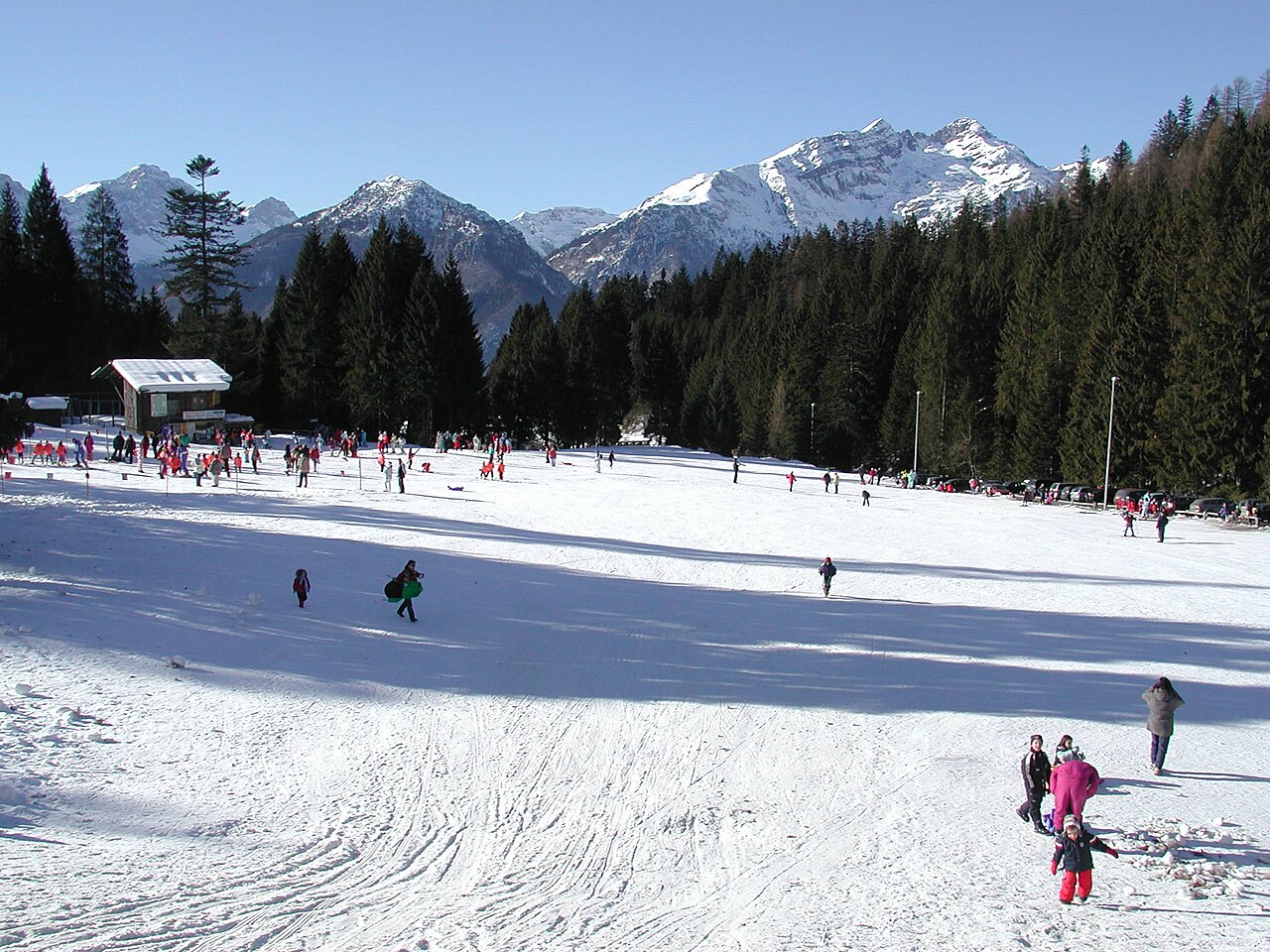
Spiazzi di Gromo is a downhill ski area in Bergamo, Italy. Mapped terrain includes beginner, easy, intermediate, advanced routes. Its mapped lift network extends from approximately 1159 to 1691 metres above sea level.
Data: OpenSkiData / OpenSkiMap, OpenStreetMap contributors (ODbL), Skimap.org, Who's On First, Mapterhorn.
Spiazzi di Gromo - Base lift station
ECMWF · Model run: Next update expected:
Day Time (UTC) Temp. (°C) Humidity (%) Wind (km/h) Wind (knots) Wind (Bft) Direction Precip. (mm) Snow (cm) Pressure (hPa) Freezing (m) Conditions | Wednesday, 04/11 06:00 3.2 86 0 0 0B SW — — 1024 1746 Overcast 98% cloud 09:00 4.9 79 3 2 1B S 0.14 0 1025 1982 Overcast 95% cloud 12:00 5.7 74 4 2 1B S 0.21 0 1025 2086 Overcast 100% cloud 15:00 5.1 81 3 2 1B S 0.31 0 1025 2055 Overcast 98% cloud 18:00 3.9 86 1 0 0B E 0.01 0 1027 1889 Overcast 94% cloud 21:00 2.3 85 1 0 0B N 0.09 0 1028 < 1611 Overcast 86% cloud Thursday, 05/11 00:00 2.5 85 1 0 0B NW 0 0 1029 1639 Cloudy 57% cloud 03:00 2 81 0 0 0B N 0.02 0 1028 < 1611 Partly cloudy 24% cloud 06:00 1.8 79 0 0 0B NW 0 0 1028 < 1611 Partly cloudy 37% cloud 09:00 6.2 68 0 0 0B E 0 0 1029 2375 Clear 9% cloud 12:00 8.9 59 2 1 1B S 0 0 1026 2643 Clear 11% cloud 15:00 7.4 72 3 1 1B SW 0 0 1026 2595 Clear 16% cloud 18:00 3.9 80 1 1 1B NW 0 0 1026 2243 Clear 10% cloud 21:00 3.3 79 1 1 1B N 0 0 1026 2082 Partly cloudy 29% cloud Friday, 06/11 00:00 3 78 1 1 0B N 0 0 1025 1997 Clear 17% cloud 03:00 2.9 79 0 0 0B — 0 0 1023 1934 Cloudy 57% cloud 06:00 2.6 80 1 1 1B N 0 0 1022 1784 Overcast 98% cloud 09:00 7 68 1 0 0B S 0 0 1023 2563 Overcast 100% cloud 12:00 6.3 80 1 1 1B E 0.29 0 1022 2492 Overcast 100% cloud 15:00 5.7 86 1 1 1B NE 2.3 0 1022 2414 Overcast 100% cloud 18:00 4.6 87 1 1 1B E 1.7 0 1022 2225 Overcast 100% cloud 21:00 4.2 87 2 1 1B E 2.3 0 1023 2053 Overcast 100% cloud Saturday, 07/11 00:00 3.7 87 2 1 1B NE 1.8 0 1022 1941 Overcast 100% cloud 03:00 3.6 89 3 1 1B SE 1.7 0 1022 1857 Overcast 100% cloud 06:00 3.5 85 0 0 0B — 2.7 0 1023 1816 Overcast 100% cloud 09:00 4.2 84 2 1 1B S 0.18 0 1024 1912 Overcast 97% cloud 12:00 5.1 78 2 1 1B SW 0.17 0 1023 2007 Overcast 99% cloud 15:00 4.1 87 2 1 1B SW 0.60 0 1024 1885 Overcast 100% cloud 18:00 3.2 89 1 1 1B SW 1.4 0 1025 1756 Overcast 100% cloud 21:00 3.2 88 1 0 0B SW 0.41 0 1026 1761 Overcast 100% cloud Sunday, 08/11 00:00 3.2 88 0 0 0B S 0.32 0 1026 1752 Overcast 100% cloud 03:00 3 88 1 0 0B SW 0.93 0 1025 1717 Overcast 100% cloud 06:00 2.8 87 2 1 1B S 0.41 0 1025 1690 Overcast 100% cloud 09:00 3.5 85 3 1 1B SW 0.12 0 1027 1803 Overcast 98% cloud 12:00 5.2 70 2 1 1B SW 0.05 0 1025 2056 Overcast 92% cloud 15:00 4.3 77 2 1 1B SW 0.05 0 1025 2003 Cloudy 61% cloud 18:00 0.7 86 1 1 1B N 0 0 1026 < 1611 Clear 15% cloud 21:00 0.5 81 1 0 0B N 0 0 1026 < 1611 Partly cloudy 21% cloud Monday, 09/11 00:00 0.6 71 1 0 0B N 0 0 1025 < 1611 Overcast 90% cloud 03:00 1.5 66 0 0 0B NW 0 0 1025 < 1611 Overcast 99% cloud 06:00 1.9 72 0 0 0B NW 0.09 0 1025 < 1611 Overcast 88% cloud 09:00 5.1 69 1 1 0B SW 0 0 1025 2302 Overcast 96% cloud 12:00 5.8 69 1 1 1B SW 0 0 1024 2311 Overcast 100% cloud 15:00 5.1 77 2 1 1B N 0.35 0 1022 2236 Overcast 100% cloud 18:00 5 78 0 0 0B SW 1.2 0 1022 2238 Overcast 100% cloud 21:00 4.9 83 0 0 0B W 1.3 0 1022 2284 Overcast 100% cloud Tuesday, 10/11 00:00 5.3 83 0 0 0B NW 0.51 0 1021 2392 Overcast 100% cloud 03:00 5.7 84 0 0 0B W 0.32 0 1019 2488 Overcast 100% cloud 06:00 5.9 85 0 0 0B NE 0.75 0 1017 2613 Overcast 100% cloud |
|---|
Forecast notes
Forecast table times: UTC.
Coordinates: 45.9704993°N, 9.961756°E · Requested elevation: 1177 m. Model terrain: 1608 m. Terrain and 1000/925/850/700 hPa profiles are used for height estimates.
Outside the available profile, temperature uses an estimated 5.5°C/km height correction; wind retains the nearest available model-level value. Humidity is estimated with adjusted pressure and temperature.
These are altitude estimates, not a simulation of local mountain terrain. Precipitation, cloud and sea-level pressure use horizontal interpolation only.
Precipitation includes rain and snow water equivalent: preceding 3 hours through day 6, then 6 hours (see cell tooltip). Snow (cm) estimates fresh snowfall from precipitation and temperature using the GFS conversion; it is not snow depth on the ground. Freezing (m) uses additional 600/500 hPa temperatures when available and estimates the lowest resolved 0°C crossing above sea level. When all sampled levels are warm, the upper profile limit is shown (see tooltip). < marks an entirely cold sampled profile and its lower height limit. No extrapolation is used.
Source: ECMWF · CC BY 4.0 · Processed by Snow Report.
Spiazzi di Gromo - Top lift station
ECMWF · Model run: Next update expected:
Day Time (UTC) Temp. (°C) Humidity (%) Wind (km/h) Wind (knots) Wind (Bft) Direction Precip. (mm) Snow (cm) Pressure (hPa) Freezing (m) Conditions | Wednesday, 04/11 06:00 0.3 96 1 1 1B E — — 1024 1753 Overcast 97% cloud 09:00 1.9 89 5 2 1B SE 0.14 0 1025 1976 Overcast 96% cloud 12:00 2.7 84 5 3 1B S 0.21 0 1025 2082 Overcast 100% cloud 15:00 2.2 91 4 2 1B S 0.33 0 1025 2054 Overcast 98% cloud 18:00 1.1 96 2 1 1B S 0.01 0 1027 1895 Overcast 92% cloud 21:00 -0.2 95 1 0 0B SW 0.09 0 1028 1648 Overcast 83% cloud Thursday, 05/11 00:00 -0.1 95 1 1 1B SW 0 0 1029 1670 Cloudy 55% cloud 03:00 -0.4 89 1 1 0B SW 0.01 0 1028 1562 Partly cloudy 24% cloud 06:00 -0.6 87 1 1 1B S 0 0 1028 < 1553 Partly cloudy 34% cloud 09:00 3.4 76 2 1 1B S 0 0 1029 2377 Clear 7% cloud 12:00 5.8 67 4 2 1B SW 0 0 1027 2637 Clear 12% cloud 15:00 4.6 81 3 2 1B SW 0 0 1026 2592 Clear 16% cloud 18:00 1.5 88 1 1 1B W 0 0 1026 2278 Clear 10% cloud 21:00 1 86 1 0 0B W 0 0 1026 2145 Partly cloudy 29% cloud Friday, 06/11 00:00 0.7 85 1 0 0B SW 0 0 1025 2113 Clear 18% cloud 03:00 0.6 86 1 1 1B S 0 0 1024 2059 Cloudy 57% cloud 06:00 0.4 87 1 0 0B SE 0 0 1023 1923 Overcast 99% cloud 09:00 4.2 78 3 2 1B S 0 0 1023 2561 Overcast 100% cloud 12:00 3.5 91 2 1 1B SE 0.30 0 1022 2489 Overcast 100% cloud 15:00 2.9 96 2 1 1B SE 2.4 0 1022 2413 Overcast 100% cloud 18:00 2 98 2 1 1B SE 1.6 0 1022 2240 Overcast 100% cloud 21:00 1.6 97 3 2 1B SE 2.1 0 1023 2077 Overcast 100% cloud Saturday, 07/11 00:00 1.1 98 2 1 1B SE 1.8 0.5 1022 1963 Overcast 100% cloud 03:00 0.9 99 3 2 1B SE 1.7 0.5 1022 1871 Overcast 100% cloud 06:00 0.7 95 1 1 1B E 2.7 0.8 1023 1831 Overcast 100% cloud 09:00 1.4 95 3 2 1B S 0.19 0 1024 1917 Overcast 97% cloud 12:00 2.1 88 2 1 1B S 0.19 0 1023 2004 Overcast 98% cloud 15:00 1.2 98 2 1 1B S 0.68 0 1024 1884 Overcast 100% cloud 18:00 0.4 100 2 1 1B S 1.3 0.4 1025 1766 Overcast 100% cloud 21:00 0.4 98 1 1 1B SW 0.35 0.1 1026 1770 Overcast 100% cloud Sunday, 08/11 00:00 0.4 99 1 1 1B S 0.29 0.1 1026 1759 Overcast 100% cloud 03:00 0.2 99 2 1 1B SW 0.88 0.3 1025 1727 Overcast 100% cloud 06:00 0 98 2 1 1B SW 0.41 0.1 1025 1697 Overcast 100% cloud 09:00 0.7 94 4 2 1B SW 0.12 0 1027 1810 Overcast 97% cloud 12:00 2.3 76 3 2 1B SW 0.03 0 1025 2065 Overcast 91% cloud 15:00 1.6 82 3 2 1B W 0.03 0 1025 2021 Cloudy 56% cloud 18:00 -1.5 90 3 2 1B NW 0 0 1026 < 1553 Clear 12% cloud 21:00 -1.6 85 2 1 1B W 0 0 1026 < 1553 Clear 17% cloud Monday, 09/11 00:00 -1.5 78 3 1 1B W 0 0 1025 < 1553 Overcast 90% cloud 03:00 -0.8 76 3 2 1B W 0 0 1025 < 1553 Overcast 99% cloud 06:00 -0.3 80 3 2 1B W 0.09 0 1025 < 1553 Overcast 88% cloud 09:00 2.5 76 4 2 1B SW 0 0 1025 2325 Overcast 96% cloud 12:00 3.1 78 5 3 1B SW 0 0 1024 2319 Overcast 100% cloud 15:00 2.4 88 3 2 1B W 0.35 0 1023 2242 Overcast 100% cloud 18:00 2.4 89 4 2 1B SW 1.2 0 1022 2249 Overcast 100% cloud 21:00 2.3 93 4 2 1B SW 1.3 0 1022 2300 Overcast 100% cloud Tuesday, 10/11 00:00 2.7 94 4 2 1B W 0.49 0 1021 2402 Overcast 100% cloud 03:00 3.1 95 4 2 1B SW 0.30 0 1019 2498 Overcast 100% cloud 06:00 3.2 96 4 2 1B SW 0.73 0 1017 2621 Overcast 100% cloud |
|---|
Forecast notes
Forecast table times: UTC.
Coordinates: 45.9562246°N, 9.9778583°E · Requested elevation: 1691 m. Model terrain: 1551 m. Terrain and 1000/925/850/700 hPa profiles are used for height estimates.
These are altitude estimates, not a simulation of local mountain terrain. Precipitation, cloud and sea-level pressure use horizontal interpolation only.
Precipitation includes rain and snow water equivalent: preceding 3 hours through day 6, then 6 hours (see cell tooltip). Snow (cm) estimates fresh snowfall from precipitation and temperature using the GFS conversion; it is not snow depth on the ground. Freezing (m) uses additional 600/500 hPa temperatures when available and estimates the lowest resolved 0°C crossing above sea level. When all sampled levels are warm, the upper profile limit is shown (see tooltip). < marks an entirely cold sampled profile and its lower height limit. No extrapolation is used.