Previsiones para estaciones de esquí de todo el mundo

Guía de colores Temperatura · Viento · Lluvia · Nieve
Cada color comienza en el valor indicado. Los colores del viento coinciden en las tres unidades. Las celdas sin precipitación permanecen neutras. Los colores describen los valores mostrados, no son avisos meteorológicos oficiales.
Preparando gráficos de previsión…
Las horas y los valores coinciden con la previsión detallada. Toca un valor para ver detalles y desplaza los gráficos horizontalmente para los próximos días. La precipitación es el equivalente total en agua por intervalo, incluida la nieve; la nieve nueva corresponde a cada intervalo, no al espesor de nieve en el suelo.
Comparación de GFS y ECMWF. Cada modelo conserva sus propias horas y horizonte de previsión. Las cantidades de precipitación y nieve corresponden a sus propios intervalos, que pueden diferir entre modelos.
Valores de previsión y notas de los modelos
Ski Jam Katsuyama (スキージャム勝山) - Low lift station
ECMWF · Ejecución del modelo: Próxima actualización prevista:
Día Hora (UTC) Temp. (°C) Humedad (%) Viento (km/h) Viento (nudos) Viento (Bft) Dirección Precip. (mm) Nieve nueva (cm) Presión (hPa) Isoterma de 0 °C (m) Condiciones | Miércoles, 04/11 06:00 15.6 46 4 2 1B SW — — 1024 3146 Overcast 99% cloud  09:00 11.4 83 1 1 0B SE 0.81 0 1024 3151 Overcast 100% cloud 12:00 11 91 2 1 1B SE 0.74 0 1024 3141 Overcast 100% cloud 15:00 10.9 94 2 1 1B SE 2.2 0 1022 3131 Overcast 100% cloud 18:00 11 94 2 1 1B SE 0.89 0 1020 3113 Overcast 100% cloud 21:00 11.2 91 2 1 1B SE 0.21 0 1017 3105 Overcast 100% cloud Jueves, 05/11 00:00 14.7 91 2 1 1B S 0 0 1016 3098 Overcast 93% cloud 03:00 19.5 60 6 3 1B W 0 0 1012 3073 Partly cloudy 48% cloud  06:00 18.5 62 5 3 1B W 0.02 0 1009 3052 Overcast 84% cloud 09:00 14.1 86 4 2 1B SE 0.19 0 1009 3044 Overcast 88% cloud 12:00 13.5 88 6 3 2B SE 0.95 0 1007 3032 Overcast 88% cloud 15:00 13.2 96 4 2 1B SE 3.7 0 1006 3020 Overcast 83% cloud 18:00 12.6 98 6 3 2B W 9.6 0 1007 3011 Overcast 100% cloud 21:00 12.1 99 10 5 2B NW 4.6 0 1010 2887 Overcast 97% cloud Viernes, 06/11 00:00 12.4 96 9 5 2B NW 2.3 0 1013 2742 Overcast 80% cloud 03:00 14 73 16 9 3B W 1.4 0 1012 2599 Cloudy 74% cloud  06:00 12.3 79 16 9 3B W 0.97 0 1014 2463 Cloudy 75% cloud 09:00 9.1 94 12 6 2B W 1.8 0 1017 2208 Cloudy 65% cloud 12:00 7.7 97 9 5 2B W 1.2 0 1019 1944 Overcast 87% cloud 15:00 6.5 98 12 6 2B NW 2.5 0 1020 1656 Overcast 81% cloud 18:00 5.3 98 10 5 2B NW 2.0 0 1021 1392 Overcast 81% cloud 21:00 4.9 97 8 4 2B NW 1.8 0 1023 1345 Overcast 100% cloud Sábado, 07/11 00:00 5.5 95 11 6 2B NW 2.7 0 1026 1345 Overcast 91% cloud 03:00 6.1 86 16 8 3B NW 2.5 0 1026 1342 Cloudy 78% cloud 06:00 6 76 17 9 3B NW 1.5 0 1027 1291 Cloudy 60% cloud 09:00 4.4 81 10 5 2B N 0.24 0 1029 1187 Partly cloudy 45% cloud 12:00 4.7 77 11 6 2B N 0.05 0 1031 1170 Overcast 94% cloud 15:00 4.8 69 12 7 3B N 0.03 0 1032 1155 Overcast 85% cloud 18:00 4.4 76 12 6 2B N 0.04 0 1031 1146 Overcast 90% cloud 21:00 3.8 74 8 5 2B N 0.06 0 1032 1154 Cloudy 71% cloud Domingo, 08/11 00:00 6.7 56 7 4 2B N 0 0 1033 1466 Cloudy 76% cloud 03:00 9.8 47 11 6 2B N 0 0 1031 3144 Cloudy 66% cloud 06:00 8.9 54 8 4 2B N 0 0 1030 2721 Overcast 87% cloud 09:00 5.9 72 2 1 1B N 0 0 1031 2500 Overcast 94% cloud 12:00 5.5 74 1 1 1B E 0 0 1031 2471 Cloudy 77% cloud 15:00 5.4 73 1 1 0B SE 0 0 1029 2351 Overcast 96% cloud 18:00 6.1 70 1 0 0B W 0 0 1028 2297 Overcast 100% cloud 21:00 6.1 75 1 1 1B SW 0.10 0 1027 2246 Overcast 93% cloud Lunes, 09/11 00:00 9.6 59 5 3 1B W 0 0 1027 2286 Cloudy 54% cloud 03:00 12.1 57 9 5 2B W 0 0 1024 2341 Clear 19% cloud  06:00 11.1 65 11 6 2B NW 0 0 1024 2063 Overcast 81% cloud 09:00 8.3 89 4 2 1B W 0.37 0 1024 2018 Overcast 85% cloud 12:00 6.6 97 5 3 1B N 0.92 0 1025 1912 Cloudy 58% cloud 15:00 5.1 93 9 5 2B N 0.22 0 1025 1628 Cloudy 58% cloud 18:00 3.7 87 9 5 2B N 0.02 0 1026 1461 Partly cloudy 47% cloud 21:00 2.6 79 6 3 2B N 0 0 1026 1262 Partly cloudy 34% cloud Martes, 10/11 00:00 6.5 58 10 6 2B N 0 0 1027 1373 Clear 12% cloud 03:00 8.8 49 13 7 3B N 0 0 1025 1457 Partly cloudy 21% cloud 06:00 8 49 12 6 2B N 0 0 1025 1476 Clear 11% cloud |
|---|
Forecast notes
Forecast table times: UTC.
Coordinates: 36.0737926°N, 136.5567417°E · Requested elevation: 610 m. Model terrain: 570 m. Terrain and 1000/925/850/700 hPa profiles are used for height estimates.
These are altitude estimates, not a simulation of local mountain terrain. Precipitation, cloud and sea-level pressure use horizontal interpolation only.
Precipitation includes rain and snow water equivalent: preceding 3 hours through day 6, then 6 hours (see cell tooltip). Snow (cm) estimates fresh snowfall from precipitation and temperature using the GFS conversion; it is not snow depth on the ground. Freezing (m) uses additional 600/500 hPa temperatures when available and estimates the lowest resolved 0°C crossing above sea level. When all sampled levels are warm, the upper profile limit is shown (see tooltip). < marks an entirely cold sampled profile and its lower height limit. No extrapolation is used.
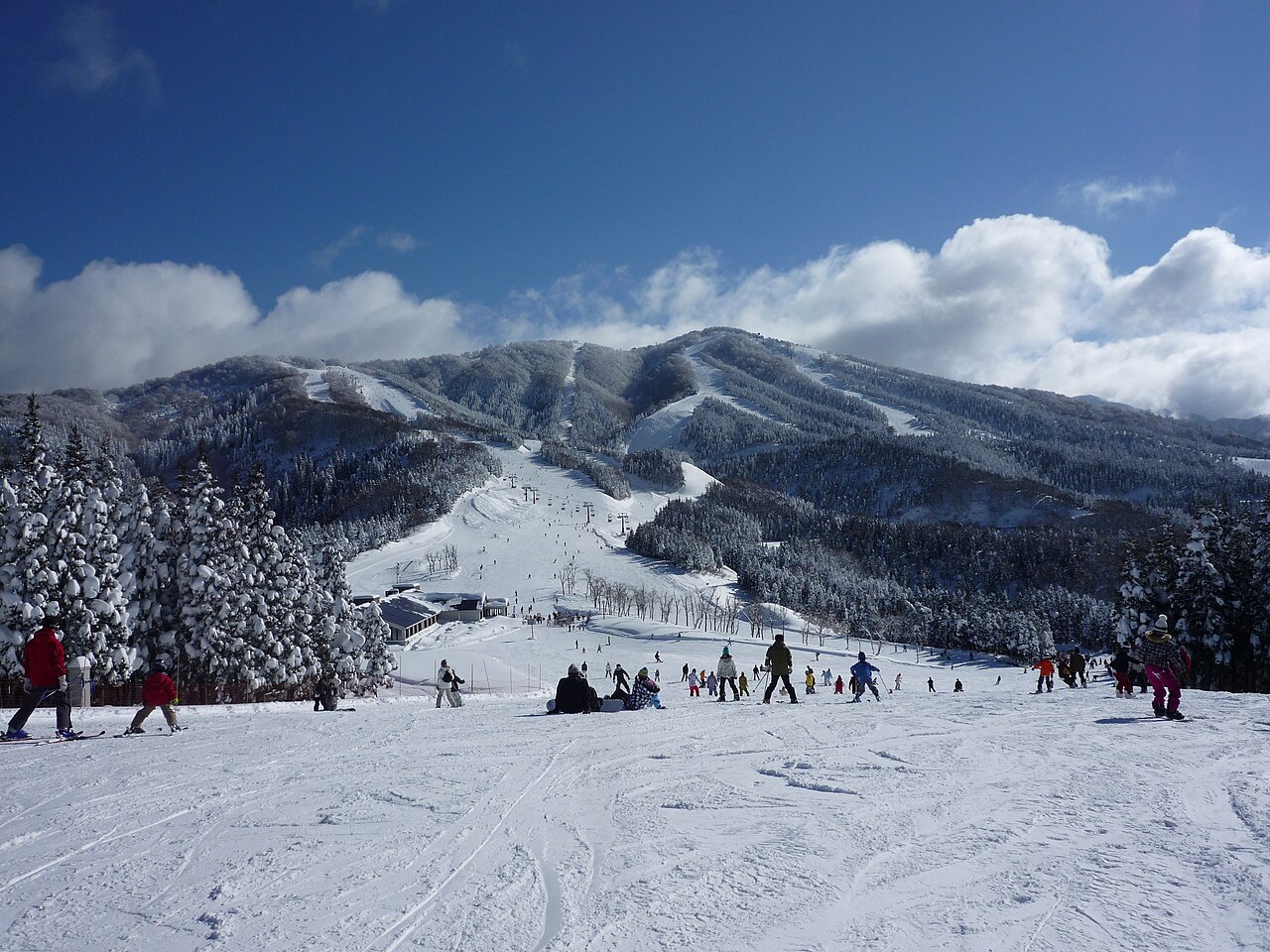
Ski Jam Katsuyama (スキージャム勝山) is a downhill ski area in Fukui Prefecture, Japan. Its mapped lift network extends from approximately 610 to 1319 metres above sea level.
Data: OpenSkiData / OpenSkiMap, OpenStreetMap contributors (ODbL), Skimap.org, Who's On First, Mapterhorn.
Preparando gráficos de previsión…
Las horas y los valores coinciden con la previsión detallada. Toca un valor para ver detalles y desplaza los gráficos horizontalmente para los próximos días. La precipitación es el equivalente total en agua por intervalo, incluida la nieve; la nieve nueva corresponde a cada intervalo, no al espesor de nieve en el suelo.
Comparación de GFS y ECMWF. Cada modelo conserva sus propias horas y horizonte de previsión. Las cantidades de precipitación y nieve corresponden a sus propios intervalos, que pueden diferir entre modelos.
Valores de previsión y notas de los modelos
Ski Jam Katsuyama (スキージャム勝山) - Base lift station
ECMWF · Ejecución del modelo: Próxima actualización prevista:
Día Hora (UTC) Temp. (°C) Humedad (%) Viento (km/h) Viento (nudos) Viento (Bft) Dirección Precip. (mm) Nieve nueva (cm) Presión (hPa) Isoterma de 0 °C (m) Condiciones | Miércoles, 04/11 06:00 15.6 46 4 2 1B SW — — 1024 3146 Overcast 99% cloud 09:00 11.4 83 1 1 0B SE 0.81 0 1024 3151 Overcast 100% cloud 12:00 11 91 2 1 1B SE 0.74 0 1024 3141 Overcast 100% cloud 15:00 10.9 94 2 1 1B SE 2.2 0 1022 3131 Overcast 100% cloud 18:00 11 94 2 1 1B SE 0.89 0 1020 3113 Overcast 100% cloud 21:00 11.2 91 2 1 1B SE 0.21 0 1017 3105 Overcast 100% cloud Jueves, 05/11 00:00 14.7 91 2 1 1B S 0 0 1016 3098 Overcast 93% cloud 03:00 19.5 60 6 3 1B W 0 0 1012 3073 Partly cloudy 48% cloud 06:00 18.5 62 5 3 1B W 0.02 0 1009 3052 Overcast 84% cloud 09:00 14.1 86 4 2 1B SE 0.19 0 1009 3044 Overcast 88% cloud 12:00 13.5 88 6 3 2B SE 0.95 0 1007 3032 Overcast 88% cloud 15:00 13.2 96 4 2 1B SE 3.7 0 1006 3020 Overcast 83% cloud 18:00 12.6 98 6 3 2B W 9.6 0 1007 3011 Overcast 100% cloud 21:00 12.1 99 10 5 2B NW 4.6 0 1010 2887 Overcast 97% cloud Viernes, 06/11 00:00 12.4 96 9 5 2B NW 2.3 0 1013 2742 Overcast 80% cloud 03:00 14 73 16 9 3B W 1.4 0 1012 2599 Cloudy 74% cloud 06:00 12.3 79 16 9 3B W 0.97 0 1014 2463 Cloudy 75% cloud 09:00 9.1 94 12 6 2B W 1.8 0 1017 2208 Cloudy 65% cloud 12:00 7.7 97 9 5 2B W 1.2 0 1019 1944 Overcast 87% cloud 15:00 6.5 98 12 6 2B NW 2.5 0 1020 1656 Overcast 81% cloud 18:00 5.3 98 10 5 2B NW 2.0 0 1021 1392 Overcast 81% cloud 21:00 4.9 97 8 4 2B NW 1.8 0 1023 1345 Overcast 100% cloud Sábado, 07/11 00:00 5.5 95 11 6 2B NW 2.7 0 1026 1345 Overcast 91% cloud 03:00 6.1 86 16 8 3B NW 2.5 0 1026 1342 Cloudy 78% cloud 06:00 6 76 17 9 3B NW 1.5 0 1027 1291 Cloudy 60% cloud 09:00 4.4 81 10 5 2B N 0.24 0 1029 1187 Partly cloudy 45% cloud 12:00 4.7 77 11 6 2B N 0.05 0 1031 1170 Overcast 94% cloud 15:00 4.8 69 12 7 3B N 0.03 0 1032 1155 Overcast 85% cloud 18:00 4.4 76 12 6 2B N 0.04 0 1031 1146 Overcast 90% cloud 21:00 3.8 74 8 5 2B N 0.06 0 1032 1154 Cloudy 71% cloud Domingo, 08/11 00:00 6.7 56 7 4 2B N 0 0 1033 1466 Cloudy 76% cloud 03:00 9.8 47 11 6 2B N 0 0 1031 3144 Cloudy 66% cloud 06:00 8.9 54 8 4 2B N 0 0 1030 2721 Overcast 87% cloud 09:00 5.9 72 2 1 1B N 0 0 1031 2500 Overcast 94% cloud 12:00 5.5 74 1 1 1B E 0 0 1031 2471 Cloudy 77% cloud 15:00 5.4 73 1 1 0B SE 0 0 1029 2351 Overcast 96% cloud 18:00 6.1 70 1 0 0B W 0 0 1028 2297 Overcast 100% cloud 21:00 6.1 75 1 1 1B SW 0.10 0 1027 2246 Overcast 93% cloud Lunes, 09/11 00:00 9.6 59 5 3 1B W 0 0 1027 2286 Cloudy 54% cloud 03:00 12.1 57 9 5 2B W 0 0 1024 2341 Clear 19% cloud 06:00 11.1 65 11 6 2B NW 0 0 1024 2063 Overcast 81% cloud 09:00 8.3 89 4 2 1B W 0.37 0 1024 2018 Overcast 85% cloud 12:00 6.6 97 5 3 1B N 0.92 0 1025 1912 Cloudy 58% cloud 15:00 5.1 93 9 5 2B N 0.22 0 1025 1628 Cloudy 58% cloud 18:00 3.7 87 9 5 2B N 0.02 0 1026 1461 Partly cloudy 47% cloud 21:00 2.6 79 6 3 2B N 0 0 1026 1262 Partly cloudy 34% cloud Martes, 10/11 00:00 6.5 58 10 6 2B N 0 0 1027 1373 Clear 12% cloud 03:00 8.8 49 13 7 3B N 0 0 1025 1457 Partly cloudy 21% cloud 06:00 8 49 12 6 2B N 0 0 1025 1476 Clear 11% cloud |
|---|
Forecast notes
Forecast table times: UTC.
Coordinates: 36.0737926°N, 136.5567417°E · Requested elevation: 610 m. Model terrain: 570 m. Terrain and 1000/925/850/700 hPa profiles are used for height estimates.
These are altitude estimates, not a simulation of local mountain terrain. Precipitation, cloud and sea-level pressure use horizontal interpolation only.
Precipitation includes rain and snow water equivalent: preceding 3 hours through day 6, then 6 hours (see cell tooltip). Snow (cm) estimates fresh snowfall from precipitation and temperature using the GFS conversion; it is not snow depth on the ground. Freezing (m) uses additional 600/500 hPa temperatures when available and estimates the lowest resolved 0°C crossing above sea level. When all sampled levels are warm, the upper profile limit is shown (see tooltip). < marks an entirely cold sampled profile and its lower height limit. No extrapolation is used.
Preparando gráficos de previsión…
Las horas y los valores coinciden con la previsión detallada. Toca un valor para ver detalles y desplaza los gráficos horizontalmente para los próximos días. La precipitación es el equivalente total en agua por intervalo, incluida la nieve; la nieve nueva corresponde a cada intervalo, no al espesor de nieve en el suelo.
Comparación de GFS y ECMWF. Cada modelo conserva sus propias horas y horizonte de previsión. Las cantidades de precipitación y nieve corresponden a sus propios intervalos, que pueden diferir entre modelos.
Valores de previsión y notas de los modelos
Ski Jam Katsuyama (スキージャム勝山) - Top lift station
ECMWF · Ejecución del modelo: Próxima actualización prevista:
Día Hora (UTC) Temp. (°C) Humedad (%) Viento (km/h) Viento (nudos) Viento (Bft) Dirección Precip. (mm) Nieve nueva (cm) Presión (hPa) Isoterma de 0 °C (m) Condiciones | Miércoles, 04/11 06:00 10.1 53 17 9 3B S — — 1024 3146 Overcast 98% cloud 09:00 9.4 87 20 11 4B S 0.73 0 1024 3152 Overcast 100% cloud 12:00 8.8 92 30 16 5B SE 0.67 0 1024 3141 Overcast 100% cloud 15:00 10.2 90 31 17 5B S 2.2 0 1022 3132 Overcast 100% cloud 18:00 10.2 89 20 11 4B S 0.80 0 1020 3118 Overcast 100% cloud 21:00 10.5 73 14 8 3B SW 0.22 0 1017 3105 Overcast 100% cloud Jueves, 05/11 00:00 11.4 68 12 6 2B SW 0 0 1016 3099 Overcast 95% cloud 03:00 13 58 11 6 2B SW 0 0 1012 3073 Cloudy 51% cloud 06:00 13.2 66 12 7 3B S 0.04 0 1009 3052 Overcast 84% cloud 09:00 11.9 73 21 11 4B S 0.15 0 1009 3044 Overcast 89% cloud 12:00 11.4 75 35 19 5B S 1.1 0 1008 3033 Overcast 89% cloud 15:00 10.9 95 39 21 6B SW 4.6 0 1006 3020 Overcast 86% cloud 18:00 9.9 100 36 20 5B W 9.1 0 1007 3011 Overcast 100% cloud 21:00 8.3 97 38 20 5B NW 4.5 0 1010 2923 Overcast 96% cloud Viernes, 06/11 00:00 7.5 93 33 18 5B NW 2.0 0 1013 2770 Cloudy 76% cloud 03:00 7.2 89 34 18 5B W 1.3 0 1012 2652 Cloudy 70% cloud 06:00 6.5 92 37 20 5B W 1.0 0 1014 2501 Cloudy 78% cloud 09:00 4.7 94 39 21 6B W 1.8 0 1017 2233 Cloudy 72% cloud 12:00 3.3 98 35 19 5B NW 1.2 0 1019 1959 Overcast 89% cloud 15:00 2 96 32 17 5B NW 2.2 0 1020 1668 Overcast 80% cloud 18:00 0.5 93 38 20 5B NW 1.9 0.6 1021 1395 Overcast 81% cloud 21:00 0.1 98 37 20 5B NW 1.6 0.5 1023 1342 Overcast 100% cloud Sábado, 07/11 00:00 0.2 96 38 21 5B NW 2.4 0.7 1026 1348 Overcast 91% cloud 03:00 0.3 89 40 22 6B NW 2.2 0.6 1026 1353 Cloudy 78% cloud 06:00 -0.2 89 36 20 5B NW 1.4 0.4 1027 1294 Cloudy 63% cloud 09:00 -1 89 34 18 5B NW 0.26 0.1 1029 1184 Cloudy 53% cloud 12:00 -1.3 91 32 17 5B NW 0.06 0 1031 1165 Overcast 93% cloud 15:00 -1.5 86 32 17 5B N 0.05 0 1032 1149 Overcast 86% cloud 18:00 -1.4 84 37 20 5B N 0.04 0 1031 1145 Overcast 90% cloud 21:00 -1.2 73 33 18 5B N 0.05 0 1032 1153 Cloudy 71% cloud Domingo, 08/11 00:00 1.3 54 26 14 4B N 0 0 1033 1494 Cloudy 69% cloud 03:00 3.2 53 17 9 3B N 0 0 1031 3144 Cloudy 60% cloud 06:00 4.3 50 9 5 2B NE 0 0 1030 2719 Overcast 88% cloud 09:00 4.1 47 2 1 1B E 0 0 1031 2490 Overcast 94% cloud 12:00 4.4 48 11 6 2B S 0 0 1031 2473 Cloudy 79% cloud 15:00 4.1 57 13 7 3B S 0 0 1029 2355 Overcast 96% cloud 18:00 5 46 11 6 2B SW 0 0 1028 2290 Overcast 100% cloud 21:00 4.9 68 14 7 3B W 0.12 0 1027 2257 Overcast 95% cloud Lunes, 09/11 00:00 5.4 66 10 5 2B NW 0 0 1027 2292 Partly cloudy 49% cloud 03:00 5.8 66 15 8 3B NW 0 0 1024 2361 Clear 19% cloud 06:00 4.5 82 21 11 4B NW 0 0 1024 2102 Overcast 81% cloud 09:00 4 94 25 13 4B NW 0.31 0 1024 2017 Overcast 87% cloud 12:00 3.2 90 25 14 4B N 0.76 0 1025 1923 Cloudy 58% cloud 15:00 1.5 80 29 16 5B N 0.21 0 1025 1626 Cloudy 62% cloud 18:00 0.6 67 34 18 5B N 0.02 0 1026 1459 Cloudy 54% cloud 21:00 -0.3 64 38 21 5B N 0 0 1026 1255 Partly cloudy 40% cloud Martes, 10/11 00:00 0.6 61 33 18 5B N 0 0 1027 1386 Clear 14% cloud 03:00 1.7 55 22 12 4B N 0 0 1025 1479 Clear 20% cloud 06:00 1.7 47 19 10 3B N 0 0 1025 1501 Clear 9% cloud |
|---|
Forecast notes
Forecast table times: UTC.
Coordinates: 36.0644346°N, 136.5980249°E · Requested elevation: 1319 m. Model terrain: 675 m. Terrain and 1000/925/850/700 hPa profiles are used for height estimates.
These are altitude estimates, not a simulation of local mountain terrain. Precipitation, cloud and sea-level pressure use horizontal interpolation only.
Precipitation includes rain and snow water equivalent: preceding 3 hours through day 6, then 6 hours (see cell tooltip). Snow (cm) estimates fresh snowfall from precipitation and temperature using the GFS conversion; it is not snow depth on the ground. Freezing (m) uses additional 600/500 hPa temperatures when available and estimates the lowest resolved 0°C crossing above sea level. When all sampled levels are warm, the upper profile limit is shown (see tooltip). < marks an entirely cold sampled profile and its lower height limit. No extrapolation is used.