Prévisions pour les stations de ski du monde entier

Plus
Guide des couleurs Température · Vent · Pluie · Neige
Chaque couleur commence à la valeur indiquée. Les couleurs du vent correspondent dans les trois unités. Les cases sans précipitations restent neutres. Les couleurs décrivent les valeurs affichées et ne sont pas des alertes officielles.
Sauris - Base lift station
ECMWF · Cycle du modèle : Prochaine mise à jour attendue :
Jour Heure (UTC) Temp. (°C) Humidité (%) Vent (km/h) Vent (nœuds) Vent (Bft) Direction Précip. (mm) Neige fraîche (cm) Pression (hPa) Isotherme 0 °C (m) Conditions | Mercredi, 04/11 06:00 2.1 91 4 2 1B N — — 1026 1688 Overcast 92% cloud  09:00 5.1 71 3 2 1B NE 0.02 0 1026 1839 Overcast 96% cloud 12:00 6.9 63 4 2 1B E 0 0 1026 2036 Overcast 89% cloud 15:00 6.2 68 4 2 1B E 0.01 0 1025 2116 Overcast 81% cloud 18:00 2.4 85 1 1 0B N 0 0 1027 2037 Partly cloudy 21% cloud  21:00 0.1 91 3 2 1B N 0 0 1029 1430 Partly cloudy 47% cloud Jeudi, 05/11 00:00 -0.5 92 4 2 1B N 0 0 1030 1487 Cloudy 65% cloud  03:00 -0.6 94 5 3 1B NW 0 0 1030 1530 Cloudy 77% cloud 06:00 -1.1 95 5 3 1B NW 0 0 1030 1510 Overcast 91% cloud 09:00 5.8 66 1 0 0B NE 0 0 1029 2378 Clear 4% cloud  12:00 8.9 56 6 3 2B SE 0 0 1027 2730 Clear 1% cloud 15:00 6.7 69 4 2 1B SE 0 0 1026 2897 Clear 0% cloud 18:00 1.9 86 1 0 0B N 0 0 1027 2970 Clear 0% cloud 21:00 -0.1 89 2 1 1B NW 0 0 1027 1378 Clear 3% cloud Vendredi, 06/11 00:00 -0.8 87 2 1 1B NW 0 0 1025 1397 Clear 4% cloud 03:00 -0.7 82 3 1 1B NW 0 0 1024 1387 Clear 4% cloud 06:00 -0 75 1 0 0B NW 0 0 1023 1365 Clear 1% cloud 09:00 8.1 58 2 1 1B SE 0 0 1023 3024 Clear 0% cloud 12:00 10.1 53 6 3 2B SE 0 0 1021 2951 Clear 0% cloud 15:00 6.7 70 4 2 1B SE 0 0 1022 2813 Clear 9% cloud 18:00 1.9 83 2 1 1B N 0 0 1022 2660 Cloudy 55% cloud 21:00 0.7 84 2 1 1B N 0 0 1023 1338 Cloudy 74% cloud Samedi, 07/11 00:00 1.4 84 3 2 1B N 0 0 1023 2323 Overcast 100% cloud 03:00 0.7 85 4 2 1B N 0 0 1022 1337 Cloudy 78% cloud 06:00 0.9 85 3 2 1B N 0 0 1023 2015 Overcast 85% cloud 09:00 5.9 52 3 2 1B E 0 0 1025 2029 Overcast 92% cloud 12:00 6.1 51 5 3 1B E 0.02 0 1024 2059 Overcast 98% cloud 15:00 3.9 63 2 1 1B E 0.19 0 1025 1871 Overcast 100% cloud 18:00 1.7 71 3 1 1B N 0.12 0 1025 1865 Overcast 96% cloud 21:00 1.9 65 3 2 1B N 0 0 1026 1845 Overcast 100% cloud Dimanche, 08/11 00:00 1.5 65 3 1 1B N 0 0 1025 1837 Partly cloudy 47% cloud 03:00 1.2 68 2 1 1B NW 0.13 0 1025 1790 Cloudy 76% cloud 06:00 1.3 75 2 1 1B NW 0.28 0 1025 1698 Overcast 82% cloud 09:00 5.3 55 3 1 1B S 0 0 1025 1842 Cloudy 63% cloud 12:00 7 52 5 3 1B S 0 0 1024 2023 Cloudy 77% cloud 15:00 5.1 62 4 2 1B SE 0 0 1024 1998 Partly cloudy 35% cloud 18:00 1.1 78 0 0 0B NW 0 0 1026 1909 Clear 5% cloud 21:00 -0.3 82 1 1 1B NW 0 0 1026 1428 Clear 3% cloud Lundi, 09/11 00:00 -0.5 83 2 1 1B NW 0 0 1026 1434 Clear 5% cloud 03:00 -0.5 83 2 1 1B NW 0 0 1025 1442 Overcast 81% cloud 06:00 -0.7 85 2 1 1B NW 0 0 1025 1470 Cloudy 75% cloud 09:00 4.5 71 3 2 1B S 0 0 1025 2147 Partly cloudy 48% cloud 12:00 6.1 64 6 3 2B S 0 0 1023 2591 Overcast 84% cloud 15:00 4 83 5 3 1B S 0 0 1023 2553 Overcast 96% cloud 18:00 2.5 93 2 1 1B SW 0 0 1024 2321 Overcast 98% cloud 21:00 1.7 93 3 1 1B NW 0 0 1024 2193 Overcast 99% cloud Mardi, 10/11 00:00 2.4 91 3 2 1B NW 0.00 0 1022 2460 Overcast 100% cloud 03:00 3 88 3 2 1B NW 0.02 0 1019 2743 Overcast 100% cloud 06:00 2.6 88 2 1 1B NW 0 0 1018 2710 Overcast 100% cloud |
|---|
Forecast notes
Forecast table times: UTC.
Coordinates: 46.4664126°N, 12.7090051°E · Requested elevation: 1201 m. Model terrain: 1333 m. Terrain and 1000/925/850/700 hPa profiles are used for height estimates.
Outside the available profile, temperature uses an estimated 5.5°C/km height correction; wind retains the nearest available model-level value. Humidity is estimated with adjusted pressure and temperature.
These are altitude estimates, not a simulation of local mountain terrain. Precipitation, cloud and sea-level pressure use horizontal interpolation only.
Precipitation includes rain and snow water equivalent: preceding 3 hours through day 6, then 6 hours (see cell tooltip). Snow (cm) estimates fresh snowfall from precipitation and temperature using the GFS conversion; it is not snow depth on the ground. Freezing (m) uses additional 600/500 hPa temperatures when available and estimates the lowest resolved 0°C crossing above sea level. When all sampled levels are warm, the upper profile limit is shown (see tooltip). < marks an entirely cold sampled profile and its lower height limit. No extrapolation is used.
Source: ECMWF · CC BY 4.0 · Processed by Snow Report.
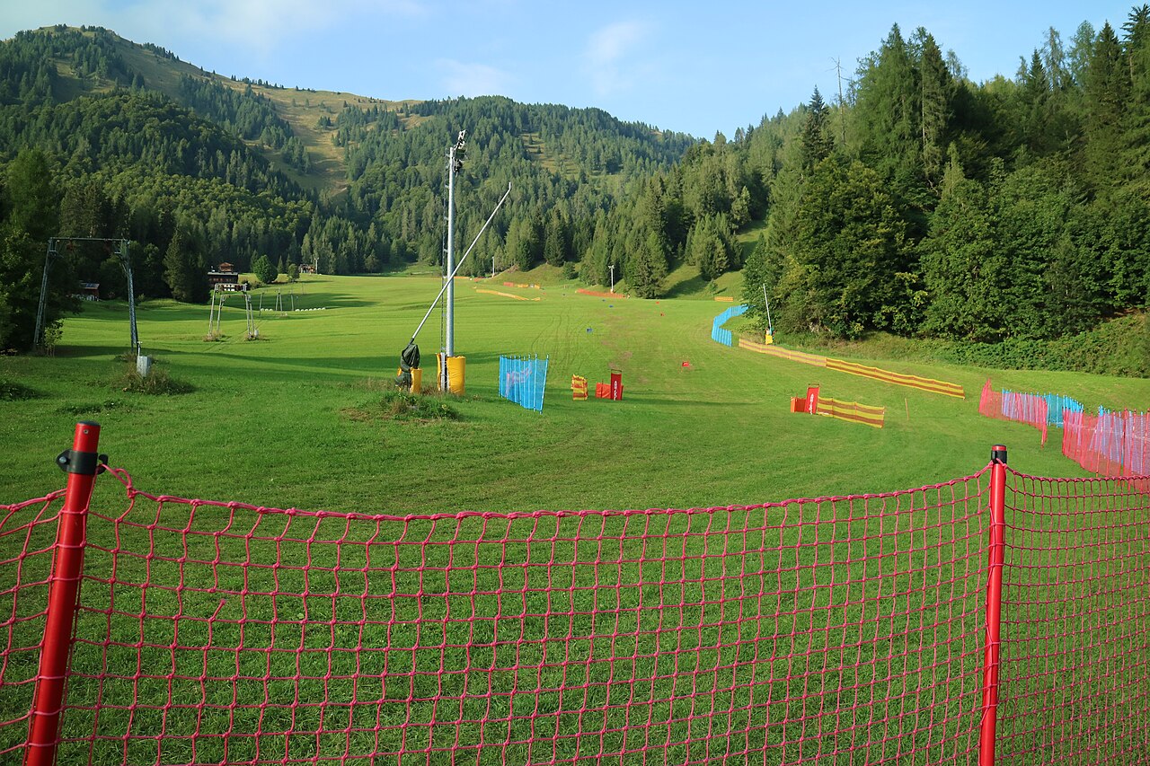
Sauris is a mapped downhill ski area in IT. Forecasts cover three real lift-station locations from approximately 1201 to 1408 metres. Elevations are terrain-model estimates.
Data: OpenSkiData / OpenSkiMap, OpenStreetMap contributors (ODbL), Skimap.org, Who's On First, Mapterhorn.
Sauris - Middle lift station
ECMWF · Cycle du modèle : Prochaine mise à jour attendue :
Jour Heure (UTC) Temp. (°C) Humidité (%) Vent (km/h) Vent (nœuds) Vent (Bft) Direction Précip. (mm) Neige fraîche (cm) Pression (hPa) Isotherme 0 °C (m) Conditions | Mercredi, 04/11 06:00 1.5 94 4 2 1B N — — 1026 1684 Overcast 92% cloud 09:00 4.4 74 3 2 1B NE 0.02 0 1026 1837 Overcast 97% cloud 12:00 6.2 65 4 2 1B E 0 0 1026 2036 Overcast 90% cloud 15:00 5.5 70 4 2 1B E 0.01 0 1025 2116 Overcast 82% cloud 18:00 1.8 88 1 1 0B N 0 0 1027 2036 Partly cloudy 20% cloud 21:00 -0.7 94 3 2 1B N 0 0 1029 1445 Partly cloudy 47% cloud Jeudi, 05/11 00:00 -1.1 95 4 2 1B N 0 0 1030 1495 Cloudy 66% cloud 03:00 -1.2 97 5 3 1B NW 0 0 1030 1537 Cloudy 78% cloud 06:00 -1.7 98 5 3 1B NW 0 0 1030 1515 Overcast 92% cloud 09:00 5.2 68 1 0 0B NE 0 0 1029 2375 Clear 4% cloud 12:00 8.3 58 6 3 2B SE 0 0 1027 2731 Clear 1% cloud 15:00 6 71 4 2 1B SE 0 0 1026 2898 Clear 0% cloud 18:00 1.2 89 1 0 0B N 0 0 1027 2970 Clear 0% cloud 21:00 -0.7 92 2 1 1B NW 0 0 1027 1389 Clear 2% cloud Vendredi, 06/11 00:00 -1.5 90 2 1 1B NW 0 0 1025 1405 Clear 3% cloud 03:00 -1.3 84 3 1 1B NW 0 0 1024 1395 Clear 3% cloud 06:00 -0.6 77 1 0 0B NW 0 0 1023 1374 Clear 1% cloud 09:00 7.5 60 2 1 1B SE 0 0 1023 3025 Clear 0% cloud 12:00 9.4 55 6 3 2B SE 0 0 1021 2952 Clear 0% cloud 15:00 6.1 72 4 2 1B SE 0 0 1022 2814 Clear 9% cloud 18:00 1.3 86 2 1 1B N 0 0 1022 2660 Cloudy 54% cloud 21:00 0 86 2 1 1B N 0 0 1023 1351 Cloudy 73% cloud Samedi, 07/11 00:00 0.8 87 3 2 1B N 0 0 1023 2322 Overcast 100% cloud 03:00 -0 88 4 2 1B N 0 0 1022 1353 Cloudy 78% cloud 06:00 0.2 88 3 2 1B N 0 0 1023 2014 Overcast 86% cloud 09:00 5.3 54 3 2 1B E 0 0 1025 2029 Overcast 92% cloud 12:00 5.4 53 5 3 1B E 0.02 0 1024 2059 Overcast 98% cloud 15:00 3.2 65 2 1 1B E 0.20 0 1025 1869 Overcast 100% cloud 18:00 1 73 3 1 1B N 0.12 0 1025 1863 Overcast 96% cloud 21:00 1.2 67 3 2 1B N 0 0 1026 1843 Overcast 100% cloud Dimanche, 08/11 00:00 0.9 67 3 1 1B N 0 0 1025 1836 Partly cloudy 46% cloud 03:00 0.5 70 2 1 1B NW 0.12 0 1025 1790 Cloudy 77% cloud 06:00 0.6 77 2 1 1B NW 0.27 0.1 1025 1696 Overcast 83% cloud 09:00 4.6 57 3 1 1B S 0 0 1025 1843 Cloudy 64% cloud 12:00 6.3 54 5 3 1B S 0 0 1024 2024 Cloudy 78% cloud 15:00 4.5 64 4 2 1B SE 0 0 1024 1999 Partly cloudy 35% cloud 18:00 0.4 81 0 0 0B NW 0 0 1026 1908 Clear 4% cloud 21:00 -1 85 1 1 1B NW 0 0 1026 1437 Clear 3% cloud Lundi, 09/11 00:00 -1.1 85 2 1 1B NW 0 0 1026 1442 Clear 5% cloud 03:00 -1.2 86 2 1 1B NW 0 0 1025 1448 Overcast 80% cloud 06:00 -1.3 87 2 1 1B NW 0 0 1025 1475 Cloudy 75% cloud 09:00 3.8 73 3 2 1B S 0 0 1025 2148 Partly cloudy 48% cloud 12:00 5.5 66 6 3 2B S 0 0 1023 2593 Overcast 85% cloud 15:00 3.4 86 5 3 1B S 0 0 1023 2555 Overcast 96% cloud 18:00 1.9 96 2 1 1B SW 0 0 1024 2317 Overcast 98% cloud 21:00 1 96 3 1 1B NW 0 0 1024 2190 Overcast 99% cloud Mardi, 10/11 00:00 1.7 94 3 2 1B W 0.00 0 1022 2460 Overcast 100% cloud 03:00 2.3 91 3 2 1B NW 0.01 0 1019 2744 Overcast 100% cloud 06:00 1.9 91 2 1 1B NW 0 0 1018 2707 Overcast 100% cloud |
|---|
Forecast notes
Forecast table times: UTC.
Coordinates: 46.4717344°N, 12.7119146°E · Requested elevation: 1320 m. Model terrain: 1344 m. Terrain and 1000/925/850/700 hPa profiles are used for height estimates.
Outside the available profile, temperature uses an estimated 5.5°C/km height correction; wind retains the nearest available model-level value. Humidity is estimated with adjusted pressure and temperature.
These are altitude estimates, not a simulation of local mountain terrain. Precipitation, cloud and sea-level pressure use horizontal interpolation only.
Precipitation includes rain and snow water equivalent: preceding 3 hours through day 6, then 6 hours (see cell tooltip). Snow (cm) estimates fresh snowfall from precipitation and temperature using the GFS conversion; it is not snow depth on the ground. Freezing (m) uses additional 600/500 hPa temperatures when available and estimates the lowest resolved 0°C crossing above sea level. When all sampled levels are warm, the upper profile limit is shown (see tooltip). < marks an entirely cold sampled profile and its lower height limit. No extrapolation is used.
Source: ECMWF · CC BY 4.0 · Processed by Snow Report.
Sauris - Top lift station
ECMWF · Cycle du modèle : Prochaine mise à jour attendue :
Jour Heure (UTC) Temp. (°C) Humidité (%) Vent (km/h) Vent (nœuds) Vent (Bft) Direction Précip. (mm) Neige fraîche (cm) Pression (hPa) Isotherme 0 °C (m) Conditions | Mercredi, 04/11 06:00 1.1 93 5 3 1B N — — 1026 1686 Overcast 93% cloud 09:00 3.5 77 4 2 1B NE 0.02 0 1026 1844 Overcast 97% cloud 12:00 5.2 68 4 2 1B E 0 0 1026 2044 Overcast 91% cloud 15:00 4.8 72 4 2 1B E 0.02 0 1025 2125 Overcast 82% cloud 18:00 1.8 87 2 1 1B NE 0 0 1027 2048 Partly cloudy 25% cloud 21:00 -0.2 93 4 2 1B N 0 0 1029 1439 Partly cloudy 47% cloud Jeudi, 05/11 00:00 -0.8 93 4 2 1B N 0 0 1030 1496 Cloudy 67% cloud 03:00 -1.1 94 5 3 1B N 0 0 1030 1533 Cloudy 80% cloud 06:00 -1.3 94 4 2 1B N 0 0 1030 1516 Overcast 91% cloud 09:00 4.3 71 1 1 0B N 0 0 1029 2394 Clear 4% cloud 12:00 7.4 59 5 3 1B SE 0 0 1026 2739 Clear 1% cloud 15:00 5.7 71 3 2 1B SE 0 0 1026 2900 Clear 0% cloud 18:00 1.8 87 1 0 0B N 0 0 1027 2972 Clear 0% cloud 21:00 0.4 88 2 1 1B NW 0 0 1027 1393 Clear 4% cloud Vendredi, 06/11 00:00 -0 85 2 1 1B NW 0 0 1025 1412 Clear 5% cloud 03:00 0.2 80 3 1 1B NW 0 0 1024 1403 Clear 4% cloud 06:00 0.7 74 1 0 0B NW 0 0 1023 1386 Clear 1% cloud 09:00 6.7 60 1 1 1B E 0 0 1023 3021 Clear 0% cloud 12:00 8.6 55 5 3 1B SE 0 0 1021 2952 Clear 0% cloud 15:00 6 69 4 2 1B SE 0 0 1022 2817 Clear 10% cloud 18:00 2.2 80 2 1 1B NE 0 0 1022 2654 Cloudy 55% cloud 21:00 1.2 80 2 1 1B N 0 0 1023 1359 Cloudy 76% cloud Samedi, 07/11 00:00 1.5 80 4 2 1B N 0 0 1023 2322 Overcast 100% cloud 03:00 1 79 4 2 1B NE 0 0 1022 1359 Cloudy 78% cloud 06:00 0.8 80 3 2 1B N 0 0 1023 2016 Overcast 83% cloud 09:00 4.4 55 4 2 1B NE 0 0 1025 2036 Overcast 92% cloud 12:00 4.7 53 6 3 1B E 0.04 0 1024 2066 Overcast 98% cloud 15:00 2.7 63 3 2 1B E 0.16 0 1025 1888 Overcast 100% cloud 18:00 1.2 67 3 2 1B N 0.12 0 1025 1869 Overcast 96% cloud 21:00 1.3 61 3 2 1B N 0 0 1026 1849 Overcast 100% cloud Dimanche, 08/11 00:00 1 62 3 2 1B N 0 0 1025 1840 Cloudy 50% cloud 03:00 0.6 65 2 1 1B NW 0.22 0 1025 1784 Cloudy 78% cloud 06:00 0.5 75 2 1 1B NW 0.40 0.1 1025 1690 Overcast 84% cloud 09:00 3.7 59 2 1 1B S 0 0 1026 1842 Cloudy 62% cloud 12:00 5.3 56 5 2 1B S 0 0 1024 2024 Cloudy 79% cloud 15:00 4 65 4 2 1B S 0 0 1024 2004 Partly cloudy 39% cloud 18:00 0.8 79 1 1 0B SW 0 0 1026 1917 Clear 5% cloud 21:00 -0.3 84 2 1 1B W 0 0 1026 1436 Clear 3% cloud Lundi, 09/11 00:00 -0.5 85 2 1 1B W 0 0 1026 1445 Clear 6% cloud 03:00 -0.6 86 2 1 1B W 0 0 1025 1453 Overcast 81% cloud 06:00 -0.8 88 3 1 1B W 0 0 1025 1476 Cloudy 76% cloud 09:00 2.9 77 4 2 1B SW 0 0 1025 2176 Partly cloudy 48% cloud 12:00 4.7 68 6 3 2B S 0 0 1023 2610 Cloudy 80% cloud 15:00 2.9 86 5 3 1B S 0 0 1023 2584 Overcast 94% cloud 18:00 1.6 96 3 2 1B SW 0 0 1024 2351 Overcast 97% cloud 21:00 1 95 4 2 1B W 0 0 1024 2217 Overcast 99% cloud Mardi, 10/11 00:00 1.8 93 4 2 1B W 0.00 0 1022 2467 Overcast 100% cloud 03:00 2.4 90 4 2 1B W 0.02 0 1019 2755 Overcast 100% cloud 06:00 1.7 91 3 2 1B W 0 0 1018 2713 Overcast 100% cloud |
|---|
Forecast notes
Forecast table times: UTC.
Coordinates: 46.4675946°N, 12.6803792°E · Requested elevation: 1408 m. Model terrain: 1352 m. Terrain and 1000/925/850/700 hPa profiles are used for height estimates.
These are altitude estimates, not a simulation of local mountain terrain. Precipitation, cloud and sea-level pressure use horizontal interpolation only.
Precipitation includes rain and snow water equivalent: preceding 3 hours through day 6, then 6 hours (see cell tooltip). Snow (cm) estimates fresh snowfall from precipitation and temperature using the GFS conversion; it is not snow depth on the ground. Freezing (m) uses additional 600/500 hPa temperatures when available and estimates the lowest resolved 0°C crossing above sea level. When all sampled levels are warm, the upper profile limit is shown (see tooltip). < marks an entirely cold sampled profile and its lower height limit. No extrapolation is used.