Wettervorhersagen für Skigebiete weltweit

Farbskala Temperatur · Wind · Regen · Schnee
Jede Farbe beginnt beim angegebenen Wert. Die Windfarben stimmen in allen drei Einheiten überein. Trockene Zellen bleiben neutral. Die Farben beschreiben die Werte und sind keine amtlichen Wetterwarnungen.
Saas Fee - base
ECMWF · Modelllauf: Nächste Aktualisierung erwartet:
Tag Uhrzeit (UTC) Temp. (°C) Luftfeuchtigkeit (%) Wind (km/h) Wind (Knoten) Wind (Bft) Richtung Niederschlag (mm) Neuschnee (cm) Luftdruck (hPa) Nullgradgrenze (m) Wetterlage | Mittwoch, 04/11 06:00 -1.8 81 2 1 1B SE — — 1024 < 2281 Overcast 95% cloud  09:00 0 79 4 2 1B SE 0.26 0.1 1025 < 2281 Overcast 96% cloud 12:00 1 72 5 3 1B SE 0.26 0.1 1025 < 2281 Overcast 100% cloud 15:00 0.1 78 5 3 1B SE 0.83 0.3 1025 < 2281 Overcast 94% cloud 18:00 -0.7 83 4 2 1B SE 0.42 0.1 1027 < 2281 Overcast 93% cloud 21:00 -1 83 4 2 1B SE 0.21 0 1028 < 2281 Overcast 94% cloud Donnerstag, 05/11 00:00 -0.6 82 4 2 1B SE 0.29 0.1 1029 < 2281 Overcast 92% cloud 03:00 -0.6 82 4 2 1B SE 0.21 0 1028 < 2281 Overcast 87% cloud 06:00 -0.5 82 3 2 1B SE 0.05 0 1028 < 2281 Overcast 88% cloud 09:00 1.8 77 3 2 1B SE 0.06 0 1028 < 2281 Overcast 89% cloud 12:00 3.5 74 4 2 1B SE 0 0 1026 2429 Overcast 87% cloud 15:00 3.2 76 2 1 1B SE 0 0 1025 2400 Cloudy 71% cloud  18:00 0.6 81 1 0 0B SE 0.06 0 1026 < 2281 Overcast 88% cloud 21:00 0 80 1 0 0B S 0.24 0 1026 < 2281 Overcast 95% cloud Freitag, 06/11 00:00 1.1 80 2 1 1B SE 0.49 0.1 1025 < 2281 Overcast 100% cloud 03:00 1.3 83 2 1 1B SE 2.0 0 1023 < 2281 Overcast 99% cloud 06:00 1.6 84 3 2 1B SE 0.63 0 1022 < 2281 Overcast 97% cloud 09:00 2.5 83 3 1 1B SE 0.20 0 1023 < 2281 Overcast 94% cloud 12:00 2.7 81 3 1 1B E 0.25 0 1022 2285 Overcast 99% cloud 15:00 2.1 83 3 2 1B E 0.92 0 1021 < 2281 Overcast 100% cloud 18:00 1 85 1 1 1B E 2.0 0.6 1021 < 2281 Overcast 100% cloud 21:00 0.9 85 2 1 1B E 0.47 0.1 1022 < 2281 Overcast 100% cloud Samstag, 07/11 00:00 0.5 85 1 0 0B NE 0.46 0.1 1022 < 2281 Overcast 100% cloud 03:00 0.2 85 1 1 1B NW 0.26 0.1 1022 < 2281 Overcast 99% cloud 06:00 0.2 83 1 0 0B NW 0.44 0.1 1022 < 2281 Overcast 100% cloud 09:00 0.7 83 1 1 1B E 0.35 0.1 1023 < 2281 Overcast 97% cloud 12:00 1.1 80 3 2 1B SE 0.19 0 1023 < 2281 Overcast 98% cloud 15:00 0.3 83 3 2 1B SE 1.0 0.3 1023 < 2281 Overcast 97% cloud 18:00 -0.4 83 2 1 1B SE 0.82 0.2 1024 < 2281 Overcast 95% cloud 21:00 -0.8 83 1 0 0B SE 0.13 0 1025 < 2281 Overcast 88% cloud Sonntag, 08/11 00:00 -1.8 84 0 0 0B — 0.05 0 1025 < 2281 Overcast 91% cloud 03:00 -3.5 81 1 0 0B W 0.14 0.1 1024 < 2281 Overcast 91% cloud 06:00 -5.3 78 0 0 0B SW 0.05 0.1 1025 < 2281 Overcast 83% cloud 09:00 -1.4 71 1 0 0B SE 0.04 0 1026 < 2281 Cloudy 65% cloud 12:00 0.9 65 1 0 0B SE 0.09 0 1025 < 2281 Partly cloudy 36% cloud  15:00 0.3 66 0 0 0B — 0 0 1024 < 2281 Partly cloudy 24% cloud 18:00 -2 61 0 0 0B SW 0 0 1024 < 2281 Partly cloudy 20% cloud 21:00 -2.2 54 1 0 0B S 0 0 1024 < 2281 Cloudy 74% cloud Montag, 09/11 00:00 -1.7 58 1 0 0B SE 0 0 1024 < 2281 Overcast 94% cloud 03:00 -2.5 63 1 0 0B S 0 0 1023 < 2281 Partly cloudy 50% cloud 06:00 -2.2 66 1 0 0B S 0 0 1023 < 2281 Overcast 85% cloud 09:00 1.4 65 2 1 1B SE 0 0 1023 < 2281 Cloudy 62% cloud 12:00 2.8 70 4 2 1B SE 0.02 0 1022 2327 Overcast 100% cloud 15:00 2.3 78 3 1 1B SE 0.09 0 1021 < 2281 Overcast 97% cloud 18:00 1.4 81 1 1 1B SE 0.02 0 1021 < 2281 Overcast 99% cloud 21:00 1 82 1 1 0B SE 0.06 0 1020 < 2281 Overcast 88% cloud Dienstag, 10/11 00:00 0.8 83 1 0 0B SE 0.05 0 1019 < 2281 Overcast 95% cloud 03:00 1.4 82 1 1 0B SE 0 0 1017 < 2281 Overcast 99% cloud 06:00 2.2 82 1 1 1B SE 0.07 0 1016 < 2281 Overcast 100% cloud |
|---|
Forecast notes
Forecast table times: UTC.
Coordinates: 46.10608915°N, 7.92800903°E · Requested elevation: 1789 m. Model terrain: 2279 m. Terrain and 1000/925/850/700 hPa profiles are used for height estimates.
Outside the available profile, temperature uses an estimated 5.5°C/km height correction; wind retains the nearest available model-level value. Humidity is estimated with adjusted pressure and temperature.
These are altitude estimates, not a simulation of local mountain terrain. Precipitation, cloud and sea-level pressure use horizontal interpolation only.
Precipitation includes rain and snow water equivalent: preceding 3 hours through day 6, then 6 hours (see cell tooltip). Snow (cm) estimates fresh snowfall from precipitation and temperature using the GFS conversion; it is not snow depth on the ground. Freezing (m) uses additional 600/500 hPa temperatures when available and estimates the lowest resolved 0°C crossing above sea level. When all sampled levels are warm, the upper profile limit is shown (see tooltip). < marks an entirely cold sampled profile and its lower height limit. No extrapolation is used.
Source: ECMWF · CC BY 4.0 · Processed by Snow Report.
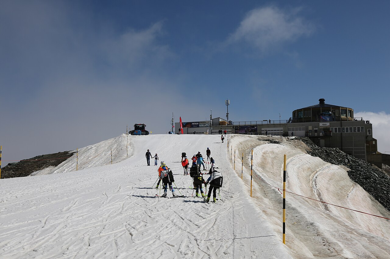
Saas-Fee combines a car-free resort centre with glacier skiing that reaches 3,600 m. It belongs to the wider Saas Valley destination, which also includes Saas-Grund and Saas-Almagell. Figures advertised for the whole valley should not automatically be attributed to Saas-Fee alone; the separate areas have their own operating information.
The selected forecast point here is at 1,789 m, far below the highest skiing. That difference is central to interpreting this page. A mild afternoon around the resort does not describe the glacier temperature, and a snowfall forecast at the top does not establish how much will settle at the lower point. Use the elevation selection to make the comparison relevant to your plans.
For early-season skiing, read the actual list of open lifts and pistes. The presence of a glacier is not a promise that the entire winter area is available. During a visit, compare the timing of cloud, wind and snow at altitude rather than judging the day from the resort-centre temperature alone. Winter walking and sightseeing also require their own route and facility checks.
Official sources: Saas-Fee/Saastal — winter · Saas-Fee glacier skiing. Reviewed 18 October 2026.