Worldwide Ski Resort Forecasts

Colour guide Temperature · Wind · Rain · Snow
Each colour starts at the value shown. Wind colours match across all three units. Dry cells stay neutral. Colours describe the displayed values, not official weather warnings.
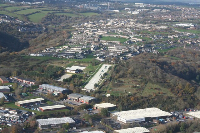
Plymouth Snowsports Centre - Outdoor dry slope
ECMWF · Model run: Next update expected:
Day Time (UTC) Temp. (°C) Humidity (%) Wind (km/h) Wind (knots) Wind (Bft) Direction Precip. (mm) Snow (cm) Pressure (hPa) Freezing (m) Conditions | Wednesday, 04/11 06:00 9.2 76 29 16 5B E — — 1027 1245 Overcast 93% cloud  09:00 8.6 68 33 18 5B E 0.05 0 1028 1207 Cloudy 76% cloud  12:00 9.5 62 35 19 5B E 0 0 1027 1210 Overcast 82% cloud 15:00 9.2 68 29 16 5B E 0.04 0 1026 1221 Overcast 84% cloud 18:00 8.9 71 25 13 4B E 0.03 0 1026 1307 Overcast 84% cloud 21:00 8.8 72 26 14 4B NE 0 0 1026 1376 Overcast 92% cloud Thursday, 05/11 00:00 8.7 76 27 14 4B NE 0.03 0 1025 1449 Overcast 99% cloud 03:00 8.4 82 24 13 4B NE 0.75 0 1024 1399 Overcast 100% cloud 06:00 8.1 88 24 13 4B NE 0.68 0 1024 1418 Overcast 100% cloud 09:00 8.7 88 25 13 4B NE 0.54 0 1024 1478 Overcast 98% cloud 12:00 9.5 86 23 12 4B E 0.62 0 1025 1492 Overcast 99% cloud 15:00 10.3 81 23 12 4B E 0.69 0 1023 1510 Overcast 82% cloud 18:00 8.8 81 18 10 3B NE 0.02 0 1024 1577 Cloudy 69% cloud 21:00 8.5 84 15 8 3B NE 0 0 1024 1623 Overcast 100% cloud Friday, 06/11 00:00 8.3 88 16 9 3B NE 0.29 0 1024 1593 Overcast 100% cloud 03:00 8.1 89 15 8 3B NE 0.78 0 1023 1627 Overcast 92% cloud 06:00 7.4 91 12 7 3B NE 1.3 0 1023 1614 Overcast 80% cloud 09:00 8.9 90 15 8 3B NE 2.1 0 1024 1635 Cloudy 52% cloud 12:00 10.9 83 12 6 2B E 0 0 1024 1643 Partly cloudy 36% cloud  15:00 11 80 9 5 2B E 0.20 0 1023 1662 Partly cloudy 43% cloud 18:00 8.8 88 7 4 2B NE 0.12 0 1024 1633 Clear 20% cloud  21:00 7.3 92 8 5 2B NE 0 0 1024 1644 Partly cloudy 38% cloud Saturday, 07/11 00:00 6.3 94 8 5 2B NE 0 0 1024 1640 Cloudy 65% cloud 03:00 5.8 94 10 5 2B NE 0 0 1023 1616 Cloudy 63% cloud 06:00 5.6 93 9 5 2B NE 0 0 1023 1583 Cloudy 61% cloud 09:00 7.1 93 9 5 2B NE 0 0 1024 1565 Cloudy 53% cloud 12:00 10.8 79 5 3 1B E 0.05 0 1023 1547 Cloudy 50% cloud 15:00 10.3 82 6 3 2B SE 0.65 0 1022 1547 Cloudy 78% cloud 18:00 8.6 91 8 4 2B E 0.63 0 1022 1546 Cloudy 55% cloud 21:00 7.6 92 6 3 2B E 0.27 0 1022 1525 Cloudy 60% cloud Sunday, 08/11 00:00 7.7 88 5 2 1B SE 0.67 0 1021 1497 Cloudy 63% cloud 03:00 7.2 92 3 2 1B E 0.33 0 1020 1482 Partly cloudy 48% cloud 06:00 6 96 5 3 1B NE 0 0 1019 1479 Cloudy 67% cloud 09:00 7.2 95 8 4 2B E 0.02 0 1019 1531 Partly cloudy 50% cloud 12:00 10.7 83 8 4 2B E 0 0 1018 1619 Clear 13% cloud 15:00 11.1 76 11 6 2B SE 0.06 0 1017 1615 Partly cloudy 46% cloud 18:00 8.3 90 10 6 2B E 0.10 0 1016 1790 Partly cloudy 48% cloud 21:00 7.8 90 13 7 3B E 0 0 1016 1938 Partly cloudy 30% cloud Monday, 09/11 00:00 8.3 88 19 10 3B E 0 0 1014 2169 Partly cloudy 32% cloud 03:00 9.1 84 19 10 3B E 0 0 1013 2182 Overcast 98% cloud 06:00 9.1 86 22 12 4B E 0 0 1012 2500 Overcast 97% cloud 09:00 9.5 85 27 15 4B E 0 0 1012 2689 Overcast 95% cloud 12:00 10.7 83 28 15 4B E 0 0 1011 2824 Overcast 99% cloud 15:00 11 83 30 16 5B E 0 0 1009 2898 Overcast 100% cloud 18:00 10.3 85 31 17 5B E 0.08 0 1008 2891 Overcast 100% cloud 21:00 9.5 85 31 17 5B E 0.08 0 1008 2912 Overcast 100% cloud Tuesday, 10/11 00:00 9.7 88 30 16 5B E 0.11 0 1006 2874 Overcast 100% cloud 03:00 9.2 90 32 17 5B E 0.57 0 1004 2846 Overcast 100% cloud 06:00 8.5 89 34 18 5B NE 0.28 0 1002 2756 Overcast 100% cloud |
|---|
Forecast notes
Forecast table times: UTC.
Coordinates: 50.3976195°N, -4.0912825°E · Requested elevation: 52 m. Model terrain: 144 m. Terrain and 1000/925/850/700 hPa profiles are used for height estimates.
Outside the available profile, temperature uses an estimated 5.5°C/km height correction; wind retains the nearest available model-level value. Humidity is estimated with adjusted pressure and temperature.
These are altitude estimates, not a simulation of local mountain terrain. Precipitation, cloud and sea-level pressure use horizontal interpolation only.
Precipitation includes rain and snow water equivalent: preceding 3 hours through day 6, then 6 hours (see cell tooltip). Snow (cm) estimates fresh snowfall from precipitation and temperature using the GFS conversion; it is not snow depth on the ground. Freezing (m) uses additional 600/500 hPa temperatures when available and estimates the lowest resolved 0°C crossing above sea level. When all sampled levels are warm, the upper profile limit is shown (see tooltip). < marks an entirely cold sampled profile and its lower height limit. No extrapolation is used.
Source: ECMWF · CC BY 4.0 · Processed by Snow Report.
Outdoor dry ski slope · Synthetic surface; weather forecast for the outdoor location.