Wettervorhersagen für Skigebiete weltweit

Farbskala Temperatur · Wind · Regen · Schnee
Jede Farbe beginnt beim angegebenen Wert. Die Windfarben stimmen in allen drei Einheiten überein. Trockene Zellen bleiben neutral. Die Farben beschreiben die Werte und sind keine amtlichen Wetterwarnungen.
Mt Baker - Low lift station
ECMWF · Modelllauf: Nächste Aktualisierung erwartet:
Tag Ortszeit Temp. (°C) Luftfeuchtigkeit (%) Wind (km/h) Wind (Knoten) Wind (Bft) Richtung Niederschlag (mm) Neuschnee (cm) Luftdruck (hPa) Nullgradgrenze (m) Wetterlage | Mittwoch, 04/11 01:00 0.7 70 1 0 0B NE 0 0 1019 2577 Clear 1% cloud  04:00 0.5 73 1 1 0B E 0 0 1018 1213 Clear 0% cloud 07:00 0.5 74 1 1 1B SE 0 0 1018 1214 Partly cloudy 47% cloud  10:00 7.6 54 3 1 1B SE 0 0 1017 2637 Overcast 89% cloud  13:00 9 53 3 2 1B SW 0 0 1015 2522 Overcast 90% cloud 16:00 5.4 71 2 1 1B S 0 0 1015 2289 Overcast 100% cloud 19:00 3.7 78 4 2 1B S 0 0 1016 2007 Overcast 98% cloud 22:00 2.3 95 4 2 1B S 2.8 0 1018 1709 Overcast 100% cloud Donnerstag, 05/11 01:00 1.8 97 2 1 1B S 4.6 0 1019 1655 Overcast 100% cloud 04:00 0.9 97 2 1 1B SW 1.4 0.4 1021 1596 Overcast 100% cloud 07:00 1.4 96 2 1 1B S 0.77 0 1022 1544 Overcast 94% cloud 10:00 2.5 96 3 2 1B SW 0.67 0 1024 1534 Overcast 96% cloud 13:00 4.1 83 5 2 1B S 0.27 0 1024 1645 Overcast 90% cloud 16:00 3.1 85 3 1 1B S 0.06 0 1024 1661 Cloudy 57% cloud  19:00 0.3 95 2 1 1B SE 0.04 0 1024 1295 Overcast 89% cloud 22:00 1.4 94 3 2 1B SE 0.07 0 1023 1699 Overcast 93% cloud Freitag, 06/11 01:00 1.5 91 4 2 1B SE 0.04 0 1022 1912 Overcast 93% cloud 04:00 2.3 85 3 2 1B SE 0 0 1021 2065 Overcast 100% cloud 07:00 1.2 95 6 3 1B SE 2.6 0 1022 1417 Overcast 100% cloud 10:00 1.8 91 5 3 1B SE 4.1 0 1021 2060 Overcast 100% cloud 13:00 3.7 85 4 2 1B S 2.6 0 1019 2671 Overcast 100% cloud 16:00 3.4 90 3 2 1B SE 9.7 0 1018 2710 Overcast 100% cloud 19:00 3.8 92 4 2 1B S 3.9 0 1019 2661 Overcast 100% cloud 22:00 3.8 94 2 1 1B S 0.36 0 1021 2549 Overcast 100% cloud Samstag, 07/11 01:00 4.1 94 2 1 1B S 0.25 0 1020 2451 Overcast 100% cloud 04:00 3.9 96 2 1 1B SE 0.09 0 1021 2370 Overcast 96% cloud 07:00 2.6 95 3 2 1B E 0 0 1019 2637 Overcast 99% cloud 10:00 5.5 86 4 2 1B E 0 0 1016 2856 Overcast 99% cloud 13:00 8.8 72 4 2 1B SE 0 0 1014 3051 Overcast 93% cloud 16:00 6.6 82 4 2 1B SE 0 0 1010 3003 Overcast 90% cloud 19:00 4.9 84 6 3 1B SE 0 0 1008 2727 Overcast 95% cloud 22:00 6.6 73 9 5 2B S 0 0 1006 2591 Overcast 97% cloud Sonntag, 08/11 01:00 4.5 94 9 5 2B S 10.3 0 1010 2005 Overcast 100% cloud 04:00 3.1 96 9 5 2B S 6.4 0 1010 1883 Overcast 97% cloud 07:00 2.3 94 8 5 2B S 5.0 0 1014 1655 Overcast 100% cloud 10:00 2.7 95 7 4 2B S 6.1 0 1019 1574 Overcast 100% cloud 13:00 2.8 94 6 3 1B S 5.5 0 1022 1543 Overcast 98% cloud 16:00 2.1 96 4 2 1B S 1.5 0 1023 1496 Overcast 87% cloud 19:00 0.6 96 2 1 1B S 0 0 1024 1229 Overcast 85% cloud 22:00 0.3 94 2 1 1B E 0 0 1025 < 1209 Overcast 91% cloud Montag, 09/11 01:00 -0.7 93 3 1 1B E 0 0 1025 < 1209 Overcast 92% cloud 04:00 -2 93 3 2 1B NE 0 0 1023 1482 Overcast 97% cloud 07:00 -3.5 93 3 2 1B E 0 0 1021 1412 Overcast 100% cloud 10:00 3.1 75 2 1 1B SE 0 0 1020 2120 Overcast 99% cloud 13:00 5.9 51 4 2 1B SE 0 0 1019 2073 Overcast 97% cloud 16:00 3.8 62 3 2 1B S 0.02 0 1019 1999 Overcast 83% cloud 19:00 3.3 69 3 2 1B SE 0.04 0 1018 2112 Overcast 99% cloud 22:00 3.8 70 6 3 1B SE 0.07 0 1017 2262 Overcast 100% cloud |
|---|
Forecast notes
Forecast table times: America/Los_Angeles.
Coordinates: 48.8616269°N, -121.653513°E · Requested elevation: 1106 m. Model terrain: 1206 m. Terrain and 1000/925/850/700 hPa profiles are used for height estimates.
Outside the available profile, temperature uses an estimated 5.5°C/km height correction; wind retains the nearest available model-level value. Humidity is estimated with adjusted pressure and temperature.
These are altitude estimates, not a simulation of local mountain terrain. Precipitation, cloud and sea-level pressure use horizontal interpolation only.
Precipitation includes rain and snow water equivalent: preceding 3 hours through day 6, then 6 hours (see cell tooltip). Snow (cm) estimates fresh snowfall from precipitation and temperature using the GFS conversion; it is not snow depth on the ground. Freezing (m) uses additional 600/500 hPa temperatures when available and estimates the lowest resolved 0°C crossing above sea level. When all sampled levels are warm, the upper profile limit is shown (see tooltip). < marks an entirely cold sampled profile and its lower height limit. No extrapolation is used.
Source: ECMWF · CC BY 4.0 · Processed by Snow Report.
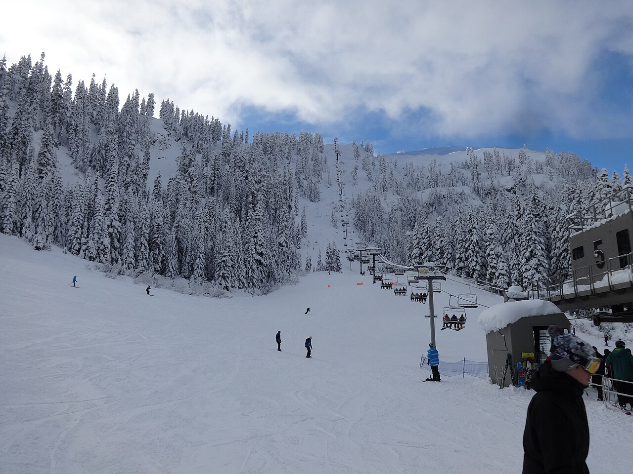
Mt Baker is a downhill ski area in Washington, United States. Mapped terrain includes beginner, easy, intermediate, advanced routes. Its mapped lift network extends from approximately 1106 to 1556 metres above sea level.
Data: OpenSkiData / OpenSkiMap, OpenStreetMap contributors (ODbL), Skimap.org, Who's On First, Mapterhorn.
Mt Baker - Base lift station
ECMWF · Modelllauf: Nächste Aktualisierung erwartet:
Tag Ortszeit Temp. (°C) Luftfeuchtigkeit (%) Wind (km/h) Wind (Knoten) Wind (Bft) Richtung Niederschlag (mm) Neuschnee (cm) Luftdruck (hPa) Nullgradgrenze (m) Wetterlage | Mittwoch, 04/11 01:00 0.7 70 1 0 0B NE 0 0 1019 2579 Clear 1% cloud 04:00 0.4 73 1 1 0B E 0 0 1018 1210 Clear 0% cloud 07:00 0.4 75 1 1 1B SE 0 0 1018 1211 Partly cloudy 48% cloud 10:00 7.5 54 3 1 1B SE 0 0 1017 2638 Overcast 89% cloud 13:00 8.9 53 3 2 1B S 0 0 1015 2520 Overcast 90% cloud 16:00 5.3 71 2 1 1B S 0 0 1015 2287 Overcast 100% cloud 19:00 3.6 79 4 2 1B S 0 0 1016 2005 Overcast 98% cloud 22:00 2.2 95 4 2 1B S 2.8 0 1018 1710 Overcast 100% cloud Donnerstag, 05/11 01:00 1.7 97 2 1 1B S 4.7 0 1019 1658 Overcast 100% cloud 04:00 0.8 97 2 1 1B SW 1.5 0.4 1021 1596 Overcast 100% cloud 07:00 1.4 97 2 1 1B S 0.78 0 1022 1545 Overcast 93% cloud 10:00 2.5 97 3 2 1B SW 0.69 0 1024 1533 Overcast 96% cloud 13:00 4 83 4 2 1B S 0.26 0 1024 1644 Overcast 90% cloud 16:00 3 85 3 1 1B S 0.06 0 1024 1662 Cloudy 58% cloud 19:00 0.3 96 2 1 1B SE 0.04 0 1024 1284 Overcast 89% cloud 22:00 1.3 94 3 2 1B SE 0.07 0 1023 1700 Overcast 93% cloud Freitag, 06/11 01:00 1.4 91 4 2 1B SE 0.04 0 1022 1914 Overcast 93% cloud 04:00 2.2 85 3 2 1B SE 0 0 1021 2067 Overcast 100% cloud 07:00 1.1 95 6 3 1B SE 2.6 0.8 1022 1418 Overcast 100% cloud 10:00 1.7 92 5 3 1B SE 4.1 0 1021 2069 Overcast 100% cloud 13:00 3.6 85 4 2 1B S 2.7 0 1019 2666 Overcast 100% cloud 16:00 3.3 90 3 2 1B SE 9.8 0 1018 2708 Overcast 100% cloud 19:00 3.7 92 4 2 1B S 4.0 0 1019 2659 Overcast 100% cloud 22:00 3.7 94 2 1 1B S 0.37 0 1021 2548 Overcast 100% cloud Samstag, 07/11 01:00 4.1 94 2 1 1B S 0.25 0 1020 2449 Overcast 100% cloud 04:00 3.8 96 2 1 1B SE 0.09 0 1021 2372 Overcast 96% cloud 07:00 2.6 96 3 1 1B E 0 0 1019 2641 Overcast 99% cloud 10:00 5.5 86 4 2 1B E 0 0 1016 2858 Overcast 99% cloud 13:00 8.7 72 4 2 1B SE 0 0 1014 3051 Overcast 94% cloud 16:00 6.6 82 4 2 1B SE 0 0 1010 3003 Overcast 90% cloud 19:00 4.9 84 6 3 1B SE 0 0 1008 2729 Overcast 95% cloud 22:00 6.5 74 9 5 2B S 0 0 1006 2592 Overcast 97% cloud Sonntag, 08/11 01:00 4.5 94 9 5 2B S 10.3 0 1010 2006 Overcast 100% cloud 04:00 2.9 96 9 5 2B S 6.4 0 1010 1883 Overcast 97% cloud 07:00 2.2 95 8 5 2B S 5.0 0 1014 1655 Overcast 100% cloud 10:00 2.6 95 7 4 2B S 6.2 0 1019 1572 Overcast 100% cloud 13:00 2.7 94 6 3 1B S 5.5 0 1022 1542 Overcast 98% cloud 16:00 2 96 4 2 1B S 1.5 0 1023 1494 Overcast 87% cloud 19:00 0.5 96 2 1 1B S 0 0 1024 1221 Overcast 85% cloud 22:00 0.2 95 2 1 1B E 0 0 1025 < 1206 Overcast 90% cloud Montag, 09/11 01:00 -0.8 94 3 1 1B E 0 0 1025 < 1206 Overcast 92% cloud 04:00 -2.2 93 3 2 1B NE 0 0 1023 1477 Overcast 97% cloud 07:00 -3.6 93 3 2 1B E 0 0 1021 1410 Overcast 100% cloud 10:00 3.1 75 2 1 1B SE 0 0 1020 2124 Overcast 99% cloud 13:00 5.8 52 3 2 1B SE 0 0 1019 2074 Overcast 97% cloud 16:00 3.7 62 3 2 1B S 0.02 0 1019 1998 Overcast 83% cloud 19:00 3.3 69 3 2 1B SE 0.04 0 1018 2113 Overcast 99% cloud 22:00 3.7 71 5 3 1B SE 0.07 0 1017 2263 Overcast 100% cloud |
|---|
Forecast notes
Forecast table times: America/Los_Angeles.
Coordinates: 48.8574276°N, -121.6615746°E · Requested elevation: 1117 m. Model terrain: 1203 m. Terrain and 1000/925/850/700 hPa profiles are used for height estimates.
Outside the available profile, temperature uses an estimated 5.5°C/km height correction; wind retains the nearest available model-level value. Humidity is estimated with adjusted pressure and temperature.
These are altitude estimates, not a simulation of local mountain terrain. Precipitation, cloud and sea-level pressure use horizontal interpolation only.
Precipitation includes rain and snow water equivalent: preceding 3 hours through day 6, then 6 hours (see cell tooltip). Snow (cm) estimates fresh snowfall from precipitation and temperature using the GFS conversion; it is not snow depth on the ground. Freezing (m) uses additional 600/500 hPa temperatures when available and estimates the lowest resolved 0°C crossing above sea level. When all sampled levels are warm, the upper profile limit is shown (see tooltip). < marks an entirely cold sampled profile and its lower height limit. No extrapolation is used.
Source: ECMWF · CC BY 4.0 · Processed by Snow Report.
Mt Baker - Top lift station
ECMWF · Modelllauf: Nächste Aktualisierung erwartet:
Tag Ortszeit Temp. (°C) Luftfeuchtigkeit (%) Wind (km/h) Wind (Knoten) Wind (Bft) Richtung Niederschlag (mm) Neuschnee (cm) Luftdruck (hPa) Nullgradgrenze (m) Wetterlage | Mittwoch, 04/11 01:00 4.2 55 5 3 1B S 0 0 1019 2582 Clear 1% cloud 04:00 4.4 57 4 2 1B SW 0 0 1018 1205 Clear 0% cloud 07:00 4.3 59 7 4 2B S 0 0 1018 1205 Partly cloudy 48% cloud 10:00 4.6 60 7 4 2B S 0 0 1017 2639 Overcast 89% cloud 13:00 5.4 60 9 5 2B S 0 0 1015 2519 Overcast 90% cloud 16:00 4.5 63 13 7 3B S 0 0 1015 2286 Overcast 100% cloud 19:00 2.8 78 18 10 3B S 0 0 1016 2002 Overcast 99% cloud 22:00 0.7 99 17 9 3B S 2.9 0.9 1018 1709 Overcast 100% cloud Donnerstag, 05/11 01:00 0.6 98 17 9 3B SW 4.8 1.9 1019 1658 Overcast 100% cloud 04:00 0.2 98 19 10 3B SW 1.6 0.5 1021 1596 Overcast 100% cloud 07:00 -0.1 98 13 7 3B SW 0.81 0.2 1022 1545 Overcast 94% cloud 10:00 -0.1 99 15 8 3B SW 0.73 0.2 1024 1533 Overcast 96% cloud 13:00 0.4 88 11 6 2B SW 0.26 0.1 1024 1641 Overcast 89% cloud 16:00 0.6 88 13 7 3B S 0.06 0 1024 1661 Cloudy 59% cloud 19:00 0.5 95 14 8 3B S 0.05 0 1024 1258 Overcast 90% cloud 22:00 0.6 96 16 8 3B S 0.07 0 1023 1699 Overcast 93% cloud Freitag, 06/11 01:00 1.2 82 16 9 3B S 0.05 0 1022 1915 Overcast 93% cloud 04:00 2 68 18 10 3B S 0 0 1021 2069 Overcast 100% cloud 07:00 -0.4 93 22 12 4B S 2.6 0.8 1022 1413 Overcast 100% cloud 10:00 0.8 88 23 12 4B S 4.1 1.7 1021 2063 Overcast 100% cloud 13:00 2.6 84 25 14 4B S 2.7 0 1019 2663 Overcast 100% cloud 16:00 3.5 90 25 13 4B S 9.9 0 1018 2706 Overcast 100% cloud 19:00 4 93 23 13 4B SW 4.0 0 1020 2657 Overcast 100% cloud 22:00 4.2 97 18 10 3B SW 0.39 0 1021 2547 Overcast 100% cloud Samstag, 07/11 01:00 4 97 16 9 3B SW 0.25 0 1020 2447 Overcast 100% cloud 04:00 3.4 92 12 7 3B S 0.10 0 1021 2374 Overcast 96% cloud 07:00 4.5 67 10 6 2B SE 0 0 1019 2647 Overcast 99% cloud 10:00 6.9 51 16 9 3B S 0 0 1016 2863 Overcast 99% cloud 13:00 8.2 59 18 10 3B S 0 0 1014 3051 Overcast 94% cloud 16:00 8.7 64 24 13 4B S 0 0 1010 3002 Overcast 90% cloud 19:00 8.3 62 31 17 5B S 0 0 1008 2728 Overcast 95% cloud 22:00 7.6 59 43 23 6B S 0 0 1006 2590 Overcast 97% cloud Sonntag, 08/11 01:00 2.7 95 42 23 6B SW 10.5 0 1010 2005 Overcast 100% cloud 04:00 2.1 97 39 21 5B SW 6.5 0 1011 1883 Overcast 97% cloud 07:00 0.6 99 36 19 5B SW 5.2 2.1 1014 1654 Overcast 100% cloud 10:00 0.1 99 32 17 5B SW 6.4 2.6 1019 1571 Overcast 100% cloud 13:00 -0.1 98 24 13 4B SW 5.7 2.3 1022 1541 Overcast 98% cloud 16:00 -0.4 93 18 10 3B SW 1.6 0.5 1023 1489 Overcast 88% cloud 19:00 -0.9 92 16 9 3B SW 0 0 1024 1215 Overcast 86% cloud 22:00 -1.1 91 5 3 1B SW 0 0 1025 < 1204 Overcast 90% cloud Montag, 09/11 01:00 -1.1 83 8 5 2B SE 0 0 1025 < 1204 Overcast 93% cloud 04:00 0.2 63 6 3 2B SE 0 0 1023 1472 Overcast 97% cloud 07:00 1.6 45 11 6 2B SE 0 0 1021 1408 Overcast 100% cloud 10:00 2.5 38 12 6 2B S 0 0 1020 2128 Overcast 99% cloud 13:00 3 41 15 8 3B S 0 0 1019 2073 Overcast 97% cloud 16:00 2.7 51 20 11 4B S 0.02 0 1019 1997 Overcast 84% cloud 19:00 2.7 64 17 9 3B S 0.05 0 1018 2116 Overcast 99% cloud 22:00 3.2 64 26 14 4B S 0.06 0 1017 2264 Overcast 100% cloud |
|---|
Forecast notes
Forecast table times: America/Los_Angeles.
Coordinates: 48.8482821°N, -121.6652069°E · Requested elevation: 1556 m. Model terrain: 1201 m. Terrain and 1000/925/850/700 hPa profiles are used for height estimates.
These are altitude estimates, not a simulation of local mountain terrain. Precipitation, cloud and sea-level pressure use horizontal interpolation only.
Precipitation includes rain and snow water equivalent: preceding 3 hours through day 6, then 6 hours (see cell tooltip). Snow (cm) estimates fresh snowfall from precipitation and temperature using the GFS conversion; it is not snow depth on the ground. Freezing (m) uses additional 600/500 hPa temperatures when available and estimates the lowest resolved 0°C crossing above sea level. When all sampled levels are warm, the upper profile limit is shown (see tooltip). < marks an entirely cold sampled profile and its lower height limit. No extrapolation is used.