Wettervorhersagen für Skigebiete weltweit

Farbskala Temperatur · Wind · Regen · Schnee
Jede Farbe beginnt beim angegebenen Wert. Die Windfarben stimmen in allen drei Einheiten überein. Trockene Zellen bleiben neutral. Die Farben beschreiben die Werte und sind keine amtlichen Wetterwarnungen.
Mount Sunapee - Low lift station
ECMWF · Modelllauf: Nächste Aktualisierung erwartet:
Tag Uhrzeit (UTC) Temp. (°C) Luftfeuchtigkeit (%) Wind (km/h) Wind (Knoten) Wind (Bft) Richtung Niederschlag (mm) Neuschnee (cm) Luftdruck (hPa) Nullgradgrenze (m) Wetterlage | Mittwoch, 04/11 06:00 9.7 87 5 2 1B SW — — 1021 3146 Clear 12% cloud  09:00 10.1 86 7 4 2B SW 0 0 1020 3141 Partly cloudy 40% cloud  12:00 10.1 86 8 4 2B SW 0 0 1020 3145 Cloudy 80% cloud  15:00 18.6 55 8 5 2B SW 0 0 1018 3145 Cloudy 56% cloud 18:00 21.8 45 10 5 2B SW 0 0 1016 3133 Clear 12% cloud 21:00 18.6 60 10 5 2B SW 0 0 1016 3129 Clear 0% cloud Donnerstag, 05/11 00:00 14.4 80 13 7 3B SW 0 0 1016 3129 Partly cloudy 24% cloud 03:00 12.9 84 12 6 2B SW 0 0 1015 3121 Clear 17% cloud 06:00 12.1 83 13 7 3B SW 0 0 1015 3111 Partly cloudy 33% cloud 09:00 10.9 88 12 7 3B SW 0 0 1014 3100 Clear 18% cloud 12:00 11.2 97 14 8 3B SW 0 0 1014 3092 Overcast 93% cloud  15:00 15.4 90 17 9 3B S 0 0 1012 3085 Overcast 100% cloud 18:00 15.8 99 20 11 4B SW 2.8 0 1010 3066 Overcast 100% cloud 21:00 16 98 18 10 3B SW 3.7 0 1010 3062 Overcast 90% cloud Freitag, 06/11 00:00 15.8 97 16 9 3B SW 0.06 0 1010 3065 Overcast 100% cloud 03:00 15.6 97 15 8 3B SW 0.37 0 1010 3064 Overcast 93% cloud 06:00 15.3 99 12 6 2B SW 1.3 0 1010 3057 Overcast 90% cloud 09:00 14.4 98 9 5 2B W 0 0 1011 3054 Overcast 99% cloud 12:00 11.7 99 4 2 1B W 0 0 1013 3057 Overcast 98% cloud 15:00 16.6 65 4 2 1B W 0 0 1013 3060 Overcast 86% cloud 18:00 19 51 6 3 2B SW 0 0 1011 3051 Cloudy 66% cloud 21:00 16.1 68 3 1 1B N 0 0 1011 3051 Overcast 97% cloud Samstag, 07/11 00:00 12.2 78 7 4 2B N 0 0 1012 3050 Overcast 100% cloud 03:00 11.8 76 7 4 2B N 0 0 1012 3045 Overcast 100% cloud 06:00 11.7 76 11 6 2B NE 0 0 1012 2997 Overcast 100% cloud 09:00 10.8 79 11 6 2B NE 0 0 1012 2816 Overcast 100% cloud 12:00 9.2 87 12 6 2B NE 0 0 1012 2839 Partly cloudy 43% cloud 15:00 12.6 71 15 8 3B NE 0.08 0 1011 2864 Overcast 97% cloud 18:00 11.7 75 12 7 3B NE 0.06 0 1009 2806 Overcast 100% cloud 21:00 10.5 77 11 6 2B E 0 0 1009 2721 Overcast 98% cloud Sonntag, 08/11 00:00 8.1 96 10 5 2B NE 1.3 0 1008 2595 Overcast 100% cloud 03:00 7.2 98 6 3 1B NE 4.6 0 1008 2276 Overcast 100% cloud 06:00 6.6 98 3 1 1B NE 2.8 0 1006 2051 Overcast 100% cloud 09:00 6.7 98 12 7 2B NW 1.0 0 1005 1860 Overcast 100% cloud 12:00 4.2 98 19 10 3B NW 1.3 0 1006 1633 Overcast 96% cloud 15:00 5.5 75 20 11 4B NW 0.44 0 1007 1471 Overcast 100% cloud 18:00 8.1 62 25 13 4B NW 0.05 0 1005 1204 Overcast 99% cloud 21:00 7.9 64 15 8 3B NW 0 0 1005 1242 Cloudy 74% cloud Montag, 09/11 00:00 5.8 73 12 7 3B W 0 0 1005 1287 Partly cloudy 21% cloud 03:00 4.6 69 13 7 3B W 0 0 1004 1270 Cloudy 71% cloud 06:00 5.5 69 10 5 2B SW 0 0 1003 1252 Overcast 99% cloud 09:00 5.3 86 11 6 2B SW 0.39 0 1002 1279 Overcast 94% cloud 12:00 5.5 90 13 7 3B W 0.84 0 1003 1222 Overcast 98% cloud 15:00 6.2 86 18 9 3B NW 0.59 0 1005 1194 Partly cloudy 40% cloud 18:00 8.3 54 25 13 4B NW 0.08 0 1005 1152 Overcast 84% cloud 21:00 6.3 55 22 12 4B NW 0 0 1007 1065 Partly cloudy 28% cloud Dienstag, 10/11 00:00 3.8 67 21 11 4B NW 0 0 1010 892 Clear 11% cloud 03:00 2.4 67 19 10 3B NW 0 0 1011 750 Clear 8% cloud 06:00 1.4 71 16 9 3B NW 0 0 1013 601 Partly cloudy 25% cloud |
|---|
Forecast notes
Forecast table times: UTC.
Coordinates: 43.3325876°N, -72.0772151°E · Requested elevation: 384 m. Model terrain: 383 m. Terrain and 1000/925/850/700 hPa profiles are used for height estimates.
These are altitude estimates, not a simulation of local mountain terrain. Precipitation, cloud and sea-level pressure use horizontal interpolation only.
Precipitation includes rain and snow water equivalent: preceding 3 hours through day 6, then 6 hours (see cell tooltip). Snow (cm) estimates fresh snowfall from precipitation and temperature using the GFS conversion; it is not snow depth on the ground. Freezing (m) uses additional 600/500 hPa temperatures when available and estimates the lowest resolved 0°C crossing above sea level. When all sampled levels are warm, the upper profile limit is shown (see tooltip). < marks an entirely cold sampled profile and its lower height limit. No extrapolation is used.
Source: ECMWF · CC BY 4.0 · Processed by Snow Report.
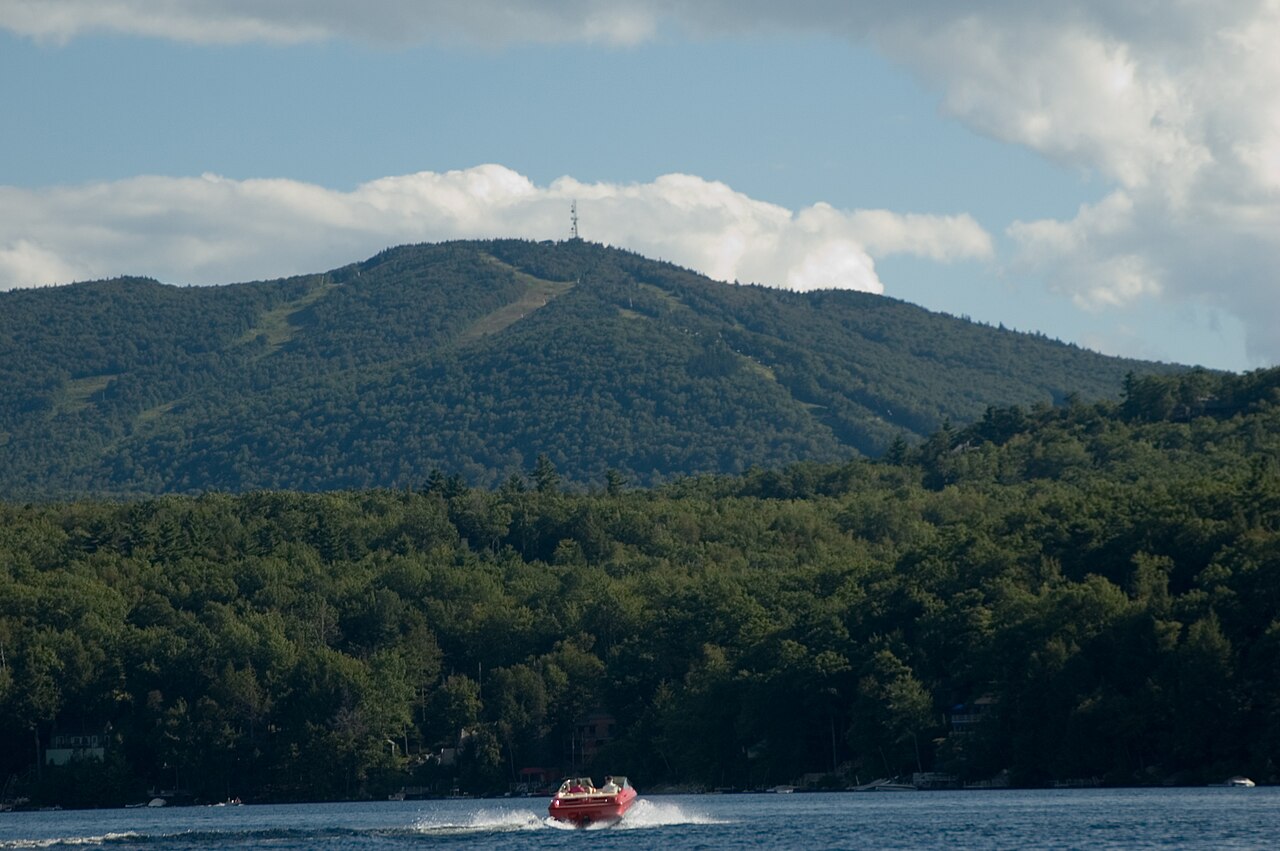
Mount Sunapee is a downhill ski area in New Hampshire, United States. Mapped terrain includes beginner, easy, intermediate, advanced, expert routes. Its mapped lift network extends from approximately 384 to 827 metres above sea level.
Data: OpenSkiData / OpenSkiMap, OpenStreetMap contributors (ODbL), Skimap.org, Who's On First, Mapterhorn.
Mount Sunapee - Base lift station
ECMWF · Modelllauf: Nächste Aktualisierung erwartet:
Tag Uhrzeit (UTC) Temp. (°C) Luftfeuchtigkeit (%) Wind (km/h) Wind (Knoten) Wind (Bft) Richtung Niederschlag (mm) Neuschnee (cm) Luftdruck (hPa) Nullgradgrenze (m) Wetterlage | Mittwoch, 04/11 06:00 9.7 87 5 3 1B SW — — 1021 3146 Clear 12% cloud 09:00 10.2 85 8 4 2B SW 0 0 1020 3141 Partly cloudy 40% cloud 12:00 10.1 85 8 4 2B SW 0 0 1020 3145 Cloudy 80% cloud 15:00 18.6 55 9 5 2B SW 0 0 1018 3145 Cloudy 56% cloud 18:00 21.7 45 10 6 2B SW 0 0 1016 3133 Clear 12% cloud 21:00 18.6 60 10 5 2B SW 0 0 1016 3129 Clear 0% cloud Donnerstag, 05/11 00:00 14.4 80 14 7 3B SW 0 0 1016 3129 Partly cloudy 24% cloud 03:00 12.9 84 12 7 3B SW 0 0 1015 3121 Clear 17% cloud 06:00 12.1 82 13 7 3B SW 0 0 1015 3111 Partly cloudy 33% cloud 09:00 11 87 13 7 3B SW 0 0 1014 3100 Clear 18% cloud 12:00 11.2 97 15 8 3B SW 0 0 1014 3092 Overcast 94% cloud 15:00 15.4 91 17 9 3B S 0 0 1012 3085 Overcast 100% cloud 18:00 15.8 99 21 11 4B SW 2.8 0 1010 3066 Overcast 100% cloud 21:00 16 98 18 10 3B SW 3.7 0 1010 3062 Overcast 90% cloud Freitag, 06/11 00:00 15.7 97 17 9 3B SW 0.06 0 1010 3065 Overcast 100% cloud 03:00 15.6 97 15 8 3B SW 0.38 0 1010 3064 Overcast 93% cloud 06:00 15.2 99 12 7 3B SW 1.3 0 1010 3057 Overcast 90% cloud 09:00 14.4 98 10 5 2B W 0 0 1011 3054 Overcast 99% cloud 12:00 11.7 98 4 2 1B W 0 0 1013 3057 Overcast 98% cloud 15:00 16.6 66 4 2 1B W 0 0 1013 3060 Overcast 86% cloud 18:00 18.9 51 6 3 2B SW 0 0 1011 3051 Cloudy 66% cloud 21:00 16.1 68 3 1 1B N 0 0 1011 3051 Overcast 97% cloud Samstag, 07/11 00:00 12.2 77 7 4 2B N 0 0 1012 3050 Overcast 100% cloud 03:00 11.8 76 7 4 2B N 0 0 1012 3045 Overcast 100% cloud 06:00 11.7 76 11 6 2B NE 0 0 1012 2997 Overcast 100% cloud 09:00 10.8 79 12 6 2B NE 0 0 1012 2816 Overcast 100% cloud 12:00 9.2 87 12 7 2B NE 0 0 1012 2839 Partly cloudy 43% cloud 15:00 12.5 71 15 8 3B NE 0.08 0 1011 2864 Overcast 97% cloud 18:00 11.6 75 13 7 3B NE 0.06 0 1009 2806 Overcast 100% cloud 21:00 10.4 77 12 6 2B E 0 0 1009 2720 Overcast 98% cloud Sonntag, 08/11 00:00 8.1 96 10 6 2B NE 1.3 0 1008 2595 Overcast 100% cloud 03:00 7.2 98 6 3 2B NE 4.6 0 1008 2276 Overcast 100% cloud 06:00 6.6 98 3 2 1B NE 2.8 0 1006 2051 Overcast 100% cloud 09:00 6.6 98 13 7 3B NW 1.0 0 1005 1860 Overcast 100% cloud 12:00 4.2 98 19 10 3B NW 1.3 0 1006 1632 Overcast 96% cloud 15:00 5.4 75 20 11 4B NW 0.44 0 1007 1470 Overcast 100% cloud 18:00 8.1 63 25 13 4B NW 0.05 0 1005 1204 Overcast 99% cloud 21:00 7.8 64 16 9 3B NW 0 0 1005 1242 Cloudy 74% cloud Montag, 09/11 00:00 5.8 73 13 7 3B W 0 0 1005 1287 Partly cloudy 21% cloud 03:00 4.6 69 13 7 3B W 0 0 1004 1270 Cloudy 71% cloud 06:00 5.5 69 10 6 2B SW 0 0 1003 1253 Overcast 99% cloud 09:00 5.2 86 12 6 2B SW 0.39 0 1002 1279 Overcast 94% cloud 12:00 5.4 90 13 7 3B W 0.83 0 1003 1222 Overcast 98% cloud 15:00 6.2 86 18 10 3B NW 0.59 0 1005 1193 Partly cloudy 40% cloud 18:00 8.3 54 25 14 4B NW 0.08 0 1005 1152 Overcast 84% cloud 21:00 6.3 56 22 12 4B NW 0 0 1007 1066 Partly cloudy 28% cloud Dienstag, 10/11 00:00 3.8 67 21 11 4B NW 0 0 1010 892 Clear 11% cloud 03:00 2.4 67 20 11 3B NW 0 0 1011 750 Clear 8% cloud 06:00 1.4 72 17 9 3B NW 0 0 1013 601 Partly cloudy 25% cloud |
|---|
Forecast notes
Forecast table times: UTC.
Coordinates: 43.3313043°N, -72.0786435°E · Requested elevation: 390 m. Model terrain: 383 m. Terrain and 1000/925/850/700 hPa profiles are used for height estimates.
These are altitude estimates, not a simulation of local mountain terrain. Precipitation, cloud and sea-level pressure use horizontal interpolation only.
Precipitation includes rain and snow water equivalent: preceding 3 hours through day 6, then 6 hours (see cell tooltip). Snow (cm) estimates fresh snowfall from precipitation and temperature using the GFS conversion; it is not snow depth on the ground. Freezing (m) uses additional 600/500 hPa temperatures when available and estimates the lowest resolved 0°C crossing above sea level. When all sampled levels are warm, the upper profile limit is shown (see tooltip). < marks an entirely cold sampled profile and its lower height limit. No extrapolation is used.
Source: ECMWF · CC BY 4.0 · Processed by Snow Report.
Mount Sunapee - Top lift station
ECMWF · Modelllauf: Nächste Aktualisierung erwartet:
Tag Uhrzeit (UTC) Temp. (°C) Luftfeuchtigkeit (%) Wind (km/h) Wind (Knoten) Wind (Bft) Richtung Niederschlag (mm) Neuschnee (cm) Luftdruck (hPa) Nullgradgrenze (m) Wetterlage | Mittwoch, 04/11 06:00 15.3 77 26 14 4B W — — 1021 3146 Clear 11% cloud 09:00 15.6 71 32 17 5B W 0 0 1020 3141 Partly cloudy 42% cloud 12:00 15.7 63 35 19 5B W 0 0 1020 3145 Cloudy 79% cloud 15:00 16.4 53 32 17 5B W 0 0 1018 3145 Cloudy 56% cloud 18:00 16.6 56 21 11 4B SW 0 0 1016 3133 Clear 11% cloud 21:00 16.8 58 31 17 5B SW 0 0 1016 3130 Clear 0% cloud Donnerstag, 05/11 00:00 16.2 58 35 19 5B SW 0 0 1016 3129 Partly cloudy 24% cloud 03:00 16.7 55 34 18 5B SW 0 0 1015 3121 Clear 18% cloud 06:00 16.3 45 43 23 6B SW 0 0 1015 3111 Partly cloudy 33% cloud 09:00 15.3 48 53 29 7B SW 0 0 1014 3100 Clear 18% cloud 12:00 13.5 79 56 30 7B SW 0 0 1014 3092 Overcast 94% cloud 15:00 13.3 98 58 31 7B SW 0 0 1012 3085 Overcast 100% cloud 18:00 13.9 98 63 34 8B SW 2.8 0 1010 3067 Overcast 100% cloud 21:00 14 98 53 29 7B SW 3.8 0 1010 3062 Overcast 90% cloud Freitag, 06/11 00:00 14.2 98 53 29 7B SW 0.06 0 1010 3066 Overcast 100% cloud 03:00 14.2 97 49 27 6B SW 0.40 0 1010 3064 Overcast 94% cloud 06:00 14 94 42 23 6B SW 1.1 0 1010 3057 Overcast 91% cloud 09:00 12.2 90 31 17 5B W 0 0 1011 3054 Overcast 99% cloud 12:00 11.8 75 17 9 3B W 0 0 1013 3057 Overcast 98% cloud 15:00 11.8 75 11 6 2B W 0 0 1013 3060 Overcast 85% cloud 18:00 13.7 66 12 6 2B SW 0 0 1011 3052 Cloudy 65% cloud 21:00 14.2 64 6 3 2B SW 0 0 1011 3052 Overcast 97% cloud Samstag, 07/11 00:00 13.3 65 13 7 3B NE 0 0 1012 3050 Overcast 100% cloud 03:00 12.9 62 24 13 4B NE 0 0 1012 3045 Overcast 100% cloud 06:00 10.7 83 38 21 5B E 0 0 1012 2998 Overcast 100% cloud 09:00 9.1 82 41 22 6B E 0 0 1012 2815 Overcast 100% cloud 12:00 8.1 90 42 22 6B NE 0 0 1012 2841 Partly cloudy 47% cloud 15:00 7.9 91 32 17 5B NE 0.09 0 1011 2869 Overcast 97% cloud 18:00 7.6 92 28 15 4B NE 0.06 0 1009 2809 Overcast 100% cloud 21:00 7.2 91 33 18 5B NE 0 0 1009 2721 Overcast 98% cloud Sonntag, 08/11 00:00 6.1 92 31 17 5B NE 1.3 0 1008 2600 Overcast 100% cloud 03:00 4.7 93 22 12 4B NE 4.5 0 1008 2277 Overcast 100% cloud 06:00 4.5 94 17 9 3B NE 2.9 0 1006 2046 Overcast 100% cloud 09:00 3.8 100 34 18 5B NW 0.92 0 1005 1859 Overcast 100% cloud 12:00 1.7 95 49 26 6B NW 1.3 0 1006 1637 Overcast 96% cloud 15:00 1.6 86 52 28 7B NW 0.39 0 1007 1478 Overcast 100% cloud 18:00 3.3 80 45 24 6B NW 0.05 0 1005 1207 Overcast 99% cloud 21:00 3.8 78 39 21 5B W 0 0 1005 1246 Cloudy 77% cloud Montag, 09/11 00:00 3.8 70 42 23 6B W 0 0 1005 1291 Partly cloudy 22% cloud 03:00 3 74 47 25 6B W 0 0 1004 1277 Cloudy 69% cloud 06:00 2.9 82 33 18 5B W 0 0 1003 1257 Overcast 99% cloud 09:00 2.7 92 36 20 5B W 0.31 0 1002 1282 Overcast 94% cloud 12:00 2.5 95 35 19 5B W 0.70 0 1003 1226 Overcast 98% cloud 15:00 2.2 91 40 21 6B NW 0.59 0 1005 1199 Partly cloudy 41% cloud 18:00 3.2 69 46 25 6B NW 0.09 0 1005 1155 Overcast 84% cloud 21:00 2.3 67 49 26 6B NW 0 0 1007 1069 Partly cloudy 28% cloud Dienstag, 10/11 00:00 0.5 74 57 31 7B NW 0 0 1010 894 Clear 11% cloud 03:00 -0.4 68 55 30 7B NW 0 0 1011 755 Clear 7% cloud 06:00 -1.3 76 49 27 6B NW 0 0 1013 603 Partly cloudy 23% cloud |
|---|
Forecast notes
Forecast table times: UTC.
Coordinates: 43.3145716°N, -72.0741222°E · Requested elevation: 827 m. Model terrain: 382 m. Terrain and 1000/925/850/700 hPa profiles are used for height estimates.
These are altitude estimates, not a simulation of local mountain terrain. Precipitation, cloud and sea-level pressure use horizontal interpolation only.
Precipitation includes rain and snow water equivalent: preceding 3 hours through day 6, then 6 hours (see cell tooltip). Snow (cm) estimates fresh snowfall from precipitation and temperature using the GFS conversion; it is not snow depth on the ground. Freezing (m) uses additional 600/500 hPa temperatures when available and estimates the lowest resolved 0°C crossing above sea level. When all sampled levels are warm, the upper profile limit is shown (see tooltip). < marks an entirely cold sampled profile and its lower height limit. No extrapolation is used.