SNOWREPORT METEOCAM

Previsioni per le stazioni sciistiche di tutto il mondo

Modelli meteo GFS, ECMWF e ICON Previsioni fino a 16 giorni
125 webcam sulla neve Ultima webcam aggiunta: Skeetawk ↗
Esperienza nel meteo di montagna dal 1996
Altro
Legenda dei colori Temperatura · Vento · Pioggia · Neve
Temperatura °C< −10 / −10 / 0 / 10 / 20 / 30+
Vento km/h< 10 / 10 / 29 / 50 / 75+
Pioggia mm< 1 / 1 / 3 / 10 / 20+
Neve cm< 1 / 1 / 5 / 10 / 20+

Ogni colore inizia dal valore indicato. I colori del vento corrispondono nelle tre unità di misura. Le celle senza precipitazioni restano neutre. I colori descrivono i valori visualizzati, non avvisi meteo ufficiali.

Mayrhofen Hippach - Low lift station · 616 m

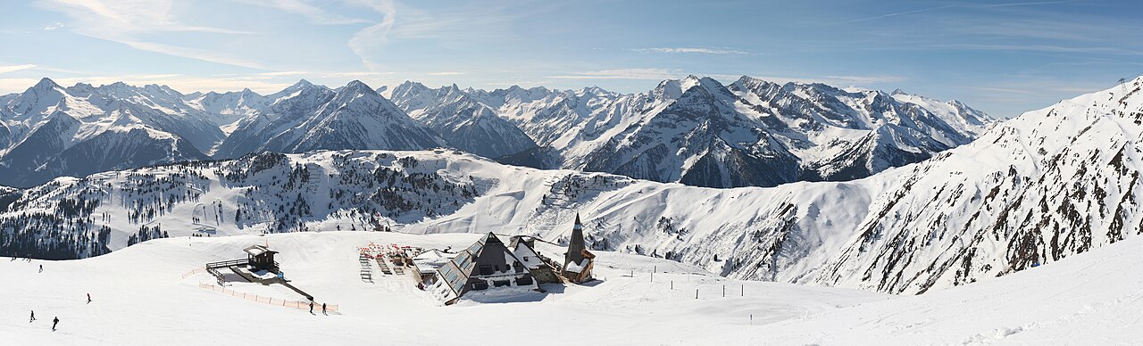
Mayrhofen Hippach — winter panorama. Photo: Vašek Vinklát from Czech Republic. Archive image; resized.
Mayrhofen Hippach — winter panorama. Photo: Vašek Vinklát from Czech Republic. Archive image; resized. Source · CC BY 2.0

Mayrhofen Hippach is a downhill ski area in Tyrol, Austria. Mapped terrain includes beginner, easy, intermediate, advanced routes. Its mapped lift network extends from approximately 616 to 2468 metres above sea level. Cross-country skiing is also mapped within the area.

Resort website

Data: OpenSkiData / OpenSkiMap, OpenStreetMap contributors (ODbL), Skimap.org, Who's On First, Mapterhorn.

Resort cameras

Mayrhofen - Penkenbahn · Panorama/video

Mayrhofen - Penkenbahn · Panorama/video preview

Provider panorama/video player. Capture time is shown by the camera.

Open camera page ↗

Mayrhofen - Ahornbahn · Panorama/video

Mayrhofen - Ahornbahn · Panorama/video preview

Provider panorama/video player. Capture time is shown by the camera.

Open camera page ↗

Hippach - Paulerhof - Schwendberg · Panorama/video

Hippach - Paulerhof - Schwendberg · Panorama/video preview

Provider panorama/video player. Capture time is shown by the camera.

Open camera page ↗

Mayrhofen Hippach - Base lift station · 665 m

Mayrhofen Hippach - Top lift station · 2468 m