Previsioni per le stazioni sciistiche di tutto il mondo

Altro
Legenda dei colori Temperatura · Vento · Pioggia · Neve
Ogni colore inizia dal valore indicato. I colori del vento corrispondono nelle tre unità di misura. Le celle senza precipitazioni restano neutre. I colori descrivono i valori visualizzati, non avvisi meteo ufficiali.
Lutsen Mountains - Low lift station
ECMWF · Elaborazione del modello: Prossimo aggiornamento previsto:
Giorno Ora (UTC) Temp. (°C) Umidità (%) Vento (km/h) Vento (nodi) Vento (Bft) Direzione Precip. (mm) Neve (cm) Pressione (hPa) Zero termico (m) Condizioni | Mercoledì, 04/11 06:00 11.5 94 25 14 4B NE — — 1005 3002 Overcast 100% cloud  09:00 11.4 94 24 13 4B NE 0.29 0 1004 2994 Overcast 100% cloud 12:00 11.2 93 23 13 4B NE 0.05 0 1002 2979 Overcast 100% cloud 15:00 11 95 20 11 4B NE 3.3 0 1001 2960 Overcast 100% cloud 18:00 10.6 94 17 9 3B NE 8.5 0 999 2940 Overcast 100% cloud 21:00 10.1 94 16 9 3B N 4.9 0 999 2922 Overcast 100% cloud Giovedì, 05/11 00:00 9 92 21 11 4B N 3.0 0 999 2862 Overcast 100% cloud 03:00 8.3 91 26 14 4B N 1.3 0 1000 2803 Overcast 100% cloud 06:00 8.1 89 26 14 4B N 0.89 0 1001 2701 Overcast 100% cloud 09:00 6.3 90 30 16 5B N 2.5 0 1004 2543 Overcast 100% cloud 12:00 5.8 84 27 14 4B N 2.5 0 1007 2336 Overcast 99% cloud 15:00 4.4 75 29 16 5B N 0 0 1012 713 Overcast 88% cloud 18:00 4.5 65 25 13 4B N 0 0 1015 705 Overcast 82% cloud 21:00 4.6 55 24 13 4B N 0 0 1017 736 Cloudy 60% cloud  Venerdì, 06/11 00:00 3.7 58 20 11 3B N 0 0 1021 683 Overcast 87% cloud 03:00 3.3 61 15 8 3B N 0 0 1022 658 Cloudy 70% cloud 06:00 2.4 66 14 8 3B NE 0 0 1023 553 Partly cloudy 42% cloud  09:00 0.9 73 11 6 2B N 0 0 1025 412 Clear 15% cloud  12:00 0.4 77 9 5 2B N 0 0 1026 < 356 Cloudy 52% cloud 15:00 2 69 6 3 2B NE 0 0 1027 496 Cloudy 77% cloud 18:00 3.9 59 5 3 1B S 0 0 1025 671 Clear 16% cloud 21:00 3.9 66 7 4 2B S 0 0 1025 1920 Clear 8% cloud Sabato, 07/11 00:00 1.5 83 6 3 2B SW 0 0 1025 2419 Clear 0% cloud 03:00 1.6 83 7 4 2B SW 0 0 1024 2720 Clear 2% cloud 06:00 2.1 85 9 5 2B SW 0 0 1023 2723 Overcast 92% cloud 09:00 2.2 85 8 4 2B SW 0 0 1023 2454 Cloudy 75% cloud 12:00 2.4 87 11 6 2B SW 0 0 1022 2283 Clear 3% cloud 15:00 4.3 82 11 6 2B SW 0 0 1021 2368 Clear 1% cloud 18:00 7 73 15 8 3B SW 0 0 1018 2535 Partly cloudy 25% cloud 21:00 7.5 78 13 7 3B SW 0 0 1016 2787 Partly cloudy 48% cloud Domenica, 08/11 00:00 5.7 83 18 10 3B SW 0 0 1015 2993 Partly cloudy 22% cloud 03:00 6.2 79 19 11 3B SW 0 0 1012 3014 Overcast 89% cloud 06:00 8 76 20 11 4B W 0 0 1010 2991 Partly cloudy 23% cloud 09:00 7.5 77 22 12 4B NW 0 0 1011 2347 Clear 0% cloud 12:00 7.3 73 27 15 4B NW 0 0 1012 2408 Clear 19% cloud 15:00 7.1 72 22 12 4B NW 0 0 1015 2373 Cloudy 56% cloud 18:00 8.7 62 20 11 3B NW 0 0 1016 2334 Clear 7% cloud 21:00 9.1 61 18 10 3B NW 0 0 1017 2697 Overcast 95% cloud Lunedì, 09/11 00:00 6.5 75 16 8 3B NW 0 0 1019 2680 Clear 0% cloud 03:00 5 85 17 9 3B NW 0 0 1020 2674 Partly cloudy 30% cloud 06:00 5 87 3 2 1B W 0 0 1020 2866 Overcast 98% cloud 09:00 4.1 91 8 4 2B SW 0 0 1020 3060 Overcast 82% cloud 12:00 4.8 93 10 6 2B S 0 0 1018 3056 Overcast 99% cloud 15:00 6 89 13 7 3B S 0 0 1017 3051 Overcast 97% cloud 18:00 8.1 79 14 8 3B S 0 0 1014 3039 Cloudy 74% cloud 21:00 11 64 15 8 3B SW 0.01 0 1010 3021 Cloudy 62% cloud Martedì, 10/11 00:00 9 76 16 8 3B W 0 0 1011 2859 Overcast 99% cloud 03:00 8.8 74 20 11 4B W 0 0 1010 2570 Overcast 94% cloud 06:00 7.9 72 27 14 4B NW 0 0 1010 2174 Clear 0% cloud |
|---|
Forecast notes
Forecast table times: UTC.
Coordinates: 47.6495095°N, -90.7194973°E · Requested elevation: 276 m. Model terrain: 354 m. Terrain and 1000/925/850/700 hPa profiles are used for height estimates.
Outside the available profile, temperature uses an estimated 5.5°C/km height correction; wind retains the nearest available model-level value. Humidity is estimated with adjusted pressure and temperature.
These are altitude estimates, not a simulation of local mountain terrain. Precipitation, cloud and sea-level pressure use horizontal interpolation only.
Precipitation includes rain and snow water equivalent: preceding 3 hours through day 6, then 6 hours (see cell tooltip). Snow (cm) estimates fresh snowfall from precipitation and temperature using the GFS conversion; it is not snow depth on the ground. Freezing (m) uses additional 600/500 hPa temperatures when available and estimates the lowest resolved 0°C crossing above sea level. When all sampled levels are warm, the upper profile limit is shown (see tooltip). < marks an entirely cold sampled profile and its lower height limit. No extrapolation is used.
Source: ECMWF · CC BY 4.0 · Processed by Snow Report.
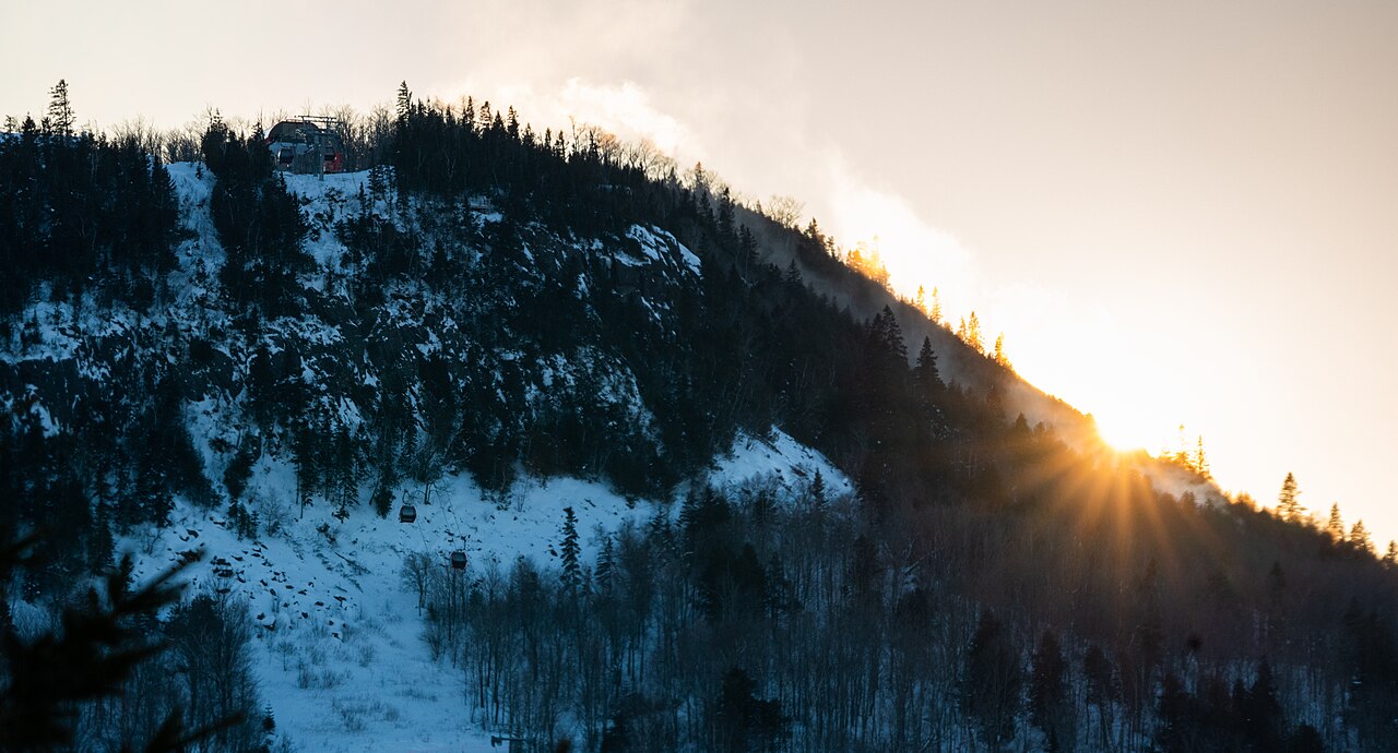
Lutsen Mountains is a downhill ski area in Minnesota, United States. Mapped terrain includes beginner, easy, intermediate, advanced, expert routes. Its mapped lift network extends from approximately 276 to 512 metres above sea level.
Data: OpenSkiData / OpenSkiMap, OpenStreetMap contributors (ODbL), Skimap.org, Who's On First, Mapterhorn.
Lutsen Mountains - Base lift station
ECMWF · Elaborazione del modello: Prossimo aggiornamento previsto:
Giorno Ora (UTC) Temp. (°C) Umidità (%) Vento (km/h) Vento (nodi) Vento (Bft) Direzione Precip. (mm) Neve (cm) Pressione (hPa) Zero termico (m) Condizioni | Mercoledì, 04/11 06:00 11.4 95 25 13 4B NE — — 1005 3002 Overcast 100% cloud 09:00 11.3 95 23 12 4B NE 0.29 0 1004 2994 Overcast 100% cloud 12:00 11.2 94 22 12 4B NE 0.05 0 1002 2979 Overcast 100% cloud 15:00 10.9 96 19 10 3B NE 3.1 0 1001 2960 Overcast 100% cloud 18:00 10.5 94 17 9 3B NE 8.5 0 999 2940 Overcast 100% cloud 21:00 10 95 16 9 3B N 5.1 0 999 2922 Overcast 100% cloud Giovedì, 05/11 00:00 8.8 93 21 11 4B N 2.9 0 999 2864 Overcast 100% cloud 03:00 8 92 26 14 4B N 1.2 0 1000 2805 Overcast 100% cloud 06:00 7.8 90 26 14 4B N 0.89 0 1001 2700 Overcast 100% cloud 09:00 6 91 30 16 5B N 2.5 0 1004 2543 Overcast 100% cloud 12:00 5.5 84 27 15 4B N 2.3 0 1007 2337 Overcast 99% cloud 15:00 4.1 75 29 16 5B N 0 0 1012 711 Overcast 88% cloud 18:00 4.3 65 25 13 4B N 0 0 1015 704 Overcast 80% cloud 21:00 4.4 55 23 13 4B N 0 0 1017 735 Cloudy 60% cloud Venerdì, 06/11 00:00 3.4 59 19 10 3B N 0 0 1021 682 Overcast 87% cloud 03:00 3 61 14 7 3B N 0 0 1022 657 Cloudy 68% cloud 06:00 2 67 14 8 3B NE 0 0 1023 548 Partly cloudy 40% cloud 09:00 0.5 75 11 6 2B N 0 0 1025 396 Clear 14% cloud 12:00 -0 79 9 5 2B N 0 0 1026 < 371 Partly cloudy 49% cloud 15:00 1.7 69 6 3 2B N 0 0 1027 499 Cloudy 76% cloud 18:00 3.8 59 5 2 1B S 0 0 1025 682 Clear 17% cloud 21:00 3.8 67 7 4 2B S 0 0 1025 1925 Clear 8% cloud Sabato, 07/11 00:00 1.1 85 6 3 1B SW 0 0 1025 2427 Clear 0% cloud 03:00 1.2 85 7 4 2B SW 0 0 1024 2721 Clear 2% cloud 06:00 1.6 86 8 4 2B SW 0 0 1023 2722 Overcast 93% cloud 09:00 1.7 86 8 4 2B SW 0 0 1023 2448 Cloudy 76% cloud 12:00 2 88 10 5 2B SW 0 0 1022 2282 Clear 3% cloud 15:00 4.1 83 11 6 2B SW 0 0 1021 2365 Clear 1% cloud 18:00 7 72 14 8 3B SW 0 0 1018 2531 Partly cloudy 25% cloud 21:00 7.3 79 12 7 3B S 0 0 1016 2787 Partly cloudy 48% cloud Domenica, 08/11 00:00 5.4 85 17 9 3B SW 0 0 1015 2992 Partly cloudy 21% cloud 03:00 5.9 80 19 10 3B W 0 0 1012 3013 Overcast 89% cloud 06:00 7.7 77 20 11 4B W 0 0 1010 2990 Partly cloudy 21% cloud 09:00 7.2 77 22 12 4B NW 0 0 1011 2335 Clear 0% cloud 12:00 7 74 27 15 4B NW 0 0 1012 2397 Partly cloudy 21% cloud 15:00 6.9 73 23 12 4B NW 0 0 1014 2374 Cloudy 58% cloud 18:00 8.5 62 20 11 4B NW 0 0 1016 2320 Clear 7% cloud 21:00 8.9 61 18 10 3B NW 0 0 1017 2692 Overcast 95% cloud Lunedì, 09/11 00:00 6.2 76 15 8 3B NW 0 0 1019 2675 Clear 0% cloud 03:00 4.6 86 17 9 3B NW 0 0 1020 2674 Partly cloudy 30% cloud 06:00 4.7 88 4 2 1B NW 0 0 1020 2863 Overcast 98% cloud 09:00 3.7 92 7 4 2B SW 0 0 1020 3059 Overcast 81% cloud 12:00 4.5 94 10 5 2B S 0 0 1018 3056 Overcast 99% cloud 15:00 5.8 90 13 7 3B S 0 0 1017 3050 Overcast 97% cloud 18:00 8.1 78 13 7 3B S 0 0 1014 3038 Cloudy 74% cloud 21:00 11 64 14 8 3B SW 0.01 0 1010 3021 Cloudy 62% cloud Martedì, 10/11 00:00 8.8 76 15 8 3B W 0 0 1010 2856 Overcast 99% cloud 03:00 8.5 75 20 11 4B NW 0 0 1010 2567 Overcast 94% cloud 06:00 7.6 73 26 14 4B NW 0 0 1010 2168 Clear 0% cloud |
|---|
Forecast notes
Forecast table times: UTC.
Coordinates: 47.6621827°N, -90.7182049°E · Requested elevation: 313 m. Model terrain: 369 m. Terrain and 1000/925/850/700 hPa profiles are used for height estimates.
Outside the available profile, temperature uses an estimated 5.5°C/km height correction; wind retains the nearest available model-level value. Humidity is estimated with adjusted pressure and temperature.
These are altitude estimates, not a simulation of local mountain terrain. Precipitation, cloud and sea-level pressure use horizontal interpolation only.
Precipitation includes rain and snow water equivalent: preceding 3 hours through day 6, then 6 hours (see cell tooltip). Snow (cm) estimates fresh snowfall from precipitation and temperature using the GFS conversion; it is not snow depth on the ground. Freezing (m) uses additional 600/500 hPa temperatures when available and estimates the lowest resolved 0°C crossing above sea level. When all sampled levels are warm, the upper profile limit is shown (see tooltip). < marks an entirely cold sampled profile and its lower height limit. No extrapolation is used.
Source: ECMWF · CC BY 4.0 · Processed by Snow Report.
Lutsen Mountains - Top lift station
ECMWF · Elaborazione del modello: Prossimo aggiornamento previsto:
Giorno Ora (UTC) Temp. (°C) Umidità (%) Vento (km/h) Vento (nodi) Vento (Bft) Direzione Precip. (mm) Neve (cm) Pressione (hPa) Zero termico (m) Condizioni | Mercoledì, 04/11 06:00 11.4 95 37 20 5B NE — — 1005 3002 Overcast 100% cloud 09:00 11.3 97 36 19 5B NE 0.25 0 1004 2994 Overcast 100% cloud 12:00 11 97 32 17 5B NE 0.05 0 1002 2979 Overcast 100% cloud 15:00 11 98 27 15 4B NE 3.3 0 1001 2960 Overcast 100% cloud 18:00 10.4 96 23 12 4B NE 8.6 0 999 2940 Overcast 100% cloud 21:00 9.7 95 22 12 4B NE 5.1 0 999 2922 Overcast 100% cloud Giovedì, 05/11 00:00 8.3 92 31 17 5B N 3.1 0 999 2864 Overcast 100% cloud 03:00 7.2 92 41 22 6B N 1.3 0 1000 2802 Overcast 100% cloud 06:00 6.9 91 42 23 6B N 0.95 0 1001 2700 Overcast 100% cloud 09:00 4.9 91 46 25 6B N 2.6 0 1004 2541 Overcast 100% cloud 12:00 4 88 44 24 6B N 2.4 0 1007 2336 Overcast 99% cloud 15:00 2.2 82 37 20 5B N 0 0 1012 713 Overcast 88% cloud 18:00 2.3 72 30 16 5B N 0 0 1015 706 Overcast 81% cloud 21:00 2.5 60 29 15 4B N 0 0 1017 737 Cloudy 60% cloud Venerdì, 06/11 00:00 1.7 63 24 13 4B N 0 0 1021 683 Overcast 87% cloud 03:00 1.4 65 18 10 3B N 0 0 1022 658 Cloudy 70% cloud 06:00 0.4 71 17 9 3B NE 0 0 1023 553 Partly cloudy 41% cloud 09:00 -0.9 77 14 8 3B NE 0 0 1025 405 Clear 14% cloud 12:00 -1.4 82 11 6 2B N 0 0 1026 < 363 Cloudy 51% cloud 15:00 -0.2 76 7 4 2B NE 0 0 1027 498 Cloudy 77% cloud 18:00 1.8 64 3 2 1B S 0 0 1025 678 Clear 16% cloud 21:00 2.5 69 5 3 1B SW 0 0 1025 1924 Clear 8% cloud Sabato, 07/11 00:00 0.9 79 6 3 2B SW 0 0 1025 2429 Clear 0% cloud 03:00 1 78 10 5 2B SW 0 0 1024 2722 Clear 2% cloud 06:00 1.3 80 13 7 3B SW 0 0 1023 2724 Overcast 93% cloud 09:00 1.3 82 15 8 3B SW 0 0 1023 2451 Cloudy 76% cloud 12:00 1.6 82 15 8 3B SW 0 0 1022 2282 Clear 3% cloud 15:00 3.3 78 17 9 3B SW 0 0 1021 2367 Clear 0% cloud 18:00 5.8 72 16 9 3B SW 0 0 1018 2540 Partly cloudy 25% cloud 21:00 6.7 76 15 8 3B SW 0 0 1016 2793 Partly cloudy 49% cloud Domenica, 08/11 00:00 5.7 77 26 14 4B SW 0 0 1015 2992 Partly cloudy 22% cloud 03:00 6.2 73 34 18 5B W 0 0 1012 3014 Overcast 89% cloud 06:00 7.1 77 35 19 5B W 0 0 1010 2991 Partly cloudy 23% cloud 09:00 6.5 77 38 20 5B NW 0 0 1011 2348 Clear 0% cloud 12:00 5.9 76 43 23 6B NW 0 0 1012 2405 Clear 18% cloud 15:00 5.1 79 32 18 5B NW 0 0 1015 2375 Cloudy 56% cloud 18:00 6.6 67 26 14 4B NW 0 0 1016 2343 Clear 7% cloud 21:00 7.3 65 25 14 4B NW 0 0 1017 2712 Overcast 95% cloud Lunedì, 09/11 00:00 5.4 74 25 14 4B NW 0 0 1019 2680 Clear 0% cloud 03:00 4.6 75 23 12 4B NW 0 0 1020 2677 Partly cloudy 30% cloud 06:00 4.7 74 9 5 2B NW 0 0 1020 2869 Overcast 98% cloud 09:00 3.6 83 12 6 2B SW 0 0 1020 3060 Overcast 82% cloud 12:00 4.2 85 19 10 3B SW 0 0 1018 3056 Overcast 99% cloud 15:00 5.3 83 23 12 4B SW 0 0 1017 3051 Overcast 97% cloud 18:00 7.7 72 23 12 4B SW 0 0 1014 3039 Cloudy 74% cloud 21:00 10.3 63 20 11 3B W 0.00 0 1010 3021 Cloudy 62% cloud Martedì, 10/11 00:00 9.1 70 28 15 4B W 0 0 1011 2857 Overcast 99% cloud 03:00 8.5 68 35 19 5B NW 0 0 1010 2568 Overcast 94% cloud 06:00 7 70 42 23 6B NW 0 0 1010 2171 Clear 0% cloud |
|---|
Forecast notes
Forecast table times: UTC.
Coordinates: 47.6516599°N, -90.7341609°E · Requested elevation: 512 m. Model terrain: 360 m. Terrain and 1000/925/850/700 hPa profiles are used for height estimates.
These are altitude estimates, not a simulation of local mountain terrain. Precipitation, cloud and sea-level pressure use horizontal interpolation only.
Precipitation includes rain and snow water equivalent: preceding 3 hours through day 6, then 6 hours (see cell tooltip). Snow (cm) estimates fresh snowfall from precipitation and temperature using the GFS conversion; it is not snow depth on the ground. Freezing (m) uses additional 600/500 hPa temperatures when available and estimates the lowest resolved 0°C crossing above sea level. When all sampled levels are warm, the upper profile limit is shown (see tooltip). < marks an entirely cold sampled profile and its lower height limit. No extrapolation is used.