Προγνώσεις για χιονοδρομικά σε όλο τον κόσμο

Περισσότερα
Χρωματική κλίμακα Θερμοκρασία · Άνεμος · Βροχή · Χιόνι
Κάθε χρώμα ξεκινά από την τιμή που αναγράφεται. Τα χρώματα ανέμου αντιστοιχούν και στις τρεις μονάδες. Οι τιμές χωρίς υετό παραμένουν ουδέτερες. Τα χρώματα περιγράφουν τις τιμές και δεν αποτελούν επίσημες προειδοποιήσεις.
Les Mosses - Χαμηλός σταθμός
ECMWF · Εκτέλεση μοντέλου: Αναμενόμενη επόμενη ενημέρωση:
Ημέρα Ώρα (UTC) Θερμ. (°C) Υγρασία (%) Άνεμος (km/h) Άνεμος (κόμβοι) Άνεμος (Bft) Διεύθυνση Υετός (mm) Νέο χιόνι (cm) Πίεση (hPa) Σημείο παγοποίησης (m) Συνθήκες | Τετάρτη, 04/11 06:00 -2.5 90 3 1 1B E — — 1021 < 1326 Cloudy 66% cloud  09:00 3.5 75 2 1 1B E 0 0 1021 2008 Partly cloudy 32% cloud  12:00 6.5 61 2 1 1B NE 0 0 1019 2292 Overcast 92% cloud  15:00 5.2 70 1 1 1B E 0 0 1020 2164 Partly cloudy 32% cloud 18:00 0.4 82 4 2 1B SE 0 0 1021 1534 Clear 12% cloud  21:00 -0 79 4 2 1B SE 0 0 1022 1360 Clear 5% cloud Πέμπτη, 05/11 00:00 -0.4 80 5 3 1B SE 0 0 1023 < 1326 Partly cloudy 41% cloud 03:00 -0.6 83 6 3 1B SE 0 0 1022 < 1326 Partly cloudy 39% cloud 06:00 0.1 83 5 3 1B SE 0 0 1022 1463 Partly cloudy 42% cloud 09:00 6.1 66 4 2 1B SE 0 0 1023 2705 Clear 12% cloud 12:00 9.6 56 1 0 0B SE 0 0 1022 2803 Partly cloudy 43% cloud 15:00 8.6 68 1 1 1B NE 0 0 1021 2765 Clear 19% cloud 18:00 2.7 79 3 1 1B SE 0 0 1021 2421 Clear 8% cloud 21:00 1.5 81 3 2 1B SE 0.02 0 1022 2137 Partly cloudy 40% cloud Παρασκευή, 06/11 00:00 1.3 86 2 1 1B SE 0 0 1021 2129 Overcast 92% cloud 03:00 1.5 89 2 1 1B SE 0 0 1021 2177 Overcast 97% cloud 06:00 0.8 94 1 1 1B S 0 0 1022 1813 Overcast 85% cloud 09:00 3.3 92 2 1 1B W 0.07 0 1024 2213 Overcast 98% cloud 12:00 3.2 97 2 1 1B W 1.1 0 1023 2129 Overcast 100% cloud 15:00 2.3 99 0 0 0B NW 2.5 0 1023 1935 Overcast 100% cloud 18:00 1.9 98 1 0 0B SE 2.7 0 1023 1819 Overcast 100% cloud 21:00 1.6 98 1 0 0B SE 2.1 0 1024 1731 Overcast 100% cloud Σάββατο, 07/11 00:00 1.7 98 1 0 0B S 0.63 0 1024 1726 Overcast 100% cloud 03:00 1.7 98 1 0 0B SE 0.25 0 1023 1700 Overcast 100% cloud 06:00 1.5 98 1 0 0B E 0.20 0 1023 1664 Overcast 100% cloud 09:00 3.3 90 0 0 0B SE 0.04 0 1023 1925 Cloudy 52% cloud 12:00 5.5 71 2 1 1B NW 0.05 0 1021 2134 Overcast 93% cloud 15:00 4.3 82 2 1 1B NW 0.02 0 1022 2026 Overcast 95% cloud 18:00 2.4 94 0 0 0B SW 0.26 0 1023 1804 Overcast 82% cloud 21:00 -0.8 96 1 1 1B SE 0 0 1023 < 1326 Cloudy 60% cloud Κυριακή, 08/11 00:00 -3 96 2 1 1B SE 0 0 1023 < 1326 Overcast 90% cloud 03:00 -2.5 92 2 1 1B SE 0 0 1023 < 1326 Partly cloudy 44% cloud 06:00 -3.2 92 2 1 1B SE 0 0 1023 < 1326 Partly cloudy 36% cloud 09:00 2.5 85 2 1 1B SE 0 0 1024 1870 Partly cloudy 22% cloud 12:00 6.6 53 2 1 1B W 0 0 1022 2298 Clear 3% cloud 15:00 6 58 2 1 1B W 0 0 1021 2322 Clear 11% cloud 18:00 1.7 66 2 1 1B S 0 0 1020 1866 Cloudy 78% cloud 21:00 2.7 81 2 1 1B S 0.94 0 1020 2133 Overcast 100% cloud Δευτέρα, 09/11 00:00 3 80 3 1 1B S 0 0 1019 2167 Overcast 100% cloud 03:00 2.6 79 3 2 1B SE 0 0 1018 2099 Cloudy 68% cloud 06:00 2.1 80 4 2 1B SE 0 0 1018 2093 Overcast 91% cloud 09:00 6.8 69 5 3 1B SE 0 0 1017 2637 Cloudy 76% cloud 12:00 9.5 56 3 2 1B SW 0.02 0 1016 2793 Overcast 100% cloud 15:00 7.7 66 3 1 1B S 0 0 1015 2784 Overcast 100% cloud 18:00 5.7 71 4 2 1B SE 0.04 0 1015 2825 Overcast 100% cloud 21:00 4.5 75 5 3 1B SE 0 0 1014 3069 Overcast 87% cloud Τρίτη, 10/11 00:00 3.2 80 5 3 1B SE 0 0 1013 3063 Overcast 95% cloud 03:00 4.5 75 6 3 2B SE 0 0 1011 3047 Overcast 95% cloud 06:00 4.4 88 6 3 2B SE 0.71 0 1010 3036 Overcast 100% cloud |
|---|
Forecast notes
Forecast table times: UTC.
Coordinates: 46.4197997°N, 7.1070196°E · Requested elevation: 1380 m. Model terrain: 1324 m. Terrain and 1000/925/850/700 hPa profiles are used for height estimates.
These are altitude estimates, not a simulation of local mountain terrain. Precipitation, cloud and sea-level pressure use horizontal interpolation only.
Precipitation includes rain and snow water equivalent: preceding 3 hours through day 6, then 6 hours (see cell tooltip). Snow (cm) estimates fresh snowfall from precipitation and temperature using the GFS conversion; it is not snow depth on the ground. Freezing (m) uses additional 600/500 hPa temperatures when available and estimates the lowest resolved 0°C crossing above sea level. When all sampled levels are warm, the upper profile limit is shown (see tooltip). < marks an entirely cold sampled profile and its lower height limit. No extrapolation is used.
Source: ECMWF · CC BY 4.0 · Processed by Snow Report.
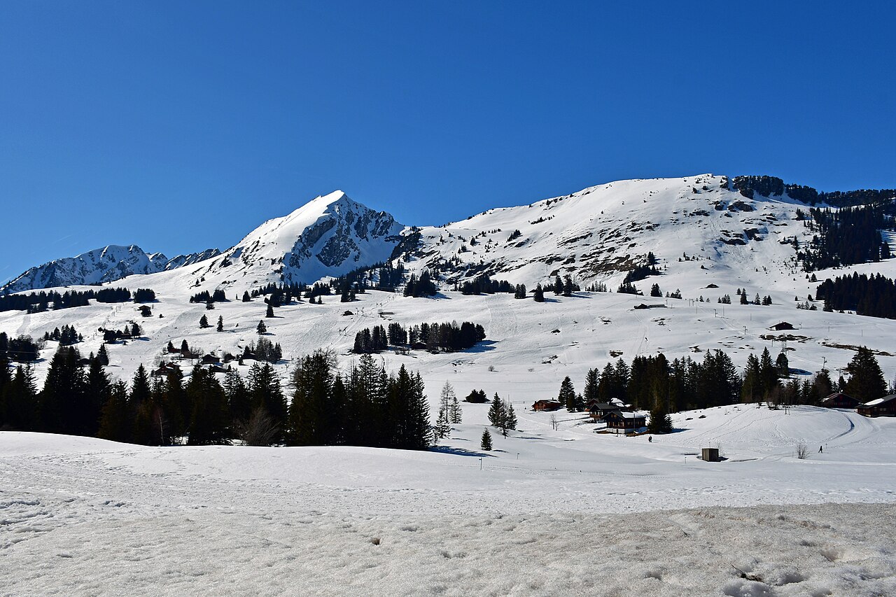
Les Mosses is a downhill ski area in Vaud, Switzerland. Mapped terrain includes easy, intermediate, advanced routes. Its mapped lift network extends from approximately 1380 to 1871 metres above sea level. Cross-country skiing is also mapped within the area.
Data: OpenSkiData / OpenSkiMap, OpenStreetMap contributors (ODbL), Skimap.org, Who's On First, Mapterhorn.
Les Mosses - Σταθμός βάσης
ECMWF · Εκτέλεση μοντέλου: Αναμενόμενη επόμενη ενημέρωση:
Ημέρα Ώρα (UTC) Θερμ. (°C) Υγρασία (%) Άνεμος (km/h) Άνεμος (κόμβοι) Άνεμος (Bft) Διεύθυνση Υετός (mm) Νέο χιόνι (cm) Πίεση (hPa) Σημείο παγοποίησης (m) Συνθήκες | Τετάρτη, 04/11 06:00 -2.7 90 3 2 1B E — — 1021 < 1318 Cloudy 68% cloud 09:00 3.1 76 3 1 1B E 0 0 1021 1996 Partly cloudy 33% cloud 12:00 6.1 61 2 1 1B E 0 0 1019 2291 Overcast 93% cloud 15:00 4.9 70 2 1 1B SE 0 0 1020 2172 Partly cloudy 32% cloud 18:00 0.5 80 4 2 1B SE 0 0 1021 1609 Clear 13% cloud 21:00 -0 77 5 3 1B SE 0 0 1022 1440 Clear 6% cloud Πέμπτη, 05/11 00:00 -0.4 79 5 3 1B SE 0 0 1023 < 1318 Partly cloudy 44% cloud 03:00 -0.6 81 6 3 2B SE 0 0 1022 < 1318 Partly cloudy 40% cloud 06:00 0.1 81 5 3 1B SE 0 0 1022 1512 Partly cloudy 45% cloud 09:00 5.8 66 4 2 1B SE 0 0 1023 2698 Clear 13% cloud 12:00 9.2 56 1 1 1B SE 0 0 1022 2805 Partly cloudy 46% cloud 15:00 8.3 67 1 1 1B E 0 0 1021 2768 Partly cloudy 22% cloud 18:00 2.7 78 3 2 1B SE 0 0 1021 2443 Clear 8% cloud 21:00 1.4 81 3 2 1B SE 0.02 0 1022 2142 Partly cloudy 42% cloud Παρασκευή, 06/11 00:00 1.2 86 3 2 1B SE 0 0 1021 2113 Overcast 92% cloud 03:00 1.4 88 2 1 1B SE 0 0 1021 2155 Overcast 96% cloud 06:00 0.7 93 2 1 1B S 0 0 1022 1803 Overcast 85% cloud 09:00 3.1 93 2 1 1B SW 0.09 0 1024 2206 Overcast 98% cloud 12:00 3 97 2 1 1B W 1.1 0 1023 2126 Overcast 100% cloud 15:00 2.1 99 1 0 0B W 2.5 0 1023 1943 Overcast 100% cloud 18:00 1.7 98 1 0 0B SE 2.7 0 1023 1826 Overcast 100% cloud 21:00 1.3 99 0 0 0B E 2.0 0 1024 1732 Overcast 100% cloud Σάββατο, 07/11 00:00 1.4 98 1 0 0B SE 0.67 0 1024 1723 Overcast 100% cloud 03:00 1.3 98 1 0 0B E 0.27 0 1023 1701 Overcast 100% cloud 06:00 1.2 98 1 1 0B E 0.21 0 1023 1665 Overcast 100% cloud 09:00 2.9 91 1 0 0B SE 0.03 0 1023 1923 Cloudy 53% cloud 12:00 5.1 71 1 1 1B NW 0.04 0 1021 2140 Overcast 91% cloud 15:00 4 82 2 1 1B NW 0.03 0 1021 2030 Overcast 94% cloud 18:00 2.1 94 1 1 0B SW 0.25 0 1023 1811 Overcast 80% cloud 21:00 -0.9 95 1 1 1B S 0 0 1023 < 1318 Cloudy 62% cloud Κυριακή, 08/11 00:00 -3 94 1 1 1B S 0 0 1023 < 1318 Overcast 90% cloud 03:00 -2.6 90 2 1 1B S 0 0 1023 < 1318 Partly cloudy 44% cloud 06:00 -3.2 90 2 1 1B S 0 0 1023 < 1318 Partly cloudy 36% cloud 09:00 2.2 83 2 1 1B S 0 0 1024 1864 Partly cloudy 22% cloud 12:00 6.2 52 4 2 1B W 0 0 1022 2303 Clear 3% cloud 15:00 5.7 57 3 2 1B W 0 0 1020 2328 Clear 12% cloud 18:00 1.7 66 3 1 1B S 0 0 1020 1908 Cloudy 79% cloud 21:00 2.5 81 4 2 1B SW 0.88 0 1020 2143 Overcast 100% cloud Δευτέρα, 09/11 00:00 2.8 80 3 2 1B S 0 0 1019 2173 Overcast 100% cloud 03:00 2.4 78 4 2 1B S 0 0 1018 2105 Cloudy 70% cloud 06:00 2 79 4 2 1B S 0 0 1018 2123 Overcast 91% cloud 09:00 6.5 68 6 3 1B S 0 0 1017 2641 Cloudy 79% cloud 12:00 9.1 57 5 3 1B SW 0.02 0 1016 2795 Overcast 100% cloud 15:00 7.4 66 4 2 1B S 0 0 1015 2790 Overcast 100% cloud 18:00 5.5 71 4 2 1B S 0.03 0 1015 2829 Overcast 100% cloud 21:00 4.4 76 5 3 1B S 0 0 1014 3069 Overcast 87% cloud Τρίτη, 10/11 00:00 3.2 80 5 3 1B S 0 0 1013 3063 Overcast 95% cloud 03:00 4.4 76 6 3 2B SE 0 0 1011 3047 Overcast 95% cloud 06:00 4.2 89 6 3 2B S 0.78 0 1011 3037 Overcast 100% cloud |
|---|
Forecast notes
Forecast table times: UTC.
Coordinates: 46.3978542°N, 7.0975146°E · Requested elevation: 1440 m. Model terrain: 1316 m. Terrain and 1000/925/850/700 hPa profiles are used for height estimates.
These are altitude estimates, not a simulation of local mountain terrain. Precipitation, cloud and sea-level pressure use horizontal interpolation only.
Precipitation includes rain and snow water equivalent: preceding 3 hours through day 6, then 6 hours (see cell tooltip). Snow (cm) estimates fresh snowfall from precipitation and temperature using the GFS conversion; it is not snow depth on the ground. Freezing (m) uses additional 600/500 hPa temperatures when available and estimates the lowest resolved 0°C crossing above sea level. When all sampled levels are warm, the upper profile limit is shown (see tooltip). < marks an entirely cold sampled profile and its lower height limit. No extrapolation is used.
Source: ECMWF · CC BY 4.0 · Processed by Snow Report.
Les Mosses - Άνω σταθμός
ECMWF · Εκτέλεση μοντέλου: Αναμενόμενη επόμενη ενημέρωση:
Ημέρα Ώρα (UTC) Θερμ. (°C) Υγρασία (%) Άνεμος (km/h) Άνεμος (κόμβοι) Άνεμος (Bft) Διεύθυνση Υετός (mm) Νέο χιόνι (cm) Πίεση (hPa) Σημείο παγοποίησης (m) Συνθήκες | Τετάρτη, 04/11 06:00 -3.7 85 5 3 1B SE — — 1021 < 1279 Cloudy 68% cloud 09:00 0.6 72 7 4 2B SE 0 0 1021 1984 Partly cloudy 35% cloud 12:00 2.9 62 8 4 2B SE 0 0 1019 2286 Overcast 92% cloud 15:00 2 72 11 6 2B SE 0 0 1020 2177 Partly cloudy 31% cloud 18:00 -0.6 73 8 4 2B S 0 0 1021 1689 Clear 14% cloud 21:00 -0.7 68 8 4 2B SE 0 0 1022 1571 Clear 7% cloud Πέμπτη, 05/11 00:00 -0.9 69 9 5 2B SE 0 0 1023 1343 Partly cloudy 44% cloud 03:00 -0.9 72 11 6 2B SE 0 0 1022 < 1279 Partly cloudy 42% cloud 06:00 -0.3 72 9 5 2B SE 0 0 1022 1662 Partly cloudy 48% cloud 09:00 3.9 63 7 4 2B S 0 0 1023 2706 Clear 12% cloud 12:00 6.4 57 4 2 1B SE 0 0 1021 2810 Partly cloudy 48% cloud 15:00 5.7 67 4 2 1B SE 0 0 1021 2772 Partly cloudy 25% cloud 18:00 1.8 72 6 3 2B SE 0 0 1021 2489 Clear 8% cloud 21:00 0.6 77 8 4 2B SE 0.02 0 1022 2175 Partly cloudy 41% cloud Παρασκευή, 06/11 00:00 0.5 82 8 5 2B SE 0 0 1021 2160 Overcast 92% cloud 03:00 0.6 85 9 5 2B SE 0 0 1021 2184 Overcast 97% cloud 06:00 -0 90 8 5 2B SE 0 0 1022 1852 Overcast 86% cloud 09:00 1.3 93 8 4 2B SE 0.11 0 1024 2204 Overcast 99% cloud 12:00 1.1 98 4 2 1B S 1.2 0.4 1023 2121 Overcast 100% cloud 15:00 0.4 99 1 1 1B SW 2.5 0.7 1023 1958 Overcast 100% cloud 18:00 -0.1 98 1 1 1B NE 2.4 0.7 1023 1848 Overcast 100% cloud 21:00 -0.6 99 3 2 1B NE 2.1 0.6 1024 1743 Overcast 100% cloud Σάββατο, 07/11 00:00 -0.7 99 1 1 1B NE 0.69 0.2 1024 1735 Overcast 100% cloud 03:00 -0.8 99 1 1 1B NE 0.28 0.1 1023 1714 Overcast 100% cloud 06:00 -1.1 99 2 1 1B E 0.24 0 1023 1676 Overcast 100% cloud 09:00 0.3 91 2 1 1B SE 0.02 0 1023 1928 Cloudy 54% cloud 12:00 2 75 3 1 1B S 0.05 0 1021 2148 Overcast 91% cloud 15:00 1.1 85 5 2 1B SW 0.04 0 1021 2036 Overcast 93% cloud 18:00 -0.3 93 6 3 2B SW 0.24 0 1023 1830 Cloudy 80% cloud 21:00 -2.3 84 6 3 2B SW 0 0 1023 1286 Cloudy 64% cloud Κυριακή, 08/11 00:00 -3.8 80 7 4 2B SW 0 0 1023 < 1279 Overcast 92% cloud 03:00 -3.4 76 8 4 2B SW 0 0 1023 < 1279 Partly cloudy 45% cloud 06:00 -3.7 73 8 4 2B SW 0 0 1023 < 1279 Partly cloudy 35% cloud 09:00 0.1 73 10 5 2B SW 0 0 1024 1885 Partly cloudy 21% cloud 12:00 3.2 48 14 8 3B SW 0 0 1022 2311 Clear 3% cloud 15:00 3.1 57 14 8 3B SW 0 0 1020 2341 Clear 12% cloud 18:00 0.4 73 15 8 3B SW 0 0 1020 1974 Overcast 82% cloud 21:00 1.1 85 19 10 3B SW 0.95 0.3 1020 2177 Overcast 100% cloud Δευτέρα, 09/11 00:00 1.3 84 16 8 3B SW 0 0 1019 2202 Overcast 100% cloud 03:00 1 81 17 9 3B SW 0 0 1018 2145 Cloudy 72% cloud 06:00 1 79 17 9 3B SW 0 0 1018 2185 Overcast 92% cloud 09:00 4.4 73 20 11 3B SW 0 0 1017 2655 Overcast 81% cloud 12:00 6.4 64 21 12 4B SW 0.02 0 1016 2802 Overcast 100% cloud 15:00 5.3 73 18 10 3B SW 0 0 1015 2802 Overcast 100% cloud 18:00 4 76 19 10 3B SW 0.02 0 1015 2839 Overcast 100% cloud 21:00 3.5 79 17 9 3B SW 0 0 1014 3069 Overcast 87% cloud Τρίτη, 10/11 00:00 2.7 83 16 9 3B SW 0 0 1013 3063 Overcast 95% cloud 03:00 3.6 78 19 10 3B SW 0 0 1011 3047 Overcast 95% cloud 06:00 3.3 91 18 9 3B SW 0.79 0 1011 3037 Overcast 100% cloud |
|---|
Forecast notes
Forecast table times: UTC.
Coordinates: 46.3916136°N, 7.0714701°E · Requested elevation: 1871 m. Model terrain: 1276 m. Terrain and 1000/925/850/700 hPa profiles are used for height estimates.
These are altitude estimates, not a simulation of local mountain terrain. Precipitation, cloud and sea-level pressure use horizontal interpolation only.
Precipitation includes rain and snow water equivalent: preceding 3 hours through day 6, then 6 hours (see cell tooltip). Snow (cm) estimates fresh snowfall from precipitation and temperature using the GFS conversion; it is not snow depth on the ground. Freezing (m) uses additional 600/500 hPa temperatures when available and estimates the lowest resolved 0°C crossing above sea level. When all sampled levels are warm, the upper profile limit is shown (see tooltip). < marks an entirely cold sampled profile and its lower height limit. No extrapolation is used.