Previsiones para estaciones de esquí de todo el mundo

Guía de colores Temperatura · Viento · Lluvia · Nieve
Cada color comienza en el valor indicado. Los colores del viento coinciden en las tres unidades. Las celdas sin precipitación permanecen neutras. Los colores describen los valores mostrados, no son avisos meteorológicos oficiales.
Le Brassus - Base lift station
ECMWF · Ejecución del modelo: Próxima actualización prevista:
Día Hora (UTC) Temp. (°C) Humedad (%) Viento (km/h) Viento (nudos) Viento (Bft) Dirección Precip. (mm) Nieve nueva (cm) Presión (hPa) Isoterma de 0 °C (m) Condiciones | Miércoles, 04/11 06:00 1.3 87 11 6 2B NE — — 1021 2035 Cloudy 53% cloud  09:00 4.2 74 10 5 2B E 0 0 1022 2077 Partly cloudy 39% cloud  12:00 6.5 65 8 4 2B E 0 0 1021 2148 Overcast 85% cloud  15:00 5.9 74 6 3 2B E 0 0 1020 2198 Overcast 93% cloud 18:00 3.1 80 7 4 2B E 0 0 1021 2315 Partly cloudy 24% cloud 21:00 2.6 84 4 2 1B E 0 0 1022 2400 Partly cloudy 41% cloud Jueves, 05/11 00:00 2.7 80 6 3 2B E 0 0 1022 2480 Cloudy 73% cloud 03:00 3 74 6 3 2B E 0 0 1021 2581 Partly cloudy 38% cloud 06:00 3.3 74 4 2 1B E 0 0 1022 2609 Partly cloudy 21% cloud 09:00 7.7 61 4 2 1B SE 0 0 1022 2615 Clear 10% cloud  12:00 10.9 57 1 0 0B E 0 0 1022 2645 Partly cloudy 38% cloud 15:00 10 70 4 2 1B NE 0 0 1021 2681 Clear 15% cloud 18:00 6.7 69 7 4 2B NE 0 0 1021 2723 Clear 19% cloud 21:00 5 73 1 1 0B NE 0 0 1022 2668 Partly cloudy 39% cloud Viernes, 06/11 00:00 3.4 84 1 1 0B N 0 0 1022 2627 Overcast 91% cloud 03:00 3.4 89 2 1 1B NW 0.08 0 1022 2491 Overcast 94% cloud 06:00 2.9 91 3 2 1B N 0.02 0 1022 2190 Overcast 99% cloud 09:00 4.3 98 3 1 1B N 1.8 0 1024 1948 Overcast 100% cloud 12:00 4.8 97 2 1 1B N 3.2 0 1023 1910 Overcast 100% cloud 15:00 4.8 98 3 2 1B N 0.90 0 1023 1914 Overcast 100% cloud 18:00 4.2 99 4 2 1B NW 0.45 0 1023 1822 Overcast 100% cloud 21:00 4.1 99 3 2 1B NW 0.58 0 1024 1810 Overcast 100% cloud Sábado, 07/11 00:00 4 98 1 0 0B NW 0.30 0 1024 1795 Overcast 100% cloud 03:00 3.5 97 1 1 0B W 0.37 0 1023 1767 Overcast 100% cloud 06:00 3.6 97 2 1 1B W 0.31 0 1023 1763 Overcast 100% cloud 09:00 5.1 93 1 1 0B W 0.05 0 1023 1800 Cloudy 73% cloud 12:00 6.2 87 2 1 1B N 0.36 0 1022 1870 Overcast 91% cloud 15:00 5.4 92 2 1 1B N 0.69 0 1022 1849 Cloudy 72% cloud 18:00 4.1 96 2 1 1B E 0.16 0 1023 1873 Cloudy 77% cloud 21:00 2.7 94 3 2 1B SE 0 0 1023 1965 Cloudy 63% cloud Domingo, 08/11 00:00 2.2 94 4 2 1B S 0 0 1023 1943 Cloudy 63% cloud 03:00 2.4 95 6 3 2B S 0 0 1023 1926 Cloudy 74% cloud 06:00 2.6 91 7 4 2B SW 0 0 1023 1994 Cloudy 77% cloud 09:00 5 86 8 4 2B S 0 0 1024 2093 Cloudy 60% cloud 12:00 7.7 64 12 7 3B S 0 0 1022 2215 Clear 10% cloud 15:00 7.8 70 9 5 2B SW 0 0 1020 2406 Partly cloudy 31% cloud 18:00 6.5 75 9 5 2B S 0.12 0 1020 2466 Overcast 99% cloud 21:00 6.2 87 13 7 3B S 1.2 0 1020 2497 Overcast 99% cloud Lunes, 09/11 00:00 6.8 85 16 9 3B SW 0.72 0 1019 2597 Overcast 100% cloud 03:00 7.3 83 17 9 3B SW 0 0 1017 2614 Overcast 92% cloud 06:00 8 84 18 10 3B SW 0.45 0 1017 2694 Overcast 100% cloud 09:00 10.6 77 21 11 4B SW 0.23 0 1016 2788 Overcast 92% cloud 12:00 12 70 22 12 4B SW 0 0 1015 2829 Overcast 99% cloud 15:00 11.7 71 22 12 4B SW 0 0 1014 2887 Overcast 100% cloud 18:00 10.8 79 20 11 4B SW 0.20 0 1013 2959 Overcast 99% cloud 21:00 10.8 75 21 11 4B SW 0.01 0 1013 3064 Overcast 95% cloud Martes, 10/11 00:00 10.6 72 19 10 3B SW 0 0 1012 3058 Overcast 88% cloud 03:00 11.4 69 16 9 3B S 0 0 1009 3039 Overcast 98% cloud 06:00 9.4 89 17 9 3B S 2.0 0 1009 3027 Overcast 100% cloud |
|---|
Forecast notes
Forecast table times: UTC.
Coordinates: 46.5788946°N, 6.2141352°E · Requested elevation: 1062 m. Model terrain: 983 m. Terrain and 1000/925/850/700 hPa profiles are used for height estimates.
These are altitude estimates, not a simulation of local mountain terrain. Precipitation, cloud and sea-level pressure use horizontal interpolation only.
Precipitation includes rain and snow water equivalent: preceding 3 hours through day 6, then 6 hours (see cell tooltip). Snow (cm) estimates fresh snowfall from precipitation and temperature using the GFS conversion; it is not snow depth on the ground. Freezing (m) uses additional 600/500 hPa temperatures when available and estimates the lowest resolved 0°C crossing above sea level. When all sampled levels are warm, the upper profile limit is shown (see tooltip). < marks an entirely cold sampled profile and its lower height limit. No extrapolation is used.
Source: ECMWF · CC BY 4.0 · Processed by Snow Report.
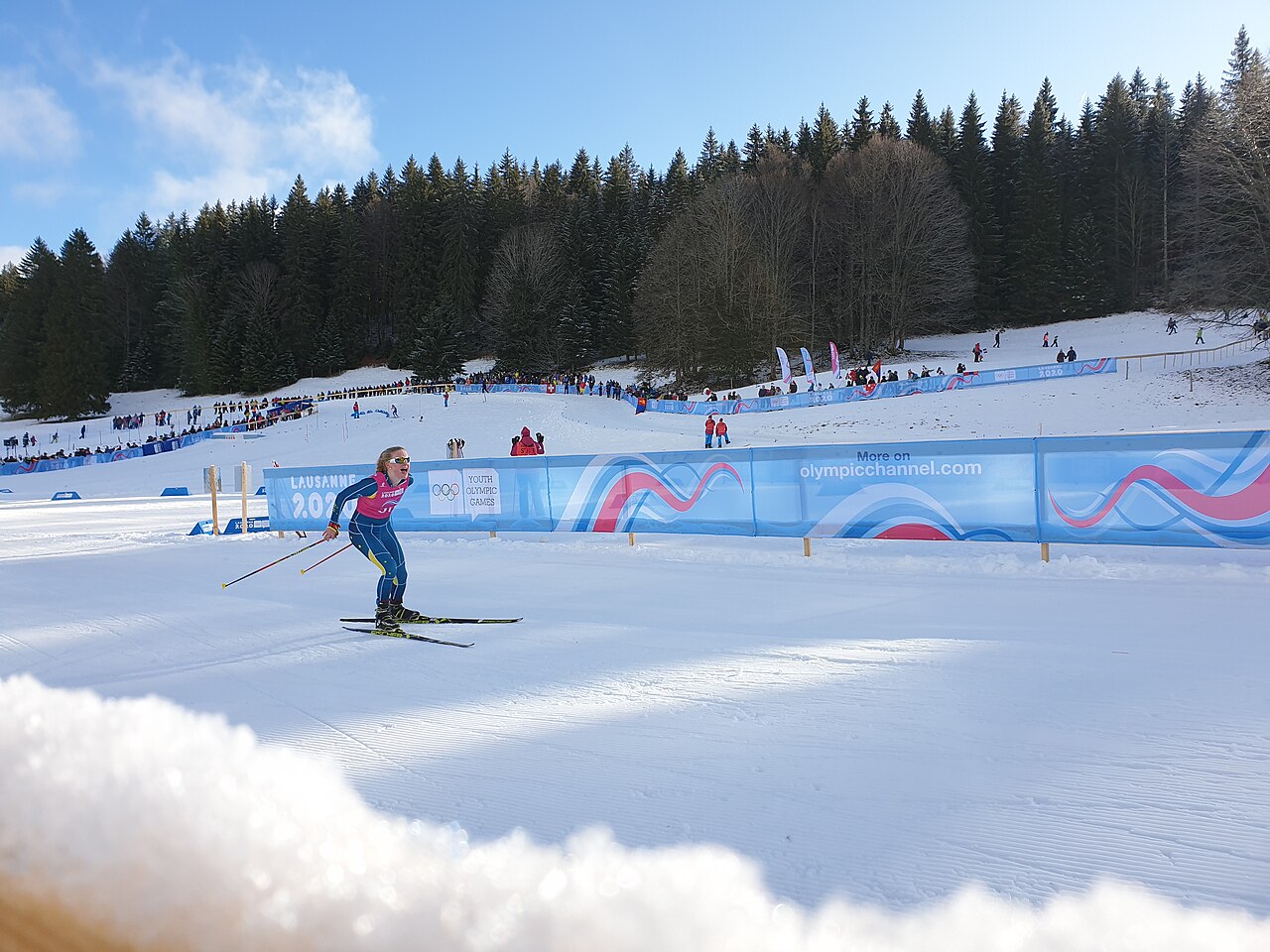
Le Brassus is a mapped downhill ski area in CH. Forecasts cover three real lift-station locations from approximately 1062 to 1366 metres. Elevations are terrain-model estimates.
Data: OpenSkiData / OpenSkiMap, OpenStreetMap contributors (ODbL), Skimap.org, Who's On First, Mapterhorn.
Le Brassus - Middle lift station
ECMWF · Ejecución del modelo: Próxima actualización prevista:
Día Hora (UTC) Temp. (°C) Humedad (%) Viento (km/h) Viento (nudos) Viento (Bft) Dirección Precip. (mm) Nieve nueva (cm) Presión (hPa) Isoterma de 0 °C (m) Condiciones | Miércoles, 04/11 06:00 1.8 77 13 7 3B NE — — 1021 2035 Cloudy 53% cloud 09:00 4.1 69 12 7 3B NE 0 0 1022 2077 Partly cloudy 38% cloud 12:00 5.9 63 8 4 2B E 0 0 1021 2148 Overcast 86% cloud 15:00 5.6 71 6 3 1B E 0 0 1020 2198 Overcast 93% cloud 18:00 3.7 70 7 4 2B E 0 0 1021 2314 Partly cloudy 24% cloud 21:00 3.3 75 4 2 1B E 0 0 1022 2399 Partly cloudy 40% cloud Jueves, 05/11 00:00 3.6 69 8 4 2B E 0 0 1022 2480 Cloudy 72% cloud 03:00 3.9 65 7 4 2B E 0 0 1021 2581 Partly cloudy 38% cloud 06:00 4.1 66 5 3 1B E 0 0 1022 2608 Partly cloudy 20% cloud 09:00 7.7 56 5 3 1B SE 0 0 1022 2614 Clear 10% cloud 12:00 10.2 54 0 0 0B NE 0 0 1022 2645 Partly cloudy 38% cloud 15:00 9.6 67 6 3 2B NE 0 0 1021 2680 Clear 14% cloud 18:00 7.1 62 10 6 2B NE 0 0 1021 2722 Clear 19% cloud 21:00 5.5 66 4 2 1B NE 0 0 1022 2668 Partly cloudy 40% cloud Viernes, 06/11 00:00 3.9 78 3 2 1B NE 0 0 1022 2627 Overcast 91% cloud 03:00 3.6 84 3 2 1B N 0.09 0 1022 2491 Overcast 94% cloud 06:00 2.8 89 6 3 2B N 0.03 0 1022 2189 Overcast 99% cloud 09:00 3.6 98 6 3 2B N 1.9 0 1024 1946 Overcast 100% cloud 12:00 4 97 5 3 1B N 3.2 0 1023 1909 Overcast 100% cloud 15:00 4.1 98 6 3 2B N 0.89 0 1023 1914 Overcast 100% cloud 18:00 3.5 99 7 4 2B N 0.44 0 1023 1822 Overcast 100% cloud 21:00 3.5 99 6 3 2B N 0.57 0 1024 1810 Overcast 100% cloud Sábado, 07/11 00:00 3.4 98 2 1 1B N 0.30 0 1024 1795 Overcast 100% cloud 03:00 3 98 1 1 1B NW 0.37 0 1023 1766 Overcast 100% cloud 06:00 3.1 97 2 1 1B W 0.31 0 1023 1764 Overcast 100% cloud 09:00 4.2 94 1 0 0B N 0.05 0 1023 1801 Cloudy 72% cloud 12:00 5.2 89 2 1 1B N 0.36 0 1022 1872 Overcast 91% cloud 15:00 4.6 93 2 1 1B NE 0.70 0 1022 1851 Cloudy 71% cloud 18:00 3.6 95 4 2 1B E 0.16 0 1023 1873 Cloudy 77% cloud 21:00 2.6 92 5 3 1B SE 0 0 1023 1965 Cloudy 64% cloud Domingo, 08/11 00:00 2.2 91 9 5 2B SW 0 0 1023 1944 Cloudy 64% cloud 03:00 2.3 92 12 6 2B SW 0 0 1023 1926 Cloudy 75% cloud 06:00 2.5 87 13 7 3B SW 0 0 1023 1995 Cloudy 78% cloud 09:00 4.5 80 14 7 3B S 0 0 1024 2093 Cloudy 61% cloud 12:00 6.7 65 18 10 3B S 0 0 1022 2216 Clear 10% cloud 15:00 7.1 72 15 8 3B SW 0 0 1020 2407 Partly cloudy 31% cloud 18:00 6.3 75 17 9 3B S 0.12 0 1020 2466 Overcast 99% cloud 21:00 6 85 21 12 4B SW 1.1 0 1020 2497 Overcast 99% cloud Lunes, 09/11 00:00 6.7 85 26 14 4B SW 0.68 0 1019 2596 Overcast 100% cloud 03:00 7.2 83 28 15 4B SW 0 0 1017 2614 Overcast 92% cloud 06:00 7.8 84 28 15 4B SW 0.46 0 1017 2694 Overcast 100% cloud 09:00 10 77 30 16 5B SW 0.23 0 1016 2788 Overcast 92% cloud 12:00 11.1 73 32 17 5B SW 0 0 1015 2829 Overcast 99% cloud 15:00 11 72 32 17 5B SW 0 0 1014 2887 Overcast 100% cloud 18:00 10.4 78 30 16 5B SW 0.19 0 1013 2960 Overcast 99% cloud 21:00 10.7 74 31 17 5B SW 0.01 0 1013 3064 Overcast 95% cloud Martes, 10/11 00:00 10.6 71 31 17 5B SW 0 0 1012 3058 Overcast 88% cloud 03:00 11.3 68 27 15 4B S 0 0 1009 3039 Overcast 98% cloud 06:00 9.7 85 28 15 4B S 2.0 0 1009 3027 Overcast 100% cloud |
|---|
Forecast notes
Forecast table times: UTC.
Coordinates: 46.5744338°N, 6.2125949°E · Requested elevation: 1172 m. Model terrain: 982 m. Terrain and 1000/925/850/700 hPa profiles are used for height estimates.
These are altitude estimates, not a simulation of local mountain terrain. Precipitation, cloud and sea-level pressure use horizontal interpolation only.
Precipitation includes rain and snow water equivalent: preceding 3 hours through day 6, then 6 hours (see cell tooltip). Snow (cm) estimates fresh snowfall from precipitation and temperature using the GFS conversion; it is not snow depth on the ground. Freezing (m) uses additional 600/500 hPa temperatures when available and estimates the lowest resolved 0°C crossing above sea level. When all sampled levels are warm, the upper profile limit is shown (see tooltip). < marks an entirely cold sampled profile and its lower height limit. No extrapolation is used.
Source: ECMWF · CC BY 4.0 · Processed by Snow Report.
Le Brassus - Top lift station
ECMWF · Ejecución del modelo: Próxima actualización prevista:
Día Hora (UTC) Temp. (°C) Humedad (%) Viento (km/h) Viento (nudos) Viento (Bft) Dirección Precip. (mm) Nieve nueva (cm) Presión (hPa) Isoterma de 0 °C (m) Condiciones | Miércoles, 04/11 06:00 2.9 63 16 9 3B NE — — 1022 2031 Cloudy 55% cloud 09:00 3.8 60 16 9 3B NE 0 0 1022 2075 Partly cloudy 40% cloud 12:00 4.9 58 9 5 2B E 0 0 1021 2147 Overcast 86% cloud 15:00 4.9 66 5 3 1B E 0 0 1021 2197 Overcast 92% cloud 18:00 4.7 55 10 5 2B E 0 0 1021 2313 Partly cloudy 24% cloud 21:00 4.7 61 6 3 1B SE 0 0 1022 2398 Partly cloudy 42% cloud Jueves, 05/11 00:00 5.2 54 10 5 2B E 0 0 1022 2479 Cloudy 72% cloud 03:00 5.5 50 10 6 2B E 0 0 1021 2581 Partly cloudy 38% cloud 06:00 5.5 54 6 3 2B E 0 0 1022 2611 Partly cloudy 21% cloud 09:00 7.8 47 6 3 2B S 0 0 1022 2616 Clear 11% cloud 12:00 9 49 1 1 0B NW 0 0 1022 2647 Partly cloudy 39% cloud 15:00 8.9 60 9 5 2B NE 0 0 1021 2683 Clear 15% cloud 18:00 7.8 50 16 9 3B NE 0 0 1021 2726 Clear 19% cloud 21:00 6.4 55 9 5 2B NE 0 0 1022 2671 Partly cloudy 38% cloud Viernes, 06/11 00:00 4.8 67 6 3 2B NE 0 0 1022 2628 Overcast 91% cloud 03:00 3.9 76 5 3 1B N 0.09 0 1022 2495 Overcast 94% cloud 06:00 2.6 87 12 6 2B N 0.02 0 1022 2195 Overcast 99% cloud 09:00 2.5 99 12 7 2B N 1.7 0 1024 1947 Overcast 100% cloud 12:00 2.7 98 9 5 2B N 3.2 0 1023 1910 Overcast 100% cloud 15:00 2.8 98 11 6 2B N 0.90 0 1023 1914 Overcast 100% cloud 18:00 2.4 99 14 7 3B N 0.45 0 1023 1823 Overcast 100% cloud 21:00 2.3 99 12 6 2B N 0.59 0 1024 1809 Overcast 100% cloud Sábado, 07/11 00:00 2.3 98 6 3 2B N 0.30 0 1024 1795 Overcast 100% cloud 03:00 2.1 98 3 2 1B N 0.38 0 1023 1767 Overcast 100% cloud 06:00 2.2 96 3 1 1B W 0.31 0 1023 1766 Overcast 100% cloud 09:00 2.8 94 2 1 1B NE 0.04 0 1023 1805 Cloudy 72% cloud 12:00 3.4 92 3 2 1B N 0.37 0 1022 1875 Overcast 91% cloud 15:00 3 93 3 2 1B NE 0.72 0 1022 1851 Cloudy 70% cloud 18:00 2.7 92 6 3 2B SE 0.17 0 1023 1874 Cloudy 78% cloud 21:00 2.5 88 10 5 2B S 0 0 1023 1962 Cloudy 63% cloud Domingo, 08/11 00:00 2.2 86 17 9 3B SW 0 0 1023 1945 Cloudy 63% cloud 03:00 2.2 88 22 12 4B SW 0 0 1023 1925 Cloudy 75% cloud 06:00 2.5 81 23 12 4B SW 0 0 1023 1994 Cloudy 78% cloud 09:00 3.7 69 24 13 4B SW 0 0 1024 2090 Cloudy 64% cloud 12:00 5 65 27 15 4B SW 0 0 1022 2216 Clear 10% cloud 15:00 5.8 76 25 14 4B SW 0 0 1020 2407 Partly cloudy 31% cloud 18:00 6.1 74 30 16 5B SW 0.12 0 1020 2465 Overcast 100% cloud 21:00 5.7 81 36 20 5B SW 1.2 0 1020 2492 Overcast 99% cloud Lunes, 09/11 00:00 6.5 84 43 23 6B SW 0.73 0 1019 2595 Overcast 100% cloud 03:00 7 84 46 25 6B SW 0 0 1017 2614 Overcast 92% cloud 06:00 7.6 83 47 25 6B SW 0.48 0 1017 2694 Overcast 100% cloud 09:00 9 76 47 25 6B SW 0.24 0 1016 2790 Overcast 92% cloud 12:00 9.5 77 49 26 6B SW 0 0 1015 2830 Overcast 99% cloud 15:00 9.7 74 49 27 6B SW 0 0 1014 2888 Overcast 100% cloud 18:00 9.8 77 48 26 6B SW 0.19 0 1013 2958 Overcast 99% cloud 21:00 10.4 71 50 27 7B SW 0.00 0 1013 3064 Overcast 95% cloud Martes, 10/11 00:00 10.8 67 50 27 7B SW 0 0 1012 3058 Overcast 88% cloud 03:00 11.4 66 45 24 6B SW 0 0 1009 3039 Overcast 98% cloud 06:00 10.1 78 48 26 6B S 2.0 0 1009 3027 Overcast 100% cloud |
|---|
Forecast notes
Forecast table times: UTC.
Coordinates: 46.574416°N, 6.2274791°E · Requested elevation: 1366 m. Model terrain: 981 m. Terrain and 1000/925/850/700 hPa profiles are used for height estimates.
These are altitude estimates, not a simulation of local mountain terrain. Precipitation, cloud and sea-level pressure use horizontal interpolation only.
Precipitation includes rain and snow water equivalent: preceding 3 hours through day 6, then 6 hours (see cell tooltip). Snow (cm) estimates fresh snowfall from precipitation and temperature using the GFS conversion; it is not snow depth on the ground. Freezing (m) uses additional 600/500 hPa temperatures when available and estimates the lowest resolved 0°C crossing above sea level. When all sampled levels are warm, the upper profile limit is shown (see tooltip). < marks an entirely cold sampled profile and its lower height limit. No extrapolation is used.