Wettervorhersagen für Skigebiete weltweit

Farbskala Temperatur · Wind · Regen · Schnee
Jede Farbe beginnt beim angegebenen Wert. Die Windfarben stimmen in allen drei Einheiten überein. Trockene Zellen bleiben neutral. Die Farben beschreiben die Werte und sind keine amtlichen Wetterwarnungen.
Diagramme werden vorbereitet…
Zeiten und Werte entsprechen der detaillierten Vorhersage. Tippen Sie auf einen Wert für Details und scrollen Sie seitlich für spätere Tage. Niederschlag ist das gesamte Wasseräquivalent je Intervall einschließlich Schnee. Neuschnee gilt je Intervall und ist keine Schneehöhe am Boden.
Vergleich von GFS und ECMWF. Jedes Modell behält seine eigenen Vorhersagezeiten und seinen Zeitraum. Niederschlags- und Schneemengen gelten für die jeweiligen, möglicherweise unterschiedlichen Intervalle.
Vorhersagewerte und Modellhinweise
La Berra - Low lift station
ECMWF · Modelllauf: Nächste Aktualisierung erwartet:
Tag Uhrzeit (UTC) Temp. (°C) Luftfeuchtigkeit (%) Wind (km/h) Wind (Knoten) Wind (Bft) Richtung Niederschlag (mm) Neuschnee (cm) Luftdruck (hPa) Nullgradgrenze (m) Wetterlage | Mittwoch, 04/11 06:00 -0.2 91 4 2 1B E — — 1023 < 1013 Cloudy 70% cloud  09:00 3.6 82 9 5 2B NE 0 0 1022 1809 Cloudy 62% cloud 12:00 6.3 72 8 4 2B NE 0 0 1021 2131 Cloudy 79% cloud 15:00 5.3 80 7 4 2B NE 0 0 1021 2029 Cloudy 59% cloud 18:00 1.4 90 4 2 1B E 0 0 1022 1518 Clear 13% cloud  21:00 0.5 86 3 2 1B SE 0 0 1023 1253 Partly cloudy 25% cloud  Donnerstag, 05/11 00:00 -0.1 84 4 2 1B SE 0 0 1023 < 1013 Partly cloudy 48% cloud 03:00 0.3 84 4 2 1B SE 0 0 1022 1248 Partly cloudy 35% cloud 06:00 0.5 84 4 2 1B SE 0 0 1023 1432 Partly cloudy 47% cloud 09:00 6 72 1 1 1B E 0 0 1024 2625 Partly cloudy 25% cloud 12:00 8.6 72 2 1 1B N 0 0 1023 2701 Partly cloudy 32% cloud 15:00 8.5 78 3 2 1B NE 0 0 1022 2675 Clear 14% cloud 18:00 4.3 83 3 2 1B E 0 0 1022 2518 Clear 11% cloud 21:00 2.8 80 2 1 1B SE 0 0 1022 2346 Clear 15% cloud Freitag, 06/11 00:00 2.3 82 2 1 1B SE 0 0 1022 2265 Overcast 84% cloud  03:00 2.7 85 3 2 1B S 0 0 1022 2336 Overcast 95% cloud 06:00 2.2 93 4 2 1B S 0 0 1022 2160 Overcast 86% cloud 09:00 5.6 86 8 4 2B SW 0 0 1023 2384 Overcast 88% cloud 12:00 6.3 86 8 4 2B W 0.34 0 1023 2292 Overcast 99% cloud 15:00 4.9 96 3 2 1B SW 2.0 0 1023 2091 Overcast 100% cloud 18:00 4.2 97 2 1 1B SE 2.8 0 1023 1945 Overcast 100% cloud 21:00 3.9 96 4 2 1B S 2.6 0 1024 1864 Overcast 100% cloud Samstag, 07/11 00:00 3.9 96 4 2 1B S 0.61 0 1023 1819 Overcast 99% cloud 03:00 3.9 95 4 2 1B S 0.13 0 1023 1764 Overcast 100% cloud 06:00 3.9 94 3 2 1B S 0.13 0 1023 1734 Overcast 100% cloud 09:00 5.7 89 1 1 1B W 0.02 0 1023 1940 Partly cloudy 39% cloud 12:00 6.8 81 5 3 1B N 0.27 0 1022 2050 Overcast 98% cloud 15:00 5.9 89 4 2 1B NE 0.58 0 1022 1961 Overcast 93% cloud 18:00 4.2 94 1 1 1B SE 0.30 0 1023 1777 Overcast 91% cloud 21:00 2.3 94 2 1 1B S 0 0 1023 1530 Cloudy 69% cloud Sonntag, 08/11 00:00 0.5 92 3 2 1B S 0 0 1023 1162 Cloudy 68% cloud 03:00 0.5 94 4 2 1B S 0 0 1023 1170 Cloudy 60% cloud 06:00 -0.1 92 3 2 1B S 0 0 1023 1014 Cloudy 56% cloud 09:00 5 86 1 0 0B SE 0 0 1024 1935 Clear 9% cloud 12:00 7.8 71 3 2 1B W 0 0 1022 2223 Clear 9% cloud 15:00 7.4 78 0 0 0B N 0 0 1021 2289 Clear 9% cloud 18:00 3.4 69 3 2 1B SE 0 0 1020 1960 Cloudy 62% cloud 21:00 4 75 5 3 1B S 0.45 0 1020 2147 Overcast 100% cloud Montag, 09/11 00:00 3.9 87 4 2 1B S 0.49 0 1019 2101 Overcast 98% cloud 03:00 3.8 84 5 3 1B S 0 0 1018 2108 Cloudy 72% cloud 06:00 3.2 82 6 3 2B SE 0 0 1017 2125 Overcast 89% cloud 09:00 8 73 5 3 1B S 0 0 1017 2612 Overcast 85% cloud 12:00 10.9 65 3 2 1B SW 0 0 1016 2749 Overcast 100% cloud 15:00 9.9 71 3 2 1B S 0 0 1014 2764 Overcast 99% cloud 18:00 7.9 68 6 3 2B SE 0.02 0 1014 2822 Overcast 100% cloud 21:00 6.5 72 7 4 2B S 0.06 0 1013 3064 Overcast 87% cloud Dienstag, 10/11 00:00 5.5 74 8 4 2B SE 0 0 1012 3059 Overcast 90% cloud 03:00 6.1 71 7 4 2B SE 0 0 1010 3044 Overcast 96% cloud 06:00 6.8 77 7 4 2B S 0.21 0 1009 3032 Overcast 100% cloud |
|---|
Forecast notes
Forecast table times: UTC.
Coordinates: 46.6866078°N, 7.1549781°E · Requested elevation: 1038 m. Model terrain: 1010 m. Terrain and 1000/925/850/700 hPa profiles are used for height estimates.
These are altitude estimates, not a simulation of local mountain terrain. Precipitation, cloud and sea-level pressure use horizontal interpolation only.
Precipitation includes rain and snow water equivalent: preceding 3 hours through day 6, then 6 hours (see cell tooltip). Snow (cm) estimates fresh snowfall from precipitation and temperature using the GFS conversion; it is not snow depth on the ground. Freezing (m) uses additional 600/500 hPa temperatures when available and estimates the lowest resolved 0°C crossing above sea level. When all sampled levels are warm, the upper profile limit is shown (see tooltip). < marks an entirely cold sampled profile and its lower height limit. No extrapolation is used.
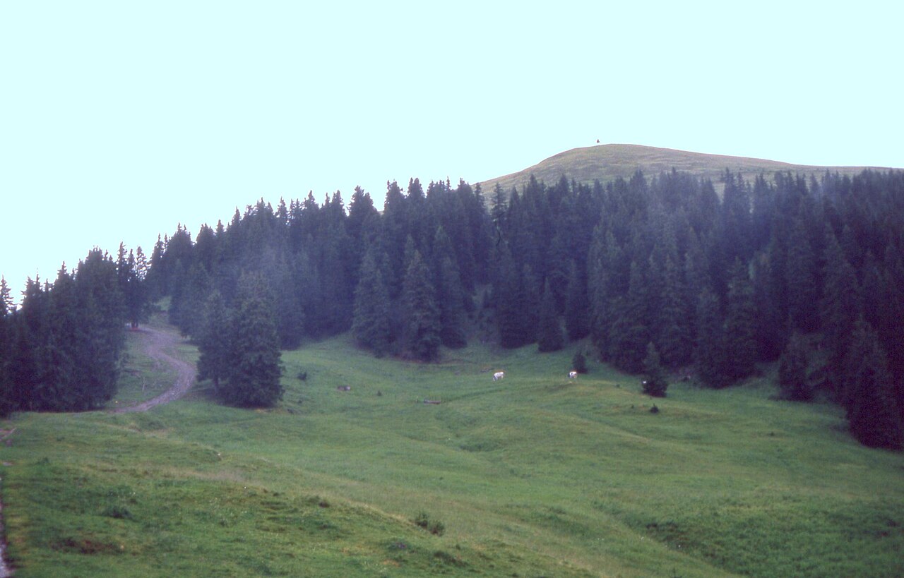
La Berra is a downhill ski area in Fribourg, Switzerland. Mapped terrain includes easy, intermediate routes. Its mapped lift network extends from approximately 1038 to 1633 metres above sea level.
Data: OpenSkiData / OpenSkiMap, OpenStreetMap contributors (ODbL), Skimap.org, Who's On First, Mapterhorn.
Diagramme werden vorbereitet…
Zeiten und Werte entsprechen der detaillierten Vorhersage. Tippen Sie auf einen Wert für Details und scrollen Sie seitlich für spätere Tage. Niederschlag ist das gesamte Wasseräquivalent je Intervall einschließlich Schnee. Neuschnee gilt je Intervall und ist keine Schneehöhe am Boden.
Vergleich von GFS und ECMWF. Jedes Modell behält seine eigenen Vorhersagezeiten und seinen Zeitraum. Niederschlags- und Schneemengen gelten für die jeweiligen, möglicherweise unterschiedlichen Intervalle.
Vorhersagewerte und Modellhinweise
La Berra - Base lift station
ECMWF · Modelllauf: Nächste Aktualisierung erwartet:
Tag Uhrzeit (UTC) Temp. (°C) Luftfeuchtigkeit (%) Wind (km/h) Wind (Knoten) Wind (Bft) Richtung Niederschlag (mm) Neuschnee (cm) Luftdruck (hPa) Nullgradgrenze (m) Wetterlage | Mittwoch, 04/11 06:00 -0.2 91 4 2 1B E — — 1023 < 1013 Cloudy 70% cloud 09:00 3.6 82 9 5 2B NE 0 0 1022 1809 Cloudy 62% cloud 12:00 6.3 72 8 4 2B NE 0 0 1021 2131 Cloudy 79% cloud 15:00 5.3 80 7 4 2B NE 0 0 1021 2029 Cloudy 59% cloud 18:00 1.4 90 4 2 1B E 0 0 1022 1518 Clear 13% cloud 21:00 0.5 86 3 2 1B SE 0 0 1023 1253 Partly cloudy 25% cloud Donnerstag, 05/11 00:00 -0.1 84 4 2 1B SE 0 0 1023 < 1013 Partly cloudy 48% cloud 03:00 0.3 84 4 2 1B SE 0 0 1022 1248 Partly cloudy 35% cloud 06:00 0.5 84 4 2 1B SE 0 0 1023 1432 Partly cloudy 47% cloud 09:00 6 72 1 1 1B E 0 0 1024 2625 Partly cloudy 25% cloud 12:00 8.6 72 2 1 1B N 0 0 1023 2701 Partly cloudy 32% cloud 15:00 8.5 78 3 2 1B NE 0 0 1022 2675 Clear 14% cloud 18:00 4.3 83 3 2 1B E 0 0 1022 2518 Clear 11% cloud 21:00 2.8 80 2 1 1B SE 0 0 1022 2346 Clear 15% cloud Freitag, 06/11 00:00 2.3 82 2 1 1B SE 0 0 1022 2265 Overcast 84% cloud 03:00 2.7 85 3 2 1B S 0 0 1022 2336 Overcast 95% cloud 06:00 2.2 93 4 2 1B S 0 0 1022 2160 Overcast 86% cloud 09:00 5.6 86 8 4 2B SW 0 0 1023 2384 Overcast 88% cloud 12:00 6.3 86 8 4 2B W 0.34 0 1023 2292 Overcast 99% cloud 15:00 4.9 96 3 2 1B SW 2.0 0 1023 2091 Overcast 100% cloud 18:00 4.2 97 2 1 1B SE 2.8 0 1023 1945 Overcast 100% cloud 21:00 3.9 96 4 2 1B S 2.6 0 1024 1864 Overcast 100% cloud Samstag, 07/11 00:00 3.9 96 4 2 1B S 0.61 0 1023 1819 Overcast 99% cloud 03:00 3.9 95 4 2 1B S 0.13 0 1023 1764 Overcast 100% cloud 06:00 3.9 94 3 2 1B S 0.13 0 1023 1734 Overcast 100% cloud 09:00 5.7 89 1 1 1B W 0.02 0 1023 1940 Partly cloudy 39% cloud 12:00 6.8 81 5 3 1B N 0.27 0 1022 2050 Overcast 98% cloud 15:00 5.9 89 4 2 1B NE 0.58 0 1022 1961 Overcast 93% cloud 18:00 4.2 94 1 1 1B SE 0.30 0 1023 1777 Overcast 91% cloud 21:00 2.3 94 2 1 1B S 0 0 1023 1530 Cloudy 69% cloud Sonntag, 08/11 00:00 0.5 92 3 2 1B S 0 0 1023 1162 Cloudy 68% cloud 03:00 0.5 94 4 2 1B S 0 0 1023 1170 Cloudy 60% cloud 06:00 -0.1 92 3 2 1B S 0 0 1023 1014 Cloudy 56% cloud 09:00 5 86 1 0 0B SE 0 0 1024 1935 Clear 9% cloud 12:00 7.8 71 3 2 1B W 0 0 1022 2223 Clear 9% cloud 15:00 7.4 78 0 0 0B N 0 0 1021 2289 Clear 9% cloud 18:00 3.4 69 3 2 1B SE 0 0 1020 1960 Cloudy 62% cloud 21:00 4 75 5 3 1B S 0.45 0 1020 2147 Overcast 100% cloud Montag, 09/11 00:00 3.9 87 4 2 1B S 0.49 0 1019 2101 Overcast 98% cloud 03:00 3.8 84 5 3 1B S 0 0 1018 2108 Cloudy 72% cloud 06:00 3.2 82 6 3 2B SE 0 0 1017 2125 Overcast 89% cloud 09:00 8 73 5 3 1B S 0 0 1017 2612 Overcast 85% cloud 12:00 10.9 65 3 2 1B SW 0 0 1016 2749 Overcast 100% cloud 15:00 9.9 71 3 2 1B S 0 0 1014 2764 Overcast 99% cloud 18:00 7.9 68 6 3 2B SE 0.02 0 1014 2822 Overcast 100% cloud 21:00 6.5 72 7 4 2B S 0.06 0 1013 3064 Overcast 87% cloud Dienstag, 10/11 00:00 5.5 74 8 4 2B SE 0 0 1012 3059 Overcast 90% cloud 03:00 6.1 71 7 4 2B SE 0 0 1010 3044 Overcast 96% cloud 06:00 6.8 77 7 4 2B S 0.21 0 1009 3032 Overcast 100% cloud |
|---|
Forecast notes
Forecast table times: UTC.
Coordinates: 46.6866078°N, 7.1549781°E · Requested elevation: 1038 m. Model terrain: 1010 m. Terrain and 1000/925/850/700 hPa profiles are used for height estimates.
These are altitude estimates, not a simulation of local mountain terrain. Precipitation, cloud and sea-level pressure use horizontal interpolation only.
Precipitation includes rain and snow water equivalent: preceding 3 hours through day 6, then 6 hours (see cell tooltip). Snow (cm) estimates fresh snowfall from precipitation and temperature using the GFS conversion; it is not snow depth on the ground. Freezing (m) uses additional 600/500 hPa temperatures when available and estimates the lowest resolved 0°C crossing above sea level. When all sampled levels are warm, the upper profile limit is shown (see tooltip). < marks an entirely cold sampled profile and its lower height limit. No extrapolation is used.
Diagramme werden vorbereitet…
Zeiten und Werte entsprechen der detaillierten Vorhersage. Tippen Sie auf einen Wert für Details und scrollen Sie seitlich für spätere Tage. Niederschlag ist das gesamte Wasseräquivalent je Intervall einschließlich Schnee. Neuschnee gilt je Intervall und ist keine Schneehöhe am Boden.
Vergleich von GFS und ECMWF. Jedes Modell behält seine eigenen Vorhersagezeiten und seinen Zeitraum. Niederschlags- und Schneemengen gelten für die jeweiligen, möglicherweise unterschiedlichen Intervalle.
Vorhersagewerte und Modellhinweise
La Berra - Top lift station
ECMWF · Modelllauf: Nächste Aktualisierung erwartet:
Tag Uhrzeit (UTC) Temp. (°C) Luftfeuchtigkeit (%) Wind (km/h) Wind (Knoten) Wind (Bft) Richtung Niederschlag (mm) Neuschnee (cm) Luftdruck (hPa) Nullgradgrenze (m) Wetterlage | Mittwoch, 04/11 06:00 -2.3 88 4 2 1B E — — 1022 < 1068 Cloudy 67% cloud 09:00 1 76 8 4 2B E 0 0 1022 1835 Cloudy 58% cloud 12:00 3.1 68 5 3 1B E 0 0 1021 2155 Cloudy 79% cloud 15:00 2.2 77 5 3 1B E 0 0 1021 2040 Cloudy 57% cloud 18:00 -0.5 81 7 4 2B S 0 0 1022 1476 Clear 12% cloud 21:00 -0.9 75 7 4 2B S 0 0 1023 1175 Clear 19% cloud Donnerstag, 05/11 00:00 -1 72 8 4 2B S 0 0 1023 < 1068 Partly cloudy 44% cloud 03:00 -0.6 73 10 5 2B S 0 0 1022 1192 Partly cloudy 30% cloud 06:00 -0.3 74 9 5 2B S 0 0 1022 1392 Partly cloudy 43% cloud 09:00 3.9 66 5 3 1B S 0 0 1024 2645 Partly cloudy 21% cloud 12:00 5.8 69 2 1 1B S 0 0 1023 2719 Partly cloudy 32% cloud 15:00 5.6 76 4 2 1B SE 0 0 1022 2689 Clear 14% cloud 18:00 2.6 75 7 4 2B SE 0 0 1022 2520 Clear 10% cloud 21:00 1.5 73 6 3 2B SE 0 0 1022 2345 Clear 16% cloud Freitag, 06/11 00:00 1.1 77 6 3 2B SE 0 0 1021 2266 Overcast 84% cloud 03:00 1.5 81 7 4 2B SE 0 0 1021 2336 Overcast 94% cloud 06:00 1 89 7 4 2B S 0 0 1022 2155 Overcast 84% cloud 09:00 3.1 87 7 4 2B S 0 0 1023 2384 Overcast 87% cloud 12:00 3.3 89 7 4 2B SW 0.32 0 1023 2296 Overcast 98% cloud 15:00 2 98 4 2 1B SW 1.9 0 1023 2078 Overcast 100% cloud 18:00 1.4 98 2 1 1B SE 3.0 0 1023 1933 Overcast 100% cloud 21:00 1 97 2 1 1B SE 2.6 0.8 1024 1856 Overcast 100% cloud Samstag, 07/11 00:00 0.9 97 3 2 1B S 0.58 0.2 1023 1814 Overcast 99% cloud 03:00 0.7 97 3 1 1B SW 0.13 0 1023 1762 Overcast 100% cloud 06:00 0.5 96 2 1 1B S 0.12 0 1023 1732 Overcast 100% cloud 09:00 1.9 91 0 0 0B — 0.03 0 1023 1940 Partly cloudy 40% cloud 12:00 2.8 84 1 0 0B NE 0.28 0 1022 2054 Overcast 98% cloud 15:00 2.1 92 1 1 1B SW 0.61 0 1022 1960 Overcast 94% cloud 18:00 0.8 96 5 3 1B SW 0.31 0.1 1023 1770 Overcast 91% cloud 21:00 -0.6 88 6 3 2B SW 0 0 1023 1511 Cloudy 68% cloud Sonntag, 08/11 00:00 -2 79 8 4 2B SW 0 0 1023 1088 Cloudy 68% cloud 03:00 -2 79 9 5 2B SW 0 0 1023 1071 Cloudy 55% cloud 06:00 -2.2 76 9 5 2B SW 0 0 1023 < 1068 Cloudy 52% cloud 09:00 1.7 77 9 5 2B SW 0 0 1024 1938 Clear 9% cloud 12:00 4 64 14 7 3B W 0 0 1022 2232 Clear 9% cloud 15:00 3.9 71 13 7 3B SW 0 0 1021 2289 Clear 9% cloud 18:00 1.1 71 14 8 3B SW 0 0 1020 1930 Cloudy 60% cloud 21:00 1.8 80 20 11 4B SW 0.41 0 1020 2138 Overcast 100% cloud Montag, 09/11 00:00 1.7 87 16 8 3B SW 0.46 0 1019 2097 Overcast 98% cloud 03:00 1.6 84 17 9 3B SW 0 0 1018 2098 Cloudy 71% cloud 06:00 1.3 79 17 9 3B SW 0 0 1017 2102 Overcast 89% cloud 09:00 5 74 19 10 3B SW 0 0 1017 2612 Overcast 83% cloud 12:00 7.2 70 22 12 4B SW 0 0 1016 2753 Overcast 100% cloud 15:00 6.4 76 18 10 3B SW 0 0 1014 2763 Overcast 99% cloud 18:00 5.1 75 20 11 4B SW 0.03 0 1014 2820 Overcast 100% cloud 21:00 4.5 77 19 10 3B SW 0.06 0 1013 3065 Overcast 86% cloud Dienstag, 10/11 00:00 3.8 79 16 9 3B SW 0 0 1012 3060 Overcast 90% cloud 03:00 4.4 76 19 10 3B SW 0 0 1010 3044 Overcast 96% cloud 06:00 4.8 83 19 10 3B SW 0.22 0 1009 3033 Overcast 100% cloud |
|---|
Forecast notes
Forecast table times: UTC.
Coordinates: 46.6777136°N, 7.1786429°E · Requested elevation: 1633 m. Model terrain: 1066 m. Terrain and 1000/925/850/700 hPa profiles are used for height estimates.
These are altitude estimates, not a simulation of local mountain terrain. Precipitation, cloud and sea-level pressure use horizontal interpolation only.
Precipitation includes rain and snow water equivalent: preceding 3 hours through day 6, then 6 hours (see cell tooltip). Snow (cm) estimates fresh snowfall from precipitation and temperature using the GFS conversion; it is not snow depth on the ground. Freezing (m) uses additional 600/500 hPa temperatures when available and estimates the lowest resolved 0°C crossing above sea level. When all sampled levels are warm, the upper profile limit is shown (see tooltip). < marks an entirely cold sampled profile and its lower height limit. No extrapolation is used.