Wettervorhersagen für Skigebiete weltweit

Farbskala Temperatur · Wind · Regen · Schnee
Jede Farbe beginnt beim angegebenen Wert. Die Windfarben stimmen in allen drei Einheiten überein. Trockene Zellen bleiben neutral. Die Farben beschreiben die Werte und sind keine amtlichen Wetterwarnungen.
Koralpe - Base lift station
ECMWF · Modelllauf: Nächste Aktualisierung erwartet:
Tag Uhrzeit (UTC) Temp. (°C) Luftfeuchtigkeit (%) Wind (km/h) Wind (Knoten) Wind (Bft) Richtung Niederschlag (mm) Neuschnee (cm) Luftdruck (hPa) Nullgradgrenze (m) Wetterlage | Mittwoch, 04/11 06:00 -0.9 99 9 5 2B E — — 1028 1384 Overcast 100% cloud  09:00 -1 99 9 5 2B E 0.13 0 1029 1434 Overcast 100% cloud 12:00 -0.7 98 5 3 1B E 0.60 0.2 1029 1481 Overcast 100% cloud 15:00 -0.6 96 7 4 2B E 0.58 0.2 1029 1481 Overcast 97% cloud 18:00 -1.3 98 11 6 2B E 0.11 0 1031 1339 Overcast 95% cloud 21:00 -1.4 96 8 4 2B E 0 0 1032 1238 Overcast 84% cloud Donnerstag, 05/11 00:00 -1.4 92 6 3 1B SE 0 0 1032 < 1005 Cloudy 71% cloud  03:00 -1.3 93 8 4 2B S 0 0 1032 < 1005 Cloudy 80% cloud 06:00 -1.2 94 9 5 2B S 0 0 1032 < 1005 Cloudy 79% cloud 09:00 -1.6 96 9 5 2B S 0 0 1032 1366 Overcast 100% cloud 12:00 -0.7 93 7 4 2B S 0.02 0 1031 1494 Overcast 95% cloud 15:00 0.4 86 7 4 2B S 0 0 1029 2128 Cloudy 60% cloud 18:00 1.6 74 7 4 2B S 0 0 1030 2624 Partly cloudy 22% cloud  21:00 1.6 74 8 4 2B S 0 0 1030 1104 Partly cloudy 47% cloud Freitag, 06/11 00:00 2.4 64 10 5 2B SW 0 0 1029 1176 Cloudy 54% cloud 03:00 4.2 51 10 5 2B SW 0 0 1027 1133 Cloudy 71% cloud 06:00 3.7 52 10 6 2B S 0 0 1026 1107 Partly cloudy 37% cloud 09:00 2.7 59 11 6 2B S 0 0 1027 2995 Clear 13% cloud  12:00 3.1 62 7 4 2B S 0 0 1024 2922 Clear 4% cloud 15:00 2.9 63 7 4 2B SE 0 0 1024 2738 Clear 1% cloud 18:00 3 57 10 6 2B SE 0 0 1025 2715 Clear 20% cloud 21:00 1.8 60 13 7 3B SE 0 0 1026 1194 Partly cloudy 26% cloud Samstag, 07/11 00:00 1.1 57 14 7 3B SE 0 0 1027 1297 Clear 20% cloud 03:00 0.4 53 13 7 3B SE 0 0 1027 1402 Partly cloudy 21% cloud 06:00 -0.4 49 13 7 3B SE 0 0 1028 < 1005 Partly cloudy 26% cloud 09:00 -0.7 50 15 8 3B SE 0 0 1029 1470 Clear 16% cloud 12:00 -0.3 66 11 6 2B SE 0 0 1027 1531 Clear 10% cloud 15:00 0.3 56 11 6 2B SE 0 0 1027 1752 Clear 7% cloud 18:00 1.1 32 15 8 3B SE 0 0 1028 1300 Clear 19% cloud 21:00 0.7 31 14 8 3B SE 0 0 1028 1398 Clear 12% cloud Sonntag, 08/11 00:00 0.4 24 13 7 3B S 0 0 1028 1420 Partly cloudy 26% cloud 03:00 0.4 29 14 8 3B S 0 0 1027 1399 Clear 12% cloud 06:00 0.3 46 14 8 3B SW 0 0 1027 1420 Clear 3% cloud 09:00 0.9 65 14 8 3B SW 0.03 0 1027 1808 Partly cloudy 22% cloud 12:00 1.3 74 15 8 3B SW 0.08 0 1025 1860 Clear 13% cloud 15:00 1.7 73 15 8 3B SW 0 0 1025 1920 Clear 2% cloud 18:00 2.1 71 12 6 2B SW 0 0 1026 1992 Clear 0% cloud 21:00 2 72 13 7 3B SW 0 0 1026 1995 Clear 0% cloud Montag, 09/11 00:00 1.9 69 13 7 3B W 0 0 1025 1100 Clear 0% cloud 03:00 2 62 15 8 3B W 0 0 1024 1147 Clear 0% cloud 06:00 2.5 55 15 8 3B W 0 0 1024 1140 Cloudy 63% cloud 09:00 3 52 15 8 3B W 0 0 1024 2378 Cloudy 76% cloud 12:00 2.9 58 17 9 3B W 0 0 1022 2548 Cloudy 75% cloud 15:00 2.7 72 21 11 4B W 0 0 1021 2716 Overcast 90% cloud 18:00 2.7 74 24 13 4B W 0 0 1020 2878 Cloudy 54% cloud 21:00 3.4 76 31 17 5B W 0 0 1020 3047 Cloudy 76% cloud Dienstag, 10/11 00:00 4.3 81 36 19 5B W 0 0 1018 3046 Overcast 96% cloud 03:00 4.4 85 39 21 6B W 0 0 1016 3049 Overcast 95% cloud 06:00 5 84 33 18 5B W 0 0 1015 3050 Overcast 97% cloud |
|---|
Forecast notes
Forecast table times: UTC.
Coordinates: 46.8056499°N, 14.9487986°E · Requested elevation: 1626 m. Model terrain: 1003 m. Terrain and 1000/925/850/700 hPa profiles are used for height estimates.
These are altitude estimates, not a simulation of local mountain terrain. Precipitation, cloud and sea-level pressure use horizontal interpolation only.
Precipitation includes rain and snow water equivalent: preceding 3 hours through day 6, then 6 hours (see cell tooltip). Snow (cm) estimates fresh snowfall from precipitation and temperature using the GFS conversion; it is not snow depth on the ground. Freezing (m) uses additional 600/500 hPa temperatures when available and estimates the lowest resolved 0°C crossing above sea level. When all sampled levels are warm, the upper profile limit is shown (see tooltip). < marks an entirely cold sampled profile and its lower height limit. No extrapolation is used.
Source: ECMWF · CC BY 4.0 · Processed by Snow Report.
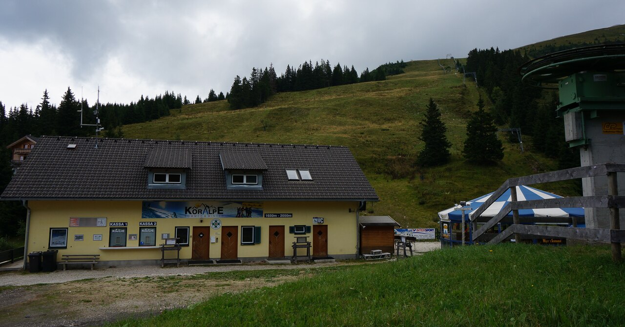
Koralpe is a mapped downhill ski area in AT. Forecasts cover three real lift-station locations from approximately 1626 to 2065 metres. Elevations are terrain-model estimates.
Data: OpenSkiData / OpenSkiMap, OpenStreetMap contributors (ODbL), Skimap.org, Who's On First, Mapterhorn.
Koralpe - Middle lift station
ECMWF · Modelllauf: Nächste Aktualisierung erwartet:
Tag Uhrzeit (UTC) Temp. (°C) Luftfeuchtigkeit (%) Wind (km/h) Wind (Knoten) Wind (Bft) Richtung Niederschlag (mm) Neuschnee (cm) Luftdruck (hPa) Nullgradgrenze (m) Wetterlage | Mittwoch, 04/11 06:00 -1.7 99 12 6 2B E — — 1028 1382 Overcast 100% cloud 09:00 -1.7 97 12 6 2B E 0.13 0 1029 1432 Overcast 100% cloud 12:00 -1.4 95 8 4 2B E 0.60 0.2 1029 1480 Overcast 100% cloud 15:00 -1.3 94 9 5 2B E 0.58 0.2 1029 1479 Overcast 98% cloud 18:00 -1.7 95 11 6 2B E 0.11 0 1031 1335 Overcast 95% cloud 21:00 -1.8 92 9 5 2B E 0 0 1032 1232 Overcast 84% cloud Donnerstag, 05/11 00:00 -1.7 88 7 4 2B SE 0 0 1032 < 1010 Cloudy 71% cloud 03:00 -1.6 88 8 5 2B S 0 0 1032 < 1010 Cloudy 79% cloud 06:00 -1.4 88 9 5 2B S 0 0 1032 < 1010 Cloudy 79% cloud 09:00 -1.7 87 9 5 2B S 0 0 1032 1366 Overcast 100% cloud 12:00 -0.9 84 7 4 2B S 0.02 0 1031 1492 Overcast 95% cloud 15:00 0.2 77 7 4 2B S 0 0 1029 2114 Cloudy 60% cloud 18:00 1.3 66 7 4 2B S 0 0 1030 2625 Partly cloudy 21% cloud 21:00 1.2 65 8 4 2B S 0 0 1030 1116 Partly cloudy 47% cloud Freitag, 06/11 00:00 2 56 9 5 2B SW 0 0 1029 1181 Cloudy 55% cloud 03:00 3.5 45 9 5 2B SW 0 0 1027 1136 Cloudy 71% cloud 06:00 3.1 46 9 5 2B S 0 0 1026 1110 Partly cloudy 36% cloud 09:00 2.3 51 10 6 2B S 0 0 1027 2995 Clear 12% cloud 12:00 2.5 55 8 4 2B S 0 0 1024 2922 Clear 4% cloud 15:00 2.3 56 7 4 2B SE 0 0 1024 2737 Clear 1% cloud 18:00 2.4 51 12 6 2B SE 0 0 1025 2714 Clear 20% cloud 21:00 1.2 54 15 8 3B SE 0 0 1026 1196 Partly cloudy 25% cloud Samstag, 07/11 00:00 0.6 52 16 9 3B SE 0 0 1027 1295 Clear 18% cloud 03:00 -0.1 49 16 9 3B SE 0 0 1027 1402 Clear 20% cloud 06:00 -0.8 44 16 9 3B SE 0 0 1028 < 1010 Partly cloudy 25% cloud 09:00 -1 45 19 10 3B SE 0 0 1029 1471 Clear 16% cloud 12:00 -0.8 59 15 8 3B SE 0 0 1027 1528 Clear 10% cloud 15:00 -0.3 49 15 8 3B SE 0 0 1027 1748 Clear 7% cloud 18:00 0.3 29 19 10 3B SE 0 0 1028 1305 Clear 19% cloud 21:00 -0.1 28 19 10 3B SE 0 0 1028 1397 Clear 12% cloud Sonntag, 08/11 00:00 -0.4 24 18 10 3B S 0 0 1028 1419 Partly cloudy 26% cloud 03:00 -0.5 33 17 9 3B S 0 0 1027 1398 Clear 12% cloud 06:00 -0.6 46 17 9 3B SW 0 0 1027 1419 Clear 3% cloud 09:00 -0.2 67 17 9 3B SW 0.02 0 1027 1810 Partly cloudy 22% cloud 12:00 -0 75 18 10 3B SW 0.08 0 1025 1859 Clear 12% cloud 15:00 0.4 72 19 10 3B SW 0 0 1025 1920 Clear 2% cloud 18:00 0.8 70 15 8 3B SW 0 0 1026 1992 Clear 0% cloud 21:00 0.7 69 14 7 3B W 0 0 1026 1996 Clear 0% cloud Montag, 09/11 00:00 0.8 65 14 8 3B W 0 0 1025 1102 Clear 0% cloud 03:00 1 57 16 9 3B W 0 0 1024 1150 Clear 0% cloud 06:00 1.5 50 17 9 3B W 0 0 1024 1143 Cloudy 63% cloud 09:00 2.1 49 16 9 3B W 0 0 1024 2382 Cloudy 76% cloud 12:00 2.2 55 19 10 3B W 0 0 1022 2549 Cloudy 75% cloud 15:00 2.1 68 22 12 4B W 0 0 1021 2719 Overcast 90% cloud 18:00 2.2 69 24 13 4B W 0 0 1020 2881 Cloudy 54% cloud 21:00 2.9 72 30 16 5B W 0 0 1020 3052 Cloudy 76% cloud Dienstag, 10/11 00:00 3.7 77 34 19 5B W 0 0 1018 3048 Overcast 96% cloud 03:00 3.9 80 37 20 5B W 0 0 1016 3049 Overcast 95% cloud 06:00 4.4 82 32 17 5B W 0 0 1015 3050 Overcast 97% cloud |
|---|
Forecast notes
Forecast table times: UTC.
Coordinates: 46.8035542°N, 14.9571997°E · Requested elevation: 1857 m. Model terrain: 1007 m. Terrain and 1000/925/850/700 hPa profiles are used for height estimates.
These are altitude estimates, not a simulation of local mountain terrain. Precipitation, cloud and sea-level pressure use horizontal interpolation only.
Precipitation includes rain and snow water equivalent: preceding 3 hours through day 6, then 6 hours (see cell tooltip). Snow (cm) estimates fresh snowfall from precipitation and temperature using the GFS conversion; it is not snow depth on the ground. Freezing (m) uses additional 600/500 hPa temperatures when available and estimates the lowest resolved 0°C crossing above sea level. When all sampled levels are warm, the upper profile limit is shown (see tooltip). < marks an entirely cold sampled profile and its lower height limit. No extrapolation is used.
Source: ECMWF · CC BY 4.0 · Processed by Snow Report.
Koralpe - Top lift station
ECMWF · Modelllauf: Nächste Aktualisierung erwartet:
Tag Uhrzeit (UTC) Temp. (°C) Luftfeuchtigkeit (%) Wind (km/h) Wind (Knoten) Wind (Bft) Richtung Niederschlag (mm) Neuschnee (cm) Luftdruck (hPa) Nullgradgrenze (m) Wetterlage | Mittwoch, 04/11 06:00 -2.5 98 15 8 3B E — — 1028 1384 Overcast 100% cloud 09:00 -2.4 96 14 8 3B E 0.13 0 1029 1433 Overcast 100% cloud 12:00 -2.1 94 10 5 2B E 0.61 0.2 1029 1479 Overcast 100% cloud 15:00 -1.8 93 11 6 2B E 0.60 0.2 1029 1478 Overcast 98% cloud 18:00 -2.1 93 12 7 3B E 0.11 0 1031 1335 Overcast 95% cloud 21:00 -2.1 89 11 6 2B SE 0 0 1032 1229 Overcast 83% cloud Donnerstag, 05/11 00:00 -1.9 84 9 5 2B SE 0 0 1032 < 1008 Cloudy 69% cloud 03:00 -1.8 84 9 5 2B S 0 0 1032 < 1008 Cloudy 79% cloud 06:00 -1.6 82 10 5 2B S 0 0 1032 < 1008 Cloudy 80% cloud 09:00 -1.7 80 9 5 2B S 0 0 1032 1365 Overcast 100% cloud 12:00 -1 76 8 4 2B S 0.02 0 1031 1488 Overcast 96% cloud 15:00 0 69 6 3 2B S 0 0 1029 2094 Cloudy 60% cloud 18:00 0.9 60 7 4 2B S 0 0 1030 2623 Partly cloudy 20% cloud 21:00 1 57 8 4 2B S 0 0 1030 1110 Partly cloudy 47% cloud Freitag, 06/11 00:00 1.6 50 8 4 2B SW 0 0 1029 1176 Cloudy 54% cloud 03:00 2.9 41 8 4 2B SW 0 0 1027 1131 Cloudy 70% cloud 06:00 2.6 40 8 4 2B S 0 0 1026 1100 Partly cloudy 35% cloud 09:00 1.8 45 10 5 2B S 0 0 1027 2993 Clear 12% cloud 12:00 2 48 8 5 2B S 0 0 1024 2921 Clear 4% cloud 15:00 1.7 48 8 4 2B SE 0 0 1024 2735 Clear 1% cloud 18:00 1.8 45 13 7 3B SE 0 0 1025 2714 Clear 17% cloud 21:00 0.7 48 16 9 3B SE 0 0 1026 1193 Partly cloudy 21% cloud Samstag, 07/11 00:00 0.1 48 19 10 3B SE 0 0 1027 1291 Clear 15% cloud 03:00 -0.6 45 19 10 3B SE 0 0 1027 1398 Clear 17% cloud 06:00 -1.1 40 19 10 3B SE 0 0 1028 < 1008 Partly cloudy 21% cloud 09:00 -1.4 40 22 12 4B SE 0 0 1029 1473 Clear 14% cloud 12:00 -1.3 52 20 11 3B SE 0 0 1027 1526 Clear 9% cloud 15:00 -0.8 43 20 11 3B SE 0 0 1027 1747 Clear 6% cloud 18:00 -0.4 26 23 13 4B SE 0 0 1028 1302 Clear 15% cloud 21:00 -0.8 24 23 13 4B SE 0 0 1028 1394 Clear 10% cloud Sonntag, 08/11 00:00 -1.2 24 23 12 4B S 0 0 1028 1416 Partly cloudy 24% cloud 03:00 -1.3 37 20 11 4B S 0 0 1027 1394 Clear 10% cloud 06:00 -1.5 47 18 10 3B SW 0 0 1027 1415 Clear 3% cloud 09:00 -1.3 70 20 11 3B SW 0.02 0 1027 1813 Partly cloudy 21% cloud 12:00 -1.1 76 21 11 4B SW 0.08 0 1025 1859 Clear 13% cloud 15:00 -0.8 70 23 12 4B SW 0 0 1025 1922 Clear 2% cloud 18:00 -0.4 68 17 9 3B SW 0 0 1026 1993 Clear 0% cloud 21:00 -0.4 66 15 8 3B W 0 0 1026 1998 Clear 0% cloud Montag, 09/11 00:00 -0.3 61 15 8 3B W 0 0 1025 1083 Clear 0% cloud 03:00 0.1 52 18 10 3B W 0 0 1024 1140 Clear 0% cloud 06:00 0.7 46 18 10 3B W 0 0 1024 1135 Cloudy 64% cloud 09:00 1.3 46 18 10 3B W 0 0 1024 2382 Cloudy 77% cloud 12:00 1.5 53 22 12 4B W 0 0 1022 2550 Cloudy 75% cloud 15:00 1.6 64 23 13 4B W 0 0 1021 2724 Overcast 90% cloud 18:00 1.7 65 24 13 4B W 0 0 1020 2884 Cloudy 54% cloud 21:00 2.4 68 29 16 5B W 0 0 1020 3061 Cloudy 76% cloud Dienstag, 10/11 00:00 3 73 33 18 5B W 0 0 1018 3052 Overcast 96% cloud 03:00 3.4 77 35 19 5B W 0 0 1016 3049 Overcast 95% cloud 06:00 3.8 80 30 16 5B W 0 0 1015 3050 Overcast 97% cloud |
|---|
Forecast notes
Forecast table times: UTC.
Coordinates: 46.7938825°N, 14.9594096°E · Requested elevation: 2065 m. Model terrain: 1005 m. Terrain and 1000/925/850/700 hPa profiles are used for height estimates.
These are altitude estimates, not a simulation of local mountain terrain. Precipitation, cloud and sea-level pressure use horizontal interpolation only.
Precipitation includes rain and snow water equivalent: preceding 3 hours through day 6, then 6 hours (see cell tooltip). Snow (cm) estimates fresh snowfall from precipitation and temperature using the GFS conversion; it is not snow depth on the ground. Freezing (m) uses additional 600/500 hPa temperatures when available and estimates the lowest resolved 0°C crossing above sea level. When all sampled levels are warm, the upper profile limit is shown (see tooltip). < marks an entirely cold sampled profile and its lower height limit. No extrapolation is used.