Prévisions pour les stations de ski du monde entier

Plus
Guide des couleurs Température · Vent · Pluie · Neige
Chaque couleur commence à la valeur indiquée. Les couleurs du vent correspondent dans les trois unités. Les cases sans précipitations restent neutres. Les couleurs décrivent les valeurs affichées et ne sont pas des alertes officielles.
Klippitztörl - Low lift station
ECMWF · Cycle du modèle : Prochaine mise à jour attendue :
Jour Heure (UTC) Temp. (°C) Humidité (%) Vent (km/h) Vent (nœuds) Vent (Bft) Direction Précip. (mm) Neige fraîche (cm) Pression (hPa) Isotherme 0 °C (m) Conditions | Mercredi, 04/11 06:00 -0.5 98 3 2 1B SE — — 1028 1283 Overcast 100% cloud  09:00 -0.1 97 4 2 1B E 0.18 0 1029 1456 Overcast 100% cloud 12:00 0.5 97 2 1 1B E 0.54 0.2 1029 1522 Overcast 100% cloud 15:00 0.7 98 4 2 1B E 0.48 0.1 1029 1597 Overcast 96% cloud 18:00 -0.2 98 6 3 2B E 0.01 0 1030 1436 Overcast 96% cloud 21:00 -0.7 97 4 2 1B E 0.02 0 1032 1322 Overcast 96% cloud Jeudi, 05/11 00:00 -0.9 96 2 1 1B S 0.02 0 1032 < 1187 Overcast 92% cloud 03:00 -1.1 97 4 2 1B SW 0.02 0 1032 < 1187 Overcast 98% cloud 06:00 -1.1 95 5 2 1B S 0 0 1031 < 1187 Overcast 93% cloud 09:00 -0.6 98 5 3 1B S 0 0 1032 1408 Overcast 98% cloud 12:00 0.9 90 5 2 1B SW 0 0 1030 1558 Overcast 91% cloud 15:00 1.2 88 5 3 1B S 0 0 1029 2344 Partly cloudy 34% cloud  18:00 0.8 81 4 2 1B SW 0 0 1030 2498 Cloudy 77% cloud  21:00 0.7 81 4 2 1B SW 0 0 1029 1299 Cloudy 51% cloud Vendredi, 06/11 00:00 1.1 77 6 3 2B SW 0 0 1028 1323 Cloudy 70% cloud 03:00 2.6 68 6 3 2B SW 0 0 1026 1308 Cloudy 61% cloud 06:00 2.8 65 6 3 2B SW 0 0 1025 1280 Partly cloudy 25% cloud 09:00 2.9 72 7 4 2B S 0 0 1026 3014 Clear 18% cloud  12:00 4.3 68 6 3 2B SE 0 0 1023 2960 Clear 6% cloud 15:00 3.6 73 7 4 2B SE 0 0 1024 2784 Clear 4% cloud 18:00 2.7 59 6 3 2B SE 0 0 1024 1205 Clear 9% cloud 21:00 1.4 66 7 4 2B SE 0 0 1026 1342 Cloudy 67% cloud Samedi, 07/11 00:00 0.5 76 7 4 2B SE 0 0 1027 1416 Cloudy 80% cloud 03:00 -0.1 76 7 4 2B SE 0 0 1027 1486 Cloudy 76% cloud 06:00 -0.8 71 7 4 2B SE 0 0 1028 < 1187 Cloudy 75% cloud 09:00 -0.1 70 7 4 2B SE 0 0 1028 1460 Clear 8% cloud 12:00 1.7 61 8 4 2B SE 0 0 1026 1802 Clear 1% cloud 15:00 1.2 68 7 4 2B SE 0 0 1026 1854 Clear 3% cloud 18:00 0.6 54 6 3 2B SE 0 0 1027 1404 Clear 14% cloud 21:00 -0.2 54 6 3 2B S 0 0 1028 1494 Partly cloudy 31% cloud Dimanche, 08/11 00:00 -0.4 43 6 3 2B S 0 0 1027 1511 Clear 16% cloud 03:00 -0.3 37 7 4 2B S 0 0 1027 1516 Clear 16% cloud 06:00 -0.4 47 7 4 2B SW 0 0 1027 1521 Clear 4% cloud 09:00 0.7 62 9 5 2B SW 0.12 0 1027 1644 Partly cloudy 35% cloud 12:00 2.5 68 10 5 2B SW 0 0 1025 1862 Clear 10% cloud 15:00 2.2 73 10 5 2B SW 0 0 1024 1893 Clear 2% cloud 18:00 1.7 71 8 4 2B SW 0 0 1025 1261 Clear 0% cloud 21:00 1.4 78 9 5 2B SW 0 0 1025 1285 Clear 0% cloud Lundi, 09/11 00:00 1.3 75 10 5 2B SW 0 0 1025 1311 Clear 0% cloud 03:00 1.5 70 10 5 2B SW 0 0 1024 1307 Clear 0% cloud 06:00 1.6 67 11 6 2B SW 0 0 1024 1292 Cloudy 64% cloud 09:00 2.7 66 11 6 2B SW 0 0 1024 2200 Cloudy 72% cloud 12:00 3.4 67 12 6 2B SW 0 0 1021 2479 Cloudy 78% cloud 15:00 2.5 80 15 8 3B SW 0 0 1021 2567 Overcast 87% cloud 18:00 1.7 86 17 9 3B SW 0 0 1021 1218 Cloudy 68% cloud 21:00 1.8 85 22 12 4B SW 0 0 1021 1252 Cloudy 74% cloud Mardi, 10/11 00:00 2.7 89 24 13 4B SW 0 0 1019 2973 Overcast 95% cloud 03:00 2.9 94 24 13 4B SW 0 0 1017 3047 Overcast 88% cloud 06:00 3.8 93 23 12 4B SW 0 0 1016 3048 Overcast 95% cloud |
|---|
Forecast notes
Forecast table times: UTC.
Coordinates: 46.9492418°N, 14.6983334°E · Requested elevation: 1471 m. Model terrain: 1185 m. Terrain and 1000/925/850/700 hPa profiles are used for height estimates.
These are altitude estimates, not a simulation of local mountain terrain. Precipitation, cloud and sea-level pressure use horizontal interpolation only.
Precipitation includes rain and snow water equivalent: preceding 3 hours through day 6, then 6 hours (see cell tooltip). Snow (cm) estimates fresh snowfall from precipitation and temperature using the GFS conversion; it is not snow depth on the ground. Freezing (m) uses additional 600/500 hPa temperatures when available and estimates the lowest resolved 0°C crossing above sea level. When all sampled levels are warm, the upper profile limit is shown (see tooltip). < marks an entirely cold sampled profile and its lower height limit. No extrapolation is used.
Source: ECMWF · CC BY 4.0 · Processed by Snow Report.
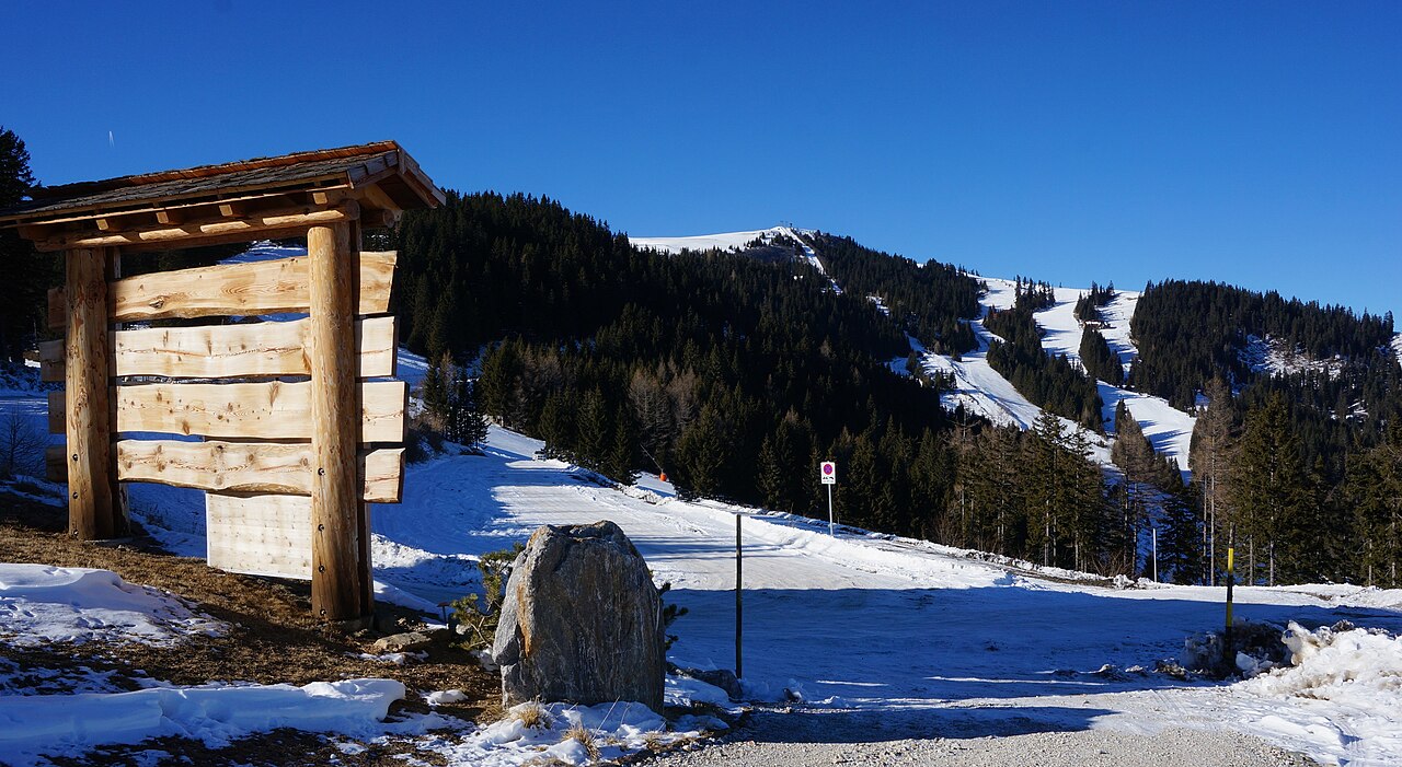
Klippitztörl is a downhill ski area in Carinthia, Austria. Mapped terrain includes easy, intermediate routes. Its mapped lift network extends from approximately 1471 to 1817 metres above sea level.
Data: OpenSkiData / OpenSkiMap, OpenStreetMap contributors (ODbL), Skimap.org, Who's On First, Mapterhorn.
Klippitztörl - Base lift station
ECMWF · Cycle du modèle : Prochaine mise à jour attendue :
Jour Heure (UTC) Temp. (°C) Humidité (%) Vent (km/h) Vent (nœuds) Vent (Bft) Direction Précip. (mm) Neige fraîche (cm) Pression (hPa) Isotherme 0 °C (m) Conditions | Mercredi, 04/11 06:00 -0.7 98 4 2 1B SE — — 1028 1299 Overcast 100% cloud 09:00 -0.6 99 5 3 1B E 0.18 0 1029 1456 Overcast 100% cloud 12:00 -0.1 99 2 1 1B E 0.54 0.2 1029 1522 Overcast 100% cloud 15:00 0.3 98 4 2 1B E 0.47 0.1 1029 1595 Overcast 96% cloud 18:00 -0.5 98 7 4 2B E 0.01 0 1030 1439 Overcast 96% cloud 21:00 -0.9 97 5 3 1B SE 0.02 0 1032 1326 Overcast 96% cloud Jeudi, 05/11 00:00 -1 95 2 1 1B S 0.02 0 1032 < 1175 Overcast 91% cloud 03:00 -1.3 96 5 3 1B SW 0.02 0 1032 < 1175 Overcast 97% cloud 06:00 -1.2 94 5 3 1B S 0 0 1031 < 1175 Overcast 92% cloud 09:00 -1.2 100 5 3 1B S 0 0 1032 1404 Overcast 97% cloud 12:00 0.2 93 5 2 1B SW 0 0 1030 1556 Overcast 91% cloud 15:00 0.8 88 5 3 1B S 0 0 1029 2334 Partly cloudy 35% cloud 18:00 0.9 78 4 2 1B SW 0 0 1030 2493 Cloudy 74% cloud 21:00 0.9 78 4 2 1B SW 0 0 1029 1271 Cloudy 50% cloud Vendredi, 06/11 00:00 1.6 73 7 4 2B SW 0 0 1028 1309 Cloudy 68% cloud 03:00 3.5 63 7 4 2B SW 0 0 1026 1297 Cloudy 61% cloud 06:00 3.6 61 7 4 2B SW 0 0 1025 1269 Partly cloudy 27% cloud 09:00 2.5 72 7 4 2B S 0 0 1026 3013 Clear 19% cloud 12:00 3.7 69 6 3 2B SE 0 0 1023 2957 Clear 6% cloud 15:00 3.4 71 8 4 2B SE 0 0 1024 2785 Clear 4% cloud 18:00 3.3 54 8 4 2B SE 0 0 1024 1185 Clear 8% cloud 21:00 2.1 60 9 5 2B SE 0 0 1026 1333 Cloudy 63% cloud Samedi, 07/11 00:00 1.1 72 9 5 2B SE 0 0 1027 1412 Cloudy 79% cloud 03:00 0.4 71 9 5 2B SE 0 0 1027 1484 Cloudy 74% cloud 06:00 -0.4 66 9 5 2B SE 0 0 1028 < 1175 Cloudy 72% cloud 09:00 -0.6 68 9 5 2B SE 0 0 1028 1458 Clear 8% cloud 12:00 0.8 63 9 5 2B SE 0 0 1026 1797 Clear 1% cloud 15:00 1 65 8 4 2B SE 0 0 1026 1851 Clear 4% cloud 18:00 1.2 47 8 4 2B SE 0 0 1027 1396 Clear 13% cloud 21:00 0.4 47 8 4 2B S 0 0 1028 1492 Partly cloudy 29% cloud Dimanche, 08/11 00:00 0.2 36 7 4 2B S 0 0 1027 1511 Clear 16% cloud 03:00 0.1 31 8 4 2B S 0 0 1027 1516 Clear 16% cloud 06:00 0.1 42 9 5 2B SW 0 0 1027 1520 Clear 5% cloud 09:00 0.5 63 10 5 2B SW 0.12 0 1027 1644 Partly cloudy 34% cloud 12:00 1.9 71 11 6 2B SW 0 0 1025 1859 Clear 12% cloud 15:00 2.2 72 11 6 2B SW 0 0 1025 1893 Clear 2% cloud 18:00 2.1 69 9 5 2B SW 0 0 1025 1243 Clear 0% cloud 21:00 1.9 77 11 6 2B SW 0 0 1025 1270 Clear 0% cloud Lundi, 09/11 00:00 1.8 74 11 6 2B SW 0 0 1025 1301 Clear 0% cloud 03:00 1.9 67 11 6 2B SW 0 0 1024 1299 Clear 0% cloud 06:00 2 64 12 7 3B SW 0 0 1024 1284 Cloudy 64% cloud 09:00 2.3 66 13 7 3B SW 0 0 1024 2196 Cloudy 72% cloud 12:00 2.8 67 13 7 3B SW 0 0 1022 2476 Cloudy 78% cloud 15:00 2.4 79 16 9 3B SW 0 0 1021 2566 Overcast 86% cloud 18:00 1.8 85 18 10 3B SW 0 0 1021 1188 Cloudy 69% cloud 21:00 2 84 23 12 4B SW 0 0 1021 1230 Cloudy 74% cloud Mardi, 10/11 00:00 2.7 88 24 13 4B SW 0 0 1019 2974 Overcast 95% cloud 03:00 2.9 93 24 13 4B SW 0 0 1017 3047 Overcast 88% cloud 06:00 3.6 93 23 12 4B SW 0 0 1016 3048 Overcast 95% cloud |
|---|
Forecast notes
Forecast table times: UTC.
Coordinates: 46.9438948°N, 14.6911601°E · Requested elevation: 1532 m. Model terrain: 1172 m. Terrain and 1000/925/850/700 hPa profiles are used for height estimates.
These are altitude estimates, not a simulation of local mountain terrain. Precipitation, cloud and sea-level pressure use horizontal interpolation only.
Precipitation includes rain and snow water equivalent: preceding 3 hours through day 6, then 6 hours (see cell tooltip). Snow (cm) estimates fresh snowfall from precipitation and temperature using the GFS conversion; it is not snow depth on the ground. Freezing (m) uses additional 600/500 hPa temperatures when available and estimates the lowest resolved 0°C crossing above sea level. When all sampled levels are warm, the upper profile limit is shown (see tooltip). < marks an entirely cold sampled profile and its lower height limit. No extrapolation is used.
Source: ECMWF · CC BY 4.0 · Processed by Snow Report.
Klippitztörl - Top lift station
ECMWF · Cycle du modèle : Prochaine mise à jour attendue :
Jour Heure (UTC) Temp. (°C) Humidité (%) Vent (km/h) Vent (nœuds) Vent (Bft) Direction Précip. (mm) Neige fraîche (cm) Pression (hPa) Isotherme 0 °C (m) Conditions | Mercredi, 04/11 06:00 -1.7 98 8 4 2B SE — — 1028 1274 Overcast 100% cloud 09:00 -1.6 97 9 5 2B E 0.18 0 1029 1457 Overcast 100% cloud 12:00 -1.2 97 6 3 1B SE 0.53 0.2 1029 1523 Overcast 100% cloud 15:00 -0.7 96 7 4 2B E 0.46 0.1 1028 1598 Overcast 97% cloud 18:00 -1.2 95 9 5 2B SE 0.01 0 1030 1441 Overcast 97% cloud 21:00 -1.5 93 7 4 2B SE 0.03 0 1032 1328 Overcast 96% cloud Jeudi, 05/11 00:00 -1.5 91 5 3 1B S 0.03 0 1032 < 1196 Overcast 93% cloud 03:00 -1.6 90 6 3 1B S 0.03 0 1032 < 1196 Overcast 98% cloud 06:00 -1.5 87 6 3 2B S 0 0 1031 < 1196 Overcast 94% cloud 09:00 -1.7 92 6 3 2B S 0 0 1032 1408 Overcast 97% cloud 12:00 -0.4 85 5 3 1B S 0 0 1030 1557 Overcast 91% cloud 15:00 0.4 79 5 3 1B S 0 0 1029 2333 Partly cloudy 35% cloud 18:00 0.7 68 4 2 1B S 0 0 1030 2483 Cloudy 76% cloud 21:00 0.7 67 5 3 1B SW 0 0 1029 1304 Cloudy 52% cloud Vendredi, 06/11 00:00 1.3 63 7 4 2B SW 0 0 1028 1329 Cloudy 70% cloud 03:00 2.9 55 6 3 2B SW 0 0 1026 1314 Cloudy 60% cloud 06:00 3 53 6 3 2B SW 0 0 1025 1287 Partly cloudy 24% cloud 09:00 1.9 62 7 4 2B S 0 0 1026 3014 Clear 17% cloud 12:00 2.9 60 7 4 2B SE 0 0 1023 2959 Clear 5% cloud 15:00 2.6 63 8 4 2B SE 0 0 1024 2788 Clear 4% cloud 18:00 2.4 47 9 5 2B SE 0 0 1024 1218 Clear 9% cloud 21:00 1.5 52 12 6 2B SE 0 0 1026 1347 Cloudy 65% cloud Samedi, 07/11 00:00 0.4 64 13 7 3B SE 0 0 1027 1419 Overcast 81% cloud 03:00 -0.2 65 13 7 3B SE 0 0 1027 1489 Cloudy 75% cloud 06:00 -0.8 59 13 7 3B SE 0 0 1028 < 1196 Cloudy 74% cloud 09:00 -1.2 60 14 7 3B SE 0 0 1028 1460 Clear 8% cloud 12:00 -0 56 14 8 3B SE 0 0 1026 1804 Clear 1% cloud 15:00 0.1 58 14 8 3B SE 0 0 1026 1855 Clear 4% cloud 18:00 0.3 42 14 8 3B SE 0 0 1027 1410 Clear 13% cloud 21:00 -0.3 42 14 8 3B S 0 0 1028 1496 Partly cloudy 30% cloud Dimanche, 08/11 00:00 -0.7 36 14 7 3B S 0 0 1027 1514 Clear 16% cloud 03:00 -0.9 36 13 7 3B S 0 0 1027 1521 Clear 16% cloud 06:00 -1 43 12 7 3B SW 0 0 1027 1525 Clear 5% cloud 09:00 -0.8 65 13 7 3B SW 0.12 0 1027 1633 Partly cloudy 35% cloud 12:00 0.2 73 15 8 3B SW 0 0 1025 1858 Clear 11% cloud 15:00 0.4 71 16 8 3B SW 0 0 1025 1890 Clear 2% cloud 18:00 0.5 68 12 6 2B SW 0 0 1025 1272 Clear 0% cloud 21:00 0.4 74 11 6 2B SW 0 0 1025 1292 Clear 0% cloud Lundi, 09/11 00:00 0.4 68 12 7 2B W 0 0 1025 1319 Clear 0% cloud 03:00 0.7 60 13 7 3B W 0 0 1024 1316 Clear 0% cloud 06:00 0.9 57 14 8 3B W 0 0 1024 1302 Cloudy 64% cloud 09:00 1.3 61 15 8 3B SW 0 0 1024 2189 Cloudy 72% cloud 12:00 2 64 16 9 3B SW 0 0 1022 2471 Cloudy 78% cloud 15:00 1.7 74 18 10 3B SW 0 0 1021 2557 Overcast 86% cloud 18:00 1.4 77 18 10 3B SW 0 0 1021 1226 Cloudy 69% cloud 21:00 1.4 80 23 12 4B W 0 0 1021 1258 Cloudy 74% cloud Mardi, 10/11 00:00 2.2 82 25 14 4B SW 0 0 1019 2976 Overcast 95% cloud 03:00 2.4 87 23 13 4B W 0 0 1017 3047 Overcast 87% cloud 06:00 3 90 22 12 4B W 0 0 1016 3048 Overcast 95% cloud |
|---|
Forecast notes
Forecast table times: UTC.
Coordinates: 46.9544435°N, 14.6852312°E · Requested elevation: 1817 m. Model terrain: 1193 m. Terrain and 1000/925/850/700 hPa profiles are used for height estimates.
These are altitude estimates, not a simulation of local mountain terrain. Precipitation, cloud and sea-level pressure use horizontal interpolation only.
Precipitation includes rain and snow water equivalent: preceding 3 hours through day 6, then 6 hours (see cell tooltip). Snow (cm) estimates fresh snowfall from precipitation and temperature using the GFS conversion; it is not snow depth on the ground. Freezing (m) uses additional 600/500 hPa temperatures when available and estimates the lowest resolved 0°C crossing above sea level. When all sampled levels are warm, the upper profile limit is shown (see tooltip). < marks an entirely cold sampled profile and its lower height limit. No extrapolation is used.