Worldwide Ski Resort Forecasts

Colour guide Temperature · Wind · Rain · Snow
Each colour starts at the value shown. Wind colours match across all three units. Dry cells stay neutral. Colours describe the displayed values, not official weather warnings.
Kirkwood Mountain Resort - Low lift station
ECMWF · Model run: Next update expected:
Day Time (UTC) Temp. (°C) Humidity (%) Wind (km/h) Wind (knots) Wind (Bft) Direction Precip. (mm) Snow (cm) Pressure (hPa) Freezing (m) Conditions | Friday, 30/10 06:00 0.7 90 15 8 3B S — — 1014 2514 Overcast 100% cloud  09:00 0.1 95 16 9 3B S 1.9 0.6 1014 2394 Overcast 100% cloud 12:00 0.1 98 12 7 3B SW 1.7 0.5 1013 2398 Overcast 100% cloud 15:00 0.2 96 11 6 2B S 0.20 0 1013 2412 Overcast 81% cloud 18:00 3.5 68 16 8 3B S 0.03 0 1012 2719 Cloudy 73% cloud  21:00 4.3 65 17 9 3B SW 0.24 0 1011 2794 Overcast 81% cloud Saturday, 31/10 00:00 2.2 83 13 7 3B SW 0.61 0 1012 2664 Cloudy 70% cloud 03:00 0.3 95 7 4 2B S 0.13 0 1014 2440 Overcast 85% cloud 06:00 -0.1 95 10 5 2B S 0.00 0 1014 2359 Overcast 82% cloud 09:00 -0.4 96 9 5 2B S 0.11 0 1014 < 2292 Cloudy 79% cloud 12:00 -0.2 97 9 5 2B S 0.54 0.2 1014 2342 Overcast 90% cloud 15:00 -0.3 96 9 5 2B S 0.15 0 1015 2328 Overcast 86% cloud 18:00 2.4 84 15 8 3B S 0.45 0 1014 2659 Overcast 100% cloud 21:00 2.3 87 20 11 3B S 1.5 0 1013 2656 Overcast 97% cloud Sunday, 01/11 00:00 1.1 93 16 9 3B S 2.0 0.6 1013 2546 Overcast 94% cloud 03:00 -0.1 98 10 5 2B SW 2.2 0.7 1013 2368 Overcast 100% cloud 06:00 -0.5 100 6 3 1B SW 6.2 2.5 1013 < 2292 Overcast 100% cloud 09:00 -1 99 7 4 2B SW 4.8 1.9 1013 < 2292 Overcast 100% cloud 12:00 -2.1 98 9 5 2B SW 2.0 0.6 1013 < 2292 Overcast 90% cloud 15:00 -2.6 95 4 2 1B SW 0.60 0.2 1015 < 2292 Overcast 96% cloud 18:00 1 61 4 2 1B SW 0.02 0 1015 2472 Partly cloudy 27% cloud  21:00 2.3 57 4 2 1B W 0.04 0 1014 2597 Partly cloudy 50% cloud Monday, 02/11 00:00 1.5 62 5 3 1B NW 0 0 1015 2564 Clear 11% cloud  03:00 -4 74 9 5 2B NE 0 0 1018 < 2292 Clear 0% cloud 06:00 -3.2 73 12 6 2B NE 0 0 1021 < 2292 Clear 0% cloud 09:00 -3.4 74 9 5 2B NE 0 0 1022 2800 Clear 0% cloud 12:00 -3.5 70 10 5 2B NE 0 0 1022 2686 Partly cloudy 40% cloud 15:00 -2.5 61 10 5 2B NE 0 0 1022 2573 Partly cloudy 35% cloud 18:00 8.5 28 4 2 1B E 0 0 1022 3150 Partly cloudy 25% cloud 21:00 10.6 26 2 1 1B SW 0 0 1021 3152 Cloudy 69% cloud Tuesday, 03/11 00:00 6.9 49 2 1 1B SE 0 0 1022 3156 Overcast 99% cloud 03:00 1.3 62 3 2 1B E 0 0 1022 3163 Overcast 97% cloud 06:00 0.5 53 2 1 1B SE 0 0 1022 2335 Overcast 97% cloud 09:00 2.6 31 3 2 1B S 0 0 1021 3164 Overcast 91% cloud 12:00 2.2 34 4 2 1B S 0 0 1021 3162 Overcast 81% cloud 15:00 3.3 27 4 2 1B S 0 0 1021 3165 Cloudy 74% cloud 18:00 12.4 17 7 4 2B S 0 0 1021 3167 Overcast 83% cloud 21:00 13.2 21 8 4 2B S 0 0 1019 3157 Overcast 95% cloud Wednesday, 04/11 00:00 9.1 46 3 2 1B S 0 0 1019 3150 Overcast 98% cloud 03:00 3.5 61 4 2 1B SE 0 0 1018 3144 Overcast 94% cloud 06:00 3.3 55 4 2 1B SE 0 0 1017 3135 Overcast 93% cloud 09:00 3.8 45 5 3 1B S 0 0 1016 3113 Overcast 98% cloud 12:00 2.7 46 5 3 1B S 0 0 1015 3092 Overcast 86% cloud 15:00 2.1 50 5 3 1B S 0 0 1014 3086 Partly cloudy 47% cloud 18:00 8.9 32 14 7 3B S 0 0 1014 3082 Cloudy 75% cloud 21:00 7.2 50 14 8 3B SW 0 0 1013 3063 Overcast 93% cloud Thursday, 05/11 00:00 4.1 71 12 6 2B SW 0.07 0 1014 2882 Partly cloudy 24% cloud 03:00 -0.4 91 7 4 2B S 0.02 0 1016 < 2292 Clear 7% cloud 06:00 -0.9 93 6 3 2B S 0 0 1017 < 2292 Partly cloudy 34% cloud |
|---|
Forecast notes
Forecast table times: UTC.
Coordinates: 38.6833343°N, -120.06797°E · Requested elevation: 2381 m. Model terrain: 2290 m. Terrain and 1000/925/850/700 hPa profiles are used for height estimates.
These are altitude estimates, not a simulation of local mountain terrain. Precipitation, cloud and sea-level pressure use horizontal interpolation only.
Precipitation includes rain and snow water equivalent: preceding 3 hours through day 6, then 6 hours (see cell tooltip). Snow (cm) estimates fresh snowfall from precipitation and temperature using the GFS conversion; it is not snow depth on the ground. Freezing (m) uses additional 600/500 hPa temperatures when available and estimates the lowest resolved 0°C crossing above sea level. When all sampled levels are warm, the upper profile limit is shown (see tooltip). < marks an entirely cold sampled profile and its lower height limit. No extrapolation is used.
Source: ECMWF · CC BY 4.0 · Processed by Snow Report.
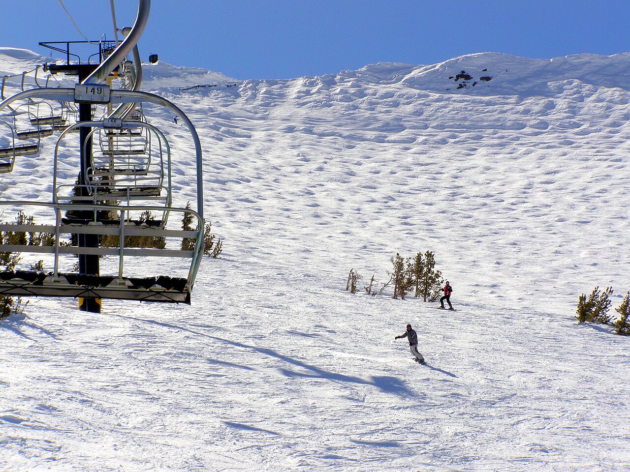
Kirkwood Mountain Resort is a downhill ski area in California, United States. Mapped terrain includes easy, intermediate, advanced routes. Its mapped lift network extends from approximately 2381 to 2886 metres above sea level.
Data: OpenSkiData / OpenSkiMap, OpenStreetMap contributors (ODbL), Skimap.org, Who's On First, Mapterhorn.
Kirkwood Mountain Resort - Base lift station
ECMWF · Model run: Next update expected:
Day Time (UTC) Temp. (°C) Humidity (%) Wind (km/h) Wind (knots) Wind (Bft) Direction Precip. (mm) Snow (cm) Pressure (hPa) Freezing (m) Conditions | Friday, 30/10 06:00 0.7 90 15 8 3B S — — 1014 2514 Overcast 100% cloud 09:00 0 95 16 9 3B S 1.9 0.6 1014 2394 Overcast 100% cloud 12:00 0 98 13 7 3B SW 1.7 0.5 1013 2398 Overcast 100% cloud 15:00 0.1 96 12 6 2B S 0.20 0 1013 2412 Overcast 81% cloud 18:00 3.4 68 16 9 3B S 0.03 0 1012 2719 Cloudy 73% cloud 21:00 4.3 65 17 9 3B SW 0.24 0 1011 2794 Overcast 81% cloud Saturday, 31/10 00:00 2.2 83 13 7 3B SW 0.62 0 1012 2664 Cloudy 70% cloud 03:00 0.2 95 8 4 2B S 0.13 0 1014 2440 Overcast 85% cloud 06:00 -0.1 94 10 5 2B S 0.00 0 1014 2358 Overcast 83% cloud 09:00 -0.4 96 9 5 2B S 0.11 0 1014 < 2296 Cloudy 79% cloud 12:00 -0.2 97 9 5 2B S 0.55 0.2 1014 2343 Overcast 90% cloud 15:00 -0.3 96 9 5 2B S 0.15 0 1015 2328 Overcast 87% cloud 18:00 2.3 84 16 8 3B S 0.45 0 1014 2659 Overcast 100% cloud 21:00 2.2 87 20 11 4B S 1.5 0 1013 2656 Overcast 97% cloud Sunday, 01/11 00:00 1 93 16 9 3B S 2.0 0.6 1013 2547 Overcast 94% cloud 03:00 -0.1 98 10 6 2B SW 2.2 0.7 1013 2368 Overcast 100% cloud 06:00 -0.5 100 6 3 2B SW 6.2 2.5 1013 < 2296 Overcast 100% cloud 09:00 -1 99 7 4 2B SW 4.8 1.9 1013 < 2296 Overcast 100% cloud 12:00 -2.2 98 9 5 2B SW 2.0 0.6 1013 < 2296 Overcast 90% cloud 15:00 -2.6 95 5 2 1B SW 0.60 0.2 1015 < 2296 Overcast 96% cloud 18:00 0.9 62 4 2 1B SW 0.02 0 1015 2473 Partly cloudy 27% cloud 21:00 2.3 57 4 2 1B W 0.03 0 1014 2598 Partly cloudy 50% cloud Monday, 02/11 00:00 1.4 62 5 3 1B NW 0 0 1015 2565 Clear 11% cloud 03:00 -4 74 9 5 2B NE 0 0 1018 < 2296 Clear 0% cloud 06:00 -3.2 72 12 6 2B NE 0 0 1021 < 2296 Clear 0% cloud 09:00 -3.4 73 9 5 2B NE 0 0 1022 2803 Clear 0% cloud 12:00 -3.4 69 10 5 2B NE 0 0 1022 2689 Partly cloudy 40% cloud 15:00 -2.5 60 10 5 2B NE 0 0 1022 2577 Partly cloudy 35% cloud 18:00 8.5 27 4 2 1B E 0 0 1022 3150 Partly cloudy 25% cloud 21:00 10.5 25 2 1 1B SW 0 0 1021 3152 Cloudy 69% cloud Tuesday, 03/11 00:00 6.9 48 2 1 1B SE 0 0 1022 3156 Overcast 99% cloud 03:00 1.3 62 3 2 1B E 0 0 1022 3163 Overcast 97% cloud 06:00 0.6 53 2 1 1B SE 0 0 1022 2339 Overcast 97% cloud 09:00 2.6 31 4 2 1B S 0 0 1021 3164 Overcast 91% cloud 12:00 2.2 34 4 2 1B S 0 0 1021 3162 Overcast 81% cloud 15:00 3.3 27 4 2 1B S 0 0 1021 3165 Cloudy 74% cloud 18:00 12.3 17 7 4 2B S 0 0 1021 3167 Overcast 83% cloud 21:00 13.1 21 8 4 2B S 0 0 1019 3157 Overcast 95% cloud Wednesday, 04/11 00:00 9 45 4 2 1B S 0 0 1019 3150 Overcast 98% cloud 03:00 3.5 60 4 2 1B SE 0 0 1018 3144 Overcast 94% cloud 06:00 3.4 54 5 2 1B SE 0 0 1017 3135 Overcast 93% cloud 09:00 3.8 45 5 3 1B S 0 0 1016 3113 Overcast 98% cloud 12:00 2.7 46 5 3 1B S 0 0 1015 3092 Overcast 86% cloud 15:00 2.1 50 5 3 1B S 0 0 1014 3086 Partly cloudy 47% cloud 18:00 8.8 32 14 7 3B S 0 0 1014 3082 Cloudy 75% cloud 21:00 7.1 50 14 8 3B SW 0 0 1013 3064 Overcast 93% cloud Thursday, 05/11 00:00 4 71 12 6 2B SW 0.06 0 1014 2882 Partly cloudy 24% cloud 03:00 -0.4 90 7 4 2B S 0.02 0 1016 < 2296 Clear 7% cloud 06:00 -1 93 6 3 2B S 0 0 1017 < 2296 Partly cloudy 34% cloud |
|---|
Forecast notes
Forecast table times: UTC.
Coordinates: 38.6827103°N, -120.066252°E · Requested elevation: 2388 m. Model terrain: 2293 m. Terrain and 1000/925/850/700 hPa profiles are used for height estimates.
These are altitude estimates, not a simulation of local mountain terrain. Precipitation, cloud and sea-level pressure use horizontal interpolation only.
Precipitation includes rain and snow water equivalent: preceding 3 hours through day 6, then 6 hours (see cell tooltip). Snow (cm) estimates fresh snowfall from precipitation and temperature using the GFS conversion; it is not snow depth on the ground. Freezing (m) uses additional 600/500 hPa temperatures when available and estimates the lowest resolved 0°C crossing above sea level. When all sampled levels are warm, the upper profile limit is shown (see tooltip). < marks an entirely cold sampled profile and its lower height limit. No extrapolation is used.
Source: ECMWF · CC BY 4.0 · Processed by Snow Report.
Kirkwood Mountain Resort - Top lift station
ECMWF · Model run: Next update expected:
Day Time (UTC) Temp. (°C) Humidity (%) Wind (km/h) Wind (knots) Wind (Bft) Direction Precip. (mm) Snow (cm) Pressure (hPa) Freezing (m) Conditions | Friday, 30/10 06:00 -2 81 35 19 5B S — — 1014 2507 Overcast 100% cloud 09:00 -2.8 98 53 28 7B S 1.9 0.6 1014 2390 Overcast 100% cloud 12:00 -2.8 99 40 22 6B S 1.7 0.5 1013 2397 Overcast 100% cloud 15:00 -2.6 92 33 18 5B S 0.20 0 1013 2408 Overcast 83% cloud 18:00 -1.8 82 27 14 4B SW 0.04 0 1012 2716 Cloudy 76% cloud 21:00 -1 82 28 15 4B SW 0.31 0.1 1012 2787 Overcast 83% cloud Saturday, 31/10 00:00 -1.8 88 27 14 4B SW 0.70 0.2 1012 2660 Cloudy 71% cloud 03:00 -2.1 78 27 15 4B S 0.15 0 1014 2447 Overcast 86% cloud 06:00 -1.9 82 32 17 5B S 0.00 0 1014 2366 Overcast 84% cloud 09:00 -2.4 93 34 18 5B S 0.14 0 1014 < 2299 Overcast 81% cloud 12:00 -2.7 95 32 17 5B SW 0.62 0.2 1014 2348 Overcast 92% cloud 15:00 -2.8 91 32 17 5B S 0.16 0 1015 2328 Overcast 89% cloud 18:00 -2 89 35 19 5B S 0.50 0.2 1014 2654 Overcast 100% cloud 21:00 -2 89 46 25 6B S 1.5 0.5 1013 2651 Overcast 98% cloud Sunday, 01/11 00:00 -2.2 93 46 25 6B S 2.0 0.6 1013 2545 Overcast 94% cloud 03:00 -2.7 98 32 17 5B SW 2.4 0.7 1013 2366 Overcast 100% cloud 06:00 -3 99 24 13 4B SW 6.4 6.4 1014 < 2299 Overcast 100% cloud 09:00 -3.6 97 29 16 5B SW 4.9 4.9 1013 < 2299 Overcast 100% cloud 12:00 -4.6 94 28 15 4B SW 1.8 1.8 1013 < 2299 Overcast 91% cloud 15:00 -5.4 80 19 10 3B SW 0.67 0.7 1015 < 2299 Overcast 96% cloud 18:00 -4.6 76 7 4 2B SW 0.02 0 1015 2473 Partly cloudy 28% cloud 21:00 -3.2 72 6 3 1B NW 0.04 0 1014 2598 Partly cloudy 48% cloud Monday, 02/11 00:00 -2.6 67 11 6 2B N 0 0 1015 2569 Clear 12% cloud 03:00 -2.9 50 21 11 4B NE 0 0 1018 < 2299 Clear 0% cloud 06:00 -0.9 30 23 12 4B NE 0 0 1021 3087 Clear 0% cloud 09:00 0.8 23 15 8 3B NE 0 0 1022 2796 Clear 0% cloud 12:00 2.3 17 16 9 3B NE 0 0 1022 2686 Partly cloudy 39% cloud 15:00 4.2 14 13 7 3B NE 0 0 1022 2574 Partly cloudy 33% cloud 18:00 8.5 10 6 3 2B NE 0 0 1022 3150 Partly cloudy 24% cloud 21:00 8.8 11 6 3 2B SW 0 0 1021 3152 Cloudy 69% cloud Tuesday, 03/11 00:00 8.2 16 5 3 1B SW 0 0 1022 3156 Overcast 99% cloud 03:00 6.3 17 6 3 2B S 0 0 1022 3163 Overcast 98% cloud 06:00 6.1 16 12 7 3B S 0 0 1022 2347 Overcast 97% cloud 09:00 6.6 12 18 10 3B S 0 0 1022 3164 Overcast 91% cloud 12:00 6 15 20 11 3B SW 0 0 1021 3162 Cloudy 80% cloud 15:00 6.3 19 18 10 3B SW 0 0 1021 3165 Cloudy 71% cloud 18:00 9.6 17 20 11 4B S 0 0 1021 3167 Cloudy 79% cloud 21:00 9.8 17 22 12 4B S 0 0 1019 3157 Overcast 94% cloud Wednesday, 04/11 00:00 8.6 25 20 11 4B S 0 0 1019 3150 Overcast 98% cloud 03:00 6.4 28 20 11 4B S 0 0 1018 3144 Overcast 93% cloud 06:00 6.2 25 24 13 4B S 0 0 1017 3135 Overcast 93% cloud 09:00 5.4 26 29 16 4B S 0 0 1016 3113 Overcast 98% cloud 12:00 3.6 35 28 15 4B S 0 0 1015 3092 Overcast 85% cloud 15:00 2.4 38 28 15 4B S 0 0 1014 3086 Partly cloudy 45% cloud 18:00 3.6 37 33 18 5B S 0 0 1014 3082 Cloudy 75% cloud 21:00 1.8 63 27 15 4B S 0 0 1013 3059 Overcast 93% cloud Thursday, 05/11 00:00 -0.1 81 29 16 5B S 0.06 0 1015 2877 Partly cloudy 23% cloud 03:00 -1 70 30 16 5B S 0.02 0 1016 < 2299 Clear 8% cloud 06:00 -1.4 78 26 14 4B S 0 0 1017 < 2299 Partly cloudy 33% cloud |
|---|
Forecast notes
Forecast table times: UTC.
Coordinates: 38.6612673°N, -120.057681°E · Requested elevation: 2886 m. Model terrain: 2297 m. Terrain and 1000/925/850/700 hPa profiles are used for height estimates.
These are altitude estimates, not a simulation of local mountain terrain. Precipitation, cloud and sea-level pressure use horizontal interpolation only.
Precipitation includes rain and snow water equivalent: preceding 3 hours through day 6, then 6 hours (see cell tooltip). Snow (cm) estimates fresh snowfall from precipitation and temperature using the GFS conversion; it is not snow depth on the ground. Freezing (m) uses additional 600/500 hPa temperatures when available and estimates the lowest resolved 0°C crossing above sea level. When all sampled levels are warm, the upper profile limit is shown (see tooltip). < marks an entirely cold sampled profile and its lower height limit. No extrapolation is used.