Ischgl - Idalp · Panorama/video

Provider panorama/video player. Capture time is shown by the camera.
Open camera page ↗
Chaque couleur commence à la valeur indiquée. Les couleurs du vent correspondent dans les trois unités. Les cases sans précipitations restent neutres. Les couleurs décrivent les valeurs affichées et ne sont pas des alertes officielles.
ECMWF · Cycle du modèle : Prochaine mise à jour attendue :
Jour Heure (UTC) Temp. (°C) Humidité (%) Vent (km/h) Vent (nœuds) Vent (Bft) Direction Précip. (mm) Neige fraîche (cm) Pression (hPa) Isotherme 0 °C (m) Conditions | Mercredi, 04/11 06:00 0.6 73 3 2 1B S — — 1022 < 2253 Cloudy 58% cloud  09:00 5.1 58 5 3 1B SE 0.00 0 1023 2289 Clear 12% cloud  12:00 6.9 47 6 4 2B SE 0.00 0 1022 2464 Partly cloudy 21% cloud  15:00 5 55 4 2 1B SE 0 0 1022 2286 Partly cloudy 27% cloud 18:00 0.8 67 3 2 1B S 0 0 1024 < 2253 Clear 2% cloud 21:00 0.4 70 4 2 1B S 0 0 1026 < 2253 Clear 2% cloud Jeudi, 05/11 00:00 -0 73 5 3 1B S 0 0 1026 < 2253 Clear 7% cloud 03:00 -0.4 71 5 3 1B S 0 0 1024 < 2253 Cloudy 55% cloud 06:00 -0.5 69 4 2 1B S 0 0 1024 < 2253 Partly cloudy 49% cloud 09:00 6.7 51 5 3 1B S 0 0 1024 2792 Clear 3% cloud 12:00 9.6 41 5 2 1B S 0 0 1023 2954 Clear 0% cloud 15:00 7.7 49 2 1 1B S 0 0 1022 2943 Clear 0% cloud 18:00 3.3 58 2 1 1B S 0 0 1023 < 2253 Clear 0% cloud 21:00 2.2 62 2 1 1B S 0 0 1023 < 2253 Clear 10% cloud Vendredi, 06/11 00:00 2.1 61 2 1 1B S 0 0 1021 < 2253 Clear 16% cloud 03:00 2.3 59 2 1 1B S 0 0 1020 3087 Clear 0% cloud 06:00 2.3 60 2 1 1B S 0 0 1019 < 2253 Partly cloudy 37% cloud 09:00 9.4 42 3 2 1B S 0 0 1019 3096 Cloudy 75% cloud 12:00 11 35 2 1 1B S 0 0 1017 2986 Overcast 95% cloud  15:00 8.5 47 1 0 0B SE 0.03 0 1017 2825 Overcast 93% cloud 18:00 5.1 61 2 1 1B E 0.35 0 1018 2342 Partly cloudy 48% cloud 21:00 3.5 71 2 1 1B S 0.96 0 1020 < 2253 Overcast 87% cloud Samedi, 07/11 00:00 3.2 77 2 1 1B S 0.81 0 1020 < 2253 Overcast 100% cloud 03:00 2.1 77 1 0 0B S 0.20 0 1020 < 2253 Overcast 100% cloud 06:00 2.8 76 2 1 1B SE 0.41 0 1022 < 2253 Overcast 100% cloud 09:00 4 72 2 1 1B SE 1.1 0 1023 < 2253 Overcast 95% cloud 12:00 5.7 57 3 1 1B SE 0.12 0 1020 2346 Overcast 95% cloud 15:00 4.5 61 1 0 0B NE 0.00 0 1021 < 2253 Partly cloudy 40% cloud 18:00 1.3 72 1 1 0B SE 0.01 0 1023 < 2253 Partly cloudy 45% cloud 21:00 -0.9 75 3 2 1B S 0 0 1023 < 2253 Overcast 85% cloud Dimanche, 08/11 00:00 1.7 71 3 2 1B S 0.10 0 1024 < 2253 Overcast 100% cloud 03:00 1.1 72 3 1 1B S 0.65 0.2 1023 < 2253 Overcast 91% cloud 06:00 -1.2 72 4 2 1B S 0.03 0 1024 < 2253 Cloudy 78% cloud 09:00 2.6 63 5 3 1B S 0.10 0 1024 < 2253 Partly cloudy 28% cloud 12:00 4.3 52 6 3 2B SW 0.02 0 1024 < 2253 Clear 12% cloud 15:00 2.8 55 2 1 1B SW 0 0 1023 < 2253 Clear 8% cloud 18:00 -1.8 64 3 1 1B S 0 0 1024 < 2253 Clear 3% cloud 21:00 -3.5 59 3 2 1B S 0 0 1022 < 2253 Partly cloudy 26% cloud Lundi, 09/11 00:00 0.1 54 4 2 1B S 0 0 1021 < 2253 Overcast 97% cloud 03:00 0.8 62 5 3 1B S 0.00 0 1020 < 2253 Overcast 89% cloud 06:00 0.6 62 5 3 1B S 0.00 0 1019 < 2253 Overcast 91% cloud 09:00 5.3 54 7 4 2B S 0.00 0 1020 2414 Overcast 88% cloud 12:00 7.7 49 7 4 2B S 0 0 1018 2753 Cloudy 73% cloud 15:00 5.7 58 5 3 1B S 0 0 1018 2503 Overcast 98% cloud 18:00 2.6 68 6 3 2B S 0.00 0 1019 < 2253 Overcast 90% cloud 21:00 3 72 7 4 2B S 0.10 0 1018 < 2253 Overcast 96% cloud Mardi, 10/11 00:00 3.7 72 7 4 2B S 0.23 0 1017 < 2253 Overcast 99% cloud 03:00 3.6 73 6 3 2B S 0 0 1015 < 2253 Overcast 87% cloud 06:00 3.6 74 7 4 2B S 0 0 1014 3034 Overcast 95% cloud |
|---|
Forecast table times: UTC.
Coordinates: 47.00905514°N, 10.28835297°E · Requested elevation: 1379 m. Model terrain: 2250 m. Terrain and 1000/925/850/700 hPa profiles are used for height estimates.
Outside the available profile, temperature uses an estimated 5.5°C/km height correction; wind retains the nearest available model-level value. Humidity is estimated with adjusted pressure and temperature.
These are altitude estimates, not a simulation of local mountain terrain. Precipitation, cloud and sea-level pressure use horizontal interpolation only.
Precipitation includes rain and snow water equivalent: preceding 3 hours through day 6, then 6 hours (see cell tooltip). Snow (cm) estimates fresh snowfall from precipitation and temperature using the GFS conversion; it is not snow depth on the ground. Freezing (m) uses additional 600/500 hPa temperatures when available and estimates the lowest resolved 0°C crossing above sea level. When all sampled levels are warm, the upper profile limit is shown (see tooltip). < marks an entirely cold sampled profile and its lower height limit. No extrapolation is used.
Source: ECMWF · CC BY 4.0 · Processed by Snow Report.
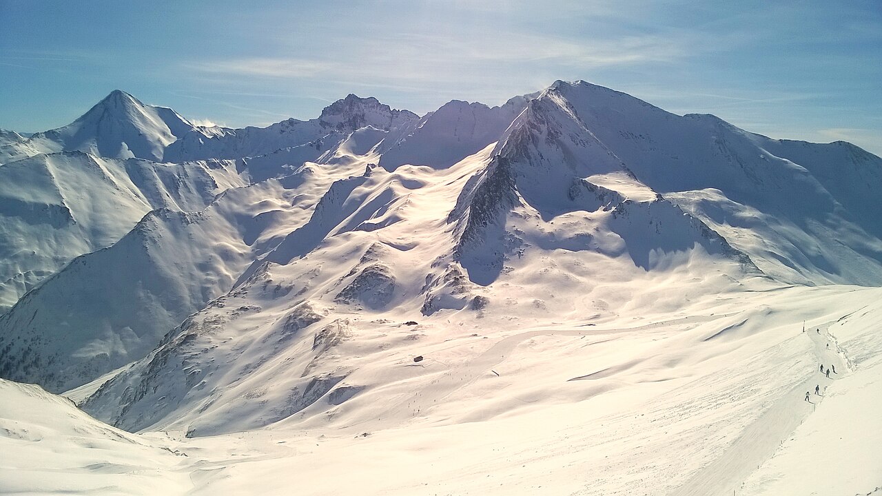
Ischgl partage la Silvretta Arena avec Samnaun, en Suisse : une journée de ski peut ainsi franchir une frontière sans quitter le domaine. Les informations officielles indiquent des altitudes de 1 377 à 2 872 m. Ce dénivelé compte davantage pour lire la météo qu’une prévision unique appliquée à tout le domaine.
Notre point par défaut se trouve à 1 379 m, près de la partie basse. Avant de lire le cumul de neige, vérifiez l’altitude choisie : la température et la nature des précipitations peuvent différer sur les pistes supérieures. Comparez un point en altitude avec le bas du domaine, surtout lorsque l’isotherme zéro degré se situe entre les deux.
Examinez aussi les horaires des précipitations. Une chute de neige tardive ne décrit pas les conditions du ski matinal. GFS et ECMWF peuvent annoncer l’arrivée du même épisode à des moments différents. Pour rejoindre Samnaun, complétez cette comparaison par l’état officiel des remontées et des pistes : une prévision ne confirme pas qu’une liaison est ouverte.
Sources officielles: Silvretta Arena Ischgl/Samnaun. Informations vérifiées le 18 octobre 2026.
Provider panorama/video player. Capture time is shown by the camera.
Open camera page ↗
Provider panorama/video player. Capture time is shown by the camera.
Open camera page ↗
Provider panorama/video player. Capture time is shown by the camera.
Open camera page ↗ECMWF · Cycle du modèle : Prochaine mise à jour attendue :
Jour Heure (UTC) Temp. (°C) Humidité (%) Vent (km/h) Vent (nœuds) Vent (Bft) Direction Précip. (mm) Neige fraîche (cm) Pression (hPa) Isotherme 0 °C (m) Conditions | Mercredi, 04/11 06:00 -3.4 90 3 2 1B S — — 1022 < 2231 Cloudy 61% cloud 09:00 1 70 5 3 1B SE 0.00 0 1023 2279 Clear 15% cloud 12:00 2.8 57 7 4 2B S 0.00 0 1022 2457 Partly cloudy 24% cloud 15:00 0.9 67 4 2 1B SE 0.00 0 1022 2282 Partly cloudy 29% cloud 18:00 -3.1 82 3 2 1B S 0.00 0 1024 < 2231 Clear 5% cloud 21:00 -3.6 86 4 2 1B S 0 0 1026 < 2231 Clear 4% cloud Jeudi, 05/11 00:00 -4 90 5 2 1B S 0 0 1026 < 2231 Clear 8% cloud 03:00 -4.4 88 5 3 1B S 0 0 1025 < 2231 Cloudy 54% cloud 06:00 -4.5 86 4 2 1B S 0 0 1024 < 2231 Partly cloudy 50% cloud 09:00 2.3 63 5 3 1B S 0 0 1025 2759 Clear 4% cloud 12:00 5.5 49 5 3 1B S 0 0 1023 2947 Clear 0% cloud 15:00 3.5 60 2 1 1B S 0 0 1023 2939 Clear 0% cloud 18:00 -0.9 71 2 1 1B S 0 0 1023 < 2231 Clear 0% cloud 21:00 -1.9 77 2 1 1B S 0 0 1023 < 2231 Clear 11% cloud Vendredi, 06/11 00:00 -2.1 76 2 1 1B S 0 0 1022 < 2231 Clear 17% cloud 03:00 -2 74 3 1 1B S 0 0 1020 3095 Clear 4% cloud 06:00 -2.1 76 3 1 1B S 0 0 1019 < 2231 Partly cloudy 38% cloud 09:00 5 53 3 2 1B S 0 0 1019 3095 Cloudy 68% cloud 12:00 6.9 42 2 1 1B S 0 0 1017 2982 Overcast 93% cloud 15:00 4.5 56 1 0 0B SE 0 0 1017 2828 Overcast 94% cloud 18:00 1.1 74 2 1 1B SE 0.33 0.1 1018 2378 Cloudy 51% cloud 21:00 -0.6 87 2 1 1B S 0.92 0.3 1020 < 2231 Overcast 85% cloud Samedi, 07/11 00:00 -0.9 94 2 1 1B S 0.84 0.3 1020 < 2231 Overcast 100% cloud 03:00 -1.9 95 1 0 0B S 0.21 0 1020 < 2231 Overcast 100% cloud 06:00 -1.3 94 2 1 1B SE 0.45 0.1 1022 < 2231 Overcast 100% cloud 09:00 -0 88 2 1 1B SE 1.0 0.3 1023 < 2231 Overcast 93% cloud 12:00 1.6 70 2 1 1B SE 0.12 0 1020 2341 Overcast 95% cloud 15:00 0.4 75 1 0 0B NE 0.01 0 1021 < 2231 Partly cloudy 39% cloud 18:00 -2.9 89 1 0 0B SE 0.01 0 1023 < 2231 Partly cloudy 47% cloud 21:00 -4.9 93 3 2 1B S 0 0 1024 < 2231 Overcast 84% cloud Dimanche, 08/11 00:00 -2.5 88 3 2 1B S 0.09 0 1024 < 2231 Overcast 100% cloud 03:00 -3.1 89 3 1 1B S 0.56 0.6 1023 < 2231 Overcast 92% cloud 06:00 -5.2 89 4 2 1B S 0.03 0 1024 < 2231 Overcast 80% cloud 09:00 -1.3 77 5 3 1B S 0.09 0 1025 < 2231 Partly cloudy 31% cloud 12:00 0.5 63 6 3 2B SW 0.03 0 1023 < 2231 Clear 18% cloud 15:00 -1.1 67 2 1 1B SW 0 0 1023 < 2231 Clear 9% cloud 18:00 -5.6 79 2 1 1B S 0 0 1024 < 2231 Clear 7% cloud 21:00 -7.4 75 3 2 1B S 0 0 1023 < 2231 Partly cloudy 28% cloud Lundi, 09/11 00:00 -4.2 69 4 2 1B S 0 0 1022 < 2231 Overcast 97% cloud 03:00 -3.4 76 5 3 1B S 0 0 1021 < 2231 Overcast 88% cloud 06:00 -3.6 77 5 3 1B S 0 0 1020 < 2231 Overcast 91% cloud 09:00 1.1 66 7 4 2B S 0.01 0 1020 2405 Overcast 88% cloud 12:00 3.7 58 7 4 2B S 0 0 1018 2758 Cloudy 72% cloud 15:00 1.6 70 5 3 1B S 0 0 1018 2502 Overcast 98% cloud 18:00 -1.5 83 6 3 1B S 0 0 1019 < 2231 Overcast 89% cloud 21:00 -1.1 88 6 3 2B S 0.09 0 1019 < 2231 Overcast 96% cloud Mardi, 10/11 00:00 -0.4 88 7 4 2B S 0.21 0 1017 < 2231 Overcast 99% cloud 03:00 -0.6 89 6 3 2B S 0 0 1016 < 2231 Overcast 86% cloud 06:00 -0.6 90 7 4 2B S 0 0 1015 < 2231 Overcast 95% cloud |
|---|
Forecast table times: UTC.
Coordinates: 46.98844985°N, 10.3099823°E · Requested elevation: 2121 m. Model terrain: 2229 m. Terrain and 1000/925/850/700 hPa profiles are used for height estimates.
Outside the available profile, temperature uses an estimated 5.5°C/km height correction; wind retains the nearest available model-level value. Humidity is estimated with adjusted pressure and temperature.
These are altitude estimates, not a simulation of local mountain terrain. Precipitation, cloud and sea-level pressure use horizontal interpolation only.
Precipitation includes rain and snow water equivalent: preceding 3 hours through day 6, then 6 hours (see cell tooltip). Snow (cm) estimates fresh snowfall from precipitation and temperature using the GFS conversion; it is not snow depth on the ground. Freezing (m) uses additional 600/500 hPa temperatures when available and estimates the lowest resolved 0°C crossing above sea level. When all sampled levels are warm, the upper profile limit is shown (see tooltip). < marks an entirely cold sampled profile and its lower height limit. No extrapolation is used.
Source: ECMWF · CC BY 4.0 · Processed by Snow Report.
ECMWF · Cycle du modèle : Prochaine mise à jour attendue :
Jour Heure (UTC) Temp. (°C) Humidité (%) Vent (km/h) Vent (nœuds) Vent (Bft) Direction Précip. (mm) Neige fraîche (cm) Pression (hPa) Isotherme 0 °C (m) Conditions | Mercredi, 04/11 06:00 -6 82 12 7 3B S — — 1022 < 2228 Cloudy 66% cloud 09:00 -4.5 66 15 8 3B SE 0.01 0 1023 2257 Partly cloudy 26% cloud 12:00 -4 72 18 10 3B S 0.01 0 1022 2438 Partly cloudy 36% cloud 15:00 -3.8 67 20 11 4B S 0.01 0 1022 2279 Partly cloudy 40% cloud 18:00 -4.2 64 19 10 3B S 0.00 0 1024 < 2228 Clear 15% cloud 21:00 -4.2 63 21 11 4B S 0 0 1026 < 2228 Clear 11% cloud Jeudi, 05/11 00:00 -3.9 66 18 10 3B S 0 0 1026 < 2228 Clear 16% cloud 03:00 -3.5 59 19 10 3B S 0 0 1026 < 2228 Cloudy 58% cloud 06:00 -2.7 53 19 10 3B S 0 0 1025 < 2228 Cloudy 57% cloud 09:00 -0.5 48 18 10 3B S 0 0 1025 2688 Clear 10% cloud 12:00 0.5 50 16 9 3B SW 0 0 1023 2926 Clear 0% cloud 15:00 0.3 53 8 4 2B S 0 0 1023 2920 Clear 0% cloud 18:00 -1 55 8 4 2B S 0 0 1024 < 2228 Clear 0% cloud 21:00 -1.2 53 10 6 2B S 0 0 1023 < 2228 Clear 16% cloud Vendredi, 06/11 00:00 -1 50 11 6 2B S 0 0 1022 < 2228 Partly cloudy 23% cloud 03:00 -0.9 51 10 5 2B S 0 0 1021 < 2228 Clear 15% cloud 06:00 -0.9 53 11 6 2B S 0 0 1020 < 2228 Partly cloudy 43% cloud 09:00 1.1 49 14 7 3B S 0 0 1019 3072 Cloudy 63% cloud 12:00 0.9 52 13 7 3B S 0 0 1018 2965 Overcast 92% cloud 15:00 -0.2 71 14 7 3B SE 0 0 1017 2815 Overcast 93% cloud 18:00 -1.8 88 14 8 3B SE 0.32 0.1 1019 2351 Cloudy 58% cloud 21:00 -2.7 87 19 10 3B SE 1.1 0.3 1020 < 2228 Overcast 87% cloud Samedi, 07/11 00:00 -3.8 88 21 11 4B SE 1.1 1.1 1021 < 2228 Overcast 99% cloud 03:00 -4.5 91 12 6 2B S 0.28 0.3 1020 < 2228 Overcast 100% cloud 06:00 -4.9 96 11 6 2B SE 0.55 0.6 1022 < 2228 Overcast 100% cloud 09:00 -5.1 94 13 7 3B SE 1.0 1 1023 < 2228 Overcast 94% cloud 12:00 -4.8 88 14 8 3B S 0.12 0.1 1021 2323 Overcast 94% cloud 15:00 -5.2 87 13 7 3B S 0.02 0 1021 < 2228 Partly cloudy 45% cloud 18:00 -6.2 87 12 7 3B S 0.03 0 1023 < 2228 Cloudy 55% cloud 21:00 -6.4 79 12 6 2B S 0 0 1024 < 2228 Overcast 86% cloud Dimanche, 08/11 00:00 -6.2 83 10 6 2B SW 0.10 0.1 1024 < 2228 Overcast 100% cloud 03:00 -6.6 86 13 7 3B SW 0.49 0.5 1024 < 2228 Overcast 93% cloud 06:00 -7.3 85 15 8 3B SW 0.03 0 1024 < 2228 Overcast 83% cloud 09:00 -6.4 79 15 8 3B SW 0.07 0.1 1025 < 2228 Partly cloudy 35% cloud 12:00 -5.5 62 11 6 2B SW 0.02 0 1023 < 2228 Partly cloudy 25% cloud 15:00 -5.4 51 10 5 2B SW 0 0 1023 < 2228 Clear 14% cloud 18:00 -5.9 43 14 8 3B W 0 0 1024 < 2228 Clear 17% cloud 21:00 -5.7 42 18 9 3B W 0 0 1023 < 2228 Partly cloudy 38% cloud Lundi, 09/11 00:00 -4.4 53 18 10 3B SW 0 0 1022 < 2228 Overcast 98% cloud 03:00 -3.6 68 23 13 4B SW 0 0 1021 < 2228 Overcast 90% cloud 06:00 -3.2 73 21 11 4B SW 0 0 1021 < 2228 Overcast 92% cloud 09:00 -1.5 64 21 11 4B SW 0.02 0 1021 2326 Overcast 88% cloud 12:00 -0.7 57 23 12 4B SW 0 0 1019 2739 Cloudy 70% cloud 15:00 -1.5 67 21 11 4B SW 0 0 1019 2451 Overcast 97% cloud 18:00 -1.9 83 29 16 5B SW 0 0 1019 < 2228 Overcast 89% cloud 21:00 -1.3 84 34 18 5B SW 0.09 0 1019 < 2228 Overcast 97% cloud Mardi, 10/11 00:00 -0.9 85 32 17 5B SW 0.18 0 1018 < 2228 Overcast 98% cloud 03:00 -0.7 84 26 14 4B SW 0 0 1016 < 2228 Overcast 88% cloud 06:00 -0.5 84 24 13 4B SW 0 0 1015 < 2228 Overcast 96% cloud |
|---|
Forecast table times: UTC.
Coordinates: 46.95002788°N, 10.30929565°E · Requested elevation: 2850 m. Model terrain: 2225 m. Terrain and 1000/925/850/700 hPa profiles are used for height estimates.
These are altitude estimates, not a simulation of local mountain terrain. Precipitation, cloud and sea-level pressure use horizontal interpolation only.
Precipitation includes rain and snow water equivalent: preceding 3 hours through day 6, then 6 hours (see cell tooltip). Snow (cm) estimates fresh snowfall from precipitation and temperature using the GFS conversion; it is not snow depth on the ground. Freezing (m) uses additional 600/500 hPa temperatures when available and estimates the lowest resolved 0°C crossing above sea level. When all sampled levels are warm, the upper profile limit is shown (see tooltip). < marks an entirely cold sampled profile and its lower height limit. No extrapolation is used.