Previsiones para estaciones de esquí de todo el mundo

Guía de colores Temperatura · Viento · Lluvia · Nieve
Cada color comienza en el valor indicado. Los colores del viento coinciden en las tres unidades. Las celdas sin precipitación permanecen neutras. Los colores describen los valores mostrados, no son avisos meteorológicos oficiales.
Hunter Mountain - Low lift station
ECMWF · Ejecución del modelo: Próxima actualización prevista:
Día Hora (UTC) Temp. (°C) Humedad (%) Viento (km/h) Viento (nudos) Viento (Bft) Dirección Precip. (mm) Nieve nueva (cm) Presión (hPa) Isoterma de 0 °C (m) Condiciones | Miércoles, 04/11 06:00 10.5 81 6 3 2B SW — — 1021 3162 Overcast 82% cloud  09:00 10.6 79 7 4 2B SW 0 0 1020 3157 Cloudy 53% cloud  12:00 10.3 84 7 4 2B SW 0 0 1020 3156 Clear 0% cloud  15:00 18.6 54 6 3 2B SW 0 0 1019 3150 Clear 0% cloud 18:00 21.4 46 12 6 2B SW 0 0 1017 3139 Clear 0% cloud 21:00 18.7 59 10 6 2B S 0 0 1016 3134 Clear 7% cloud Jueves, 05/11 00:00 13.8 78 11 6 2B SW 0 0 1017 3131 Clear 2% cloud 03:00 12.5 78 12 7 2B SW 0 0 1016 3123 Partly cloudy 21% cloud  06:00 12.1 82 13 7 3B S 0 0 1015 3110 Clear 16% cloud 09:00 12.1 92 16 8 3B SW 0 0 1014 3095 Overcast 85% cloud 12:00 13.2 96 12 6 2B S 0.32 0 1013 3088 Overcast 100% cloud 15:00 14.7 96 18 10 3B S 3.3 0 1012 3081 Overcast 100% cloud 18:00 16.1 95 18 10 3B S 4.4 0 1010 3067 Overcast 96% cloud 21:00 16.7 93 15 8 3B SW 0.55 0 1010 3062 Overcast 91% cloud Viernes, 06/11 00:00 15.9 95 12 7 3B S 0.18 0 1010 3069 Overcast 99% cloud 03:00 15.3 96 12 6 2B SW 0.71 0 1011 3064 Overcast 85% cloud 06:00 14.2 96 7 4 2B W 0.15 0 1011 3059 Overcast 100% cloud 09:00 13.7 98 3 2 1B NW 0.25 0 1012 3057 Overcast 97% cloud 12:00 11.2 96 3 2 1B SW 0.08 0 1013 3059 Overcast 98% cloud 15:00 16 66 4 2 1B SW 0 0 1013 3060 Overcast 95% cloud 18:00 18.8 51 5 2 1B SW 0.02 0 1011 3048 Overcast 94% cloud 21:00 16.2 68 1 0 0B E 0.09 0 1011 3044 Cloudy 59% cloud Sábado, 07/11 00:00 11.5 89 5 2 1B N 0 0 1012 3046 Overcast 99% cloud 03:00 11.2 85 6 3 2B N 0 0 1012 2997 Overcast 100% cloud 06:00 10.5 87 6 3 1B N 0 0 1011 2840 Overcast 100% cloud 09:00 10.2 90 4 2 1B N 0 0 1010 2745 Cloudy 63% cloud 12:00 10.4 89 4 2 1B NE 0 0 1010 2691 Overcast 92% cloud 15:00 13.4 80 4 2 1B E 0.10 0 1010 2650 Overcast 99% cloud 18:00 11 96 5 3 1B NW 4.2 0 1009 2457 Overcast 100% cloud 21:00 8.9 96 13 7 3B NW 3.9 0 1009 2241 Overcast 99% cloud Domingo, 08/11 00:00 6 96 15 8 3B W 3.2 0 1010 2019 Overcast 100% cloud 03:00 5.9 96 14 8 3B W 7.4 0 1009 1882 Overcast 100% cloud 06:00 6 96 16 8 3B NW 7.1 0 1008 1897 Overcast 100% cloud 09:00 4.9 95 21 12 4B NW 0.84 0 1009 1802 Overcast 100% cloud 12:00 5.2 91 20 11 4B NW 0.40 0 1011 1794 Overcast 98% cloud 15:00 7.4 80 20 11 4B NW 0 0 1010 1667 Overcast 90% cloud 18:00 8.1 68 21 11 4B W 0.08 0 1009 1353 Overcast 91% cloud 21:00 7.9 59 12 7 3B W 0 0 1008 1728 Clear 7% cloud Lunes, 09/11 00:00 5.1 72 10 5 2B W 0 0 1007 1744 Clear 5% cloud 03:00 6.1 62 13 7 3B W 0 0 1006 1482 Overcast 99% cloud 06:00 5.9 77 15 8 3B W 0.08 0 1005 1340 Overcast 91% cloud 09:00 4.8 89 18 10 3B W 0.30 0 1005 1242 Overcast 98% cloud 12:00 4.1 89 22 12 4B W 0.48 0 1007 1154 Overcast 97% cloud 15:00 5.4 78 25 14 4B NW 0.10 0 1009 1178 Overcast 94% cloud 18:00 6.1 72 24 13 4B NW 0.25 0 1010 1174 Overcast 97% cloud 21:00 5.2 72 23 13 4B NW 0.08 0 1012 1095 Cloudy 71% cloud Martes, 10/11 00:00 3.9 78 26 14 4B NW 0 0 1014 1453 Cloudy 76% cloud 03:00 4.3 78 20 11 3B NW 0 0 1014 1256 Overcast 93% cloud 06:00 4.2 81 18 10 3B NW 0 0 1015 1133 Overcast 96% cloud |
|---|
Forecast notes
Forecast table times: UTC.
Coordinates: 42.2042264°N, -74.2062122°E · Requested elevation: 502 m. Model terrain: 571 m. Terrain and 1000/925/850/700 hPa profiles are used for height estimates.
Outside the available profile, temperature uses an estimated 5.5°C/km height correction; wind retains the nearest available model-level value. Humidity is estimated with adjusted pressure and temperature.
These are altitude estimates, not a simulation of local mountain terrain. Precipitation, cloud and sea-level pressure use horizontal interpolation only.
Precipitation includes rain and snow water equivalent: preceding 3 hours through day 6, then 6 hours (see cell tooltip). Snow (cm) estimates fresh snowfall from precipitation and temperature using the GFS conversion; it is not snow depth on the ground. Freezing (m) uses additional 600/500 hPa temperatures when available and estimates the lowest resolved 0°C crossing above sea level. When all sampled levels are warm, the upper profile limit is shown (see tooltip). < marks an entirely cold sampled profile and its lower height limit. No extrapolation is used.
Source: ECMWF · CC BY 4.0 · Processed by Snow Report.
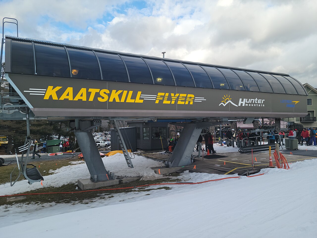
Hunter Mountain is the New York ski resort, not Hunter Mountain Shiobara in Japan. Its official trail guide divides the mountain into four faces and includes terrain for different abilities. Use the winter trail map to choose a sector and return route; the summer hiking map serves a different purpose.
For a first visit, distinguish the learning facilities and their meeting points from the main mountain trails. For a returning visit, consult the current map rather than relying on an old photograph or remembered lift arrangement. The resort publishes operating hours separately from its weather and webcam information.
The forecast opens at a lower point of 502 m. Around freezing, that height matters: a small temperature change can alter what falls at the base compared with higher terrain. Look at the sequence of precipitation and temperature through the day, including the journey home. Fresh-snow forecasts do not describe snowmaking, grooming or the existing piste base, so compare the weather outlook with the operator’s current terrain report.
Official sources: Hunter Mountain trail maps · Hunter Mountain operating hours. Reviewed 18 October 2026.
Hunter Mountain - Base lift station
ECMWF · Ejecución del modelo: Próxima actualización prevista:
Día Hora (UTC) Temp. (°C) Humedad (%) Viento (km/h) Viento (nudos) Viento (Bft) Dirección Precip. (mm) Nieve nueva (cm) Presión (hPa) Isoterma de 0 °C (m) Condiciones | Miércoles, 04/11 06:00 10.4 81 6 3 2B SW — — 1021 3162 Overcast 82% cloud 09:00 10.6 79 7 4 2B SW 0 0 1020 3157 Cloudy 52% cloud 12:00 10.2 85 7 4 2B SW 0 0 1020 3156 Clear 0% cloud 15:00 18.6 54 6 3 2B SW 0 0 1019 3150 Clear 0% cloud 18:00 21.4 46 12 6 2B SW 0 0 1017 3139 Clear 0% cloud 21:00 18.6 59 10 6 2B S 0 0 1016 3134 Clear 7% cloud Jueves, 05/11 00:00 13.8 79 11 6 2B SW 0 0 1017 3131 Clear 3% cloud 03:00 12.4 78 12 7 2B SW 0 0 1016 3123 Partly cloudy 21% cloud 06:00 12 82 13 7 3B S 0 0 1015 3110 Clear 16% cloud 09:00 12 92 16 8 3B SW 0 0 1014 3095 Overcast 85% cloud 12:00 13.1 96 12 6 2B S 0.32 0 1013 3088 Overcast 100% cloud 15:00 14.6 97 18 10 3B S 3.3 0 1012 3081 Overcast 100% cloud 18:00 16.1 95 18 10 3B S 4.3 0 1010 3067 Overcast 96% cloud 21:00 16.7 93 15 8 3B SW 0.55 0 1010 3062 Overcast 91% cloud Viernes, 06/11 00:00 15.8 95 13 7 3B S 0.18 0 1011 3069 Overcast 99% cloud 03:00 15.2 96 12 6 2B SW 0.69 0 1011 3064 Overcast 86% cloud 06:00 14.1 97 7 4 2B W 0.15 0 1011 3059 Overcast 100% cloud 09:00 13.6 98 3 2 1B NW 0.24 0 1012 3057 Overcast 97% cloud 12:00 11.1 96 3 2 1B SW 0.08 0 1013 3059 Overcast 98% cloud 15:00 15.9 65 4 2 1B SW 0 0 1013 3060 Overcast 95% cloud 18:00 18.7 50 5 3 1B SW 0.02 0 1011 3048 Overcast 94% cloud 21:00 16.1 68 1 0 0B E 0.08 0 1011 3044 Cloudy 58% cloud Sábado, 07/11 00:00 11.4 90 5 2 1B N 0 0 1012 3046 Overcast 99% cloud 03:00 11.1 86 6 3 2B N 0 0 1012 2996 Overcast 100% cloud 06:00 10.4 87 6 3 1B N 0 0 1011 2840 Overcast 100% cloud 09:00 10.1 90 4 2 1B N 0 0 1010 2744 Cloudy 63% cloud 12:00 10.3 89 4 2 1B NE 0 0 1010 2690 Overcast 93% cloud 15:00 13.3 80 4 2 1B E 0.11 0 1010 2649 Overcast 99% cloud 18:00 10.9 97 5 3 1B NW 4.2 0 1009 2455 Overcast 100% cloud 21:00 8.8 96 13 7 3B NW 3.9 0 1009 2239 Overcast 99% cloud Domingo, 08/11 00:00 5.9 96 15 8 3B W 3.1 0 1010 2017 Overcast 100% cloud 03:00 5.8 96 14 8 3B W 7.4 0 1009 1882 Overcast 100% cloud 06:00 5.9 96 16 8 3B NW 7.1 0 1008 1898 Overcast 100% cloud 09:00 4.8 95 21 12 4B NW 0.84 0 1009 1801 Overcast 100% cloud 12:00 5.1 91 20 11 4B NW 0.40 0 1011 1794 Overcast 99% cloud 15:00 7.3 80 20 11 4B NW 0 0 1010 1667 Overcast 91% cloud 18:00 8 68 21 11 4B W 0.08 0 1009 1352 Overcast 90% cloud 21:00 7.8 59 13 7 3B W 0 0 1008 1727 Clear 7% cloud Lunes, 09/11 00:00 5 72 10 6 2B W 0 0 1007 1745 Clear 5% cloud 03:00 6.1 62 13 7 3B W 0 0 1006 1482 Overcast 99% cloud 06:00 5.8 77 15 8 3B W 0.08 0 1005 1341 Overcast 91% cloud 09:00 4.8 89 18 10 3B W 0.31 0 1005 1241 Overcast 98% cloud 12:00 4 89 23 12 4B W 0.49 0 1007 1152 Overcast 98% cloud 15:00 5.3 78 26 14 4B NW 0.10 0 1009 1177 Overcast 95% cloud 18:00 6 73 24 13 4B NW 0.25 0 1010 1173 Overcast 98% cloud 21:00 5.1 73 23 13 4B NW 0.08 0 1012 1095 Cloudy 72% cloud Martes, 10/11 00:00 3.8 78 26 14 4B NW 0 0 1014 1448 Cloudy 77% cloud 03:00 4.2 78 20 11 4B NW 0 0 1014 1252 Overcast 93% cloud 06:00 4.1 81 18 10 3B NW 0 0 1015 1132 Overcast 97% cloud |
|---|
Forecast notes
Forecast table times: UTC.
Coordinates: 42.2038346°N, -74.2108188°E · Requested elevation: 517 m. Model terrain: 578 m. Terrain and 1000/925/850/700 hPa profiles are used for height estimates.
Outside the available profile, temperature uses an estimated 5.5°C/km height correction; wind retains the nearest available model-level value. Humidity is estimated with adjusted pressure and temperature.
These are altitude estimates, not a simulation of local mountain terrain. Precipitation, cloud and sea-level pressure use horizontal interpolation only.
Precipitation includes rain and snow water equivalent: preceding 3 hours through day 6, then 6 hours (see cell tooltip). Snow (cm) estimates fresh snowfall from precipitation and temperature using the GFS conversion; it is not snow depth on the ground. Freezing (m) uses additional 600/500 hPa temperatures when available and estimates the lowest resolved 0°C crossing above sea level. When all sampled levels are warm, the upper profile limit is shown (see tooltip). < marks an entirely cold sampled profile and its lower height limit. No extrapolation is used.
Source: ECMWF · CC BY 4.0 · Processed by Snow Report.
Hunter Mountain - Top lift station
ECMWF · Ejecución del modelo: Próxima actualización prevista:
Día Hora (UTC) Temp. (°C) Humedad (%) Viento (km/h) Viento (nudos) Viento (Bft) Dirección Precip. (mm) Nieve nueva (cm) Presión (hPa) Isoterma de 0 °C (m) Condiciones | Miércoles, 04/11 06:00 15.4 59 28 15 4B SW — — 1021 3162 Overcast 82% cloud 09:00 14.8 55 34 18 5B SW 0 0 1020 3157 Cloudy 51% cloud 12:00 14.5 58 33 18 5B W 0 0 1020 3156 Clear 0% cloud 15:00 15.4 54 21 11 4B SW 0 0 1019 3150 Clear 0% cloud 18:00 16.6 53 21 11 4B SW 0 0 1017 3139 Clear 0% cloud 21:00 16.4 56 26 14 4B SW 0 0 1016 3134 Clear 8% cloud Jueves, 05/11 00:00 14.7 61 35 19 5B SW 0 0 1017 3131 Clear 3% cloud 03:00 14.5 55 40 21 6B SW 0 0 1016 3123 Partly cloudy 22% cloud 06:00 13.7 64 43 23 6B SW 0 0 1015 3109 Clear 16% cloud 09:00 12.9 79 48 26 6B SW 0 0 1014 3095 Overcast 87% cloud 12:00 12.6 96 44 24 6B SW 0.36 0 1013 3088 Overcast 100% cloud 15:00 13.4 93 54 29 7B SW 3.3 0 1012 3081 Overcast 100% cloud 18:00 13.8 95 46 25 6B SW 4.2 0 1010 3067 Overcast 95% cloud 21:00 14.4 94 38 21 5B SW 0.56 0 1010 3062 Overcast 91% cloud Viernes, 06/11 00:00 14.4 97 40 22 6B SW 0.18 0 1011 3069 Overcast 99% cloud 03:00 13.8 91 40 22 6B SW 0.61 0 1011 3064 Overcast 89% cloud 06:00 12.3 95 25 14 4B W 0.15 0 1011 3059 Overcast 100% cloud 09:00 11.6 92 18 10 3B W 0.19 0 1012 3057 Overcast 97% cloud 12:00 10.9 85 15 8 3B SW 0.09 0 1013 3059 Overcast 98% cloud 15:00 11.5 70 12 7 2B SW 0 0 1013 3060 Overcast 96% cloud 18:00 13.4 62 10 5 2B SW 0.01 0 1011 3048 Overcast 93% cloud 21:00 13.2 61 5 3 1B SW 0.04 0 1011 3043 Cloudy 57% cloud Sábado, 07/11 00:00 11.1 82 6 3 2B N 0 0 1013 3046 Overcast 99% cloud 03:00 10.3 82 13 7 3B N 0 0 1012 2993 Overcast 100% cloud 06:00 9.8 85 12 7 3B NE 0 0 1011 2840 Overcast 100% cloud 09:00 9.9 82 11 6 2B NE 0 0 1010 2742 Cloudy 63% cloud 12:00 9.3 88 13 7 3B E 0 0 1010 2686 Overcast 95% cloud 15:00 9.4 93 6 3 1B SE 0.11 0 1010 2646 Overcast 99% cloud 18:00 8 97 7 4 2B NW 4.2 0 1009 2449 Overcast 100% cloud 21:00 6.4 95 17 9 3B NW 3.7 0 1009 2230 Overcast 99% cloud Domingo, 08/11 00:00 4.2 94 24 13 4B NW 3.1 0 1010 2008 Overcast 100% cloud 03:00 3.9 95 30 16 5B NW 7.4 0 1009 1880 Overcast 100% cloud 06:00 4.1 96 35 19 5B NW 7.0 0 1008 1901 Overcast 100% cloud 09:00 2.8 96 56 30 7B NW 0.86 0 1009 1798 Overcast 100% cloud 12:00 3.2 92 52 28 7B NW 0.42 0 1011 1797 Overcast 99% cloud 15:00 3.7 89 46 25 6B NW 0 0 1011 1667 Overcast 94% cloud 18:00 3.4 82 39 21 6B W 0.09 0 1009 1349 Overcast 90% cloud 21:00 4.5 59 37 20 5B W 0 0 1008 1727 Clear 6% cloud Lunes, 09/11 00:00 4.1 63 41 22 6B W 0 0 1007 1753 Clear 5% cloud 03:00 3.2 72 37 20 5B W 0 0 1006 1481 Overcast 99% cloud 06:00 2.7 88 40 22 6B W 0.09 0 1006 1342 Overcast 94% cloud 09:00 1.8 94 45 24 6B W 0.31 0 1005 1239 Overcast 99% cloud 12:00 1.1 93 50 27 6B NW 0.53 0.2 1007 1143 Overcast 99% cloud 15:00 1.4 89 50 27 7B NW 0.11 0 1009 1173 Overcast 96% cloud 18:00 1.7 86 46 25 6B NW 0.27 0 1010 1172 Overcast 98% cloud 21:00 1.1 84 52 28 7B NW 0.09 0 1012 1095 Cloudy 73% cloud Martes, 10/11 00:00 1.3 70 61 33 7B NW 0 0 1014 1431 Cloudy 78% cloud 03:00 1.4 82 54 29 7B NW 0 0 1014 1236 Overcast 94% cloud 06:00 0.9 87 46 25 6B NW 0 0 1016 1128 Overcast 97% cloud |
|---|
Forecast notes
Forecast table times: UTC.
Coordinates: 42.2005354°N, -74.2302992°E · Requested elevation: 969 m. Model terrain: 605 m. Terrain and 1000/925/850/700 hPa profiles are used for height estimates.
These are altitude estimates, not a simulation of local mountain terrain. Precipitation, cloud and sea-level pressure use horizontal interpolation only.
Precipitation includes rain and snow water equivalent: preceding 3 hours through day 6, then 6 hours (see cell tooltip). Snow (cm) estimates fresh snowfall from precipitation and temperature using the GFS conversion; it is not snow depth on the ground. Freezing (m) uses additional 600/500 hPa temperatures when available and estimates the lowest resolved 0°C crossing above sea level. When all sampled levels are warm, the upper profile limit is shown (see tooltip). < marks an entirely cold sampled profile and its lower height limit. No extrapolation is used.