Prévisions pour les stations de ski du monde entier

Plus
Guide des couleurs Température · Vent · Pluie · Neige
Chaque couleur commence à la valeur indiquée. Les couleurs du vent correspondent dans les trois unités. Les cases sans précipitations restent neutres. Les couleurs décrivent les valeurs affichées et ne sont pas des alertes officielles.
Hoodoo Ski Area - Low lift station
ECMWF · Cycle du modèle : Prochaine mise à jour attendue :
Jour Heure locale Temp. (°C) Humidité (%) Vent (km/h) Vent (nœuds) Vent (Bft) Direction Précip. (mm) Neige fraîche (cm) Pression (hPa) Isotherme 0 °C (m) Conditions | Mercredi, 04/11 01:00 -1.1 92 1 1 1B E 0 0 1020 < 1338 Cloudy 58% cloud  04:00 -0.3 91 1 0 0B S 0 0 1019 < 1338 Cloudy 55% cloud 07:00 0.1 87 2 1 1B S 0 0 1019 1578 Cloudy 63% cloud 10:00 7.5 59 5 3 1B S 0 0 1018 3051 Partly cloudy 47% cloud  13:00 9.1 50 12 7 2B SW 0 0 1017 2956 Overcast 100% cloud  16:00 5.4 75 9 5 2B W 0 0 1019 2443 Overcast 100% cloud 19:00 2.7 97 9 5 2B SW 0.98 0 1020 2124 Overcast 100% cloud 22:00 2.8 99 8 4 2B SW 1.2 0 1021 2034 Overcast 99% cloud Jeudi, 05/11 01:00 2.4 97 9 5 2B W 1.6 0 1022 1896 Overcast 100% cloud 04:00 1.5 96 6 3 2B W 0.24 0 1024 1774 Overcast 94% cloud 07:00 1 94 3 2 1B W 0 0 1026 1813 Overcast 84% cloud 10:00 3.8 76 4 2 1B W 0.02 0 1026 2528 Cloudy 61% cloud 13:00 7.3 47 4 2 1B SW 0 0 1023 2789 Clear 2% cloud  16:00 6 56 3 1 1B W 0 0 1023 2641 Overcast 93% cloud 19:00 1.6 66 0 0 0B — 0 0 1023 2332 Overcast 100% cloud 22:00 0.7 67 1 1 0B S 0 0 1022 2528 Partly cloudy 38% cloud Vendredi, 06/11 01:00 2.1 58 3 1 1B SW 0 0 1022 3120 Overcast 84% cloud 04:00 3.4 42 5 3 1B SW 0 0 1021 3117 Overcast 96% cloud 07:00 3.4 42 6 3 1B SW 0 0 1022 3124 Overcast 92% cloud 10:00 8.5 37 7 4 2B SW 0 0 1023 3130 Overcast 100% cloud 13:00 9.1 40 8 4 2B SW 0.02 0 1022 3108 Overcast 96% cloud 16:00 7.2 54 6 3 1B SW 0.18 0 1022 3127 Overcast 99% cloud 19:00 6.1 58 7 4 2B SW 0 0 1022 3135 Overcast 99% cloud 22:00 6.1 68 5 3 1B SW 0 0 1023 3139 Overcast 90% cloud Samedi, 07/11 01:00 4.7 81 3 1 1B SW 0 0 1021 3134 Clear 9% cloud 04:00 3.8 84 2 1 1B S 0 0 1019 3130 Clear 3% cloud 07:00 3.3 79 3 2 1B S 0 0 1017 3123 Cloudy 80% cloud 10:00 12.9 51 6 3 1B S 0 0 1016 3123 Cloudy 68% cloud 13:00 16.5 30 10 6 2B SW 0 0 1015 3108 Overcast 92% cloud 16:00 11.5 53 8 4 2B SW 0 0 1014 3097 Cloudy 75% cloud 19:00 7.1 61 9 5 2B SW 0 0 1014 3084 Overcast 88% cloud 22:00 4.8 70 11 6 2B SW 0 0 1015 3076 Cloudy 67% cloud Dimanche, 08/11 01:00 5.9 75 21 11 4B SW 0.04 0 1015 2869 Overcast 97% cloud 04:00 4.9 99 19 10 3B W 4.4 0 1019 2464 Overcast 100% cloud 07:00 3.9 100 21 11 4B W 2.8 0 1022 2247 Overcast 100% cloud 10:00 4 93 15 8 3B SW 0.48 0 1025 2183 Overcast 95% cloud 13:00 6.3 65 11 6 2B SW 0.06 0 1024 2452 Overcast 99% cloud 16:00 5.1 72 3 1 1B SW 0 0 1023 2345 Overcast 99% cloud 19:00 2.4 82 0 0 0B SW 0 0 1022 1989 Overcast 100% cloud 22:00 1.8 86 2 1 1B SE 0.04 0 1022 1942 Overcast 91% cloud Lundi, 09/11 01:00 -0.3 90 2 1 1B SE 0 0 1021 < 1338 Clear 5% cloud 04:00 -0.6 88 2 1 1B S 0 0 1020 < 1338 Clear 9% cloud 07:00 0.1 86 2 1 1B S 0 0 1020 1526 Overcast 89% cloud 10:00 7.5 68 7 4 2B SW 0 0 1021 2854 Overcast 96% cloud 13:00 9.2 52 12 6 2B SW 0 0 1019 2796 Overcast 93% cloud 16:00 6.6 70 5 3 1B SW 0 0 1020 2693 Clear 19% cloud 19:00 1.9 85 3 2 1B SW 0 0 1020 2650 Partly cloudy 41% cloud 22:00 2.5 80 6 3 2B SW 0 0 1021 2625 Partly cloudy 47% cloud |
|---|
Forecast notes
Forecast table times: America/Los_Angeles.
Coordinates: 44.4092135°N, -121.872266°E · Requested elevation: 1427 m. Model terrain: 1335 m. Terrain and 1000/925/850/700 hPa profiles are used for height estimates.
These are altitude estimates, not a simulation of local mountain terrain. Precipitation, cloud and sea-level pressure use horizontal interpolation only.
Precipitation includes rain and snow water equivalent: preceding 3 hours through day 6, then 6 hours (see cell tooltip). Snow (cm) estimates fresh snowfall from precipitation and temperature using the GFS conversion; it is not snow depth on the ground. Freezing (m) uses additional 600/500 hPa temperatures when available and estimates the lowest resolved 0°C crossing above sea level. When all sampled levels are warm, the upper profile limit is shown (see tooltip). < marks an entirely cold sampled profile and its lower height limit. No extrapolation is used.
Source: ECMWF · CC BY 4.0 · Processed by Snow Report.
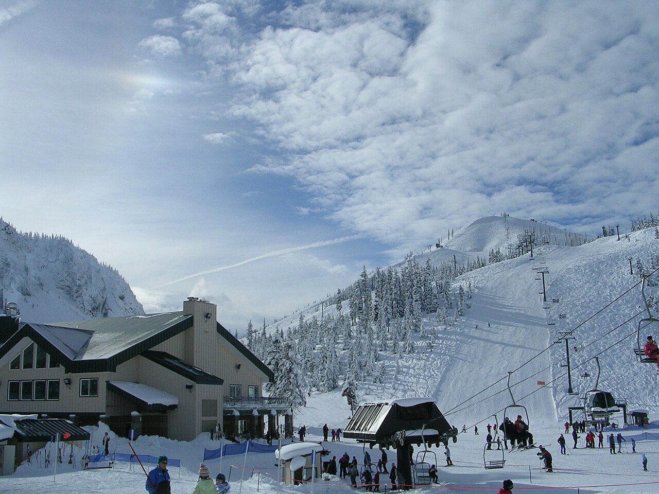
Hoodoo Ski Area is a downhill ski area in Oregon, United States. Mapped terrain includes easy, intermediate, advanced routes. Its mapped lift network extends from approximately 1427 to 1728 metres above sea level.
Data: OpenSkiData / OpenSkiMap, OpenStreetMap contributors (ODbL), Skimap.org, Who's On First, Mapterhorn.
Hoodoo Ski Area - Base lift station
ECMWF · Cycle du modèle : Prochaine mise à jour attendue :
Jour Heure locale Temp. (°C) Humidité (%) Vent (km/h) Vent (nœuds) Vent (Bft) Direction Précip. (mm) Neige fraîche (cm) Pression (hPa) Isotherme 0 °C (m) Conditions | Mercredi, 04/11 01:00 -1.1 92 1 1 1B E 0 0 1020 < 1338 Cloudy 58% cloud 04:00 -0.3 91 1 0 0B S 0 0 1019 < 1338 Cloudy 55% cloud 07:00 0.1 87 2 1 1B S 0 0 1019 1580 Cloudy 63% cloud 10:00 7.5 59 5 3 1B S 0 0 1018 3051 Partly cloudy 47% cloud 13:00 9.1 50 12 7 2B SW 0 0 1017 2956 Overcast 100% cloud 16:00 5.4 75 9 5 2B W 0 0 1019 2443 Overcast 100% cloud 19:00 2.7 97 9 5 2B SW 0.98 0 1020 2125 Overcast 100% cloud 22:00 2.8 99 8 4 2B SW 1.2 0 1021 2034 Overcast 99% cloud Jeudi, 05/11 01:00 2.4 97 9 5 2B W 1.6 0 1022 1896 Overcast 100% cloud 04:00 1.5 96 6 3 2B W 0.24 0 1024 1775 Overcast 94% cloud 07:00 1 94 3 2 1B W 0 0 1026 1813 Overcast 84% cloud 10:00 3.8 76 4 2 1B W 0.02 0 1026 2528 Cloudy 61% cloud 13:00 7.3 47 4 2 1B SW 0 0 1023 2789 Clear 2% cloud 16:00 6 56 3 1 1B W 0 0 1023 2642 Overcast 93% cloud 19:00 1.6 66 0 0 0B — 0 0 1023 2332 Overcast 100% cloud 22:00 0.7 67 1 1 0B S 0 0 1022 2528 Partly cloudy 38% cloud Vendredi, 06/11 01:00 2.1 58 3 1 1B SW 0 0 1022 3120 Overcast 84% cloud 04:00 3.4 42 5 3 1B SW 0 0 1021 3117 Overcast 96% cloud 07:00 3.4 42 6 3 1B SW 0 0 1022 3124 Overcast 92% cloud 10:00 8.5 37 7 4 2B SW 0 0 1023 3130 Overcast 100% cloud 13:00 9.1 40 8 4 2B SW 0.02 0 1022 3108 Overcast 96% cloud 16:00 7.2 54 6 3 1B SW 0.18 0 1022 3127 Overcast 99% cloud 19:00 6.2 58 7 4 2B SW 0 0 1022 3135 Overcast 99% cloud 22:00 6.1 68 5 3 1B SW 0 0 1023 3139 Overcast 90% cloud Samedi, 07/11 01:00 4.7 81 3 1 1B S 0 0 1021 3134 Clear 9% cloud 04:00 3.8 84 2 1 1B S 0 0 1019 3130 Clear 3% cloud 07:00 3.3 79 3 2 1B S 0 0 1017 3123 Cloudy 80% cloud 10:00 12.9 51 6 3 1B S 0 0 1016 3123 Cloudy 68% cloud 13:00 16.5 30 10 6 2B SW 0 0 1015 3108 Overcast 92% cloud 16:00 11.5 53 8 4 2B SW 0 0 1014 3097 Cloudy 75% cloud 19:00 7.1 61 9 5 2B SW 0 0 1014 3084 Overcast 88% cloud 22:00 4.8 70 11 6 2B SW 0 0 1015 3076 Cloudy 67% cloud Dimanche, 08/11 01:00 5.9 75 21 11 4B SW 0.04 0 1015 2869 Overcast 97% cloud 04:00 4.9 99 19 10 3B W 4.4 0 1019 2463 Overcast 100% cloud 07:00 3.9 100 21 11 4B W 2.8 0 1022 2247 Overcast 100% cloud 10:00 4 93 15 8 3B SW 0.48 0 1025 2183 Overcast 95% cloud 13:00 6.3 65 11 6 2B SW 0.06 0 1024 2452 Overcast 99% cloud 16:00 5.1 72 3 1 1B SW 0 0 1023 2345 Overcast 99% cloud 19:00 2.4 82 0 0 0B SW 0 0 1022 1989 Overcast 100% cloud 22:00 1.8 86 2 1 1B SE 0.04 0 1022 1942 Overcast 91% cloud Lundi, 09/11 01:00 -0.3 90 2 1 1B SE 0 0 1021 < 1338 Clear 5% cloud 04:00 -0.6 88 2 1 1B S 0 0 1020 < 1338 Clear 9% cloud 07:00 0.1 85 2 1 1B S 0 0 1020 1526 Overcast 89% cloud 10:00 7.5 68 7 4 2B SW 0 0 1021 2854 Overcast 96% cloud 13:00 9.2 52 12 6 2B SW 0 0 1019 2796 Overcast 93% cloud 16:00 6.6 70 5 3 1B SW 0 0 1020 2693 Clear 19% cloud 19:00 1.9 85 3 2 1B SW 0 0 1020 2651 Partly cloudy 41% cloud 22:00 2.5 80 6 3 2B SW 0 0 1021 2625 Partly cloudy 47% cloud |
|---|
Forecast notes
Forecast table times: America/Los_Angeles.
Coordinates: 44.4088954°N, -121.8725771°E · Requested elevation: 1427 m. Model terrain: 1335 m. Terrain and 1000/925/850/700 hPa profiles are used for height estimates.
These are altitude estimates, not a simulation of local mountain terrain. Precipitation, cloud and sea-level pressure use horizontal interpolation only.
Precipitation includes rain and snow water equivalent: preceding 3 hours through day 6, then 6 hours (see cell tooltip). Snow (cm) estimates fresh snowfall from precipitation and temperature using the GFS conversion; it is not snow depth on the ground. Freezing (m) uses additional 600/500 hPa temperatures when available and estimates the lowest resolved 0°C crossing above sea level. When all sampled levels are warm, the upper profile limit is shown (see tooltip). < marks an entirely cold sampled profile and its lower height limit. No extrapolation is used.
Source: ECMWF · CC BY 4.0 · Processed by Snow Report.
Hoodoo Ski Area - Top lift station
ECMWF · Cycle du modèle : Prochaine mise à jour attendue :
Jour Heure locale Temp. (°C) Humidité (%) Vent (km/h) Vent (nœuds) Vent (Bft) Direction Précip. (mm) Neige fraîche (cm) Pression (hPa) Isotherme 0 °C (m) Conditions | Mercredi, 04/11 01:00 -1.1 78 2 1 1B E 0 0 1020 < 1330 Cloudy 57% cloud 04:00 -0.5 77 1 1 1B SE 0 0 1019 < 1330 Cloudy 52% cloud 07:00 -0.1 73 4 2 1B S 0 0 1019 1598 Cloudy 61% cloud 10:00 6.2 54 8 5 2B S 0 0 1018 3051 Partly cloudy 49% cloud 13:00 7.3 49 16 9 3B SW 0 0 1017 2954 Overcast 100% cloud 16:00 3.8 72 15 8 3B SW 0 0 1019 2439 Overcast 100% cloud 19:00 1.6 97 15 8 3B SW 1.00 0 1021 2133 Overcast 100% cloud 22:00 1.4 99 14 8 3B W 1.2 0 1021 2039 Overcast 100% cloud Jeudi, 05/11 01:00 0.9 88 15 8 3B W 1.6 0.5 1022 1902 Overcast 100% cloud 04:00 0.2 84 12 7 3B W 0.25 0.1 1024 1784 Overcast 95% cloud 07:00 0.3 79 11 6 2B NW 0 0 1026 1832 Overcast 84% cloud 10:00 2.8 66 7 4 2B NW 0.03 0 1026 2538 Cloudy 62% cloud 13:00 5.7 43 9 5 2B W 0 0 1023 2789 Clear 2% cloud 16:00 4.5 53 8 5 2B W 0 0 1023 2645 Overcast 93% cloud 19:00 1.1 61 5 3 1B NW 0 0 1023 2328 Overcast 100% cloud 22:00 0.5 60 5 2 1B W 0 0 1022 2525 Partly cloudy 37% cloud Vendredi, 06/11 01:00 1.8 56 9 5 2B SW 0 0 1022 3120 Overcast 84% cloud 04:00 3 50 11 6 2B W 0 0 1021 3117 Overcast 96% cloud 07:00 3 45 14 7 3B W 0 0 1023 3124 Overcast 92% cloud 10:00 7.1 41 16 9 3B SW 0 0 1023 3130 Overcast 100% cloud 13:00 7.5 46 17 9 3B W 0.02 0 1022 3106 Overcast 96% cloud 16:00 6.2 61 14 8 3B W 0.17 0 1022 3127 Overcast 100% cloud 19:00 5.4 64 12 6 2B SW 0 0 1022 3135 Overcast 100% cloud 22:00 5.5 69 9 5 2B SW 0 0 1023 3139 Overcast 90% cloud Samedi, 07/11 01:00 4.5 72 8 4 2B SW 0 0 1021 3134 Clear 9% cloud 04:00 4 69 9 5 2B SW 0 0 1019 3130 Clear 3% cloud 07:00 3.6 65 10 5 2B SW 0 0 1017 3123 Cloudy 80% cloud 10:00 11.6 47 15 8 3B SW 0 0 1016 3123 Cloudy 67% cloud 13:00 14.3 31 22 12 4B SW 0 0 1015 3108 Overcast 92% cloud 16:00 9.9 54 21 11 4B SW 0 0 1014 3097 Cloudy 75% cloud 19:00 6 60 22 12 4B SW 0 0 1014 3084 Overcast 87% cloud 22:00 4.2 66 27 14 4B SW 0 0 1015 3076 Cloudy 68% cloud Dimanche, 08/11 01:00 4.6 77 36 19 5B SW 0.04 0 1016 2859 Overcast 98% cloud 04:00 3.4 99 31 17 5B SW 4.5 0 1019 2457 Overcast 100% cloud 07:00 2.5 100 33 18 5B SW 2.8 0 1023 2248 Overcast 100% cloud 10:00 2.4 86 26 14 4B SW 0.48 0 1025 2182 Overcast 96% cloud 13:00 4.4 60 19 10 3B SW 0.06 0 1024 2452 Overcast 99% cloud 16:00 3.4 67 10 5 2B SW 0 0 1023 2350 Overcast 99% cloud 19:00 1.2 77 7 4 2B SW 0 0 1022 1998 Overcast 100% cloud 22:00 0.8 80 9 5 2B S 0.03 0 1022 1946 Overcast 91% cloud Lundi, 09/11 01:00 -0.8 79 8 4 2B SW 0 0 1021 < 1330 Clear 5% cloud 04:00 -1 80 8 4 2B SW 0 0 1020 < 1330 Clear 9% cloud 07:00 -0.2 77 8 4 2B SW 0 0 1020 1528 Overcast 89% cloud 10:00 5.9 64 14 8 3B SW 0 0 1021 2855 Overcast 96% cloud 13:00 7.1 53 19 10 3B SW 0 0 1019 2795 Overcast 93% cloud 16:00 5 69 13 7 3B SW 0 0 1020 2696 Clear 19% cloud 19:00 1.5 83 9 5 2B SW 0 0 1020 2667 Partly cloudy 41% cloud 22:00 1.9 81 14 8 3B SW 0 0 1021 2634 Partly cloudy 47% cloud |
|---|
Forecast notes
Forecast table times: America/Los_Angeles.
Coordinates: 44.402024°N, -121.8829466°E · Requested elevation: 1728 m. Model terrain: 1327 m. Terrain and 1000/925/850/700 hPa profiles are used for height estimates.
These are altitude estimates, not a simulation of local mountain terrain. Precipitation, cloud and sea-level pressure use horizontal interpolation only.
Precipitation includes rain and snow water equivalent: preceding 3 hours through day 6, then 6 hours (see cell tooltip). Snow (cm) estimates fresh snowfall from precipitation and temperature using the GFS conversion; it is not snow depth on the ground. Freezing (m) uses additional 600/500 hPa temperatures when available and estimates the lowest resolved 0°C crossing above sea level. When all sampled levels are warm, the upper profile limit is shown (see tooltip). < marks an entirely cold sampled profile and its lower height limit. No extrapolation is used.