Previsiones para estaciones de esquí de todo el mundo

Guía de colores Temperatura · Viento · Lluvia · Nieve
Cada color comienza en el valor indicado. Los colores del viento coinciden en las tres unidades. Las celdas sin precipitación permanecen neutras. Los colores describen los valores mostrados, no son avisos meteorológicos oficiales.
Hodaigi Ski Resort - Low lift station
ECMWF · Ejecución del modelo: Próxima actualización prevista:
Día Hora (UTC) Temp. (°C) Humedad (%) Viento (km/h) Viento (nudos) Viento (Bft) Dirección Precip. (mm) Nieve nueva (cm) Presión (hPa) Isoterma de 0 °C (m) Condiciones | Miércoles, 04/11 06:00 10.4 69 10 5 2B S — — 1028 3109 Overcast 99% cloud  09:00 7.6 88 6 3 1B S 0.30 0 1029 3154 Overcast 98% cloud 12:00 7.3 93 7 4 2B S 1.0 0 1028 3149 Overcast 100% cloud 15:00 7.5 93 3 1 1B S 4.4 0 1026 3131 Overcast 100% cloud 18:00 7.6 93 2 1 1B SE 5.2 0 1023 3120 Overcast 100% cloud 21:00 8.3 93 3 2 1B SE 5.1 0 1021 3116 Overcast 100% cloud Jueves, 05/11 00:00 10.8 90 3 2 1B S 0.48 0 1018 3106 Overcast 91% cloud 03:00 14.2 75 4 2 1B S 0.06 0 1014 3078 Overcast 90% cloud 06:00 15.1 73 4 2 1B SW 0 0 1011 3054 Cloudy 74% cloud  09:00 10.9 89 0 0 0B E 0 0 1010 3044 Cloudy 54% cloud 12:00 9.2 93 1 1 1B E 0.12 0 1008 3033 Cloudy 76% cloud 15:00 8.6 89 2 1 1B NE 0.06 0 1006 3017 Partly cloudy 49% cloud  18:00 8.8 83 2 1 1B N 0.03 0 1004 2999 Partly cloudy 41% cloud 21:00 8.9 92 5 3 1B N 1.1 0 1006 2996 Overcast 86% cloud Viernes, 06/11 00:00 11.7 87 14 7 3B NW 2.5 0 1008 2950 Overcast 89% cloud 03:00 13.2 67 15 8 3B NW 1.1 0 1008 2916 Partly cloudy 49% cloud 06:00 13 63 9 5 2B NW 0.26 0 1009 2772 Cloudy 53% cloud 09:00 9.6 85 9 5 2B N 0.51 0 1012 2595 Cloudy 80% cloud 12:00 8.4 84 9 5 2B NW 0.67 0 1014 2293 Cloudy 72% cloud 15:00 6.5 85 14 8 3B NW 2.1 0 1015 1986 Overcast 96% cloud 18:00 4.3 86 15 8 3B NW 3.2 0 1017 1620 Overcast 98% cloud 21:00 3.7 83 12 7 3B NW 1.9 0 1019 1456 Overcast 98% cloud Sábado, 07/11 00:00 3.7 83 10 6 2B NW 2.1 0 1021 1345 Overcast 95% cloud 03:00 4.4 74 18 10 3B NW 2.3 0 1021 1356 Overcast 85% cloud 06:00 3.3 80 17 9 3B NW 2.2 0 1023 1281 Overcast 93% cloud 09:00 1.9 86 17 9 3B NW 1.7 0 1026 1144 Overcast 87% cloud 12:00 1.6 81 17 9 3B NW 0.56 0 1028 1092 Overcast 84% cloud 15:00 1.2 81 14 7 3B NW 0.44 0 1030 1042 Overcast 82% cloud 18:00 1.4 83 11 6 2B NW 0.61 0 1030 1078 Overcast 98% cloud 21:00 1.6 84 9 5 2B NW 0.60 0 1031 1098 Overcast 97% cloud Domingo, 08/11 00:00 3.5 72 12 6 2B NW 0.76 0 1033 1293 Overcast 96% cloud 03:00 4.8 69 14 8 3B NW 0.77 0 1032 1392 Overcast 95% cloud 06:00 4.2 72 11 6 2B N 0.38 0 1032 1411 Overcast 94% cloud 09:00 2.3 81 7 4 2B N 0.04 0 1033 1339 Overcast 95% cloud 12:00 1.2 82 4 2 1B NE 0.03 0 1033 1142 Overcast 83% cloud 15:00 -0.2 81 4 2 1B N 0 0 1031 < 1029 Overcast 92% cloud 18:00 0.9 77 4 2 1B N 0 0 1030 < 1029 Overcast 96% cloud 21:00 1.3 80 3 2 1B N 0.12 0 1029 1768 Overcast 91% cloud Lunes, 09/11 00:00 6.4 62 2 1 1B S 0 0 1027 2009 Cloudy 69% cloud 03:00 9.1 57 3 2 1B SW 0 0 1023 2155 Cloudy 57% cloud 06:00 8 66 6 3 2B NW 0.03 0 1023 1878 Overcast 97% cloud 09:00 4.9 80 5 3 1B N 0.01 0 1024 1856 Cloudy 60% cloud 12:00 3.8 88 6 3 2B N 0.85 0 1024 1670 Cloudy 77% cloud 15:00 2.7 87 11 6 2B N 1.6 0 1025 1297 Overcast 87% cloud 18:00 1.4 86 16 8 3B N 1.7 0 1025 1067 Overcast 96% cloud 21:00 1.2 85 13 7 3B NW 0.89 0 1025 1045 Overcast 96% cloud Martes, 10/11 00:00 2 81 9 5 2B NW 1.3 0 1027 1133 Overcast 92% cloud 03:00 2.6 74 10 5 2B NW 1.2 0 1026 1186 Overcast 86% cloud 06:00 2.1 73 9 5 2B N 0.66 0 1027 1143 Cloudy 74% cloud |
|---|
Forecast notes
Forecast table times: UTC.
Coordinates: 36.8384296°N, 139.0704833°E · Requested elevation: 831 m. Model terrain: 1027 m. Terrain and 1000/925/850/700 hPa profiles are used for height estimates.
Outside the available profile, temperature uses an estimated 5.5°C/km height correction; wind retains the nearest available model-level value. Humidity is estimated with adjusted pressure and temperature.
These are altitude estimates, not a simulation of local mountain terrain. Precipitation, cloud and sea-level pressure use horizontal interpolation only.
Precipitation includes rain and snow water equivalent: preceding 3 hours through day 6, then 6 hours (see cell tooltip). Snow (cm) estimates fresh snowfall from precipitation and temperature using the GFS conversion; it is not snow depth on the ground. Freezing (m) uses additional 600/500 hPa temperatures when available and estimates the lowest resolved 0°C crossing above sea level. When all sampled levels are warm, the upper profile limit is shown (see tooltip). < marks an entirely cold sampled profile and its lower height limit. No extrapolation is used.
Source: ECMWF · CC BY 4.0 · Processed by Snow Report.
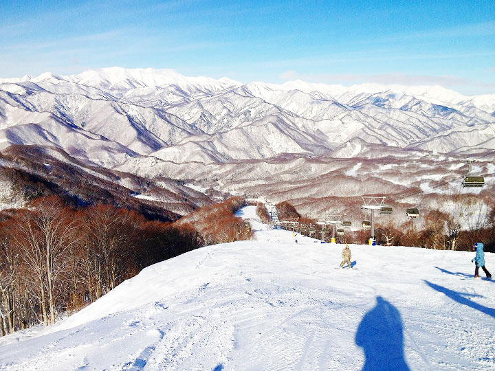
Hodaigi Ski Resort is a downhill ski area in Gunma Prefecture, Japan. Mapped terrain includes easy, intermediate, advanced routes. Its mapped lift network extends from approximately 831 to 1384 metres above sea level.
Data: OpenSkiData / OpenSkiMap, OpenStreetMap contributors (ODbL), Skimap.org, Who's On First, Mapterhorn.
Hodaigi Ski Resort - Base lift station
ECMWF · Ejecución del modelo: Próxima actualización prevista:
Día Hora (UTC) Temp. (°C) Humedad (%) Viento (km/h) Viento (nudos) Viento (Bft) Dirección Precip. (mm) Nieve nueva (cm) Presión (hPa) Isoterma de 0 °C (m) Condiciones | Miércoles, 04/11 06:00 10 71 9 5 2B S — — 1028 3104 Overcast 99% cloud 09:00 7.3 90 6 3 1B S 0.30 0 1029 3154 Overcast 98% cloud 12:00 6.9 94 7 4 2B S 1.0 0 1028 3149 Overcast 100% cloud 15:00 7.1 95 3 2 1B S 4.4 0 1026 3131 Overcast 100% cloud 18:00 7.2 94 2 1 1B SE 5.1 0 1023 3120 Overcast 100% cloud 21:00 7.9 94 3 2 1B SE 5.2 0 1021 3116 Overcast 100% cloud Jueves, 05/11 00:00 10.5 92 3 2 1B S 0.48 0 1018 3106 Overcast 92% cloud 03:00 13.8 76 4 2 1B S 0.05 0 1014 3078 Overcast 91% cloud 06:00 14.7 74 5 2 1B SW 0 0 1011 3054 Cloudy 75% cloud 09:00 10.5 91 0 0 0B E 0 0 1010 3044 Cloudy 53% cloud 12:00 8.8 94 1 1 1B E 0.11 0 1008 3034 Cloudy 77% cloud 15:00 8.3 89 2 1 1B NE 0.05 0 1006 3017 Partly cloudy 48% cloud 18:00 8.5 84 2 1 1B N 0.03 0 1004 2999 Partly cloudy 40% cloud 21:00 8.5 93 5 3 1B N 1.0 0 1006 2996 Overcast 85% cloud Viernes, 06/11 00:00 11.3 88 14 7 3B NW 2.4 0 1008 2954 Overcast 89% cloud 03:00 12.8 68 15 8 3B NW 1.0 0 1008 2921 Partly cloudy 49% cloud 06:00 12.6 64 9 5 2B NW 0.25 0 1009 2777 Cloudy 53% cloud 09:00 9.2 86 9 5 2B N 0.51 0 1012 2598 Cloudy 79% cloud 12:00 8 85 9 5 2B NW 0.66 0 1014 2295 Cloudy 72% cloud 15:00 6.1 86 14 7 3B NW 2.0 0 1015 1988 Overcast 96% cloud 18:00 3.9 87 15 8 3B NW 3.1 0 1017 1621 Overcast 98% cloud 21:00 3.3 84 12 7 3B NW 1.8 0 1019 1456 Overcast 98% cloud Sábado, 07/11 00:00 3.3 84 10 6 2B NW 2.1 0 1021 1346 Overcast 95% cloud 03:00 4 76 18 10 3B NW 2.3 0 1021 1357 Overcast 86% cloud 06:00 2.8 81 17 9 3B NW 2.1 0 1023 1282 Overcast 93% cloud 09:00 1.5 87 17 9 3B NW 1.7 0 1026 1144 Overcast 88% cloud 12:00 1.2 82 17 9 3B NW 0.56 0 1028 1092 Overcast 84% cloud 15:00 0.7 82 14 7 3B NW 0.45 0.1 1030 < 1045 Overcast 83% cloud 18:00 1 84 11 6 2B NW 0.61 0.2 1030 1079 Overcast 98% cloud 21:00 1.2 85 9 5 2B NW 0.59 0 1031 1099 Overcast 97% cloud Domingo, 08/11 00:00 3.1 74 12 7 2B NW 0.75 0 1033 1296 Overcast 96% cloud 03:00 4.5 70 14 8 3B NW 0.75 0 1032 1397 Overcast 95% cloud 06:00 3.8 73 11 6 2B N 0.37 0 1032 1417 Overcast 94% cloud 09:00 1.9 82 7 4 2B N 0.04 0 1033 1339 Overcast 95% cloud 12:00 0.8 83 4 2 1B NE 0.03 0 1033 1088 Overcast 84% cloud 15:00 -0.6 82 4 2 1B N 0 0 1031 < 1045 Overcast 92% cloud 18:00 0.6 78 4 2 1B N 0 0 1030 < 1045 Overcast 96% cloud 21:00 0.9 81 3 2 1B NE 0.11 0 1029 1770 Overcast 91% cloud Lunes, 09/11 00:00 6 63 2 1 1B S 0 0 1027 2009 Cloudy 70% cloud 03:00 8.7 57 3 2 1B SW 0 0 1023 2161 Cloudy 57% cloud 06:00 7.6 67 6 3 2B NW 0.03 0 1023 1886 Overcast 97% cloud 09:00 4.5 81 5 3 1B N 0.01 0 1024 1856 Cloudy 60% cloud 12:00 3.4 89 6 3 2B N 0.81 0 1024 1672 Cloudy 77% cloud 15:00 2.3 88 11 6 2B N 1.6 0 1025 1299 Overcast 87% cloud 18:00 1 87 16 8 3B N 1.7 0.5 1025 1071 Overcast 96% cloud 21:00 0.8 86 13 7 3B NW 0.86 0.3 1025 1047 Overcast 95% cloud Martes, 10/11 00:00 1.6 82 10 5 2B NW 1.2 0 1027 1139 Overcast 92% cloud 03:00 2.3 74 10 5 2B NW 1.1 0 1026 1194 Overcast 85% cloud 06:00 1.7 74 9 5 2B N 0.63 0 1027 1150 Cloudy 73% cloud |
|---|
Forecast notes
Forecast table times: UTC.
Coordinates: 36.8369842°N, 139.079428°E · Requested elevation: 903 m. Model terrain: 1042 m. Terrain and 1000/925/850/700 hPa profiles are used for height estimates.
Outside the available profile, temperature uses an estimated 5.5°C/km height correction; wind retains the nearest available model-level value. Humidity is estimated with adjusted pressure and temperature.
These are altitude estimates, not a simulation of local mountain terrain. Precipitation, cloud and sea-level pressure use horizontal interpolation only.
Precipitation includes rain and snow water equivalent: preceding 3 hours through day 6, then 6 hours (see cell tooltip). Snow (cm) estimates fresh snowfall from precipitation and temperature using the GFS conversion; it is not snow depth on the ground. Freezing (m) uses additional 600/500 hPa temperatures when available and estimates the lowest resolved 0°C crossing above sea level. When all sampled levels are warm, the upper profile limit is shown (see tooltip). < marks an entirely cold sampled profile and its lower height limit. No extrapolation is used.
Source: ECMWF · CC BY 4.0 · Processed by Snow Report.
Hodaigi Ski Resort - Top lift station
ECMWF · Ejecución del modelo: Próxima actualización prevista:
Día Hora (UTC) Temp. (°C) Humedad (%) Viento (km/h) Viento (nudos) Viento (Bft) Dirección Precip. (mm) Nieve nueva (cm) Presión (hPa) Isoterma de 0 °C (m) Condiciones | Miércoles, 04/11 06:00 6.3 82 17 9 3B S — — 1028 3096 Overcast 99% cloud 09:00 5.4 91 21 11 4B S 0.33 0 1029 3154 Overcast 98% cloud 12:00 5.2 95 27 15 4B S 1.0 0 1028 3149 Overcast 100% cloud 15:00 5.7 94 19 10 3B SE 4.4 0 1026 3131 Overcast 100% cloud 18:00 6 95 21 11 4B SE 4.8 0 1023 3120 Overcast 100% cloud 21:00 7.2 93 20 11 3B SE 5.2 0 1021 3116 Overcast 100% cloud Jueves, 05/11 00:00 8.9 91 15 8 3B SE 0.46 0 1018 3106 Overcast 92% cloud 03:00 10.6 87 11 6 2B S 0.05 0 1014 3078 Overcast 91% cloud 06:00 12 78 13 7 3B W 0 0 1011 3054 Cloudy 77% cloud 09:00 8.5 92 8 4 2B W 0 0 1010 3045 Cloudy 54% cloud 12:00 7.2 95 9 5 2B W 0.10 0 1008 3034 Cloudy 78% cloud 15:00 6.8 91 7 4 2B W 0.05 0 1006 3017 Partly cloudy 45% cloud 18:00 6.7 86 11 6 2B W 0.02 0 1004 2999 Partly cloudy 39% cloud 21:00 6.3 96 12 7 3B NW 0.88 0 1006 2996 Overcast 83% cloud Viernes, 06/11 00:00 8.8 86 22 12 4B NW 2.0 0 1008 2972 Overcast 89% cloud 03:00 10 67 23 13 4B NW 0.91 0 1008 2941 Partly cloudy 49% cloud 06:00 9.7 67 17 9 3B W 0.22 0 1009 2794 Cloudy 51% cloud 09:00 6.6 87 14 8 3B NW 0.45 0 1012 2611 Cloudy 78% cloud 12:00 5.3 87 14 8 3B NW 0.59 0 1014 2310 Cloudy 72% cloud 15:00 3.5 88 20 11 4B NW 1.8 0 1015 2004 Overcast 95% cloud 18:00 1.3 88 21 12 4B NW 2.7 0 1017 1634 Overcast 97% cloud 21:00 0.5 87 23 13 4B NW 1.6 0.5 1018 1464 Overcast 98% cloud Sábado, 07/11 00:00 -0.3 90 34 18 5B NW 1.9 0.6 1021 1353 Overcast 95% cloud 03:00 -0.2 85 42 23 6B NW 2.1 0.6 1021 1364 Overcast 85% cloud 06:00 -0.8 87 45 24 6B NW 2.0 0.6 1023 1290 Overcast 93% cloud 09:00 -1.8 91 47 25 6B NW 1.6 0.5 1026 1151 Overcast 88% cloud 12:00 -2.4 87 43 23 6B NW 0.54 0.2 1028 1097 Overcast 85% cloud 15:00 -2.3 87 40 21 6B NW 0.41 0.1 1030 < 1065 Overcast 83% cloud 18:00 -2.2 90 41 22 6B NW 0.56 0.2 1030 1086 Overcast 97% cloud 21:00 -2.1 92 34 19 5B NW 0.53 0.2 1031 1106 Overcast 97% cloud Domingo, 08/11 00:00 -0.8 85 27 15 4B NW 0.66 0.2 1033 1306 Overcast 95% cloud 03:00 0.3 82 27 15 4B NW 0.65 0.2 1032 1410 Overcast 95% cloud 06:00 0.4 77 20 11 3B NW 0.32 0.1 1032 1435 Overcast 94% cloud 09:00 -0.1 74 9 5 2B NW 0.04 0 1033 1360 Overcast 95% cloud 12:00 -0.3 76 3 2 1B W 0.02 0 1033 < 1065 Overcast 83% cloud 15:00 -0.7 79 4 2 1B W 0 0 1031 < 1065 Overcast 92% cloud 18:00 -0.2 78 6 3 2B NW 0 0 1030 < 1065 Overcast 96% cloud 21:00 0.6 76 5 3 1B W 0.10 0 1029 1784 Overcast 92% cloud Lunes, 09/11 00:00 3.1 67 7 4 2B SW 0 0 1027 2012 Cloudy 72% cloud 03:00 4.7 66 6 3 2B W 0 0 1023 2174 Cloudy 57% cloud 06:00 3.5 81 12 7 3B NW 0.02 0 1022 1909 Overcast 97% cloud 09:00 2.5 85 10 5 2B NW 0.01 0 1024 1866 Cloudy 58% cloud 12:00 1.4 90 14 8 3B NW 0.69 0 1024 1686 Cloudy 76% cloud 15:00 -0.5 89 28 15 4B NW 1.4 0.4 1025 1310 Overcast 86% cloud 18:00 -2.2 89 38 21 5B NW 1.5 0.4 1025 1084 Overcast 95% cloud 21:00 -2.5 91 39 21 5B NW 0.79 0.2 1025 < 1065 Overcast 94% cloud Martes, 10/11 00:00 -2.1 90 31 17 5B NW 1.1 0.3 1027 1156 Overcast 91% cloud 03:00 -1.8 86 22 12 4B NW 1.00 0.3 1026 1213 Overcast 84% cloud 06:00 -2 82 18 10 3B NW 0.53 0.2 1027 1171 Cloudy 69% cloud |
|---|
Forecast notes
Forecast table times: UTC.
Coordinates: 36.8258528°N, 139.0952128°E · Requested elevation: 1384 m. Model terrain: 1062 m. Terrain and 1000/925/850/700 hPa profiles are used for height estimates.
These are altitude estimates, not a simulation of local mountain terrain. Precipitation, cloud and sea-level pressure use horizontal interpolation only.
Precipitation includes rain and snow water equivalent: preceding 3 hours through day 6, then 6 hours (see cell tooltip). Snow (cm) estimates fresh snowfall from precipitation and temperature using the GFS conversion; it is not snow depth on the ground. Freezing (m) uses additional 600/500 hPa temperatures when available and estimates the lowest resolved 0°C crossing above sea level. When all sampled levels are warm, the upper profile limit is shown (see tooltip). < marks an entirely cold sampled profile and its lower height limit. No extrapolation is used.