Prévisions pour les stations de ski du monde entier

Plus
Guide des couleurs Température · Vent · Pluie · Neige
Chaque couleur commence à la valeur indiquée. Les couleurs du vent correspondent dans les trois unités. Les cases sans précipitations restent neutres. Les couleurs décrivent les valeurs affichées et ne sont pas des alertes officielles.
Préparation des graphiques…
Les heures et valeurs correspondent aux prévisions détaillées. Touchez une valeur pour plus de détails et faites défiler horizontalement pour les jours suivants. Les précipitations représentent l’équivalent en eau total par intervalle, neige comprise. La neige fraîche correspond à chaque intervalle, et non à l’épaisseur au sol.
Comparaison GFS et ECMWF. Chaque modèle conserve ses heures et son horizon de prévision. Les quantités de précipitations et de neige couvrent leurs propres intervalles, qui peuvent différer entre modèles.
Valeurs des prévisions et notes des modèles
Hakuba Happo One - Low lift station
ECMWF · Cycle du modèle : Prochaine mise à jour attendue :
Jour Heure (UTC) Temp. (°C) Humidité (%) Vent (km/h) Vent (nœuds) Vent (Bft) Direction Précip. (mm) Neige fraîche (cm) Pression (hPa) Isotherme 0 °C (m) Conditions | Mercredi, 04/11 06:00 12.9 53 7 4 2B SE — — 1025 3145 Overcast 97% cloud  09:00 9.3 77 4 2 1B SE 0.02 0 1027 3152 Overcast 100% cloud 12:00 9.1 83 6 3 2B SE 1.1 0 1027 3143 Overcast 100% cloud 15:00 9 83 5 3 1B S 4.6 0 1025 3129 Overcast 100% cloud 18:00 9.2 83 6 3 2B S 4.0 0 1022 3119 Overcast 100% cloud 21:00 9.5 82 5 3 1B S 1.2 0 1020 3109 Overcast 98% cloud Jeudi, 05/11 00:00 12 82 6 3 2B S 0.27 0 1017 3095 Overcast 100% cloud 03:00 16.8 58 3 2 1B S 0.03 0 1013 3069 Partly cloudy 50% cloud  06:00 16.9 58 1 1 1B SE 0.02 0 1010 3049 Cloudy 58% cloud  09:00 12.8 78 2 1 1B S 0.18 0 1009 3042 Overcast 96% cloud 12:00 12.1 78 2 1 1B S 1.1 0 1008 3027 Overcast 90% cloud 15:00 11.5 77 1 1 1B SW 2.8 0 1006 3008 Overcast 93% cloud 18:00 11.3 79 2 1 1B W 3.1 0 1005 2997 Overcast 88% cloud 21:00 10.8 82 5 3 1B NW 5.4 0 1008 2793 Overcast 95% cloud Vendredi, 06/11 00:00 11.6 82 6 3 2B NW 2.3 0 1010 2799 Overcast 84% cloud 03:00 13.3 58 9 5 2B W 0.67 0 1009 2812 Cloudy 69% cloud 06:00 11.8 64 7 4 2B W 0.96 0 1010 2712 Overcast 86% cloud 09:00 9.6 74 7 4 2B W 2.4 0 1013 2457 Overcast 92% cloud 12:00 7.8 77 6 3 2B NW 2.2 0 1015 2119 Overcast 87% cloud 15:00 5.7 80 6 3 2B NW 3.7 0 1017 1757 Overcast 95% cloud 18:00 3.8 80 5 3 1B NW 4.5 0 1019 1433 Overcast 98% cloud 21:00 2.9 78 5 3 1B NW 2.1 0 1020 < 1409 Overcast 98% cloud Samedi, 07/11 00:00 3.1 73 6 3 2B NW 2.8 0 1023 < 1409 Overcast 98% cloud 03:00 3.6 65 9 5 2B NW 2.4 0 1024 < 1409 Overcast 85% cloud 06:00 2.9 66 10 5 2B NW 2.1 0 1026 < 1409 Overcast 92% cloud 09:00 0.7 72 6 3 2B NW 1.5 0.4 1029 < 1409 Overcast 86% cloud 12:00 0 71 5 3 1B NW 0.33 0.1 1031 < 1409 Overcast 82% cloud 15:00 -1.2 69 5 2 1B W 0.08 0 1033 < 1409 Overcast 84% cloud 18:00 -1.4 69 5 3 1B NW 0.12 0 1033 < 1409 Overcast 86% cloud 21:00 -0.5 72 3 2 1B W 0.10 0 1034 < 1409 Overcast 89% cloud Dimanche, 08/11 00:00 3.6 57 3 1 1B NW 0 0 1034 < 1409 Overcast 89% cloud 03:00 6.5 48 4 2 1B N 0 0 1032 2368 Overcast 83% cloud 06:00 5.2 62 4 2 1B N 0 0 1032 2118 Overcast 90% cloud 09:00 1.3 75 2 1 1B N 0 0 1033 < 1409 Overcast 100% cloud 12:00 0.5 76 1 1 1B S 0 0 1032 < 1409 Overcast 96% cloud 15:00 0.8 72 1 0 0B W 0 0 1031 < 1409 Overcast 100% cloud 18:00 2.1 72 0 0 0B W 0.16 0 1030 < 1409 Overcast 100% cloud 21:00 2.7 75 2 1 1B S 0.82 0 1028 < 1409 Overcast 96% cloud Lundi, 09/11 00:00 7.5 64 1 0 0B W 0.12 0 1026 2123 Cloudy 62% cloud 03:00 10.7 51 3 1 1B NW 0.02 0 1022 2361 Cloudy 76% cloud 06:00 8.3 63 3 2 1B NW 0.01 0 1023 2127 Overcast 90% cloud 09:00 5.5 76 3 1 1B NW 0.12 0 1024 1761 Overcast 97% cloud 12:00 4.3 81 5 3 1B NW 2.9 0 1026 1533 Overcast 97% cloud 15:00 3 80 5 2 1B NW 1.4 0 1027 < 1409 Overcast 95% cloud 18:00 1.8 78 5 3 1B NW 1.2 0 1027 < 1409 Overcast 88% cloud 21:00 0.9 77 5 3 1B NW 0.22 0 1028 < 1409 Overcast 83% cloud Mardi, 10/11 00:00 3 61 5 3 1B NW 0.07 0 1028 < 1409 Cloudy 59% cloud 03:00 5 55 5 3 1B N 0.13 0 1026 1663 Partly cloudy 43% cloud 06:00 4.2 62 4 2 1B N 0 0 1026 1530 Partly cloudy 48% cloud |
|---|
Forecast notes
Forecast table times: UTC.
Coordinates: 36.6982934°N, 137.8387784°E · Requested elevation: 749 m. Model terrain: 1407 m. Terrain and 1000/925/850/700 hPa profiles are used for height estimates.
Outside the available profile, temperature uses an estimated 5.5°C/km height correction; wind retains the nearest available model-level value. Humidity is estimated with adjusted pressure and temperature.
These are altitude estimates, not a simulation of local mountain terrain. Precipitation, cloud and sea-level pressure use horizontal interpolation only.
Precipitation includes rain and snow water equivalent: preceding 3 hours through day 6, then 6 hours (see cell tooltip). Snow (cm) estimates fresh snowfall from precipitation and temperature using the GFS conversion; it is not snow depth on the ground. Freezing (m) uses additional 600/500 hPa temperatures when available and estimates the lowest resolved 0°C crossing above sea level. When all sampled levels are warm, the upper profile limit is shown (see tooltip). < marks an entirely cold sampled profile and its lower height limit. No extrapolation is used.
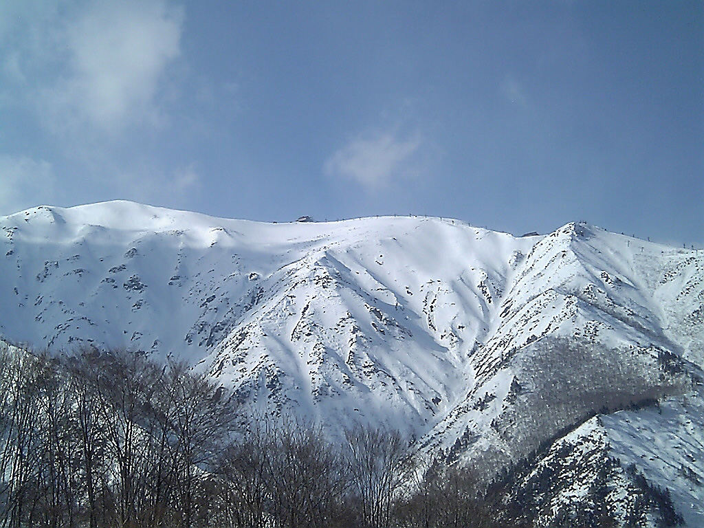
Hakuba Happo-one se situe à Nagano et possède des pistes ayant accueilli des épreuves alpines des Jeux olympiques d’hiver de 1998. Le guide officiel distingue ces pistes des espaces d’apprentissage et des autres parcours. Les remontées supérieures atteignent environ 1 830 m, dans un environnement différent des départs plus bas.
Le nom olympique appartient à l’histoire du domaine ; ce n’est pas une cotation pour chaque piste. Choisissez l’itinéraire sur le guide actuel, en repérant les alternatives plus faciles indiquées. Pour un groupe de niveaux variés, convenez d’un lieu de rendez-vous adapté avant de monter, sans supposer que tout le monde empruntera la même descente.
La prévision SnowReportMeteo commence à un point bas de 749 m. Pour skier près des remontées supérieures, choisissez une altitude correspondante et examinez vent et nébulosité avec la neige. La température basse ne décrit pas toute la montagne. Complétez la prévision par les webcams et les informations d’exploitation : l’ouverture d’une zone basse ne confirme pas l’accès à tout le terrain supérieur.
Sources officielles: Hakuba Happo-one mountain information · Happo-one trail guide · 白馬八方尾根 — ゲレンデ情報. Informations vérifiées le 18 octobre 2026.
Préparation des graphiques…
Les heures et valeurs correspondent aux prévisions détaillées. Touchez une valeur pour plus de détails et faites défiler horizontalement pour les jours suivants. Les précipitations représentent l’équivalent en eau total par intervalle, neige comprise. La neige fraîche correspond à chaque intervalle, et non à l’épaisseur au sol.
Comparaison GFS et ECMWF. Chaque modèle conserve ses heures et son horizon de prévision. Les quantités de précipitations et de neige couvrent leurs propres intervalles, qui peuvent différer entre modèles.
Valeurs des prévisions et notes des modèles
Hakuba Happo One - Base lift station
ECMWF · Cycle du modèle : Prochaine mise à jour attendue :
Jour Heure (UTC) Temp. (°C) Humidité (%) Vent (km/h) Vent (nœuds) Vent (Bft) Direction Précip. (mm) Neige fraîche (cm) Pression (hPa) Isotherme 0 °C (m) Conditions | Mercredi, 04/11 06:00 12.8 53 7 4 2B SE — — 1025 3144 Overcast 97% cloud 09:00 9.2 77 4 2 1B SE 0.02 0 1027 3152 Overcast 100% cloud 12:00 9 84 7 4 2B SE 1.0 0 1027 3143 Overcast 100% cloud 15:00 8.9 84 5 3 1B S 4.6 0 1025 3129 Overcast 100% cloud 18:00 9.1 83 6 3 2B S 4.1 0 1022 3119 Overcast 100% cloud 21:00 9.4 82 5 3 1B S 1.2 0 1020 3109 Overcast 98% cloud Jeudi, 05/11 00:00 11.9 82 6 3 2B S 0.28 0 1017 3095 Overcast 100% cloud 03:00 16.7 58 3 2 1B S 0.02 0 1013 3069 Partly cloudy 49% cloud 06:00 16.8 58 1 1 1B SE 0.02 0 1010 3049 Cloudy 58% cloud 09:00 12.7 78 2 1 1B S 0.18 0 1009 3042 Overcast 96% cloud 12:00 12 79 2 1 1B S 1.1 0 1008 3027 Overcast 90% cloud 15:00 11.4 78 1 1 1B SW 2.8 0 1006 3008 Overcast 93% cloud 18:00 11.2 79 2 1 1B W 3.2 0 1005 2997 Overcast 88% cloud 21:00 10.7 82 5 3 1B W 5.5 0 1008 2792 Overcast 95% cloud Vendredi, 06/11 00:00 11.5 82 6 3 2B NW 2.4 0 1010 2797 Overcast 85% cloud 03:00 13.2 59 9 5 2B W 0.68 0 1009 2807 Cloudy 70% cloud 06:00 11.7 64 7 4 2B W 0.98 0 1010 2706 Overcast 87% cloud 09:00 9.4 74 7 4 2B W 2.4 0 1014 2452 Overcast 92% cloud 12:00 7.7 78 6 3 2B NW 2.3 0 1015 2115 Overcast 87% cloud 15:00 5.6 80 6 3 2B NW 3.8 0 1017 1753 Overcast 96% cloud 18:00 3.6 80 5 3 1B NW 4.6 0 1019 1428 Overcast 98% cloud 21:00 2.8 78 5 3 1B NW 2.2 0 1020 < 1416 Overcast 98% cloud Samedi, 07/11 00:00 2.9 73 6 3 2B NW 2.9 0 1023 < 1416 Overcast 98% cloud 03:00 3.4 65 9 5 2B NW 2.4 0 1024 < 1416 Overcast 86% cloud 06:00 2.8 67 10 5 2B NW 2.1 0 1026 < 1416 Overcast 92% cloud 09:00 0.6 72 6 3 2B NW 1.5 0.5 1029 < 1416 Overcast 87% cloud 12:00 -0.1 71 5 3 1B NW 0.34 0.1 1031 < 1416 Overcast 82% cloud 15:00 -1.3 70 5 2 1B W 0.08 0 1033 < 1416 Overcast 84% cloud 18:00 -1.6 70 5 3 1B NW 0.13 0 1033 < 1416 Overcast 86% cloud 21:00 -0.6 73 3 2 1B W 0.10 0 1034 < 1416 Overcast 89% cloud Dimanche, 08/11 00:00 3.4 57 3 2 1B NW 0 0 1034 < 1416 Overcast 89% cloud 03:00 6.3 49 4 2 1B N 0 0 1032 2356 Overcast 83% cloud 06:00 5.1 62 4 2 1B N 0 0 1032 2099 Overcast 90% cloud 09:00 1.2 75 2 1 1B N 0 0 1033 < 1416 Overcast 100% cloud 12:00 0.3 77 1 1 1B S 0 0 1032 < 1416 Overcast 96% cloud 15:00 0.7 72 1 0 0B W 0 0 1031 < 1416 Overcast 100% cloud 18:00 2 72 0 0 0B W 0.16 0 1030 < 1416 Overcast 100% cloud 21:00 2.6 76 2 1 1B S 0.82 0 1028 < 1416 Overcast 96% cloud Lundi, 09/11 00:00 7.4 64 1 1 0B W 0.12 0 1026 2124 Cloudy 63% cloud 03:00 10.6 52 3 1 1B NW 0.02 0 1022 2359 Cloudy 76% cloud 06:00 8.1 64 4 2 1B NW 0.01 0 1023 2123 Overcast 90% cloud 09:00 5.4 76 3 1 1B NW 0.13 0 1024 1758 Overcast 97% cloud 12:00 4.1 81 5 3 1B NW 3.0 0 1026 1530 Overcast 97% cloud 15:00 2.9 80 5 2 1B NW 1.4 0 1027 < 1416 Overcast 95% cloud 18:00 1.7 78 5 3 1B NW 1.2 0 1027 < 1416 Overcast 88% cloud 21:00 0.8 77 5 3 1B NW 0.22 0 1028 < 1416 Overcast 84% cloud Mardi, 10/11 00:00 2.8 61 5 3 1B NW 0.07 0 1028 < 1416 Cloudy 59% cloud 03:00 4.8 55 5 3 1B N 0.13 0 1026 1655 Partly cloudy 42% cloud 06:00 4.1 62 4 2 1B N 0 0 1026 1524 Partly cloudy 48% cloud |
|---|
Forecast notes
Forecast table times: UTC.
Coordinates: 36.7017907°N, 137.8368278°E · Requested elevation: 768 m. Model terrain: 1413 m. Terrain and 1000/925/850/700 hPa profiles are used for height estimates.
Outside the available profile, temperature uses an estimated 5.5°C/km height correction; wind retains the nearest available model-level value. Humidity is estimated with adjusted pressure and temperature.
These are altitude estimates, not a simulation of local mountain terrain. Precipitation, cloud and sea-level pressure use horizontal interpolation only.
Precipitation includes rain and snow water equivalent: preceding 3 hours through day 6, then 6 hours (see cell tooltip). Snow (cm) estimates fresh snowfall from precipitation and temperature using the GFS conversion; it is not snow depth on the ground. Freezing (m) uses additional 600/500 hPa temperatures when available and estimates the lowest resolved 0°C crossing above sea level. When all sampled levels are warm, the upper profile limit is shown (see tooltip). < marks an entirely cold sampled profile and its lower height limit. No extrapolation is used.
Préparation des graphiques…
Les heures et valeurs correspondent aux prévisions détaillées. Touchez une valeur pour plus de détails et faites défiler horizontalement pour les jours suivants. Les précipitations représentent l’équivalent en eau total par intervalle, neige comprise. La neige fraîche correspond à chaque intervalle, et non à l’épaisseur au sol.
Comparaison GFS et ECMWF. Chaque modèle conserve ses heures et son horizon de prévision. Les quantités de précipitations et de neige couvrent leurs propres intervalles, qui peuvent différer entre modèles.
Valeurs des prévisions et notes des modèles
Hakuba Happo One - Top lift station
ECMWF · Cycle du modèle : Prochaine mise à jour attendue :
Jour Heure (UTC) Temp. (°C) Humidité (%) Vent (km/h) Vent (nœuds) Vent (Bft) Direction Précip. (mm) Neige fraîche (cm) Pression (hPa) Isotherme 0 °C (m) Conditions | Mercredi, 04/11 06:00 7.3 61 14 8 3B S — — 1025 3144 Overcast 96% cloud 09:00 4.4 91 13 7 3B S 0.03 0 1027 3152 Overcast 100% cloud 12:00 4.1 99 16 9 3B S 1.1 0 1027 3143 Overcast 100% cloud 15:00 4 99 18 10 3B S 4.8 0 1024 3129 Overcast 100% cloud 18:00 4.4 92 20 11 4B SW 4.1 0 1022 3119 Overcast 100% cloud 21:00 4.6 92 17 9 3B SW 1.1 0 1020 3108 Overcast 98% cloud Jeudi, 05/11 00:00 6.7 92 18 10 3B SW 0.29 0 1017 3095 Overcast 100% cloud 03:00 10.8 67 14 8 3B SW 0.03 0 1013 3069 Partly cloudy 44% cloud 06:00 10.4 72 10 6 2B SW 0.02 0 1010 3049 Cloudy 60% cloud 09:00 7.3 91 14 7 3B SW 0.19 0 1010 3042 Overcast 97% cloud 12:00 6.8 93 14 7 3B W 1.0 0 1008 3027 Overcast 92% cloud 15:00 6.1 93 16 8 3B SW 3.2 0 1006 3008 Overcast 94% cloud 18:00 5.7 93 18 10 3B W 3.5 0 1005 2997 Overcast 94% cloud 21:00 5 97 18 10 3B W 6.1 0 1008 2783 Overcast 97% cloud Vendredi, 06/11 00:00 5.5 91 20 11 4B W 2.8 0 1010 2774 Overcast 91% cloud 03:00 6.4 70 25 13 4B W 0.80 0 1010 2761 Cloudy 78% cloud 06:00 5 81 23 12 4B W 1.2 0 1011 2646 Overcast 92% cloud 09:00 3.1 87 22 12 4B W 2.9 0 1014 2387 Overcast 95% cloud 12:00 1.4 93 19 10 3B W 2.7 0 1016 2064 Overcast 93% cloud 15:00 -0.7 97 17 9 3B W 4.4 1.8 1017 1715 Overcast 97% cloud 18:00 -2.6 95 20 11 4B W 5.3 2.1 1019 < 1491 Overcast 99% cloud 21:00 -3.5 93 23 12 4B W 2.5 2.5 1020 < 1491 Overcast 99% cloud Samedi, 07/11 00:00 -3.8 89 23 12 4B W 3.4 3.4 1023 < 1491 Overcast 99% cloud 03:00 -3.6 82 26 14 4B W 2.8 2.8 1024 < 1491 Overcast 91% cloud 06:00 -4 82 26 14 4B NW 2.5 1.9 1026 < 1491 Overcast 95% cloud 09:00 -5.3 79 23 12 4B NW 1.7 1.7 1030 < 1491 Overcast 92% cloud 12:00 -5.2 70 23 12 4B NW 0.41 0.4 1032 < 1491 Overcast 90% cloud 15:00 -5.8 67 21 12 4B W 0.10 0.1 1034 < 1491 Overcast 91% cloud 18:00 -5.7 65 22 12 4B W 0.15 0.2 1033 < 1491 Overcast 90% cloud 21:00 -4.6 69 18 10 3B NW 0.10 0.1 1034 < 1491 Overcast 90% cloud Dimanche, 08/11 00:00 -1 56 14 8 3B NW 0 0 1034 < 1491 Overcast 89% cloud 03:00 1.3 51 12 6 2B W 0 0 1032 2278 Overcast 82% cloud 06:00 0.3 65 12 6 2B W 0 0 1032 1994 Overcast 89% cloud 09:00 -3.1 81 13 7 3B W 0 0 1032 < 1491 Overcast 100% cloud 12:00 -3.9 88 14 8 3B W 0 0 1032 < 1491 Overcast 97% cloud 15:00 -3.8 86 16 9 3B W 0 0 1031 < 1491 Overcast 100% cloud 18:00 -2.8 87 16 9 3B W 0.17 0 1030 < 1491 Overcast 100% cloud 21:00 -2.3 90 17 9 3B SW 0.89 0.3 1028 < 1491 Overcast 98% cloud Lundi, 09/11 00:00 1.7 78 14 8 3B W 0.12 0 1026 2129 Cloudy 64% cloud 03:00 3.8 67 15 8 3B W 0.02 0 1022 2341 Cloudy 75% cloud 06:00 1.6 76 15 8 3B W 0.01 0 1023 2086 Overcast 93% cloud 09:00 -0.6 92 14 8 3B W 0.15 0 1024 1718 Overcast 98% cloud 12:00 -1.6 95 11 6 2B NW 3.2 1.3 1026 1518 Overcast 97% cloud 15:00 -2.9 90 12 6 2B NW 1.4 1.4 1027 < 1491 Overcast 94% cloud 18:00 -3.7 83 16 9 3B NW 1.2 1.2 1027 < 1491 Overcast 88% cloud 21:00 -4.2 75 16 9 3B NW 0.17 0.2 1028 < 1491 Overcast 84% cloud Mardi, 10/11 00:00 -2.6 62 14 7 3B NW 0.04 0 1028 < 1491 Cloudy 54% cloud 03:00 -1 58 13 7 3B NW 0.12 0 1026 1643 Partly cloudy 34% cloud 06:00 -1.4 66 12 7 2B NW 0 0 1026 1524 Partly cloudy 41% cloud |
|---|
Forecast notes
Forecast table times: UTC.
Coordinates: 36.6969699°N, 137.7992746°E · Requested elevation: 1827 m. Model terrain: 1489 m. Terrain and 1000/925/850/700 hPa profiles are used for height estimates.
These are altitude estimates, not a simulation of local mountain terrain. Precipitation, cloud and sea-level pressure use horizontal interpolation only.
Precipitation includes rain and snow water equivalent: preceding 3 hours through day 6, then 6 hours (see cell tooltip). Snow (cm) estimates fresh snowfall from precipitation and temperature using the GFS conversion; it is not snow depth on the ground. Freezing (m) uses additional 600/500 hPa temperatures when available and estimates the lowest resolved 0°C crossing above sea level. When all sampled levels are warm, the upper profile limit is shown (see tooltip). < marks an entirely cold sampled profile and its lower height limit. No extrapolation is used.