Προγνώσεις για χιονοδρομικά σε όλο τον κόσμο

Περισσότερα
Χρωματική κλίμακα Θερμοκρασία · Άνεμος · Βροχή · Χιόνι
Κάθε χρώμα ξεκινά από την τιμή που αναγράφεται. Τα χρώματα ανέμου αντιστοιχούν και στις τρεις μονάδες. Οι τιμές χωρίς υετό παραμένουν ουδέτερες. Τα χρώματα περιγράφουν τις τιμές και δεν αποτελούν επίσημες προειδοποιήσεις.
Gurtis - Base lift station
ECMWF · Εκτέλεση μοντέλου: Αναμενόμενη επόμενη ενημέρωση:
Ημέρα Ώρα (UTC) Θερμ. (°C) Υγρασία (%) Άνεμος (km/h) Άνεμος (κόμβοι) Άνεμος (Bft) Διεύθυνση Υετός (mm) Νέο χιόνι (cm) Πίεση (hPa) Σημείο παγοποίησης (m) Συνθήκες | Τετάρτη, 04/11 06:00 1.3 86 1 1 0B S — — 1023 1197 Cloudy 63% cloud  09:00 5 76 1 0 0B W 0 0 1024 1883 Partly cloudy 37% cloud  12:00 8.5 64 3 1 1B N 0 0 1022 2264 Clear 13% cloud  15:00 6.5 78 2 1 1B N 0 0 1022 2211 Clear 13% cloud 18:00 2.7 83 3 1 1B S 0 0 1023 1664 Partly cloudy 46% cloud 21:00 2 77 5 3 1B SE 0 0 1023 1567 Clear 11% cloud Πέμπτη, 05/11 00:00 2.2 73 6 3 2B SE 0 0 1023 1705 Clear 3% cloud 03:00 1.9 74 7 4 2B SE 0 0 1023 1707 Clear 9% cloud 06:00 1.4 77 7 4 2B SE 0 0 1023 1726 Clear 18% cloud 09:00 8.6 59 6 3 1B S 0 0 1024 2938 Clear 6% cloud 12:00 12 54 1 1 0B NW 0 0 1022 2997 Clear 8% cloud 15:00 9.1 75 2 1 1B N 0 0 1023 2939 Clear 9% cloud 18:00 4.7 83 1 1 1B S 0 0 1023 2830 Partly cloudy 35% cloud 21:00 3 80 3 1 1B SE 0 0 1022 2793 Partly cloudy 48% cloud Παρασκευή, 06/11 00:00 1.8 82 4 2 1B S 0 0 1021 3072 Partly cloudy 44% cloud 03:00 1.3 79 4 2 1B S 0 0 1020 3100 Partly cloudy 44% cloud 06:00 1.1 79 2 1 1B SE 0 0 1020 1963 Partly cloudy 36% cloud 09:00 7.2 66 1 1 0B NW 0 0 1021 2983 Overcast 89% cloud  12:00 7.4 72 4 2 1B N 0 0 1021 2714 Overcast 100% cloud 15:00 5.6 84 3 2 1B N 0.13 0 1022 2410 Overcast 93% cloud 18:00 4.1 90 0 0 0B — 1.0 0 1022 2151 Overcast 90% cloud 21:00 4.1 90 0 0 0B N 0.64 0 1023 2043 Overcast 100% cloud Σάββατο, 07/11 00:00 4.1 90 1 0 0B E 2.6 0 1023 1907 Overcast 100% cloud 03:00 4 90 0 0 0B NE 1.4 0 1023 1834 Overcast 100% cloud 06:00 4.1 89 1 0 0B E 0.57 0 1023 1807 Overcast 100% cloud 09:00 4.4 91 2 1 1B SE 2.6 0 1024 1797 Overcast 100% cloud 12:00 5.7 89 1 1 1B SW 0.59 0 1023 1920 Overcast 98% cloud 15:00 5.9 86 1 0 0B NE 0.18 0 1023 1924 Overcast 88% cloud 18:00 4.1 91 1 0 0B SE 0.10 0 1023 1716 Partly cloudy 47% cloud 21:00 1.3 92 1 1 1B S 0 0 1024 1194 Cloudy 61% cloud Κυριακή, 08/11 00:00 -0.1 94 4 2 1B S 0.02 0 1024 < 1089 Cloudy 77% cloud 03:00 0 89 4 2 1B S 0.01 0 1023 < 1089 Cloudy 79% cloud 06:00 0.7 87 4 2 1B S 0.14 0 1023 < 1089 Cloudy 78% cloud 09:00 6.1 76 3 2 1B S 0.04 0 1024 1882 Clear 5% cloud 12:00 9.4 57 2 1 1B NW 0 0 1022 2158 Clear 3% cloud 15:00 7 75 2 1 1B N 0 0 1022 2029 Clear 6% cloud 18:00 1.8 79 3 2 1B SE 0 0 1022 1366 Clear 13% cloud 21:00 0.8 68 7 4 2B SE 0 0 1022 < 1089 Clear 18% cloud Δευτέρα, 09/11 00:00 3.4 55 7 4 2B S 0 0 1021 1783 Overcast 99% cloud 03:00 3.6 60 6 3 2B SE 0.09 0 1020 1916 Overcast 89% cloud 06:00 3.7 69 7 4 2B SE 0.19 0 1020 1955 Overcast 89% cloud 09:00 8.4 55 8 4 2B S 0 0 1019 2551 Cloudy 77% cloud 12:00 12.2 43 7 4 2B S 0 0 1016 2723 Overcast 85% cloud 15:00 9.8 53 6 3 2B S 0 0 1016 2699 Overcast 99% cloud 18:00 8.5 56 8 4 2B S 0 0 1015 2727 Overcast 100% cloud 21:00 7.5 65 8 4 2B S 0.15 0 1015 2832 Overcast 100% cloud Τρίτη, 10/11 00:00 7.6 69 9 5 2B S 0.12 0 1014 2944 Overcast 93% cloud 03:00 7.7 66 9 5 2B S 0 0 1012 2946 Overcast 99% cloud 06:00 7.9 66 8 5 2B S 0 0 1011 3040 Overcast 100% cloud |
|---|
Forecast notes
Forecast table times: UTC.
Coordinates: 47.1943718°N, 9.6409807°E · Requested elevation: 918 m. Model terrain: 1087 m. Terrain and 1000/925/850/700 hPa profiles are used for height estimates.
Outside the available profile, temperature uses an estimated 5.5°C/km height correction; wind retains the nearest available model-level value. Humidity is estimated with adjusted pressure and temperature.
These are altitude estimates, not a simulation of local mountain terrain. Precipitation, cloud and sea-level pressure use horizontal interpolation only.
Precipitation includes rain and snow water equivalent: preceding 3 hours through day 6, then 6 hours (see cell tooltip). Snow (cm) estimates fresh snowfall from precipitation and temperature using the GFS conversion; it is not snow depth on the ground. Freezing (m) uses additional 600/500 hPa temperatures when available and estimates the lowest resolved 0°C crossing above sea level. When all sampled levels are warm, the upper profile limit is shown (see tooltip). < marks an entirely cold sampled profile and its lower height limit. No extrapolation is used.
Source: ECMWF · CC BY 4.0 · Processed by Snow Report.
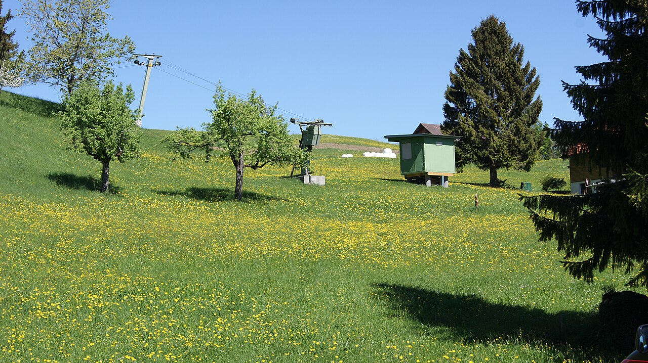
Gurtis is a mapped downhill ski area in AT. Forecasts cover three real lift-station locations from approximately 918 to 1394 metres. Elevations are terrain-model estimates.
Data: OpenSkiData / OpenSkiMap, OpenStreetMap contributors (ODbL), Skimap.org, Who's On First, Mapterhorn.
Gurtis - Middle lift station
ECMWF · Εκτέλεση μοντέλου: Αναμενόμενη επόμενη ενημέρωση:
Ημέρα Ώρα (UTC) Θερμ. (°C) Υγρασία (%) Άνεμος (km/h) Άνεμος (κόμβοι) Άνεμος (Bft) Διεύθυνση Υετός (mm) Νέο χιόνι (cm) Πίεση (hPa) Σημείο παγοποίησης (m) Συνθήκες | Τετάρτη, 04/11 06:00 0 90 2 1 1B S — — 1023 1181 Cloudy 66% cloud 09:00 3.5 80 1 0 0B SW 0 0 1024 1872 Partly cloudy 41% cloud 12:00 6.9 67 1 1 1B N 0 0 1022 2260 Clear 13% cloud 15:00 5.1 80 0 0 0B NW 0 0 1022 2205 Clear 14% cloud 18:00 1.5 87 4 2 1B S 0 0 1023 1647 Partly cloudy 50% cloud 21:00 0.9 80 5 3 1B S 0 0 1023 1573 Clear 12% cloud Πέμπτη, 05/11 00:00 1.1 75 6 3 2B S 0 0 1023 1719 Clear 3% cloud 03:00 0.8 76 7 4 2B S 0 0 1023 1727 Clear 9% cloud 06:00 0.4 78 8 4 2B S 0 0 1023 1765 Clear 17% cloud 09:00 7.2 62 7 4 2B S 0 0 1024 2937 Clear 6% cloud 12:00 10.6 56 1 0 0B SW 0 0 1022 2997 Clear 7% cloud 15:00 7.8 77 1 1 0B NW 0 0 1023 2939 Clear 9% cloud 18:00 3.5 85 2 1 1B S 0 0 1023 2825 Partly cloudy 38% cloud 21:00 2 82 3 2 1B S 0 0 1022 2797 Cloudy 50% cloud Παρασκευή, 06/11 00:00 0.8 84 5 3 1B S 0 0 1021 3074 Partly cloudy 45% cloud 03:00 0.3 81 4 2 1B S 0 0 1020 3100 Partly cloudy 45% cloud 06:00 0.2 81 3 2 1B SE 0 0 1020 2044 Partly cloudy 35% cloud 09:00 5.9 70 0 0 0B NE 0 0 1021 2980 Overcast 90% cloud 12:00 6.2 75 3 2 1B N 0 0 1021 2713 Overcast 100% cloud 15:00 4.3 88 2 1 1B N 0.13 0 1022 2411 Overcast 94% cloud 18:00 2.9 94 1 1 0B SE 1.0 0 1022 2149 Overcast 91% cloud 21:00 2.9 95 1 0 0B SE 0.67 0 1023 2047 Overcast 100% cloud Σάββατο, 07/11 00:00 2.9 95 1 1 1B SE 2.6 0 1023 1912 Overcast 100% cloud 03:00 2.7 95 0 0 0B S 1.5 0 1023 1838 Overcast 100% cloud 06:00 2.8 94 1 0 0B SE 0.55 0 1023 1811 Overcast 100% cloud 09:00 3.1 95 2 1 1B SE 2.5 0 1024 1802 Overcast 100% cloud 12:00 4.3 93 2 1 1B S 0.61 0 1023 1920 Overcast 98% cloud 15:00 4.5 91 0 0 0B S 0.18 0 1023 1924 Overcast 87% cloud 18:00 2.7 95 1 1 1B S 0.09 0 1023 1714 Partly cloudy 46% cloud 21:00 0.1 95 2 1 1B S 0 0 1024 1212 Cloudy 59% cloud Κυριακή, 08/11 00:00 -1.3 97 5 3 1B S 0.01 0 1024 < 1082 Cloudy 77% cloud 03:00 -1.2 93 4 2 1B S 0.01 0 1023 < 1082 Cloudy 80% cloud 06:00 -0.6 91 4 2 1B S 0.14 0 1023 < 1082 Cloudy 78% cloud 09:00 4.6 80 4 2 1B S 0.05 0 1024 1877 Clear 5% cloud 12:00 7.7 60 2 1 1B W 0 0 1022 2158 Clear 3% cloud 15:00 5.5 78 2 1 1B NW 0 0 1022 2029 Clear 6% cloud 18:00 0.7 82 3 2 1B S 0 0 1022 1394 Clear 14% cloud 21:00 -0.2 71 6 3 2B S 0 0 1022 1097 Clear 18% cloud Δευτέρα, 09/11 00:00 2.2 59 7 4 2B S 0 0 1021 1790 Overcast 99% cloud 03:00 2.4 64 6 3 2B S 0.09 0 1020 1921 Overcast 90% cloud 06:00 2.5 72 7 4 2B S 0.19 0 1020 1960 Overcast 89% cloud 09:00 6.9 59 8 4 2B S 0 0 1019 2550 Cloudy 77% cloud 12:00 10.6 46 8 4 2B S 0 0 1016 2721 Overcast 85% cloud 15:00 8.4 57 7 4 2B S 0 0 1016 2700 Overcast 99% cloud 18:00 7.2 60 8 5 2B S 0 0 1015 2729 Overcast 100% cloud 21:00 6.3 69 8 4 2B S 0.15 0 1015 2833 Overcast 100% cloud Τρίτη, 10/11 00:00 6.3 73 9 5 2B S 0.12 0 1014 2944 Overcast 93% cloud 03:00 6.4 70 9 5 2B S 0 0 1012 2947 Overcast 99% cloud 06:00 6.6 70 8 4 2B S 0 0 1011 3040 Overcast 100% cloud |
|---|
Forecast notes
Forecast table times: UTC.
Coordinates: 47.192664°N, 9.626599°E · Requested elevation: 1175 m. Model terrain: 1079 m. Terrain and 1000/925/850/700 hPa profiles are used for height estimates.
These are altitude estimates, not a simulation of local mountain terrain. Precipitation, cloud and sea-level pressure use horizontal interpolation only.
Precipitation includes rain and snow water equivalent: preceding 3 hours through day 6, then 6 hours (see cell tooltip). Snow (cm) estimates fresh snowfall from precipitation and temperature using the GFS conversion; it is not snow depth on the ground. Freezing (m) uses additional 600/500 hPa temperatures when available and estimates the lowest resolved 0°C crossing above sea level. When all sampled levels are warm, the upper profile limit is shown (see tooltip). < marks an entirely cold sampled profile and its lower height limit. No extrapolation is used.
Source: ECMWF · CC BY 4.0 · Processed by Snow Report.
Gurtis - Top lift station
ECMWF · Εκτέλεση μοντέλου: Αναμενόμενη επόμενη ενημέρωση:
Ημέρα Ώρα (UTC) Θερμ. (°C) Υγρασία (%) Άνεμος (km/h) Άνεμος (κόμβοι) Άνεμος (Bft) Διεύθυνση Υετός (mm) Νέο χιόνι (cm) Πίεση (hPa) Σημείο παγοποίησης (m) Συνθήκες | Τετάρτη, 04/11 06:00 -0.7 89 3 2 1B S — — 1023 1179 Cloudy 66% cloud 09:00 2.5 79 2 1 1B S 0 0 1024 1878 Partly cloudy 40% cloud 12:00 5.6 67 2 1 1B SE 0 0 1022 2263 Clear 14% cloud 15:00 4 78 3 2 1B S 0 0 1022 2208 Clear 15% cloud 18:00 0.8 84 7 4 2B S 0 0 1023 1651 Cloudy 50% cloud 21:00 0.4 77 8 4 2B S 0 0 1023 1578 Clear 12% cloud Πέμπτη, 05/11 00:00 0.7 72 7 4 2B S 0 0 1023 1714 Clear 3% cloud 03:00 0.5 72 8 4 2B S 0 0 1023 1718 Clear 10% cloud 06:00 0.2 73 10 5 2B S 0 0 1023 1742 Clear 17% cloud 09:00 6.3 60 9 5 2B S 0 0 1024 2935 Clear 6% cloud 12:00 9.3 56 3 2 1B SW 0 0 1022 2996 Clear 7% cloud 15:00 6.8 75 2 1 1B SW 0 0 1023 2939 Clear 9% cloud 18:00 3.1 81 3 2 1B S 0 0 1023 2825 Partly cloudy 38% cloud 21:00 1.7 78 5 3 1B S 0 0 1022 2795 Cloudy 51% cloud Παρασκευή, 06/11 00:00 0.7 79 6 3 2B S 0 0 1021 3067 Partly cloudy 44% cloud 03:00 0.3 77 5 3 1B S 0 0 1020 3100 Partly cloudy 45% cloud 06:00 0.1 77 4 2 1B SE 0 0 1020 2036 Partly cloudy 36% cloud 09:00 5.2 68 2 1 1B SE 0 0 1021 2979 Overcast 90% cloud 12:00 5.3 74 1 1 0B NE 0 0 1021 2715 Overcast 100% cloud 15:00 3.6 88 2 1 1B E 0.14 0 1022 2411 Overcast 94% cloud 18:00 2.2 94 3 2 1B SE 1.0 0 1022 2147 Overcast 91% cloud 21:00 2.2 95 3 2 1B SE 0.67 0 1023 2046 Overcast 100% cloud Σάββατο, 07/11 00:00 2 95 4 2 1B S 2.6 0 1023 1909 Overcast 100% cloud 03:00 1.8 95 2 1 1B S 1.5 0 1023 1836 Overcast 100% cloud 06:00 1.8 94 1 1 1B SE 0.55 0 1023 1808 Overcast 100% cloud 09:00 2 96 3 2 1B SE 2.5 0 1024 1800 Overcast 100% cloud 12:00 3 94 4 2 1B S 0.61 0 1023 1918 Overcast 98% cloud 15:00 3.1 92 2 1 1B S 0.18 0 1023 1922 Overcast 87% cloud 18:00 1.6 95 3 2 1B S 0.09 0 1023 1709 Partly cloudy 45% cloud 21:00 -0.7 93 4 2 1B S 0 0 1024 1200 Cloudy 59% cloud Κυριακή, 08/11 00:00 -2 95 7 4 2B S 0.02 0 1024 < 1089 Cloudy 77% cloud 03:00 -1.9 92 5 3 1B S 0.02 0 1023 < 1089 Cloudy 79% cloud 06:00 -1.4 91 5 3 1B S 0.14 0 1023 < 1089 Cloudy 78% cloud 09:00 3.1 80 4 2 1B SW 0.05 0 1024 1877 Clear 5% cloud 12:00 6 60 4 2 1B W 0 0 1022 2159 Clear 3% cloud 15:00 4.1 76 5 2 1B W 0 0 1022 2031 Clear 6% cloud 18:00 -0 77 6 3 2B SW 0 0 1022 1389 Clear 14% cloud 21:00 -0.8 70 7 4 2B SW 0 0 1022 < 1089 Clear 18% cloud Δευτέρα, 09/11 00:00 1.4 62 7 4 2B SW 0 0 1021 1785 Overcast 99% cloud 03:00 1.7 66 8 5 2B SW 0.09 0 1020 1915 Overcast 90% cloud 06:00 1.8 74 9 5 2B SW 0.18 0 1020 1956 Overcast 89% cloud 09:00 5.8 60 10 6 2B SW 0 0 1019 2550 Cloudy 77% cloud 12:00 9.1 49 11 6 2B SW 0 0 1016 2721 Overcast 85% cloud 15:00 7.1 59 10 5 2B SW 0 0 1016 2700 Overcast 99% cloud 18:00 6.2 63 11 6 2B SW 0 0 1015 2729 Overcast 100% cloud 21:00 5.4 71 11 6 2B SW 0.15 0 1015 2833 Overcast 100% cloud Τρίτη, 10/11 00:00 5.5 75 12 6 2B SW 0.12 0 1014 2945 Overcast 93% cloud 03:00 5.6 73 10 5 2B SW 0 0 1012 2947 Overcast 99% cloud 06:00 5.8 72 9 5 2B S 0 0 1011 3040 Overcast 100% cloud |
|---|
Forecast notes
Forecast table times: UTC.
Coordinates: 47.1883977°N, 9.6248084°E · Requested elevation: 1394 m. Model terrain: 1086 m. Terrain and 1000/925/850/700 hPa profiles are used for height estimates.
These are altitude estimates, not a simulation of local mountain terrain. Precipitation, cloud and sea-level pressure use horizontal interpolation only.
Precipitation includes rain and snow water equivalent: preceding 3 hours through day 6, then 6 hours (see cell tooltip). Snow (cm) estimates fresh snowfall from precipitation and temperature using the GFS conversion; it is not snow depth on the ground. Freezing (m) uses additional 600/500 hPa temperatures when available and estimates the lowest resolved 0°C crossing above sea level. When all sampled levels are warm, the upper profile limit is shown (see tooltip). < marks an entirely cold sampled profile and its lower height limit. No extrapolation is used.