全球滑雪场天气预报

颜色说明 温度 · 风 · 降雨 · 降雪
每种颜色从所示数值开始。三种风速单位的颜色相互对应。无降水单元格保持中性色。颜色仅描述显示值,并非官方天气预警。
正在准备预报图表…
时间和数值与详细预报一致。点击数值查看详情,横向滚动查看后续日期。降水量为每时段总水当量,包含降雪;新雪量指每时段新增降雪,并非地面积雪深度。
GFS与ECMWF模式对比。各模式保留各自的预报时间和时长。降水量和降雪量对应各模式自身的时段,模式之间的时段可能不同。
预报数值与模式说明
Grindelwald-Wengen and the Jungfrau - base
ECMWF · 模式起报时间: 预计下次更新:
日期 时间(UTC) 气温(°C) 湿度(%) 风速(km/h) 风速(节) 风力(Bft) 风向 降水(mm) 新雪(cm) 气压(hPa) 零度层(m) 天气状况 | 星期三, 04/11 06:00 0.2 67 1 1 1B E — — 1022 < 2074 Overcast 91% cloud  09:00 4.1 62 3 2 1B E 0.01 0 1023 < 2074 Cloudy 78% cloud  12:00 5.9 61 3 2 1B SE 0.02 0 1023 2122 Overcast 92% cloud 15:00 5.5 62 3 2 1B SE 0.06 0 1023 < 2074 Overcast 95% cloud 18:00 3.4 68 3 2 1B SE 0.07 0 1023 < 2074 Cloudy 76% cloud 21:00 3.3 65 3 2 1B SE 0.03 0 1025 < 2074 Cloudy 61% cloud 星期四, 05/11 00:00 2.8 62 4 2 1B SE 0.01 0 1025 < 2074 Cloudy 66% cloud 03:00 2.5 62 4 2 1B SE 0 0 1024 < 2074 Cloudy 67% cloud 06:00 2.7 63 3 2 1B SE 0.06 0 1024 < 2074 Cloudy 73% cloud 09:00 7 54 4 2 1B SE 0 0 1025 2527 Cloudy 66% cloud 12:00 9.1 52 3 2 1B SE 0 0 1024 2754 Partly cloudy 44% cloud  15:00 9 58 2 1 1B SE 0 0 1023 2765 Partly cloudy 26% cloud 18:00 5.3 63 2 1 1B SE 0 0 1023 < 2074 Cloudy 68% cloud 21:00 4.5 63 2 1 1B SE 0 0 1023 < 2074 Cloudy 67% cloud 星期五, 06/11 00:00 4.6 67 2 1 1B SE 0 0 1021 < 2074 Overcast 99% cloud 03:00 5.4 70 2 1 1B SE 0.60 0 1020 < 2074 Overcast 97% cloud 06:00 5.3 69 2 1 1B SE 0.22 0 1020 < 2074 Overcast 93% cloud 09:00 6.8 68 1 1 1B S 0.08 0 1021 2413 Overcast 85% cloud 12:00 6.9 67 1 0 0B S 0.01 0 1022 2358 Overcast 99% cloud 15:00 6.2 72 0 0 0B NW 0.29 0 1021 2207 Overcast 99% cloud 18:00 5.2 75 1 1 1B NW 1.2 0 1022 < 2074 Overcast 100% cloud 21:00 4.7 75 2 1 1B W 0.52 0 1023 < 2074 Overcast 100% cloud 星期六, 07/11 00:00 4.3 75 2 1 1B W 0.47 0 1023 < 2074 Overcast 100% cloud 03:00 4 75 2 1 1B NW 0.31 0 1023 < 2074 Overcast 100% cloud 06:00 4.1 73 1 1 1B NW 0.37 0 1023 < 2074 Overcast 99% cloud 09:00 4.7 72 1 0 0B NW 0.25 0 1024 < 2074 Overcast 100% cloud 12:00 5.6 69 1 1 1B SE 0.43 0 1022 2080 Overcast 100% cloud 15:00 4.8 73 1 1 1B SE 0.65 0 1023 < 2074 Overcast 100% cloud 18:00 3.7 73 1 1 1B SE 0.20 0 1024 < 2074 Overcast 90% cloud 21:00 2.6 71 1 0 0B SE 0.05 0 1024 < 2074 Overcast 89% cloud 星期日, 08/11 00:00 1.3 69 1 0 0B SE 0.01 0 1024 < 2074 Overcast 88% cloud 03:00 0.8 68 0 0 0B E 0.05 0 1023 < 2074 Overcast 81% cloud 06:00 0.4 68 0 0 0B E 0 0 1023 < 2074 Cloudy 56% cloud 09:00 4 55 1 1 1B SE 0 0 1024 < 2074 Partly cloudy 24% cloud 12:00 7 41 2 1 1B SW 0 0 1023 2263 Clear 11% cloud  15:00 5.5 49 1 1 1B NW 0 0 1022 < 2074 Clear 3% cloud 18:00 1.2 53 1 1 0B SE 0 0 1022 < 2074 Clear 12% cloud 21:00 2.6 53 1 0 0B SE 0 0 1020 < 2074 Overcast 95% cloud 星期一, 09/11 00:00 4.4 57 1 1 1B SE 0.07 0 1020 < 2074 Overcast 98% cloud 03:00 5.7 57 1 1 0B S 0.01 0 1018 2110 Overcast 89% cloud 06:00 5.1 59 1 1 1B SE 0 0 1018 < 2074 Overcast 97% cloud 09:00 7.7 58 3 1 1B SE 0.07 0 1018 2595 Overcast 96% cloud 12:00 9.8 49 3 1 1B S 0 0 1018 2781 Overcast 100% cloud 15:00 8.6 57 3 1 1B SE 0 0 1017 2794 Overcast 99% cloud 18:00 7.1 62 3 2 1B SE 0.07 0 1016 2705 Overcast 100% cloud 21:00 6.7 62 3 1 1B SE 0.07 0 1016 3067 Overcast 89% cloud 星期二, 10/11 00:00 6.2 64 3 1 1B SE 0 0 1015 3062 Overcast 98% cloud 03:00 6.5 64 3 2 1B SE 0 0 1013 3048 Overcast 99% cloud 06:00 7.2 64 3 2 1B SE 0.07 0 1011 3038 Overcast 100% cloud |
|---|
Forecast notes
Forecast table times: UTC.
Coordinates: 46.62492015°N, 8.04182053°E · Requested elevation: 1062 m. Model terrain: 2072 m. Terrain and 1000/925/850/700 hPa profiles are used for height estimates.
Outside the available profile, temperature uses an estimated 5.5°C/km height correction; wind retains the nearest available model-level value. Humidity is estimated with adjusted pressure and temperature.
These are altitude estimates, not a simulation of local mountain terrain. Precipitation, cloud and sea-level pressure use horizontal interpolation only.
Precipitation includes rain and snow water equivalent: preceding 3 hours through day 6, then 6 hours (see cell tooltip). Snow (cm) estimates fresh snowfall from precipitation and temperature using the GFS conversion; it is not snow depth on the ground. Freezing (m) uses additional 600/500 hPa temperatures when available and estimates the lowest resolved 0°C crossing above sea level. When all sampled levels are warm, the upper profile limit is shown (see tooltip). < marks an entirely cold sampled profile and its lower height limit. No extrapolation is used.
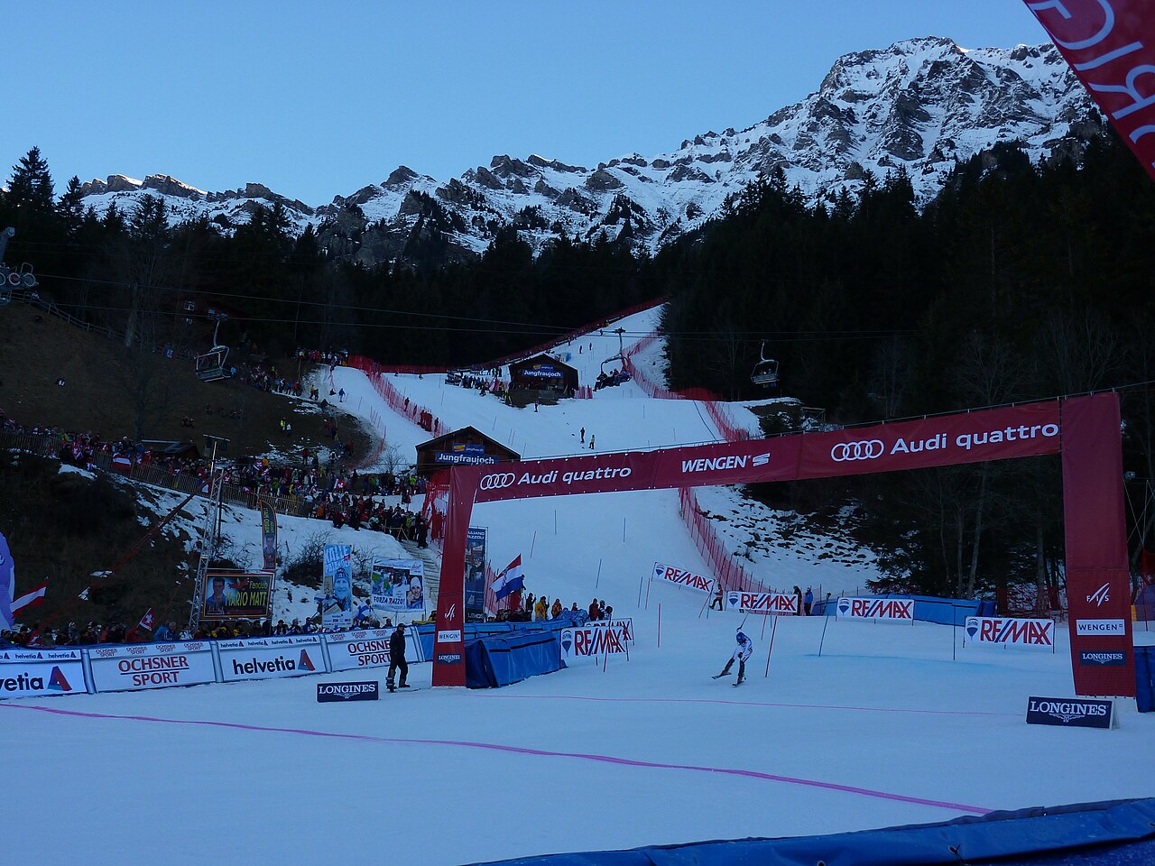
Grindelwald-Wengen covers the Kleine Scheidegg and Männlichen sectors, with the Lauberhorn slopes forming part of its identity. The wider Jungfrau Ski Region also includes Grindelwald-First and Mürren-Schilthorn. These names describe distinct ski areas: a regional pass or a regional piste total should not be read as one uninterrupted ski route.
For orientation, begin with the part of the official map that matches your departure point. A day around Kleine Scheidegg is a different plan from one at First or Mürren. Railways and mountain lifts are part of the area’s transport network, so the return journey deserves the same attention as the first ascent.
The forecast on this page starts at 1,062 m. It is a lower reference for this broad mountain destination, not a prediction for the surrounding summits. Compare weather at your chosen skiing height and at the lower return point. A temperature rise can change the precipitation type between those levels. The public forecast cannot determine the condition or opening of an individual piste; use the regional live report for that detail.
Official sources: Jungfrau Ski Region · Grindelwald-Wengen. Reviewed 18 October 2026.