Προγνώσεις για χιονοδρομικά σε όλο τον κόσμο

Περισσότερα
Χρωματική κλίμακα Θερμοκρασία · Άνεμος · Βροχή · Χιόνι
Κάθε χρώμα ξεκινά από την τιμή που αναγράφεται. Τα χρώματα ανέμου αντιστοιχούν και στις τρεις μονάδες. Οι τιμές χωρίς υετό παραμένουν ουδέτερες. Τα χρώματα περιγράφουν τις τιμές και δεν αποτελούν επίσημες προειδοποιήσεις.
Gemeindealpe Mitterbach - Base lift station
ECMWF · Εκτέλεση μοντέλου: Αναμενόμενη επόμενη ενημέρωση:
Ημέρα Ώρα (UTC) Θερμ. (°C) Υγρασία (%) Άνεμος (km/h) Άνεμος (κόμβοι) Άνεμος (Bft) Διεύθυνση Υετός (mm) Νέο χιόνι (cm) Πίεση (hPa) Σημείο παγοποίησης (m) Συνθήκες | Τετάρτη, 04/11 06:00 0.7 93 6 3 2B NE — — 1030 < 992 Overcast 100% cloud  09:00 2.4 84 5 3 1B E 0 0 1030 1377 Overcast 100% cloud 12:00 5.1 75 5 3 1B E 0 0 1029 1473 Overcast 100% cloud 15:00 4.3 79 7 4 2B E 0 0 1029 1514 Overcast 90% cloud 18:00 2 89 7 4 2B SE 0 0 1030 1366 Cloudy 76% cloud  21:00 1.4 91 9 5 2B SE 0 0 1031 1790 Partly cloudy 42% cloud  Πέμπτη, 05/11 00:00 0.4 91 10 5 2B SE 0 0 1031 1129 Partly cloudy 41% cloud 03:00 0.5 91 11 6 2B SE 0 0 1030 1059 Partly cloudy 45% cloud 06:00 0.4 92 11 6 2B SE 0 0 1030 1071 Cloudy 62% cloud 09:00 4.3 78 10 6 2B SE 0 0 1030 2779 Cloudy 55% cloud 12:00 7.1 64 11 6 2B SE 0 0 1028 2953 Partly cloudy 33% cloud 15:00 4.8 75 8 4 2B SE 0 0 1027 3032 Clear 7% cloud  18:00 0.5 91 10 5 2B S 0 0 1028 1028 Clear 10% cloud 21:00 0.6 91 10 5 2B S 0 0 1028 1022 Partly cloudy 45% cloud Παρασκευή, 06/11 00:00 0.7 92 9 5 2B S 0 0 1026 1013 Cloudy 52% cloud 03:00 0.2 92 8 5 2B S 0 0 1025 1041 Cloudy 51% cloud 06:00 -0.1 92 9 5 2B SE 0 0 1024 1061 Cloudy 53% cloud 09:00 5.4 75 8 4 2B SE 0 0 1025 3018 Partly cloudy 27% cloud 12:00 9.3 53 10 5 2B SE 0 0 1023 2994 Clear 2% cloud 15:00 6.4 65 9 5 2B SE 0 0 1023 2949 Clear 0% cloud 18:00 1.4 87 10 5 2B SE 0 0 1023 2890 Clear 0% cloud 21:00 0.5 85 11 6 2B SE 0 0 1024 1037 Clear 0% cloud Σάββατο, 07/11 00:00 0.4 85 12 6 2B SE 0 0 1025 1057 Clear 3% cloud 03:00 -0.2 86 11 6 2B S 0 0 1025 1104 Partly cloudy 20% cloud 06:00 -0.7 86 11 6 2B S 0 0 1026 1135 Partly cloudy 31% cloud 09:00 4.7 58 10 5 2B S 0 0 1027 2574 Clear 20% cloud 12:00 8 44 12 6 2B SE 0 0 1025 2336 Clear 1% cloud 15:00 5 56 10 5 2B SE 0 0 1025 2453 Clear 0% cloud 18:00 -0.1 71 11 6 2B S 0 0 1026 1090 Clear 0% cloud 21:00 -1 72 12 6 2B S 0 0 1026 1149 Clear 0% cloud Κυριακή, 08/11 00:00 -1.7 76 11 6 2B S 0 0 1026 1194 Clear 5% cloud 03:00 -2.5 76 11 6 2B S 0 0 1025 1230 Clear 15% cloud 06:00 -0.7 62 10 5 2B S 0 0 1024 1149 Cloudy 71% cloud 09:00 5.4 45 6 3 2B S 0 0 1025 2177 Clear 2% cloud 12:00 7.3 48 2 1 1B S 0.95 0 1024 1944 Cloudy 53% cloud 15:00 4.2 67 1 1 1B SE 0.02 0 1024 1876 Cloudy 76% cloud 18:00 -0.1 81 5 3 1B S 0 0 1025 1140 Clear 0% cloud 21:00 -1.2 86 6 3 2B S 0 0 1024 1194 Clear 1% cloud Δευτέρα, 09/11 00:00 -1.1 85 6 3 2B S 0 0 1023 1179 Clear 0% cloud 03:00 -1 82 6 3 2B S 0 0 1022 1154 Clear 0% cloud 06:00 -1.1 83 6 3 2B S 0 0 1021 1146 Clear 11% cloud 09:00 7.6 55 5 3 1B SE 0 0 1021 2428 Cloudy 75% cloud 12:00 9.7 43 5 3 1B SE 0 0 1019 2447 Overcast 98% cloud 15:00 4.5 74 6 3 2B S 0.59 0 1019 2501 Overcast 99% cloud 18:00 2.9 81 7 4 2B S 0 0 1018 2701 Overcast 83% cloud 21:00 1.2 86 7 4 2B S 0 0 1016 2667 Cloudy 63% cloud Τρίτη, 10/11 00:00 1.9 84 7 4 2B S 0 0 1014 2824 Overcast 92% cloud 03:00 4.1 76 6 3 1B S 0.08 0 1012 2809 Overcast 97% cloud 06:00 5 74 8 4 2B S 0 0 1011 2900 Overcast 97% cloud |
|---|
Forecast notes
Forecast table times: UTC.
Coordinates: 47.8106104°N, 15.2889961°E · Requested elevation: 804 m. Model terrain: 989 m. Terrain and 1000/925/850/700 hPa profiles are used for height estimates.
Outside the available profile, temperature uses an estimated 5.5°C/km height correction; wind retains the nearest available model-level value. Humidity is estimated with adjusted pressure and temperature.
These are altitude estimates, not a simulation of local mountain terrain. Precipitation, cloud and sea-level pressure use horizontal interpolation only.
Precipitation includes rain and snow water equivalent: preceding 3 hours through day 6, then 6 hours (see cell tooltip). Snow (cm) estimates fresh snowfall from precipitation and temperature using the GFS conversion; it is not snow depth on the ground. Freezing (m) uses additional 600/500 hPa temperatures when available and estimates the lowest resolved 0°C crossing above sea level. When all sampled levels are warm, the upper profile limit is shown (see tooltip). < marks an entirely cold sampled profile and its lower height limit. No extrapolation is used.
Source: ECMWF · CC BY 4.0 · Processed by Snow Report.
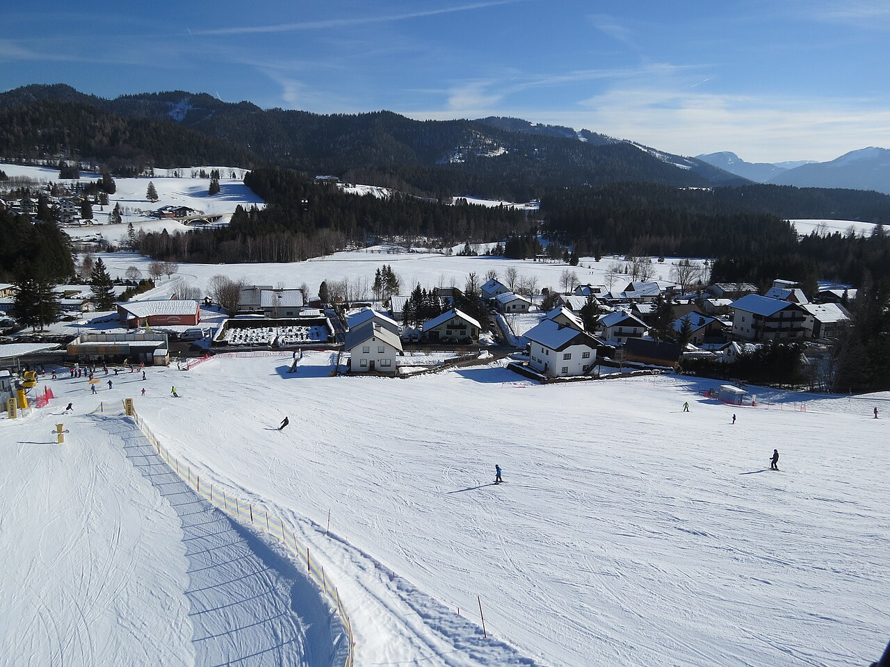
Gemeindealpe Mitterbach is a mapped downhill ski area in AT. Forecasts cover three real lift-station locations from approximately 804 to 1622 metres. Elevations are terrain-model estimates.
Data: OpenSkiData / OpenSkiMap, OpenStreetMap contributors (ODbL), Skimap.org, Who's On First, Mapterhorn.
Gemeindealpe Mitterbach - Middle lift station
ECMWF · Εκτέλεση μοντέλου: Αναμενόμενη επόμενη ενημέρωση:
Ημέρα Ώρα (UTC) Θερμ. (°C) Υγρασία (%) Άνεμος (km/h) Άνεμος (κόμβοι) Άνεμος (Bft) Διεύθυνση Υετός (mm) Νέο χιόνι (cm) Πίεση (hPa) Σημείο παγοποίησης (m) Συνθήκες | Τετάρτη, 04/11 06:00 -1 97 8 5 2B E — — 1030 < 993 Overcast 100% cloud 09:00 0.3 91 7 4 2B E 0 0 1030 1396 Overcast 100% cloud 12:00 1.6 88 6 3 2B SE 0 0 1029 1484 Overcast 100% cloud 15:00 1.4 90 10 5 2B SE 0 0 1029 1529 Overcast 90% cloud 18:00 0.2 94 13 7 3B SE 0 0 1030 1379 Cloudy 76% cloud 21:00 0.6 80 17 9 3B SE 0 0 1031 1828 Partly cloudy 46% cloud Πέμπτη, 05/11 00:00 0.8 70 18 10 3B SE 0 0 1031 1118 Partly cloudy 39% cloud 03:00 1.8 62 15 8 3B SE 0 0 1030 1054 Partly cloudy 41% cloud 06:00 1.8 59 15 8 3B SE 0 0 1030 1073 Cloudy 59% cloud 09:00 4.4 50 16 8 3B SE 0 0 1030 2785 Cloudy 52% cloud 12:00 5.8 45 15 8 3B S 0 0 1028 2963 Partly cloudy 32% cloud 15:00 5.4 48 12 6 2B S 0 0 1027 3037 Clear 6% cloud 18:00 3.5 53 13 7 3B SE 0 0 1028 1033 Clear 9% cloud 21:00 3.8 52 13 7 3B S 0 0 1028 1024 Partly cloudy 42% cloud Παρασκευή, 06/11 00:00 4.4 49 12 7 2B SE 0 0 1026 1012 Partly cloudy 48% cloud 03:00 4.2 49 12 7 2B S 0 0 1024 1043 Partly cloudy 48% cloud 06:00 3.9 52 12 7 2B SE 0 0 1024 1063 Cloudy 51% cloud 09:00 6.2 47 16 9 3B SE 0 0 1025 3024 Partly cloudy 26% cloud 12:00 7.6 39 18 10 3B SE 0 0 1023 2997 Clear 2% cloud 15:00 6.2 37 20 11 4B SE 0 0 1023 2952 Clear 0% cloud 18:00 3.9 42 22 12 4B SE 0 0 1023 2893 Clear 0% cloud 21:00 2.9 45 26 14 4B SE 0 0 1024 1032 Clear 0% cloud Σάββατο, 07/11 00:00 2.5 45 28 15 4B S 0 0 1025 1052 Clear 2% cloud 03:00 2.1 43 25 14 4B S 0 0 1025 1105 Clear 16% cloud 06:00 2 41 22 12 4B S 0 0 1026 1135 Partly cloudy 28% cloud 09:00 3.9 39 24 13 4B S 0 0 1027 2581 Clear 19% cloud 12:00 4.5 44 24 13 4B S 0 0 1025 2350 Clear 1% cloud 15:00 3.7 33 25 14 4B S 0 0 1025 2458 Clear 0% cloud 18:00 2.3 28 28 15 4B S 0 0 1025 1093 Clear 0% cloud 21:00 1.8 27 28 15 4B S 0 0 1026 1153 Clear 0% cloud Κυριακή, 08/11 00:00 1.3 29 26 14 4B S 0 0 1025 1198 Clear 6% cloud 03:00 0.9 29 24 13 4B S 0 0 1024 1232 Clear 14% cloud 06:00 1.7 39 19 10 3B S 0 0 1024 1142 Cloudy 71% cloud 09:00 4 41 15 8 3B S 0 0 1025 2173 Clear 1% cloud 12:00 4.1 55 8 4 2B SW 1.1 0 1024 1941 Cloudy 54% cloud 15:00 2.6 66 6 3 1B SW 0.00 0 1024 1878 Cloudy 76% cloud 18:00 1.1 67 6 3 2B SW 0 0 1025 1141 Clear 0% cloud 21:00 1.1 67 7 4 2B SW 0 0 1024 1197 Clear 1% cloud Δευτέρα, 09/11 00:00 1.3 66 7 4 2B SW 0 0 1023 1182 Clear 0% cloud 03:00 1.7 58 6 3 2B S 0 0 1022 1154 Clear 0% cloud 06:00 2 53 8 4 2B S 0 0 1021 1146 Clear 13% cloud 09:00 6.1 39 6 3 2B S 0 0 1021 2430 Cloudy 74% cloud 12:00 7.3 36 7 4 2B S 0 0 1019 2448 Overcast 100% cloud 15:00 4.9 51 7 4 2B S 0.64 0 1019 2502 Overcast 99% cloud 18:00 5 51 8 4 2B SW 0 0 1018 2703 Overcast 83% cloud 21:00 4.7 58 5 3 1B SW 0 0 1016 2664 Cloudy 65% cloud Τρίτη, 10/11 00:00 6.3 49 16 9 3B W 0 0 1014 2826 Overcast 92% cloud 03:00 6.3 71 17 9 3B W 0.09 0 1012 2805 Overcast 96% cloud 06:00 7.7 59 15 8 3B SW 0 0 1011 2896 Overcast 97% cloud |
|---|
Forecast notes
Forecast table times: UTC.
Coordinates: 47.8096113°N, 15.2600808°E · Requested elevation: 1293 m. Model terrain: 991 m. Terrain and 1000/925/850/700 hPa profiles are used for height estimates.
These are altitude estimates, not a simulation of local mountain terrain. Precipitation, cloud and sea-level pressure use horizontal interpolation only.
Precipitation includes rain and snow water equivalent: preceding 3 hours through day 6, then 6 hours (see cell tooltip). Snow (cm) estimates fresh snowfall from precipitation and temperature using the GFS conversion; it is not snow depth on the ground. Freezing (m) uses additional 600/500 hPa temperatures when available and estimates the lowest resolved 0°C crossing above sea level. When all sampled levels are warm, the upper profile limit is shown (see tooltip). < marks an entirely cold sampled profile and its lower height limit. No extrapolation is used.
Source: ECMWF · CC BY 4.0 · Processed by Snow Report.
Gemeindealpe Mitterbach - Top lift station
ECMWF · Εκτέλεση μοντέλου: Αναμενόμενη επόμενη ενημέρωση:
Ημέρα Ώρα (UTC) Θερμ. (°C) Υγρασία (%) Άνεμος (km/h) Άνεμος (κόμβοι) Άνεμος (Bft) Διεύθυνση Υετός (mm) Νέο χιόνι (cm) Πίεση (hPa) Σημείο παγοποίησης (m) Συνθήκες | Τετάρτη, 04/11 06:00 -1.8 96 11 6 2B E — — 1030 < 989 Overcast 100% cloud 09:00 -0.7 92 9 5 2B SE 0 0 1030 1406 Overcast 100% cloud 12:00 -0.7 95 9 5 2B SE 0 0 1029 1488 Overcast 100% cloud 15:00 -0.3 95 16 9 3B SE 0 0 1029 1534 Overcast 89% cloud 18:00 -0.6 92 18 10 3B SE 0 0 1030 1388 Cloudy 75% cloud 21:00 0.6 66 25 13 4B SE 0 0 1031 1841 Partly cloudy 47% cloud Πέμπτη, 05/11 00:00 1.9 50 25 13 4B SE 0 0 1031 1106 Partly cloudy 38% cloud 03:00 3.5 39 18 10 3B SE 0 0 1030 1048 Partly cloudy 39% cloud 06:00 3.8 35 19 10 3B SE 0 0 1030 1069 Cloudy 57% cloud 09:00 5.1 26 20 11 4B SE 0 0 1030 2789 Cloudy 50% cloud 12:00 5.4 25 19 10 3B S 0 0 1028 2967 Partly cloudy 31% cloud 15:00 6.5 26 15 8 3B S 0 0 1027 3040 Clear 6% cloud 18:00 6.6 29 15 8 3B SE 0 0 1028 1028 Clear 9% cloud 21:00 7.1 28 15 8 3B SE 0 0 1028 1019 Partly cloudy 41% cloud Παρασκευή, 06/11 00:00 7.9 25 14 8 3B SE 0 0 1026 1008 Partly cloudy 46% cloud 03:00 7.8 27 14 8 3B S 0 0 1024 1039 Partly cloudy 47% cloud 06:00 7.5 30 14 8 3B SE 0 0 1024 1059 Partly cloudy 50% cloud 09:00 7.2 27 21 11 4B SE 0 0 1024 3026 Partly cloudy 25% cloud 12:00 6.6 25 25 13 4B SE 0 0 1023 2999 Clear 2% cloud 15:00 6.5 17 28 15 4B SE 0 0 1023 2953 Clear 0% cloud 18:00 6.2 17 30 16 5B SE 0 0 1023 2896 Clear 0% cloud 21:00 5.2 22 36 20 5B SE 0 0 1024 1024 Clear 0% cloud Σάββατο, 07/11 00:00 4.5 22 39 21 6B S 0 0 1025 1045 Clear 2% cloud 03:00 4.3 19 35 19 5B S 0 0 1025 1100 Clear 14% cloud 06:00 4.5 16 31 17 5B S 0 0 1026 1130 Partly cloudy 27% cloud 09:00 3.8 22 35 19 5B S 0 0 1027 2584 Clear 19% cloud 12:00 2.2 38 34 19 5B S 0 0 1025 2358 Clear 1% cloud 15:00 3.2 14 37 20 5B S 0 0 1025 2461 Clear 0% cloud 18:00 4.6 4 40 22 6B S 0 0 1025 1089 Clear 0% cloud 21:00 4.4 4 40 22 6B S 0 0 1026 1149 Clear 0% cloud Κυριακή, 08/11 00:00 4.1 5 38 20 5B S 0 0 1025 1195 Clear 6% cloud 03:00 3.9 7 35 19 5B S 0 0 1024 1228 Clear 14% cloud 06:00 3.6 27 27 14 4B S 0 0 1024 1135 Cloudy 70% cloud 09:00 3 37 23 12 4B SW 0 0 1025 2172 Clear 1% cloud 12:00 1.8 58 14 7 3B SW 1.1 0 1024 1942 Cloudy 54% cloud 15:00 1.5 62 11 6 2B SW 0 0 1024 1879 Cloudy 76% cloud 18:00 2.1 58 10 5 2B W 0 0 1025 1134 Clear 0% cloud 21:00 3 54 10 5 2B SW 0 0 1024 1194 Clear 1% cloud Δευτέρα, 09/11 00:00 3.2 52 11 6 2B SW 0 0 1023 1178 Clear 0% cloud 03:00 3.8 43 9 5 2B SW 0 0 1022 1150 Clear 0% cloud 06:00 4.4 36 10 5 2B SW 0 0 1021 1142 Clear 14% cloud 09:00 4.9 26 9 5 2B SW 0 0 1021 2430 Cloudy 75% cloud 12:00 5.5 32 11 6 2B SW 0 0 1019 2448 Overcast 100% cloud 15:00 5.1 39 9 5 2B SW 0.64 0 1019 2503 Overcast 99% cloud 18:00 6.3 37 12 7 3B SW 0 0 1018 2703 Overcast 82% cloud 21:00 6.6 47 8 4 2B W 0 0 1016 2663 Cloudy 66% cloud Τρίτη, 10/11 00:00 8.5 38 27 15 4B W 0 0 1014 2826 Overcast 92% cloud 03:00 7.1 68 28 15 4B W 0.09 0 1012 2803 Overcast 96% cloud 06:00 8.4 55 24 13 4B W 0 0 1011 2895 Overcast 97% cloud |
|---|
Forecast notes
Forecast table times: UTC.
Coordinates: 47.8115676°N, 15.2482°E · Requested elevation: 1622 m. Model terrain: 986 m. Terrain and 1000/925/850/700 hPa profiles are used for height estimates.
These are altitude estimates, not a simulation of local mountain terrain. Precipitation, cloud and sea-level pressure use horizontal interpolation only.
Precipitation includes rain and snow water equivalent: preceding 3 hours through day 6, then 6 hours (see cell tooltip). Snow (cm) estimates fresh snowfall from precipitation and temperature using the GFS conversion; it is not snow depth on the ground. Freezing (m) uses additional 600/500 hPa temperatures when available and estimates the lowest resolved 0°C crossing above sea level. When all sampled levels are warm, the upper profile limit is shown (see tooltip). < marks an entirely cold sampled profile and its lower height limit. No extrapolation is used.