Prévisions pour les stations de ski du monde entier

Plus
Guide des couleurs Température · Vent · Pluie · Neige
Chaque couleur commence à la valeur indiquée. Les couleurs du vent correspondent dans les trois unités. Les cases sans précipitations restent neutres. Les couleurs décrivent les valeurs affichées et ne sont pas des alertes officielles.
Folgarida - base
ECMWF · Cycle du modèle : Prochaine mise à jour attendue :
Jour Heure (UTC) Temp. (°C) Humidité (%) Vent (km/h) Vent (nœuds) Vent (Bft) Direction Précip. (mm) Neige fraîche (cm) Pression (hPa) Isotherme 0 °C (m) Conditions | Mercredi, 04/11 06:00 2.5 82 0 0 0B NW — — 1024 1742 Overcast 100% cloud  09:00 4 79 2 1 1B E 0.10 0 1025 1956 Overcast 82% cloud 12:00 5.5 70 3 2 1B E 0.25 0 1025 2122 Overcast 94% cloud 15:00 4.9 76 2 1 1B E 0.11 0 1025 2085 Overcast 99% cloud 18:00 3 80 1 1 0B S 0.06 0 1027 1838 Cloudy 76% cloud  21:00 0.8 81 2 1 1B W 0 0 1028 < 1697 Cloudy 55% cloud Jeudi, 05/11 00:00 -0.6 80 3 2 1B W 0 0 1028 < 1697 Cloudy 56% cloud 03:00 -1.2 79 3 2 1B W 0 0 1028 < 1697 Partly cloudy 41% cloud  06:00 -1.7 76 2 1 1B W 0 0 1028 < 1697 Partly cloudy 21% cloud 09:00 5.7 59 1 1 1B E 0 0 1028 2518 Clear 11% cloud  12:00 8 57 2 1 1B SE 0 0 1026 2713 Clear 5% cloud 15:00 6.7 68 2 1 1B E 0 0 1025 2752 Clear 3% cloud 18:00 2.1 76 1 1 0B W 0 0 1026 < 1697 Clear 2% cloud 21:00 0.7 73 1 1 1B W 0 0 1026 < 1697 Clear 10% cloud Vendredi, 06/11 00:00 0.3 69 1 1 1B W 0 0 1025 < 1697 Clear 1% cloud 03:00 0.3 68 1 1 1B W 0 0 1023 < 1697 Clear 2% cloud 06:00 0.2 68 2 1 1B W 0 0 1023 < 1697 Cloudy 57% cloud 09:00 7.1 54 1 1 1B E 0 0 1023 2829 Overcast 86% cloud 12:00 9.1 54 3 2 1B E 0 0 1020 2769 Overcast 90% cloud 15:00 6.9 69 1 1 1B SE 0.11 0 1020 2598 Overcast 99% cloud 18:00 5.1 78 1 0 0B S 0.41 0 1021 2337 Overcast 98% cloud 21:00 4.2 82 1 1 1B S 0.99 0 1022 2102 Overcast 100% cloud Samedi, 07/11 00:00 3.8 82 1 1 1B SW 1.7 0 1022 1992 Overcast 100% cloud 03:00 3.1 84 1 0 0B S 2.3 0 1022 1860 Overcast 100% cloud 06:00 2.6 85 0 0 0B SW 3.8 0 1023 1759 Overcast 100% cloud 09:00 3.7 81 2 1 1B NE 0.43 0 1024 1931 Overcast 100% cloud 12:00 4.3 79 2 1 1B E 0.22 0 1023 2009 Overcast 99% cloud 15:00 4.1 80 2 1 1B E 0.12 0 1023 1977 Overcast 94% cloud 18:00 2.7 84 0 0 0B SW 0.20 0 1024 1773 Cloudy 80% cloud 21:00 2 83 1 0 0B SW 0 0 1025 < 1697 Overcast 89% cloud Dimanche, 08/11 00:00 2.5 83 1 0 0B SW 0.32 0 1025 1746 Overcast 99% cloud 03:00 2.3 85 1 0 0B S 1.1 0 1025 1703 Overcast 96% cloud 06:00 2.3 84 1 0 0B S 0.42 0 1025 1708 Overcast 92% cloud 09:00 3.6 78 1 1 1B SE 0.06 0 1026 1893 Overcast 81% cloud 12:00 4.6 72 2 1 1B SE 0.07 0 1025 2036 Cloudy 66% cloud 15:00 4.4 76 2 1 1B E 0.08 0 1024 2044 Cloudy 66% cloud 18:00 2 82 1 0 0B SW 0.10 0 1025 < 1697 Cloudy 69% cloud 21:00 0.7 79 2 1 1B W 0.11 0 1026 < 1697 Cloudy 65% cloud Lundi, 09/11 00:00 0.8 75 1 1 1B W 0 0 1025 < 1697 Cloudy 55% cloud 03:00 0.7 73 1 1 1B W 0 0 1025 < 1697 Overcast 81% cloud 06:00 1 73 1 1 1B W 0 0 1024 < 1697 Cloudy 78% cloud 09:00 4.4 68 1 1 0B SE 0 0 1024 2378 Cloudy 62% cloud 12:00 6.1 66 2 1 1B SE 0 0 1022 2536 Cloudy 74% cloud 15:00 5.6 71 1 0 0B SE 0 0 1021 2431 Overcast 95% cloud 18:00 4.1 79 2 1 1B SW 0 0 1022 2213 Overcast 96% cloud 21:00 4 82 2 1 1B SW 0.12 0 1022 2262 Overcast 95% cloud Mardi, 10/11 00:00 4.2 82 2 1 1B SW 0.15 0 1020 2347 Overcast 96% cloud 03:00 4.2 84 2 1 1B W 0.11 0 1018 2478 Overcast 99% cloud 06:00 4.3 84 1 1 1B SW 0 0 1018 2520 Overcast 100% cloud |
|---|
Forecast notes
Forecast table times: UTC.
Coordinates: 46.30336293°N, 10.85895538°E · Requested elevation: 1285 m. Model terrain: 1695 m. Terrain and 1000/925/850/700 hPa profiles are used for height estimates.
Outside the available profile, temperature uses an estimated 5.5°C/km height correction; wind retains the nearest available model-level value. Humidity is estimated with adjusted pressure and temperature.
These are altitude estimates, not a simulation of local mountain terrain. Precipitation, cloud and sea-level pressure use horizontal interpolation only.
Precipitation includes rain and snow water equivalent: preceding 3 hours through day 6, then 6 hours (see cell tooltip). Snow (cm) estimates fresh snowfall from precipitation and temperature using the GFS conversion; it is not snow depth on the ground. Freezing (m) uses additional 600/500 hPa temperatures when available and estimates the lowest resolved 0°C crossing above sea level. When all sampled levels are warm, the upper profile limit is shown (see tooltip). < marks an entirely cold sampled profile and its lower height limit. No extrapolation is used.
Source: ECMWF · CC BY 4.0 · Processed by Snow Report.
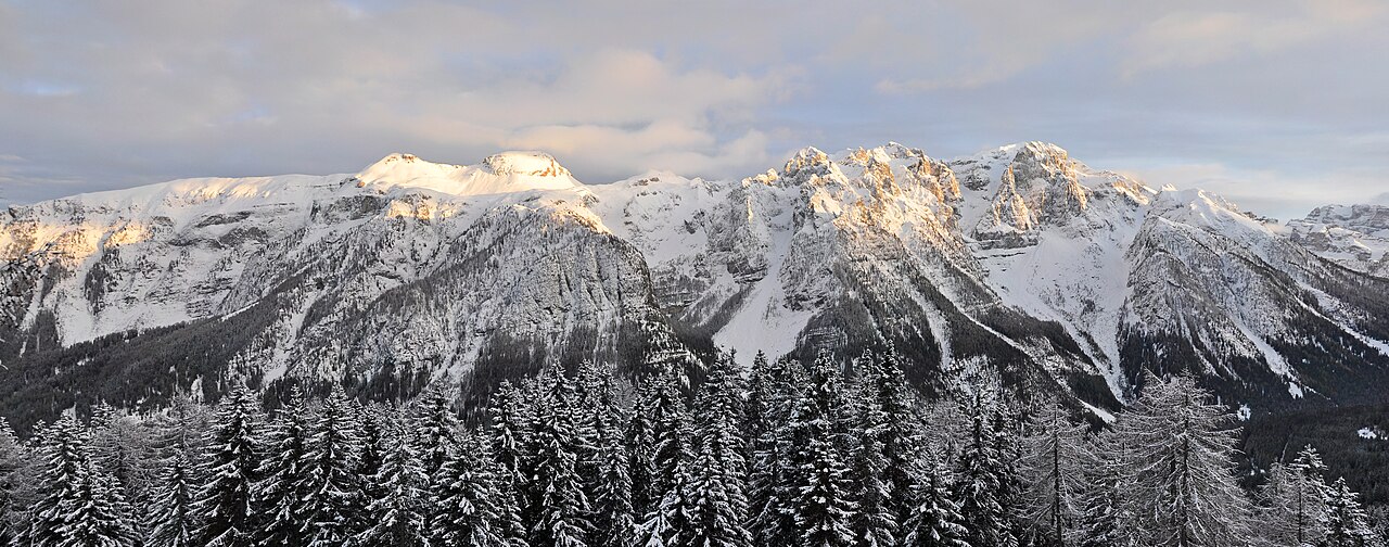
Folgarida - Middle - Folgarida upper station
ECMWF · Cycle du modèle : Prochaine mise à jour attendue :
Jour Heure (UTC) Temp. (°C) Humidité (%) Vent (km/h) Vent (nœuds) Vent (Bft) Direction Précip. (mm) Neige fraîche (cm) Pression (hPa) Isotherme 0 °C (m) Conditions | Mercredi, 04/11 06:00 -0.6 92 1 0 0B E — — 1024 1745 Overcast 100% cloud 09:00 0.6 90 3 2 1B E 0.11 0 1025 1949 Overcast 83% cloud 12:00 2 81 4 2 1B SE 0.27 0 1025 2116 Overcast 94% cloud 15:00 1.6 85 3 2 1B SE 0.12 0 1025 2082 Overcast 99% cloud 18:00 -0.1 89 2 1 1B S 0.06 0 1027 1842 Cloudy 77% cloud 21:00 -1.9 88 3 2 1B SW 0 0 1028 < 1698 Cloudy 56% cloud Jeudi, 05/11 00:00 -3.1 87 4 2 1B W 0 0 1028 < 1698 Cloudy 58% cloud 03:00 -3.6 86 4 2 1B W 0 0 1028 < 1698 Partly cloudy 43% cloud 06:00 -3.9 82 3 2 1B SW 0 0 1028 < 1698 Partly cloudy 21% cloud 09:00 2.8 65 2 1 1B S 0 0 1028 2517 Clear 12% cloud 12:00 4.9 63 2 1 1B S 0 0 1026 2713 Clear 5% cloud 15:00 3.8 73 1 1 1B SE 0 0 1025 2748 Clear 3% cloud 18:00 -0.3 81 1 1 1B SW 0 0 1026 < 1698 Clear 3% cloud 21:00 -1.6 78 2 1 1B SW 0 0 1026 < 1698 Clear 11% cloud Vendredi, 06/11 00:00 -1.9 75 2 1 1B SW 0 0 1025 < 1698 Clear 1% cloud 03:00 -1.9 73 2 1 1B SW 0 0 1023 < 1698 Clear 2% cloud 06:00 -2 73 2 1 1B SW 0 0 1023 < 1698 Cloudy 60% cloud 09:00 4.2 58 2 1 1B S 0 0 1023 2825 Overcast 86% cloud 12:00 5.9 62 4 2 1B SE 0 0 1020 2766 Overcast 92% cloud 15:00 3.8 78 3 2 1B SE 0.12 0 1020 2591 Overcast 99% cloud 18:00 2.1 86 3 2 1B SE 0.41 0 1021 2331 Overcast 98% cloud 21:00 1.2 90 4 2 1B SE 1.1 0 1022 2095 Overcast 100% cloud Samedi, 07/11 00:00 0.7 92 3 2 1B SE 1.8 0.5 1022 1983 Overcast 100% cloud 03:00 0 94 3 2 1B SE 2.4 0.7 1022 1855 Overcast 100% cloud 06:00 -0.5 96 2 1 1B SE 3.9 1.5 1023 1756 Overcast 100% cloud 09:00 0.5 91 2 1 1B E 0.44 0.1 1024 1930 Overcast 100% cloud 12:00 1 89 3 1 1B SE 0.23 0 1023 2007 Overcast 99% cloud 15:00 0.8 90 2 1 1B SE 0.13 0 1023 1976 Overcast 94% cloud 18:00 -0.4 94 1 1 1B S 0.22 0 1024 1785 Overcast 82% cloud 21:00 -1 94 2 1 1B SW 0 0 1025 < 1698 Overcast 91% cloud Dimanche, 08/11 00:00 -0.6 93 1 1 1B SW 0.33 0.1 1025 1751 Overcast 99% cloud 03:00 -0.8 96 1 1 1B SW 1.2 0.4 1025 1707 Overcast 97% cloud 06:00 -0.8 95 2 1 1B SW 0.44 0.1 1025 1714 Overcast 93% cloud 09:00 0.3 88 1 1 1B SW 0.06 0 1026 1902 Overcast 82% cloud 12:00 1.3 80 1 1 1B S 0.07 0 1025 2040 Cloudy 65% cloud 15:00 1.3 83 0 0 0B S 0.08 0 1024 2051 Cloudy 66% cloud 18:00 -0.7 87 2 1 1B W 0.10 0 1025 < 1698 Cloudy 70% cloud 21:00 -1.9 85 4 2 1B W 0.12 0 1026 < 1698 Cloudy 67% cloud Lundi, 09/11 00:00 -1.8 79 3 2 1B W 0 0 1025 < 1698 Cloudy 54% cloud 03:00 -1.9 79 3 2 1B W 0 0 1025 < 1698 Overcast 81% cloud 06:00 -1.4 79 3 2 1B W 0 0 1024 < 1698 Cloudy 77% cloud 09:00 1.7 74 2 1 1B SW 0 0 1024 2388 Cloudy 59% cloud 12:00 3.2 72 3 2 1B SW 0 0 1022 2541 Cloudy 72% cloud 15:00 2.7 79 4 2 1B W 0 0 1021 2435 Overcast 95% cloud 18:00 1.3 89 5 3 1B SW 0 0 1022 2222 Overcast 97% cloud 21:00 1.3 91 6 3 2B W 0.12 0 1022 2266 Overcast 95% cloud Mardi, 10/11 00:00 1.5 92 6 3 2B SW 0.16 0 1020 2356 Overcast 96% cloud 03:00 1.6 93 6 3 2B W 0.11 0 1018 2486 Overcast 100% cloud 06:00 1.7 93 6 3 2B SW 0 0 1018 2526 Overcast 100% cloud |
|---|
Forecast notes
Forecast table times: UTC.
Coordinates: 46.2906484°N, 10.8512062°E · Requested elevation: 1851 m. Model terrain: 1695 m. Terrain and 1000/925/850/700 hPa profiles are used for height estimates.
These are altitude estimates, not a simulation of local mountain terrain. Precipitation, cloud and sea-level pressure use horizontal interpolation only.
Precipitation includes rain and snow water equivalent: preceding 3 hours through day 6, then 6 hours (see cell tooltip). Snow (cm) estimates fresh snowfall from precipitation and temperature using the GFS conversion; it is not snow depth on the ground. Freezing (m) uses additional 600/500 hPa temperatures when available and estimates the lowest resolved 0°C crossing above sea level. When all sampled levels are warm, the upper profile limit is shown (see tooltip). < marks an entirely cold sampled profile and its lower height limit. No extrapolation is used.
Source: ECMWF · CC BY 4.0 · Processed by Snow Report.
Folgarida - Top lift station
ECMWF · Cycle du modèle : Prochaine mise à jour attendue :
Jour Heure (UTC) Temp. (°C) Humidité (%) Vent (km/h) Vent (nœuds) Vent (Bft) Direction Précip. (mm) Neige fraîche (cm) Pression (hPa) Isotherme 0 °C (m) Conditions | Mercredi, 04/11 06:00 -2.5 93 3 2 1B E — — 1024 1744 Overcast 100% cloud 09:00 -1.5 92 5 3 1B SE 0.13 0 1025 1944 Overcast 84% cloud 12:00 -0.5 85 6 3 2B SE 0.32 0.1 1025 2108 Overcast 96% cloud 15:00 -0.6 88 5 3 1B SE 0.15 0 1025 2078 Overcast 100% cloud 18:00 -1.8 88 5 3 1B S 0.06 0 1027 1833 Overcast 81% cloud 21:00 -3 84 5 3 1B SW 0 0 1028 < 1741 Cloudy 59% cloud Jeudi, 05/11 00:00 -3.7 82 5 3 1B SW 0 0 1028 < 1741 Cloudy 64% cloud 03:00 -3.8 80 6 3 2B SW 0 0 1028 < 1741 Partly cloudy 44% cloud 06:00 -3.9 75 6 3 2B SW 0 0 1028 < 1741 Partly cloudy 21% cloud 09:00 1.5 62 5 3 1B SW 0 0 1028 2514 Clear 12% cloud 12:00 3.2 61 4 2 1B SW 0 0 1026 2712 Clear 5% cloud 15:00 2.4 70 2 1 1B S 0 0 1025 2735 Clear 4% cloud 18:00 -0.8 74 3 1 1B SW 0 0 1026 < 1741 Clear 3% cloud 21:00 -1.8 72 3 2 1B SW 0 0 1026 < 1741 Clear 13% cloud Vendredi, 06/11 00:00 -2 70 4 2 1B SW 0 0 1025 < 1741 Clear 0% cloud 03:00 -1.9 67 4 2 1B SW 0 0 1023 < 1741 Clear 3% cloud 06:00 -2 67 5 3 1B SW 0 0 1023 < 1741 Cloudy 67% cloud 09:00 2.9 56 6 3 2B S 0 0 1022 2821 Overcast 88% cloud 12:00 3.8 68 7 4 2B S 0 0 1020 2761 Overcast 95% cloud 15:00 2 82 7 4 2B S 0.15 0 1021 2574 Overcast 100% cloud 18:00 0.6 87 7 4 2B SE 0.43 0.1 1021 2311 Overcast 98% cloud 21:00 -0.5 88 9 5 2B SE 1.3 0.4 1022 2073 Overcast 100% cloud Samedi, 07/11 00:00 -1 92 8 5 2B SE 2.0 0.6 1022 1961 Overcast 100% cloud 03:00 -1.8 95 7 4 2B SE 2.6 0.8 1022 1843 Overcast 100% cloud 06:00 -2.3 97 6 3 2B SE 4.0 1.6 1024 1750 Overcast 100% cloud 09:00 -1.5 93 4 2 1B SE 0.48 0.1 1024 1930 Overcast 100% cloud 12:00 -1.1 91 4 2 1B SE 0.27 0.1 1023 2009 Overcast 99% cloud 15:00 -1.3 92 3 2 1B SE 0.16 0 1023 1976 Overcast 95% cloud 18:00 -2.2 94 3 2 1B S 0.26 0.1 1024 1793 Overcast 87% cloud 21:00 -2.7 94 3 2 1B S 0 0 1025 < 1741 Overcast 94% cloud Dimanche, 08/11 00:00 -2.5 95 3 2 1B S 0.32 0.1 1025 1756 Overcast 99% cloud 03:00 -2.6 96 3 2 1B SW 1.2 0.4 1025 < 1741 Overcast 98% cloud 06:00 -2.7 96 4 2 1B SW 0.46 0.1 1025 < 1741 Overcast 95% cloud 09:00 -1.8 88 4 2 1B SW 0.04 0 1025 1924 Overcast 84% cloud 12:00 -0.8 80 4 2 1B W 0.08 0 1024 2052 Cloudy 63% cloud 15:00 -0.7 80 3 2 1B W 0.08 0 1024 2061 Cloudy 68% cloud 18:00 -1.9 81 5 3 1B W 0.11 0 1025 < 1741 Cloudy 74% cloud 21:00 -2.7 78 6 3 2B W 0.15 0 1026 < 1741 Cloudy 71% cloud Lundi, 09/11 00:00 -2.5 69 7 4 2B W 0 0 1025 < 1741 Partly cloudy 50% cloud 03:00 -2.5 73 7 4 2B W 0 0 1024 < 1741 Cloudy 79% cloud 06:00 -2 75 7 4 2B W 0 0 1024 < 1741 Cloudy 73% cloud 09:00 0.7 70 7 4 2B SW 0 0 1024 2398 Cloudy 53% cloud 12:00 1.8 70 10 5 2B W 0 0 1022 2539 Cloudy 66% cloud 15:00 1.2 80 12 6 2B W 0 0 1021 2434 Overcast 95% cloud 18:00 0.2 90 13 7 3B SW 0 0 1022 2226 Overcast 98% cloud 21:00 0.3 92 14 7 3B W 0.12 0 1021 2258 Overcast 96% cloud Mardi, 10/11 00:00 0.6 92 15 8 3B W 0.19 0 1020 2359 Overcast 96% cloud 03:00 0.8 92 14 7 3B W 0.11 0 1018 2482 Overcast 100% cloud 06:00 0.9 94 14 7 3B SW 0 0 1017 2525 Overcast 100% cloud |
|---|
Forecast notes
Forecast table times: UTC.
Coordinates: 46.2746903°N, 10.8273718°E · Requested elevation: 2167 m. Model terrain: 1739 m. Terrain and 1000/925/850/700 hPa profiles are used for height estimates.
These are altitude estimates, not a simulation of local mountain terrain. Precipitation, cloud and sea-level pressure use horizontal interpolation only.
Precipitation includes rain and snow water equivalent: preceding 3 hours through day 6, then 6 hours (see cell tooltip). Snow (cm) estimates fresh snowfall from precipitation and temperature using the GFS conversion; it is not snow depth on the ground. Freezing (m) uses additional 600/500 hPa temperatures when available and estimates the lowest resolved 0°C crossing above sea level. When all sampled levels are warm, the upper profile limit is shown (see tooltip). < marks an entirely cold sampled profile and its lower height limit. No extrapolation is used.