Previsiones para estaciones de esquí de todo el mundo

Guía de colores Temperatura · Viento · Lluvia · Nieve
Cada color comienza en el valor indicado. Los colores del viento coinciden en las tres unidades. Las celdas sin precipitación permanecen neutras. Los colores describen los valores mostrados, no son avisos meteorológicos oficiales.
Preparando gráficos de previsión…
Las horas y los valores coinciden con la previsión detallada. Toca un valor para ver detalles y desplaza los gráficos horizontalmente para los próximos días. La precipitación es el equivalente total en agua por intervalo, incluida la nieve; la nieve nueva corresponde a cada intervalo, no al espesor de nieve en el suelo.
Comparación de GFS y ECMWF. Cada modelo conserva sus propias horas y horizonte de previsión. Las cantidades de precipitación y nieve corresponden a sus propios intervalos, que pueden diferir entre modelos.
Valores de previsión y notas de los modelos
Diavolezza-Lagalb - Low lift station
ECMWF · Ejecución del modelo: Próxima actualización prevista:
Día Hora (UTC) Temp. (°C) Humedad (%) Viento (km/h) Viento (nudos) Viento (Bft) Dirección Precip. (mm) Nieve nueva (cm) Presión (hPa) Isoterma de 0 °C (m) Condiciones | Miércoles, 04/11 06:00 -2.6 88 3 1 1B SE — — 1023 < 2311 Overcast 86% cloud  09:00 -0.4 80 4 2 1B SE 0.04 0 1024 < 2311 Overcast 88% cloud 12:00 0.7 74 6 3 2B SE 0.04 0 1024 < 2311 Overcast 94% cloud 15:00 0.2 77 4 2 1B SE 0.04 0 1024 < 2311 Overcast 95% cloud 18:00 -0.4 83 3 2 1B SE 0.06 0 1026 < 2311 Overcast 99% cloud 21:00 -1.1 87 2 1 1B SE 0.03 0 1028 < 2311 Overcast 89% cloud Jueves, 05/11 00:00 -1.6 83 2 1 1B SE 0 0 1029 < 2311 Cloudy 68% cloud  03:00 -4.9 87 2 1 1B S 0 0 1028 < 2311 Cloudy 79% cloud 06:00 -6.4 85 3 2 1B S 0 0 1027 < 2311 Cloudy 52% cloud 09:00 0.6 73 3 2 1B SE 0 0 1027 < 2311 Partly cloudy 22% cloud  12:00 3.5 61 3 2 1B S 0 0 1025 2674 Clear 2% cloud  15:00 2.6 64 1 0 0B S 0 0 1024 2591 Clear 3% cloud 18:00 -2.5 75 1 1 1B S 0 0 1025 < 2311 Clear 2% cloud 21:00 -3.2 73 2 1 1B S 0 0 1024 < 2311 Partly cloudy 45% cloud Viernes, 06/11 00:00 -3 72 2 1 1B S 0 0 1023 < 2311 Clear 11% cloud 03:00 -2.9 71 2 1 1B S 0 0 1022 < 2311 Cloudy 62% cloud 06:00 -2.8 70 2 1 1B SE 0 0 1021 < 2311 Cloudy 66% cloud 09:00 3.2 62 2 1 1B SE 0 0 1021 2703 Cloudy 56% cloud 12:00 3.3 67 3 1 1B SE 0.12 0 1020 2642 Cloudy 66% cloud 15:00 2.5 81 2 1 1B SE 0.38 0 1019 2543 Overcast 98% cloud 18:00 1.2 90 2 1 1B E 1.0 0 1019 < 2311 Overcast 100% cloud 21:00 0.7 92 2 1 1B E 1.4 0.4 1020 < 2311 Overcast 100% cloud Sábado, 07/11 00:00 0.3 91 2 1 1B E 2.2 0.7 1021 < 2311 Overcast 100% cloud 03:00 -0.2 92 2 1 1B E 0.34 0.1 1020 < 2311 Overcast 100% cloud 06:00 -0.8 91 2 1 1B E 3.6 1.4 1021 < 2311 Overcast 100% cloud 09:00 -0 86 3 2 1B SE 1.7 0.5 1022 < 2311 Overcast 100% cloud 12:00 0.6 76 4 2 1B SE 0.26 0.1 1022 < 2311 Cloudy 80% cloud 15:00 -0.8 77 2 1 1B SE 0.08 0 1022 < 2311 Cloudy 58% cloud 18:00 -5.1 91 1 0 0B SW 0.09 0.1 1024 < 2311 Overcast 90% cloud 21:00 -4.2 87 1 0 0B S 0.36 0.4 1025 < 2311 Overcast 100% cloud Domingo, 08/11 00:00 -2.4 86 1 1 1B SE 0.16 0 1025 < 2311 Overcast 99% cloud 03:00 -3 89 1 0 0B SE 0.09 0.1 1025 < 2311 Overcast 100% cloud 06:00 -3 87 1 0 0B SE 0.06 0.1 1025 < 2311 Cloudy 77% cloud 09:00 -1.3 81 1 1 1B S 0.03 0 1026 < 2311 Overcast 83% cloud 12:00 -0.5 75 4 2 1B S 0.09 0 1025 < 2311 Cloudy 69% cloud 15:00 -1.8 75 2 1 1B S 0 0 1025 < 2311 Partly cloudy 34% cloud 18:00 -8.9 84 2 1 1B S 0 0 1025 < 2311 Overcast 82% cloud 21:00 -9.8 74 3 1 1B S 0 0 1025 < 2311 Partly cloudy 25% cloud Lunes, 09/11 00:00 -5.9 66 3 2 1B S 0 0 1024 < 2311 Overcast 92% cloud 03:00 -4.4 70 2 1 1B S 0 0 1023 < 2311 Overcast 92% cloud 06:00 -3.6 72 3 2 1B S 0.00 0 1023 < 2311 Overcast 84% cloud 09:00 0.5 69 3 2 1B S 0 0 1023 < 2311 Cloudy 62% cloud 12:00 2 70 5 3 1B S 0 0 1022 2448 Overcast 82% cloud 15:00 0.7 82 3 2 1B S 0.03 0 1022 < 2311 Overcast 100% cloud 18:00 0.3 85 2 1 1B S 0.21 0 1021 < 2311 Overcast 99% cloud 21:00 0.2 88 3 1 1B SE 0.37 0.1 1021 < 2311 Overcast 99% cloud Martes, 10/11 00:00 0.4 87 2 1 1B S 0.09 0 1020 < 2311 Overcast 100% cloud 03:00 0.7 88 2 1 1B SE 0.18 0 1018 < 2311 Overcast 100% cloud 06:00 0.7 89 2 1 1B SE 0.12 0 1017 < 2311 Overcast 100% cloud |
|---|
Forecast notes
Forecast table times: UTC.
Coordinates: 46.4416523°N, 9.9827246°E · Requested elevation: 2083 m. Model terrain: 2308 m. Terrain and 1000/925/850/700 hPa profiles are used for height estimates.
Outside the available profile, temperature uses an estimated 5.5°C/km height correction; wind retains the nearest available model-level value. Humidity is estimated with adjusted pressure and temperature.
These are altitude estimates, not a simulation of local mountain terrain. Precipitation, cloud and sea-level pressure use horizontal interpolation only.
Precipitation includes rain and snow water equivalent: preceding 3 hours through day 6, then 6 hours (see cell tooltip). Snow (cm) estimates fresh snowfall from precipitation and temperature using the GFS conversion; it is not snow depth on the ground. Freezing (m) uses additional 600/500 hPa temperatures when available and estimates the lowest resolved 0°C crossing above sea level. When all sampled levels are warm, the upper profile limit is shown (see tooltip). < marks an entirely cold sampled profile and its lower height limit. No extrapolation is used.
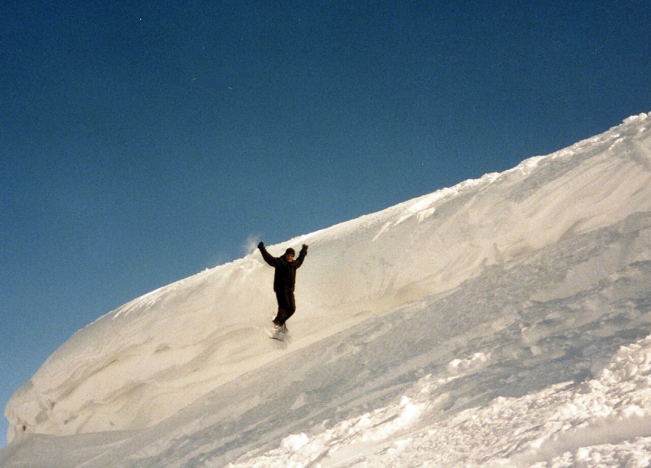
Diavolezza-Lagalb is a downhill ski area in Graubunden, Switzerland. Mapped terrain includes intermediate, advanced, expert routes. Its mapped lift network extends from approximately 2083 to 3003 metres above sea level. Cross-country skiing is also mapped within the area.
Data: OpenSkiData / OpenSkiMap, OpenStreetMap contributors (ODbL), Skimap.org, Who's On First, Mapterhorn.
Preparando gráficos de previsión…
Las horas y los valores coinciden con la previsión detallada. Toca un valor para ver detalles y desplaza los gráficos horizontalmente para los próximos días. La precipitación es el equivalente total en agua por intervalo, incluida la nieve; la nieve nueva corresponde a cada intervalo, no al espesor de nieve en el suelo.
Comparación de GFS y ECMWF. Cada modelo conserva sus propias horas y horizonte de previsión. Las cantidades de precipitación y nieve corresponden a sus propios intervalos, que pueden diferir entre modelos.
Valores de previsión y notas de los modelos
Diavolezza-Lagalb - Base lift station
ECMWF · Ejecución del modelo: Próxima actualización prevista:
Día Hora (UTC) Temp. (°C) Humedad (%) Viento (km/h) Viento (nudos) Viento (Bft) Dirección Precip. (mm) Nieve nueva (cm) Presión (hPa) Isoterma de 0 °C (m) Condiciones | Miércoles, 04/11 06:00 -2.7 88 3 1 1B SE — — 1023 < 2309 Overcast 86% cloud 09:00 -0.4 80 4 2 1B SE 0.04 0 1024 < 2309 Overcast 88% cloud 12:00 0.7 74 6 3 2B SE 0.04 0 1024 < 2309 Overcast 94% cloud 15:00 0.2 77 4 2 1B SE 0.04 0 1024 < 2309 Overcast 95% cloud 18:00 -0.5 84 3 2 1B SE 0.06 0 1026 < 2309 Overcast 99% cloud 21:00 -1.1 88 2 1 1B SE 0.03 0 1028 < 2309 Overcast 89% cloud Jueves, 05/11 00:00 -1.6 83 2 1 1B SE 0 0 1029 < 2309 Cloudy 68% cloud 03:00 -4.9 87 2 1 1B S 0 0 1028 < 2309 Cloudy 79% cloud 06:00 -6.4 86 3 2 1B S 0 0 1027 < 2309 Cloudy 52% cloud 09:00 0.6 74 3 2 1B SE 0 0 1027 < 2309 Partly cloudy 22% cloud 12:00 3.4 61 3 2 1B S 0 0 1025 2674 Clear 2% cloud 15:00 2.5 64 1 0 0B S 0 0 1024 2592 Clear 3% cloud 18:00 -2.5 76 1 1 1B S 0 0 1025 < 2309 Clear 2% cloud 21:00 -3.2 74 2 1 1B S 0 0 1024 < 2309 Partly cloudy 44% cloud Viernes, 06/11 00:00 -3 72 2 1 1B S 0 0 1023 < 2309 Clear 11% cloud 03:00 -2.9 71 2 1 1B S 0 0 1022 < 2309 Cloudy 62% cloud 06:00 -2.8 70 2 1 1B SE 0 0 1021 < 2309 Cloudy 66% cloud 09:00 3.1 63 2 1 1B SE 0 0 1021 2703 Cloudy 56% cloud 12:00 3.2 67 3 1 1B SE 0.12 0 1020 2642 Cloudy 66% cloud 15:00 2.4 81 2 1 1B SE 0.38 0 1019 2543 Overcast 98% cloud 18:00 1.2 90 2 1 1B E 1.0 0 1019 < 2309 Overcast 100% cloud 21:00 0.6 92 2 1 1B E 1.4 0.4 1020 < 2309 Overcast 100% cloud Sábado, 07/11 00:00 0.3 91 2 1 1B E 2.2 0.7 1021 < 2309 Overcast 100% cloud 03:00 -0.3 93 2 1 1B E 0.34 0.1 1020 < 2309 Overcast 100% cloud 06:00 -0.8 92 2 1 1B E 3.6 1.4 1021 < 2309 Overcast 100% cloud 09:00 -0.1 86 3 2 1B SE 1.6 0.5 1022 < 2309 Overcast 100% cloud 12:00 0.6 77 4 2 1B SE 0.26 0.1 1022 < 2309 Cloudy 80% cloud 15:00 -0.9 77 2 1 1B SE 0.08 0 1022 < 2309 Cloudy 58% cloud 18:00 -5.2 91 1 0 0B SW 0.09 0.1 1024 < 2309 Overcast 90% cloud 21:00 -4.2 87 1 0 0B S 0.36 0.4 1025 < 2309 Overcast 100% cloud Domingo, 08/11 00:00 -2.5 87 1 1 1B SE 0.16 0 1025 < 2309 Overcast 99% cloud 03:00 -3.1 89 1 0 0B SE 0.09 0.1 1025 < 2309 Overcast 100% cloud 06:00 -3.1 88 1 0 0B SE 0.06 0.1 1025 < 2309 Cloudy 77% cloud 09:00 -1.4 81 1 1 1B S 0.03 0 1026 < 2309 Overcast 83% cloud 12:00 -0.5 75 4 2 1B S 0.09 0 1025 < 2309 Cloudy 69% cloud 15:00 -1.8 75 2 1 1B S 0 0 1025 < 2309 Partly cloudy 34% cloud 18:00 -9 84 2 1 1B S 0 0 1025 < 2309 Overcast 82% cloud 21:00 -9.9 74 3 1 1B S 0 0 1025 < 2309 Partly cloudy 25% cloud Lunes, 09/11 00:00 -6 67 3 2 1B S 0 0 1024 < 2309 Overcast 92% cloud 03:00 -4.4 70 2 1 1B S 0 0 1023 < 2309 Overcast 92% cloud 06:00 -3.7 73 3 2 1B S 0.00 0 1023 < 2309 Overcast 84% cloud 09:00 0.4 69 3 2 1B S 0 0 1023 < 2309 Cloudy 62% cloud 12:00 1.9 70 5 3 1B S 0 0 1022 2448 Overcast 82% cloud 15:00 0.7 82 3 2 1B S 0.03 0 1022 < 2309 Overcast 100% cloud 18:00 0.3 85 2 1 1B S 0.21 0 1021 < 2309 Overcast 99% cloud 21:00 0.1 88 2 1 1B SE 0.37 0.1 1021 < 2309 Overcast 99% cloud Martes, 10/11 00:00 0.3 88 2 1 1B S 0.09 0 1020 < 2309 Overcast 100% cloud 03:00 0.6 89 2 1 1B SE 0.18 0 1018 < 2309 Overcast 100% cloud 06:00 0.7 89 2 1 1B SE 0.13 0 1017 < 2309 Overcast 100% cloud |
|---|
Forecast notes
Forecast table times: UTC.
Coordinates: 46.4409867°N, 9.9834511°E · Requested elevation: 2092 m. Model terrain: 2307 m. Terrain and 1000/925/850/700 hPa profiles are used for height estimates.
Outside the available profile, temperature uses an estimated 5.5°C/km height correction; wind retains the nearest available model-level value. Humidity is estimated with adjusted pressure and temperature.
These are altitude estimates, not a simulation of local mountain terrain. Precipitation, cloud and sea-level pressure use horizontal interpolation only.
Precipitation includes rain and snow water equivalent: preceding 3 hours through day 6, then 6 hours (see cell tooltip). Snow (cm) estimates fresh snowfall from precipitation and temperature using the GFS conversion; it is not snow depth on the ground. Freezing (m) uses additional 600/500 hPa temperatures when available and estimates the lowest resolved 0°C crossing above sea level. When all sampled levels are warm, the upper profile limit is shown (see tooltip). < marks an entirely cold sampled profile and its lower height limit. No extrapolation is used.
Preparando gráficos de previsión…
Las horas y los valores coinciden con la previsión detallada. Toca un valor para ver detalles y desplaza los gráficos horizontalmente para los próximos días. La precipitación es el equivalente total en agua por intervalo, incluida la nieve; la nieve nueva corresponde a cada intervalo, no al espesor de nieve en el suelo.
Comparación de GFS y ECMWF. Cada modelo conserva sus propias horas y horizonte de previsión. Las cantidades de precipitación y nieve corresponden a sus propios intervalos, que pueden diferir entre modelos.
Valores de previsión y notas de los modelos
Diavolezza-Lagalb - Top lift station
ECMWF · Ejecución del modelo: Próxima actualización prevista:
Día Hora (UTC) Temp. (°C) Humedad (%) Viento (km/h) Viento (nudos) Viento (Bft) Dirección Precip. (mm) Nieve nueva (cm) Presión (hPa) Isoterma de 0 °C (m) Condiciones | Miércoles, 04/11 06:00 -7.2 90 13 7 3B SE — — 1023 < 2221 Overcast 86% cloud 09:00 -7.2 90 17 9 3B SE 0.05 0 1024 < 2221 Overcast 86% cloud 12:00 -6.8 93 16 9 3B SE 0.05 0 1024 2234 Overcast 94% cloud 15:00 -6.5 90 17 9 3B SE 0.06 0.1 1024 < 2221 Overcast 94% cloud 18:00 -6.7 92 19 10 3B S 0.06 0.1 1026 < 2221 Overcast 99% cloud 21:00 -6.2 87 19 10 3B S 0.05 0.1 1028 < 2221 Overcast 85% cloud Jueves, 05/11 00:00 -5.3 80 17 9 3B S 0 0 1029 < 2221 Cloudy 64% cloud 03:00 -4.4 68 15 8 3B S 0 0 1028 < 2221 Cloudy 72% cloud 06:00 -3.8 59 17 9 3B S 0 0 1027 < 2221 Cloudy 53% cloud 09:00 -2.7 62 18 10 3B S 0 0 1027 < 2221 Clear 19% cloud 12:00 -2.1 65 15 8 3B SW 0 0 1025 2674 Clear 2% cloud 15:00 -2 62 9 5 2B SW 0 0 1024 2620 Clear 3% cloud 18:00 -1.9 60 8 4 2B S 0 0 1025 < 2221 Clear 2% cloud 21:00 -1.9 62 10 5 2B S 0 0 1024 < 2221 Partly cloudy 42% cloud Viernes, 06/11 00:00 -1.6 58 11 6 2B S 0 0 1023 < 2221 Clear 12% cloud 03:00 -1.4 61 12 7 2B S 0 0 1022 < 2221 Cloudy 64% cloud 06:00 -1.7 64 15 8 3B S 0 0 1021 < 2221 Cloudy 69% cloud 09:00 -1.6 65 19 10 3B S 0 0 1021 2692 Cloudy 63% cloud 12:00 -2.2 90 17 9 3B S 0.11 0 1020 2628 Cloudy 71% cloud 15:00 -2.5 97 15 8 3B SE 0.45 0.1 1020 2517 Overcast 98% cloud 18:00 -3 99 15 8 3B SE 1.1 1.1 1020 2299 Overcast 100% cloud 21:00 -3.8 98 17 9 3B SE 1.5 1.5 1021 < 2221 Overcast 100% cloud Sábado, 07/11 00:00 -4.7 96 15 8 3B SE 2.3 2.3 1021 < 2221 Overcast 100% cloud 03:00 -5.3 97 6 3 2B SE 0.39 0.4 1020 < 2221 Overcast 100% cloud 06:00 -5.8 97 9 5 2B SE 3.6 3.6 1021 < 2221 Overcast 100% cloud 09:00 -6.3 97 11 6 2B SE 1.7 1.7 1023 < 2221 Overcast 100% cloud 12:00 -6.5 86 10 6 2B SE 0.33 0.3 1022 < 2221 Overcast 80% cloud 15:00 -6.8 86 9 5 2B S 0.11 0.1 1022 < 2221 Cloudy 62% cloud 18:00 -7.1 90 9 5 2B SE 0.13 0.1 1024 < 2221 Overcast 92% cloud 21:00 -7.4 96 12 6 2B S 0.50 0.5 1025 < 2221 Overcast 100% cloud Domingo, 08/11 00:00 -7.7 94 10 6 2B SW 0.18 0.2 1025 < 2221 Overcast 99% cloud 03:00 -7.8 94 12 6 2B SW 0.15 0.1 1025 < 2221 Overcast 99% cloud 06:00 -7.9 93 13 7 3B SW 0.09 0.1 1025 < 2221 Overcast 81% cloud 09:00 -7.6 73 12 7 2B SW 0.04 0 1026 < 2221 Overcast 85% cloud 12:00 -6.8 47 10 5 2B SW 0.07 0.1 1025 < 2221 Cloudy 74% cloud 15:00 -6.1 43 11 6 2B W 0 0 1025 < 2221 Partly cloudy 41% cloud 18:00 -5.2 24 12 7 2B W 0 0 1025 < 2221 Cloudy 75% cloud 21:00 -4.8 27 12 6 2B W 0 0 1025 < 2221 Partly cloudy 31% cloud Lunes, 09/11 00:00 -4 52 16 9 3B SW 0 0 1025 < 2221 Overcast 92% cloud 03:00 -3.7 69 19 10 3B SW 0 0 1023 < 2221 Overcast 92% cloud 06:00 -3.2 70 15 8 3B SW 0.01 0 1023 < 2221 Overcast 84% cloud 09:00 -2.6 64 19 10 3B SW 0 0 1023 < 2221 Cloudy 63% cloud 12:00 -3 69 26 14 4B SW 0 0 1022 2446 Overcast 83% cloud 15:00 -3.5 93 32 17 5B SW 0.04 0 1022 2226 Overcast 100% cloud 18:00 -3.4 97 33 18 5B SW 0.27 0.3 1022 < 2221 Overcast 99% cloud 21:00 -2.9 94 34 18 5B SW 0.44 0.4 1021 < 2221 Overcast 99% cloud Martes, 10/11 00:00 -2.6 98 35 19 5B SW 0.15 0 1020 < 2221 Overcast 100% cloud 03:00 -2.3 98 30 16 5B SW 0.22 0 1018 < 2221 Overcast 100% cloud 06:00 -2.1 99 33 18 5B SW 0.19 0 1017 < 2221 Overcast 100% cloud |
|---|
Forecast notes
Forecast table times: UTC.
Coordinates: 46.4106411°N, 9.9709062°E · Requested elevation: 3003 m. Model terrain: 2219 m. Terrain and 1000/925/850/700 hPa profiles are used for height estimates.
These are altitude estimates, not a simulation of local mountain terrain. Precipitation, cloud and sea-level pressure use horizontal interpolation only.
Precipitation includes rain and snow water equivalent: preceding 3 hours through day 6, then 6 hours (see cell tooltip). Snow (cm) estimates fresh snowfall from precipitation and temperature using the GFS conversion; it is not snow depth on the ground. Freezing (m) uses additional 600/500 hPa temperatures when available and estimates the lowest resolved 0°C crossing above sea level. When all sampled levels are warm, the upper profile limit is shown (see tooltip). < marks an entirely cold sampled profile and its lower height limit. No extrapolation is used.