Previsiones para estaciones de esquí de todo el mundo

Guía de colores Temperatura · Viento · Lluvia · Nieve
Cada color comienza en el valor indicado. Los colores del viento coinciden en las tres unidades. Las celdas sin precipitación permanecen neutras. Los colores describen los valores mostrados, no son avisos meteorológicos oficiales.
Preparando gráficos de previsión…
Las horas y los valores coinciden con la previsión detallada. Toca un valor para ver detalles y desplaza los gráficos horizontalmente para los próximos días. La precipitación es el equivalente total en agua por intervalo, incluida la nieve; la nieve nueva corresponde a cada intervalo, no al espesor de nieve en el suelo.
Comparación de GFS y ECMWF. Cada modelo conserva sus propias horas y horizonte de previsión. Las cantidades de precipitación y nieve corresponden a sus propios intervalos, que pueden diferir entre modelos.
Valores de previsión y notas de los modelos
Crans Montana - base
ECMWF · Ejecución del modelo: Próxima actualización prevista:
Día Hora (UTC) Temp. (°C) Humedad (%) Viento (km/h) Viento (nudos) Viento (Bft) Dirección Precip. (mm) Nieve nueva (cm) Presión (hPa) Isoterma de 0 °C (m) Condiciones | Miércoles, 04/11 06:00 -5 89 4 2 1B SE — — 1021 < 1692 Cloudy 54% cloud  09:00 -0.2 70 6 3 2B SE 0 0 1022 2042 Partly cloudy 39% cloud  12:00 1.1 64 7 4 2B SE 0.00 0 1021 2234 Overcast 99% cloud  15:00 0.2 69 7 4 2B SE 0 0 1021 2110 Partly cloudy 44% cloud 18:00 -2.2 77 8 5 2B SE 0.00 0 1023 < 1692 Partly cloudy 28% cloud 21:00 -2.6 78 8 4 2B SE 0.00 0 1025 < 1692 Clear 14% cloud  Jueves, 05/11 00:00 -2.4 77 8 4 2B SE 0 0 1025 < 1692 Cloudy 52% cloud 03:00 -2.1 77 9 5 2B SE 0 0 1025 < 1692 Partly cloudy 32% cloud 06:00 -1.7 77 7 4 2B SE 0 0 1025 < 1692 Partly cloudy 23% cloud 09:00 2 67 6 3 2B SE 0 0 1025 2556 Overcast 82% cloud 12:00 4 62 4 2 1B SE 0 0 1023 2738 Partly cloudy 38% cloud 15:00 3.4 67 3 1 1B E 0 0 1022 2728 Clear 12% cloud 18:00 0.1 74 4 2 1B SE 0 0 1023 2162 Partly cloudy 32% cloud 21:00 -0.3 78 5 3 1B SE 0.08 0 1023 1886 Cloudy 56% cloud Viernes, 06/11 00:00 -0.3 80 5 3 1B SE 0 0 1022 1857 Overcast 93% cloud 03:00 -0.2 85 6 3 1B SE 0.14 0 1021 1948 Overcast 94% cloud 06:00 -0.3 86 5 2 1B SE 0 0 1020 1894 Cloudy 73% cloud 09:00 1.2 89 3 1 1B SE 0 0 1022 2355 Cloudy 73% cloud 12:00 1.2 89 1 0 0B SW 0.00 0 1022 2324 Overcast 100% cloud 15:00 -0.5 100 1 1 1B N 0.85 0.3 1022 1956 Overcast 100% cloud 18:00 -1.4 99 2 1 1B N 4.0 1.6 1023 1736 Overcast 100% cloud 21:00 -1.7 98 1 1 0B N 1.3 0.4 1024 < 1692 Overcast 100% cloud Sábado, 07/11 00:00 -1.8 99 0 0 0B S 0.84 0.3 1024 < 1692 Overcast 100% cloud 03:00 -2.2 99 0 0 0B W 0.20 0 1023 < 1692 Overcast 100% cloud 06:00 -2.2 98 0 0 0B NE 0.24 0 1024 < 1692 Overcast 100% cloud 09:00 -1.1 90 2 1 1B SE 0.12 0 1024 1893 Overcast 90% cloud 12:00 0.1 81 2 1 1B S 0.00 0 1022 2096 Overcast 94% cloud 15:00 -1 89 2 1 1B SW 1.1 0.3 1022 1913 Overcast 86% cloud 18:00 -2.2 93 3 2 1B S 0.54 0.2 1023 < 1692 Overcast 98% cloud 21:00 -4.1 92 4 2 1B S 0 0 1024 < 1692 Partly cloudy 37% cloud Domingo, 08/11 00:00 -6.2 81 4 2 1B SW 0 0 1024 < 1692 Overcast 85% cloud 03:00 -6.8 75 4 2 1B SW 0 0 1024 < 1692 Partly cloudy 45% cloud 06:00 -7.8 68 5 3 1B SW 0 0 1024 < 1692 Cloudy 51% cloud 09:00 -2.1 61 6 3 2B SW 0 0 1026 < 1692 Clear 7% cloud 12:00 1.2 53 8 5 2B SW 0 0 1022 2252 Clear 6% cloud 15:00 0.8 52 9 5 2B SW 0 0 1021 2220 Clear 5% cloud 18:00 -2.6 64 10 6 2B SW 0 0 1021 < 1692 Partly cloudy 27% cloud 21:00 -2 70 11 6 2B SW 0.04 0 1021 < 1692 Overcast 98% cloud Lunes, 09/11 00:00 -0.8 68 10 5 2B SW 0 0 1021 1787 Overcast 99% cloud 03:00 -1.2 72 11 6 2B SW 0 0 1021 < 1692 Cloudy 62% cloud 06:00 -1.4 73 10 6 2B SW 0 0 1021 < 1692 Cloudy 75% cloud 09:00 1.7 68 11 6 2B SW 0.00 0 1020 2497 Cloudy 61% cloud 12:00 3.4 63 11 6 2B SW 0 0 1018 2728 Overcast 100% cloud 15:00 2.3 73 10 5 2B SW 0.08 0 1018 2718 Overcast 94% cloud 18:00 1.5 78 10 6 2B SW 0.04 0 1018 2779 Overcast 100% cloud 21:00 1.3 82 11 6 2B SW 0 0 1018 3070 Overcast 82% cloud Martes, 10/11 00:00 0.2 85 10 5 2B SW 0 0 1017 3064 Overcast 95% cloud 03:00 0.8 86 10 5 2B SW 0 0 1015 3049 Overcast 95% cloud 06:00 1.3 87 8 4 2B S 0.25 0 1014 3040 Overcast 100% cloud |
|---|
Forecast notes
Forecast table times: UTC.
Coordinates: 46.34026°N, 7.5034°E · Requested elevation: 2079 m. Model terrain: 1690 m. Terrain and 1000/925/850/700 hPa profiles are used for height estimates.
These are altitude estimates, not a simulation of local mountain terrain. Precipitation, cloud and sea-level pressure use horizontal interpolation only.
Precipitation includes rain and snow water equivalent: preceding 3 hours through day 6, then 6 hours (see cell tooltip). Snow (cm) estimates fresh snowfall from precipitation and temperature using the GFS conversion; it is not snow depth on the ground. Freezing (m) uses additional 600/500 hPa temperatures when available and estimates the lowest resolved 0°C crossing above sea level. When all sampled levels are warm, the upper profile limit is shown (see tooltip). < marks an entirely cold sampled profile and its lower height limit. No extrapolation is used.
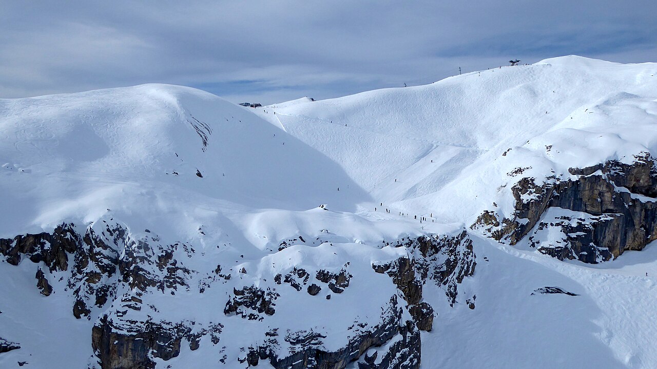
In Crans-Montana, you can ski at altitudes ranging from 1500 right up to the glacier at 3000m. The ski area includes 28 ski lifts – amongst them, the brand new "Nationale Express" chairlift. The area extends over 140 km of marked pistes, a third of which can be covered with artificial snow, so a great ski season is guaranteed in this region which is among the sunniest in Valais.