Previsiones para estaciones de esquí de todo el mundo

Guía de colores Temperatura · Viento · Lluvia · Nieve
Cada color comienza en el valor indicado. Los colores del viento coinciden en las tres unidades. Las celdas sin precipitación permanecen neutras. Los colores describen los valores mostrados, no son avisos meteorológicos oficiales.
Christie Mountain Ski Area - Low lift station
ECMWF · Ejecución del modelo: Próxima actualización prevista:
Día Hora (UTC) Temp. (°C) Humedad (%) Viento (km/h) Viento (nudos) Viento (Bft) Dirección Precip. (mm) Nieve nueva (cm) Presión (hPa) Isoterma de 0 °C (m) Condiciones | Miércoles, 04/11 06:00 15.3 100 13 7 3B SE — — 1001 2982 Overcast 93% cloud  09:00 14.9 99 16 9 3B SE 1.3 0 999 2961 Overcast 100% cloud 12:00 14.1 99 15 8 3B SE 0.42 0 998 2939 Overcast 98% cloud 15:00 13.5 98 16 9 3B SE 0.79 0 998 2928 Overcast 100% cloud 18:00 12.9 96 13 7 3B S 1.2 0 998 2919 Overcast 100% cloud 21:00 12.2 83 14 8 3B SW 0.37 0 998 2847 Overcast 100% cloud Jueves, 05/11 00:00 10.3 90 12 6 2B SW 0.24 0 999 2791 Overcast 100% cloud 03:00 9 97 10 5 2B SW 1.0 0 1000 2701 Overcast 100% cloud 06:00 8.6 98 9 5 2B SW 0.76 0 1001 2583 Overcast 100% cloud 09:00 8.4 98 15 8 3B N 0.73 0 1002 2440 Overcast 100% cloud 12:00 8 96 19 10 3B N 0.60 0 1005 2251 Overcast 100% cloud 15:00 7.3 78 25 13 4B N 0.25 0 1010 1325 Overcast 100% cloud 18:00 7.5 71 21 11 4B N 0.00 0 1013 1204 Overcast 100% cloud 21:00 6.3 69 19 10 3B N 0.00 0 1015 1044 Overcast 100% cloud Viernes, 06/11 00:00 4.5 69 17 9 3B N 0 0 1019 848 Overcast 100% cloud 03:00 3.5 62 16 8 3B NE 0 0 1021 749 Overcast 96% cloud 06:00 3 61 11 6 2B NE 0 0 1022 708 Overcast 93% cloud 09:00 1.2 71 8 5 2B N 0 0 1024 625 Partly cloudy 25% cloud  12:00 1.2 78 9 5 2B N 0 0 1025 595 Cloudy 66% cloud  15:00 3.4 60 10 5 2B N 0 0 1026 699 Partly cloudy 21% cloud 18:00 6.2 50 7 4 2B N 0 0 1025 1003 Clear 9% cloud  21:00 6.9 50 8 4 2B N 0 0 1024 1433 Clear 4% cloud Sábado, 07/11 00:00 2.2 75 5 3 1B NW 0 0 1024 2571 Clear 0% cloud 03:00 0.5 82 3 2 1B N 0 0 1025 3005 Clear 4% cloud 06:00 -0.3 85 1 1 0B S 0 0 1024 480 Overcast 88% cloud 09:00 -1.7 93 4 2 1B SW 0 0 1024 630 Overcast 97% cloud 12:00 -2.1 96 4 2 1B SW 0 0 1024 660 Cloudy 61% cloud 15:00 2.1 83 8 4 2B S 0 0 1024 2781 Clear 18% cloud 18:00 8.2 58 12 7 3B SW 0 0 1022 2863 Cloudy 55% cloud 21:00 9.3 57 14 7 3B SW 0 0 1019 3066 Overcast 83% cloud Domingo, 08/11 00:00 5.1 79 12 7 2B SW 0 0 1019 3069 Overcast 86% cloud 03:00 4.8 82 14 8 3B SW 0 0 1017 3063 Partly cloudy 33% cloud 06:00 5.9 87 16 9 3B SW 0 0 1016 3054 Cloudy 72% cloud 09:00 6 89 15 8 3B W 0 0 1015 3050 Partly cloudy 42% cloud 12:00 4.8 90 14 8 3B NW 0 0 1017 3046 Clear 12% cloud 15:00 7.6 71 15 8 3B NW 0 0 1018 3054 Clear 0% cloud 18:00 11.5 53 17 9 3B NW 0 0 1018 3063 Partly cloudy 25% cloud 21:00 12.1 47 15 8 3B NW 0 0 1018 3067 Overcast 88% cloud Lunes, 09/11 00:00 6.3 69 11 6 2B NW 0 0 1019 3076 Clear 0% cloud 03:00 4.1 80 9 5 2B NW 0 0 1021 3084 Clear 0% cloud 06:00 2.6 86 5 3 1B N 0 0 1021 3091 Cloudy 75% cloud 09:00 1.2 90 4 2 1B S 0 0 1021 3096 Cloudy 64% cloud 12:00 1.3 94 9 5 2B S 0 0 1021 3096 Overcast 98% cloud 15:00 5.3 84 10 5 2B S 0 0 1020 3096 Overcast 97% cloud 18:00 11.5 57 15 8 3B SW 0 0 1017 3086 Cloudy 77% cloud 21:00 13.6 58 14 8 3B SW 0 0 1014 3071 Clear 15% cloud Martes, 10/11 00:00 8.9 84 12 6 2B SW 0 0 1014 3062 Overcast 85% cloud 03:00 8.6 90 13 7 3B W 0 0 1013 3051 Overcast 86% cloud 06:00 7.8 84 16 9 3B NW 0 0 1014 2861 Cloudy 57% cloud |
|---|
Forecast notes
Forecast table times: UTC.
Coordinates: 45.5090287°N, -91.380078°E · Requested elevation: 396 m. Model terrain: 393 m. Terrain and 1000/925/850/700 hPa profiles are used for height estimates.
These are altitude estimates, not a simulation of local mountain terrain. Precipitation, cloud and sea-level pressure use horizontal interpolation only.
Precipitation includes rain and snow water equivalent: preceding 3 hours through day 6, then 6 hours (see cell tooltip). Snow (cm) estimates fresh snowfall from precipitation and temperature using the GFS conversion; it is not snow depth on the ground. Freezing (m) uses additional 600/500 hPa temperatures when available and estimates the lowest resolved 0°C crossing above sea level. When all sampled levels are warm, the upper profile limit is shown (see tooltip). < marks an entirely cold sampled profile and its lower height limit. No extrapolation is used.
Source: ECMWF · CC BY 4.0 · Processed by Snow Report.
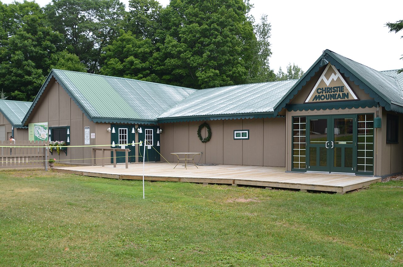
Christie Mountain Ski Area is a downhill ski area in Wisconsin, United States. Mapped terrain includes beginner, easy, intermediate, advanced routes. Its mapped lift network extends from approximately 396 to 502 metres above sea level.
Data: OpenSkiData / OpenSkiMap, OpenStreetMap contributors (ODbL), Skimap.org, Who's On First, Mapterhorn.
Christie Mountain Ski Area - Base lift station
ECMWF · Ejecución del modelo: Próxima actualización prevista:
Día Hora (UTC) Temp. (°C) Humedad (%) Viento (km/h) Viento (nudos) Viento (Bft) Dirección Precip. (mm) Nieve nueva (cm) Presión (hPa) Isoterma de 0 °C (m) Condiciones | Miércoles, 04/11 06:00 15.3 100 13 7 3B SE — — 1001 2982 Overcast 93% cloud 09:00 14.9 99 16 9 3B SE 1.3 0 999 2961 Overcast 100% cloud 12:00 14.1 99 15 8 3B SE 0.42 0 998 2939 Overcast 98% cloud 15:00 13.5 98 16 9 3B SE 0.79 0 998 2928 Overcast 100% cloud 18:00 12.9 96 13 7 3B S 1.2 0 998 2919 Overcast 100% cloud 21:00 12.2 83 14 8 3B SW 0.37 0 998 2847 Overcast 100% cloud Jueves, 05/11 00:00 10.3 90 12 7 2B SW 0.24 0 999 2791 Overcast 100% cloud 03:00 9 97 10 5 2B SW 1.0 0 1000 2701 Overcast 100% cloud 06:00 8.6 98 10 5 2B SW 0.76 0 1001 2583 Overcast 100% cloud 09:00 8.4 98 15 8 3B N 0.73 0 1002 2440 Overcast 100% cloud 12:00 8 96 19 10 3B N 0.60 0 1005 2251 Overcast 100% cloud 15:00 7.3 78 25 13 4B N 0.25 0 1010 1325 Overcast 100% cloud 18:00 7.5 71 21 11 4B N 0.00 0 1013 1204 Overcast 100% cloud 21:00 6.2 69 19 10 3B N 0.00 0 1015 1044 Overcast 100% cloud Viernes, 06/11 00:00 4.4 69 17 9 3B N 0 0 1019 848 Overcast 100% cloud 03:00 3.5 62 16 8 3B NE 0 0 1021 749 Overcast 96% cloud 06:00 3 61 11 6 2B NE 0 0 1022 708 Overcast 93% cloud 09:00 1.2 71 8 5 2B N 0 0 1024 625 Partly cloudy 25% cloud 12:00 1.2 78 10 5 2B N 0 0 1025 595 Cloudy 66% cloud 15:00 3.4 60 10 5 2B N 0 0 1026 699 Partly cloudy 21% cloud 18:00 6.2 50 7 4 2B N 0 0 1025 1003 Clear 9% cloud 21:00 6.9 50 8 4 2B N 0 0 1024 1433 Clear 4% cloud Sábado, 07/11 00:00 2.2 74 5 3 1B NW 0 0 1024 2572 Clear 0% cloud 03:00 0.5 82 3 2 1B N 0 0 1025 3005 Clear 4% cloud 06:00 -0.3 85 1 1 0B S 0 0 1024 480 Overcast 88% cloud 09:00 -1.7 92 4 2 1B SW 0 0 1024 630 Overcast 97% cloud 12:00 -2.1 96 4 2 1B SW 0 0 1024 660 Cloudy 61% cloud 15:00 2.1 83 8 4 2B S 0 0 1024 2781 Clear 18% cloud 18:00 8.2 58 12 7 3B SW 0 0 1022 2863 Cloudy 55% cloud 21:00 9.3 57 14 7 3B SW 0 0 1019 3066 Overcast 83% cloud Domingo, 08/11 00:00 5.1 79 12 7 3B SW 0 0 1019 3069 Overcast 86% cloud 03:00 4.8 82 14 8 3B SW 0 0 1017 3063 Partly cloudy 33% cloud 06:00 5.9 87 16 9 3B SW 0 0 1016 3054 Cloudy 72% cloud 09:00 6 89 15 8 3B W 0 0 1015 3050 Partly cloudy 42% cloud 12:00 4.8 90 14 8 3B NW 0 0 1017 3046 Clear 12% cloud 15:00 7.6 71 15 8 3B NW 0 0 1018 3054 Clear 0% cloud 18:00 11.5 53 17 9 3B NW 0 0 1018 3063 Partly cloudy 25% cloud 21:00 12.1 47 15 8 3B NW 0 0 1018 3067 Overcast 89% cloud Lunes, 09/11 00:00 6.3 69 11 6 2B NW 0 0 1019 3076 Clear 0% cloud 03:00 4.1 80 9 5 2B NW 0 0 1021 3084 Clear 0% cloud 06:00 2.7 86 5 3 1B N 0 0 1021 3091 Cloudy 75% cloud 09:00 1.2 90 4 2 1B S 0 0 1021 3096 Cloudy 64% cloud 12:00 1.3 94 9 5 2B S 0 0 1021 3096 Overcast 98% cloud 15:00 5.3 84 10 5 2B S 0 0 1020 3096 Overcast 97% cloud 18:00 11.5 57 15 8 3B SW 0 0 1017 3086 Cloudy 77% cloud 21:00 13.5 58 14 8 3B SW 0 0 1014 3071 Clear 15% cloud Martes, 10/11 00:00 8.9 84 12 6 2B SW 0 0 1014 3062 Overcast 85% cloud 03:00 8.6 90 13 7 3B W 0 0 1013 3051 Overcast 86% cloud 06:00 7.8 84 16 9 3B NW 0 0 1014 2861 Cloudy 57% cloud |
|---|
Forecast notes
Forecast table times: UTC.
Coordinates: 45.5086713°N, -91.380334°E · Requested elevation: 397 m. Model terrain: 393 m. Terrain and 1000/925/850/700 hPa profiles are used for height estimates.
These are altitude estimates, not a simulation of local mountain terrain. Precipitation, cloud and sea-level pressure use horizontal interpolation only.
Precipitation includes rain and snow water equivalent: preceding 3 hours through day 6, then 6 hours (see cell tooltip). Snow (cm) estimates fresh snowfall from precipitation and temperature using the GFS conversion; it is not snow depth on the ground. Freezing (m) uses additional 600/500 hPa temperatures when available and estimates the lowest resolved 0°C crossing above sea level. When all sampled levels are warm, the upper profile limit is shown (see tooltip). < marks an entirely cold sampled profile and its lower height limit. No extrapolation is used.
Source: ECMWF · CC BY 4.0 · Processed by Snow Report.
Christie Mountain Ski Area - Top lift station
ECMWF · Ejecución del modelo: Próxima actualización prevista:
Día Hora (UTC) Temp. (°C) Humedad (%) Viento (km/h) Viento (nudos) Viento (Bft) Dirección Precip. (mm) Nieve nueva (cm) Presión (hPa) Isoterma de 0 °C (m) Condiciones | Miércoles, 04/11 06:00 15.2 99 22 12 4B SE — — 1001 2982 Overcast 93% cloud 09:00 14.4 100 27 14 4B SE 1.3 0 999 2961 Overcast 100% cloud 12:00 13.6 99 24 13 4B SE 0.42 0 998 2939 Overcast 98% cloud 15:00 12.7 99 25 14 4B SE 0.82 0 998 2928 Overcast 100% cloud 18:00 11.9 97 18 10 3B S 1.2 0 998 2919 Overcast 100% cloud 21:00 11.1 87 19 10 3B SW 0.36 0 998 2845 Overcast 100% cloud Jueves, 05/11 00:00 9.4 92 17 9 3B SW 0.24 0 1000 2792 Overcast 100% cloud 03:00 8.2 97 14 8 3B SW 1.0 0 1000 2702 Overcast 100% cloud 06:00 7.9 98 14 7 3B W 0.75 0 1001 2583 Overcast 100% cloud 09:00 7.7 98 24 13 4B N 0.72 0 1002 2437 Overcast 100% cloud 12:00 7.2 97 28 15 4B N 0.60 0 1005 2252 Overcast 100% cloud 15:00 6.2 82 32 18 5B N 0.25 0 1010 1324 Overcast 100% cloud 18:00 6.3 75 26 14 4B N 0.00 0 1013 1205 Overcast 100% cloud 21:00 5.1 73 23 13 4B N 0.00 0 1015 1046 Overcast 100% cloud Viernes, 06/11 00:00 3.4 73 21 12 4B N 0 0 1019 849 Overcast 100% cloud 03:00 2.4 65 19 10 3B NE 0 0 1021 750 Overcast 96% cloud 06:00 2 64 14 8 3B NE 0 0 1022 708 Overcast 93% cloud 09:00 0.7 71 13 7 3B N 0 0 1024 625 Partly cloudy 25% cloud 12:00 0.6 79 13 7 3B N 0 0 1025 595 Cloudy 64% cloud 15:00 2.2 64 12 7 2B N 0 0 1026 698 Partly cloudy 21% cloud 18:00 4.8 54 8 4 2B N 0 0 1025 1006 Clear 9% cloud 21:00 5.8 53 9 5 2B N 0 0 1024 1438 Clear 4% cloud Sábado, 07/11 00:00 2.1 72 6 3 2B N 0 0 1024 2573 Clear 0% cloud 03:00 0.7 78 4 2 1B N 0 0 1025 3010 Clear 4% cloud 06:00 0.1 77 2 1 1B SW 0 0 1024 478 Overcast 88% cloud 09:00 -0.9 84 7 4 2B SW 0 0 1024 630 Overcast 97% cloud 12:00 -1.3 86 8 4 2B W 0 0 1024 660 Cloudy 61% cloud 15:00 2.1 77 12 6 2B SW 0 0 1024 2782 Clear 18% cloud 18:00 6.9 62 15 8 3B SW 0 0 1022 2864 Cloudy 54% cloud 21:00 8.2 60 17 9 3B SW 0 0 1019 3066 Overcast 82% cloud Domingo, 08/11 00:00 5.5 73 20 11 4B SW 0 0 1019 3069 Overcast 86% cloud 03:00 5.6 77 25 13 4B SW 0 0 1017 3063 Partly cloudy 31% cloud 06:00 6.7 80 29 16 5B W 0 0 1016 3054 Cloudy 72% cloud 09:00 6.5 83 25 13 4B NW 0 0 1015 3050 Partly cloudy 42% cloud 12:00 5.3 82 25 13 4B NW 0 0 1017 3046 Clear 13% cloud 15:00 6.9 70 26 14 4B NW 0 0 1018 3054 Clear 0% cloud 18:00 10.1 56 20 11 4B NW 0 0 1018 3063 Partly cloudy 25% cloud 21:00 11 49 19 10 3B NW 0 0 1018 3067 Overcast 89% cloud Lunes, 09/11 00:00 6.7 64 18 10 3B NW 0 0 1019 3076 Clear 0% cloud 03:00 4.8 72 14 8 3B NW 0 0 1021 3085 Clear 0% cloud 06:00 3.7 74 8 4 2B NW 0 0 1021 3091 Cloudy 76% cloud 09:00 2.8 75 5 3 1B SW 0 0 1021 3096 Cloudy 64% cloud 12:00 2.7 81 15 8 3B SW 0 0 1021 3096 Overcast 98% cloud 15:00 5.8 76 17 9 3B SW 0 0 1020 3096 Overcast 97% cloud 18:00 10.7 57 24 13 4B SW 0 0 1017 3086 Cloudy 77% cloud 21:00 12.7 60 22 12 4B SW 0 0 1014 3071 Clear 15% cloud Martes, 10/11 00:00 9.6 79 21 11 4B SW 0 0 1014 3063 Overcast 85% cloud 03:00 9.2 83 22 12 4B W 0 0 1013 3051 Overcast 86% cloud 06:00 8.1 76 27 15 4B NW 0 0 1014 2861 Cloudy 57% cloud |
|---|
Forecast notes
Forecast table times: UTC.
Coordinates: 45.504776°N, -91.3877672°E · Requested elevation: 502 m. Model terrain: 394 m. Terrain and 1000/925/850/700 hPa profiles are used for height estimates.
These are altitude estimates, not a simulation of local mountain terrain. Precipitation, cloud and sea-level pressure use horizontal interpolation only.
Precipitation includes rain and snow water equivalent: preceding 3 hours through day 6, then 6 hours (see cell tooltip). Snow (cm) estimates fresh snowfall from precipitation and temperature using the GFS conversion; it is not snow depth on the ground. Freezing (m) uses additional 600/500 hPa temperatures when available and estimates the lowest resolved 0°C crossing above sea level. When all sampled levels are warm, the upper profile limit is shown (see tooltip). < marks an entirely cold sampled profile and its lower height limit. No extrapolation is used.