Wettervorhersagen für Skigebiete weltweit

Farbskala Temperatur · Wind · Regen · Schnee
Jede Farbe beginnt beim angegebenen Wert. Die Windfarben stimmen in allen drei Einheiten überein. Trockene Zellen bleiben neutral. Die Farben beschreiben die Werte und sind keine amtlichen Wetterwarnungen.
Diagramme werden vorbereitet…
Zeiten und Werte entsprechen der detaillierten Vorhersage. Tippen Sie auf einen Wert für Details und scrollen Sie seitlich für spätere Tage. Niederschlag ist das gesamte Wasseräquivalent je Intervall einschließlich Schnee. Neuschnee gilt je Intervall und ist keine Schneehöhe am Boden.
Vergleich von GFS und ECMWF. Jedes Modell behält seine eigenen Vorhersagezeiten und seinen Zeitraum. Niederschlags- und Schneemengen gelten für die jeweiligen, möglicherweise unterschiedlichen Intervalle.
Vorhersagewerte und Modellhinweise
Cari - Base lift station
ECMWF · Modelllauf: Nächste Aktualisierung erwartet:
Tag Uhrzeit (UTC) Temp. (°C) Luftfeuchtigkeit (%) Wind (km/h) Wind (Knoten) Wind (Bft) Richtung Niederschlag (mm) Neuschnee (cm) Luftdruck (hPa) Nullgradgrenze (m) Wetterlage | Mittwoch, 04/11 06:00 0.2 90 3 2 1B SE — — 1024 < 1910 Overcast 100% cloud  09:00 0.9 88 6 3 2B S 0.38 0.1 1025 < 1910 Overcast 100% cloud 12:00 1.7 83 7 4 2B S 0.69 0 1026 1944 Overcast 100% cloud 15:00 0.9 89 6 3 1B S 0.52 0.2 1026 < 1910 Overcast 100% cloud 18:00 0.5 92 5 3 1B S 0.39 0.1 1027 < 1910 Overcast 100% cloud 21:00 0.6 92 6 3 1B S 0.46 0.1 1028 < 1910 Overcast 100% cloud Donnerstag, 05/11 00:00 0.6 91 5 3 1B S 0.24 0 1029 < 1910 Overcast 100% cloud 03:00 0.6 92 4 2 1B S 0.03 0 1029 < 1910 Overcast 100% cloud 06:00 0.6 92 5 3 1B S 0.12 0 1029 < 1910 Overcast 100% cloud 09:00 1.9 85 5 3 1B S 0 0 1030 2037 Overcast 85% cloud 12:00 4 73 4 2 1B S 0 0 1028 2424 Cloudy 64% cloud  15:00 3.5 76 3 1 1B S 0 0 1027 2471 Partly cloudy 21% cloud  18:00 0 88 0 0 0B NE 0 0 1027 < 1910 Partly cloudy 43% cloud 21:00 -0.5 91 1 1 1B NE 0 0 1027 < 1910 Overcast 99% cloud Freitag, 06/11 00:00 -1.3 91 1 1 1B N 0 0 1026 < 1910 Overcast 99% cloud 03:00 0 89 1 1 1B NE 0 0 1024 < 1910 Overcast 94% cloud 06:00 -0.6 90 1 0 0B NE 0.09 0 1024 < 1910 Overcast 98% cloud 09:00 3.3 78 2 1 1B SE 0.00 0 1024 2342 Overcast 98% cloud 12:00 3.4 83 4 2 1B SE 0.56 0 1023 2325 Overcast 100% cloud 15:00 2.6 90 2 1 1B S 0.68 0 1022 2204 Overcast 100% cloud 18:00 1.9 92 2 1 1B S 0.84 0 1022 2041 Overcast 100% cloud 21:00 1.4 92 2 1 1B S 2.6 0 1023 < 1910 Overcast 100% cloud Samstag, 07/11 00:00 0.9 94 2 1 1B S 2.1 0.6 1023 < 1910 Overcast 100% cloud 03:00 1 92 0 0 0B NW 0.72 0.2 1022 < 1910 Overcast 100% cloud 06:00 0.9 92 1 0 0B SW 0.44 0.1 1022 < 1910 Overcast 100% cloud 09:00 1.5 89 4 2 1B S 2.4 0 1024 1921 Overcast 100% cloud 12:00 1.1 88 4 2 1B S 3.3 1.3 1024 < 1910 Overcast 100% cloud 15:00 0.5 92 3 2 1B SE 0.67 0.2 1024 < 1910 Overcast 100% cloud 18:00 -0.1 92 3 2 1B SE 0.09 0 1025 < 1910 Overcast 100% cloud 21:00 0.1 90 4 2 1B SE 0.18 0 1026 < 1910 Overcast 99% cloud Sonntag, 08/11 00:00 -0.7 89 3 1 1B SE 0.09 0 1026 < 1910 Overcast 100% cloud 03:00 -0.6 88 2 1 1B S 0.03 0 1026 < 1910 Overcast 97% cloud 06:00 -3.5 90 0 0 0B SE 0.00 0 1026 < 1910 Overcast 90% cloud 09:00 -0 80 3 1 1B S 0 0 1027 < 1910 Cloudy 76% cloud 12:00 1.6 73 5 3 1B S 0 0 1026 1946 Overcast 96% cloud 15:00 0.8 79 3 1 1B S 0.09 0 1026 < 1910 Overcast 86% cloud 18:00 -2.4 89 1 0 0B S 0 0 1027 < 1910 Cloudy 77% cloud 21:00 -3.6 90 0 0 0B E 0 0 1027 < 1910 Overcast 98% cloud Montag, 09/11 00:00 -1.1 82 1 1 0B SE 0 0 1027 < 1910 Overcast 96% cloud 03:00 -2.2 85 1 0 0B S 0 0 1026 < 1910 Overcast 94% cloud 06:00 -1.8 86 2 1 1B S 0 0 1026 < 1910 Overcast 99% cloud 09:00 0.4 82 5 3 1B S 0.09 0 1026 < 1910 Overcast 99% cloud 12:00 1.8 77 7 4 2B S 0 0 1025 2089 Overcast 100% cloud 15:00 1.6 84 5 3 1B S 0.03 0 1023 2017 Overcast 100% cloud 18:00 1.1 90 5 2 1B S 0.28 0.1 1023 < 1910 Overcast 100% cloud 21:00 1 92 5 3 1B S 0.67 0.2 1023 < 1910 Overcast 100% cloud Dienstag, 10/11 00:00 1.4 92 4 2 1B S 0.40 0 1022 < 1910 Overcast 100% cloud 03:00 1.6 93 4 2 1B S 0.40 0 1020 2023 Overcast 100% cloud 06:00 1.9 93 4 2 1B S 0.49 0 1018 2160 Overcast 100% cloud |
|---|
Forecast notes
Forecast table times: UTC.
Coordinates: 46.4941922°N, 8.8167648°E · Requested elevation: 1651 m. Model terrain: 1908 m. Terrain and 1000/925/850/700 hPa profiles are used for height estimates.
Outside the available profile, temperature uses an estimated 5.5°C/km height correction; wind retains the nearest available model-level value. Humidity is estimated with adjusted pressure and temperature.
These are altitude estimates, not a simulation of local mountain terrain. Precipitation, cloud and sea-level pressure use horizontal interpolation only.
Precipitation includes rain and snow water equivalent: preceding 3 hours through day 6, then 6 hours (see cell tooltip). Snow (cm) estimates fresh snowfall from precipitation and temperature using the GFS conversion; it is not snow depth on the ground. Freezing (m) uses additional 600/500 hPa temperatures when available and estimates the lowest resolved 0°C crossing above sea level. When all sampled levels are warm, the upper profile limit is shown (see tooltip). < marks an entirely cold sampled profile and its lower height limit. No extrapolation is used.
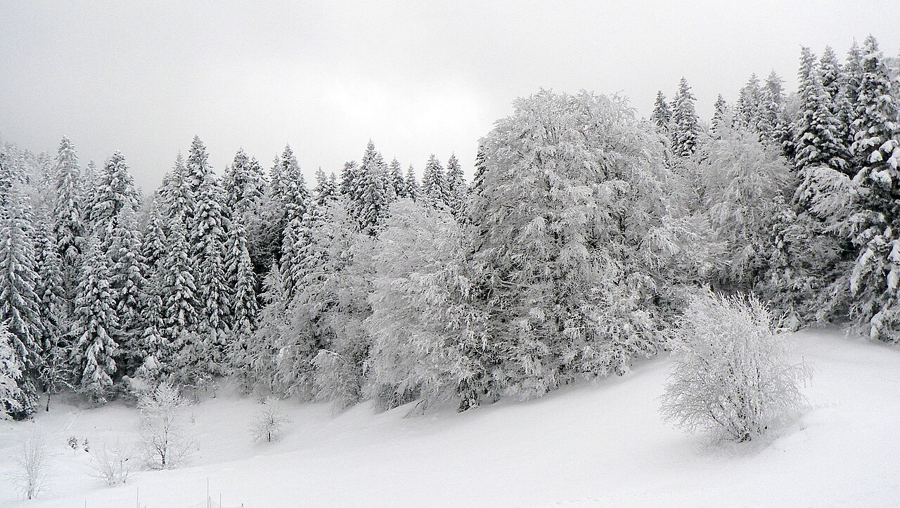
Cari is a mapped downhill ski area in CH. Forecasts cover three real lift-station locations from approximately 1651 to 2280 metres. Elevations are terrain-model estimates.
Data: OpenSkiData / OpenSkiMap, OpenStreetMap contributors (ODbL), Skimap.org, Who's On First, Mapterhorn.
Diagramme werden vorbereitet…
Zeiten und Werte entsprechen der detaillierten Vorhersage. Tippen Sie auf einen Wert für Details und scrollen Sie seitlich für spätere Tage. Niederschlag ist das gesamte Wasseräquivalent je Intervall einschließlich Schnee. Neuschnee gilt je Intervall und ist keine Schneehöhe am Boden.
Vergleich von GFS und ECMWF. Jedes Modell behält seine eigenen Vorhersagezeiten und seinen Zeitraum. Niederschlags- und Schneemengen gelten für die jeweiligen, möglicherweise unterschiedlichen Intervalle.
Vorhersagewerte und Modellhinweise
Cari - Middle lift station
ECMWF · Modelllauf: Nächste Aktualisierung erwartet:
Tag Uhrzeit (UTC) Temp. (°C) Luftfeuchtigkeit (%) Wind (km/h) Wind (Knoten) Wind (Bft) Richtung Niederschlag (mm) Neuschnee (cm) Luftdruck (hPa) Nullgradgrenze (m) Wetterlage | Mittwoch, 04/11 06:00 -1.5 97 4 2 1B SE — — 1024 < 1929 Overcast 100% cloud 09:00 -0.7 94 7 4 2B S 0.38 0.1 1025 < 1929 Overcast 100% cloud 12:00 -0 89 8 4 2B S 0.70 0.2 1026 1950 Overcast 100% cloud 15:00 -0.7 95 7 4 2B S 0.52 0.2 1026 < 1929 Overcast 100% cloud 18:00 -1.2 99 6 3 2B S 0.39 0.1 1027 < 1929 Overcast 100% cloud 21:00 -1 99 6 3 2B S 0.46 0.1 1028 < 1929 Overcast 100% cloud Donnerstag, 05/11 00:00 -1.1 98 6 3 2B S 0.24 0 1029 < 1929 Overcast 100% cloud 03:00 -1.1 98 5 3 1B S 0.03 0 1029 < 1929 Overcast 100% cloud 06:00 -1 98 6 3 2B S 0.12 0 1029 < 1929 Overcast 100% cloud 09:00 0.3 91 6 3 1B S 0 0 1029 2029 Overcast 86% cloud 12:00 2.4 79 5 3 1B S 0 0 1028 2425 Cloudy 64% cloud 15:00 1.9 81 3 2 1B S 0 0 1027 2468 Partly cloudy 21% cloud 18:00 -1.5 94 0 0 0B SE 0 0 1027 < 1929 Partly cloudy 42% cloud 21:00 -2 97 1 0 0B NE 0 0 1027 < 1929 Overcast 99% cloud Freitag, 06/11 00:00 -2.8 98 0 0 0B NE 0 0 1026 < 1929 Overcast 99% cloud 03:00 -1.5 96 1 0 0B NE 0 0 1024 < 1929 Overcast 95% cloud 06:00 -2.2 97 1 0 0B SE 0.09 0 1024 < 1929 Overcast 98% cloud 09:00 1.7 84 3 2 1B SE 0 0 1024 2342 Overcast 97% cloud 12:00 1.8 90 4 2 1B SE 0.56 0 1022 2325 Overcast 100% cloud 15:00 1 96 2 1 1B S 0.67 0.2 1022 2202 Overcast 100% cloud 18:00 0.3 99 2 1 1B S 0.81 0.2 1022 2034 Overcast 100% cloud 21:00 -0.2 99 3 1 1B S 2.6 0.8 1023 < 1929 Overcast 100% cloud Samstag, 07/11 00:00 -0.7 100 2 1 1B S 2.2 0.7 1023 < 1929 Overcast 100% cloud 03:00 -0.7 98 0 0 0B W 0.70 0.2 1022 < 1929 Overcast 100% cloud 06:00 -0.7 99 1 0 0B SW 0.42 0.1 1022 < 1929 Overcast 100% cloud 09:00 -0.2 95 4 2 1B S 2.4 0.7 1024 < 1929 Overcast 100% cloud 12:00 -0.6 95 4 2 1B S 3.3 1.3 1024 < 1929 Overcast 100% cloud 15:00 -1.1 99 4 2 1B S 0.68 0.2 1024 < 1929 Overcast 100% cloud 18:00 -1.8 99 3 2 1B SE 0.09 0 1025 < 1929 Overcast 100% cloud 21:00 -1.6 97 4 2 1B SE 0.18 0 1026 < 1929 Overcast 100% cloud Sonntag, 08/11 00:00 -2.3 95 3 2 1B SE 0.09 0 1026 < 1929 Overcast 100% cloud 03:00 -2.2 94 2 1 1B S 0.03 0 1026 < 1929 Overcast 98% cloud 06:00 -5.1 96 1 0 0B S 0 0 1026 < 1929 Overcast 90% cloud 09:00 -1.7 85 3 1 1B S 0 0 1028 < 1929 Cloudy 76% cloud 12:00 -0.1 77 5 3 1B S 0 0 1026 1938 Overcast 96% cloud 15:00 -0.9 84 3 1 1B S 0.09 0 1026 < 1929 Overcast 86% cloud 18:00 -4 94 1 0 0B S 0 0 1027 < 1929 Cloudy 77% cloud 21:00 -5.1 96 0 0 0B SE 0 0 1027 < 1929 Overcast 99% cloud Montag, 09/11 00:00 -2.6 88 1 1 1B S 0 0 1027 < 1929 Overcast 96% cloud 03:00 -3.7 91 1 1 1B S 0 0 1026 < 1929 Overcast 94% cloud 06:00 -3.3 92 2 1 1B S 0 0 1026 < 1929 Overcast 99% cloud 09:00 -1.1 88 5 3 1B S 0.09 0 1026 < 1929 Overcast 100% cloud 12:00 0.2 83 7 4 2B S 0.00 0 1025 2043 Overcast 100% cloud 15:00 0 90 6 3 1B S 0.03 0 1023 1962 Overcast 100% cloud 18:00 -0.5 97 5 3 1B S 0.28 0.1 1023 < 1929 Overcast 100% cloud 21:00 -0.6 99 6 3 2B S 0.67 0.2 1023 < 1929 Overcast 100% cloud Dienstag, 10/11 00:00 -0.2 99 5 3 1B S 0.40 0.1 1022 < 1929 Overcast 100% cloud 03:00 0 99 4 2 1B S 0.39 0.1 1020 1970 Overcast 100% cloud 06:00 0.3 100 5 3 1B S 0.48 0.1 1018 2127 Overcast 100% cloud |
|---|
Forecast notes
Forecast table times: UTC.
Coordinates: 46.503002°N, 8.8181191°E · Requested elevation: 1950 m. Model terrain: 1926 m. Terrain and 1000/925/850/700 hPa profiles are used for height estimates.
These are altitude estimates, not a simulation of local mountain terrain. Precipitation, cloud and sea-level pressure use horizontal interpolation only.
Precipitation includes rain and snow water equivalent: preceding 3 hours through day 6, then 6 hours (see cell tooltip). Snow (cm) estimates fresh snowfall from precipitation and temperature using the GFS conversion; it is not snow depth on the ground. Freezing (m) uses additional 600/500 hPa temperatures when available and estimates the lowest resolved 0°C crossing above sea level. When all sampled levels are warm, the upper profile limit is shown (see tooltip). < marks an entirely cold sampled profile and its lower height limit. No extrapolation is used.
Diagramme werden vorbereitet…
Zeiten und Werte entsprechen der detaillierten Vorhersage. Tippen Sie auf einen Wert für Details und scrollen Sie seitlich für spätere Tage. Niederschlag ist das gesamte Wasseräquivalent je Intervall einschließlich Schnee. Neuschnee gilt je Intervall und ist keine Schneehöhe am Boden.
Vergleich von GFS und ECMWF. Jedes Modell behält seine eigenen Vorhersagezeiten und seinen Zeitraum. Niederschlags- und Schneemengen gelten für die jeweiligen, möglicherweise unterschiedlichen Intervalle.
Vorhersagewerte und Modellhinweise
Cari - Top lift station
ECMWF · Modelllauf: Nächste Aktualisierung erwartet:
Tag Uhrzeit (UTC) Temp. (°C) Luftfeuchtigkeit (%) Wind (km/h) Wind (Knoten) Wind (Bft) Richtung Niederschlag (mm) Neuschnee (cm) Luftdruck (hPa) Nullgradgrenze (m) Wetterlage | Mittwoch, 04/11 06:00 -3.5 97 11 6 2B S — — 1024 < 1930 Overcast 99% cloud 09:00 -3 95 15 8 3B S 0.37 0.4 1025 < 1930 Overcast 99% cloud 12:00 -2.3 91 16 9 3B S 0.67 0.2 1025 1959 Overcast 100% cloud 15:00 -2.8 96 18 10 3B S 0.50 0.2 1026 < 1930 Overcast 100% cloud 18:00 -3.1 98 17 9 3B S 0.38 0.4 1027 < 1930 Overcast 100% cloud 21:00 -3 99 16 9 3B S 0.45 0.4 1028 < 1930 Overcast 99% cloud Donnerstag, 05/11 00:00 -2.7 97 17 9 3B S 0.23 0 1029 < 1930 Overcast 100% cloud 03:00 -2.5 95 16 8 3B S 0.03 0 1029 < 1930 Overcast 100% cloud 06:00 -2.4 96 16 9 3B S 0.12 0 1029 < 1930 Overcast 100% cloud 09:00 -1 89 16 9 3B S 0 0 1029 2041 Overcast 86% cloud 12:00 0.8 79 14 7 3B S 0 0 1028 2436 Cloudy 63% cloud 15:00 0.7 78 10 5 2B SW 0 0 1026 2478 Partly cloudy 21% cloud 18:00 -1.7 86 8 4 2B S 0 0 1027 < 1930 Partly cloudy 41% cloud 21:00 -2.1 91 8 4 2B S 0 0 1027 < 1930 Overcast 99% cloud Freitag, 06/11 00:00 -2.6 93 9 5 2B S 0 0 1026 < 1930 Overcast 99% cloud 03:00 -1.9 95 11 6 2B S 0 0 1024 < 1930 Overcast 94% cloud 06:00 -2.3 92 11 6 2B S 0.08 0 1024 < 1930 Overcast 98% cloud 09:00 0.3 84 13 7 3B S 0 0 1024 2350 Overcast 97% cloud 12:00 0.3 92 12 6 2B S 0.56 0.2 1022 2335 Overcast 100% cloud 15:00 -0.3 97 8 4 2B S 0.65 0.2 1022 2213 Overcast 100% cloud 18:00 -0.9 99 8 4 2B SE 0.82 0.2 1022 2040 Overcast 100% cloud 21:00 -1.6 99 6 3 2B S 2.7 0.8 1023 < 1930 Overcast 100% cloud Samstag, 07/11 00:00 -2.1 100 5 3 1B S 2.2 0.7 1023 < 1930 Overcast 100% cloud 03:00 -2.3 99 2 1 1B S 0.71 0.2 1022 < 1930 Overcast 100% cloud 06:00 -2.4 99 2 1 1B SW 0.42 0.1 1022 < 1930 Overcast 100% cloud 09:00 -2.2 97 5 3 1B S 2.3 0.7 1024 < 1930 Overcast 100% cloud 12:00 -2.6 96 8 4 2B S 3.2 1.3 1024 < 1930 Overcast 100% cloud 15:00 -3.1 98 8 4 2B S 0.70 0.7 1024 < 1930 Overcast 100% cloud 18:00 -3.5 96 8 5 2B S 0.09 0.1 1025 < 1930 Overcast 99% cloud 21:00 -3.4 93 9 5 2B S 0.17 0.2 1026 < 1930 Overcast 100% cloud Sonntag, 08/11 00:00 -4 92 8 4 2B S 0.08 0.1 1026 < 1930 Overcast 100% cloud 03:00 -3.9 90 6 3 2B SW 0.03 0 1026 < 1930 Overcast 97% cloud 06:00 -5.9 84 4 2 1B SW 0 0 1026 < 1930 Overcast 90% cloud 09:00 -3.3 74 5 3 1B SW 0 0 1027 < 1930 Cloudy 75% cloud 12:00 -2 68 7 4 2B SW 0 0 1026 1941 Overcast 94% cloud 15:00 -2.3 69 5 3 1B SW 0.08 0 1026 < 1930 Overcast 84% cloud 18:00 -4.1 72 5 2 1B W 0 0 1027 < 1930 Cloudy 76% cloud 21:00 -4.9 79 5 3 1B W 0 0 1027 < 1930 Overcast 99% cloud Montag, 09/11 00:00 -2.9 83 8 4 2B SW 0 0 1026 < 1930 Overcast 96% cloud 03:00 -3.5 86 7 4 2B SW 0 0 1026 < 1930 Overcast 94% cloud 06:00 -3.1 83 6 3 2B SW 0 0 1026 < 1930 Overcast 98% cloud 09:00 -1.4 78 9 5 2B SW 0.08 0 1026 < 1930 Overcast 99% cloud 12:00 -0.5 76 12 6 2B SW 0.00 0 1025 2049 Overcast 100% cloud 15:00 -0.6 86 11 6 2B SW 0.03 0 1023 1959 Overcast 100% cloud 18:00 -0.9 94 12 7 2B S 0.27 0.1 1023 < 1930 Overcast 100% cloud 21:00 -1 96 15 8 3B S 0.65 0.2 1023 < 1930 Overcast 100% cloud Dienstag, 10/11 00:00 -0.6 96 13 7 3B SW 0.38 0.1 1022 < 1930 Overcast 100% cloud 03:00 -0.4 97 11 6 2B S 0.38 0.1 1020 1974 Overcast 100% cloud 06:00 -0.2 98 15 8 3B S 0.47 0.1 1018 2137 Overcast 100% cloud |
|---|
Forecast notes
Forecast table times: UTC.
Coordinates: 46.5122744°N, 8.8188444°E · Requested elevation: 2280 m. Model terrain: 1928 m. Terrain and 1000/925/850/700 hPa profiles are used for height estimates.
These are altitude estimates, not a simulation of local mountain terrain. Precipitation, cloud and sea-level pressure use horizontal interpolation only.
Precipitation includes rain and snow water equivalent: preceding 3 hours through day 6, then 6 hours (see cell tooltip). Snow (cm) estimates fresh snowfall from precipitation and temperature using the GFS conversion; it is not snow depth on the ground. Freezing (m) uses additional 600/500 hPa temperatures when available and estimates the lowest resolved 0°C crossing above sea level. When all sampled levels are warm, the upper profile limit is shown (see tooltip). < marks an entirely cold sampled profile and its lower height limit. No extrapolation is used.