Wettervorhersagen für Skigebiete weltweit

Farbskala Temperatur · Wind · Regen · Schnee
Jede Farbe beginnt beim angegebenen Wert. Die Windfarben stimmen in allen drei Einheiten überein. Trockene Zellen bleiben neutral. Die Farben beschreiben die Werte und sind keine amtlichen Wetterwarnungen.
Brighton Resort - Low lift station
ECMWF · Modelllauf: Nächste Aktualisierung erwartet:
Tag Uhrzeit (UTC) Temp. (°C) Luftfeuchtigkeit (%) Wind (km/h) Wind (Knoten) Wind (Bft) Richtung Niederschlag (mm) Neuschnee (cm) Luftdruck (hPa) Nullgradgrenze (m) Wetterlage | Mittwoch, 04/11 06:00 1.9 60 16 8 3B S — — 1014 3065 Overcast 97% cloud  09:00 1 70 10 5 2B S 0 0 1013 3051 Partly cloudy 37% cloud  12:00 -0.3 77 9 5 2B SW 0 0 1013 2434 Overcast 92% cloud 15:00 -0.7 84 4 2 1B SW 0.18 0 1014 2480 Overcast 94% cloud 18:00 -0.8 91 7 4 2B N 0.83 0.2 1016 2542 Overcast 100% cloud 21:00 -1 96 13 7 3B N 2.6 0.8 1016 2506 Overcast 100% cloud Donnerstag, 05/11 00:00 -1.1 95 12 7 2B N 0.33 0.1 1018 2493 Cloudy 78% cloud  03:00 -1.3 91 7 4 2B N 0.06 0 1020 2435 Overcast 85% cloud 06:00 -1.8 91 5 3 1B N 0 0 1021 2292 Overcast 91% cloud 09:00 -2.1 88 2 1 1B NE 0 0 1021 < 2141 Overcast 80% cloud 12:00 -2.2 85 3 2 1B SE 0 0 1022 < 2141 Overcast 82% cloud 15:00 -1.5 85 7 4 2B S 0 0 1023 2244 Cloudy 73% cloud 18:00 1.1 71 10 5 2B S 0 0 1021 2801 Cloudy 67% cloud 21:00 2.8 64 6 3 1B SW 0 0 1018 2968 Overcast 99% cloud Freitag, 06/11 00:00 1.1 74 4 2 1B SW 0 0 1020 2857 Overcast 100% cloud 03:00 -0.6 83 2 1 1B SW 0 0 1022 2495 Overcast 99% cloud 06:00 -1.6 84 2 1 1B SW 0 0 1023 < 2141 Cloudy 59% cloud 09:00 -2.3 85 2 1 1B NW 0 0 1024 < 2141 Cloudy 58% cloud 12:00 -2.4 81 3 1 1B N 0 0 1025 < 2141 Partly cloudy 49% cloud 15:00 -1.2 78 5 3 1B N 0 0 1028 2267 Partly cloudy 47% cloud 18:00 1.5 65 5 3 1B NE 0 0 1026 2871 Clear 15% cloud  21:00 2.7 66 3 2 1B N 0.03 0 1023 2952 Partly cloudy 27% cloud Samstag, 07/11 00:00 1.6 68 2 1 1B NE 0 0 1024 2979 Partly cloudy 32% cloud 03:00 -0.5 65 1 0 0B NW 0 0 1026 3105 Cloudy 71% cloud 06:00 -0.5 58 3 2 1B NW 0 0 1027 2885 Cloudy 54% cloud 09:00 0.4 48 6 3 1B NW 0 0 1027 2507 Partly cloudy 34% cloud 12:00 0.8 43 6 3 2B N 0.03 0 1027 2314 Partly cloudy 27% cloud 15:00 1.7 43 6 3 2B N 0 0 1028 3161 Partly cloudy 33% cloud 18:00 5.2 34 4 2 1B N 0 0 1026 3164 Clear 19% cloud 21:00 6.8 34 2 1 1B N 0 0 1023 3158 Partly cloudy 30% cloud Sonntag, 08/11 00:00 4.7 44 2 1 1B N 0 0 1024 3163 Clear 0% cloud 03:00 3.6 53 1 1 1B N 0 0 1025 3168 Clear 0% cloud 06:00 3.5 50 2 1 1B SW 0 0 1025 3169 Clear 0% cloud 09:00 3.6 44 5 3 1B S 0 0 1024 3164 Clear 0% cloud 12:00 3.5 41 7 4 2B SW 0 0 1024 3160 Clear 0% cloud 15:00 4.2 41 9 5 2B SW 0 0 1025 3169 Clear 0% cloud 18:00 7.9 35 9 5 2B SW 0 0 1024 3174 Clear 13% cloud 21:00 8.7 33 8 4 2B SW 0 0 1021 3161 Clear 11% cloud Montag, 09/11 00:00 6.6 38 6 3 2B SW 0 0 1021 3159 Clear 0% cloud 03:00 5 37 7 4 2B SW 0 0 1022 3160 Clear 8% cloud 06:00 4.4 37 9 5 2B SW 0 0 1023 3162 Clear 1% cloud 09:00 4.3 36 10 5 2B SW 0 0 1022 3155 Clear 2% cloud 12:00 4.1 36 10 5 2B SW 0 0 1021 3148 Clear 0% cloud 15:00 4.6 38 10 5 2B SW 0 0 1022 3152 Clear 3% cloud 18:00 8 35 9 5 2B SW 0 0 1022 3157 Clear 1% cloud 21:00 8.5 36 6 3 2B W 0 0 1020 3151 Cloudy 77% cloud Dienstag, 10/11 00:00 5.8 48 3 2 1B W 0 0 1021 3152 Partly cloudy 39% cloud 03:00 4.2 47 4 2 1B SW 0 0 1021 3153 Cloudy 65% cloud 06:00 3.9 43 7 4 2B W 0 0 1022 3154 Partly cloudy 28% cloud |
|---|
Forecast notes
Forecast table times: UTC.
Coordinates: 40.5993789°N, -111.5860359°E · Requested elevation: 2666 m. Model terrain: 2139 m. Terrain and 1000/925/850/700 hPa profiles are used for height estimates.
These are altitude estimates, not a simulation of local mountain terrain. Precipitation, cloud and sea-level pressure use horizontal interpolation only.
Precipitation includes rain and snow water equivalent: preceding 3 hours through day 6, then 6 hours (see cell tooltip). Snow (cm) estimates fresh snowfall from precipitation and temperature using the GFS conversion; it is not snow depth on the ground. Freezing (m) uses additional 600/500 hPa temperatures when available and estimates the lowest resolved 0°C crossing above sea level. When all sampled levels are warm, the upper profile limit is shown (see tooltip). < marks an entirely cold sampled profile and its lower height limit. No extrapolation is used.
Source: ECMWF · CC BY 4.0 · Processed by Snow Report.
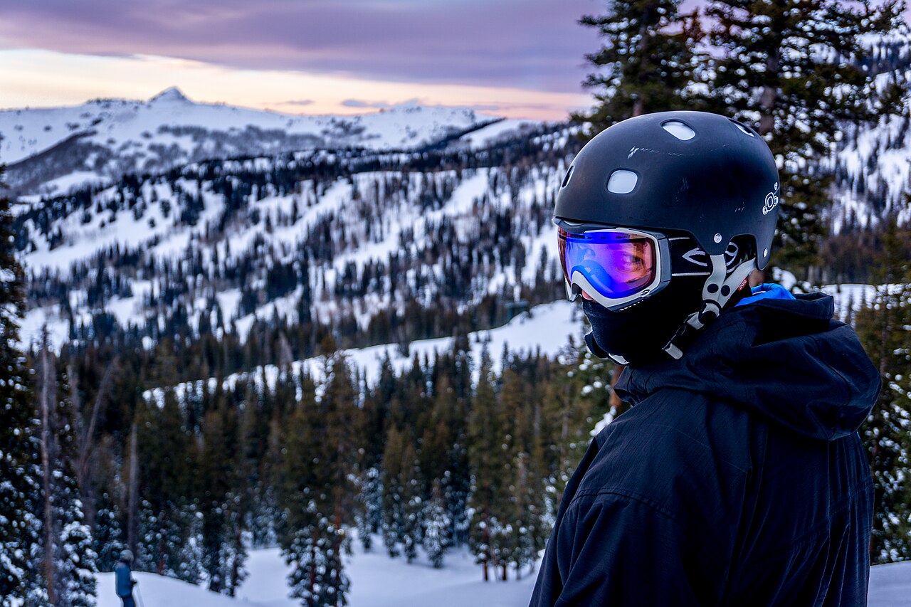
Brighton Resort is a downhill ski area in Utah, United States. Mapped terrain includes easy, intermediate, advanced, expert routes. Its mapped lift network extends from approximately 2666 to 3185 metres above sea level.
Data: OpenSkiData / OpenSkiMap, OpenStreetMap contributors (ODbL), Skimap.org, Who's On First, Mapterhorn.
Brighton Resort - Base lift station
ECMWF · Modelllauf: Nächste Aktualisierung erwartet:
Tag Uhrzeit (UTC) Temp. (°C) Luftfeuchtigkeit (%) Wind (km/h) Wind (Knoten) Wind (Bft) Richtung Niederschlag (mm) Neuschnee (cm) Luftdruck (hPa) Nullgradgrenze (m) Wetterlage | Mittwoch, 04/11 06:00 1.9 60 16 8 3B S — — 1014 3065 Overcast 97% cloud 09:00 1 70 10 6 2B S 0 0 1013 3051 Partly cloudy 38% cloud 12:00 -0.3 77 10 5 2B SW 0 0 1013 2423 Overcast 92% cloud 15:00 -0.8 84 4 2 1B SW 0.19 0 1014 2478 Overcast 94% cloud 18:00 -0.8 92 8 4 2B N 0.84 0.3 1016 2540 Overcast 100% cloud 21:00 -1 96 13 7 3B N 2.6 0.8 1016 2505 Overcast 100% cloud Donnerstag, 05/11 00:00 -1.1 95 12 7 3B N 0.33 0.1 1018 2492 Cloudy 77% cloud 03:00 -1.4 91 7 4 2B N 0.07 0 1020 2434 Overcast 85% cloud 06:00 -1.8 91 5 3 1B N 0 0 1021 2293 Overcast 92% cloud 09:00 -2.1 88 2 1 1B NE 0 0 1021 < 2141 Overcast 80% cloud 12:00 -2.2 85 3 2 1B SE 0 0 1022 < 2141 Overcast 82% cloud 15:00 -1.5 85 7 4 2B S 0 0 1023 2240 Cloudy 73% cloud 18:00 1.1 71 10 5 2B S 0 0 1021 2801 Cloudy 66% cloud 21:00 2.8 64 6 3 2B SW 0 0 1018 2970 Overcast 99% cloud Freitag, 06/11 00:00 1.1 74 5 2 1B SW 0 0 1020 2858 Overcast 100% cloud 03:00 -0.6 83 2 1 1B SW 0 0 1022 2498 Overcast 99% cloud 06:00 -1.6 84 2 1 1B SW 0 0 1023 < 2141 Cloudy 60% cloud 09:00 -2.3 85 2 1 1B NW 0 0 1024 < 2141 Cloudy 59% cloud 12:00 -2.4 81 3 1 1B N 0 0 1025 < 2141 Cloudy 50% cloud 15:00 -1.2 78 5 3 1B N 0 0 1028 2265 Partly cloudy 47% cloud 18:00 1.5 65 5 3 1B NE 0 0 1026 2871 Clear 15% cloud 21:00 2.7 66 3 2 1B N 0.02 0 1023 2953 Partly cloudy 26% cloud Samstag, 07/11 00:00 1.6 67 2 1 1B NE 0 0 1024 2980 Partly cloudy 31% cloud 03:00 -0.5 64 1 0 0B NW 0 0 1026 3108 Cloudy 71% cloud 06:00 -0.5 57 3 2 1B NW 0 0 1027 2886 Cloudy 54% cloud 09:00 0.4 48 6 3 1B NW 0 0 1027 2517 Partly cloudy 34% cloud 12:00 0.8 43 6 3 2B N 0.03 0 1027 2321 Partly cloudy 28% cloud 15:00 1.7 42 6 3 2B N 0 0 1028 3161 Partly cloudy 33% cloud 18:00 5.2 34 4 2 1B N 0 0 1026 3164 Clear 20% cloud 21:00 6.8 34 2 1 1B N 0 0 1023 3158 Partly cloudy 30% cloud Sonntag, 08/11 00:00 4.7 44 2 1 1B N 0 0 1024 3163 Clear 0% cloud 03:00 3.6 53 2 1 1B N 0 0 1025 3168 Clear 0% cloud 06:00 3.6 50 2 1 1B SW 0 0 1025 3169 Clear 0% cloud 09:00 3.6 44 5 3 1B S 0 0 1024 3164 Clear 0% cloud 12:00 3.4 40 7 4 2B SW 0 0 1024 3160 Clear 0% cloud 15:00 4.2 41 9 5 2B SW 0 0 1025 3169 Clear 0% cloud 18:00 7.9 35 9 5 2B SW 0 0 1024 3174 Clear 13% cloud 21:00 8.7 33 8 4 2B SW 0 0 1021 3161 Clear 11% cloud Montag, 09/11 00:00 6.6 38 6 3 2B SW 0 0 1021 3159 Clear 0% cloud 03:00 5 37 7 4 2B SW 0 0 1022 3160 Clear 8% cloud 06:00 4.4 37 9 5 2B SW 0 0 1023 3162 Clear 1% cloud 09:00 4.3 36 10 5 2B SW 0 0 1022 3155 Clear 2% cloud 12:00 4.1 36 10 5 2B SW 0 0 1021 3148 Clear 0% cloud 15:00 4.6 38 10 6 2B SW 0 0 1022 3152 Clear 3% cloud 18:00 7.9 35 9 5 2B SW 0 0 1022 3157 Clear 1% cloud 21:00 8.5 36 6 3 2B W 0 0 1020 3151 Cloudy 77% cloud Dienstag, 10/11 00:00 5.8 48 3 2 1B W 0 0 1021 3152 Partly cloudy 39% cloud 03:00 4.2 47 4 2 1B SW 0 0 1021 3153 Cloudy 65% cloud 06:00 3.9 43 7 4 2B W 0 0 1022 3154 Partly cloudy 28% cloud |
|---|
Forecast notes
Forecast table times: UTC.
Coordinates: 40.5993851°N, -111.5820307°E · Requested elevation: 2672 m. Model terrain: 2139 m. Terrain and 1000/925/850/700 hPa profiles are used for height estimates.
These are altitude estimates, not a simulation of local mountain terrain. Precipitation, cloud and sea-level pressure use horizontal interpolation only.
Precipitation includes rain and snow water equivalent: preceding 3 hours through day 6, then 6 hours (see cell tooltip). Snow (cm) estimates fresh snowfall from precipitation and temperature using the GFS conversion; it is not snow depth on the ground. Freezing (m) uses additional 600/500 hPa temperatures when available and estimates the lowest resolved 0°C crossing above sea level. When all sampled levels are warm, the upper profile limit is shown (see tooltip). < marks an entirely cold sampled profile and its lower height limit. No extrapolation is used.
Source: ECMWF · CC BY 4.0 · Processed by Snow Report.
Brighton Resort - Top lift station
ECMWF · Modelllauf: Nächste Aktualisierung erwartet:
Tag Uhrzeit (UTC) Temp. (°C) Luftfeuchtigkeit (%) Wind (km/h) Wind (Knoten) Wind (Bft) Richtung Niederschlag (mm) Neuschnee (cm) Luftdruck (hPa) Nullgradgrenze (m) Wetterlage | Mittwoch, 04/11 06:00 1.4 49 26 14 4B S — — 1014 3065 Overcast 97% cloud 09:00 -0.1 67 17 9 3B S 0 0 1013 3051 Partly cloudy 40% cloud 12:00 -1.6 77 16 8 3B SW 0 0 1013 2398 Overcast 92% cloud 15:00 -3 88 7 4 2B SW 0.19 0.2 1015 2479 Overcast 94% cloud 18:00 -3.8 97 13 7 3B N 0.88 0.9 1016 2531 Overcast 100% cloud 21:00 -4 99 20 11 3B N 2.6 2 1016 2502 Overcast 100% cloud Donnerstag, 05/11 00:00 -4.3 100 20 11 4B N 0.32 0.3 1018 2491 Cloudy 75% cloud 03:00 -4.2 89 12 7 3B N 0.07 0.1 1020 2432 Overcast 85% cloud 06:00 -4.3 91 10 5 2B N 0 0 1021 2309 Overcast 93% cloud 09:00 -4 85 5 3 1B NE 0 0 1021 < 2142 Cloudy 79% cloud 12:00 -3.4 78 6 3 2B SE 0 0 1022 < 2142 Overcast 85% cloud 15:00 -3.5 81 14 8 3B S 0 0 1023 2223 Cloudy 74% cloud 18:00 -3 77 18 10 3B S 0 0 1021 2804 Cloudy 65% cloud 21:00 -1.6 72 11 6 2B S 0 0 1018 2981 Overcast 99% cloud Freitag, 06/11 00:00 -1.9 73 7 4 2B SW 0 0 1020 2869 Overcast 100% cloud 03:00 -2.5 80 4 2 1B SW 0 0 1022 2520 Overcast 99% cloud 06:00 -2.6 82 4 2 1B S 0 0 1023 < 2142 Cloudy 65% cloud 09:00 -3 82 3 2 1B NW 0 0 1024 < 2142 Cloudy 63% cloud 12:00 -2.8 76 4 2 1B N 0 0 1025 < 2142 Cloudy 54% cloud 15:00 -2.9 72 7 4 2B N 0 0 1028 2252 Partly cloudy 49% cloud 18:00 -2.3 61 7 4 2B NE 0 0 1026 2868 Clear 13% cloud 21:00 -2 73 3 2 1B N 0.02 0 1023 2957 Partly cloudy 21% cloud Samstag, 07/11 00:00 -1.1 55 3 2 1B E 0 0 1024 2986 Partly cloudy 26% cloud 03:00 -0.2 40 1 0 0B W 0 0 1026 3127 Cloudy 68% cloud 06:00 0.5 33 5 3 1B NW 0 0 1027 2893 Cloudy 55% cloud 09:00 1.2 23 10 6 2B NW 0 0 1027 2568 Partly cloudy 38% cloud 12:00 1.7 17 11 6 2B N 0.03 0 1028 2356 Partly cloudy 30% cloud 15:00 2.2 16 11 6 2B N 0 0 1028 3161 Partly cloudy 31% cloud 18:00 3 15 7 4 2B N 0 0 1026 3164 Partly cloudy 20% cloud 21:00 3.4 18 3 2 1B N 0 0 1023 3158 Partly cloudy 31% cloud Sonntag, 08/11 00:00 3.5 22 3 2 1B N 0 0 1024 3163 Clear 0% cloud 03:00 3.8 38 3 2 1B N 0 0 1025 3168 Clear 0% cloud 06:00 4.5 36 4 2 1B S 0 0 1025 3169 Clear 0% cloud 09:00 4.9 27 10 5 2B S 0 0 1025 3164 Clear 0% cloud 12:00 4.7 27 13 7 3B SW 0 0 1024 3160 Clear 0% cloud 15:00 4.5 28 16 9 3B SW 0 0 1025 3169 Clear 0% cloud 18:00 4.7 27 16 9 3B W 0 0 1024 3174 Clear 15% cloud 21:00 4.5 33 12 6 2B SW 0 0 1021 3161 Clear 12% cloud Montag, 09/11 00:00 5.2 28 10 5 2B SW 0 0 1021 3159 Clear 0% cloud 03:00 5.4 25 13 7 3B SW 0 0 1022 3160 Clear 9% cloud 06:00 4.9 27 17 9 3B SW 0 0 1023 3162 Clear 1% cloud 09:00 5 28 18 10 3B SW 0 0 1022 3155 Clear 2% cloud 12:00 4.7 28 17 9 3B SW 0 0 1022 3148 Clear 0% cloud 15:00 4.4 30 18 10 3B W 0 0 1022 3152 Clear 3% cloud 18:00 4.2 31 16 8 3B SW 0 0 1022 3157 Clear 1% cloud 21:00 3.9 41 9 5 2B W 0 0 1020 3151 Cloudy 76% cloud Dienstag, 10/11 00:00 4 41 3 2 1B W 0 0 1020 3152 Partly cloudy 37% cloud 03:00 3.9 39 7 4 2B SW 0 0 1021 3153 Cloudy 65% cloud 06:00 3.7 34 13 7 3B W 0 0 1022 3154 Partly cloudy 29% cloud |
|---|
Forecast notes
Forecast table times: UTC.
Coordinates: 40.5926076°N, -111.5616197°E · Requested elevation: 3185 m. Model terrain: 2139 m. Terrain and 1000/925/850/700 hPa profiles are used for height estimates.
Outside the available profile, temperature uses an estimated 5.5°C/km height correction; wind retains the nearest available model-level value. Humidity is estimated with adjusted pressure and temperature.
These are altitude estimates, not a simulation of local mountain terrain. Precipitation, cloud and sea-level pressure use horizontal interpolation only.
Precipitation includes rain and snow water equivalent: preceding 3 hours through day 6, then 6 hours (see cell tooltip). Snow (cm) estimates fresh snowfall from precipitation and temperature using the GFS conversion; it is not snow depth on the ground. Freezing (m) uses additional 600/500 hPa temperatures when available and estimates the lowest resolved 0°C crossing above sea level. When all sampled levels are warm, the upper profile limit is shown (see tooltip). < marks an entirely cold sampled profile and its lower height limit. No extrapolation is used.