Previsioni per le stazioni sciistiche di tutto il mondo

Altro
Legenda dei colori Temperatura · Vento · Pioggia · Neve
Ogni colore inizia dal valore indicato. I colori del vento corrispondono nelle tre unità di misura. Le celle senza precipitazioni restano neutre. I colori descrivono i valori visualizzati, non avvisi meteo ufficiali.
Boreal Mountain Resort - Low lift station
ECMWF · Elaborazione del modello: Prossimo aggiornamento previsto:
Giorno Ora (UTC) Temp. (°C) Umidità (%) Vento (km/h) Vento (nodi) Vento (Bft) Direzione Precip. (mm) Neve (cm) Pressione (hPa) Zero termico (m) Condizioni | Mercoledì, 04/11 06:00 -1.7 92 4 2 1B W — — 1020 < 2015 Overcast 94% cloud  09:00 -1.6 92 1 1 1B N 0 0 1020 < 2015 Overcast 86% cloud 12:00 -2.4 89 2 1 1B NE 0 0 1019 < 2015 Cloudy 76% cloud  15:00 -2.1 85 4 2 1B NE 0 0 1020 < 2015 Cloudy 71% cloud 18:00 4.7 62 6 3 1B E 0 0 1018 3038 Clear 13% cloud  21:00 8.1 41 4 2 1B S 0 0 1016 3045 Partly cloudy 26% cloud  Giovedì, 05/11 00:00 6.1 57 7 4 2B W 0 0 1016 3083 Partly cloudy 21% cloud 03:00 0.3 82 3 1 1B W 0 0 1019 2636 Partly cloudy 35% cloud 06:00 -0.2 75 3 1 1B N 0 0 1019 2365 Cloudy 70% cloud 09:00 0.4 76 6 3 1B N 0 0 1019 3101 Overcast 85% cloud 12:00 0 76 6 3 2B NE 0 0 1019 2175 Clear 6% cloud 15:00 -0.1 76 6 3 2B N 0 0 1020 < 2015 Clear 6% cloud 18:00 7.3 43 9 5 2B N 0 0 1021 3115 Clear 2% cloud 21:00 9.6 28 8 4 2B N 0 0 1019 3117 Cloudy 53% cloud Venerdì, 06/11 00:00 7.3 33 9 5 2B N 0 0 1020 3122 Clear 3% cloud 03:00 2 53 11 6 2B NE 0 0 1022 3129 Partly cloudy 49% cloud 06:00 1.4 59 9 5 2B NE 0 0 1023 3141 Clear 11% cloud 09:00 0.9 60 6 3 2B NE 0 0 1023 3144 Clear 2% cloud 12:00 0.4 63 5 3 1B NE 0 0 1023 2021 Cloudy 53% cloud 15:00 0.9 65 7 4 2B NE 0 0 1024 3154 Partly cloudy 30% cloud 18:00 9.5 37 7 4 2B NE 0 0 1024 3162 Partly cloudy 28% cloud 21:00 11.9 29 8 4 2B NE 0 0 1021 3157 Overcast 96% cloud Sabato, 07/11 00:00 9.1 44 7 4 2B NE 0 0 1022 3158 Cloudy 76% cloud 03:00 4.5 57 8 4 2B NE 0 0 1023 3165 Clear 0% cloud 06:00 3.5 62 8 4 2B E 0 0 1023 3170 Clear 0% cloud 09:00 3.1 63 6 3 2B E 0 0 1022 3164 Clear 1% cloud 12:00 2.8 64 5 3 1B E 0 0 1022 3160 Clear 2% cloud 15:00 2.8 66 4 2 1B E 0 0 1022 3161 Clear 2% cloud 18:00 11.9 37 5 3 1B SE 0 0 1022 3167 Clear 6% cloud 21:00 14.9 28 8 4 2B SW 0 0 1019 3161 Cloudy 54% cloud Domenica, 08/11 00:00 11.4 45 6 3 2B SW 0 0 1020 3158 Overcast 88% cloud 03:00 5.2 61 5 3 1B SW 0 0 1021 3159 Overcast 87% cloud 06:00 3.8 61 10 5 2B SW 0 0 1021 3162 Overcast 89% cloud 09:00 3 65 10 5 2B SW 0 0 1022 3159 Cloudy 71% cloud 12:00 3.2 51 10 5 2B SW 0 0 1022 3153 Overcast 89% cloud 15:00 2.8 48 6 3 1B SW 0 0 1022 3159 Overcast 84% cloud 18:00 11.8 27 8 5 2B SW 0 0 1022 3165 Cloudy 67% cloud 21:00 13.5 23 14 8 3B SW 0 0 1020 3157 Overcast 87% cloud Lunedì, 09/11 00:00 10.2 40 9 5 2B SW 0 0 1021 3153 Cloudy 63% cloud 03:00 4.2 59 9 5 2B SW 0 0 1021 3151 Partly cloudy 42% cloud 06:00 3.2 52 11 6 2B SW 0 0 1021 3152 Cloudy 66% cloud 09:00 2.7 52 12 7 3B SW 0 0 1021 3143 Cloudy 79% cloud 12:00 2.1 49 11 6 2B SW 0 0 1021 3138 Cloudy 69% cloud 15:00 1.9 43 11 6 2B SW 0 0 1021 3144 Cloudy 63% cloud 18:00 11 20 16 8 3B SW 0 0 1021 3151 Partly cloudy 34% cloud 21:00 12.1 20 18 10 3B SW 0 0 1020 3146 Partly cloudy 27% cloud Martedì, 10/11 00:00 9.3 31 11 6 2B SW 0 0 1021 3145 Partly cloudy 45% cloud 03:00 3.6 50 8 4 2B SW 0 0 1021 3148 Clear 13% cloud 06:00 2.2 47 7 4 2B SW 0 0 1022 3157 Clear 0% cloud |
|---|
Forecast notes
Forecast table times: UTC.
Coordinates: 39.3358181°N, -120.3506972°E · Requested elevation: 2185 m. Model terrain: 2013 m. Terrain and 1000/925/850/700 hPa profiles are used for height estimates.
These are altitude estimates, not a simulation of local mountain terrain. Precipitation, cloud and sea-level pressure use horizontal interpolation only.
Precipitation includes rain and snow water equivalent: preceding 3 hours through day 6, then 6 hours (see cell tooltip). Snow (cm) estimates fresh snowfall from precipitation and temperature using the GFS conversion; it is not snow depth on the ground. Freezing (m) uses additional 600/500 hPa temperatures when available and estimates the lowest resolved 0°C crossing above sea level. When all sampled levels are warm, the upper profile limit is shown (see tooltip). < marks an entirely cold sampled profile and its lower height limit. No extrapolation is used.
Source: ECMWF · CC BY 4.0 · Processed by Snow Report.
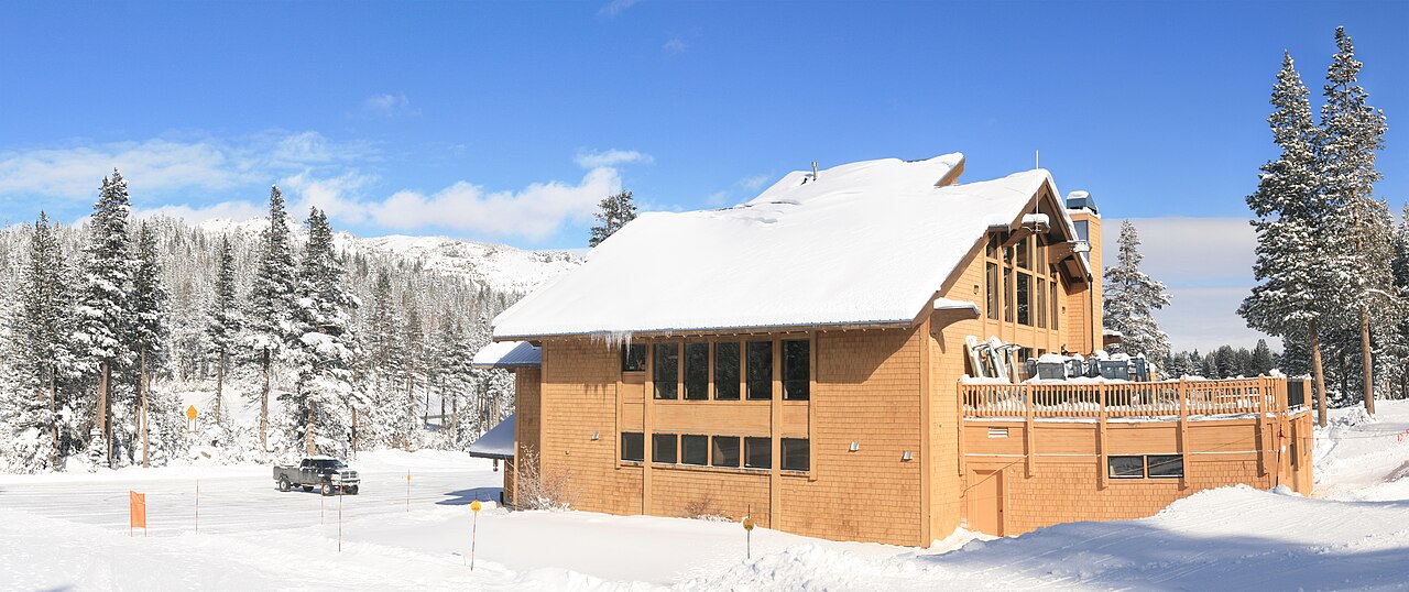
Boreal Mountain Resort is a downhill ski area in California, United States. Mapped terrain includes beginner, easy, intermediate, advanced, freeride routes. Its mapped lift network extends from approximately 2185 to 2347 metres above sea level.
Data: OpenSkiData / OpenSkiMap, OpenStreetMap contributors (ODbL), Skimap.org, Who's On First, Mapterhorn.
Boreal Mountain Resort - Base lift station
ECMWF · Elaborazione del modello: Prossimo aggiornamento previsto:
Giorno Ora (UTC) Temp. (°C) Umidità (%) Vento (km/h) Vento (nodi) Vento (Bft) Direzione Precip. (mm) Neve (cm) Pressione (hPa) Zero termico (m) Condizioni | Mercoledì, 04/11 06:00 -1.7 92 4 2 1B W — — 1020 < 2016 Overcast 94% cloud 09:00 -1.6 92 1 1 1B N 0 0 1020 < 2016 Overcast 86% cloud 12:00 -2.4 89 2 1 1B NE 0 0 1019 < 2016 Cloudy 77% cloud 15:00 -2.1 84 4 2 1B NE 0 0 1020 < 2016 Cloudy 71% cloud 18:00 4.6 62 6 3 1B E 0 0 1018 3037 Clear 13% cloud 21:00 8 41 4 2 1B S 0 0 1016 3044 Partly cloudy 26% cloud Giovedì, 05/11 00:00 6.1 56 7 4 2B W 0 0 1016 3083 Partly cloudy 21% cloud 03:00 0.3 81 3 1 1B W 0 0 1019 2628 Partly cloudy 35% cloud 06:00 -0.2 75 3 1 1B N 0 0 1019 2367 Cloudy 70% cloud 09:00 0.4 76 6 3 1B N 0 0 1019 3101 Overcast 85% cloud 12:00 0 76 6 3 2B N 0 0 1019 2178 Clear 6% cloud 15:00 -0.1 76 6 3 2B N 0 0 1020 < 2016 Clear 6% cloud 18:00 7.3 43 9 5 2B N 0 0 1021 3115 Clear 2% cloud 21:00 9.6 28 8 4 2B N 0 0 1019 3117 Cloudy 53% cloud Venerdì, 06/11 00:00 7.2 33 9 5 2B N 0 0 1020 3122 Clear 3% cloud 03:00 2 52 11 6 2B NE 0 0 1022 3129 Partly cloudy 49% cloud 06:00 1.4 59 9 5 2B NE 0 0 1023 3141 Clear 11% cloud 09:00 0.9 59 6 3 2B NE 0 0 1023 3144 Clear 2% cloud 12:00 0.4 63 5 3 1B NE 0 0 1023 2025 Cloudy 52% cloud 15:00 0.9 64 7 4 2B NE 0 0 1024 3154 Partly cloudy 30% cloud 18:00 9.5 37 7 4 2B NE 0 0 1024 3162 Partly cloudy 28% cloud 21:00 11.9 29 8 4 2B NE 0 0 1021 3157 Overcast 96% cloud Sabato, 07/11 00:00 9.1 44 8 4 2B NE 0 0 1022 3158 Cloudy 76% cloud 03:00 4.5 57 8 4 2B NE 0 0 1023 3165 Clear 0% cloud 06:00 3.5 62 8 4 2B E 0 0 1023 3170 Clear 0% cloud 09:00 3.1 63 6 3 2B E 0 0 1023 3164 Clear 1% cloud 12:00 2.8 64 5 3 1B E 0 0 1022 3160 Clear 2% cloud 15:00 2.8 66 4 2 1B E 0 0 1022 3161 Clear 2% cloud 18:00 11.8 37 5 3 1B SE 0 0 1022 3167 Clear 6% cloud 21:00 14.9 28 8 4 2B SW 0 0 1019 3161 Cloudy 54% cloud Domenica, 08/11 00:00 11.4 45 6 3 2B SW 0 0 1020 3158 Overcast 88% cloud 03:00 5.2 61 5 3 1B SW 0 0 1021 3159 Overcast 87% cloud 06:00 3.8 61 10 5 2B SW 0 0 1021 3162 Overcast 89% cloud 09:00 3 65 10 5 2B SW 0 0 1022 3159 Cloudy 71% cloud 12:00 3.2 51 10 5 2B SW 0 0 1022 3153 Overcast 89% cloud 15:00 2.7 48 6 3 2B SW 0 0 1022 3159 Overcast 84% cloud 18:00 11.8 27 8 5 2B SW 0 0 1022 3165 Cloudy 67% cloud 21:00 13.5 23 14 8 3B SW 0 0 1020 3157 Overcast 87% cloud Lunedì, 09/11 00:00 10.1 40 9 5 2B SW 0 0 1021 3153 Cloudy 63% cloud 03:00 4.2 59 9 5 2B SW 0 0 1021 3151 Partly cloudy 42% cloud 06:00 3.2 52 11 6 2B SW 0 0 1021 3152 Cloudy 66% cloud 09:00 2.7 52 12 7 3B SW 0 0 1021 3143 Cloudy 79% cloud 12:00 2.1 49 11 6 2B SW 0 0 1021 3138 Cloudy 69% cloud 15:00 1.9 43 11 6 2B SW 0 0 1021 3144 Cloudy 63% cloud 18:00 11 20 16 9 3B SW 0 0 1021 3151 Partly cloudy 34% cloud 21:00 12.1 20 18 10 3B SW 0 0 1020 3146 Partly cloudy 27% cloud Martedì, 10/11 00:00 9.3 31 12 6 2B SW 0 0 1021 3145 Partly cloudy 45% cloud 03:00 3.6 50 8 4 2B SW 0 0 1021 3148 Clear 13% cloud 06:00 2.2 47 7 4 2B SW 0 0 1022 3157 Clear 0% cloud |
|---|
Forecast notes
Forecast table times: UTC.
Coordinates: 39.3359482°N, -120.3494436°E · Requested elevation: 2189 m. Model terrain: 2013 m. Terrain and 1000/925/850/700 hPa profiles are used for height estimates.
These are altitude estimates, not a simulation of local mountain terrain. Precipitation, cloud and sea-level pressure use horizontal interpolation only.
Precipitation includes rain and snow water equivalent: preceding 3 hours through day 6, then 6 hours (see cell tooltip). Snow (cm) estimates fresh snowfall from precipitation and temperature using the GFS conversion; it is not snow depth on the ground. Freezing (m) uses additional 600/500 hPa temperatures when available and estimates the lowest resolved 0°C crossing above sea level. When all sampled levels are warm, the upper profile limit is shown (see tooltip). < marks an entirely cold sampled profile and its lower height limit. No extrapolation is used.
Source: ECMWF · CC BY 4.0 · Processed by Snow Report.
Boreal Mountain Resort - Top lift station
ECMWF · Elaborazione del modello: Prossimo aggiornamento previsto:
Giorno Ora (UTC) Temp. (°C) Umidità (%) Vento (km/h) Vento (nodi) Vento (Bft) Direzione Precip. (mm) Neve (cm) Pressione (hPa) Zero termico (m) Condizioni | Mercoledì, 04/11 06:00 -2.1 87 6 3 2B W — — 1020 < 2016 Overcast 94% cloud 09:00 -2 87 2 1 1B NW 0 0 1020 < 2016 Overcast 86% cloud 12:00 -2.5 82 4 2 1B N 0 0 1019 < 2016 Cloudy 78% cloud 15:00 -2.1 75 5 3 1B NE 0 0 1020 < 2016 Cloudy 73% cloud 18:00 3.8 58 5 3 1B E 0 0 1018 3038 Clear 14% cloud 21:00 6.5 41 5 3 1B S 0 0 1016 3044 Partly cloudy 26% cloud Giovedì, 05/11 00:00 5 55 8 4 2B W 0 0 1016 3084 Partly cloudy 21% cloud 03:00 0.1 74 4 2 1B NW 0 0 1019 2589 Partly cloudy 35% cloud 06:00 -0.1 67 5 2 1B NW 0 0 1019 2420 Cloudy 71% cloud 09:00 0.5 70 8 4 2B N 0 0 1019 3101 Overcast 86% cloud 12:00 0.2 70 8 4 2B N 0 0 1019 2210 Clear 6% cloud 15:00 -0.2 70 9 5 2B N 0 0 1020 < 2016 Clear 6% cloud 18:00 6.2 38 13 7 3B N 0 0 1021 3115 Clear 2% cloud 21:00 8 28 10 6 2B N 0 0 1019 3117 Cloudy 53% cloud Venerdì, 06/11 00:00 6.1 30 12 7 3B N 0 0 1020 3122 Clear 2% cloud 03:00 2.1 44 16 9 3B NE 0 0 1022 3129 Partly cloudy 48% cloud 06:00 1.6 49 12 6 2B NE 0 0 1023 3141 Clear 11% cloud 09:00 1.2 50 7 4 2B NE 0 0 1023 3144 Clear 2% cloud 12:00 0.8 54 7 4 2B N 0 0 1023 2044 Cloudy 52% cloud 15:00 1.3 57 9 5 2B NE 0 0 1024 3154 Partly cloudy 30% cloud 18:00 8.7 36 9 5 2B NE 0 0 1024 3162 Partly cloudy 27% cloud 21:00 10.7 30 9 5 2B NE 0 0 1021 3157 Overcast 96% cloud Sabato, 07/11 00:00 8.5 43 10 5 2B NE 0 0 1022 3158 Cloudy 77% cloud 03:00 4.7 54 10 6 2B NE 0 0 1023 3165 Clear 0% cloud 06:00 4 57 9 5 2B NE 0 0 1023 3169 Clear 0% cloud 09:00 3.7 57 6 3 2B E 0 0 1023 3164 Clear 1% cloud 12:00 3.5 57 5 3 1B E 0 0 1022 3160 Clear 2% cloud 15:00 3.4 59 4 2 1B E 0 0 1022 3161 Clear 2% cloud 18:00 11 36 5 3 1B SE 0 0 1022 3167 Clear 6% cloud 21:00 13.6 29 9 5 2B SW 0 0 1019 3161 Cloudy 54% cloud Domenica, 08/11 00:00 10.6 43 8 4 2B SW 0 0 1020 3159 Overcast 88% cloud 03:00 5.3 55 7 4 2B SW 0 0 1021 3159 Overcast 87% cloud 06:00 4.1 56 14 7 3B SW 0 0 1021 3162 Overcast 89% cloud 09:00 3.4 58 16 9 3B SW 0 0 1022 3159 Cloudy 70% cloud 12:00 3.5 47 16 8 3B SW 0 0 1022 3153 Overcast 89% cloud 15:00 3.1 42 9 5 2B SW 0 0 1022 3160 Overcast 84% cloud 18:00 10.7 26 11 6 2B SW 0 0 1022 3165 Cloudy 67% cloud 21:00 11.9 24 16 9 3B SW 0 0 1020 3157 Overcast 86% cloud Lunedì, 09/11 00:00 9.2 38 13 7 3B SW 0 0 1021 3153 Cloudy 62% cloud 03:00 4.2 52 14 8 3B SW 0 0 1021 3151 Partly cloudy 42% cloud 06:00 3.3 47 16 9 3B SW 0 0 1021 3152 Cloudy 67% cloud 09:00 2.9 45 19 10 3B SW 0 0 1021 3143 Cloudy 79% cloud 12:00 2.4 41 18 10 3B SW 0 0 1021 3138 Cloudy 70% cloud 15:00 2.2 37 18 10 3B SW 0 0 1021 3144 Cloudy 63% cloud 18:00 9.8 19 21 11 4B SW 0 0 1021 3151 Partly cloudy 34% cloud 21:00 10.7 19 22 12 4B SW 0 0 1020 3146 Partly cloudy 26% cloud Martedì, 10/11 00:00 8.3 29 17 9 3B SW 0 0 1021 3145 Partly cloudy 44% cloud 03:00 3.6 45 13 7 3B SW 0 0 1021 3148 Clear 14% cloud 06:00 2.4 43 11 6 2B SW 0 0 1022 3157 Clear 0% cloud |
|---|
Forecast notes
Forecast table times: UTC.
Coordinates: 39.3303833°N, -120.3450427°E · Requested elevation: 2347 m. Model terrain: 2013 m. Terrain and 1000/925/850/700 hPa profiles are used for height estimates.
These are altitude estimates, not a simulation of local mountain terrain. Precipitation, cloud and sea-level pressure use horizontal interpolation only.
Precipitation includes rain and snow water equivalent: preceding 3 hours through day 6, then 6 hours (see cell tooltip). Snow (cm) estimates fresh snowfall from precipitation and temperature using the GFS conversion; it is not snow depth on the ground. Freezing (m) uses additional 600/500 hPa temperatures when available and estimates the lowest resolved 0°C crossing above sea level. When all sampled levels are warm, the upper profile limit is shown (see tooltip). < marks an entirely cold sampled profile and its lower height limit. No extrapolation is used.