Wettervorhersagen für Skigebiete weltweit

Farbskala Temperatur · Wind · Regen · Schnee
Jede Farbe beginnt beim angegebenen Wert. Die Windfarben stimmen in allen drei Einheiten überein. Trockene Zellen bleiben neutral. Die Farben beschreiben die Werte und sind keine amtlichen Wetterwarnungen.
Aspen Highlands - Low lift station
ECMWF · Modelllauf: Nächste Aktualisierung erwartet:
Tag Ortszeit Temp. (°C) Luftfeuchtigkeit (%) Wind (km/h) Wind (Knoten) Wind (Bft) Richtung Niederschlag (mm) Neuschnee (cm) Luftdruck (hPa) Nullgradgrenze (m) Wetterlage | Mittwoch, 04/11 02:00 -3.4 63 3 2 1B SE 0 0 1016 — Partly cloudy 28% cloud  05:00 -2.8 62 4 2 1B SE 0 0 1013 — Partly cloudy 43% cloud 08:00 1.6 52 1 1 1B SE 0 0 1013 — Partly cloudy 26% cloud 11:00 8.7 31 2 1 1B W 0 0 1009 — Clear 4% cloud  14:00 7.8 37 5 2 1B W 0.25 0 1007 — Overcast 96% cloud  17:00 1.6 77 2 1 1B W 1.2 0 1012 — Overcast 100% cloud 20:00 0.6 84 3 2 1B W 2.1 0.6 1015 — Overcast 100% cloud 23:00 0.5 83 1 1 1B NW 3.5 1.4 1017 — Overcast 99% cloud Donnerstag, 05/11 02:00 -0.5 82 0 0 0B — 0.86 0.3 1019 — Cloudy 80% cloud  05:00 -3.2 81 2 1 1B E 0.15 0.2 1021 — Overcast 84% cloud 08:00 -1.4 68 2 1 1B E 0 0 1022 — Partly cloudy 46% cloud 11:00 5.7 42 0 0 0B NW 0 0 1019 — Clear 3% cloud 14:00 8 35 1 1 0B W 0 0 1016 — Clear 11% cloud 17:00 2 54 1 1 1B SE 0 0 1018 — Clear 7% cloud 20:00 -2.9 62 5 3 1B SE 0 0 1020 — Cloudy 56% cloud 23:00 -3.4 65 4 2 1B SE 0 0 1022 — Overcast 98% cloud Freitag, 06/11 02:00 -3 67 4 2 1B SE 0 0 1022 — Overcast 94% cloud 05:00 -2.9 68 3 1 1B SE 0 0 1023 — Overcast 99% cloud 08:00 1 60 2 1 1B SE 0 0 1024 — Overcast 89% cloud 11:00 6.6 40 2 1 1B NW 0.03 0 1023 — Overcast 98% cloud 14:00 7.3 39 4 2 1B NW 0.03 0 1021 — Overcast 89% cloud 17:00 2.4 57 1 1 1B W 0 0 1022 — Partly cloudy 38% cloud 20:00 -2.3 69 3 1 1B SE 0 0 1024 — Clear 0% cloud 23:00 -3.2 70 3 2 1B SE 0 0 1025 — Clear 0% cloud Samstag, 07/11 02:00 -3.9 72 3 2 1B SE 0 0 1025 — Clear 0% cloud 05:00 -4.7 71 3 2 1B SE 0 0 1026 — Clear 0% cloud 08:00 -0.4 58 3 1 1B SE 0 0 1027 — Clear 0% cloud 11:00 7.7 33 3 2 1B NW 0 0 1025 — Clear 0% cloud 14:00 9.3 31 4 2 1B NW 0 0 1022 — Clear 1% cloud 17:00 2.8 49 0 0 0B S 0 0 1024 — Clear 2% cloud 20:00 -1.7 58 3 2 1B SE 0 0 1026 — Cloudy 62% cloud 23:00 -1.7 55 3 2 1B SE 0 0 1026 — Partly cloudy 48% cloud Sonntag, 08/11 02:00 -2.5 51 3 2 1B SE 0 0 1026 — Clear 1% cloud 05:00 -2.6 47 3 2 1B SE 0 0 1025 — Clear 0% cloud 08:00 2.2 37 2 1 1B SE 0 0 1026 — Clear 0% cloud 11:00 10.4 20 2 1 1B NW 0 0 1024 — Clear 0% cloud 14:00 11.2 20 4 2 1B NW 0 0 1022 — Clear 0% cloud 17:00 4.1 39 1 0 0B NW 0 0 1024 — Clear 0% cloud 20:00 -1.1 54 3 2 1B SE 0 0 1024 — Clear 0% cloud 23:00 -0.7 47 3 2 1B SE 0 0 1024 — Clear 0% cloud Montag, 09/11 02:00 -1 44 2 1 1B SE 0 0 1024 — Clear 0% cloud 05:00 -1.7 46 3 2 1B SE 0 0 1024 — Clear 0% cloud 08:00 2.5 38 2 1 1B SE 0 0 1024 — Clear 0% cloud 11:00 11.1 21 3 1 1B NW 0 0 1022 — Clear 0% cloud 14:00 11.7 23 5 3 1B NW 0 0 1020 — Clear 0% cloud 17:00 4.6 42 1 0 0B N 0 0 1021 — Clear 0% cloud 20:00 -0.1 55 3 2 1B SE 0 0 1023 — Clear 0% cloud 23:00 -1 55 3 2 1B SE 0 0 1023 — Clear 0% cloud |
|---|
Forecast notes
Forecast table times: America/Denver.
Coordinates: 39.1810288°N, -106.8560012°E · Requested elevation: 2470 m. Model terrain: 2985 m. Terrain and 1000/925/850/700 hPa profiles are used for height estimates.
Outside the available profile, temperature uses an estimated 5.5°C/km height correction; wind retains the nearest available model-level value. Humidity is estimated with adjusted pressure and temperature.
These are altitude estimates, not a simulation of local mountain terrain. Precipitation, cloud and sea-level pressure use horizontal interpolation only.
Precipitation includes rain and snow water equivalent: preceding 3 hours through day 6, then 6 hours (see cell tooltip). Snow (cm) estimates fresh snowfall from precipitation and temperature using the GFS conversion; it is not snow depth on the ground. Freezing (m) uses additional 600/500 hPa temperatures when available and estimates the lowest resolved 0°C crossing above sea level. When all sampled levels are warm, the upper profile limit is shown (see tooltip). < marks an entirely cold sampled profile and its lower height limit. No extrapolation is used.
Source: ECMWF · CC BY 4.0 · Processed by Snow Report.
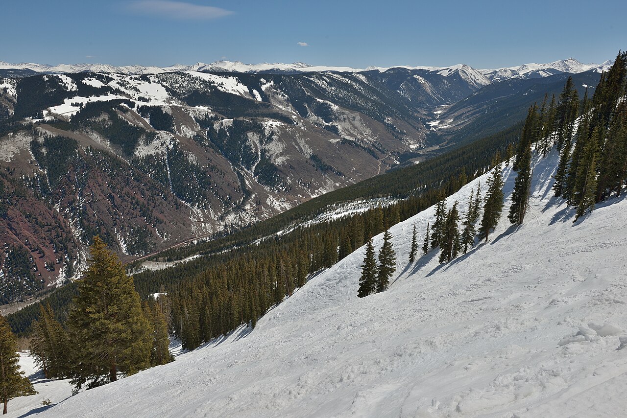
Aspen Highlands is the Aspen Snowmass mountain associated with steep terrain and the hike to Highland Bowl. It is a distinct ski area from Aspen Mountain, despite the similar name. The operator highlights experienced skiers and riders as its main audience; the Bowl is a particular undertaking within the area, not simply another lift-served beginner run.
When making plans, separate a day on the mapped lift-served trails from a plan involving the Bowl hike. Check the operator’s current guidance and terrain status for the latter. Snowfall totals cannot establish whether that terrain is open, and a photograph of the Bowl is not a report of today’s access.
This page initially uses a lower reference at 2,470 m. It is not a forecast at the Bowl summit. Select the relevant height and follow the wind and temperature through the planned hours, not just the snow accumulation. If comparing Highlands with Aspen Mountain or Snowmass, keep in mind that their selected forecast points can be at different elevations; apparent differences in snow may partly reflect that choice.
Official sources: Aspen Highlands. Reviewed 18 October 2026.
Aspen Highlands - Base lift station
ECMWF · Modelllauf: Nächste Aktualisierung erwartet:
Tag Ortszeit Temp. (°C) Luftfeuchtigkeit (%) Wind (km/h) Wind (Knoten) Wind (Bft) Richtung Niederschlag (mm) Neuschnee (cm) Luftdruck (hPa) Nullgradgrenze (m) Wetterlage | Mittwoch, 04/11 02:00 -3.4 63 3 2 1B SE 0 0 1016 — Partly cloudy 28% cloud 05:00 -2.8 62 4 2 1B SE 0 0 1013 — Partly cloudy 43% cloud 08:00 1.6 52 1 1 1B SE 0 0 1013 — Partly cloudy 26% cloud 11:00 8.7 31 2 1 1B W 0 0 1009 — Clear 4% cloud 14:00 7.8 37 5 2 1B W 0.25 0 1007 — Overcast 96% cloud 17:00 1.6 77 2 1 1B W 1.2 0 1012 — Overcast 100% cloud 20:00 0.6 84 3 2 1B W 2.1 0.6 1015 — Overcast 100% cloud 23:00 0.5 83 1 1 1B NW 3.5 1.4 1017 — Overcast 99% cloud Donnerstag, 05/11 02:00 -0.5 82 0 0 0B — 0.86 0.3 1019 — Cloudy 80% cloud 05:00 -3.2 81 2 1 1B E 0.15 0.2 1021 — Overcast 84% cloud 08:00 -1.4 68 2 1 1B E 0 0 1022 — Partly cloudy 46% cloud 11:00 5.7 42 0 0 0B NW 0 0 1019 — Clear 3% cloud 14:00 8 35 1 1 0B W 0 0 1016 — Clear 11% cloud 17:00 2 54 1 1 1B SE 0 0 1018 — Clear 7% cloud 20:00 -2.9 62 5 3 1B SE 0 0 1020 — Cloudy 56% cloud 23:00 -3.4 65 4 2 1B SE 0 0 1022 — Overcast 98% cloud Freitag, 06/11 02:00 -3 67 4 2 1B SE 0 0 1022 — Overcast 94% cloud 05:00 -2.9 68 3 1 1B SE 0 0 1023 — Overcast 99% cloud 08:00 1 60 2 1 1B SE 0 0 1024 — Overcast 89% cloud 11:00 6.6 40 2 1 1B NW 0.03 0 1023 — Overcast 98% cloud 14:00 7.3 39 4 2 1B NW 0.03 0 1021 — Overcast 89% cloud 17:00 2.4 57 1 1 1B W 0 0 1022 — Partly cloudy 38% cloud 20:00 -2.3 69 3 1 1B SE 0 0 1024 — Clear 0% cloud 23:00 -3.2 70 3 2 1B SE 0 0 1025 — Clear 0% cloud Samstag, 07/11 02:00 -3.9 72 3 2 1B SE 0 0 1025 — Clear 0% cloud 05:00 -4.7 71 3 2 1B SE 0 0 1026 — Clear 0% cloud 08:00 -0.4 58 3 1 1B SE 0 0 1027 — Clear 0% cloud 11:00 7.7 33 3 2 1B NW 0 0 1025 — Clear 0% cloud 14:00 9.3 31 4 2 1B NW 0 0 1022 — Clear 1% cloud 17:00 2.8 49 0 0 0B S 0 0 1024 — Clear 2% cloud 20:00 -1.7 58 3 2 1B SE 0 0 1026 — Cloudy 62% cloud 23:00 -1.7 55 3 2 1B SE 0 0 1026 — Partly cloudy 48% cloud Sonntag, 08/11 02:00 -2.5 51 3 2 1B SE 0 0 1026 — Clear 1% cloud 05:00 -2.6 47 3 2 1B SE 0 0 1025 — Clear 0% cloud 08:00 2.2 37 2 1 1B SE 0 0 1026 — Clear 0% cloud 11:00 10.4 20 2 1 1B NW 0 0 1024 — Clear 0% cloud 14:00 11.2 20 4 2 1B NW 0 0 1022 — Clear 0% cloud 17:00 4.1 39 1 0 0B NW 0 0 1024 — Clear 0% cloud 20:00 -1.1 54 3 2 1B SE 0 0 1024 — Clear 0% cloud 23:00 -0.7 47 3 2 1B SE 0 0 1024 — Clear 0% cloud Montag, 09/11 02:00 -1 44 2 1 1B SE 0 0 1024 — Clear 0% cloud 05:00 -1.7 46 3 2 1B SE 0 0 1024 — Clear 0% cloud 08:00 2.5 38 2 1 1B SE 0 0 1024 — Clear 0% cloud 11:00 11.1 21 3 1 1B NW 0 0 1022 — Clear 0% cloud 14:00 11.7 23 5 3 1B NW 0 0 1020 — Clear 0% cloud 17:00 4.6 42 1 0 0B N 0 0 1021 — Clear 0% cloud 20:00 -0.1 55 3 2 1B SE 0 0 1023 — Clear 0% cloud 23:00 -1 55 3 2 1B SE 0 0 1023 — Clear 0% cloud |
|---|
Forecast notes
Forecast table times: America/Denver.
Coordinates: 39.1810288°N, -106.8560012°E · Requested elevation: 2470 m. Model terrain: 2985 m. Terrain and 1000/925/850/700 hPa profiles are used for height estimates.
Outside the available profile, temperature uses an estimated 5.5°C/km height correction; wind retains the nearest available model-level value. Humidity is estimated with adjusted pressure and temperature.
These are altitude estimates, not a simulation of local mountain terrain. Precipitation, cloud and sea-level pressure use horizontal interpolation only.
Precipitation includes rain and snow water equivalent: preceding 3 hours through day 6, then 6 hours (see cell tooltip). Snow (cm) estimates fresh snowfall from precipitation and temperature using the GFS conversion; it is not snow depth on the ground. Freezing (m) uses additional 600/500 hPa temperatures when available and estimates the lowest resolved 0°C crossing above sea level. When all sampled levels are warm, the upper profile limit is shown (see tooltip). < marks an entirely cold sampled profile and its lower height limit. No extrapolation is used.
Source: ECMWF · CC BY 4.0 · Processed by Snow Report.
Aspen Highlands - Top lift station
ECMWF · Modelllauf: Nächste Aktualisierung erwartet:
Tag Ortszeit Temp. (°C) Luftfeuchtigkeit (%) Wind (km/h) Wind (Knoten) Wind (Bft) Richtung Niederschlag (mm) Neuschnee (cm) Luftdruck (hPa) Nullgradgrenze (m) Wetterlage | Mittwoch, 04/11 02:00 -9.5 82 2 1 1B SE 0 0 1016 — Partly cloudy 30% cloud 05:00 -8.7 80 3 2 1B SE 0 0 1013 — Partly cloudy 44% cloud 08:00 -4.8 68 1 1 1B SE 0 0 1013 — Partly cloudy 25% cloud 11:00 2.4 43 1 1 1B SW 0 0 1010 — Clear 5% cloud 14:00 1.6 50 4 2 1B W 0.27 0 1008 — Overcast 95% cloud 17:00 -4.4 100 1 1 1B W 1.3 1.3 1013 — Overcast 100% cloud 20:00 -5.3 100 3 2 1B NW 2.1 1.6 1015 — Overcast 100% cloud 23:00 -5.4 100 2 1 1B NW 3.2 2.5 1017 — Overcast 99% cloud Donnerstag, 05/11 02:00 -6.7 100 1 0 0B NE 0.76 0.8 1019 — Cloudy 77% cloud 05:00 -10.3 100 2 1 1B NE 0.11 0.1 1021 — Overcast 81% cloud 08:00 -8.1 88 2 1 1B E 0 0 1022 — Partly cloudy 48% cloud 11:00 -0.4 53 1 1 0B SE 0 0 1019 — Clear 3% cloud 14:00 1.8 45 1 1 0B SW 0 0 1017 — Clear 11% cloud 17:00 -4.1 69 1 1 1B SE 0 0 1019 — Clear 7% cloud 20:00 -8.5 79 4 2 1B SE 0 0 1021 — Cloudy 58% cloud 23:00 -9 84 3 2 1B SE 0 0 1022 — Overcast 98% cloud Freitag, 06/11 02:00 -8.7 85 3 2 1B SE 0 0 1022 — Overcast 95% cloud 05:00 -8.5 87 2 1 1B SE 0 0 1023 — Overcast 99% cloud 08:00 -5.2 78 1 1 0B SE 0 0 1024 — Overcast 90% cloud 11:00 0.4 55 2 1 1B NW 0.05 0 1023 — Overcast 98% cloud 14:00 1.2 52 4 2 1B NW 0.05 0 1021 — Overcast 91% cloud 17:00 -3.7 76 1 1 1B NW 0 0 1023 — Partly cloudy 37% cloud 20:00 -8.3 91 2 1 1B E 0 0 1024 — Clear 0% cloud 23:00 -9.1 93 2 1 1B E 0 0 1025 — Clear 0% cloud Samstag, 07/11 02:00 -9.9 96 2 1 1B E 0 0 1025 — Clear 0% cloud 05:00 -10.7 94 2 1 1B E 0 0 1026 — Clear 0% cloud 08:00 -6.7 76 2 1 1B E 0 0 1027 — Clear 0% cloud 11:00 1.6 42 3 2 1B NW 0 0 1025 — Clear 0% cloud 14:00 3.3 40 4 2 1B NW 0 0 1022 — Clear 0% cloud 17:00 -3.3 63 0 0 0B N 0 0 1024 — Clear 2% cloud 20:00 -7.5 72 2 1 1B E 0 0 1026 — Cloudy 59% cloud 23:00 -7.5 69 2 1 1B SE 0 0 1026 — Partly cloudy 43% cloud Sonntag, 08/11 02:00 -8 62 2 1 1B SE 0 0 1026 — Clear 1% cloud 05:00 -8.3 57 2 1 1B SE 0 0 1025 — Clear 0% cloud 08:00 -4 45 1 1 1B SE 0 0 1026 — Clear 0% cloud 11:00 4.4 28 3 1 1B NW 0 0 1025 — Clear 0% cloud 14:00 5.1 28 4 2 1B NW 0 0 1022 — Clear 0% cloud 17:00 -2.1 53 1 1 1B N 0 0 1024 — Clear 0% cloud 20:00 -6.8 68 2 1 1B SE 0 0 1024 — Clear 0% cloud 23:00 -6.6 59 2 1 1B SE 0 0 1024 — Clear 0% cloud Montag, 09/11 02:00 -7.1 56 2 1 1B E 0 0 1024 — Clear 0% cloud 05:00 -7.7 58 2 1 1B E 0 0 1024 — Clear 0% cloud 08:00 -3.8 48 1 1 1B E 0 0 1024 — Clear 0% cloud 11:00 5 29 3 1 1B NW 0 0 1022 — Clear 0% cloud 14:00 5.6 31 5 3 1B NW 0 0 1020 — Clear 0% cloud 17:00 -1.6 57 2 1 1B N 0 0 1022 — Clear 0% cloud 20:00 -5.9 71 2 1 1B E 0 0 1023 — Clear 0% cloud 23:00 -6.7 68 2 1 1B SE 0 0 1023 — Clear 0% cloud |
|---|
Forecast notes
Forecast table times: America/Denver.
Coordinates: 39.1427038°N, -106.8727775°E · Requested elevation: 3527 m. Model terrain: 3084 m. Terrain and 1000/925/850/700 hPa profiles are used for height estimates.
Outside the available profile, temperature uses an estimated 5.5°C/km height correction; wind retains the nearest available model-level value. Humidity is estimated with adjusted pressure and temperature.
These are altitude estimates, not a simulation of local mountain terrain. Precipitation, cloud and sea-level pressure use horizontal interpolation only.
Precipitation includes rain and snow water equivalent: preceding 3 hours through day 6, then 6 hours (see cell tooltip). Snow (cm) estimates fresh snowfall from precipitation and temperature using the GFS conversion; it is not snow depth on the ground. Freezing (m) uses additional 600/500 hPa temperatures when available and estimates the lowest resolved 0°C crossing above sea level. When all sampled levels are warm, the upper profile limit is shown (see tooltip). < marks an entirely cold sampled profile and its lower height limit. No extrapolation is used.