Previsioni per le stazioni sciistiche di tutto il mondo

Altro
Legenda dei colori Temperatura · Vento · Pioggia · Neve
Ogni colore inizia dal valore indicato. I colori del vento corrispondono nelle tre unità di misura. Le celle senza precipitazioni restano neutre. I colori descrivono i valori visualizzati, non avvisi meteo ufficiali.
Preparazione dei grafici…
Orari e valori corrispondono alla previsione dettagliata. Tocca un valore o passaci sopra per i dettagli. Scorri orizzontalmente ogni grafico per i giorni successivi. Pioggia / precipitazioni indica l’equivalente totale in acqua per intervallo, inclusa la neve; la nevicata indica la neve fresca per intervallo, non l’altezza del manto nevoso.
Confronto dei modelli GFS ed ECMWF. Ogni modello mantiene i propri orari e il proprio orizzonte di previsione. Le quantità di precipitazioni e neve si riferiscono ai rispettivi intervalli, che possono differire tra i modelli.
Valori previsti e note sul modello
Andermatt+Disentis+Sedrun - Low lift station
ECMWF · Elaborazione del modello: Prossimo aggiornamento previsto:
Giorno Ora (UTC) Temp. (°C) Umidità (%) Vento (km/h) Vento (nodi) Vento (Bft) Direzione Precip. (mm) Neve (cm) Pressione (hPa) Zero termico (m) Condizioni | Mercoledì, 04/11 06:00 1.7 78 3 2 1B S — — 1023 < 1958 Overcast 80% cloud  09:00 4.7 68 7 4 2B S 0.12 0 1023 2044 Overcast 82% cloud 12:00 5.6 59 8 4 2B S 0.18 0 1023 2154 Overcast 94% cloud 15:00 4.4 67 7 4 2B S 0.17 0 1024 2017 Overcast 100% cloud 18:00 3.7 74 8 4 2B S 0.14 0 1025 < 1958 Overcast 100% cloud 21:00 3.8 73 8 4 2B S 0.16 0 1027 < 1958 Overcast 90% cloud Giovedì, 05/11 00:00 3.8 73 7 4 2B S 0.05 0 1027 < 1958 Overcast 94% cloud 03:00 3.5 74 7 4 2B S 0.01 0 1027 < 1958 Overcast 94% cloud 06:00 3.6 74 8 4 2B S 0.09 0 1027 < 1958 Overcast 92% cloud 09:00 5.4 68 9 5 2B S 0 0 1028 2348 Overcast 86% cloud 12:00 7.4 60 9 5 2B S 0 0 1026 2690 Partly cloudy 50% cloud  15:00 6.9 62 7 4 2B S 0 0 1025 2692 Clear 14% cloud  18:00 3.2 74 4 2 1B S 0 0 1026 < 1958 Partly cloudy 24% cloud 21:00 2.7 78 5 3 1B S 0 0 1025 < 1958 Overcast 98% cloud Venerdì, 06/11 00:00 2.4 77 5 3 1B S 0 0 1024 < 1958 Overcast 96% cloud 03:00 2.7 78 5 3 1B S 0 0 1023 < 1958 Overcast 89% cloud 06:00 2.4 79 5 3 1B S 0.02 0 1022 < 1958 Overcast 92% cloud 09:00 6.6 67 6 3 2B S 0 0 1022 2530 Overcast 90% cloud 12:00 7.3 66 6 3 2B S 0.38 0 1021 2533 Overcast 97% cloud 15:00 6.2 72 3 2 1B S 0.30 0 1021 2402 Overcast 100% cloud 18:00 4.9 81 1 1 0B SW 1.0 0 1021 2160 Overcast 100% cloud 21:00 4.1 82 1 1 0B W 2.8 0 1022 1982 Overcast 100% cloud Sabato, 07/11 00:00 3.8 80 1 0 0B NW 2.3 0 1022 < 1958 Overcast 100% cloud 03:00 3.3 81 2 1 1B NW 0.83 0 1022 < 1958 Overcast 100% cloud 06:00 3.2 80 2 1 1B NW 0.48 0 1023 < 1958 Overcast 100% cloud 09:00 3.7 76 1 1 0B N 1.4 0 1024 < 1958 Overcast 100% cloud 12:00 4.1 75 3 1 1B SE 1.8 0 1023 1968 Overcast 100% cloud 15:00 3.9 75 3 1 1B S 1.1 0 1023 < 1958 Overcast 93% cloud 18:00 1.7 79 2 1 1B S 0.11 0 1024 < 1958 Overcast 87% cloud 21:00 1.5 79 4 2 1B S 0.03 0 1025 < 1958 Overcast 93% cloud Domenica, 08/11 00:00 1 79 3 2 1B S 0.02 0 1025 < 1958 Overcast 97% cloud 03:00 1.4 77 4 2 1B S 0.01 0 1025 < 1958 Overcast 93% cloud 06:00 -0.8 77 3 1 1B S 0 0 1026 < 1958 Overcast 85% cloud 09:00 2 71 5 3 1B S 0 0 1027 < 1958 Cloudy 65% cloud  12:00 4.2 61 5 3 1B S 0 0 1025 1992 Partly cloudy 44% cloud 15:00 2.8 65 3 2 1B S 0.02 0 1024 < 1958 Partly cloudy 39% cloud 18:00 -1.1 76 3 2 1B S 0 0 1026 < 1958 Cloudy 60% cloud 21:00 -1.3 77 5 3 1B S 0 0 1026 < 1958 Overcast 100% cloud Lunedì, 09/11 00:00 1.3 73 5 3 1B S 0 0 1026 < 1958 Overcast 93% cloud 03:00 1.2 75 5 3 1B S 0 0 1025 < 1958 Overcast 96% cloud 06:00 0.9 76 6 3 1B S 0 0 1025 < 1958 Overcast 93% cloud 09:00 3.2 71 8 4 2B S 0.02 0 1025 < 1958 Overcast 97% cloud 12:00 4.5 67 8 5 2B S 0.06 0 1023 2175 Overcast 98% cloud 15:00 3.9 73 8 4 2B S 0.01 0 1022 < 1958 Overcast 100% cloud 18:00 3.6 76 7 4 2B S 0.15 0 1022 < 1958 Overcast 100% cloud 21:00 3.9 77 7 4 2B S 0.24 0 1021 < 1958 Overcast 99% cloud Martedì, 10/11 00:00 4 78 7 4 2B S 0.14 0 1020 < 1958 Overcast 100% cloud 03:00 4.1 79 6 3 2B S 0.08 0 1018 2046 Overcast 100% cloud 06:00 4.4 78 7 4 2B S 0.16 0 1017 2621 Overcast 100% cloud |
|---|
Forecast notes
Forecast table times: UTC.
Coordinates: 46.7009501°N, 8.841013°E · Requested elevation: 1223 m. Model terrain: 1955 m. Terrain and 1000/925/850/700 hPa profiles are used for height estimates.
Outside the available profile, temperature uses an estimated 5.5°C/km height correction; wind retains the nearest available model-level value. Humidity is estimated with adjusted pressure and temperature.
These are altitude estimates, not a simulation of local mountain terrain. Precipitation, cloud and sea-level pressure use horizontal interpolation only.
Precipitation includes rain and snow water equivalent: preceding 3 hours through day 6, then 6 hours (see cell tooltip). Snow (cm) estimates fresh snowfall from precipitation and temperature using the GFS conversion; it is not snow depth on the ground. Freezing (m) uses additional 600/500 hPa temperatures when available and estimates the lowest resolved 0°C crossing above sea level. When all sampled levels are warm, the upper profile limit is shown (see tooltip). < marks an entirely cold sampled profile and its lower height limit. No extrapolation is used.
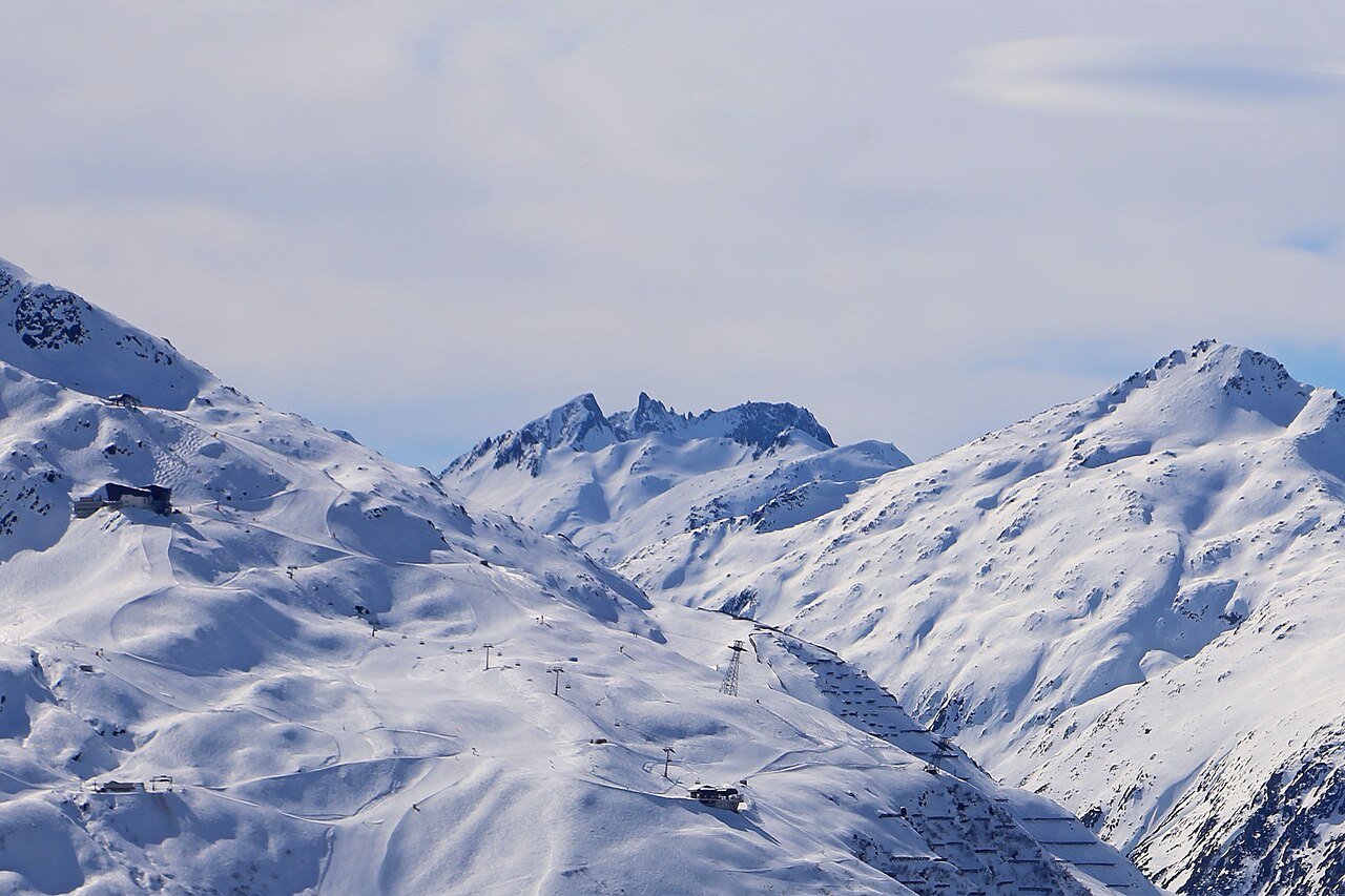
Andermatt+Disentis+Sedrun is a downhill ski area in Uri, Switzerland. Mapped terrain includes beginner, easy, intermediate, advanced, expert, freeride routes. Its mapped lift network extends from approximately 1223 to 2958 metres above sea level.
Data: OpenSkiData / OpenSkiMap, OpenStreetMap contributors (ODbL), Skimap.org, Who's On First, Mapterhorn.
Preparazione dei grafici…
Orari e valori corrispondono alla previsione dettagliata. Tocca un valore o passaci sopra per i dettagli. Scorri orizzontalmente ogni grafico per i giorni successivi. Pioggia / precipitazioni indica l’equivalente totale in acqua per intervallo, inclusa la neve; la nevicata indica la neve fresca per intervallo, non l’altezza del manto nevoso.
Confronto dei modelli GFS ed ECMWF. Ogni modello mantiene i propri orari e il proprio orizzonte di previsione. Le quantità di precipitazioni e neve si riferiscono ai rispettivi intervalli, che possono differire tra i modelli.
Valori previsti e note sul modello
Andermatt+Disentis+Sedrun - Base lift station
ECMWF · Elaborazione del modello: Prossimo aggiornamento previsto:
Giorno Ora (UTC) Temp. (°C) Umidità (%) Vento (km/h) Vento (nodi) Vento (Bft) Direzione Precip. (mm) Neve (cm) Pressione (hPa) Zero termico (m) Condizioni | Mercoledì, 04/11 06:00 0.8 83 5 2 1B SE — — 1023 < 1945 Overcast 83% cloud 09:00 3.1 74 8 4 2B S 0.13 0 1023 2026 Overcast 88% cloud 12:00 4 65 9 5 2B S 0.19 0 1024 2135 Overcast 96% cloud 15:00 2.7 75 7 4 2B S 0.14 0 1024 1966 Overcast 100% cloud 18:00 2.1 81 9 5 2B S 0.12 0 1026 < 1945 Overcast 100% cloud 21:00 2.2 81 9 5 2B S 0.19 0 1027 < 1945 Overcast 94% cloud Giovedì, 05/11 00:00 2.2 80 8 4 2B S 0.07 0 1027 < 1945 Overcast 97% cloud 03:00 2 82 8 4 2B S 0.00 0 1027 < 1945 Overcast 99% cloud 06:00 2 82 9 5 2B S 0.12 0 1027 < 1945 Overcast 97% cloud 09:00 3.7 75 10 5 2B S 0 0 1028 2281 Overcast 92% cloud 12:00 5.7 65 9 5 2B S 0 0 1026 2644 Cloudy 59% cloud 15:00 5.2 68 7 4 2B S 0 0 1025 2650 Clear 15% cloud 18:00 1.6 80 4 2 1B S 0 0 1026 < 1945 Partly cloudy 22% cloud 21:00 1.2 84 5 3 1B S 0 0 1026 < 1945 Overcast 99% cloud Venerdì, 06/11 00:00 0.9 84 6 3 2B S 0 0 1024 < 1945 Overcast 97% cloud 03:00 1.3 84 6 3 1B S 0 0 1023 < 1945 Overcast 94% cloud 06:00 0.9 85 6 3 2B S 0.03 0 1022 < 1945 Overcast 97% cloud 09:00 4.7 74 7 4 2B S 0 0 1023 2460 Overcast 92% cloud 12:00 5.6 73 6 3 2B S 0.37 0 1021 2486 Overcast 96% cloud 15:00 4.5 79 3 1 1B S 0.34 0 1021 2361 Overcast 100% cloud 18:00 3.3 87 1 0 0B SW 0.69 0 1021 2123 Overcast 100% cloud 21:00 2.6 87 1 1 0B W 2.5 0 1022 1947 Overcast 100% cloud Sabato, 07/11 00:00 2.2 86 1 0 0B NW 1.9 0 1023 < 1945 Overcast 100% cloud 03:00 1.8 88 3 1 1B NW 0.75 0 1022 < 1945 Overcast 100% cloud 06:00 1.6 86 2 1 1B NW 0.41 0 1023 < 1945 Overcast 100% cloud 09:00 2.2 82 1 0 0B N 1.4 0 1024 < 1945 Overcast 100% cloud 12:00 2.8 80 3 1 1B SE 1.9 0 1023 1977 Overcast 100% cloud 15:00 2.5 81 3 2 1B S 0.99 0 1023 < 1945 Overcast 98% cloud 18:00 0.9 85 3 2 1B SE 0.12 0 1024 < 1945 Overcast 89% cloud 21:00 0.5 85 5 2 1B S 0.06 0 1025 < 1945 Overcast 92% cloud Domenica, 08/11 00:00 0.3 85 4 2 1B SE 0.03 0 1025 < 1945 Overcast 98% cloud 03:00 0.5 81 5 2 1B S 0.00 0 1025 < 1945 Overcast 94% cloud 06:00 -1.6 83 3 2 1B S 0 0 1025 < 1945 Overcast 84% cloud 09:00 0.9 74 5 3 1B S 0 0 1027 < 1945 Cloudy 55% cloud 12:00 3 64 6 3 2B S 0 0 1025 2011 Partly cloudy 46% cloud 15:00 1.5 69 4 2 1B S 0.03 0 1024 < 1945 Partly cloudy 39% cloud 18:00 -2.5 82 4 2 1B SE 0 0 1026 < 1945 Cloudy 54% cloud 21:00 -2.5 83 6 3 2B S 0 0 1026 < 1945 Overcast 100% cloud Lunedì, 09/11 00:00 0.1 79 6 3 2B S 0 0 1026 < 1945 Overcast 92% cloud 03:00 -0.1 80 6 3 2B S 0 0 1025 < 1945 Overcast 98% cloud 06:00 -0.3 82 7 4 2B S 0 0 1025 < 1945 Overcast 97% cloud 09:00 1.7 77 9 5 2B S 0.03 0 1025 < 1945 Overcast 99% cloud 12:00 3 72 9 5 2B S 0.08 0 1023 2184 Overcast 100% cloud 15:00 2.4 78 9 5 2B S 0.00 0 1022 < 1945 Overcast 100% cloud 18:00 2.2 82 8 4 2B S 0.16 0 1022 < 1945 Overcast 100% cloud 21:00 2.4 83 8 4 2B S 0.26 0 1021 < 1945 Overcast 100% cloud Martedì, 10/11 00:00 2.5 85 8 4 2B S 0.18 0 1021 < 1945 Overcast 100% cloud 03:00 2.7 85 7 4 2B S 0.10 0 1018 2277 Overcast 100% cloud 06:00 3 84 8 4 2B S 0.21 0 1017 2653 Overcast 100% cloud |
|---|
Forecast notes
Forecast table times: UTC.
Coordinates: 46.6833523°N, 8.7691674°E · Requested elevation: 1479 m. Model terrain: 1942 m. Terrain and 1000/925/850/700 hPa profiles are used for height estimates.
Outside the available profile, temperature uses an estimated 5.5°C/km height correction; wind retains the nearest available model-level value. Humidity is estimated with adjusted pressure and temperature.
These are altitude estimates, not a simulation of local mountain terrain. Precipitation, cloud and sea-level pressure use horizontal interpolation only.
Precipitation includes rain and snow water equivalent: preceding 3 hours through day 6, then 6 hours (see cell tooltip). Snow (cm) estimates fresh snowfall from precipitation and temperature using the GFS conversion; it is not snow depth on the ground. Freezing (m) uses additional 600/500 hPa temperatures when available and estimates the lowest resolved 0°C crossing above sea level. When all sampled levels are warm, the upper profile limit is shown (see tooltip). < marks an entirely cold sampled profile and its lower height limit. No extrapolation is used.
Preparazione dei grafici…
Orari e valori corrispondono alla previsione dettagliata. Tocca un valore o passaci sopra per i dettagli. Scorri orizzontalmente ogni grafico per i giorni successivi. Pioggia / precipitazioni indica l’equivalente totale in acqua per intervallo, inclusa la neve; la nevicata indica la neve fresca per intervallo, non l’altezza del manto nevoso.
Confronto dei modelli GFS ed ECMWF. Ogni modello mantiene i propri orari e il proprio orizzonte di previsione. Le quantità di precipitazioni e neve si riferiscono ai rispettivi intervalli, che possono differire tra i modelli.
Valori previsti e note sul modello
Andermatt+Disentis+Sedrun - Top lift station
ECMWF · Elaborazione del modello: Prossimo aggiornamento previsto:
Giorno Ora (UTC) Temp. (°C) Umidità (%) Vento (km/h) Vento (nodi) Vento (Bft) Direzione Precip. (mm) Neve (cm) Pressione (hPa) Zero termico (m) Condizioni | Mercoledì, 04/11 06:00 -7.2 87 27 15 4B S — — 1023 < 2043 Overcast 91% cloud 09:00 -7.1 82 33 18 5B S 0.14 0.1 1024 < 2043 Overcast 90% cloud 12:00 -6.7 86 40 22 6B S 0.33 0.3 1024 2112 Overcast 98% cloud 15:00 -6.7 91 47 26 6B S 0.44 0.4 1024 < 2043 Overcast 100% cloud 18:00 -6.3 83 39 21 6B S 0.47 0.5 1026 < 2043 Overcast 99% cloud 21:00 -6.1 81 33 18 5B S 0.51 0.5 1027 < 2043 Overcast 95% cloud Giovedì, 05/11 00:00 -5.2 79 35 19 5B S 0.25 0.3 1028 < 2043 Overcast 94% cloud 03:00 -4.7 75 32 17 5B S 0.08 0.1 1028 < 2043 Overcast 96% cloud 06:00 -4.2 77 34 19 5B S 0.09 0.1 1028 < 2043 Overcast 95% cloud 09:00 -2.9 72 32 17 5B SW 0.03 0 1028 2096 Overcast 88% cloud 12:00 -2 72 27 14 4B SW 0 0 1027 2490 Cloudy 74% cloud 15:00 -1.5 66 19 10 3B SW 0 0 1026 2469 Partly cloudy 49% cloud 18:00 -1.7 67 23 12 4B S 0 0 1026 < 2043 Cloudy 60% cloud 21:00 -2 76 26 14 4B S 0 0 1026 < 2043 Overcast 99% cloud Venerdì, 06/11 00:00 -2 81 29 16 5B S 0.04 0 1024 < 2043 Overcast 99% cloud 03:00 -2.3 90 35 19 5B S 0.27 0.1 1023 < 2043 Overcast 97% cloud 06:00 -2.5 84 36 19 5B S 0.44 0.1 1022 < 2043 Overcast 99% cloud 09:00 -2.6 88 35 19 5B S 0.16 0 1023 2376 Overcast 97% cloud 12:00 -3 95 28 15 4B S 0.16 0.2 1022 2406 Overcast 97% cloud 15:00 -3.1 98 21 12 4B S 0.57 0.6 1021 2240 Overcast 100% cloud 18:00 -3.7 99 19 10 3B SE 0.66 0.7 1022 < 2043 Overcast 100% cloud 21:00 -4.5 98 14 8 3B S 1.5 1.5 1022 < 2043 Overcast 100% cloud Sabato, 07/11 00:00 -5.1 97 11 6 2B S 1.1 1.1 1023 < 2043 Overcast 100% cloud 03:00 -5.7 96 7 4 2B S 0.49 0.5 1022 < 2043 Overcast 100% cloud 06:00 -6 96 6 3 2B SW 0.41 0.4 1023 < 2043 Overcast 100% cloud 09:00 -6.4 96 8 4 2B S 1.6 1.6 1023 < 2043 Overcast 100% cloud 12:00 -6.6 94 16 9 3B S 2.0 2 1023 < 2043 Overcast 100% cloud 15:00 -6.9 89 19 11 3B S 0.70 0.7 1023 < 2043 Overcast 100% cloud 18:00 -6.8 85 20 11 3B S 0.12 0.1 1024 < 2043 Overcast 92% cloud 21:00 -6.8 79 14 8 3B SW 0.10 0.1 1025 < 2043 Overcast 94% cloud Domenica, 08/11 00:00 -7.2 81 12 7 2B SW 0.07 0.1 1025 < 2043 Overcast 96% cloud 03:00 -7.2 74 10 6 2B SW 0.04 0 1025 < 2043 Overcast 95% cloud 06:00 -7.1 54 10 5 2B SW 0 0 1026 < 2043 Overcast 83% cloud 09:00 -6.5 40 11 6 2B W 0 0 1027 < 2043 Partly cloudy 49% cloud 12:00 -5.8 34 14 8 3B W 0 0 1025 < 2043 Cloudy 58% cloud 15:00 -5 31 17 9 3B W 0.03 0 1025 < 2043 Partly cloudy 46% cloud 18:00 -4.6 37 18 10 3B W 0 0 1026 < 2043 Partly cloudy 41% cloud 21:00 -4.1 66 18 10 3B W 0 0 1025 < 2043 Overcast 95% cloud Lunedì, 09/11 00:00 -3.7 79 22 12 4B SW 0.04 0 1025 < 2043 Overcast 91% cloud 03:00 -3.3 82 19 10 3B SW 0 0 1024 < 2043 Overcast 95% cloud 06:00 -2.9 75 17 9 3B SW 0 0 1025 < 2043 Overcast 98% cloud 09:00 -2 65 21 11 4B SW 0.06 0 1025 < 2043 Overcast 100% cloud 12:00 -1.7 66 22 12 4B SW 0.02 0 1024 < 2043 Overcast 99% cloud 15:00 -1.5 78 22 12 4B SW 0.04 0 1023 < 2043 Overcast 100% cloud 18:00 -1.3 86 24 13 4B SW 0.15 0 1022 < 2043 Overcast 100% cloud 21:00 -0.9 86 29 16 5B SW 0.31 0.1 1022 < 2043 Overcast 99% cloud Martedì, 10/11 00:00 -0.9 89 24 13 4B SW 0.16 0 1021 < 2043 Overcast 100% cloud 03:00 -0.6 87 21 11 4B SW 0.10 0 1018 < 2043 Overcast 100% cloud 06:00 -0.5 89 27 15 4B S 0.30 0.1 1017 < 2043 Overcast 100% cloud |
|---|
Forecast notes
Forecast table times: UTC.
Coordinates: 46.6023096°N, 8.6116036°E · Requested elevation: 2958 m. Model terrain: 2040 m. Terrain and 1000/925/850/700 hPa profiles are used for height estimates.
These are altitude estimates, not a simulation of local mountain terrain. Precipitation, cloud and sea-level pressure use horizontal interpolation only.
Precipitation includes rain and snow water equivalent: preceding 3 hours through day 6, then 6 hours (see cell tooltip). Snow (cm) estimates fresh snowfall from precipitation and temperature using the GFS conversion; it is not snow depth on the ground. Freezing (m) uses additional 600/500 hPa temperatures when available and estimates the lowest resolved 0°C crossing above sea level. When all sampled levels are warm, the upper profile limit is shown (see tooltip). < marks an entirely cold sampled profile and its lower height limit. No extrapolation is used.