Home Basin

Camera image unavailable
Camera image · refreshes every 60 seconds while visible.
Open camera page ↗
Chaque couleur commence à la valeur indiquée. Les couleurs du vent correspondent dans les trois unités. Les cases sans précipitations restent neutres. Les couleurs décrivent les valeurs affichées et ne sont pas des alertes officielles.
Préparation des graphiques…
Les heures et valeurs correspondent aux prévisions détaillées. Touchez une valeur pour plus de détails et faites défiler horizontalement pour les jours suivants. Les précipitations représentent l’équivalent en eau total par intervalle, neige comprise. La neige fraîche correspond à chaque intervalle, et non à l’épaisseur au sol.
Comparaison GFS et ECMWF. Chaque modèle conserve ses heures et son horizon de prévision. Les quantités de précipitations et de neige couvrent leurs propres intervalles, qui peuvent différer entre modèles.
ECMWF · Cycle du modèle : Prochaine mise à jour attendue :
Jour Heure (UTC) Temp. (°C) Humidité (%) Vent (km/h) Vent (nœuds) Vent (Bft) Direction Précip. (mm) Neige fraîche (cm) Pression (hPa) Isotherme 0 °C (m) Conditions | Mercredi, 04/11 06:00 10.3 86 15 8 3B N — — 1015 3068 Cloudy 73% cloud  09:00 8.5 93 10 5 2B N 0.32 0 1017 3050 Overcast 94% cloud  12:00 8.2 94 11 6 2B N 0.28 0 1016 2956 Overcast 98% cloud 15:00 7.8 95 12 6 2B N 0.36 0 1014 2991 Overcast 93% cloud 18:00 7.5 95 10 5 2B N 0.24 0 1014 3041 Overcast 98% cloud 21:00 8.7 88 13 7 3B N 0.33 0 1014 3045 Overcast 85% cloud Jeudi, 05/11 00:00 11.2 67 14 7 3B N 0.17 0 1012 3039 Overcast 96% cloud 03:00 11.5 66 12 7 2B N 0.09 0 1010 2827 Overcast 100% cloud 06:00 9.8 82 13 7 3B N 0.37 0 1009 2718 Overcast 100% cloud 09:00 8.7 89 13 7 3B NE 0.98 0 1009 3011 Overcast 100% cloud 12:00 8.3 93 13 7 3B NE 0.50 0 1007 2998 Overcast 100% cloud 15:00 8 95 14 8 3B NE 2.1 0 1005 2979 Overcast 97% cloud 18:00 8.4 95 19 10 3B N 1.6 0 1004 2935 Overcast 96% cloud 21:00 9 89 20 11 4B N 0.67 0 1003 2966 Overcast 89% cloud Vendredi, 06/11 00:00 10.4 80 24 13 4B N 0.66 0 1003 2972 Overcast 97% cloud 03:00 10.9 77 26 14 4B N 0.71 0 1003 2969 Overcast 93% cloud 06:00 9.6 84 18 10 3B NW 0.71 0 1003 2920 Overcast 97% cloud 09:00 8.3 91 13 7 3B N 1.4 0 1006 2934 Overcast 85% cloud 12:00 7.9 92 9 5 2B NW 0.39 0 1007 2980 Overcast 85% cloud 15:00 7.6 94 7 4 2B NW 0.12 0 1008 2996 Overcast 95% cloud 18:00 7.2 95 9 5 2B NW 0.13 0 1010 3005 Overcast 81% cloud 21:00 8.6 84 8 4 2B NW 0.09 0 1011 3019 Cloudy 58% cloud Samedi, 07/11 00:00 11.5 63 8 4 2B NW 0.03 0 1010 3010 Partly cloudy 45% cloud  03:00 12.9 53 7 4 2B NW 0 0 1008 2919 Partly cloudy 21% cloud 06:00 12.6 52 4 2 1B NW 0 0 1008 2931 Clear 19% cloud  09:00 9.9 64 3 2 1B N 0 0 1010 2811 Partly cloudy 38% cloud 12:00 7.3 81 5 3 1B N 0 0 1011 2854 Partly cloudy 40% cloud 15:00 5.4 90 5 3 1B N 0 0 1011 2944 Overcast 92% cloud 18:00 5.5 91 4 2 1B N 0 0 1012 2965 Overcast 97% cloud 21:00 8.9 82 4 2 1B N 0 0 1013 2981 Overcast 86% cloud Dimanche, 08/11 00:00 12.1 67 2 1 1B N 0 0 1013 2944 Cloudy 55% cloud 03:00 13.4 57 1 1 1B NE 0.45 0 1012 2938 Cloudy 76% cloud 06:00 12.4 67 4 2 1B E 0.42 0 1014 2929 Cloudy 60% cloud 09:00 9.6 87 5 2 1B E 0.54 0 1017 2883 Overcast 91% cloud 12:00 8.5 93 4 2 1B E 0.09 0 1018 2909 Overcast 98% cloud 15:00 7.8 97 4 2 1B NE 0.03 0 1018 2928 Overcast 99% cloud 18:00 7.8 98 5 3 1B E 0.18 0 1019 2924 Overcast 100% cloud 21:00 9 92 6 3 2B E 0.27 0 1020 2921 Overcast 97% cloud Lundi, 09/11 00:00 10 87 8 5 2B E 0.63 0 1019 2900 Overcast 100% cloud 03:00 10.1 83 8 4 2B E 1.0 0 1018 2908 Overcast 100% cloud 06:00 9.6 86 7 4 2B E 0.96 0 1017 2854 Overcast 90% cloud 09:00 8.1 94 7 4 2B E 0.20 0 1018 2783 Cloudy 70% cloud 12:00 7.1 95 8 4 2B NE 0.14 0 1018 2732 Overcast 92% cloud 15:00 6.6 96 7 4 2B NE 0.19 0 1017 2764 Overcast 90% cloud 18:00 6.5 97 8 4 2B NE 0.59 0 1016 2604 Overcast 96% cloud 21:00 7.8 91 11 6 2B NE 0.39 0 1016 2570 Cloudy 71% cloud Mardi, 10/11 00:00 11 62 15 8 3B N 0.18 0 1013 2626 Partly cloudy 38% cloud 03:00 11.8 54 17 9 3B N 0.05 0 1011 2681 Partly cloudy 43% cloud 06:00 10.3 56 13 7 3B N 0.02 0 1011 2663 Clear 7% cloud |
|---|
Forecast table times: UTC.
Coordinates: -44.634°N, 168.896°E · Requested elevation: 1260 m. Model terrain: 1088 m. Terrain and 1000/925/850/700 hPa profiles are used for height estimates.
These are altitude estimates, not a simulation of local mountain terrain. Precipitation, cloud and sea-level pressure use horizontal interpolation only.
Precipitation includes rain and snow water equivalent: preceding 3 hours through day 6, then 6 hours (see cell tooltip). Snow (cm) estimates fresh snowfall from precipitation and temperature using the GFS conversion; it is not snow depth on the ground. Freezing (m) uses additional 600/500 hPa temperatures when available and estimates the lowest resolved 0°C crossing above sea level. When all sampled levels are warm, the upper profile limit is shown (see tooltip). < marks an entirely cold sampled profile and its lower height limit. No extrapolation is used.
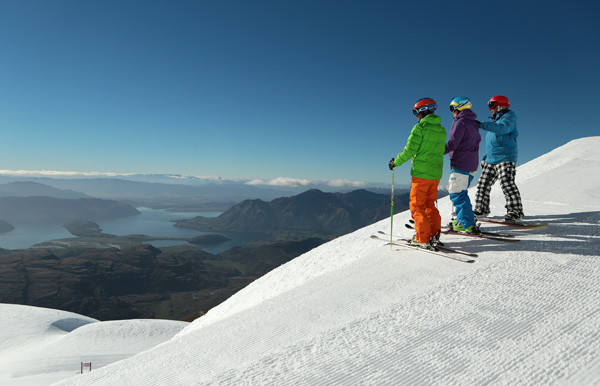
Camera image · refreshes every 60 seconds while visible.
Open camera page ↗