Sölden - Seekogl · Panorama/video

Provider panorama/video player. Capture time is shown by the camera.
Open camera page ↗
Chaque couleur commence à la valeur indiquée. Les couleurs du vent correspondent dans les trois unités. Les cases sans précipitations restent neutres. Les couleurs décrivent les valeurs affichées et ne sont pas des alertes officielles.
Préparation des graphiques…
Les heures et valeurs correspondent aux prévisions détaillées. Touchez une valeur pour plus de détails et faites défiler horizontalement pour les jours suivants. Les précipitations représentent l’équivalent en eau total par intervalle, neige comprise. La neige fraîche correspond à chaque intervalle, et non à l’épaisseur au sol.
Comparaison GFS et ECMWF. Chaque modèle conserve ses heures et son horizon de prévision. Les quantités de précipitations et de neige couvrent leurs propres intervalles, qui peuvent différer entre modèles.
ECMWF · Cycle du modèle : Prochaine mise à jour attendue :
Jour Heure (UTC) Temp. (°C) Humidité (%) Vent (km/h) Vent (nœuds) Vent (Bft) Direction Précip. (mm) Neige fraîche (cm) Pression (hPa) Isotherme 0 °C (m) Conditions | Mercredi, 04/11 06:00 -0.1 69 4 2 1B SE — — 1024 < 2417 Overcast 95% cloud  09:00 2.8 64 6 3 2B SE 0.03 0 1026 < 2417 Cloudy 70% cloud  12:00 4.3 60 9 5 2B SE 0.03 0 1025 < 2417 Cloudy 60% cloud 15:00 3.4 62 6 3 1B S 0 0 1025 < 2417 Partly cloudy 39% cloud  18:00 0.1 66 4 2 1B SE 0 0 1026 < 2417 Cloudy 66% cloud 21:00 -1.3 69 5 2 1B SE 0.10 0 1027 < 2417 Cloudy 65% cloud Jeudi, 05/11 00:00 -2.8 67 3 2 1B SE 0 0 1026 < 2417 Cloudy 59% cloud 03:00 -3.5 64 3 1 1B SE 0 0 1025 < 2417 Cloudy 51% cloud 06:00 -3.6 62 2 1 1B SE 0 0 1025 < 2417 Partly cloudy 49% cloud 09:00 5.4 49 4 2 1B SE 0 0 1025 < 2417 Clear 3% cloud  12:00 8.1 43 3 2 1B SE 0 0 1024 2920 Clear 0% cloud 15:00 5.9 53 1 1 0B S 0 0 1024 2472 Clear 0% cloud 18:00 1.1 59 1 0 0B SE 0 0 1024 < 2417 Clear 0% cloud 21:00 1.4 47 2 1 1B SE 0 0 1023 3120 Clear 0% cloud Vendredi, 06/11 00:00 1.7 40 1 1 1B SE 0 0 1022 3082 Clear 0% cloud 03:00 1 42 1 1 1B SE 0 0 1021 3060 Clear 0% cloud 06:00 0.6 45 2 1 1B SE 0 0 1020 3071 Clear 0% cloud 09:00 7.3 42 3 2 1B SE 0 0 1020 3098 Clear 3% cloud 12:00 9.1 43 4 2 1B SE 0 0 1019 3017 Clear 3% cloud 15:00 6.7 53 2 1 1B SE 0 0 1019 2684 Clear 19% cloud 18:00 3.2 61 3 2 1B SE 0.01 0 1020 < 2417 Overcast 85% cloud 21:00 3.1 61 4 2 1B SE 0 0 1021 < 2417 Overcast 99% cloud Samedi, 07/11 00:00 1.9 66 4 2 1B SE 0 0 1022 < 2417 Overcast 98% cloud 03:00 2 66 3 2 1B SE 0.04 0 1021 < 2417 Cloudy 62% cloud 06:00 1.7 67 3 2 1B SE 0.36 0 1022 < 2417 Overcast 96% cloud 09:00 4 62 6 3 2B SE 0.51 0 1023 < 2417 Overcast 89% cloud 12:00 4.8 59 6 3 1B SE 0.24 0 1022 < 2417 Overcast 99% cloud 15:00 4 63 3 2 1B SE 0.13 0 1022 < 2417 Cloudy 70% cloud 18:00 1.4 65 2 1 1B SE 0.00 0 1024 < 2417 Overcast 84% cloud 21:00 -1.6 67 3 2 1B SE 0 0 1025 < 2417 Cloudy 74% cloud Dimanche, 08/11 00:00 -2 65 2 1 1B S 0 0 1025 < 2417 Overcast 91% cloud 03:00 -1.8 65 1 1 1B S 0.15 0 1024 < 2417 Overcast 97% cloud 06:00 -3.2 67 1 1 1B S 0.12 0.1 1024 < 2417 Cloudy 76% cloud 09:00 2.8 55 2 1 1B S 0.02 0 1025 < 2417 Cloudy 53% cloud 12:00 5 45 3 1 1B SW 0.03 0 1023 < 2417 Cloudy 71% cloud 15:00 3.4 45 1 1 1B SW 0.04 0 1023 < 2417 Partly cloudy 22% cloud 18:00 -0.1 56 1 1 1B S 0.04 0 1024 < 2417 Partly cloudy 26% cloud 21:00 -1.9 47 1 1 1B SE 0.05 0 1023 < 2417 Clear 18% cloud Lundi, 09/11 00:00 -1.8 40 2 1 1B SE 0.03 0 1023 < 2417 Overcast 87% cloud 03:00 1.5 44 1 1 1B SE 0.11 0 1021 < 2417 Cloudy 70% cloud 06:00 0.7 47 2 1 1B SE 0 0 1019 < 2417 Overcast 93% cloud 09:00 5.9 47 3 2 1B S 0.02 0 1020 < 2417 Overcast 86% cloud 12:00 7.6 48 3 2 1B S 0 0 1019 2728 Partly cloudy 48% cloud 15:00 6.2 55 2 1 1B S 0.00 0 1018 2508 Overcast 92% cloud 18:00 3.4 61 4 2 1B S 0 0 1017 < 2417 Overcast 89% cloud 21:00 3.1 60 4 2 1B SE 0 0 1018 < 2417 Overcast 89% cloud Mardi, 10/11 00:00 4.3 63 3 2 1B S 0.23 0 1016 < 2417 Overcast 94% cloud 03:00 4.8 62 2 1 1B S 0 0 1014 < 2417 Overcast 97% cloud 06:00 2.8 65 2 1 1B SE 0 0 1013 3046 Overcast 97% cloud |
|---|
Forecast table times: UTC.
Coordinates: 46.9725038°N, 11.0086824°E · Requested elevation: 1346 m. Model terrain: 2415 m. Terrain and 1000/925/850/700 hPa profiles are used for height estimates.
Outside the available profile, temperature uses an estimated 5.5°C/km height correction; wind retains the nearest available model-level value. Humidity is estimated with adjusted pressure and temperature.
These are altitude estimates, not a simulation of local mountain terrain. Precipitation, cloud and sea-level pressure use horizontal interpolation only.
Precipitation includes rain and snow water equivalent: preceding 3 hours through day 6, then 6 hours (see cell tooltip). Snow (cm) estimates fresh snowfall from precipitation and temperature using the GFS conversion; it is not snow depth on the ground. Freezing (m) uses additional 600/500 hPa temperatures when available and estimates the lowest resolved 0°C crossing above sea level. When all sampled levels are warm, the upper profile limit is shown (see tooltip). < marks an entirely cold sampled profile and its lower height limit. No extrapolation is used.
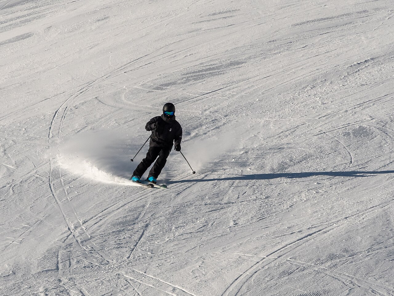
Le plan de Sölden distingue Gaislachkogl, Giggijoch et les glaciers Rettenbach et Tiefenbach. Ces noms servent à préparer la journée : skier sur Giggijoch et rejoindre les glaciers impliquent des terrains et des accès différents. Le plan officiel montre la liaison entre les glaciers ainsi que les itinéraires de retour vers la vallée.
Le point de prévision par défaut est à 1 346 m. Il ne remplace pas la météo d’une remontée glaciaire ou d’une station supérieure. Avant de comparer un cumul de neige avec une webcam en altitude, choisissez une hauteur correspondante. L’altitude affichée avec la prévision permet de comparer GFS et ECMWF sur la même référence.
En automne ou au printemps, vérifiez les secteurs réellement ouverts : un glacier accessible ne signifie pas que tout le réseau hivernal fonctionne. Préparez montée et retour à partir du plan et des horaires actuels. Côté météo, suivez l’évolution au fil des heures : neige matinale puis redoux et neige après la fermeture des pistes ne représentent pas la même journée de ski.
Sources officielles: Sölden — ski area map and sectors. Informations vérifiées le 18 octobre 2026.
Provider panorama/video player. Capture time is shown by the camera.
Open camera page ↗
Provider panorama/video player. Capture time is shown by the camera.
Open camera page ↗
Provider panorama/video player. Capture time is shown by the camera.
Open camera page ↗Préparation des graphiques…
Les heures et valeurs correspondent aux prévisions détaillées. Touchez une valeur pour plus de détails et faites défiler horizontalement pour les jours suivants. Les précipitations représentent l’équivalent en eau total par intervalle, neige comprise. La neige fraîche correspond à chaque intervalle, et non à l’épaisseur au sol.
Comparaison GFS et ECMWF. Chaque modèle conserve ses heures et son horizon de prévision. Les quantités de précipitations et de neige couvrent leurs propres intervalles, qui peuvent différer entre modèles.
ECMWF · Cycle du modèle : Prochaine mise à jour attendue :
Jour Heure (UTC) Temp. (°C) Humidité (%) Vent (km/h) Vent (nœuds) Vent (Bft) Direction Précip. (mm) Neige fraîche (cm) Pression (hPa) Isotherme 0 °C (m) Conditions | Mercredi, 04/11 06:00 -0.1 69 4 2 1B SE — — 1024 < 2411 Overcast 94% cloud 09:00 2.7 64 6 3 1B SE 0.03 0 1026 < 2411 Cloudy 69% cloud 12:00 4.3 60 9 5 2B SE 0.03 0 1025 < 2411 Cloudy 60% cloud 15:00 3.4 62 5 3 1B S 0 0 1025 < 2411 Partly cloudy 40% cloud 18:00 0 66 4 2 1B SE 0 0 1026 < 2411 Cloudy 66% cloud 21:00 -1.3 69 4 2 1B SE 0.10 0 1027 < 2411 Cloudy 65% cloud Jeudi, 05/11 00:00 -2.8 67 3 2 1B SE 0 0 1026 < 2411 Cloudy 58% cloud 03:00 -3.4 64 3 1 1B SE 0 0 1025 < 2411 Partly cloudy 49% cloud 06:00 -3.5 62 2 1 1B SE 0 0 1025 < 2411 Partly cloudy 47% cloud 09:00 5.4 49 4 2 1B SE 0 0 1025 < 2411 Clear 3% cloud 12:00 8 43 3 2 1B SE 0 0 1024 2913 Clear 0% cloud 15:00 5.9 53 1 1 0B S 0 0 1024 2493 Clear 0% cloud 18:00 1.1 59 1 0 0B SE 0 0 1024 < 2411 Clear 0% cloud 21:00 1.4 46 2 1 1B SE 0 0 1023 3123 Clear 0% cloud Vendredi, 06/11 00:00 1.7 40 1 1 1B SE 0 0 1022 3084 Clear 0% cloud 03:00 1 42 1 1 1B SE 0 0 1021 3060 Clear 0% cloud 06:00 0.6 45 1 1 1B SE 0 0 1020 3073 Clear 0% cloud 09:00 7.3 42 3 2 1B SE 0 0 1020 3098 Clear 4% cloud 12:00 9.1 43 4 2 1B SE 0 0 1019 3012 Clear 3% cloud 15:00 6.7 53 2 1 1B SE 0 0 1019 2684 Partly cloudy 20% cloud 18:00 3.2 61 3 1 1B SE 0.02 0 1020 < 2411 Overcast 85% cloud 21:00 3 61 4 2 1B SE 0 0 1021 < 2411 Overcast 99% cloud Samedi, 07/11 00:00 1.9 66 4 2 1B SE 0 0 1022 < 2411 Overcast 98% cloud 03:00 2 66 3 2 1B SE 0.05 0 1021 < 2411 Cloudy 63% cloud 06:00 1.7 67 3 2 1B SE 0.39 0 1022 < 2411 Overcast 96% cloud 09:00 3.9 62 6 3 2B SE 0.51 0 1023 < 2411 Overcast 89% cloud 12:00 4.8 60 6 3 1B SE 0.24 0 1022 < 2411 Overcast 99% cloud 15:00 3.9 63 3 2 1B SE 0.13 0 1022 < 2411 Cloudy 70% cloud 18:00 1.4 65 2 1 1B SE 0.00 0 1024 < 2411 Overcast 84% cloud 21:00 -1.7 67 3 2 1B SE 0 0 1025 < 2411 Cloudy 74% cloud Dimanche, 08/11 00:00 -2 65 2 1 1B S 0 0 1025 < 2411 Overcast 91% cloud 03:00 -1.8 65 1 1 1B S 0.15 0 1024 < 2411 Overcast 97% cloud 06:00 -3.2 67 1 1 1B S 0.12 0.1 1024 < 2411 Cloudy 76% cloud 09:00 2.7 56 2 1 1B S 0.02 0 1025 < 2411 Cloudy 54% cloud 12:00 5 45 2 1 1B SW 0.03 0 1023 < 2411 Cloudy 71% cloud 15:00 3.4 46 1 1 1B SW 0.05 0 1023 < 2411 Partly cloudy 23% cloud 18:00 -0.1 56 1 1 1B S 0.05 0 1024 < 2411 Partly cloudy 26% cloud 21:00 -1.8 48 1 1 1B SE 0.07 0 1023 < 2411 Clear 19% cloud Lundi, 09/11 00:00 -1.7 40 2 1 1B SE 0.03 0 1023 < 2411 Overcast 87% cloud 03:00 1.5 44 1 1 1B SE 0.11 0 1021 < 2411 Cloudy 70% cloud 06:00 0.7 48 2 1 1B SE 0 0 1019 < 2411 Overcast 93% cloud 09:00 5.8 47 3 2 1B S 0.02 0 1020 < 2411 Overcast 86% cloud 12:00 7.5 48 3 2 1B S 0 0 1019 2720 Partly cloudy 49% cloud 15:00 6.1 55 2 1 1B S 0.00 0 1018 2503 Overcast 92% cloud 18:00 3.3 61 4 2 1B S 0 0 1018 < 2411 Overcast 89% cloud 21:00 3.1 60 4 2 1B SE 0 0 1018 < 2411 Overcast 89% cloud Mardi, 10/11 00:00 4.2 64 3 2 1B S 0.23 0 1016 < 2411 Overcast 93% cloud 03:00 4.7 62 2 1 1B S 0 0 1015 < 2411 Overcast 97% cloud 06:00 2.8 65 2 1 1B SE 0 0 1014 < 2411 Overcast 97% cloud |
|---|
Forecast table times: UTC.
Coordinates: 46.9657258°N, 11.0065958°E · Requested elevation: 1355 m. Model terrain: 2409 m. Terrain and 1000/925/850/700 hPa profiles are used for height estimates.
Outside the available profile, temperature uses an estimated 5.5°C/km height correction; wind retains the nearest available model-level value. Humidity is estimated with adjusted pressure and temperature.
These are altitude estimates, not a simulation of local mountain terrain. Precipitation, cloud and sea-level pressure use horizontal interpolation only.
Precipitation includes rain and snow water equivalent: preceding 3 hours through day 6, then 6 hours (see cell tooltip). Snow (cm) estimates fresh snowfall from precipitation and temperature using the GFS conversion; it is not snow depth on the ground. Freezing (m) uses additional 600/500 hPa temperatures when available and estimates the lowest resolved 0°C crossing above sea level. When all sampled levels are warm, the upper profile limit is shown (see tooltip). < marks an entirely cold sampled profile and its lower height limit. No extrapolation is used.
Préparation des graphiques…
Les heures et valeurs correspondent aux prévisions détaillées. Touchez une valeur pour plus de détails et faites défiler horizontalement pour les jours suivants. Les précipitations représentent l’équivalent en eau total par intervalle, neige comprise. La neige fraîche correspond à chaque intervalle, et non à l’épaisseur au sol.
Comparaison GFS et ECMWF. Chaque modèle conserve ses heures et son horizon de prévision. Les quantités de précipitations et de neige couvrent leurs propres intervalles, qui peuvent différer entre modèles.
ECMWF · Cycle du modèle : Prochaine mise à jour attendue :
Jour Heure (UTC) Temp. (°C) Humidité (%) Vent (km/h) Vent (nœuds) Vent (Bft) Direction Précip. (mm) Neige fraîche (cm) Pression (hPa) Isotherme 0 °C (m) Conditions | Mercredi, 04/11 06:00 -7.7 84 12 6 2B S — — 1023 < 2335 Overcast 87% cloud 09:00 -7.8 81 15 8 3B S 0.02 0 1025 < 2335 Cloudy 56% cloud 12:00 -7.2 77 18 10 3B S 0.02 0 1024 < 2335 Cloudy 54% cloud 15:00 -6.3 65 16 9 3B S 0 0 1024 < 2335 Partly cloudy 45% cloud 18:00 -5.5 55 15 8 3B S 0 0 1026 < 2335 Cloudy 59% cloud 21:00 -4.8 55 14 8 3B S 0.06 0.1 1027 < 2335 Cloudy 61% cloud Jeudi, 05/11 00:00 -4.1 49 12 7 3B S 0 0 1026 < 2335 Partly cloudy 50% cloud 03:00 -3.4 48 13 7 3B S 0 0 1025 < 2335 Partly cloudy 29% cloud 06:00 -2.7 43 11 6 2B S 0 0 1025 < 2335 Partly cloudy 26% cloud 09:00 -1.9 36 9 5 2B S 0 0 1025 2609 Clear 2% cloud 12:00 -1.8 35 6 3 2B SW 0 0 1024 2906 Clear 0% cloud 15:00 -1.4 30 2 1 1B W 0 0 1024 2810 Clear 0% cloud 18:00 -1.3 31 3 2 1B E 0 0 1024 < 2335 Clear 0% cloud 21:00 -0.9 36 8 4 2B S 0 0 1023 < 2335 Clear 0% cloud Vendredi, 06/11 00:00 -0.7 38 9 5 2B S 0 0 1022 3102 Clear 0% cloud 03:00 -0.6 36 8 4 2B S 0 0 1021 3058 Clear 0% cloud 06:00 -0.7 39 7 4 2B S 0 0 1020 3081 Clear 1% cloud 09:00 -0.7 41 10 6 2B S 0 0 1020 3098 Clear 11% cloud 12:00 -1.5 50 13 7 3B S 0 0 1019 2994 Clear 14% cloud 15:00 -2.4 78 12 6 2B S 0 0 1018 2760 Partly cloudy 42% cloud 18:00 -3.2 72 17 9 3B SE 0.20 0.2 1019 < 2335 Cloudy 80% cloud 21:00 -4 69 23 13 4B SE 0.09 0.1 1020 < 2335 Overcast 95% cloud Samedi, 07/11 00:00 -5.5 70 27 14 4B SE 0.02 0 1021 < 2335 Overcast 98% cloud 03:00 -6.1 84 22 12 4B S 0.18 0.2 1021 < 2335 Cloudy 71% cloud 06:00 -6.9 88 21 11 4B SE 0.58 0.6 1022 < 2335 Overcast 97% cloud 09:00 -7.5 93 21 11 4B S 0.54 0.5 1023 < 2335 Overcast 90% cloud 12:00 -7.6 94 14 7 3B S 0.20 0.2 1022 < 2335 Overcast 97% cloud 15:00 -7.7 93 12 6 2B S 0.26 0.3 1022 < 2335 Cloudy 74% cloud 18:00 -7.7 77 14 7 3B S 0.08 0.1 1024 < 2335 Cloudy 79% cloud 21:00 -7.9 78 11 6 2B S 0 0 1024 < 2335 Cloudy 71% cloud Dimanche, 08/11 00:00 -8.3 82 8 4 2B SW 0 0 1024 < 2335 Overcast 89% cloud 03:00 -8.7 87 8 5 2B SW 0.14 0.1 1024 < 2335 Overcast 91% cloud 06:00 -8.8 87 10 6 2B SW 0.10 0.1 1024 < 2335 Cloudy 73% cloud 09:00 -9.1 85 11 6 2B SW 0.03 0 1025 < 2335 Cloudy 55% cloud 12:00 -8.7 82 10 5 2B W 0.05 0.1 1023 < 2335 Cloudy 57% cloud 15:00 -8.3 64 12 6 2B W 0.08 0.1 1023 < 2335 Partly cloudy 25% cloud 18:00 -7.4 50 15 8 3B W 0.08 0.1 1024 < 2335 Partly cloudy 25% cloud 21:00 -6.2 36 19 10 3B W 0.10 0.1 1023 < 2335 Partly cloudy 22% cloud Lundi, 09/11 00:00 -5.3 40 18 10 3B W 0.05 0.1 1023 < 2335 Overcast 91% cloud 03:00 -4.6 59 20 11 4B W 0.06 0.1 1022 < 2335 Cloudy 71% cloud 06:00 -3.7 69 20 11 3B W 0 0 1020 < 2335 Overcast 92% cloud 09:00 -3.3 67 20 11 4B W 0.06 0.1 1020 2479 Overcast 90% cloud 12:00 -3.1 59 18 10 3B SW 0 0 1019 2706 Cloudy 51% cloud 15:00 -3.4 64 20 11 4B W 0 0 1019 2487 Overcast 92% cloud 18:00 -2.7 75 21 11 4B SW 0 0 1018 < 2335 Overcast 83% cloud 21:00 -2.2 81 24 13 4B SW 0 0 1018 < 2335 Overcast 90% cloud Mardi, 10/11 00:00 -2 86 27 14 4B W 0.16 0 1017 < 2335 Overcast 88% cloud 03:00 -1.8 87 23 13 4B W 0 0 1015 < 2335 Overcast 92% cloud 06:00 -1.3 80 19 10 3B SW 0 0 1014 < 2335 Overcast 96% cloud |
|---|
Forecast table times: UTC.
Coordinates: 46.924396°N, 10.9258119°E · Requested elevation: 3247 m. Model terrain: 2332 m. Terrain and 1000/925/850/700 hPa profiles are used for height estimates.
Outside the available profile, temperature uses an estimated 5.5°C/km height correction; wind retains the nearest available model-level value. Humidity is estimated with adjusted pressure and temperature.
These are altitude estimates, not a simulation of local mountain terrain. Precipitation, cloud and sea-level pressure use horizontal interpolation only.
Precipitation includes rain and snow water equivalent: preceding 3 hours through day 6, then 6 hours (see cell tooltip). Snow (cm) estimates fresh snowfall from precipitation and temperature using the GFS conversion; it is not snow depth on the ground. Freezing (m) uses additional 600/500 hPa temperatures when available and estimates the lowest resolved 0°C crossing above sea level. When all sampled levels are warm, the upper profile limit is shown (see tooltip). < marks an entirely cold sampled profile and its lower height limit. No extrapolation is used.