Worldwide Ski Resort Forecasts

Colour guide Temperature · Wind · Rain · Snow
Each colour starts at the value shown. Wind colours match across all three units. Dry cells stay neutral. Colours describe the displayed values, not official weather warnings.
Preparing forecast graphs…
Times and values match the detailed forecast. Tap or point at a value for details. Scroll each chart sideways for later days. Rain / precipitation is the total water equivalent per forecast interval, including snow; snowfall is fresh snow per interval, not snow depth.
GFS and ECMWF model comparison. Each model retains its own forecast times and horizon. Precipitation and snowfall amounts cover their own forecast intervals; these can differ between models.
Forecast values and model notes
Selvino - Base lift station
ECMWF · Model run: Next update expected:
Day Time (UTC) Temp. (°C) Humidity (%) Wind (km/h) Wind (knots) Wind (Bft) Direction Precip. (mm) Snow (cm) Pressure (hPa) Freezing (m) Conditions | Wednesday, 04/11 06:00 7.6 80 1 1 0B NW — — 1024 1770 Overcast 93% cloud  09:00 8.7 78 2 1 1B SW 0.02 0 1025 1913 Overcast 98% cloud 12:00 9.6 73 4 2 1B SW 0.05 0 1026 1986 Overcast 100% cloud 15:00 9.2 79 2 1 1B SW 0.23 0 1026 1999 Overcast 98% cloud 18:00 7.7 87 3 1 1B N 0.01 0 1027 1896 Cloudy 59% cloud  21:00 7.4 84 1 1 0B N 0.10 0 1028 1869 Cloudy 71% cloud Thursday, 05/11 00:00 7 83 1 1 1B N 0 0 1028 1855 Cloudy 53% cloud 03:00 5.9 83 2 1 1B N 0.01 0 1028 1795 Cloudy 50% cloud 06:00 5.5 81 1 1 1B N 0 0 1028 1825 Partly cloudy 37% cloud  09:00 10 68 4 2 1B SW 0 0 1029 2378 Partly cloudy 26% cloud 12:00 11.1 65 5 3 1B SW 0 0 1028 2543 Clear 15% cloud  15:00 10.2 72 4 2 1B SW 0 0 1027 2523 Clear 17% cloud 18:00 6.8 86 1 1 1B N 0 0 1028 2442 Partly cloudy 40% cloud 21:00 6.2 85 2 1 1B NE 0 0 1027 2397 Partly cloudy 43% cloud Friday, 06/11 00:00 5.7 84 2 1 1B NE 0 0 1026 2414 Cloudy 55% cloud 03:00 5.4 85 0 0 0B N 0 0 1025 2334 Overcast 93% cloud 06:00 5.7 85 1 0 0B N 0 0 1024 2288 Overcast 90% cloud 09:00 9.3 78 0 0 0B N 0 0 1024 2519 Overcast 100% cloud 12:00 8.7 89 2 1 1B W 0.58 0 1023 2470 Overcast 100% cloud 15:00 8.3 94 3 1 1B N 1.0 0 1022 2404 Overcast 100% cloud 18:00 7.8 93 1 0 0B NE 1.9 0 1022 2341 Overcast 100% cloud 21:00 7.9 89 2 1 1B N 6.1 0 1023 2170 Overcast 100% cloud Saturday, 07/11 00:00 7.8 88 2 1 1B SW 1.4 0 1022 2071 Overcast 100% cloud 03:00 7.7 90 0 0 0B — 1.8 0 1022 1916 Overcast 100% cloud 06:00 7.8 89 2 1 1B N 0.97 0 1023 1834 Overcast 100% cloud 09:00 8.6 90 1 0 0B S 0.94 0 1024 1875 Overcast 98% cloud 12:00 9.6 82 5 3 1B SW 0.46 0 1024 1934 Overcast 95% cloud 15:00 8.3 93 4 2 1B W 2.0 0 1024 1839 Overcast 100% cloud 18:00 7.9 95 2 1 1B SW 3.2 0 1025 1799 Overcast 100% cloud 21:00 7.4 95 3 2 1B SW 1.3 0 1026 1721 Overcast 100% cloud Sunday, 08/11 00:00 7.3 94 2 1 1B W 1.4 0 1026 1717 Overcast 100% cloud 03:00 7.3 94 0 0 0B SW 1.6 0 1025 1700 Overcast 100% cloud 06:00 7.3 93 0 0 0B E 0.13 0 1025 1702 Overcast 100% cloud 09:00 8.5 86 2 1 1B SW 0.02 0 1026 1892 Overcast 96% cloud 12:00 10.6 68 5 3 1B SW 0.02 0 1026 2141 Cloudy 63% cloud 15:00 9.8 72 4 2 1B SW 0.02 0 1025 2189 Partly cloudy 47% cloud 18:00 6.9 83 0 0 0B N 0 0 1025 2136 Clear 11% cloud 21:00 5.6 84 2 1 1B N 0 0 1026 2026 Partly cloudy 34% cloud Monday, 09/11 00:00 4.5 83 1 1 1B N 0 0 1025 1817 Overcast 91% cloud 03:00 5.8 77 2 1 1B NE 0 0 1025 1955 Overcast 98% cloud 06:00 7.2 73 0 0 0B NE 0.00 0 1025 2264 Overcast 100% cloud 09:00 10.1 67 0 0 0B S 0 0 1025 2497 Overcast 100% cloud 12:00 10.1 71 3 2 1B SW 0 0 1024 2380 Overcast 100% cloud 15:00 8 86 1 1 1B SW 0.35 0 1023 2271 Overcast 100% cloud 18:00 7.9 91 2 1 1B NE 0.35 0 1023 2304 Overcast 100% cloud 21:00 8.4 90 1 1 1B S 0.34 0 1022 2466 Overcast 100% cloud Tuesday, 10/11 00:00 8.2 90 1 0 0B NW 0.03 0 1021 2582 Overcast 100% cloud 03:00 8.6 90 3 1 1B SW 0.03 0 1019 2678 Overcast 100% cloud 06:00 8 93 2 1 1B NE 0.18 0 1018 2734 Overcast 100% cloud |
|---|
Forecast notes
Forecast table times: UTC.
Coordinates: 45.7688486°N, 9.7845174°E · Requested elevation: 417 m. Model terrain: 609 m. Terrain and 1000/925/850/700 hPa profiles are used for height estimates.
Outside the available profile, temperature uses an estimated 5.5°C/km height correction; wind retains the nearest available model-level value. Humidity is estimated with adjusted pressure and temperature.
These are altitude estimates, not a simulation of local mountain terrain. Precipitation, cloud and sea-level pressure use horizontal interpolation only.
Precipitation includes rain and snow water equivalent: preceding 3 hours through day 6, then 6 hours (see cell tooltip). Snow (cm) estimates fresh snowfall from precipitation and temperature using the GFS conversion; it is not snow depth on the ground. Freezing (m) uses additional 600/500 hPa temperatures when available and estimates the lowest resolved 0°C crossing above sea level. When all sampled levels are warm, the upper profile limit is shown (see tooltip). < marks an entirely cold sampled profile and its lower height limit. No extrapolation is used.
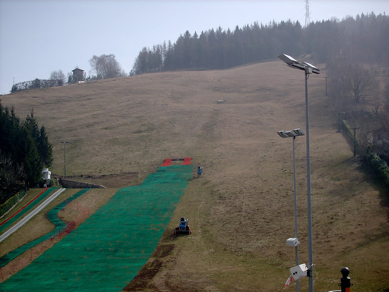
Selvino is a mapped downhill ski area in IT. Forecasts cover three real lift-station locations from approximately 417 to 1097 metres. Elevations are terrain-model estimates.
Data: OpenSkiData / OpenSkiMap, OpenStreetMap contributors (ODbL), Skimap.org, Who's On First, Mapterhorn.
Preparing forecast graphs…
Times and values match the detailed forecast. Tap or point at a value for details. Scroll each chart sideways for later days. Rain / precipitation is the total water equivalent per forecast interval, including snow; snowfall is fresh snow per interval, not snow depth.
GFS and ECMWF model comparison. Each model retains its own forecast times and horizon. Precipitation and snowfall amounts cover their own forecast intervals; these can differ between models.
Forecast values and model notes
Selvino - Middle lift station
ECMWF · Model run: Next update expected:
Day Time (UTC) Temp. (°C) Humidity (%) Wind (km/h) Wind (knots) Wind (Bft) Direction Precip. (mm) Snow (cm) Pressure (hPa) Freezing (m) Conditions | Wednesday, 04/11 06:00 4.6 86 2 1 1B E — — 1024 1761 Overcast 94% cloud 09:00 5.7 84 4 2 1B SE 0.02 0 1025 1911 Overcast 98% cloud 12:00 6.4 79 4 2 1B S 0.04 0 1026 1981 Overcast 100% cloud 15:00 6.1 84 3 2 1B S 0.20 0 1026 1992 Overcast 98% cloud 18:00 4.8 92 1 0 0B S 0.00 0 1027 1883 Cloudy 61% cloud 21:00 4.5 91 1 1 1B S 0.10 0 1028 1846 Cloudy 76% cloud Thursday, 05/11 00:00 4.2 88 1 1 1B SW 0 0 1029 1838 Cloudy 56% cloud 03:00 3.3 88 1 0 0B NW 0.02 0 1028 1765 Partly cloudy 49% cloud 06:00 3.1 85 1 1 1B S 0 0 1028 1796 Partly cloudy 39% cloud 09:00 7.3 72 6 3 1B SW 0 0 1029 2375 Partly cloudy 29% cloud 12:00 8.4 69 7 4 2B SW 0 0 1028 2543 Clear 14% cloud 15:00 7.6 76 5 3 1B SW 0 0 1027 2522 Clear 16% cloud 18:00 4.5 89 0 0 0B SW 0 0 1028 2427 Partly cloudy 41% cloud 21:00 4 87 1 0 0B NE 0 0 1027 2372 Partly cloudy 44% cloud Friday, 06/11 00:00 3.6 87 1 1 1B SE 0 0 1026 2376 Cloudy 54% cloud 03:00 3.3 87 2 1 1B SE 0 0 1025 2289 Overcast 94% cloud 06:00 3.5 87 3 1 1B SE 0 0 1024 2245 Overcast 89% cloud 09:00 6.8 83 3 2 1B S 0 0 1024 2515 Overcast 100% cloud 12:00 6.3 95 3 1 1B SW 0.58 0 1023 2469 Overcast 100% cloud 15:00 5.9 99 1 1 1B E 0.83 0 1022 2400 Overcast 100% cloud 18:00 5.4 99 3 2 1B S 2.1 0 1022 2329 Overcast 100% cloud 21:00 5.2 95 1 0 0B SW 6.4 0 1023 2152 Overcast 100% cloud Saturday, 07/11 00:00 5.1 94 3 2 1B S 1.5 0 1022 2061 Overcast 100% cloud 03:00 4.8 96 2 1 1B SE 1.7 0 1022 1906 Overcast 100% cloud 06:00 4.8 96 2 1 1B NE 0.87 0 1023 1822 Overcast 100% cloud 09:00 5.4 97 2 1 1B SE 0.97 0 1024 1868 Overcast 98% cloud 12:00 6.4 88 5 3 1B SW 0.44 0 1024 1933 Overcast 96% cloud 15:00 5.3 99 3 2 1B SW 1.9 0 1024 1838 Overcast 100% cloud 18:00 4.8 100 3 1 1B SW 3.4 0 1025 1794 Overcast 100% cloud 21:00 4.3 100 3 2 1B SW 1.4 0 1026 1710 Overcast 100% cloud Sunday, 08/11 00:00 4.3 100 3 1 1B SW 1.5 0 1026 1709 Overcast 100% cloud 03:00 4.2 100 1 0 0B S 1.8 0 1025 1690 Overcast 100% cloud 06:00 4.3 99 1 1 1B S 0.14 0 1025 1693 Overcast 100% cloud 09:00 5.5 90 3 2 1B SW 0.02 0 1026 1886 Overcast 98% cloud 12:00 7.4 72 6 3 2B SW 0.05 0 1026 2132 Cloudy 65% cloud 15:00 6.8 75 6 3 2B SW 0.05 0 1025 2182 Cloudy 52% cloud 18:00 4.4 83 3 2 1B W 0 0 1025 2112 Clear 15% cloud 21:00 3.2 85 3 2 1B NW 0 0 1026 1978 Partly cloudy 38% cloud Monday, 09/11 00:00 2.2 87 4 2 1B W 0 0 1025 1744 Overcast 91% cloud 03:00 3.3 82 3 2 1B W 0 0 1025 1921 Overcast 98% cloud 06:00 4.6 78 4 2 1B W 0.00 0 1025 2239 Overcast 100% cloud 09:00 7.4 71 5 2 1B SW 0 0 1025 2488 Overcast 100% cloud 12:00 7.3 77 8 4 2B SW 0 0 1024 2373 Overcast 100% cloud 15:00 5.5 91 6 3 2B W 0.36 0 1023 2263 Overcast 100% cloud 18:00 5.4 96 4 2 1B W 0.37 0 1023 2294 Overcast 100% cloud 21:00 5.9 95 6 3 2B SW 0.42 0 1022 2458 Overcast 100% cloud Tuesday, 10/11 00:00 5.8 96 6 3 1B W 0.05 0 1021 2575 Overcast 100% cloud 03:00 6.2 95 7 4 2B SW 0.05 0 1019 2669 Overcast 100% cloud 06:00 5.8 98 4 2 1B W 0.19 0 1018 2722 Overcast 100% cloud |
|---|
Forecast notes
Forecast table times: UTC.
Coordinates: 45.7819719°N, 9.7562623°E · Requested elevation: 945 m. Model terrain: 658 m. Terrain and 1000/925/850/700 hPa profiles are used for height estimates.
These are altitude estimates, not a simulation of local mountain terrain. Precipitation, cloud and sea-level pressure use horizontal interpolation only.
Precipitation includes rain and snow water equivalent: preceding 3 hours through day 6, then 6 hours (see cell tooltip). Snow (cm) estimates fresh snowfall from precipitation and temperature using the GFS conversion; it is not snow depth on the ground. Freezing (m) uses additional 600/500 hPa temperatures when available and estimates the lowest resolved 0°C crossing above sea level. When all sampled levels are warm, the upper profile limit is shown (see tooltip). < marks an entirely cold sampled profile and its lower height limit. No extrapolation is used.
Preparing forecast graphs…
Times and values match the detailed forecast. Tap or point at a value for details. Scroll each chart sideways for later days. Rain / precipitation is the total water equivalent per forecast interval, including snow; snowfall is fresh snow per interval, not snow depth.
GFS and ECMWF model comparison. Each model retains its own forecast times and horizon. Precipitation and snowfall amounts cover their own forecast intervals; these can differ between models.
Forecast values and model notes
Selvino - Top lift station
ECMWF · Model run: Next update expected:
Day Time (UTC) Temp. (°C) Humidity (%) Wind (km/h) Wind (knots) Wind (Bft) Direction Precip. (mm) Snow (cm) Pressure (hPa) Freezing (m) Conditions | Wednesday, 04/11 06:00 3.8 87 4 2 1B E — — 1024 1763 Overcast 94% cloud 09:00 4.8 84 5 3 1B SE 0.02 0 1025 1911 Overcast 98% cloud 12:00 5.5 80 5 3 1B S 0.03 0 1026 1981 Overcast 100% cloud 15:00 5.2 85 5 3 1B S 0.20 0 1026 1992 Overcast 98% cloud 18:00 4 92 2 1 1B S 0.00 0 1027 1884 Cloudy 60% cloud 21:00 3.8 92 2 1 1B S 0.10 0 1028 1850 Cloudy 76% cloud Thursday, 05/11 00:00 3.5 88 2 1 1B SW 0 0 1029 1841 Cloudy 55% cloud 03:00 2.7 88 1 1 0B SW 0.01 0 1028 1770 Partly cloudy 49% cloud 06:00 2.6 84 3 1 1B S 0 0 1028 1800 Partly cloudy 38% cloud 09:00 6.5 72 7 4 2B SW 0 0 1029 2376 Partly cloudy 28% cloud 12:00 7.6 70 7 4 2B SW 0 0 1028 2543 Clear 14% cloud 15:00 6.9 77 6 3 1B SW 0 0 1027 2522 Clear 16% cloud 18:00 4.1 87 1 1 1B SW 0 0 1028 2429 Partly cloudy 41% cloud 21:00 3.6 86 1 0 0B SE 0 0 1027 2376 Partly cloudy 44% cloud Friday, 06/11 00:00 3.2 86 2 1 1B SE 0 0 1026 2382 Cloudy 54% cloud 03:00 2.9 86 4 2 1B SE 0 0 1025 2296 Overcast 94% cloud 06:00 3.1 85 4 2 1B SE 0 0 1024 2251 Overcast 90% cloud 09:00 6.2 85 5 3 1B S 0 0 1024 2515 Overcast 100% cloud 12:00 5.7 95 4 2 1B SW 0.58 0 1023 2468 Overcast 100% cloud 15:00 5.3 99 2 1 1B SE 0.84 0 1022 2400 Overcast 100% cloud 18:00 4.8 99 4 2 1B S 2.0 0 1022 2331 Overcast 100% cloud 21:00 4.6 96 2 1 1B SW 6.4 0 1023 2155 Overcast 100% cloud Saturday, 07/11 00:00 4.4 95 4 2 1B S 1.4 0 1022 2063 Overcast 100% cloud 03:00 4.1 96 3 1 1B SE 1.7 0 1022 1907 Overcast 100% cloud 06:00 3.9 96 2 1 1B E 0.87 0 1023 1824 Overcast 100% cloud 09:00 4.6 97 3 2 1B SE 0.98 0 1024 1869 Overcast 98% cloud 12:00 5.4 90 5 3 1B S 0.45 0 1024 1933 Overcast 96% cloud 15:00 4.4 100 3 2 1B SW 1.9 0 1024 1838 Overcast 100% cloud 18:00 4 100 3 2 1B S 3.4 0 1025 1796 Overcast 100% cloud 21:00 3.5 100 3 2 1B SW 1.4 0 1026 1711 Overcast 100% cloud Sunday, 08/11 00:00 3.4 100 3 2 1B SW 1.5 0 1026 1710 Overcast 100% cloud 03:00 3.4 100 1 1 1B S 1.7 0 1025 1691 Overcast 100% cloud 06:00 3.4 100 2 1 1B SW 0.14 0 1025 1694 Overcast 100% cloud 09:00 4.6 89 4 2 1B SW 0.02 0 1026 1887 Overcast 98% cloud 12:00 6.5 71 7 4 2B SW 0.04 0 1026 2134 Cloudy 64% cloud 15:00 6 73 8 4 2B W 0.04 0 1025 2184 Cloudy 51% cloud 18:00 3.8 79 5 2 1B W 0 0 1025 2119 Clear 14% cloud 21:00 2.8 83 5 2 1B W 0 0 1026 1988 Partly cloudy 37% cloud Monday, 09/11 00:00 1.8 86 6 3 2B W 0 0 1025 1756 Overcast 91% cloud 03:00 2.8 82 6 3 1B W 0 0 1025 1927 Overcast 98% cloud 06:00 4.1 78 6 3 2B W 0.00 0 1025 2244 Overcast 100% cloud 09:00 6.7 72 7 4 2B W 0 0 1025 2491 Overcast 100% cloud 12:00 6.5 78 11 6 2B SW 0 0 1024 2375 Overcast 100% cloud 15:00 4.8 92 9 5 2B W 0.36 0 1023 2264 Overcast 100% cloud 18:00 4.8 96 6 3 2B W 0.36 0 1023 2296 Overcast 100% cloud 21:00 5.3 95 9 5 2B SW 0.40 0 1022 2460 Overcast 100% cloud Tuesday, 10/11 00:00 5.3 96 9 5 2B W 0.04 0 1021 2578 Overcast 100% cloud 03:00 5.7 96 10 5 2B SW 0.04 0 1019 2672 Overcast 100% cloud 06:00 5.3 98 7 4 2B SW 0.18 0 1018 2725 Overcast 100% cloud |
|---|
Forecast notes
Forecast table times: UTC.
Coordinates: 45.7783023°N, 9.7588154°E · Requested elevation: 1097 m. Model terrain: 643 m. Terrain and 1000/925/850/700 hPa profiles are used for height estimates.
These are altitude estimates, not a simulation of local mountain terrain. Precipitation, cloud and sea-level pressure use horizontal interpolation only.
Precipitation includes rain and snow water equivalent: preceding 3 hours through day 6, then 6 hours (see cell tooltip). Snow (cm) estimates fresh snowfall from precipitation and temperature using the GFS conversion; it is not snow depth on the ground. Freezing (m) uses additional 600/500 hPa temperatures when available and estimates the lowest resolved 0°C crossing above sea level. When all sampled levels are warm, the upper profile limit is shown (see tooltip). < marks an entirely cold sampled profile and its lower height limit. No extrapolation is used.