全球滑雪场天气预报

颜色说明 温度 · 风 · 降雨 · 降雪
每种颜色从所示数值开始。三种风速单位的颜色相互对应。无降水单元格保持中性色。颜色仅描述显示值,并非官方天气预警。
正在准备预报图表…
时间和数值与详细预报一致。点击数值查看详情,横向滚动查看后续日期。降水量为每时段总水当量,包含降雪;新雪量指每时段新增降雪,并非地面积雪深度。
GFS与ECMWF模式对比。各模式保留各自的预报时间和时长。降水量和降雪量对应各模式自身的时段,模式之间的时段可能不同。
预报数值与模式说明
Powder Ridge Ski Area - Low lift station
ECMWF · 模式起报时间: 预计下次更新:
日期 时间(UTC) 气温(°C) 湿度(%) 风速(km/h) 风速(节) 风力(Bft) 风向 降水(mm) 新雪(cm) 气压(hPa) 零度层(m) 天气状况 | 星期三, 04/11 06:00 12.6 85 14 8 3B SW — — 1022 3168 Partly cloudy 22% cloud  09:00 12.2 85 12 7 2B SW 0 0 1022 3162 Partly cloudy 27% cloud 12:00 11.5 87 12 7 2B SW 0 0 1022 3164 Clear 1% cloud  15:00 16.9 69 12 7 2B SW 0 0 1021 3159 Clear 0% cloud 18:00 19.4 55 19 10 3B SW 0 0 1019 3147 Clear 0% cloud 21:00 18.1 60 18 10 3B S 0 0 1018 3144 Clear 0% cloud 星期四, 05/11 00:00 15.1 79 17 9 3B SW 0 0 1018 3142 Clear 0% cloud 03:00 14.6 96 17 9 3B SW 0 0 1018 3134 Clear 13% cloud 06:00 15.7 99 17 9 3B SW 0 0 1017 3121 Overcast 100% cloud  09:00 16.2 99 18 10 3B SW 0 0 1016 3110 Overcast 100% cloud 12:00 16.2 99 16 9 3B S 0 0 1015 3109 Overcast 100% cloud 15:00 18.6 86 20 11 4B S 0 0 1015 3107 Overcast 94% cloud 18:00 19 85 21 11 4B S 0.96 0 1013 3090 Overcast 100% cloud 21:00 19 81 18 10 3B S 0.03 0 1012 3088 Overcast 83% cloud 星期五, 06/11 00:00 18 90 20 11 3B S 0.12 0 1012 3094 Overcast 95% cloud 03:00 16.7 97 19 10 3B S 1.1 0 1012 3092 Cloudy 66% cloud  06:00 16.7 97 13 7 3B S 1.4 0 1012 3085 Overcast 100% cloud 09:00 16.3 99 10 5 2B S 0.30 0 1012 3081 Overcast 84% cloud 12:00 16.2 99 4 2 1B SW 0.00 0 1012 3086 Overcast 82% cloud 15:00 19 89 4 2 1B SW 0.12 0 1013 3086 Overcast 100% cloud 18:00 20.7 79 8 4 2B S 0.24 0 1011 3073 Overcast 100% cloud 21:00 17.9 96 6 3 2B S 1.3 0 1011 3066 Overcast 100% cloud 星期六, 07/11 00:00 16.2 99 6 3 1B S 0.18 0 1011 3064 Overcast 100% cloud 03:00 16.2 99 2 1 1B N 0.01 0 1010 3052 Overcast 100% cloud 06:00 15.3 98 10 5 2B N 0.25 0 1009 3033 Overcast 100% cloud 09:00 13.3 97 11 6 2B N 0.30 0 1009 3015 Overcast 100% cloud 12:00 12.7 97 13 7 3B N 0.01 0 1009 3021 Overcast 100% cloud 15:00 14.4 87 13 7 3B N 0.01 0 1009 2918 Overcast 100% cloud 18:00 15.1 81 9 5 2B N 0.00 0 1008 2820 Overcast 100% cloud 21:00 13.8 86 6 3 2B NE 0.11 0 1007 2539 Cloudy 77% cloud 星期日, 08/11 00:00 12.3 97 2 1 1B NE 5.3 0 1007 2419 Overcast 84% cloud 03:00 11.1 99 16 8 3B W 1.2 0 1006 2088 Overcast 97% cloud 06:00 8.9 96 18 10 3B NW 1.8 0 1005 1819 Overcast 100% cloud 09:00 8.7 97 17 9 3B NW 1.2 0 1006 1716 Overcast 97% cloud 12:00 7.8 94 18 10 3B NW 1.4 0 1008 1834 Overcast 100% cloud 15:00 11 66 19 10 3B NW 0.13 0 1009 1966 Partly cloudy 29% cloud 18:00 13.6 55 22 12 4B W 0 0 1007 1817 Clear 16% cloud 21:00 11.9 58 17 9 3B W 0 0 1007 1938 Clear 2% cloud 星期一, 09/11 00:00 8.3 71 11 6 2B SW 0 0 1007 2048 Clear 0% cloud 03:00 7.2 74 12 7 2B SW 0 0 1007 1808 Partly cloudy 28% cloud 06:00 7.5 65 12 7 3B SW 0 0 1006 1582 Clear 3% cloud 09:00 6.6 70 13 7 3B SW 0 0 1005 1580 Clear 8% cloud 12:00 7.6 79 18 10 3B W 0.00 0 1006 1356 Partly cloudy 26% cloud 15:00 10.5 61 23 13 4B NW 0.00 0 1007 1259 Partly cloudy 23% cloud 18:00 10.9 56 24 13 4B NW 0 0 1008 1253 Overcast 98% cloud 21:00 10.2 58 20 11 3B NW 0 0 1010 1218 Partly cloudy 42% cloud 星期二, 10/11 00:00 7.5 65 15 8 3B NW 0 0 1013 1392 Clear 11% cloud 03:00 5.9 72 13 7 3B NW 0 0 1014 2028 Clear 18% cloud 06:00 4.8 78 6 3 2B W 0 0 1015 2441 Cloudy 53% cloud |
|---|
Forecast notes
Forecast table times: UTC.
Coordinates: 41.5028611°N, -72.7372756°E · Requested elevation: 116 m. Model terrain: 89 m. Terrain and 1000/925/850/700 hPa profiles are used for height estimates.
These are altitude estimates, not a simulation of local mountain terrain. Precipitation, cloud and sea-level pressure use horizontal interpolation only.
Precipitation includes rain and snow water equivalent: preceding 3 hours through day 6, then 6 hours (see cell tooltip). Snow (cm) estimates fresh snowfall from precipitation and temperature using the GFS conversion; it is not snow depth on the ground. Freezing (m) uses additional 600/500 hPa temperatures when available and estimates the lowest resolved 0°C crossing above sea level. When all sampled levels are warm, the upper profile limit is shown (see tooltip). < marks an entirely cold sampled profile and its lower height limit. No extrapolation is used.
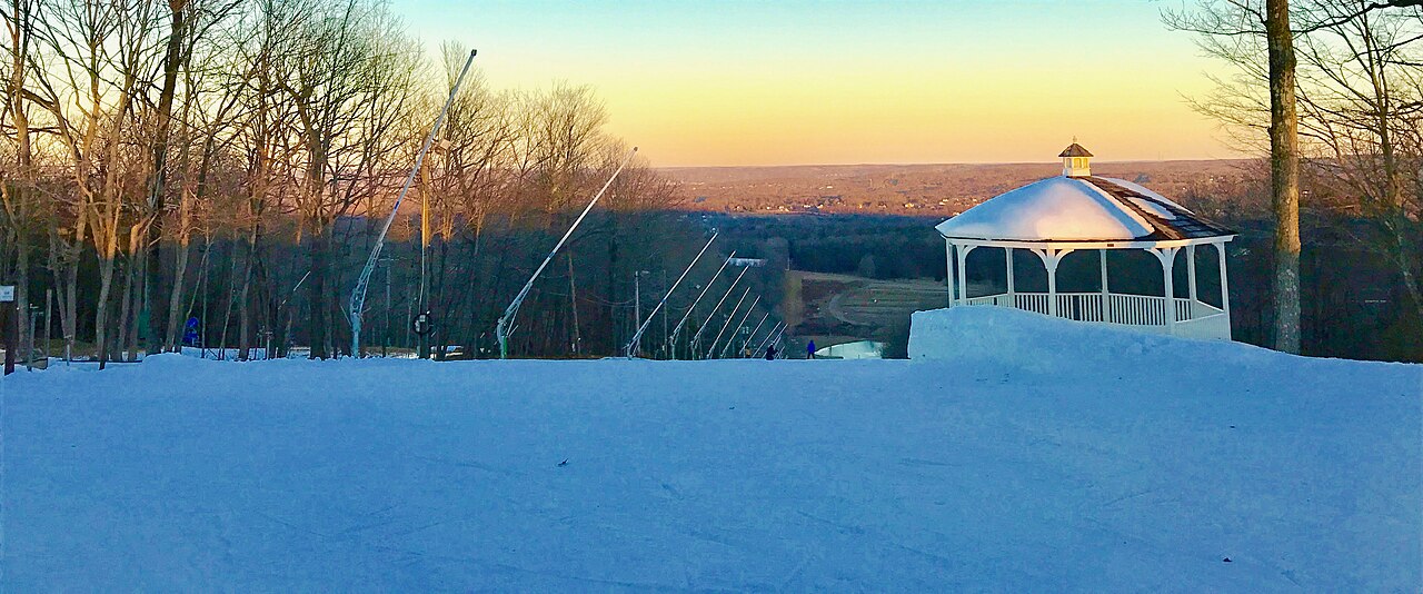
Powder Ridge Ski Area is a downhill ski area in Connecticut, United States. Mapped terrain includes easy, intermediate, advanced routes. Its mapped lift network extends from approximately 116 to 246 metres above sea level.
Data: OpenSkiData / OpenSkiMap, OpenStreetMap contributors (ODbL), Skimap.org, Who's On First, Mapterhorn.
正在准备预报图表…
时间和数值与详细预报一致。点击数值查看详情,横向滚动查看后续日期。降水量为每时段总水当量,包含降雪;新雪量指每时段新增降雪,并非地面积雪深度。
GFS与ECMWF模式对比。各模式保留各自的预报时间和时长。降水量和降雪量对应各模式自身的时段,模式之间的时段可能不同。
预报数值与模式说明
Powder Ridge Ski Area - Base lift station
ECMWF · 模式起报时间: 预计下次更新:
日期 时间(UTC) 气温(°C) 湿度(%) 风速(km/h) 风速(节) 风力(Bft) 风向 降水(mm) 新雪(cm) 气压(hPa) 零度层(m) 天气状况 | 星期三, 04/11 06:00 12.7 85 14 8 3B SW — — 1022 3168 Partly cloudy 22% cloud 09:00 12.2 85 12 7 3B SW 0 0 1022 3162 Partly cloudy 26% cloud 12:00 11.5 87 12 7 3B SW 0 0 1022 3164 Clear 1% cloud 15:00 16.8 69 12 7 3B SW 0 0 1021 3159 Clear 0% cloud 18:00 19.3 55 19 10 3B SW 0 0 1019 3147 Clear 0% cloud 21:00 18.1 60 19 10 3B S 0 0 1018 3144 Clear 0% cloud 星期四, 05/11 00:00 15.1 78 17 9 3B SW 0 0 1018 3142 Clear 0% cloud 03:00 14.7 96 18 10 3B SW 0 0 1018 3134 Clear 13% cloud 06:00 15.7 99 17 9 3B SW 0 0 1017 3121 Overcast 100% cloud 09:00 16.2 99 19 10 3B SW 0 0 1016 3110 Overcast 100% cloud 12:00 16.2 99 16 9 3B S 0 0 1015 3109 Overcast 100% cloud 15:00 18.6 86 21 11 4B S 0 0 1015 3107 Overcast 94% cloud 18:00 19 85 21 12 4B S 0.97 0 1013 3090 Overcast 100% cloud 21:00 19 81 18 10 3B S 0.03 0 1012 3088 Overcast 83% cloud 星期五, 06/11 00:00 18 90 20 11 4B S 0.12 0 1012 3094 Overcast 95% cloud 03:00 16.7 97 19 10 3B S 1.1 0 1012 3092 Cloudy 66% cloud 06:00 16.7 97 13 7 3B S 1.4 0 1012 3085 Overcast 100% cloud 09:00 16.3 99 10 5 2B S 0.30 0 1012 3081 Overcast 84% cloud 12:00 16.2 99 4 2 1B SW 0.00 0 1012 3086 Overcast 82% cloud 15:00 19 89 4 2 1B SW 0.12 0 1013 3086 Overcast 100% cloud 18:00 20.7 79 8 4 2B S 0.24 0 1011 3073 Overcast 100% cloud 21:00 17.9 96 6 3 2B S 1.3 0 1011 3066 Overcast 100% cloud 星期六, 07/11 00:00 16.2 99 6 3 1B S 0.18 0 1011 3064 Overcast 100% cloud 03:00 16.2 99 3 1 1B N 0.00 0 1010 3052 Overcast 100% cloud 06:00 15.3 98 10 5 2B N 0.26 0 1009 3033 Overcast 100% cloud 09:00 13.3 97 11 6 2B N 0.30 0 1009 3015 Overcast 100% cloud 12:00 12.7 97 13 7 3B N 0.01 0 1009 3021 Overcast 100% cloud 15:00 14.4 87 13 7 3B N 0.01 0 1009 2918 Overcast 100% cloud 18:00 15.1 82 9 5 2B N 0.00 0 1008 2821 Overcast 100% cloud 21:00 13.8 86 6 3 2B NE 0.12 0 1007 2539 Cloudy 76% cloud 星期日, 08/11 00:00 12.3 97 2 1 1B NE 5.3 0 1007 2419 Overcast 84% cloud 03:00 11.1 99 16 9 3B W 1.2 0 1006 2088 Overcast 97% cloud 06:00 8.8 96 18 10 3B NW 1.8 0 1005 1818 Overcast 100% cloud 09:00 8.7 97 17 9 3B NW 1.2 0 1006 1716 Overcast 97% cloud 12:00 7.8 94 18 10 3B NW 1.4 0 1008 1833 Overcast 100% cloud 15:00 10.9 66 19 10 3B NW 0.13 0 1009 1966 Partly cloudy 29% cloud 18:00 13.6 55 22 12 4B W 0 0 1007 1818 Clear 16% cloud 21:00 11.9 58 18 9 3B W 0 0 1007 1939 Clear 2% cloud 星期一, 09/11 00:00 8.3 71 11 6 2B SW 0 0 1007 2049 Clear 0% cloud 03:00 7.2 74 12 7 3B SW 0 0 1007 1808 Partly cloudy 28% cloud 06:00 7.5 65 12 7 3B SW 0 0 1006 1582 Clear 3% cloud 09:00 6.6 70 13 7 3B SW 0 0 1005 1580 Clear 8% cloud 12:00 7.6 79 18 10 3B W 0.00 0 1006 1356 Partly cloudy 26% cloud 15:00 10.5 61 23 13 4B NW 0.00 0 1007 1259 Partly cloudy 23% cloud 18:00 10.9 57 24 13 4B NW 0 0 1008 1253 Overcast 98% cloud 21:00 10.2 58 20 11 4B NW 0 0 1010 1218 Partly cloudy 42% cloud 星期二, 10/11 00:00 7.5 65 16 8 3B NW 0 0 1013 1391 Clear 11% cloud 03:00 5.9 72 13 7 3B NW 0 0 1014 2027 Clear 18% cloud 06:00 4.7 78 6 3 2B W 0 0 1015 2441 Cloudy 53% cloud |
|---|
Forecast notes
Forecast table times: UTC.
Coordinates: 41.5010464°N, -72.7370051°E · Requested elevation: 118 m. Model terrain: 90 m. Terrain and 1000/925/850/700 hPa profiles are used for height estimates.
These are altitude estimates, not a simulation of local mountain terrain. Precipitation, cloud and sea-level pressure use horizontal interpolation only.
Precipitation includes rain and snow water equivalent: preceding 3 hours through day 6, then 6 hours (see cell tooltip). Snow (cm) estimates fresh snowfall from precipitation and temperature using the GFS conversion; it is not snow depth on the ground. Freezing (m) uses additional 600/500 hPa temperatures when available and estimates the lowest resolved 0°C crossing above sea level. When all sampled levels are warm, the upper profile limit is shown (see tooltip). < marks an entirely cold sampled profile and its lower height limit. No extrapolation is used.
正在准备预报图表…
时间和数值与详细预报一致。点击数值查看详情,横向滚动查看后续日期。降水量为每时段总水当量,包含降雪;新雪量指每时段新增降雪,并非地面积雪深度。
GFS与ECMWF模式对比。各模式保留各自的预报时间和时长。降水量和降雪量对应各模式自身的时段,模式之间的时段可能不同。
预报数值与模式说明
Powder Ridge Ski Area - Top lift station
ECMWF · 模式起报时间: 预计下次更新:
日期 当地时间 气温(°C) 湿度(%) 风速(km/h) 风速(节) 风力(Bft) 风向 降水(mm) 新雪(cm) 气压(hPa) 零度层(m) 天气状况 | 星期三, 04/11 01:00 14.4 73 23 12 4B SW — — 1022 3168 Partly cloudy 21% cloud 04:00 13.6 73 22 12 4B SW 0 0 1022 3162 Partly cloudy 25% cloud 07:00 12.8 77 20 11 4B SW 0 0 1022 3164 Clear 0% cloud 10:00 15.4 71 17 9 3B SW 0 0 1021 3159 Clear 0% cloud 13:00 17.9 57 24 13 4B SW 0 0 1019 3147 Clear 0% cloud 16:00 17.6 59 25 14 4B SW 0 0 1018 3144 Clear 0% cloud 19:00 15.8 71 24 13 4B SW 0 0 1018 3141 Clear 0% cloud 22:00 15.1 89 24 13 4B SW 0 0 1018 3134 Clear 13% cloud 星期四, 05/11 01:00 15.4 96 25 14 4B SW 0 0 1017 3121 Overcast 100% cloud 04:00 15.7 98 26 14 4B SW 0 0 1016 3110 Overcast 100% cloud 07:00 15.8 99 23 12 4B SW 0 0 1015 3109 Overcast 100% cloud 10:00 17.9 87 30 16 5B SW 0 0 1015 3107 Overcast 94% cloud 13:00 18.1 86 30 16 5B SW 0.97 0 1013 3090 Overcast 100% cloud 16:00 18.3 83 26 14 4B SW 0.01 0 1012 3088 Overcast 83% cloud 19:00 17.7 91 29 15 4B SW 0.12 0 1012 3094 Overcast 95% cloud 22:00 16.5 97 28 15 4B SW 1.1 0 1012 3092 Cloudy 65% cloud 星期五, 06/11 01:00 16.5 97 18 10 3B SW 1.3 0 1012 3085 Overcast 100% cloud 04:00 16 98 12 7 3B SW 0.26 0 1012 3081 Overcast 83% cloud 07:00 16 97 5 3 1B SW 0.00 0 1012 3086 Overcast 82% cloud 10:00 18.1 90 4 2 1B SW 0.12 0 1013 3086 Overcast 100% cloud 13:00 19.5 82 9 5 2B S 0.24 0 1011 3073 Overcast 100% cloud 16:00 17.5 91 7 4 2B S 1.2 0 1011 3066 Overcast 100% cloud 19:00 16 95 6 3 2B SW 0.14 0 1011 3064 Overcast 100% cloud 22:00 15.9 96 3 2 1B N 0.00 0 1010 3052 Overcast 100% cloud 星期六, 07/11 01:00 15 97 10 5 2B N 0.25 0 1009 3033 Overcast 100% cloud 04:00 13.2 97 12 6 2B N 0.26 0 1009 3014 Overcast 100% cloud 07:00 12.4 98 14 7 3B N 0.00 0 1009 3021 Overcast 100% cloud 10:00 13.5 90 14 8 3B NE 0.00 0 1009 2916 Overcast 100% cloud 13:00 14 85 10 5 2B N 0.00 0 1008 2818 Overcast 100% cloud 16:00 12.8 89 6 3 2B NE 0.12 0 1007 2538 Cloudy 75% cloud 19:00 11.5 98 1 0 0B SW 5.4 0 1007 2419 Overcast 83% cloud 22:00 10.3 99 17 9 3B NW 1.1 0 1006 2086 Overcast 97% cloud 星期日, 08/11 01:00 8.1 96 23 13 4B NW 1.7 0 1005 1815 Overcast 100% cloud 04:00 8.1 95 23 12 4B NW 1.1 0 1006 1715 Overcast 97% cloud 07:00 7 94 28 15 4B NW 1.5 0 1008 1837 Overcast 100% cloud 10:00 9.5 71 25 14 4B NW 0.12 0 1009 1967 Partly cloudy 28% cloud 13:00 12.1 59 26 14 4B W 0 0 1007 1821 Clear 14% cloud 16:00 10.7 61 23 12 4B W 0 0 1007 1946 Clear 2% cloud 19:00 8.1 67 19 10 3B W 0 0 1007 2049 Clear 0% cloud 22:00 7.3 70 19 10 3B W 0 0 1007 1808 Partly cloudy 28% cloud 星期一, 09/11 01:00 7.3 63 19 10 3B W 0 0 1006 1583 Clear 2% cloud 04:00 6.4 71 22 12 4B W 0 0 1005 1583 Clear 8% cloud 07:00 6.8 80 26 14 4B W 0.00 0 1006 1357 Partly cloudy 25% cloud 10:00 9 65 28 15 4B NW 0.00 0 1007 1259 Partly cloudy 22% cloud 13:00 9.5 60 29 16 5B NW 0 0 1008 1252 Overcast 98% cloud 16:00 9 60 26 14 4B NW 0 0 1010 1218 Partly cloudy 42% cloud 19:00 6.5 67 24 13 4B NW 0 0 1013 1389 Clear 11% cloud 22:00 5 72 22 12 4B NW 0 0 1014 2031 Clear 19% cloud 星期二, 10/11 01:00 4.2 79 14 7 3B NW 0 0 1015 2447 Cloudy 53% cloud |
|---|
Forecast notes
Forecast table times: America/New_York.
Coordinates: 41.5002305°N, -72.7461177°E · Requested elevation: 246 m. Model terrain: 88 m. Terrain and 1000/925/850/700 hPa profiles are used for height estimates.
These are altitude estimates, not a simulation of local mountain terrain. Precipitation, cloud and sea-level pressure use horizontal interpolation only.
Precipitation includes rain and snow water equivalent: preceding 3 hours through day 6, then 6 hours (see cell tooltip). Snow (cm) estimates fresh snowfall from precipitation and temperature using the GFS conversion; it is not snow depth on the ground. Freezing (m) uses additional 600/500 hPa temperatures when available and estimates the lowest resolved 0°C crossing above sea level. When all sampled levels are warm, the upper profile limit is shown (see tooltip). < marks an entirely cold sampled profile and its lower height limit. No extrapolation is used.