Προγνώσεις για χιονοδρομικά σε όλο τον κόσμο

Χρωματική κλίμακα Θερμοκρασία · Άνεμος · Βροχή · Χιόνι
Κάθε χρώμα ξεκινά από την τιμή που αναγράφεται. Τα χρώματα ανέμου αντιστοιχούν και στις τρεις μονάδες. Οι τιμές χωρίς υετό παραμένουν ουδέτερες. Τα χρώματα περιγράφουν τις τιμές και δεν αποτελούν επίσημες προειδοποιήσεις.
Προετοιμασία γραφημάτων…
Οι ώρες και οι τιμές αντιστοιχούν στην αναλυτική πρόγνωση. Πατήστε μια τιμή για λεπτομέρειες και μετακινήστε οριζόντια τα γραφήματα για επόμενες ημέρες. Ο υετός είναι το συνολικό ισοδύναμο νερού ανά διάστημα, μαζί με το χιόνι. Η χιονόπτωση αφορά νέο χιόνι ανά διάστημα, όχι το ύψος του χιονιού στο έδαφος.
Σύγκριση GFS και ECMWF. Κάθε μοντέλο διατηρεί τις δικές του ώρες και διάρκεια πρόγνωσης. Ο υετός και το νέο χιόνι αφορούν τα διαστήματα κάθε μοντέλου, τα οποία μπορεί να διαφέρουν.
Τιμές πρόγνωσης και σημειώσεις μοντέλων
Mt. Bachelor - Χαμηλός σταθμός
ECMWF · Εκτέλεση μοντέλου: Αναμενόμενη επόμενη ενημέρωση:
Ημέρα Ώρα (UTC) Θερμ. (°C) Υγρασία (%) Άνεμος (km/h) Άνεμος (κόμβοι) Άνεμος (Bft) Διεύθυνση Υετός (mm) Νέο χιόνι (cm) Πίεση (hPa) Σημείο παγοποίησης (m) Συνθήκες | Κυριακή, 25/10 00:00 8.7 35 4 2 1B SW 0 0 1017 3452 Partly cloudy 46% cloud  03:00 4.4 39 2 1 1B W 0 0 1017 3414 Overcast 89% cloud  06:00 4.8 33 3 2 1B W 0 0 1017 3336 Overcast 98% cloud 09:00 4.8 36 3 2 1B SW 0 0 1016 3249 Overcast 95% cloud 12:00 3.6 41 5 2 1B SW 0 0 1016 3013 Cloudy 74% cloud  15:00 3 47 5 3 1B SW 0 0 1016 2695 Overcast 87% cloud 18:00 8 38 12 6 2B SW 0 0 1016 2917 Overcast 96% cloud 21:00 9.6 36 16 9 3B SW 0 0 1014 2801 Overcast 96% cloud Δευτέρα, 26/10 00:00 6.7 44 10 5 2B SW 0 0 1014 2667 Overcast 91% cloud 03:00 2.8 56 6 3 2B W 0 0 1015 2287 Cloudy 52% cloud 06:00 1.2 65 7 4 2B SW 0 0 1016 1984 Cloudy 75% cloud 09:00 1 76 8 4 2B SW 1.1 0.3 1017 1925 Overcast 100% cloud 12:00 -1.2 93 9 5 2B SW 0.49 0.1 1018 < 1847 Overcast 95% cloud 15:00 -0.3 96 9 5 2B SW 0.94 0.3 1018 < 1847 Overcast 100% cloud 18:00 0.5 94 13 7 3B W 0.91 0.3 1019 < 1847 Overcast 100% cloud 21:00 1.4 84 13 7 3B W 0.88 0 1019 1974 Overcast 89% cloud Τρίτη, 27/10 00:00 0.5 89 7 4 2B W 1.5 0.5 1020 < 1847 Overcast 97% cloud 03:00 0.2 95 7 4 2B W 1.9 0.6 1020 < 1847 Overcast 100% cloud 06:00 0.6 96 10 6 2B SW 1.4 0.4 1020 1848 Overcast 100% cloud 09:00 0.6 97 12 6 2B SW 0.67 0.2 1020 < 1847 Overcast 99% cloud 12:00 0.4 96 10 6 2B W 0.21 0 1019 < 1847 Overcast 99% cloud 15:00 0.1 97 6 3 2B SW 0.42 0.1 1019 < 1847 Overcast 99% cloud 18:00 1 91 7 4 2B SW 1.8 0.5 1019 1913 Overcast 99% cloud 21:00 1.5 89 8 4 2B W 0.91 0 1019 1978 Overcast 99% cloud Τετάρτη, 28/10 00:00 0.7 93 8 4 2B W 0.42 0.1 1019 1868 Overcast 96% cloud 03:00 0.2 95 9 5 2B W 0.42 0.1 1019 < 1847 Overcast 97% cloud 06:00 0.2 95 9 5 2B W 0.85 0.3 1020 < 1847 Overcast 96% cloud 09:00 0.1 96 12 6 2B SW 0.49 0.1 1019 < 1847 Overcast 99% cloud 12:00 -1 94 11 6 2B W 0.42 0.1 1019 < 1847 Overcast 97% cloud 15:00 -1.6 93 8 4 2B W 0.00 0 1020 < 1847 Overcast 95% cloud 18:00 0.6 79 9 5 2B SW 0 0 1019 1850 Overcast 94% cloud 21:00 2.4 68 14 8 3B SW 0.42 0 1016 2053 Overcast 83% cloud Πέμπτη, 29/10 00:00 0.8 84 9 5 2B SW 0.85 0.3 1017 1871 Cloudy 73% cloud 03:00 -1.2 94 7 4 2B SW 0.85 0.3 1017 < 1847 Overcast 97% cloud 06:00 -2 95 7 4 2B SW 0.42 0.1 1017 < 1847 Overcast 97% cloud 09:00 -2.1 93 11 6 2B SW 0.00 0 1017 < 1847 Overcast 95% cloud 12:00 -2.7 94 13 7 3B SW 0.42 0.1 1017 < 1847 Overcast 98% cloud 15:00 -2.9 94 14 7 3B SW 0.49 0.5 1018 < 1847 Overcast 99% cloud 18:00 -0.6 80 16 9 3B SW 1.3 0.4 1018 < 1847 Overcast 91% cloud 21:00 0.5 66 15 8 3B SW 0.85 0.3 1017 < 1847 Cloudy 51% cloud Παρασκευή, 30/10 00:00 -0.4 73 11 6 2B W 0 0 1017 < 1847 Cloudy 51% cloud 03:00 -5.4 89 3 2 1B N 0 0 1018 < 1847 Cloudy 59% cloud 06:00 -6.4 87 5 3 1B NE 0 0 1016 < 1847 Cloudy 59% cloud 09:00 -4.4 81 7 4 2B E 0 0 1014 < 1847 Overcast 92% cloud 12:00 -4.5 82 7 4 2B E 0 0 1012 < 1847 Overcast 97% cloud 15:00 -5 84 6 3 2B E 0 0 1012 < 1847 Clear 19% cloud  18:00 2.1 63 8 4 2B SE 0 0 1011 2031 Clear 11% cloud |
|---|
Forecast notes
Forecast table times: UTC.
Coordinates: 43.9996339°N, -121.71718°E · Requested elevation: 1738 m. Model terrain: 1845 m. Terrain and 1000/925/850/700 hPa profiles are used for height estimates.
Outside the available profile, temperature uses an estimated 5.5°C/km height correction; wind retains the nearest available model-level value. Humidity is estimated with adjusted pressure and temperature.
These are altitude estimates, not a simulation of local mountain terrain. Precipitation, cloud and sea-level pressure use horizontal interpolation only.
Precipitation includes rain and snow water equivalent: preceding 3 hours through day 6, then 6 hours (see cell tooltip). Snow (cm) estimates fresh snowfall from precipitation and temperature using the GFS conversion; it is not snow depth on the ground. Freezing (m) uses additional 600/500 hPa temperatures when available and estimates the lowest resolved 0°C crossing above sea level. When all sampled levels are warm, the upper profile limit is shown (see tooltip). < marks an entirely cold sampled profile and its lower height limit. No extrapolation is used.
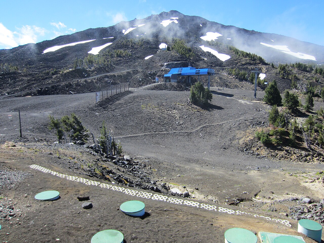
Mt. Bachelor is a downhill ski area in Oregon, United States. Mapped terrain includes easy, intermediate, advanced routes. Its mapped lift network extends from approximately 1738 to 2726 metres above sea level. Cross-country skiing is also mapped within the area.
Data: OpenSkiData / OpenSkiMap, OpenStreetMap contributors (ODbL), Skimap.org, Who's On First, Mapterhorn.
Προετοιμασία γραφημάτων…
Οι ώρες και οι τιμές αντιστοιχούν στην αναλυτική πρόγνωση. Πατήστε μια τιμή για λεπτομέρειες και μετακινήστε οριζόντια τα γραφήματα για επόμενες ημέρες. Ο υετός είναι το συνολικό ισοδύναμο νερού ανά διάστημα, μαζί με το χιόνι. Η χιονόπτωση αφορά νέο χιόνι ανά διάστημα, όχι το ύψος του χιονιού στο έδαφος.
Σύγκριση GFS και ECMWF. Κάθε μοντέλο διατηρεί τις δικές του ώρες και διάρκεια πρόγνωσης. Ο υετός και το νέο χιόνι αφορούν τα διαστήματα κάθε μοντέλου, τα οποία μπορεί να διαφέρουν.
Τιμές πρόγνωσης και σημειώσεις μοντέλων
Mt. Bachelor - Σταθμός βάσης
ECMWF · Εκτέλεση μοντέλου: Αναμενόμενη επόμενη ενημέρωση:
Ημέρα Ώρα (UTC) Θερμ. (°C) Υγρασία (%) Άνεμος (km/h) Άνεμος (κόμβοι) Άνεμος (Bft) Διεύθυνση Υετός (mm) Νέο χιόνι (cm) Πίεση (hPa) Σημείο παγοποίησης (m) Συνθήκες | Κυριακή, 25/10 00:00 7.3 37 7 4 2B W 0 0 1017 3464 Partly cloudy 47% cloud 03:00 3.3 41 7 4 2B W 0 0 1017 3435 Overcast 90% cloud 06:00 3.4 38 8 5 2B W 0 0 1017 3357 Overcast 98% cloud 09:00 3.5 40 11 6 2B SW 0 0 1016 3270 Overcast 95% cloud 12:00 2.3 48 14 8 3B SW 0 0 1016 3078 Cloudy 76% cloud 15:00 1.7 51 16 8 3B SW 0 0 1016 2675 Overcast 89% cloud 18:00 6.3 38 20 11 4B SW 0 0 1016 2927 Overcast 94% cloud 21:00 7.7 38 24 13 4B SW 0 0 1014 2819 Overcast 96% cloud Δευτέρα, 26/10 00:00 5.5 42 19 10 3B SW 0 0 1014 2693 Overcast 87% cloud 03:00 1.8 54 16 8 3B SW 0 0 1014 2326 Cloudy 58% cloud 06:00 -0.1 65 15 8 3B SW 0 0 1015 1942 Cloudy 71% cloud 09:00 -0.3 78 16 9 3B SW 0.86 0.3 1017 1925 Overcast 99% cloud 12:00 -2.3 95 15 8 3B SW 0.50 0.2 1017 < 1754 Overcast 87% cloud 15:00 -1.7 98 13 7 3B W 0.89 0.3 1018 < 1754 Overcast 100% cloud 18:00 -0.8 95 16 9 3B W 0.79 0.2 1019 1857 Overcast 100% cloud 21:00 0.5 82 16 9 3B W 0.71 0.2 1019 2043 Overcast 80% cloud Τρίτη, 27/10 00:00 -0.4 87 14 8 3B W 1.3 0.4 1020 1909 Overcast 93% cloud 03:00 -0.9 97 13 7 3B W 1.7 0.5 1020 1801 Overcast 99% cloud 06:00 -0.7 96 14 8 3B W 1.2 0.4 1019 1848 Overcast 99% cloud 09:00 -0.6 95 15 8 3B W 0.56 0.2 1020 1866 Overcast 98% cloud 12:00 -0.7 93 14 8 3B W 0.16 0 1019 1842 Overcast 98% cloud 15:00 -1.1 98 11 6 2B W 0.31 0.1 1019 1774 Overcast 98% cloud 18:00 -0.2 95 10 6 2B W 1.4 0.4 1019 1947 Overcast 98% cloud 21:00 0.5 89 12 7 3B W 0.81 0.2 1019 2051 Overcast 98% cloud Τετάρτη, 28/10 00:00 -0 88 12 6 2B W 0.31 0.1 1018 1970 Overcast 90% cloud 03:00 -0.9 93 12 6 2B W 0.31 0.1 1019 1800 Overcast 91% cloud 06:00 -1 94 13 7 3B W 0.61 0.2 1019 1781 Overcast 90% cloud 09:00 -0.9 91 16 9 3B W 0.47 0.1 1019 1771 Overcast 96% cloud 12:00 -1.8 91 17 9 3B W 0.31 0.1 1019 < 1754 Overcast 92% cloud 15:00 -2.5 92 15 8 3B W 0.01 0 1020 < 1754 Overcast 86% cloud 18:00 -0.4 74 16 8 3B W 0 0 1018 1920 Overcast 88% cloud 21:00 1.1 67 18 10 3B SW 0.31 0.1 1016 2091 Cloudy 74% cloud Πέμπτη, 29/10 00:00 -0.3 81 15 8 3B SW 0.62 0.2 1016 1930 Cloudy 58% cloud 03:00 -2.5 95 14 7 3B SW 0.61 0.2 1017 < 1754 Overcast 91% cloud 06:00 -3 94 15 8 3B SW 0.32 0.3 1017 < 1754 Overcast 91% cloud 09:00 -3.2 91 18 10 3B SW 0.02 0 1017 < 1754 Overcast 87% cloud 12:00 -4 94 20 11 3B SW 0.32 0.3 1017 < 1754 Overcast 94% cloud 15:00 -4.2 94 20 11 3B SW 0.47 0.5 1017 < 1754 Overcast 97% cloud 18:00 -2 78 21 11 4B SW 1.1 0.3 1018 < 1754 Overcast 85% cloud 21:00 -0.8 65 21 12 4B SW 0.63 0.2 1017 1883 Partly cloudy 49% cloud Παρασκευή, 30/10 00:00 -1.5 69 16 9 3B W 0 0 1017 1772 Partly cloudy 42% cloud 03:00 -5.8 82 4 2 1B W 0 0 1017 < 1754 Partly cloudy 49% cloud 06:00 -6.4 77 3 2 1B S 0 0 1016 < 1754 Cloudy 63% cloud 09:00 -4.7 73 4 2 1B S 0 0 1015 < 1754 Overcast 92% cloud 12:00 -4.9 83 3 2 1B SE 0 0 1013 < 1754 Overcast 96% cloud 15:00 -5.5 88 3 2 1B SE 0 0 1012 < 1754 Partly cloudy 22% cloud 18:00 -0 68 9 5 2B SE 0 0 1012 1974 Clear 17% cloud |
|---|
Forecast notes
Forecast table times: UTC.
Coordinates: 43.9923137°N, -121.6624341°E · Requested elevation: 1972 m. Model terrain: 1751 m. Terrain and 1000/925/850/700 hPa profiles are used for height estimates.
These are altitude estimates, not a simulation of local mountain terrain. Precipitation, cloud and sea-level pressure use horizontal interpolation only.
Precipitation includes rain and snow water equivalent: preceding 3 hours through day 6, then 6 hours (see cell tooltip). Snow (cm) estimates fresh snowfall from precipitation and temperature using the GFS conversion; it is not snow depth on the ground. Freezing (m) uses additional 600/500 hPa temperatures when available and estimates the lowest resolved 0°C crossing above sea level. When all sampled levels are warm, the upper profile limit is shown (see tooltip). < marks an entirely cold sampled profile and its lower height limit. No extrapolation is used.
Προετοιμασία γραφημάτων…
Οι ώρες και οι τιμές αντιστοιχούν στην αναλυτική πρόγνωση. Πατήστε μια τιμή για λεπτομέρειες και μετακινήστε οριζόντια τα γραφήματα για επόμενες ημέρες. Ο υετός είναι το συνολικό ισοδύναμο νερού ανά διάστημα, μαζί με το χιόνι. Η χιονόπτωση αφορά νέο χιόνι ανά διάστημα, όχι το ύψος του χιονιού στο έδαφος.
Σύγκριση GFS και ECMWF. Κάθε μοντέλο διατηρεί τις δικές του ώρες και διάρκεια πρόγνωσης. Ο υετός και το νέο χιόνι αφορούν τα διαστήματα κάθε μοντέλου, τα οποία μπορεί να διαφέρουν.
Τιμές πρόγνωσης και σημειώσεις μοντέλων
Mt. Bachelor - Άνω σταθμός
ECMWF · Εκτέλεση μοντέλου: Αναμενόμενη επόμενη ενημέρωση:
Ημέρα Ώρα (UTC) Θερμ. (°C) Υγρασία (%) Άνεμος (km/h) Άνεμος (κόμβοι) Άνεμος (Bft) Διεύθυνση Υετός (mm) Νέο χιόνι (cm) Πίεση (hPa) Σημείο παγοποίησης (m) Συνθήκες | Κυριακή, 25/10 00:00 3.5 28 22 12 4B W 0 0 1017 3466 Partly cloudy 47% cloud 03:00 2.1 33 18 10 3B W 0 0 1017 3432 Overcast 90% cloud 06:00 2 40 22 12 4B W 0 0 1017 3354 Overcast 98% cloud 09:00 1.7 45 31 17 5B SW 0 0 1016 3265 Overcast 96% cloud 12:00 0.7 57 40 22 6B SW 0 0 1016 3057 Cloudy 76% cloud 15:00 -0.1 55 47 25 6B SW 0 0 1016 2670 Overcast 89% cloud 18:00 1.3 28 48 26 6B SW 0 0 1016 2923 Overcast 94% cloud 21:00 0.8 34 49 26 6B SW 0 0 1014 2816 Overcast 96% cloud Δευτέρα, 26/10 00:00 -0.3 32 49 26 6B SW 0 0 1014 2688 Overcast 89% cloud 03:00 -2.1 46 50 27 7B SW 0 0 1014 2307 Cloudy 55% cloud 06:00 -3.2 55 50 27 6B SW 0 0 1015 1943 Cloudy 72% cloud 09:00 -4.1 81 42 23 6B SW 0.92 0.9 1017 1921 Overcast 100% cloud 12:00 -5.8 91 32 17 5B SW 0.54 0.5 1018 < 1765 Overcast 91% cloud 15:00 -6.1 96 32 18 5B W 0.91 0.9 1018 < 1765 Overcast 100% cloud 18:00 -6 94 32 17 5B W 0.79 0.8 1019 1849 Overcast 100% cloud 21:00 -4.8 84 29 16 5B W 0.76 0.8 1019 2023 Overcast 82% cloud Τρίτη, 27/10 00:00 -4.7 93 38 20 5B W 1.4 1.4 1020 1888 Overcast 95% cloud 03:00 -5 97 35 19 5B W 1.7 1.7 1020 1793 Overcast 99% cloud 06:00 -4.9 83 30 16 5B W 1.2 1.2 1020 1853 Overcast 100% cloud 09:00 -4.8 77 32 17 5B W 0.59 0.6 1020 1864 Overcast 99% cloud 12:00 -4.7 75 31 17 5B W 0.19 0.2 1019 1840 Overcast 99% cloud 15:00 -5.3 94 27 15 4B W 0.34 0.3 1019 1779 Overcast 98% cloud 18:00 -5.1 97 23 13 4B W 1.5 1.5 1019 1934 Overcast 99% cloud 21:00 -4.8 94 27 15 4B W 0.87 0.9 1019 2025 Overcast 98% cloud Τετάρτη, 28/10 00:00 -4.3 77 28 15 4B NW 0.33 0.3 1019 1951 Overcast 92% cloud 03:00 -4.6 82 25 13 4B W 0.33 0.3 1019 1800 Overcast 93% cloud 06:00 -5.1 80 28 15 4B W 0.66 0.7 1019 1787 Overcast 92% cloud 09:00 -4.2 59 34 18 5B W 0.44 0.4 1019 < 1765 Overcast 97% cloud 12:00 -4.7 70 37 20 5B W 0.33 0.3 1019 < 1765 Overcast 94% cloud 15:00 -5.7 82 38 20 5B W 0.01 0 1020 < 1765 Overcast 88% cloud 18:00 -5.5 60 35 19 5B W 0 0 1018 1912 Overcast 89% cloud 21:00 -5.8 79 29 16 5B W 0.33 0.3 1016 2082 Cloudy 77% cloud Πέμπτη, 29/10 00:00 -6.1 86 32 18 5B SW 0.69 0.7 1016 1920 Cloudy 63% cloud 03:00 -6.9 94 33 18 5B SW 0.66 0.7 1017 < 1765 Overcast 92% cloud 06:00 -7.5 87 39 21 6B SW 0.36 0.4 1017 < 1765 Overcast 94% cloud 09:00 -8 80 43 23 6B SW 0.04 0 1017 < 1765 Overcast 89% cloud 12:00 -8.7 84 46 25 6B W 0.36 0.4 1017 < 1765 Overcast 92% cloud 15:00 -9 91 44 24 6B W 0.44 0.4 1017 < 1765 Overcast 98% cloud 18:00 -8.1 79 38 21 5B W 1.2 1.2 1018 < 1765 Overcast 85% cloud 21:00 -7.7 68 39 21 6B SW 0.70 0.7 1017 1876 Cloudy 51% cloud Παρασκευή, 30/10 00:00 -7.1 63 32 17 5B W 0 0 1017 1766 Partly cloudy 46% cloud 03:00 -7.5 47 19 10 3B SW 0 0 1017 < 1765 Cloudy 52% cloud 06:00 -7.3 37 25 13 4B S 0 0 1016 < 1765 Cloudy 64% cloud 09:00 -6.3 38 26 14 4B S 0 0 1015 < 1765 Overcast 93% cloud 12:00 -6.8 74 21 11 4B S 0 0 1013 < 1765 Overcast 97% cloud 15:00 -7.4 88 18 10 3B S 0 0 1012 < 1765 Partly cloudy 26% cloud 18:00 -5.9 75 21 11 4B S 0 0 1012 1983 Clear 15% cloud |
|---|
Forecast notes
Forecast table times: UTC.
Coordinates: 43.9775738°N, -121.685874°E · Requested elevation: 2726 m. Model terrain: 1762 m. Terrain and 1000/925/850/700 hPa profiles are used for height estimates.
These are altitude estimates, not a simulation of local mountain terrain. Precipitation, cloud and sea-level pressure use horizontal interpolation only.
Precipitation includes rain and snow water equivalent: preceding 3 hours through day 6, then 6 hours (see cell tooltip). Snow (cm) estimates fresh snowfall from precipitation and temperature using the GFS conversion; it is not snow depth on the ground. Freezing (m) uses additional 600/500 hPa temperatures when available and estimates the lowest resolved 0°C crossing above sea level. When all sampled levels are warm, the upper profile limit is shown (see tooltip). < marks an entirely cold sampled profile and its lower height limit. No extrapolation is used.