Worldwide Ski Resort Forecasts

Colour guide Temperature · Wind · Rain · Snow
Each colour starts at the value shown. Wind colours match across all three units. Dry cells stay neutral. Colours describe the displayed values, not official weather warnings.
Preparing forecast graphs…
Times and values match the detailed forecast. Tap or point at a value for details. Scroll each chart sideways for later days. Rain / precipitation is the total water equivalent per forecast interval, including snow; snowfall is fresh snow per interval, not snow depth.
GFS and ECMWF model comparison. Each model retains its own forecast times and horizon. Precipitation and snowfall amounts cover their own forecast intervals; these can differ between models.
Forecast values and model notes
Mellau - Low lift station
ECMWF · Model run: Next update expected:
Day Time (UTC) Temp. (°C) Humidity (%) Wind (km/h) Wind (knots) Wind (Bft) Direction Precip. (mm) Snow (cm) Pressure (hPa) Freezing (m) Conditions | Wednesday, 04/11 06:00 3.2 80 2 1 1B E — — 1023 1345 Cloudy 60% cloud  09:00 7.1 69 1 1 0B NE 0 0 1023 1976 Partly cloudy 20% cloud  12:00 10.2 59 3 2 1B NW 0.02 0 1022 2300 Clear 7% cloud  15:00 8.8 71 2 1 1B NE 0 0 1022 2287 Clear 4% cloud 18:00 5 74 3 2 1B SE 0 0 1022 1906 Clear 10% cloud 21:00 3.2 73 5 2 1B SE 0 0 1023 1506 Clear 3% cloud Thursday, 05/11 00:00 2.7 74 5 3 1B SE 0 0 1023 1331 Clear 12% cloud 03:00 2.7 73 4 2 1B SE 0 0 1023 1370 Clear 19% cloud 06:00 2.2 74 4 2 1B SE 0 0 1023 < 1124 Partly cloudy 28% cloud 09:00 9.9 54 2 1 1B S 0 0 1024 2915 Partly cloudy 26% cloud 12:00 12.8 49 3 2 1B NW 0 0 1023 2988 Clear 11% cloud 15:00 10.8 68 2 1 1B NW 0 0 1022 2957 Clear 6% cloud 18:00 6.8 72 2 1 1B SE 0 0 1023 2888 Clear 3% cloud 21:00 4.9 70 2 1 1B SE 0 0 1022 2858 Clear 15% cloud Friday, 06/11 00:00 4.6 68 3 1 1B SE 0 0 1021 3112 Partly cloudy 32% cloud 03:00 4.4 67 2 1 1B SE 0 0 1020 3102 Partly cloudy 31% cloud 06:00 4.3 67 1 1 1B SE 0 0 1020 3004 Partly cloudy 41% cloud 09:00 8.9 59 2 1 1B NW 0.02 0 1021 3075 Overcast 88% cloud  12:00 8.7 66 5 3 1B NW 0 0 1021 2855 Overcast 99% cloud 15:00 6.9 80 2 1 1B NW 0.12 0 1022 2527 Overcast 94% cloud 18:00 5.7 86 0 0 0B S 0.26 0 1022 2273 Overcast 94% cloud 21:00 5.2 85 1 0 0B SW 1.6 0 1023 2079 Overcast 100% cloud Saturday, 07/11 00:00 5.2 85 1 1 1B SW 2.1 0 1024 1933 Overcast 100% cloud 03:00 5.1 86 1 0 0B S 1.1 0 1023 1823 Overcast 100% cloud 06:00 5.3 84 1 0 0B S 0.62 0 1023 1807 Overcast 100% cloud 09:00 5.6 85 2 1 1B S 2.3 0 1024 1801 Overcast 99% cloud 12:00 7.3 79 1 1 1B W 0.40 0 1023 1972 Overcast 93% cloud 15:00 7.2 78 1 1 1B N 0.03 0 1023 1940 Overcast 94% cloud 18:00 5.8 84 1 1 1B SE 0.06 0 1023 1781 Cloudy 65% cloud 21:00 3.2 84 1 1 0B SE 0.04 0 1024 1349 Cloudy 65% cloud Sunday, 08/11 00:00 2.9 84 3 2 1B SE 0 0 1024 1260 Cloudy 56% cloud 03:00 3 80 3 1 1B SE 0.23 0 1023 1259 Cloudy 68% cloud 06:00 3.1 78 3 2 1B SE 0.32 0 1023 1291 Cloudy 76% cloud 09:00 7.3 70 1 1 0B S 0.02 0 1024 1871 Clear 18% cloud 12:00 9.8 57 4 2 1B NW 0 0 1022 2099 Clear 5% cloud 15:00 8 68 2 1 1B NW 0 0 1022 1979 Clear 1% cloud 18:00 3.1 73 3 2 1B SE 0 0 1022 1328 Clear 0% cloud 21:00 1.4 67 5 3 1B SE 0 0 1021 < 1124 Partly cloudy 30% cloud Monday, 09/11 00:00 4.3 55 5 2 1B SE 0.03 0 1020 1678 Overcast 97% cloud 03:00 5.5 60 5 2 1B SE 0.68 0 1019 1977 Overcast 88% cloud 06:00 5.2 69 5 2 1B SE 0.98 0 1019 1963 Overcast 97% cloud 09:00 9.7 57 5 3 1B SE 0.09 0 1018 2510 Overcast 83% cloud 12:00 12.2 49 3 1 1B S 0 0 1016 2661 Overcast 85% cloud 15:00 10.3 59 4 2 1B S 0 0 1015 2626 Overcast 100% cloud 18:00 8.8 65 6 3 1B SE 0.12 0 1015 2655 Overcast 100% cloud 21:00 7.9 72 6 3 2B SE 0.42 0 1015 2765 Overcast 99% cloud Tuesday, 10/11 00:00 8 75 8 4 2B SE 0.32 0 1013 2881 Overcast 95% cloud 03:00 8.5 70 8 4 2B SE 0 0 1012 2900 Overcast 99% cloud 06:00 8.9 68 9 5 2B SE 0 0 1010 3039 Overcast 100% cloud |
|---|
Forecast notes
Forecast table times: UTC.
Coordinates: 47.3474055°N, 9.889145°E · Requested elevation: 689 m. Model terrain: 1121 m. Terrain and 1000/925/850/700 hPa profiles are used for height estimates.
Outside the available profile, temperature uses an estimated 5.5°C/km height correction; wind retains the nearest available model-level value. Humidity is estimated with adjusted pressure and temperature.
These are altitude estimates, not a simulation of local mountain terrain. Precipitation, cloud and sea-level pressure use horizontal interpolation only.
Precipitation includes rain and snow water equivalent: preceding 3 hours through day 6, then 6 hours (see cell tooltip). Snow (cm) estimates fresh snowfall from precipitation and temperature using the GFS conversion; it is not snow depth on the ground. Freezing (m) uses additional 600/500 hPa temperatures when available and estimates the lowest resolved 0°C crossing above sea level. When all sampled levels are warm, the upper profile limit is shown (see tooltip). < marks an entirely cold sampled profile and its lower height limit. No extrapolation is used.
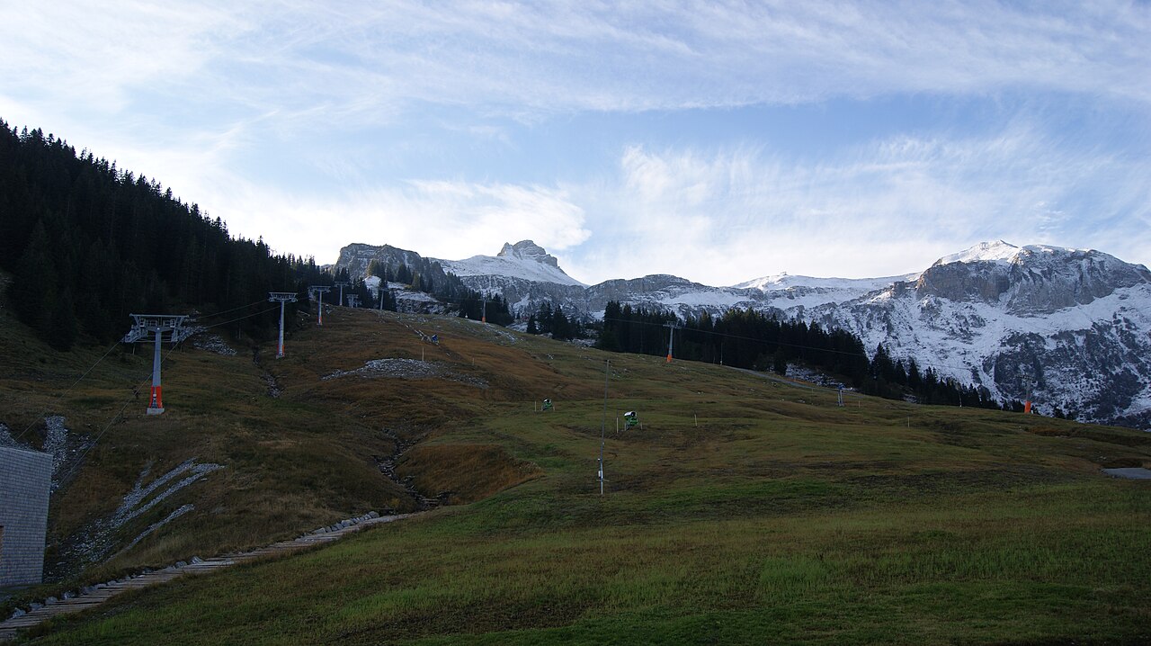
Mellau is a downhill ski area in Vorarlberg, Austria. Mapped terrain includes beginner, easy, intermediate, advanced, expert routes. Its mapped lift network extends from approximately 689 to 1922 metres above sea level. Cross-country skiing is also mapped within the area.
Data: OpenSkiData / OpenSkiMap, OpenStreetMap contributors (ODbL), Skimap.org, Who's On First, Mapterhorn.
Preparing forecast graphs…
Times and values match the detailed forecast. Tap or point at a value for details. Scroll each chart sideways for later days. Rain / precipitation is the total water equivalent per forecast interval, including snow; snowfall is fresh snow per interval, not snow depth.
GFS and ECMWF model comparison. Each model retains its own forecast times and horizon. Precipitation and snowfall amounts cover their own forecast intervals; these can differ between models.
Forecast values and model notes
Mellau - Base lift station
ECMWF · Model run: Next update expected:
Day Time (UTC) Temp. (°C) Humidity (%) Wind (km/h) Wind (knots) Wind (Bft) Direction Precip. (mm) Snow (cm) Pressure (hPa) Freezing (m) Conditions | Wednesday, 04/11 06:00 3.1 80 2 1 1B E — — 1023 1346 Cloudy 60% cloud 09:00 7 69 1 1 0B NE 0 0 1023 1978 Partly cloudy 20% cloud 12:00 10.1 59 3 2 1B NW 0.02 0 1022 2301 Clear 7% cloud 15:00 8.7 71 2 1 1B NE 0 0 1022 2287 Clear 4% cloud 18:00 4.9 74 3 2 1B SE 0 0 1022 1906 Clear 10% cloud 21:00 3.1 74 5 2 1B SE 0 0 1023 1505 Clear 3% cloud Thursday, 05/11 00:00 2.7 74 5 3 1B SE 0 0 1023 1333 Clear 12% cloud 03:00 2.6 74 4 2 1B SE 0 0 1023 1369 Clear 19% cloud 06:00 2.2 74 4 2 1B SE 0 0 1023 < 1125 Partly cloudy 28% cloud 09:00 9.8 55 2 1 1B S 0 0 1024 2915 Partly cloudy 26% cloud 12:00 12.7 49 3 2 1B NW 0 0 1023 2988 Clear 11% cloud 15:00 10.7 68 2 1 1B NW 0 0 1022 2957 Clear 6% cloud 18:00 6.8 72 2 1 1B SE 0 0 1023 2888 Clear 3% cloud 21:00 4.9 70 2 1 1B SE 0 0 1022 2857 Clear 15% cloud Friday, 06/11 00:00 4.5 68 3 1 1B SE 0 0 1021 3112 Partly cloudy 32% cloud 03:00 4.3 68 2 1 1B SE 0 0 1020 3102 Partly cloudy 31% cloud 06:00 4.2 67 1 1 1B SE 0 0 1020 3003 Partly cloudy 41% cloud 09:00 8.9 59 2 1 1B NW 0.02 0 1021 3075 Overcast 88% cloud 12:00 8.6 66 5 3 1B NW 0 0 1021 2854 Overcast 99% cloud 15:00 6.8 80 2 1 1B NW 0.12 0 1022 2526 Overcast 94% cloud 18:00 5.7 86 0 0 0B S 0.26 0 1022 2273 Overcast 94% cloud 21:00 5.1 85 1 0 0B SW 1.6 0 1023 2078 Overcast 100% cloud Saturday, 07/11 00:00 5.1 86 1 1 1B S 2.1 0 1024 1932 Overcast 100% cloud 03:00 5 86 1 0 0B S 1.1 0 1023 1822 Overcast 100% cloud 06:00 5.3 84 1 0 0B S 0.62 0 1023 1806 Overcast 100% cloud 09:00 5.5 86 2 1 1B S 2.3 0 1024 1800 Overcast 99% cloud 12:00 7.2 79 1 1 1B W 0.40 0 1023 1972 Overcast 93% cloud 15:00 7.1 78 1 1 1B N 0.03 0 1023 1939 Overcast 95% cloud 18:00 5.7 84 1 1 1B SE 0.06 0 1023 1781 Cloudy 65% cloud 21:00 3.1 85 1 1 0B SE 0.04 0 1024 1347 Cloudy 66% cloud Sunday, 08/11 00:00 2.8 85 3 2 1B SE 0 0 1024 1257 Cloudy 56% cloud 03:00 2.9 81 3 1 1B SE 0.22 0 1023 1257 Cloudy 68% cloud 06:00 3 78 3 2 1B SE 0.31 0 1023 1289 Cloudy 76% cloud 09:00 7.3 70 1 1 0B S 0.02 0 1024 1872 Clear 18% cloud 12:00 9.7 57 4 2 1B NW 0 0 1022 2099 Clear 5% cloud 15:00 7.9 69 2 1 1B NW 0 0 1022 1979 Clear 1% cloud 18:00 3 73 3 2 1B SE 0 0 1022 1326 Clear 0% cloud 21:00 1.4 67 5 3 1B SE 0 0 1021 < 1125 Partly cloudy 29% cloud Monday, 09/11 00:00 4.2 55 5 2 1B SE 0.03 0 1020 1679 Overcast 97% cloud 03:00 5.4 60 5 2 1B SE 0.67 0 1019 1976 Overcast 88% cloud 06:00 5.1 69 5 2 1B SE 0.96 0 1019 1963 Overcast 97% cloud 09:00 9.6 57 5 3 1B SE 0.09 0 1018 2510 Overcast 83% cloud 12:00 12.2 49 3 1 1B S 0 0 1016 2662 Overcast 85% cloud 15:00 10.2 59 4 2 1B S 0 0 1015 2627 Overcast 100% cloud 18:00 8.7 65 6 3 1B SE 0.11 0 1015 2655 Overcast 100% cloud 21:00 7.8 72 6 3 2B SE 0.42 0 1015 2766 Overcast 99% cloud Tuesday, 10/11 00:00 8 75 8 4 2B SE 0.32 0 1013 2881 Overcast 95% cloud 03:00 8.4 70 8 4 2B SE 0 0 1012 2900 Overcast 99% cloud 06:00 8.8 68 9 5 2B SE 0 0 1010 3039 Overcast 100% cloud |
|---|
Forecast notes
Forecast table times: UTC.
Coordinates: 47.3461017°N, 9.8885352°E · Requested elevation: 705 m. Model terrain: 1123 m. Terrain and 1000/925/850/700 hPa profiles are used for height estimates.
Outside the available profile, temperature uses an estimated 5.5°C/km height correction; wind retains the nearest available model-level value. Humidity is estimated with adjusted pressure and temperature.
These are altitude estimates, not a simulation of local mountain terrain. Precipitation, cloud and sea-level pressure use horizontal interpolation only.
Precipitation includes rain and snow water equivalent: preceding 3 hours through day 6, then 6 hours (see cell tooltip). Snow (cm) estimates fresh snowfall from precipitation and temperature using the GFS conversion; it is not snow depth on the ground. Freezing (m) uses additional 600/500 hPa temperatures when available and estimates the lowest resolved 0°C crossing above sea level. When all sampled levels are warm, the upper profile limit is shown (see tooltip). < marks an entirely cold sampled profile and its lower height limit. No extrapolation is used.
Preparing forecast graphs…
Times and values match the detailed forecast. Tap or point at a value for details. Scroll each chart sideways for later days. Rain / precipitation is the total water equivalent per forecast interval, including snow; snowfall is fresh snow per interval, not snow depth.
GFS and ECMWF model comparison. Each model retains its own forecast times and horizon. Precipitation and snowfall amounts cover their own forecast intervals; these can differ between models.
Forecast values and model notes
Mellau - Top lift station
ECMWF · Model run: Next update expected:
Day Time (UTC) Temp. (°C) Humidity (%) Wind (km/h) Wind (knots) Wind (Bft) Direction Precip. (mm) Snow (cm) Pressure (hPa) Freezing (m) Conditions | Wednesday, 04/11 06:00 -2.1 85 5 3 1B SE — — 1022 1358 Cloudy 54% cloud 09:00 0.7 75 6 3 2B SE 0 0 1023 2039 Clear 14% cloud 12:00 2.9 65 7 4 2B S 0.03 0 1021 2336 Clear 6% cloud 15:00 2.2 73 9 5 2B S 0 0 1021 2312 Clear 3% cloud 18:00 -0.1 70 10 5 2B S 0 0 1022 1906 Clear 8% cloud 21:00 -1 69 11 6 2B S 0 0 1023 1442 Clear 2% cloud Thursday, 05/11 00:00 -1 69 9 5 2B S 0 0 1023 1306 Clear 8% cloud 03:00 -0.9 66 9 5 2B S 0 0 1023 < 1216 Clear 12% cloud 06:00 -0.8 62 10 5 2B S 0 0 1023 < 1216 Partly cloudy 22% cloud 09:00 4.5 52 9 5 2B S 0 0 1023 2935 Clear 18% cloud 12:00 6.4 51 8 5 2B SW 0 0 1022 2997 Clear 9% cloud 15:00 5 67 6 3 1B SW 0 0 1022 2963 Clear 6% cloud 18:00 2.5 66 6 3 1B S 0 0 1022 2887 Clear 3% cloud 21:00 1.2 64 7 4 2B SE 0 0 1022 2831 Clear 14% cloud Friday, 06/11 00:00 1.2 61 7 4 2B S 0 0 1021 3112 Partly cloudy 30% cloud 03:00 1.1 60 5 3 1B S 0 0 1019 3102 Partly cloudy 26% cloud 06:00 1 60 4 2 1B SE 0 0 1019 2994 Partly cloudy 33% cloud 09:00 4.4 56 5 2 1B SE 0.01 0 1020 3074 Overcast 88% cloud 12:00 3.8 66 5 2 1B S 0 0 1021 2866 Overcast 99% cloud 15:00 2 84 7 4 2B SE 0.16 0 1022 2531 Overcast 93% cloud 18:00 1 93 9 5 2B SE 0.25 0.1 1022 2268 Overcast 93% cloud 21:00 0.3 94 10 5 2B SE 1.4 0.4 1023 2046 Overcast 100% cloud Saturday, 07/11 00:00 -0.1 95 12 6 2B S 2.1 0.6 1024 1883 Overcast 100% cloud 03:00 -0.6 96 7 4 2B S 1.1 0.3 1023 1778 Overcast 100% cloud 06:00 -0.6 97 4 2 1B S 0.66 0.2 1023 1772 Overcast 100% cloud 09:00 -0.7 98 6 3 2B SE 2.5 0.7 1024 1774 Overcast 100% cloud 12:00 0.2 92 8 4 2B S 0.38 0.1 1023 1959 Overcast 95% cloud 15:00 0 91 8 4 2B S 0.04 0 1023 1930 Overcast 96% cloud 18:00 -0.8 95 6 3 2B SW 0.06 0 1023 1771 Cloudy 68% cloud 21:00 -2.4 87 6 3 2B SW 0.05 0 1024 1247 Cloudy 74% cloud Sunday, 08/11 00:00 -2.8 91 7 4 2B S 0 0 1024 < 1216 Cloudy 63% cloud 03:00 -3 88 8 4 2B SW 0.18 0.2 1023 < 1216 Cloudy 67% cloud 06:00 -3 87 7 4 2B SW 0.23 0.2 1023 1256 Cloudy 73% cloud 09:00 -0.2 79 7 4 2B SW 0.01 0 1024 1891 Clear 15% cloud 12:00 1.6 60 11 6 2B W 0 0 1022 2125 Clear 3% cloud 15:00 0.5 68 13 7 3B W 0 0 1022 1998 Clear 1% cloud 18:00 -2.2 63 15 8 3B W 0 0 1022 1256 Clear 0% cloud 21:00 -2.8 63 16 8 3B W 0 0 1022 < 1216 Partly cloudy 23% cloud Monday, 09/11 00:00 -0.8 72 13 7 3B W 0.02 0 1020 1677 Overcast 97% cloud 03:00 0.1 74 17 9 3B W 0.49 0.1 1019 1942 Overcast 86% cloud 06:00 0.2 80 19 10 3B SW 0.71 0.2 1019 1973 Overcast 96% cloud 09:00 3.1 64 18 10 3B SW 0.09 0 1018 2521 Overcast 81% cloud 12:00 5.1 59 20 11 3B SW 0 0 1016 2688 Overcast 84% cloud 15:00 3.8 72 20 11 4B W 0 0 1015 2639 Overcast 100% cloud 18:00 3.1 78 20 11 4B SW 0.10 0 1015 2660 Overcast 100% cloud 21:00 2.7 83 20 11 4B SW 0.34 0 1015 2765 Overcast 99% cloud Tuesday, 10/11 00:00 3 87 23 12 4B W 0.33 0 1014 2887 Overcast 96% cloud 03:00 3.3 85 18 10 3B SW 0 0 1012 2901 Overcast 99% cloud 06:00 3.7 82 14 7 3B SW 0 0 1011 3039 Overcast 100% cloud |
|---|
Forecast notes
Forecast table times: UTC.
Coordinates: 47.3130085°N, 9.8944767°E · Requested elevation: 1922 m. Model terrain: 1214 m. Terrain and 1000/925/850/700 hPa profiles are used for height estimates.
These are altitude estimates, not a simulation of local mountain terrain. Precipitation, cloud and sea-level pressure use horizontal interpolation only.
Precipitation includes rain and snow water equivalent: preceding 3 hours through day 6, then 6 hours (see cell tooltip). Snow (cm) estimates fresh snowfall from precipitation and temperature using the GFS conversion; it is not snow depth on the ground. Freezing (m) uses additional 600/500 hPa temperatures when available and estimates the lowest resolved 0°C crossing above sea level. When all sampled levels are warm, the upper profile limit is shown (see tooltip). < marks an entirely cold sampled profile and its lower height limit. No extrapolation is used.