Spinale · Madonna di Campiglio · Panorama
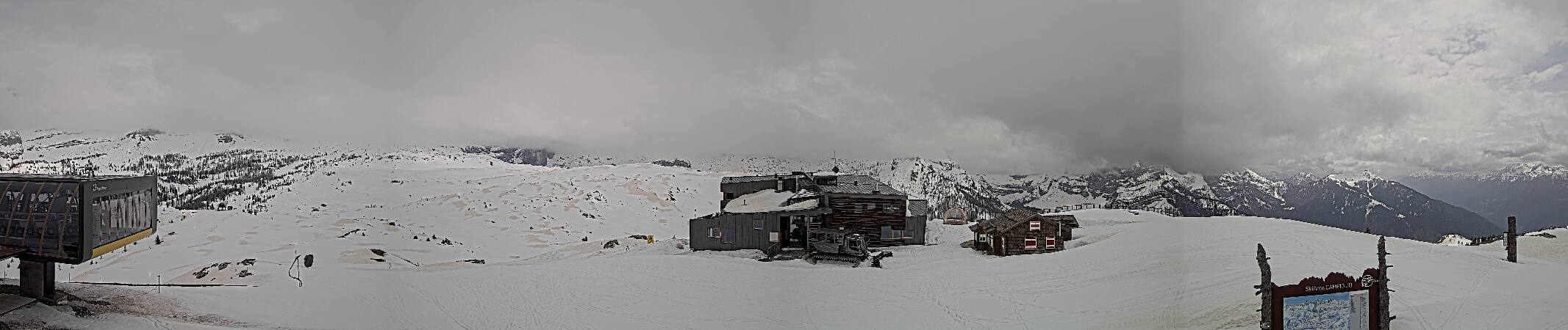
Provider panorama/video player. Capture time is shown by the camera.
Open camera page ↗
Jede Farbe beginnt beim angegebenen Wert. Die Windfarben stimmen in allen drei Einheiten überein. Trockene Zellen bleiben neutral. Die Farben beschreiben die Werte und sind keine amtlichen Wetterwarnungen.
Diagramme werden vorbereitet…
Zeiten und Werte entsprechen der detaillierten Vorhersage. Tippen Sie auf einen Wert für Details und scrollen Sie seitlich für spätere Tage. Niederschlag ist das gesamte Wasseräquivalent je Intervall einschließlich Schnee. Neuschnee gilt je Intervall und ist keine Schneehöhe am Boden.
Vergleich von GFS und ECMWF. Jedes Modell behält seine eigenen Vorhersagezeiten und seinen Zeitraum. Niederschlags- und Schneemengen gelten für die jeweiligen, möglicherweise unterschiedlichen Intervalle.
ECMWF · Modelllauf: Nächste Aktualisierung erwartet:
Tag Ortszeit Temp. (°C) Luftfeuchtigkeit (%) Wind (km/h) Wind (Knoten) Wind (Bft) Richtung Niederschlag (mm) Neuschnee (cm) Luftdruck (hPa) Nullgradgrenze (m) Wetterlage | Mittwoch, 04/11 07:00 1.3 88 1 0 0B NW — — 1024 1745 Overcast 98% cloud  10:00 2.7 86 2 1 1B NE 0.12 0 1025 1937 Overcast 83% cloud 13:00 4.2 76 2 1 1B E 0.31 0 1025 2103 Overcast 95% cloud 16:00 3.7 80 2 1 1B E 0.15 0 1025 2081 Overcast 99% cloud 19:00 2 85 0 0 0B S 0.06 0 1027 1867 Overcast 82% cloud 22:00 -0.5 88 2 1 1B W 0 0 1028 < 1635 Cloudy 57% cloud  Donnerstag, 05/11 01:00 -1.9 87 4 2 1B W 0 0 1028 < 1635 Cloudy 67% cloud 04:00 -2.6 88 4 2 1B W 0 0 1028 < 1635 Partly cloudy 47% cloud  07:00 -3.1 84 2 1 1B W 0 0 1028 < 1635 Partly cloudy 25% cloud 10:00 4.4 63 1 1 0B SE 0 0 1028 2510 Clear 13% cloud  13:00 6.9 60 2 1 1B SE 0 0 1026 2706 Clear 5% cloud 16:00 5.5 72 2 1 1B E 0 0 1025 2739 Clear 4% cloud 19:00 0.8 81 1 1 1B W 0 0 1026 1756 Clear 3% cloud 22:00 -0.8 79 1 1 1B W 0 0 1026 < 1635 Clear 14% cloud Freitag, 06/11 01:00 -1.2 77 2 1 1B W 0 0 1025 < 1635 Clear 1% cloud 04:00 -1.3 75 2 1 1B W 0 0 1024 < 1635 Clear 6% cloud 07:00 -1.4 75 2 1 1B W 0 0 1023 < 1635 Cloudy 67% cloud 10:00 5.8 57 1 0 0B SE 0 0 1023 2804 Overcast 88% cloud 13:00 7.8 57 3 1 1B SE 0 0 1020 2749 Overcast 98% cloud 16:00 5.4 75 1 0 0B E 0.15 0 1021 2567 Overcast 100% cloud 19:00 3.7 83 0 0 0B W 0.40 0 1021 2317 Overcast 98% cloud 22:00 2.8 89 1 0 0B SW 1.5 0 1022 2080 Overcast 100% cloud Samstag, 07/11 01:00 2.3 90 1 0 0B W 2.1 0 1022 1959 Overcast 100% cloud 04:00 1.9 90 0 0 0B SW 2.6 0 1022 1849 Overcast 100% cloud 07:00 1.3 92 1 0 0B NW 4.1 0 1024 1745 Overcast 100% cloud 10:00 2.5 86 2 1 1B NE 0.46 0 1024 1924 Overcast 100% cloud 13:00 3.1 84 2 1 1B E 0.27 0 1023 2001 Overcast 99% cloud 16:00 2.9 86 2 1 1B E 0.15 0 1023 1971 Overcast 93% cloud 19:00 1.8 91 0 0 0B — 0.26 0 1024 1823 Overcast 89% cloud 22:00 1.2 91 0 0 0B SW 0.01 0 1025 1727 Overcast 97% cloud Sonntag, 08/11 01:00 1.5 90 0 0 0B W 0.40 0 1025 1766 Overcast 100% cloud 04:00 1.2 93 0 0 0B SE 1.3 0 1025 1720 Overcast 100% cloud 07:00 1.3 92 0 0 0B S 0.47 0 1025 1730 Overcast 99% cloud 10:00 2.7 83 1 1 0B SE 0.06 0 1025 1915 Overcast 88% cloud 13:00 3.6 77 2 1 1B SE 0.15 0 1024 2046 Cloudy 60% cloud 16:00 3.5 81 2 1 1B E 0.10 0 1024 2073 Cloudy 69% cloud 19:00 1.5 89 0 0 0B SE 0.13 0 1025 1832 Cloudy 79% cloud 22:00 -0.2 91 2 1 1B W 0.23 0 1026 < 1635 Cloudy 76% cloud Montag, 09/11 01:00 -0.4 85 1 1 1B W 0.03 0 1025 < 1635 Cloudy 55% cloud 04:00 -0.6 82 1 1 1B W 0 0 1025 < 1635 Overcast 81% cloud 07:00 -0.3 80 2 1 1B W 0 0 1025 < 1635 Cloudy 74% cloud 10:00 3.3 71 1 0 0B S 0 0 1024 2431 Cloudy 51% cloud 13:00 5.1 68 1 1 1B S 0 0 1022 2558 Cloudy 65% cloud 16:00 4.6 75 0 0 0B SE 0 0 1021 2448 Overcast 96% cloud 19:00 3.1 85 1 1 1B SW 0.05 0 1022 2261 Overcast 99% cloud 22:00 2.9 88 2 1 1B W 0.16 0 1022 2300 Overcast 97% cloud Dienstag, 10/11 01:00 3.2 88 2 1 1B SW 0.23 0 1020 2397 Overcast 97% cloud 04:00 3.3 89 2 1 1B W 0.17 0 1018 2527 Overcast 100% cloud 07:00 3.3 90 2 1 1B SW 0.06 0 1018 2565 Overcast 100% cloud |
|---|
Forecast table times: Europe/Rome.
Coordinates: 46.22830303°N, 10.82874298°E · Requested elevation: 1508 m. Model terrain: 1632 m. Terrain and 1000/925/850/700 hPa profiles are used for height estimates.
Outside the available profile, temperature uses an estimated 5.5°C/km height correction; wind retains the nearest available model-level value. Humidity is estimated with adjusted pressure and temperature.
These are altitude estimates, not a simulation of local mountain terrain. Precipitation, cloud and sea-level pressure use horizontal interpolation only.
Precipitation includes rain and snow water equivalent: preceding 3 hours through day 6, then 6 hours (see cell tooltip). Snow (cm) estimates fresh snowfall from precipitation and temperature using the GFS conversion; it is not snow depth on the ground. Freezing (m) uses additional 600/500 hPa temperatures when available and estimates the lowest resolved 0°C crossing above sea level. When all sampled levels are warm, the upper profile limit is shown (see tooltip). < marks an entirely cold sampled profile and its lower height limit. No extrapolation is used.
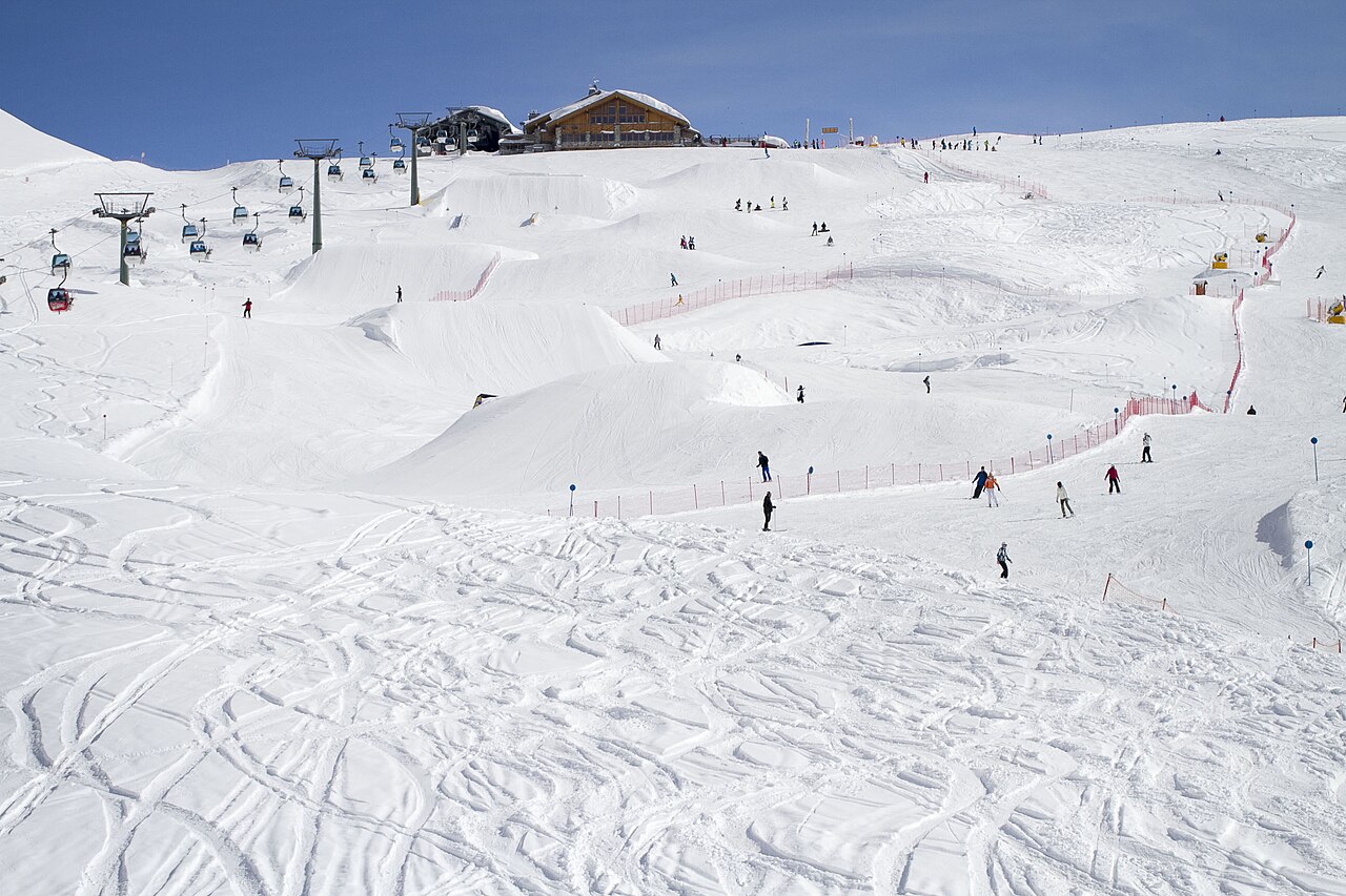
Provider panorama/video player. Capture time is shown by the camera.
Open camera page ↗Diagramme werden vorbereitet…
Zeiten und Werte entsprechen der detaillierten Vorhersage. Tippen Sie auf einen Wert für Details und scrollen Sie seitlich für spätere Tage. Niederschlag ist das gesamte Wasseräquivalent je Intervall einschließlich Schnee. Neuschnee gilt je Intervall und ist keine Schneehöhe am Boden.
Vergleich von GFS und ECMWF. Jedes Modell behält seine eigenen Vorhersagezeiten und seinen Zeitraum. Niederschlags- und Schneemengen gelten für die jeweiligen, möglicherweise unterschiedlichen Intervalle.
ECMWF · Modelllauf: Nächste Aktualisierung erwartet:
Tag Ortszeit Temp. (°C) Luftfeuchtigkeit (%) Wind (km/h) Wind (Knoten) Wind (Bft) Richtung Niederschlag (mm) Neuschnee (cm) Luftdruck (hPa) Nullgradgrenze (m) Wetterlage | Mittwoch, 04/11 07:00 -1.5 92 3 1 1B E — — 1024 1745 Overcast 98% cloud 10:00 -0.4 91 5 3 1B SE 0.11 0 1025 1935 Overcast 82% cloud 13:00 0.8 82 5 3 1B SE 0.29 0.1 1025 2105 Overcast 94% cloud 16:00 0.5 85 4 2 1B SE 0.14 0 1025 2083 Overcast 99% cloud 19:00 -0.7 87 4 2 1B S 0.05 0 1026 1879 Overcast 81% cloud 22:00 -2.1 84 4 2 1B SW 0 0 1028 < 1582 Cloudy 55% cloud Donnerstag, 05/11 01:00 -2.9 83 5 3 1B SW 0 0 1028 < 1582 Cloudy 65% cloud 04:00 -3.2 82 6 3 1B SW 0 0 1028 < 1582 Partly cloudy 48% cloud 07:00 -3.4 77 6 3 1B SW 0 0 1028 < 1582 Partly cloudy 27% cloud 10:00 2.2 63 5 3 1B SW 0 0 1028 2510 Clear 14% cloud 13:00 4 61 4 2 1B SW 0 0 1026 2706 Clear 5% cloud 16:00 3.3 71 2 1 1B S 0 0 1025 2747 Clear 4% cloud 19:00 0 75 2 1 1B SW 0 0 1026 2005 Clear 3% cloud 22:00 -1.1 73 3 1 1B SW 0 0 1026 < 1582 Clear 14% cloud Freitag, 06/11 01:00 -1.5 71 4 2 1B SW 0 0 1025 < 1582 Clear 2% cloud 04:00 -1.5 69 4 2 1B SW 0 0 1024 < 1582 Clear 7% cloud 07:00 -1.5 69 4 2 1B SW 0 0 1023 < 1582 Cloudy 64% cloud 10:00 3.4 58 6 3 1B S 0 0 1023 2803 Overcast 87% cloud 13:00 4.7 66 7 4 2B S 0 0 1020 2749 Overcast 98% cloud 16:00 2.9 80 6 3 2B S 0.14 0 1021 2575 Overcast 100% cloud 19:00 1.5 86 6 3 2B SE 0.38 0 1021 2328 Overcast 98% cloud 22:00 0.4 88 8 4 2B SE 1.4 0.4 1022 2093 Overcast 100% cloud Samstag, 07/11 01:00 -0.2 92 7 4 2B SE 2.0 0.6 1022 1969 Overcast 100% cloud 04:00 -0.8 94 6 3 2B SE 2.5 0.8 1022 1855 Overcast 100% cloud 07:00 -1.4 96 5 3 1B SE 4.1 1.6 1024 1748 Overcast 100% cloud 10:00 -0.5 92 4 2 1B SE 0.43 0.1 1024 1923 Overcast 100% cloud 13:00 -0 90 3 2 1B SE 0.26 0.1 1023 1998 Overcast 99% cloud 16:00 -0.2 91 2 1 1B SE 0.14 0 1023 1971 Overcast 93% cloud 19:00 -1 93 3 1 1B S 0.25 0 1024 1829 Overcast 88% cloud 22:00 -1.5 94 3 2 1B S 0.01 0 1025 1736 Overcast 97% cloud Sonntag, 08/11 01:00 -1.4 95 3 1 1B S 0.43 0.1 1025 1767 Overcast 100% cloud 04:00 -1.6 97 3 1 1B SW 1.3 0.4 1025 1721 Overcast 100% cloud 07:00 -1.7 96 3 2 1B SW 0.47 0.1 1025 1724 Overcast 99% cloud 10:00 -0.7 89 4 2 1B SW 0.07 0 1026 1904 Overcast 88% cloud 13:00 0.3 80 3 2 1B W 0.15 0 1025 2040 Cloudy 60% cloud 16:00 0.4 80 3 2 1B W 0.09 0 1024 2072 Cloudy 68% cloud 19:00 -0.6 83 5 2 1B W 0.13 0 1025 1854 Cloudy 77% cloud 22:00 -1.6 82 6 3 1B W 0.22 0 1026 < 1582 Cloudy 75% cloud Montag, 09/11 01:00 -1.6 74 6 3 2B W 0.03 0 1025 < 1582 Cloudy 58% cloud 04:00 -1.7 77 6 3 2B W 0 0 1025 < 1582 Overcast 82% cloud 07:00 -1.3 79 7 4 2B W 0 0 1025 < 1582 Cloudy 76% cloud 10:00 1.4 71 6 3 2B W 0 0 1025 2436 Cloudy 54% cloud 13:00 2.7 69 9 5 2B W 0 0 1022 2566 Cloudy 68% cloud 16:00 2.2 80 11 6 2B W 0 0 1021 2454 Overcast 95% cloud 19:00 1 90 12 6 2B W 0.05 0 1022 2268 Overcast 98% cloud 22:00 1 91 13 7 3B W 0.16 0 1022 2314 Overcast 98% cloud Dienstag, 10/11 01:00 1.3 92 14 8 3B W 0.23 0 1020 2405 Overcast 97% cloud 04:00 1.5 92 13 7 3B W 0.18 0 1018 2541 Overcast 100% cloud 07:00 1.6 94 13 7 3B SW 0.07 0 1018 2575 Overcast 100% cloud |
|---|
Forecast table times: Europe/Rome.
Coordinates: 46.2245028°N, 10.84299088°E · Requested elevation: 2001 m. Model terrain: 1580 m. Terrain and 1000/925/850/700 hPa profiles are used for height estimates.
These are altitude estimates, not a simulation of local mountain terrain. Precipitation, cloud and sea-level pressure use horizontal interpolation only.
Precipitation includes rain and snow water equivalent: preceding 3 hours through day 6, then 6 hours (see cell tooltip). Snow (cm) estimates fresh snowfall from precipitation and temperature using the GFS conversion; it is not snow depth on the ground. Freezing (m) uses additional 600/500 hPa temperatures when available and estimates the lowest resolved 0°C crossing above sea level. When all sampled levels are warm, the upper profile limit is shown (see tooltip). < marks an entirely cold sampled profile and its lower height limit. No extrapolation is used.
Diagramme werden vorbereitet…
Zeiten und Werte entsprechen der detaillierten Vorhersage. Tippen Sie auf einen Wert für Details und scrollen Sie seitlich für spätere Tage. Niederschlag ist das gesamte Wasseräquivalent je Intervall einschließlich Schnee. Neuschnee gilt je Intervall und ist keine Schneehöhe am Boden.
Vergleich von GFS und ECMWF. Jedes Modell behält seine eigenen Vorhersagezeiten und seinen Zeitraum. Niederschlags- und Schneemengen gelten für die jeweiligen, möglicherweise unterschiedlichen Intervalle.
ECMWF · Modelllauf: Nächste Aktualisierung erwartet:
Tag Ortszeit Temp. (°C) Luftfeuchtigkeit (%) Wind (km/h) Wind (Knoten) Wind (Bft) Richtung Niederschlag (mm) Neuschnee (cm) Luftdruck (hPa) Nullgradgrenze (m) Wetterlage | Mittwoch, 04/11 07:00 -4.5 94 7 4 2B E — — 1024 1742 Overcast 98% cloud 10:00 -3.7 93 10 6 2B SE 0.08 0.1 1025 1929 Cloudy 77% cloud 13:00 -2.9 87 11 6 2B SE 0.18 0.2 1025 2115 Overcast 91% cloud 16:00 -2.8 87 9 5 2B SE 0.09 0 1025 2094 Overcast 98% cloud 19:00 -3.3 83 9 5 2B S 0.05 0.1 1026 1920 Cloudy 76% cloud 22:00 -3.3 73 9 5 2B SW 0 0 1028 1539 Partly cloudy 47% cloud Donnerstag, 05/11 01:00 -3.4 73 8 5 2B SW 0 0 1028 < 1382 Cloudy 57% cloud 04:00 -3.1 70 10 6 2B SW 0 0 1028 < 1382 Partly cloudy 50% cloud 07:00 -2.8 64 12 6 2B SW 0 0 1028 < 1382 Partly cloudy 33% cloud 10:00 0 57 12 7 3B SW 0 0 1029 2511 Clear 17% cloud 13:00 1.1 58 10 5 2B SW 0 0 1027 2708 Clear 6% cloud 16:00 1.2 63 5 3 1B SW 0 0 1026 2775 Clear 3% cloud 19:00 -0.1 63 5 3 1B SW 0 0 1026 2434 Clear 3% cloud 22:00 -0.7 62 6 3 2B SW 0 0 1026 1674 Clear 10% cloud Freitag, 06/11 01:00 -0.9 61 8 4 2B SW 0 0 1026 < 1382 Clear 3% cloud 04:00 -0.8 57 8 5 2B SW 0 0 1024 < 1382 Clear 10% cloud 07:00 -0.8 57 10 5 2B S 0 0 1024 < 1382 Cloudy 52% cloud 10:00 1.2 55 14 7 3B S 0 0 1023 2802 Overcast 84% cloud 13:00 1.5 78 15 8 3B S 0 0 1021 2754 Overcast 96% cloud 16:00 0.5 82 14 8 3B S 0.08 0 1020 2603 Overcast 100% cloud 19:00 -0.6 82 16 8 3B SE 0.33 0.1 1021 2367 Overcast 96% cloud 22:00 -1.8 79 19 10 3B SE 0.91 0.3 1022 2137 Overcast 100% cloud Samstag, 07/11 01:00 -2.6 90 20 11 3B SE 1.5 0.5 1022 2004 Overcast 100% cloud 04:00 -3.4 95 17 9 3B SE 2.2 2.2 1022 1878 Overcast 100% cloud 07:00 -4 96 14 8 3B SE 4.0 4 1023 1763 Overcast 100% cloud 10:00 -3.5 96 9 5 2B SE 0.34 0.3 1024 1926 Overcast 100% cloud 13:00 -3.3 93 8 4 2B S 0.19 0.2 1023 1992 Overcast 98% cloud 16:00 -3.5 93 6 3 1B S 0.08 0.1 1023 1973 Overcast 90% cloud 19:00 -3.9 89 7 4 2B S 0.19 0.2 1024 1850 Overcast 81% cloud 22:00 -4.2 94 7 4 2B S 0.02 0 1025 1766 Overcast 96% cloud Sonntag, 08/11 01:00 -4.3 95 7 4 2B S 0.56 0.6 1025 1771 Overcast 100% cloud 04:00 -4.5 96 6 3 2B SW 1.3 1.3 1025 1724 Overcast 100% cloud 07:00 -4.8 97 8 4 2B SW 0.44 0.4 1025 1705 Overcast 99% cloud 10:00 -4.3 89 9 5 2B W 0.09 0.1 1026 1867 Overcast 88% cloud 13:00 -3.2 74 10 5 2B W 0.13 0.1 1025 2027 Cloudy 61% cloud 16:00 -2.6 69 10 5 2B W 0.06 0 1024 2074 Cloudy 64% cloud 19:00 -2.6 66 12 6 2B W 0.12 0 1025 1923 Cloudy 72% cloud 22:00 -2.7 67 11 6 2B W 0.16 0 1026 1669 Cloudy 68% cloud Montag, 09/11 01:00 -2.2 56 13 7 3B W 0.03 0 1026 1658 Cloudy 68% cloud 04:00 -2.2 66 14 7 3B W 0 0 1025 1548 Overcast 87% cloud 07:00 -1.7 73 13 7 3B W 0 0 1025 1614 Overcast 83% cloud 10:00 -0.1 67 14 8 3B W 0 0 1025 2459 Cloudy 66% cloud 13:00 0.4 66 22 12 4B W 0 0 1023 2598 Cloudy 79% cloud 16:00 -0.1 82 27 14 4B W 0 0 1022 2483 Overcast 95% cloud 19:00 -0.8 92 27 15 4B W 0.07 0 1022 2294 Overcast 98% cloud 22:00 -0.4 91 29 16 5B W 0.17 0 1022 2368 Overcast 98% cloud Dienstag, 10/11 01:00 -0.2 93 33 18 5B W 0.22 0 1021 2440 Overcast 97% cloud 04:00 0.3 91 29 16 5B W 0.20 0 1019 2598 Overcast 100% cloud 07:00 0.3 95 30 16 5B SW 0.09 0 1018 2612 Overcast 100% cloud |
|---|
Forecast table times: Europe/Rome.
Coordinates: 46.21143751°N, 10.9006691°E · Requested elevation: 2502 m. Model terrain: 1379 m. Terrain and 1000/925/850/700 hPa profiles are used for height estimates.
These are altitude estimates, not a simulation of local mountain terrain. Precipitation, cloud and sea-level pressure use horizontal interpolation only.
Precipitation includes rain and snow water equivalent: preceding 3 hours through day 6, then 6 hours (see cell tooltip). Snow (cm) estimates fresh snowfall from precipitation and temperature using the GFS conversion; it is not snow depth on the ground. Freezing (m) uses additional 600/500 hPa temperatures when available and estimates the lowest resolved 0°C crossing above sea level. When all sampled levels are warm, the upper profile limit is shown (see tooltip). < marks an entirely cold sampled profile and its lower height limit. No extrapolation is used.