全球滑雪场天气预报

颜色说明 温度 · 风 · 降雨 · 降雪
每种颜色从所示数值开始。三种风速单位的颜色相互对应。无降水单元格保持中性色。颜色仅描述显示值,并非官方天气预警。
正在准备预报图表…
时间和数值与详细预报一致。点击数值查看详情,横向滚动查看后续日期。降水量为每时段总水当量,包含降雪;新雪量指每时段新增降雪,并非地面积雪深度。
GFS与ECMWF模式对比。各模式保留各自的预报时间和时长。降水量和降雪量对应各模式自身的时段,模式之间的时段可能不同。
预报数值与模式说明
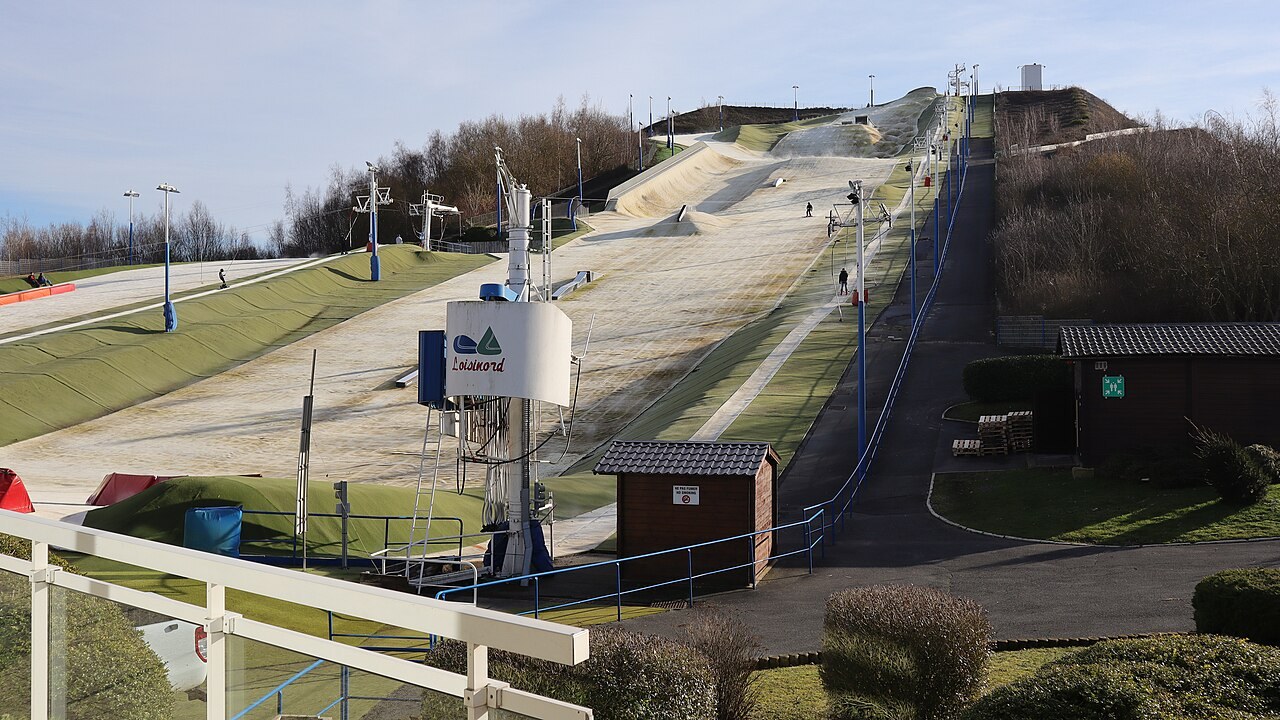
Loisinord - Noeux-les-Mines - Outdoor dry slope
ECMWF · 模式起报时间: 预计下次更新:
日期 时间(UTC) 气温(°C) 湿度(%) 风速(km/h) 风速(节) 风力(Bft) 风向 降水(mm) 新雪(cm) 气压(hPa) 零度层(m) 天气状况 | 星期三, 04/11 06:00 4.6 79 16 9 3B NE — — 1028 954 Cloudy 50% cloud  09:00 7 73 16 9 3B NE 0 0 1028 1612 Overcast 86% cloud  12:00 8.8 66 18 10 3B NE 0 0 1027 1928 Clear 19% cloud  15:00 8.5 70 15 8 3B NE 0 0 1027 1196 Overcast 99% cloud 18:00 8.1 72 16 9 3B NE 0 0 1027 1197 Overcast 100% cloud 21:00 7.5 79 16 8 3B NE 0 0 1027 1249 Overcast 87% cloud 星期四, 05/11 00:00 5 88 12 7 2B NE 0 0 1027 1784 Clear 0% cloud 03:00 3.6 92 11 6 2B NE 0 0 1026 2042 Clear 0% cloud 06:00 2.7 95 9 5 2B E 0 0 1025 2361 Clear 0% cloud 09:00 5 87 8 4 2B E 0 0 1026 2437 Clear 0% cloud 12:00 8.6 74 8 5 2B E 0 0 1025 2504 Clear 0% cloud 15:00 9.2 76 8 4 2B NE 0 0 1024 2469 Partly cloudy 41% cloud  18:00 6 92 7 4 2B NE 0 0 1025 2434 Clear 0% cloud 21:00 4.4 95 5 3 1B E 0 0 1025 2453 Clear 0% cloud 星期五, 06/11 00:00 3.3 98 3 2 1B E 0 0 1024 2455 Clear 1% cloud 03:00 2.1 100 2 1 1B NE 0 0 1024 2406 Overcast 89% cloud 06:00 2.2 98 1 0 0B NE 0 0 1023 2394 Overcast 100% cloud 09:00 3.3 99 0 0 0B N 0 0 1024 2409 Overcast 100% cloud 12:00 6.6 90 1 1 1B N 0 0 1024 2316 Overcast 100% cloud 15:00 7.2 88 2 1 1B N 0.08 0 1023 2189 Overcast 100% cloud 18:00 6 96 1 0 0B E 0.24 0 1023 2107 Overcast 100% cloud 21:00 5.8 97 2 1 1B SW 0.54 0 1024 1985 Overcast 100% cloud 星期六, 07/11 00:00 5.1 99 4 2 1B SW 0.00 0 1023 1914 Overcast 100% cloud 03:00 5.2 98 5 3 1B SW 0 0 1022 1902 Overcast 99% cloud 06:00 5.1 98 4 2 1B SW 0 0 1022 1905 Overcast 94% cloud 09:00 7.7 97 5 3 1B SW 0 0 1023 1903 Overcast 100% cloud 12:00 10.6 84 5 3 1B W 0.16 0 1022 1823 Overcast 89% cloud 15:00 10.5 87 5 3 1B W 0.04 0 1021 1502 Overcast 99% cloud 18:00 8.6 93 4 2 1B SW 0 0 1022 1518 Overcast 86% cloud 21:00 7 94 6 3 1B SW 0 0 1022 1683 Overcast 95% cloud 星期日, 08/11 00:00 7.2 95 7 4 2B SW 0.01 0 1022 1720 Overcast 96% cloud 03:00 7.1 97 8 4 2B S 0.02 0 1021 1515 Overcast 90% cloud 06:00 5.9 98 8 4 2B S 0.18 0 1021 1418 Cloudy 62% cloud 09:00 7.7 94 9 5 2B S 0.03 0 1022 1398 Cloudy 66% cloud 12:00 10.4 72 11 6 2B S 0.08 0 1021 1330 Partly cloudy 25% cloud 15:00 9.7 71 8 4 2B SE 0 0 1020 1317 Partly cloudy 50% cloud 18:00 7 84 6 4 2B SE 0 0 1019 1488 Clear 3% cloud 21:00 4.1 90 6 3 2B E 0 0 1019 1756 Clear 2% cloud 星期一, 09/11 00:00 2.8 94 6 3 1B SE 0 0 1018 1880 Clear 0% cloud 03:00 1.8 97 5 3 1B E 0 0 1017 1971 Overcast 93% cloud 06:00 1.8 97 5 3 1B E 0 0 1016 2009 Overcast 99% cloud 09:00 3.7 97 7 4 2B NE 0.31 0 1015 2033 Overcast 100% cloud 12:00 6 94 6 3 2B NE 0.41 0 1014 2131 Overcast 93% cloud 15:00 7.9 89 7 4 2B NE 0 0 1013 2213 Overcast 97% cloud 18:00 5.9 95 9 5 2B NE 0 0 1013 2576 Overcast 100% cloud 21:00 5.2 97 9 5 2B NE 0 0 1012 2765 Overcast 100% cloud 星期二, 10/11 00:00 5.2 97 10 6 2B NE 0 0 1011 2934 Overcast 100% cloud 03:00 4.8 98 11 6 2B NE 0 0 1009 2986 Overcast 100% cloud 06:00 4.6 98 14 7 3B NE 0.03 0 1008 2960 Overcast 100% cloud |
|---|
Forecast notes
Forecast table times: UTC.
Coordinates: 50.47209°N, 2.678827°E · Requested elevation: 56 m. Model terrain: 56 m. Terrain and 1000/925/850/700 hPa profiles are used for height estimates.
These are altitude estimates, not a simulation of local mountain terrain. Precipitation, cloud and sea-level pressure use horizontal interpolation only.
Precipitation includes rain and snow water equivalent: preceding 3 hours through day 6, then 6 hours (see cell tooltip). Snow (cm) estimates fresh snowfall from precipitation and temperature using the GFS conversion; it is not snow depth on the ground. Freezing (m) uses additional 600/500 hPa temperatures when available and estimates the lowest resolved 0°C crossing above sea level. When all sampled levels are warm, the upper profile limit is shown (see tooltip). < marks an entirely cold sampled profile and its lower height limit. No extrapolation is used.
Outdoor dry ski slope · Synthetic surface; weather forecast for the outdoor location.