Previsiones para estaciones de esquí de todo el mundo

Guía de colores Temperatura · Viento · Lluvia · Nieve
Cada color comienza en el valor indicado. Los colores del viento coinciden en las tres unidades. Las celdas sin precipitación permanecen neutras. Los colores describen los valores mostrados, no son avisos meteorológicos oficiales.
Preparando gráficos de previsión…
Las horas y los valores coinciden con la previsión detallada. Toca un valor para ver detalles y desplaza los gráficos horizontalmente para los próximos días. La precipitación es el equivalente total en agua por intervalo, incluida la nieve; la nieve nueva corresponde a cada intervalo, no al espesor de nieve en el suelo.
Comparación de GFS y ECMWF. Cada modelo conserva sus propias horas y horizonte de previsión. Las cantidades de precipitación y nieve corresponden a sus propios intervalos, que pueden diferir entre modelos.
Valores de previsión y notas de los modelos
Kronplatz - Plan de Corones - Low lift station
ECMWF · Ejecución del modelo: Próxima actualización prevista:
Día Hora (UTC) Temp. (°C) Humedad (%) Viento (km/h) Viento (nudos) Viento (Bft) Dirección Precip. (mm) Nieve nueva (cm) Presión (hPa) Isoterma de 0 °C (m) Condiciones | Miércoles, 04/11 06:00 3.7 77 2 1 1B SE — — 1025 < 1632 Overcast 99% cloud  09:00 7.3 61 2 1 1B E 0.08 0 1025 2094 Overcast 85% cloud 12:00 8.8 53 5 2 1B E 0.00 0 1025 2233 Cloudy 75% cloud  15:00 8.1 57 2 1 1B E 0 0 1024 2223 Overcast 92% cloud 18:00 5 66 2 1 1B SE 0.06 0 1026 1932 Partly cloudy 42% cloud  21:00 2.5 71 3 1 1B SE 0 0 1028 < 1632 Partly cloudy 45% cloud Jueves, 05/11 00:00 1.3 75 3 2 1B SE 0 0 1028 < 1632 Partly cloudy 32% cloud 03:00 0.8 74 2 1 1B SE 0 0 1029 < 1632 Partly cloudy 30% cloud 06:00 0.7 72 2 1 1B SE 0 0 1029 < 1632 Clear 20% cloud  09:00 7.9 53 1 1 1B N 0 0 1028 2642 Clear 6% cloud 12:00 11.4 42 3 2 1B NW 0 0 1025 2828 Clear 1% cloud 15:00 9.3 51 2 1 1B NW 0 0 1024 2957 Clear 0% cloud 18:00 4.9 57 1 0 0B SE 0 0 1026 2753 Clear 0% cloud 21:00 3.5 62 1 1 0B SE 0 0 1026 < 1632 Clear 0% cloud Viernes, 06/11 00:00 3 62 1 0 0B SE 0 0 1025 < 1632 Clear 0% cloud 03:00 2.7 61 1 1 1B SE 0 0 1024 < 1632 Clear 0% cloud 06:00 2.7 59 1 1 0B SE 0 0 1024 < 1632 Clear 0% cloud 09:00 9.8 41 1 1 0B NW 0 0 1022 3033 Clear 0% cloud 12:00 13.1 35 3 1 1B NW 0 0 1019 2959 Clear 0% cloud 15:00 10.6 46 1 0 0B SW 0 0 1018 2857 Clear 16% cloud 18:00 4.6 62 3 2 1B SE 0 0 1019 2032 Clear 9% cloud 21:00 3.7 68 4 2 1B SE 0 0 1021 < 1632 Overcast 98% cloud Sábado, 07/11 00:00 4.4 68 3 1 1B E 0.01 0 1022 1786 Overcast 100% cloud 03:00 3.9 69 2 1 1B SE 0.00 0 1021 1651 Overcast 81% cloud 06:00 3.1 68 3 1 1B SE 0 0 1022 < 1632 Cloudy 64% cloud 09:00 7.5 53 3 2 1B E 0.01 0 1023 2164 Overcast 99% cloud 12:00 7.8 50 1 1 0B S 0.23 0 1023 2155 Overcast 88% cloud 15:00 7.1 48 2 1 1B SE 0.00 0 1022 2105 Overcast 99% cloud 18:00 5.1 53 3 2 1B SE 0.12 0 1024 1857 Overcast 97% cloud 21:00 4.8 58 2 1 1B SE 0.03 0 1025 1807 Overcast 95% cloud Domingo, 08/11 00:00 3.7 62 2 1 1B SE 0 0 1025 < 1632 Cloudy 79% cloud 03:00 2.8 65 2 1 1B SE 0 0 1025 < 1632 Cloudy 79% cloud 06:00 3.3 66 2 1 1B SE 0.21 0 1025 < 1632 Overcast 98% cloud 09:00 5.6 58 0 0 0B S 0.00 0 1026 1880 Overcast 95% cloud 12:00 7.3 53 0 0 0B N 0.01 0 1024 2053 Overcast 88% cloud 15:00 6.6 59 1 1 1B N 0.01 0 1024 1994 Cloudy 76% cloud 18:00 2.7 68 2 1 1B SE 0 0 1025 < 1632 Partly cloudy 26% cloud 21:00 0.7 71 3 1 1B SE 0 0 1025 < 1632 Partly cloudy 27% cloud Lunes, 09/11 00:00 -0 71 2 1 1B SE 0 0 1026 < 1632 Partly cloudy 25% cloud 03:00 0.2 68 1 1 0B SE 0 0 1025 < 1632 Overcast 94% cloud 06:00 0.5 64 1 1 0B SE 0.02 0 1026 < 1632 Cloudy 63% cloud 09:00 6 49 1 1 1B W 0 0 1025 2283 Partly cloudy 47% cloud 12:00 9.1 45 2 1 1B NW 0 0 1022 2632 Partly cloudy 34% cloud 15:00 6.7 60 2 1 1B W 0 0 1021 2411 Cloudy 61% cloud 18:00 3.6 68 2 1 1B S 0 0 1022 < 1632 Overcast 88% cloud 21:00 4.4 68 1 1 1B SE 0 0 1022 1951 Overcast 100% cloud Martes, 10/11 00:00 4.8 72 1 1 1B SE 0.10 0 1021 2145 Overcast 100% cloud 03:00 4.7 75 1 1 1B S 0.03 0 1020 2243 Overcast 100% cloud 06:00 4.8 76 1 1 0B SE 0.00 0 1019 2385 Overcast 100% cloud |
|---|
Forecast notes
Forecast table times: UTC.
Coordinates: 46.7902441°N, 11.9781099°E · Requested elevation: 925 m. Model terrain: 1630 m. Terrain and 1000/925/850/700 hPa profiles are used for height estimates.
Outside the available profile, temperature uses an estimated 5.5°C/km height correction; wind retains the nearest available model-level value. Humidity is estimated with adjusted pressure and temperature.
These are altitude estimates, not a simulation of local mountain terrain. Precipitation, cloud and sea-level pressure use horizontal interpolation only.
Precipitation includes rain and snow water equivalent: preceding 3 hours through day 6, then 6 hours (see cell tooltip). Snow (cm) estimates fresh snowfall from precipitation and temperature using the GFS conversion; it is not snow depth on the ground. Freezing (m) uses additional 600/500 hPa temperatures when available and estimates the lowest resolved 0°C crossing above sea level. When all sampled levels are warm, the upper profile limit is shown (see tooltip). < marks an entirely cold sampled profile and its lower height limit. No extrapolation is used.
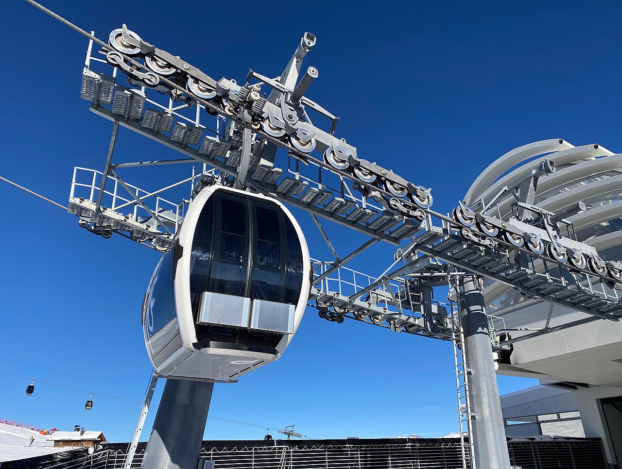
Kronplatz - Plan de Corones is a downhill ski area in Bolzano/Bozen, Italy. Mapped terrain includes easy, intermediate, advanced routes. Its mapped lift network extends from approximately 925 to 2273 metres above sea level. Cross-country skiing is also mapped within the area.
Data: OpenSkiData / OpenSkiMap, OpenStreetMap contributors (ODbL), Skimap.org, Who's On First, Mapterhorn.
Preparando gráficos de previsión…
Las horas y los valores coinciden con la previsión detallada. Toca un valor para ver detalles y desplaza los gráficos horizontalmente para los próximos días. La precipitación es el equivalente total en agua por intervalo, incluida la nieve; la nieve nueva corresponde a cada intervalo, no al espesor de nieve en el suelo.
Comparación de GFS y ECMWF. Cada modelo conserva sus propias horas y horizonte de previsión. Las cantidades de precipitación y nieve corresponden a sus propios intervalos, que pueden diferir entre modelos.
Valores de previsión y notas de los modelos
Kronplatz - Plan de Corones - Base lift station
ECMWF · Ejecución del modelo: Próxima actualización prevista:
Día Hora (UTC) Temp. (°C) Humedad (%) Viento (km/h) Viento (nudos) Viento (Bft) Dirección Precip. (mm) Nieve nueva (cm) Presión (hPa) Isoterma de 0 °C (m) Condiciones | Miércoles, 04/11 06:00 3.5 78 2 1 1B E — — 1025 1600 Overcast 99% cloud 09:00 7.1 63 2 1 1B E 0.06 0 1025 2076 Overcast 81% cloud 12:00 8.7 53 4 2 1B E 0.01 0 1025 2226 Cloudy 70% cloud 15:00 8.1 58 2 1 1B NE 0 0 1024 2224 Overcast 94% cloud 18:00 5 66 2 1 1B SE 0.05 0 1026 1993 Partly cloudy 50% cloud 21:00 2.3 72 2 1 1B SE 0 0 1028 < 1562 Partly cloudy 45% cloud Jueves, 05/11 00:00 1.1 76 2 1 1B SE 0 0 1028 < 1562 Partly cloudy 33% cloud 03:00 0.6 75 2 1 1B SE 0 0 1029 < 1562 Partly cloudy 30% cloud 06:00 0.5 74 2 1 1B SE 0 0 1029 < 1562 Clear 19% cloud 09:00 7.6 54 1 1 1B N 0 0 1029 2628 Clear 6% cloud 12:00 11.3 42 3 2 1B NW 0 0 1025 2818 Clear 1% cloud 15:00 9.2 53 2 1 1B NW 0 0 1024 2955 Clear 0% cloud 18:00 4.7 59 1 0 0B S 0 0 1026 2796 Clear 0% cloud 21:00 3.2 64 1 0 0B SE 0 0 1026 < 1562 Clear 0% cloud Viernes, 06/11 00:00 2.6 64 1 0 0B SE 0 0 1026 < 1562 Clear 0% cloud 03:00 2.3 63 1 0 0B SE 0 0 1025 < 1562 Clear 0% cloud 06:00 2.3 62 1 0 0B SE 0 0 1024 < 1562 Clear 0% cloud 09:00 9.3 43 1 1 1B NW 0 0 1023 3012 Clear 0% cloud 12:00 13 36 3 1 1B NW 0 0 1019 2953 Clear 0% cloud 15:00 10.6 47 1 0 0B W 0 0 1018 2853 Clear 18% cloud 18:00 4.4 63 3 1 1B SE 0 0 1019 2105 Clear 15% cloud 21:00 3.5 69 3 2 1B SE 0 0 1021 1650 Overcast 99% cloud Sábado, 07/11 00:00 4.2 70 2 1 1B E 0.03 0 1022 1823 Overcast 100% cloud 03:00 3.7 70 2 1 1B SE 0.00 0 1021 1670 Overcast 80% cloud 06:00 3 69 2 1 1B SE 0 0 1022 < 1562 Cloudy 62% cloud 09:00 7.2 55 2 1 1B E 0.03 0 1023 2148 Overcast 100% cloud 12:00 7.6 52 0 0 0B SE 0.25 0 1023 2144 Overcast 88% cloud 15:00 7.1 50 1 1 1B SE 0.00 0 1022 2111 Overcast 98% cloud 18:00 5.2 54 3 2 1B SE 0.12 0 1024 1900 Overcast 97% cloud 21:00 4.8 59 2 1 1B SE 0.04 0 1025 1828 Overcast 95% cloud Domingo, 08/11 00:00 3.7 63 1 1 1B SE 0 0 1025 1627 Overcast 85% cloud 03:00 2.8 67 1 1 1B SE 0 0 1024 < 1562 Overcast 83% cloud 06:00 3.3 67 2 1 1B SE 0.18 0 1025 < 1562 Overcast 98% cloud 09:00 5.5 60 0 0 0B — 0.00 0 1026 1871 Overcast 95% cloud 12:00 7.3 54 1 0 0B N 0.03 0 1024 2054 Overcast 89% cloud 15:00 6.7 59 1 1 1B N 0.03 0 1024 2011 Cloudy 73% cloud 18:00 2.6 69 2 1 1B SE 0 0 1025 < 1562 Partly cloudy 25% cloud 21:00 0.4 73 2 1 1B SE 0 0 1025 < 1562 Partly cloudy 29% cloud Lunes, 09/11 00:00 -0.4 74 2 1 1B SE 0 0 1026 < 1562 Partly cloudy 29% cloud 03:00 -0.1 71 1 0 0B SE 0 0 1026 < 1562 Overcast 94% cloud 06:00 0.3 66 1 0 0B SE 0.01 0 1026 < 1562 Cloudy 64% cloud 09:00 5.7 50 1 1 1B NW 0 0 1025 2305 Cloudy 51% cloud 12:00 9 46 3 1 1B NW 0 0 1022 2637 Partly cloudy 36% cloud 15:00 6.6 61 2 1 1B W 0 0 1021 2433 Cloudy 64% cloud 18:00 3.4 70 2 1 1B S 0 0 1022 1658 Overcast 88% cloud 21:00 4.3 70 1 0 0B SE 0 0 1022 2052 Overcast 100% cloud Martes, 10/11 00:00 4.5 73 1 1 0B SE 0.09 0 1021 2191 Overcast 100% cloud 03:00 4.4 76 1 0 0B SE 0.03 0 1020 2289 Overcast 100% cloud 06:00 4.6 77 1 0 0B E 0.00 0 1019 2432 Overcast 100% cloud |
|---|
Forecast notes
Forecast table times: UTC.
Coordinates: 46.771945°N, 11.9410267°E · Requested elevation: 956 m. Model terrain: 1560 m. Terrain and 1000/925/850/700 hPa profiles are used for height estimates.
Outside the available profile, temperature uses an estimated 5.5°C/km height correction; wind retains the nearest available model-level value. Humidity is estimated with adjusted pressure and temperature.
These are altitude estimates, not a simulation of local mountain terrain. Precipitation, cloud and sea-level pressure use horizontal interpolation only.
Precipitation includes rain and snow water equivalent: preceding 3 hours through day 6, then 6 hours (see cell tooltip). Snow (cm) estimates fresh snowfall from precipitation and temperature using the GFS conversion; it is not snow depth on the ground. Freezing (m) uses additional 600/500 hPa temperatures when available and estimates the lowest resolved 0°C crossing above sea level. When all sampled levels are warm, the upper profile limit is shown (see tooltip). < marks an entirely cold sampled profile and its lower height limit. No extrapolation is used.
Preparando gráficos de previsión…
Las horas y los valores coinciden con la previsión detallada. Toca un valor para ver detalles y desplaza los gráficos horizontalmente para los próximos días. La precipitación es el equivalente total en agua por intervalo, incluida la nieve; la nieve nueva corresponde a cada intervalo, no al espesor de nieve en el suelo.
Comparación de GFS y ECMWF. Cada modelo conserva sus propias horas y horizonte de previsión. Las cantidades de precipitación y nieve corresponden a sus propios intervalos, que pueden diferir entre modelos.
Valores de previsión y notas de los modelos
Kronplatz - Plan de Corones - Top lift station
ECMWF · Ejecución del modelo: Próxima actualización prevista:
Día Hora (UTC) Temp. (°C) Humedad (%) Viento (km/h) Viento (nudos) Viento (Bft) Dirección Precip. (mm) Nieve nueva (cm) Presión (hPa) Isoterma de 0 °C (m) Condiciones | Miércoles, 04/11 06:00 -3.3 92 10 6 2B SE — — 1025 1617 Overcast 98% cloud 09:00 -1.4 83 11 6 2B SE 0.05 0 1025 2080 Overcast 82% cloud 12:00 -0.5 74 11 6 2B SE 0.01 0 1025 2217 Cloudy 72% cloud 15:00 -0.4 73 8 4 2B S 0.00 0 1024 2224 Overcast 95% cloud 18:00 -1.1 69 10 5 2B S 0.05 0 1026 2020 Partly cloudy 48% cloud 21:00 -2.6 72 10 5 2B S 0 0 1028 < 1538 Partly cloudy 45% cloud Jueves, 05/11 00:00 -2.8 69 10 5 2B S 0 0 1029 < 1538 Partly cloudy 34% cloud 03:00 -2.6 63 9 5 2B S 0 0 1029 < 1538 Partly cloudy 32% cloud 06:00 -2.4 57 10 5 2B S 0 0 1029 < 1538 Partly cloudy 21% cloud 09:00 1.4 52 8 4 2B SW 0 0 1029 2625 Clear 7% cloud 12:00 3.5 47 7 4 2B SW 0 0 1025 2812 Clear 1% cloud 15:00 2.9 50 5 3 1B SW 0 0 1024 2946 Clear 0% cloud 18:00 0.7 50 3 2 1B S 0 0 1026 2812 Clear 0% cloud 21:00 -0.2 50 5 3 1B S 0 0 1026 < 1538 Clear 0% cloud Viernes, 06/11 00:00 -0.4 49 6 3 2B S 0 0 1026 < 1538 Clear 0% cloud 03:00 -0.6 52 6 3 2B S 0 0 1025 < 1538 Clear 0% cloud 06:00 -0.6 54 6 3 2B S 0 0 1024 < 1538 Clear 0% cloud 09:00 3.1 45 7 4 2B S 0 0 1023 3003 Clear 0% cloud 12:00 4.7 43 7 4 2B S 0 0 1019 2949 Clear 0% cloud 15:00 3.3 53 7 4 2B S 0 0 1019 2850 Clear 18% cloud 18:00 -0.4 62 9 5 2B SE 0 0 1019 2101 Clear 15% cloud 21:00 -1.3 61 14 7 3B SE 0 0 1021 1676 Overcast 100% cloud Sábado, 07/11 00:00 -1.5 67 18 9 3B SE 0.02 0 1022 1829 Overcast 100% cloud 03:00 -1.9 65 17 9 3B SE 0.00 0 1021 1678 Cloudy 79% cloud 06:00 -2.8 71 17 9 3B SE 0 0 1022 < 1538 Cloudy 60% cloud 09:00 -0.9 67 17 9 3B SE 0.04 0 1023 2148 Overcast 100% cloud 12:00 -0.9 72 16 8 3B SE 0.28 0.1 1023 2148 Overcast 88% cloud 15:00 -1.1 73 10 5 2B SE 0.01 0 1022 2109 Overcast 99% cloud 18:00 -2.1 77 10 6 2B SE 0.14 0 1024 1909 Overcast 98% cloud 21:00 -2.5 80 7 4 2B S 0.04 0 1025 1831 Overcast 94% cloud Domingo, 08/11 00:00 -3.3 81 7 4 2B S 0 0 1025 1647 Overcast 89% cloud 03:00 -3.9 85 8 4 2B SW 0.00 0 1024 < 1538 Overcast 86% cloud 06:00 -3.9 85 8 5 2B SW 0.21 0.2 1025 1567 Overcast 98% cloud 09:00 -2.9 78 10 5 2B SW 0 0 1026 1869 Overcast 97% cloud 12:00 -1.8 72 8 4 2B W 0.02 0 1024 2050 Overcast 88% cloud 15:00 -2 74 8 4 2B W 0.02 0 1024 2008 Cloudy 73% cloud 18:00 -3.3 65 8 5 2B W 0 0 1025 < 1538 Partly cloudy 24% cloud 21:00 -4 65 8 5 2B W 0 0 1025 < 1538 Partly cloudy 28% cloud Lunes, 09/11 00:00 -4.2 66 9 5 2B W 0 0 1026 < 1538 Partly cloudy 28% cloud 03:00 -3.6 64 10 5 2B W 0 0 1026 < 1538 Overcast 93% cloud 06:00 -3 66 11 6 2B W 0 0 1026 < 1538 Cloudy 64% cloud 09:00 0.1 58 12 6 2B W 0 0 1025 2317 Partly cloudy 48% cloud 12:00 2 56 13 7 3B W 0 0 1022 2641 Partly cloudy 34% cloud 15:00 0.6 67 15 8 3B W 0 0 1021 2434 Cloudy 65% cloud 18:00 -0.8 72 13 7 3B W 0 0 1022 1720 Overcast 88% cloud 21:00 -0.4 82 19 10 3B SW 0 0 1022 2072 Overcast 100% cloud Martes, 10/11 00:00 -0.1 85 21 11 4B SW 0.10 0 1021 2203 Overcast 100% cloud 03:00 0 87 17 9 3B W 0.02 0 1020 2299 Overcast 100% cloud 06:00 0.3 85 16 9 3B W 0 0 1019 2457 Overcast 100% cloud |
|---|
Forecast notes
Forecast table times: UTC.
Coordinates: 46.7383882°N, 11.9592804°E · Requested elevation: 2273 m. Model terrain: 1536 m. Terrain and 1000/925/850/700 hPa profiles are used for height estimates.
These are altitude estimates, not a simulation of local mountain terrain. Precipitation, cloud and sea-level pressure use horizontal interpolation only.
Precipitation includes rain and snow water equivalent: preceding 3 hours through day 6, then 6 hours (see cell tooltip). Snow (cm) estimates fresh snowfall from precipitation and temperature using the GFS conversion; it is not snow depth on the ground. Freezing (m) uses additional 600/500 hPa temperatures when available and estimates the lowest resolved 0°C crossing above sea level. When all sampled levels are warm, the upper profile limit is shown (see tooltip). < marks an entirely cold sampled profile and its lower height limit. No extrapolation is used.